Home  1999-2001  2002-3  2004-6  2007-9  2010-17  2018  2019  2020
 Coastwalk  LE-JOG  Counties  Random Search within km of
Hiking in Britain

Walks in Hertfordshire

Hertfordshire is one of the home counties, and despite being fairly near to London and part of the London Commuter Belt it has some pleasant scenery and good walks within it.

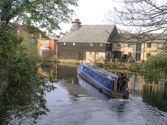
The Ridgeway National Trail passes through Hertfordshire for a short distance near its eastern end at Ivinghoe Beacon, and the western border of the county follows the Grand Union Canal for much of its length, along which runs a good long-distance footpath from London to Birmingham. Running across the county from east to west od the Lea Valley Walk, which follows teh River lea from it's junction with teh Thames in London all the way up to its source near Luton.


Below is a map showing all the walks that I have completed in Hertfordshire.

Completed walks in Hertfordshire

 
The River Lea in Hertford.

Boats on Stanborough Park lakes.

A tree on the golf course around Brocket Hall.


List of walks in Hertfordshire

Walk No. Description Distance (miles)
1041 London Loop: Moor Park to Barnet, and then down to Finchley26.5
1040 London Loop: Hatton Cross to Moor Park21.7
1026 A circular walk from Aylesbury, taking in the Grand Union Canal's Aylesbury and Wendover branches21.1
786 Icknield Way: Harlington to Baldock21.9
785 Icknield Way: Whipsnade to Harlington14.2
784 Ridgeway and Icknield Way: Ledge Hill to Whipsnade26.6
780 Icknield Way: Baldock to Great Chesterford26.7
774 Royston to Cambridge24.1
695 Hertford to Harpenden18.3
688 Tring Station to Linslade Station11.6
655 A circular walk from Ware19.7
642 A circular walk around Royston17.2
603 Bishop's Stortford to Braintree18.9
210 Rickmansworth to Stanmore via Middlesex's highest point9.2
209 Dunstable to Harpenden via Luton12.1
204 Tring to Princes Risborough13.5
141 Tring Station to Cheddington Station6.1
140 Kings Langley to Hemel Hempstead4.2
139 West Drayton to Kings Langley16.6
130 Tring Station to Hemel Hempstead Station8.0
129 Dunstable to Tring14.1
127 Hitchin to Luton13.2
122 Biggleswade to Hitchin11.6
121 Royston to Hitchin17.3
96 Great Chesterford to Royston16.6
53 Harlow Town to Bishop's Stortford9.8
52 Enfield Lock to Harlow Town12.6
49 Bishop's Stortford to Great Chesterford14.9

This was a total of 448.3 miles in 28 walks (an average of 16.01 miles per walk).


Back to counties index. Back to counties index 


Please visit my ramblings blog at: https://walkerramblings.blogspot.com/


Hosted by Spellings.net