Walk #53: Harlow Town to Bishop's Stortford
 |
 |
|
General Data
| Date Walked | 25/10/1999 |
| County | Hertfordshire, Essex |
| Start Location | Harlow Town |
| End Location | Bishop's Stortford |
| Start time | 11.08 |
| End time | 15.00 |
| Distance | 9.8 miles |
| Description | This was a pleasant walk along another section of the Stort Navigation. |
| Pack | Today I carried full Pennine Way kit. |
| Condition | I feel okay after this walk. My feet are still a bit sore with the blisters from Saturday's walk. My legs are also quite fatigued, but aside from these minor niggles I am otherwise okay. |
| Weather | Today was a mixture of sunshine and cloud. There was not a hint of any rain, and it was quite warm for the time of year. All in all it was lovely walking weather. |
| OS map | Landranger number 167 (Chelmsford, Harlow & Bishop's Stortford) |
Map of the walk
Maps courtesy of Google Maps. Route for indicative purposes only, and may have been plotted after the walk. Please let me have comments on what you think of this new format. For a detailed table of timings for this walk, please see the table file.
Notes
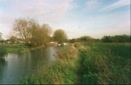
Another nice walk along the Stort Navigation in lovely weather. For the first time since leaving London on this stretch there was (shock, horror) some mud, and after the heavy rain of the last couple of days some places were quite slippery. This stretch of the path has some fairly scenic sections, or at least sections that appear scenic after the preceding sections.
Directions
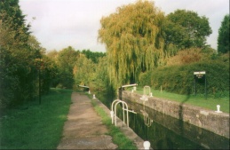
From Harlow Town Station make your way to Burnt Mill Lock on the Stort Navigation by turning right out of the station, heading up a slight hill and then right and across the railway by a large road bridge. Turn down the first road to the right and you get to the Lock and canal.
Follow the canal to the north, along some fairly attractive paths. Navigation is not really a problem; however the path does swap from bank to bank fairly regularly so it is best to ensure that you are on the right side of the canal at each lock.
Distances
| From | To | Distance (m) | Ascent (ft) | Descent (ft) |
|---|---|---|---|---|
| Harlow Town | Bishop's Stortford | 9.8 | 164 | 98 |
This makes a total distance of 9.8 miles, with 164 feet of ascent and 98 feet of descent.
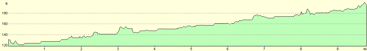
For more information on profiles, ascents and descents, see this page
Disclaimer
Please note that I take no responsibility for anything that may happen when following these directions. If you intend to follow this route, then please use the relevant maps and check the route out before you go out. As always when walking, use common sense and you should be fine.
If you find any information on any of these routes that is inaccurate, or you wish to add anything, then please email me.
All images on this site are © of the author. Any reproduction, retransmissions, or republication of all or part of any document found on this site is expressly prohibited, unless the author has explicitly granted its prior written consent to so reproduce, retransmit, or republish the material. All other rights reserved.
Although this site includes links providing convenient direct access to other Internet sites, I do not endorse, approve, certify or make warranties or representations as to the accuracy of the information on these sites.
And finally, enjoy your walking!
This walk was mentioned in the following routes:
| My sectional Land's End to John O'Groats walk |
Nearby walks
| # | Title | Walk length (miles) |
|---|---|---|
| 42 | Dufton to Garrigill | 15.4 |
|
|

|