Walk #42: Dufton to Garrigill
 |
 |
|
General Data
| Date Walked | 20/08/1999 |
| County | Cumbria |
| Start Location | Dufton |
| End Location | Garigill |
| Start time | 08.25 |
| End time | 16.15 |
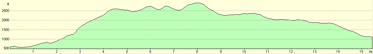
| Distance | 15.4 miles |
| Description | This was a pleasant day's walk over Cross Fell. |
| Pack | Today I carried full camping gear. |
| Condition | I feel absolutely fine after today's walk. The bottom of my feet ached on the long and stony descent from the top of Cross fell, but that was just a minor annoyance. My ankle was okay, and so are my back and legs, which is quite good considering the climbing that I have just done. |
| Weather | Today was overcast, but with no rain. The sun only rarely decided to grant us an audience, and even then for barely long enough for us to get acquainted. The wind was the main feature, and for the first section coming down of Cross Fell it was quite cold due to the wind. |
| OS map | Outdoor Leisure number 31 (North Pennines - Teesdale & Weardale) |
Map of the walk
Maps courtesy of Google Maps. Route for indicative purposes only, and may have been plotted after the walk. Please let me have comments on what you think of this new format. For a detailed table of timings for this walk, please see the table file.
Notes
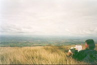
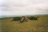
Considering how much I was not looking forward to today's walk, it went well. I hardly broke into sweat all day. That is not to say that it was easy, for it was not; more that the walk as I did it was a strenuous yet most fulfilling one.
I climbed up to Cross Fell (the highest point on the Pennine Way) with Hazel, and as she has a very slow pace climbing I found that I hardly exerted myself on this section at all. From the top of Cross Fell I left her with Michael and strode off alone, only to find Tony (who had done a different route from the top of Knock Fell) waiting for me on Carrigill village green with a pot of tea.
The views from the top of Cross Fell were amazing; 360 degree views, but especially amazing to the west, where you could look over fertile plains to the Lake District mountains and the sea.
All in all a good day. I am extremely pleased that I have finished it with so much energy spare. Things are looking good, which usually means that something bad is about to happen soon. ;*)
It is days like today that make me feel that life is great.
Directions
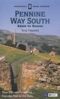
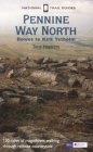
I am not going to bother giving any directions for any of the stages of the Pennine Way; there are many route descriptions produced that will better anything that I could produce. The main guides I used were the OS National Trail Guides, which come complete with strip maps of the route. Click on one of the links below to go to the Amazon page for each guide.
|
| 
|
| |
| |
Distances
| From | To | Distance (m) | Ascent (ft) | Descent (ft) |
|---|---|---|---|---|
| Dufton | Knock Old Man | 4.5 | 2156 | 141 |
| Knock Old Man | Cross Fell | 3.5 | 896 | 577 |
| Cross Fell | Garrigill | 7.4 | 285 | 2087 |
This makes a total distance of 15.4 miles, with 3337 feet of ascent and 2805 feet of descent.
For more information on profiles, ascents and descents, see this page
Disclaimer
Please note that I take no responsibility for anything that may happen when following these directions. If you intend to follow this route, then please use the relevant maps and check the route out before you go out. As always when walking, use common sense and you should be fine.
If you find any information on any of these routes that is inaccurate, or you wish to add anything, then please email me.
All images on this site are © of the author. Any reproduction, retransmissions, or republication of all or part of any document found on this site is expressly prohibited, unless the author has explicitly granted its prior written consent to so reproduce, retransmit, or republish the material. All other rights reserved.
Although this site includes links providing convenient direct access to other Internet sites, I do not endorse, approve, certify or make warranties or representations as to the accuracy of the information on these sites.
And finally, enjoy your walking!
This walk was mentioned in the following routes:
| My sectional Land's End to John O'Groats walk |
| My Pennine Way Walk, 07th to 26th August 1999 |
Nearby walks
| # | Title | Walk length (miles) |
|---|---|---|
| 41 | Langdon Beck to Dufton | 13.9 |
|
|

|