Walk #952: Angles Way: Lowestoft to Great Yarmouth
 |
 |
|
General Data
| Date Walked | 28/06/2012 |
| County | Suffolk, Norfolk |
| Start Location | Lowestoft Station |
| End Location | Great Yarmouth bus station |
| Start time | 08.43 |
| End time | 17.05 |
| Distance | 21.4 miles |
| Description | This pleasant walk followed the Angles Way as it loops around the River Waveney between Lowestoft and Great Yarmouth. |
| Pack | Today I carried my 30-litre Karrimor rucksack, filled with water, my waterproofs, a book and other odds and ends. |
| Condition | I feel absolutely fine after this walk. |
| Weather | Today's weather was warm andcloudy, with some sunny periods. It was very humid and felt like a downpour was threatening at any time; aside from two small periods of spitting rain, it remained dry. The crackle of lightning could be heared on my radio from far away, although none occurred where I was. |
| OS map | Landranger number 134 (Norwich & The Broads, Great Yarmouth) |
 |
 |
|
Map of the walk
Maps courtesy of Google Maps. Route for indicative purposes only, and may have been plotted after the walk. Please let me have comments on what you think of this new format. For a detailed table of timings for this walk, please see the table file.
 |
 |
|
Notes
Towards the end of last year I walked the majority of the Angles Way from near Thetford to Lowestoft. This did not include the last twenty miles of the trail, which runs in a long arc roughly following the River Waveney to Great Yarmouth. I had planned to do this shortly afterwards, but for various reasons I never got around to it. However my parents were spending a few nights neat Southwold, so I decided to do the walk and then stay with them for the night.
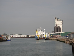
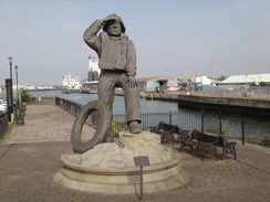
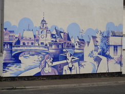
The drive to Lowestoft took much longer than I hoped due to slow lorries on the road, and I arrived at the station in a rather fractious state. I parked up and then could not find my mobile, which I knew I had put in the car. After a few minutes' frantic searching, I found it beneath one of the seats. I set off in a far-from-happy state, and the first stretch of walk hardly improved my mood. Seagulls' plaintive calls filled the air but I was going nowhere near the sea; instead I crossed a bridge over the entrance to Lowestoft's Inner Harbour and past a statue commemorating the RNLI lifeboatmen who lived and worked in the area. The statue depicts a man standing on a rock, his hands to his eyes as he gazes out over the water. It was a particularly pleasant depiction, but seemed to be sited in totally the wrong place by the road.
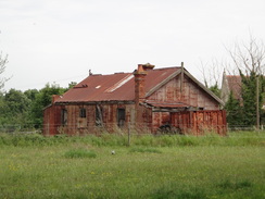
On the last walk I had left the Angles Way at Oulton Broad South station, and so my first task was to get there. I had little alternative but to follow roads and this made for a fairly boring first couple of miles. On my fifteen-year old OS map the A12(T) follows the seafront south; now a new road cuts through the suburbs. There were other changes as well: the factories 'works' marked on the map were now either demolished or replaced with the modern industries - a supermarket and car showroom amongst them. One factory was still extant but closed, with the gates firmly locked and long sheaves of grass growing up from cracks in the car park. It was a sad sight: a factory that once would have hummed with life, now derelict and forlorn.
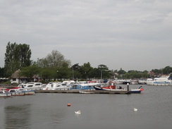
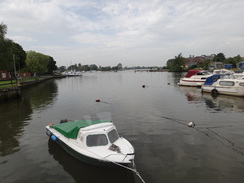
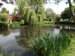
It did not take long to reach the station, and I joined the route of the Angles Way. For the first time today the route actually became interesting, despite its rural nature: the close presence of Oulton Broad and its boats meaning there was lots to see. After crossing a lift bridge over the channel that separated the broad from Lake Lothing, the latter being nearer to the sea, the road paralleled a railway line along a road. It then headed through the village of Oulton Broad itself before crossing the railway line and taking a path that led to a church.
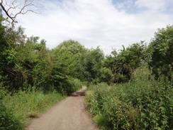
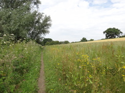
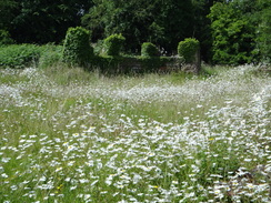
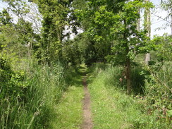
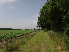
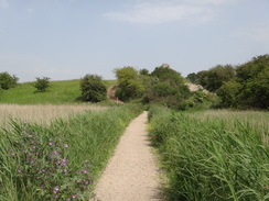
Thankfully this marked the end of road walking for a while. A series of paths took the trail north, with the Oulton Marshes stretching away to the west; the path also marked the boundary of The Broads National Park. It was a very pleasant if not overly scenic stroll, and the paths were not too muddy despite the recent heavy rains. It was the sort of path where I just put my head down and walk on autopilot whilst my mind floats amongst the clouds.
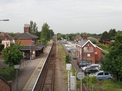
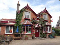
Before I knew it I had reached Somerleyton station, and I nipped down to see it before rejoining the trail. This took a rather confusing route towards the boatyard, passing the site of an old and overgrown brickworks on the way. A road then took me through the village of Somerleyton itself, which consists of little more than houses strung along the road. I soon came to the attractive red-brick post office, which also houses a cafe. On the spur of the moment I decided to nip in and was soon sitting inside the cafe. Four women and a man were sharing a nearby table and were speaking about parochial village matters. It was hard not to overhear their conversation in the small cafe, and before long I was part of the conversation as well. My breakfast took a while to arrive, but the time flew as we chatted. It was as if I had suddenly become a character in the Archers, discussing the oncoming village fete.
I tore myself away and set off down the road, soon passing the walls that guarded Somerleyton Hall. Sadly this spectacular building remained out of view, and it is on my list of places to visit due to its connections with Samuel Peto. Peto was a Victorian engineer who made a fortune from railway construction. At his height he was an MP and restored the hall over a number of years. However a precipitous fall followed his rise, and he became bankrupt in the late 1860s and died in obscurity.
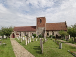
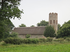
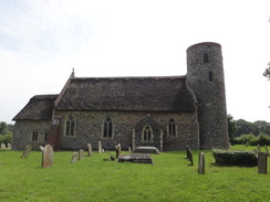
The trail soon left the road and followed tracks that led towards a round-tower church with thatched roof that sat on its own in a field. The tower and narrow aspect of the church, with no aisles, made it look picture-perfect. The lack of a local population made it seem like a strange place for a church, even such a pretty-looking one on this, and I guess that it is a symbol of shifting populations over the centuries.
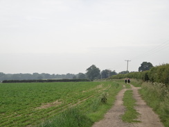
More tracks, paths and a rather long and boring road took me to the A143 in Fritton. This busy road was a bit of a culture shock after the quiet tracks and lanes of the last few miles. Fortunately a pavement soon began, taking me safely past the pub and on towards the village church, another example of a round-tower church, similar but not quite as picturesque as the previous one because of its less remote location. I did notice a semi-circular apse, which is an unusual addition.
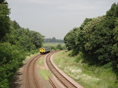
An entrance road into the Fritton Lakes complex took me up to a main road, after which a long and fairly uninteresting track took me north-northwestwards towards some power lines. The track was sandy in places, reminding me of the spectacular heathland at Dunwich further down the coast. It joined a more pleasant track that took me past a golf course and into Belton. I eschewed the nearby pub and instead continued along the road, which crossed the course of the old railway line between Yarmouth and Beccles. This closed in 1959 and I could see nothing to signify the old line aside from a bump in the road where there had once presumably been a level crossing.
Sadly the village was far from memorable, and the roads I walked down seemed to be filed with small retirement-style bungalows and houses. This is one of the problems of encountering a settlement for the first time on a walk: you get a small snapshot, both in terms of what you see and the time in which you see it. A village can appear lively at school-closing time, when parents are picking up their children, whilst the same place could appear dead just half an hour earlier. Judgement should really be withheld until several visits.
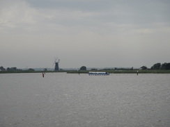
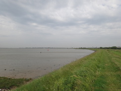
A track and footpath took me back onto the floodplain and on to the southern bank of the River Waveney. This was the first time I had seen a large expanse of water since this morning, and it had a totally different character from the broads. A couple of windmills were visible; the one at Berney Arms complete with its sails, whist the Black Drainage Mill was little more than a black stump of a tower. I would see several more mill towers during the day, each one a symbol of the Broads.
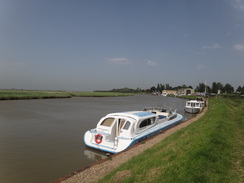
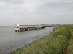
After passing around a boatyard that had some rather large boats under repair, I reached a pub. I had some time in hand, and so I sat on a bench outside for a few minutes before taking my boots off and going in to order a couple of drinks. It was a glorious day and it was a shame that I could not spend longer, but all too soon I was shrugging my pack back onto my shoulders and heading off.
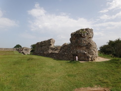
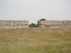
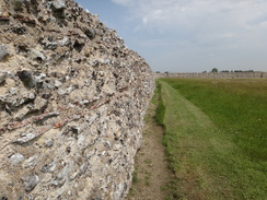
The riverside path led to Burgh Castle, the remains of a Roman Shore Fort that sits on a bluff above the river. I was not sure what to expect, and was surprised to find a large, grassy area with the flint-rubble core of the walls still substantially complete. No facing stones were left, but the rubble was still magnificent. It was somewhat reminiscent of the walls at Portchester Castle in Portsmouth, another shore fort whose walls are far more intact. It was a wonderful sight despite its ramshackle nature and I wanted to explore some more, but sadly I had to continue on. Some steps took me down off the high part of the bluff, exposing the true height of the walls. One section was hanging at a ramshackle angle and looked as if it could fall at any time, its foundations undermined.
The path rejoined the floodbank, and soon reached the junction with the River Yare. A boat was turning towards Berney Arms as the clouds gathered overhead. It looked as though it could pour with rain at any time, and static on my radio showed that there was lightning around, even if I could not hear any thunder. It turned out I was right, and there were severe thunderstorms in the midlands. Soon a bothersome headwind hampered progress, and I tried to increase my pace to avoid the potential rain.
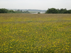
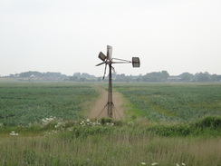
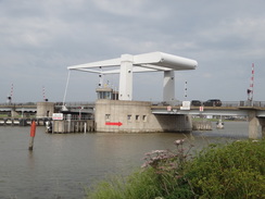
Off to my left, the Yare increased in width until the northern bank was over a kilometre away. That bank carries the Weaver's Way, another trail that is on my to-do list. Flat marshland stretched away to my right, a wonderfully bleak landscape of weed-filled drainage channels. A rusty windpump that had seen better days swung desultory in the breeze. I was getting slightly tired by now, and it was a relief when Beydon Bridge came into view. This lift-bridge is painted shock-white and could be seen several miles before I reached it; it marked the start of the outskirts of Great Yarmouth.
On the other side of the bridge the trail headed though back streets. Suddenly I felt as though I was back in some northern town, with narrow streets and mean back gardens. People were sunning themselves despite the harsh breeze, and the area was filled with life. Kids were running around, but even this could not raise the slight feeling of dereliction and decay.
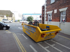
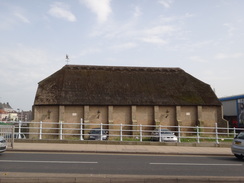
As I approached the end of trail at Haven Bridge, a strange vehicle passed me. It was a yellow builder's skip that had been converted into a car, and two men were smiling broadly as they drove past. A large thatched building sat on the other side of the bridge, and I crossed the road to get both a better view and also to join the route that I had taken on my coastal walk, creating another link with that trip.
All I had to do now was get to the bus station in the town, but that proved to be easier said than done. The location of the station had changed since my OS map had been printed, and it proved hard to find. After a couple of wrong turns I asked someone who directed me in the right direction. Soon I came across a bus waiting on the roadside away from the station and I saw that it was destined for Lowestoft; I quickly boarded and waited for it to set off.
It had been an enjoyable day's walk, and it felt good to have finally finished the Angles Way after a six-month lay-off. The trail itself had not been a classic, but it had been well worth walking; it is not a hard but is nonetheless rewarding. After getting back to Lowestoft I walked to my car, and then drove to my parents, who were staying in a caravan park near Halesworth. Their company made a perfect end to a rather good day.
 |
 |
|
Directions
This walk starts off at Lowestoft railway station at TL547928. Leave the station and turn right down Denmark Road for a few yards until it ends at a junction with Station Square. Turn right down Station Square, passing the large brick wall of the station on the right. Cross the junction with Commercial Road and cross the bridge over the entrance to the Inner Harbour. Immediately after this turn right along Pier Terrace. This curves to the right and then the left to meet a large roundabout. Pass the entrance to a large Asda store on the right and follow the A12 westwards to a second roundabout.
Here take the first road off to the left, the B1531 Waveney Drive. Follow this road westwards; it curves to the left and then right to reach a mini-roundabout. Cross this and 0.9 miles after joining the B1531 the road reaches a second mini-roundabout at TL527923. Turn left up Colville Road, then take the first road off to the right, Dell Road. Follow this road for half a mile until it ends; continue along a pavement for a few yards until it reaches the A146 Beccles Road with the Flying Dutchman pub off to the left. Turn left towards the pub and use the pedestrian crossing to reach the other side, and then turn right and angle left to walk down a short road that leads to Oulton Broad South railway station at TL519921.
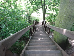
Go on to the station platform and then turn right to walk along the platform towards a road overbridge. Climb up the steps onto the top of the bridge, and then turn left to cross the road bridge over the railway. Immediately on the other side of the bridge, turn left down some steps that lead to Marsh Road. Here the route joins the Angles Way, which it will be following for the rest of the day.
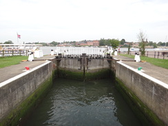
Turn right to follow Marsh Road until it ends at a junction with the A146. Turn left to follow the A146 northwards, using the pavement on the left-hand side. As the road curves to the right to approach a roundabout, turn left to follow Bridge Road northwards; when it curves to the right, turn left to head straight on along a cycle path called Freshwater Way, with Oulton Broad off to the left. The path soon leads to a lift bridge over an entrance lock into the broad.
Continue past The Wherry pub on the left to reach a roundabout. Take the second road to the left, Commodore Road, and follow it as it slowly curves to the left before ending after a fifth of a mile at a junction with Caldecott Road, with a railway line ahead. Turn left to follow Caldecott Road westwards, passing Oulton Broad on the left. After a third of a mile the road curves sharply to the left to head south, it then swings to the right to head westwards as Romany Road. After a fifth of a mile the road curves to the right and ends at a junction with Borrow Road at TL512929.
Turn left to follow Borrow Road westwards; there is a pavement on the right-hand side of the road. The road swings to the right and crosses a railway line on a bridge. As the road swings to the right once more after the bridge, turn left down a footpath that runs between hedges. Follow this path as it curves around before emerging out onto a track near Oulton Broad church at TL510935. Turn left to follow the track downhill, with the churchyard on the right. At the bottom the track swings to the right to follow the base of the slope on the right, with the church high above.
As the track curves to the left, continue straight on down another track that heads through trees. It passes some barns and then a farm on the left before ending at a surfaced road. Continue straight on along the road for about 150 yards until it swings to the right. As it does so, turn left down a driveway that soon becomes a track. This curves to the right; follow it as it heads between hedges towards some trees ahead. The track becomes a path that curves to the left and then the right to reach a clapper gate. Go through this to enter a field.
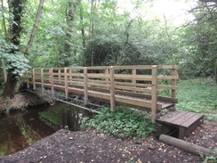
Follow a ditch on the right northwards across the field. The woodland on the right ends, and about two-thirds of the way across the field turn right through a clapper gate beside a field gate, then turn left along a track with the ditch to the left. As the track curves to the left, turn right down a path that follows a fence on the right. The path enters some woodland. Ignore a path heading off to the right and instead continue on along a path with a fence to the right. After about forty yards the path curves to the left and descends a small bank to reach a footbridge over a stream.
On the other side of the bridge, the path curves to the right and heads on through the trees. It crosses a stretch of boardwalk before reaching a footbridge over another stream, and then emerges from the trees and turns right to start following the edge of the trees on the right, with the floodplain to the left. Soon the path reaches the end of a track called Flixton Marsh Lane, with some cottages to the right at TM506954.
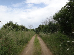
Turn right up this track for a short distance and then left to join a footpath that runs past trees on the left. After 0.4 miles, squeeze through a gap in a fence to reach the end of a sandy track at TM501957. Turn right to head uphill along this track for a fifth of a mile until it ends at a T-junction with another track called Waddling Lane. Turn left down this track and follow it as it winds in a rough westerly direction for 0.9 miles until it forks at TM489963. Take the left-hand fork and follow it westwards. When it meets another track, turn right up this track and follow it northwards until it ends at a junction with a surfaced road by Waveney Grange Farm. Turn left down this road and follow it southwestwards for a quarter of a mile until it reaches a junction with the road leading down to Somerleyton railway station on the left at TM479965.
Do not turn left towards the station, and instead turn right up an unsurfaced track that heads through trees. The track curves to the right and opens out before curving to the left, passing an old brick works. After passing a boatyard down the slope to the left the track curves to the right; as it does so go through a hedge ahead to join another road beside garages. Turn right to follow a track that passes the garages on the left; the track then curves up to the left and climbs to end at a T-junction with The Street in Somerleyton at TM479970.
Turn right to follow The Street eastwards through Somerleyton. It slowly curves to the left to take a more northeasterly course, and after half a mile ends at a junction with the B1074. Turn left along the B1074; as this curves to the left, turn right to continue straight on along Market Lane. This heads northwards and passes an entrance into Somerleyton Park; after a third of a mile turn right down a track that leads off to the right. Initially this passes a patch of woodland on the right, and after a quarter of a mile it reaches a crossroads with another track. Here turn left to follow another track northwards. It passes a church on the right - literally in the middle of nowhere - and shortly afterwards reaches a path leading off to the left at TM489991, just before a track comes in from the right.
Here turn left to follow the path, following a hedge on the right. About halfway across the field it squeezes through the hedge on the right and continues on with the same hedge on the left. When the field ends continue through an overgrown area past a garden on the left to reach a pedestrian gate that leads out onto a road at TM485991 near Beech Farm. Turn right along this road for a few yards, then turn left through a pedestrian gate beside two field gates. Follow a hedge on the right to reach the corner of the field, then turn left along a rough track. As some trees are met, turn right down a path, keeping the trees on the left. At the end of the field the path goes through a stile to reach Blocka Road at TM481994.
Turn left to follow the road west-southwestwards for 0.85 miles. Just before the bottom of the hill at TM468990 turn right along a footpath that runs northwards between hedges. This path descends and curves to the left to reach a footbridge over a stream called the Blocka Run. It heads through some trees and climbs before reaching the A143 road in Fritton at TM465998. Just before the road is reached, turn right beside a field gate to join a footpath that runs alongside a hedge on the left, with the road on the other side. Soon this turns left through a gate to join the main road.
Turn right and carefully start following the road northeastwards through the village; initially there is no pavement, but one soon starts on the right-hand side. The road passes the Decoy Tavern and curves slightly to the right, and then to the left. At the left-hand bend continue straight on along a minor road that leads to Fritton church on the right at TG473001.
At the church, turn left along a surfaced track that leads back up towards the main road. Just before the main road is reached, turn right along a path that follows a hedge on the left; the road is on the other side of the hedge. The path curves to the left to join the roadside verge. Carefully cross the road; pass the entrance to a nursery on the left, and then the driveway leading into a house. Immediately after this, turn left up a track that follows a fence on the left. When the main track curves to the left, continue straight on along a green track, following a hedge on the right. The track passes through a gap in a hedge ahead. At the end of the next field the path goes through a gap in the hedge ahead and continues along the edge of the field, still with a hedge on the right. Cross through the hedge on the right and turn left to follow a rough path until it reaches a junction with a track near Low Farm at TG468013.
Turn right and follow this track as it heads in a rough northeasterly direction, passing a golf course on the right. It crosses a complex junction of tracks and heads straight on along a path, passing a car park on the right. The path curves to the left and then right, passing under some power lines and continues on. The path becomes surfaced and curves to the left to head northwards past houses on the left. This road ends at a triangular junction with Station Road South in Belton at TG480026 opposite The Tavern pub.
Take the left-hand branch, then turn left down the road. This soon curves to the right to head north through the village. 0.4 miles after the bend it curves to the right once more; here turn left along an unsurfaced track called River Way. As the track forks, take the right-hand branch. This follows a rough track between hedges which lead to a stile beside a field gate. Cross the stile and continue on northwestwards; after a fifth of a mile go through a clapper gate beside a field gate and climb some steps up onto the top of a flood bank.
Turn right and follow the flood bank northeastwards; it soon curves to the right away from the river, with a fence on the left guarding it from a boatyard. Just before the path joins a road ahead, turn left to continue alongside the boatyard fence on the left. The footpath emerges out onto the end of a road in the boatyard; follow this northwards, heading up a slight slope. Go past a vehicle barrier to join a road, and then turn left down the road to reach the Fisherman's Inn at TG474040.
Pass the Inn and then turn right to rejoin the flood banking. The path runs between two fence and crosses a bridge over a boggy area of ground, before curving to the right to head inland towards the walls of Burgh Castle. Climb some steps to reach the curtain wall of the castle. At the top turn left to walk along the edge of the castle, which are actually the walls of an old Roman Shore Fort. Squeeze past the end of the northern wall, and then head down some steps. Continue straight on with a slope on the left; squeeze through a hedge ahead. The path becomes firmer as it heads along. When it reaches a gate ahead, turn left down some wooden steps. At the bottom turn right to join a path and follow this northward for a short distance until it meets a T-junction with another track at TG475050.
Turn left along this new path as it runs along the top of a flood bank. It soon curves to the right to run alongside the river. Go through a series of gates as the floodbank slowly curves to the right to take a more northeasterly course; after 3.7 miles it reaches Beydon Bridge, which carries the A12(T) overhead at TG515079. Head under the bridge; immediately on the other side turn slightly to the right to join a footpath that angles away from the river; this becomes a track that ends at Beydon Road. Follow this road past the end of the first row of houses, and then turn left down Stone Road.
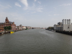
When Stone Road ends, turn right along Critten's Road. As this road curves sharply to the right, turn left and then right to head along a path between fences, with a car park on the right. This path soon ends at Stream Mill Lane. Turn left to follow this road southeastwards for a couple of hundred yards until it ends at a T-junction with the A1243 next to the Haven Bridge in Great Yarmouth. Turn left to cross the bridge; on the other side turn right to follow Hall Quay. With care cross the road to the left and start heading up Regent Street. From here make your way through the town to reach the nearby bus station.
 |
 |
|
Distances
| From | To | Distance (m) | Ascent (ft) | Descent (ft) |
|---|---|---|---|---|
| Lowestoft station | Oulton Broad South station | 2.3 | 46 | 36 |
| Oulton Broad South station | Somerleyton station | 5.8 | 200 | 207 |
| Somerleyton station | Belton | 6.9 | 266 | 266 |
| Belton | Great Yarmouth | 6.4 | 118 | 121 |
This makes a total distance of 21.4 miles, with 630 feet of ascent and 630 feet of descent.
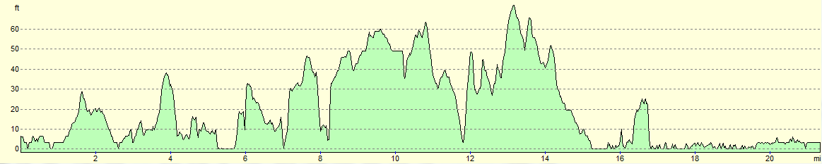
For more information on profiles, ascents and descents, see this page
Transport
It is possible to travel between Lowestoft and Great Yarmouth by train and bus.
To travel by train, you need to go via Norwich. See the National Rail website for more information.
Anglia Bus and Coach route 601 and First Suffolk and Norfolk's X1 service both run regular services between the two towns. See the Travelline website for more information.
 |
 |
|
 |
 |
|
 |
 |
|
 |
 |
|
 |
 |
|
 |
 |
|
 |
 |
|
 |
 |
|
 |
 |
|
 |
 |
|
 |
 |
|
 |
 |
|
 |
 |
|
 |
 |
|
 |
 |
|
 |
 |
|
 |
Disclaimer
Please note that I take no responsibility for anything that may happen when following these directions. If you intend to follow this route, then please use the relevant maps and check the route out before you go out. As always when walking, use common sense and you should be fine.
If you find any information on any of these routes that is inaccurate, or you wish to add anything, then please email me.
All images on this site are © of the author. Any reproduction, retransmissions, or republication of all or part of any document found on this site is expressly prohibited, unless the author has explicitly granted its prior written consent to so reproduce, retransmit, or republish the material. All other rights reserved.
Although this site includes links providing convenient direct access to other Internet sites, I do not endorse, approve, certify or make warranties or representations as to the accuracy of the information on these sites.
And finally, enjoy your walking!
Nearby walks
| # | Title | Walk length (miles) |
|---|---|---|
| 136 | Lowestoft to Caister-on-Sea | 14.4 |
| 155 | Caister-on-Sea to Sea Palling | 12.5 |
| 167 | Brampton to Lowestoft | 12.3 |
|
|

|