Walk #953: Thames Path: Woolwich to Kew
 |
 |
|
General Data
| Date Walked | 01/07/2012 |
| County | London |
| Start Location | Woolwich Arsenal station |
| End Location | Kew Gardens station |
| Start time | 08.50 |
| End time | 18.48 |
| Distance | 28.1 miles |
| Description | This was a long walk following the southern bank of the Thames through London. |
| Pack | Today I carried my 30-litre Karrimor rucksack, filled with water, my waterproofs, a book and other odds and ends. |
| Condition | Today I got one major blister on the underside of my foot; an unusual place for me to get a blister. Aside from this I was fine, and still had a fair amount of energy left at the end of the day. |
| Weather | The day was unseasonably cool, and despite some sunshine it was mostly overcast. There was a sharp shower in the mid-afternoon, but this was welcome on such a long walk. |
| OS map | Landranger number 177 (East London, Billericay & Gravesend) and Landranger number 176 (West London, Rickmansworth & Staines) |
 |
 |
|
Map of the walk
Maps courtesy of Google Maps. Route for indicative purposes only, and may have been plotted after the walk. Please let me have comments on what you think of this new format. For a detailed table of timings for this walk, please see the table file.
 |
 |
|
Notes
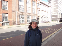
Sencan had wanted to do a marathon-walk for some time; that is to walk at last 26.6 miles in a day. Her previous record had been about 21 miles, and so it would mark a big leap in achievement. Sadly she often has trouble with her feet on long-distance walks, and especially when wearing boots, so she wanted to wear trainers. After a little thought I decided to follow the Thames path through London; it would provide a good surface for our shoes and also provide lots of public transport if we wanted to end the walk early.
We set off later than I hoped for the drive down to Leytonstone, and we then had to use three trains to get to Woolwich Arsenal. Fortunately we managed to find some toilets outside the station, and we used these before heading off down the road. Our first task was to get to the river, and a pedestrianised road took us through the centre of the town and down to the Woolwich Ferry. After a rather dangerous road crossing we joined the riverside path.
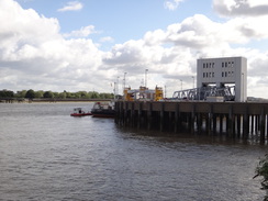
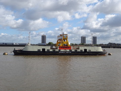
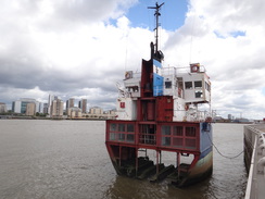
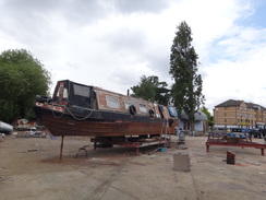
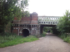
Sencan was feeling fine, and we were soon striding along the Thames Path Extension, which runs from the National Trail's trailhead at the Thames Barrier to Crayford Ness. A Woolwich ferry was moored in the river, and several other boats were plying to and fro. Sadly the trail did not spend a long time beside the river, and it diverted inland to follow a main road before heading back to meet the river at the barrier. We headed to the pedestrian tunnel under the control building which marks the start of the National Trail and were annoyed to find it was locked shut; a great shame as a map of the river is inscribed on the tunnel's wall. We walked around the building to find the reason for the closure: a small part of the path was being dug up.
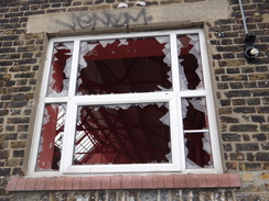
The Thames Path through East London would not be everyone's cup of tea, but I have really enjoyed it every time I have strolled along it. Wasteland and abandoned industrial buildings stand toe-by-toe with the skeletal conveyors of aggregate yards and blocks of yuppie flats, with the river constantly flowing along below. Old jetties of decaying wood stand against a backdrop of modern architecture. It is a wonderful and easy walk.
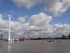
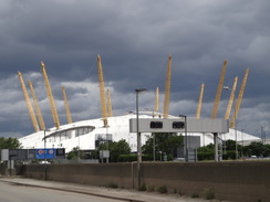
Soon the Millennium Dome became visible ahead, and nearby new features of the London skyline - the terrible sculpture by Anish Kapoor at the Olympic Park, and more notably the cable car across the river called the Emirates Air Line, which only opened earlier in the week. I hate cable cars, but Sencan was tempted to abandon the walk and take a trip. Thankfully I managed to convince her otherwise and instead we followed the path around the dome. At one point there is an interesting piece of sculpture called 'Slice of Reality' - a vertical slice through a ship, showing all its decks and cabins.
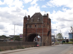
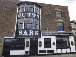
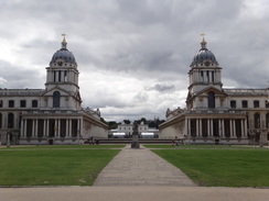
The first problem occurred on the western side of the dome, where a sign said that the path ahead was closed due to construction works. We followed the diversion signs but soon lost our way, and instead followed roads past the ornate tower that marked the entrance to the original Blackwall Tunnel. Eventually we found a path leading back towards the river, and we found that the trail was open in this area. Another diversion soon had to be made around a construction site, but we rejoined the trail ready to head past the spectacular buildings of the Greenwich naval colleges to reach the Cutty Sark.
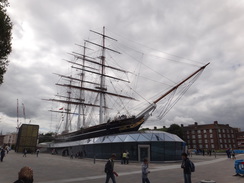
We had visited the Cutty Sark a week earlier in the company of some friends, and it is interesting to see how the ship has been renovated, although some say it has been spoilt. The entire ship has been raised about three metres from the floor of the dry dock, allowing people to walk underneath it, and the area between ship and the surrounding ground glazed. Although I can see the critics' point, it was an interesting way to display the ship and was worth the entrance price.
However our route took us across Deptford Creek, after which we nipped into a shop to buy some provisions for the rest of the day. Shortly afterwards we reached Pepys Park, where Sencan had to sit down and change trainers and socks due to a hot-spot developing on a foot. Unbeknownst to me she has worn just a thin pair of cotton socks; fortunately she had also taken a pair of thicker Thousand Mile socks, and she changed into these at the same time. I rapidly saw our chances of completing 26 miles disappearing out of the window.
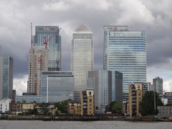
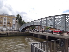
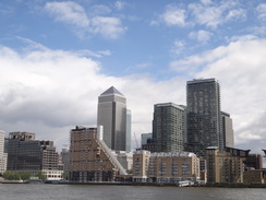
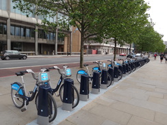
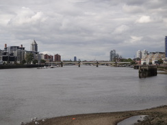
This part of the trail is hardly classic walking as it heads through East London, and we passed what appeared a church above a bookies. Loud, out-of-tune cries of 'Halleluiah!' crashed through the open windows. They were certainly enjoying themselves, but I am not so sure about the neighbours. We crossed the double entrance to the Greenland Docks as the towers of Canary Wharf approached on the other side of the river. When I first moved to London in 1991 I managed to get to the top of One Canada Square, which until the recent topping-out of the Shard was the tallest building in Britain. This was a rare opportunity, as security concerns soon closed the top floor to the public. Since then the tower has been joined by many others, giving London its first skyscraper skyline.
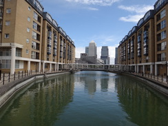
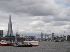
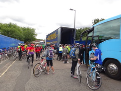
The path follows riverside paths and roads through Rotherhithe, a part of London that I have loved for a long time. We passed the tunnel portal belonging to Brunel's first tunnel under the river, and then the Brunel Museum. Despite my love for the Victorian engineer, I have never visited the museum, something that I should correct soon. The Shard grew in size ahead; its pointed shape and deliberately-incomplete top a strangely welcome addition to London's skyline. One road was blocked with coaches and cyclists, who had just taken part in an overnight bike ride to Dunwich and back. They looked tired yet ecstatic, and there was scarcely an ounce of fat between them.
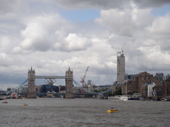
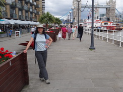
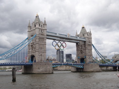
We reached the twelve mile-point as we approached Tower Bridge, and we decided to stop off for a short break. We found a cafe just off the trail and ordered sandwiches - sadly my order of hot chocolate with cream became a cappuccino with cream - a disgusting combination. We watched cheeky pigeons trying to steal the sandwiches off our plates as I skulled down the hit liquid.
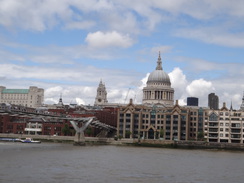
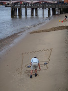
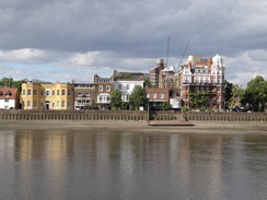
Soon we headed off once again, passing under Tower Bridge and along the southern bank of the river. When I was in London twenty years before this was a neglected part of London. It has now utterly changed; the opening of the Tate gallery in the shell of the magnificent Bankside power station - a building I have always loved - and the Millennium 'wobbly' bridge across the river from St Pauls has led it to become a tourist destination. The area was packed with people watching a series of buskers and artists, including many that were dressed up as various characters. Children were playing in a large of sand of various bright colours. It has changed from a slightly run-down area to a magnificently lively part of London, the only downside being that it was so crowded that it was hard to make fast progress. However one constant remained: a little corner shop near Bankside that I used to visit was still in business, and I guess that it must get much more trade now.
Unfortunately the passage under the various buildings meant that my GPS lost lock with the satellites and a couple of spurious points were added on. This increased massively the distance it showed as having been completed. I guesstimated this addition to be about seven miles, but it was only an estimate and was an annoyance on a day when the distance walked was critical.
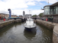
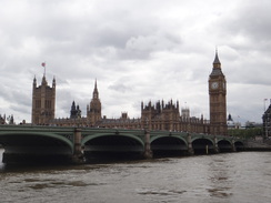
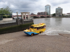
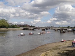
We passed the South Bank and beside the Millennium Wheel before passing under Westminster Bridge. The path on the other side was much quieter, and we strode along with better speed. Although we were both tired, we had no other problems and continued past Lambeth Bridge and the spectacular building that houses MI6. We had been watching a yellow bus-boat out in the river and it soon turned towards us and climbed out of the water, its propeller still turning on dry land until the duplex drive was disconnected.
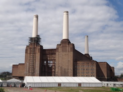
The path started to leave the river at regular intervals in Nine Elms before joining a main road that headed past the Battersea Cats and Dogs home. It started to pour with rain as we walked along the road, but the blue skies surrounding the solitary black cloud indicated it would not last long and so we did not bother stopping to put on our coats.
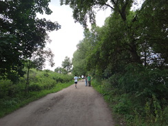
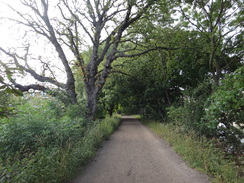
The trail soon entered Battersea Park, and we took a different route through the centre of the park. A charity walk had just ended and many women and children were waiting around in pink clothes. The park soon ended and we rejoined the trail through Battersea and Wandsworth. After passing Putney Bridge the trail rejoined the riverside and became very different in nature. The roads ended and instead the path followed rough tracks, with the river often out of view through the trees. At times it was hard to imagine that we were within the heart of the Metropolis, especially whilst passing the Wetlands Centre. Unfortunately the stony track started to play havoc with my left foot, and soon I felt a hot-spot developing in an unusual place in the middle. I stopped for a minute to take my trainer off and check for a pebble, but nothing was visible.
The river looped around to reach Hammersmith Bridge before heading on towards Barnes Bridge. There is a station by the bridge and we were tempted to stop the walk here, but due to the GPS problems I was unsure if we had completed the desired 26 miles. As we were both feeling fine we decided to continue on for another couple of miles to Kew Gardens; as it happens that was a good choice, as when we got home I discovered that at Barnes Bridge we had done just 25.7 miles. 0.3 miles may not be much, but it would have been really annoying to miss the distance by that much.
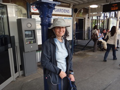
I found the last short distance difficult and we both started to slow down. The trail passed behind the Public Records Office at Kew before reaching a railway bridge over the river. All that was left was a short walk inland to the station, but this seemed to drag on forever. I could probably have continued on for another couple of miles, but it was now seven in the evening and Sencan was fairly done in. We waited for our train, but there was a nasty incident on the Piccadilly Line - Sencan half-fainted, half-slouched onto the floor of the packed train. We got off at Holborn and she sucked on a few sweets to help her low blood sugar, before continuing back to the car.
It had been a good day's walk and the final mileage of 28.1 smashes Sencan's previous record. She also managed it easily, although she will need to eat more on future walks. Best of all, we treated ourselves to pizza once we got home.
 |
 |
|
Directions
This walk starts off at Woolwich Arsenal station. Leave the station and cross Woolwich New Road to head down Vincent Road, with a magnificent building on the right and an area of grass on the left. When the road ends turn left down Greens End, and then right up Thomas Street. As this swings to the left, turn right down a short road to reach the pedestrianised Powis Street. Turn left and follow this west-northwestwards through Woolwich.
After a fifth of a mile it curves to the right and ends at a T-junction with John Wilson Street. Do not cross this, and instead turn right for a few yards to reach a roundabout with the A206. Cross to the northern side of the A206 using the pedestrian crossing, then turn left to cross the road leading to the Woolwich Ferry. Pass the ferry's car park on the right, and at its western end turn right to take a path that runs along the edge of the car park to reach the riverside path at TQ431792.
Turn left to start following the path westwards with the river on the right; it soon passes a couple of water-filled docks. After half a mile the trail heads off up a road to the left, leaving the riverside path that peters out a little further on. Take the first road to the right, Harlinger Street, and then take the first road to the left, Rushton Street. When this ends at a T-junction, turn right to continue along Rushton Road. This curves to the left to end at a roundabout. Cross the road on the left and then take the second road, the A206.
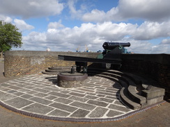
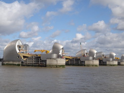
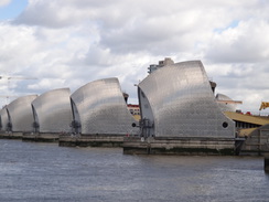
Follow this along for a quarter of a mile; when a pedestrian crossing across the road is reached on the left, turn right down a footpath that enters a small park. Soon this path joins the end of a road; continue straight on down this road, using the pavement on the right as it passes a series of buildings on the right. When this road ends at a T-junction, turn left along the new road for a few yards and then right down another road, which passes one of the Thames Barrier's buildings on the left. When this road ends, use some steps on the right over a flood bank and reach the riverside path at TQ416793.
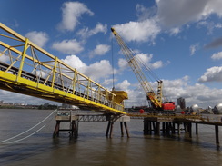
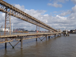
Turn left to start following the riverside path westwards; it soon reaches a tunnel under the barrier complex. If the gates are locked you will have to walk around the building to the other side; if not, just head under the tunnel to join a walkway on the other side. This tunnel marks the start of the Thames Path. The trail heads westwards with the river on the right as it will remain for much of the day. It is easy to follow and is well waymarked. At TQ409791 the path joins Riverside Road which heads past some wharfside buildings on the right. When this road curves to the left, continue straight on along a path that passes under a series of conveyor belts that stretch overhead before rejoining the riverside.
Shortly after the conveyor belts, the path turns to the left, passing Greenwich Yacht Club on the right. The path curves to the right to meet the end of Peartree Way; continue straight on with the boatyard on the right. When the path forks take the right-hand branch which rejoins the riverside path. Continue along as it passes under a cable car and approaches the O2 Arena (the new name for the Millennium Dome), following a large loop in the river. Shortly after passing a section of ship in the river on the right (a sculpture called 'Slice of Reality'), the path curves to the left to head towards the southern side of the O2 Arena; it soon meets the end of Tunnel Avenue.
Here the Thames Path should head off to the right to rejoin the riverbank. However the path was closed due to construction work (in 2012), and so we were forced to follow the diversion. If the path is open, follow that instead. We followed Tunnel Avenue inland, passing one of Blackwall Tunnel's large ventilation towers of the on the right. The road then curves to the right; follow it as it heads south to pass the tunnel's ornate entrance portal. Be careful not to join the main road on the left, but take a minor road that curves to the left and then right past a small patch of grass on the left. When the road forks take the right-hand branch and join the pavement on the right. A few yards further on turn right down a track that heads between fences to rejoin the Thames Path at TQ390792.
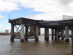
Follow the path as it winds around the eastern bank of the river; it is easy to follow. It soon comes to another diversion (in 2012): at TQ391785 turn left to follow a cycle path inland until it reaches Banning Street. Turn right along this road past a new development; when this road ends, turn right down Pelton Road. At the end of the road rejoin the trail and turn left down Ballast Quay. Just before this curves to the left, turn right along a little path beside the river; this soon ends at Cowley's Wharf. Turn right to follow this road as it heads under the massive girders belonging to Greenwich power station's loading jetty.
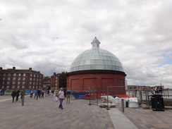
When the road ends, continue on along a footpath that soon curves slightly to the right and then left to run between buildings. It passes some old almshouses on the left and the end of a road on the left. Continue on until the end of another road is reached on the left, with the Trafalgar Tavern on the right. Turn right to reach the riverside path, then left to head in front of the magnificent buildings of the Old Royal Naval College. Continue on through Cutty Sark Gardens, and then go through some gates to reach the plaza in front of the Cutty Sark. Turn right and pass the bows of the ship and head towards a round brick building with a glass dome at TQ382778. This is the southern end of the Greenwich Foot Tunnel.
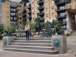
Continue across the plaza to reach the riverside path, which soon curves to the left to reach the end of Horseferry Place. Turn left to follow this road south before taking the first road to the right, Thames Street. When this ends turn left up Norway Street and follow it until it ends at a T-junction with the A200 Creek Road. Turn right to follow the road westwards as it crosses a bridge over Deptford Creek. Take the first road on the right on the other side, Clarence Road; as this curves to the left turn right down a private road that leads to the eastern bank of the creek before reaching the Thames once more beside a statue of Peter the Great at TQ376779.
Turn left to follow the southern bank of the Thames northwestwards in front of a new housing development. The path then curves to the left to meet a road; turn right down Borthwick Street. This curves to the right and then the left, before finally curving to the left once more and becoming Watergate Street. Follow this south and take the first road off to the right, Prince Street. As this curves to the left towards a roundabout, turn right down Sayes Court Street, and when this ends go through a gate into Sayes Court Park. Keep to the path on the left, then turn left down another path that emerges through another gate onto the B206.
Turn right to follow the B206 northwards; it soon curves slightly to the left. Pass Leeway road on the right, then turn right to join a path that heads across the middle of a park. At the far end squeeze between two buildings and cross Millard Road. Go up some steps and continue on along the path until it rejoins the riverside once more at TQ368785.
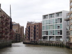
Turn left and start following the riverside path north-northwestwards. It passes a little boatyard on the left and turns left to reach some lock gates. Cross these and continue along the riverside path as it passes Greenland Pier on the right. Soon it curves to the left once more to reach a footbridge at the now-disused entrance to Greenland Dock. On the other side turn right and rejoin the riverside path; however this soon curves to the left once more, and then turn right down a stub road to join Odessa Street. When this curves to the left, turn right down a minor road that leads back to the river.
Once at the river turn left and follow the path north. It passes some gates that mark the entrance to Surrey Docks Farm, passes the farm and then goes through some more gates at the other end. Turn immediately to the right to rejoin the path alongside the river. This heads north for another quarter-mile to approach another old dock. Just before the dock, turn left down a road that passes a large building on the right (part of the Hilton Docklands Riverside hotel), and when this building ends turn right and then left. Pass the end of the dock and then turn left down some steps to reach Rotherhithe Street.
Turn right to follow Rotherhithe Street northwards; pass the Blacksmiths Arms and the Canada Wharf building on the right, then turn right down a path, with some steps to the left. This path rejoins the riverside. Follow the path as it crosses a bridge over an old dock at one point, then reaches a building at TQ359805. Here turn left up a road for about fifty yards until it ends at Rotherhithe Street once more. Turn right along the road to pass a building on the right, and then turn right up a narrow path between two buildings to rejoin the riverside path.
Continue on along the path; it curves around a little dock that is surrounded by buildings and then curves to the left to reach a large red bridge on Rotherhithe Street. Cross this and continue westwards along Rotherhithe Street. It passes St Mary's church on the left and ends; head straight on along a narrow path between buildings that emerges out onto Elephant Lane. As this road curves to the left head straight on along King Stairs Close. When this ends, continue straight on along a path through a park, with the river on the right.
The path becomes a road called Bermondsey Wall East by The Angel pub; head along this road; it soon swings to the right and then left. When the road ends cross Bevington Street and continue along Bermondsey Wall East as it passes the Old Justice pub on the right. Follow the road as it curves to the right, then sharply to the left to pass a new development on the right to end at a junction with Chambers Street at TQ343796. Turn right and follow Chambers Street; when it ends turn right along George Row and then left down the narrow Bermondsey Wall West.
When this reaches a building ahead it swings sharply to the left to become Mill Street; immediately after the bend take a narrow path that leads off to the right. This climbs a slope and turns to the right to squeeze between two buildings to meet the riverside; it then curves left to immediately reach a bridge over the entrance to Butler's Wharf. Continue along the riverside path as it passes a series of buildings on the left. When the walkway ends, turn left past the buildings to reach Shad Thames street. Turn right along this road and follow it as it heads under Tower Bridge at TQ336801.
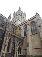
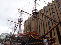
Pass under one of Tower Bridge's approach archways and continue along a pedestrian walkway. This passes the motorcycle-helmet shaped glass frontage of City Hall, and The Scoop before continuing past HMS Belfast and London Bridge City Pier to reach some steps that lead up onto London Bridge. Carefully cross the road to reach the upstream side and then turn left. Just before the end of a building on the right, turn right down some steps that lead onto Montogue Close. Turn right to head away from an underbridge. The road curves to the left towards the western end of Southwark Cathedral, and then turn hard-right down Cathedral Street. Finally turn right to head past a replica of the Golden Hinde.
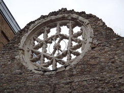
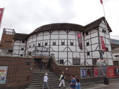
Turn left beside the Golden Hinde to follow a narrow road that leads out onto Clink Street. Follow this westwards, passing the ruined gable end of Winchester Palace and then under a large railway viaduct. Immediately on the other side, turn right down a road that leads back to join a riverside path. Follow this west as it passes under Southwark Bridge and past the Globe Theatre on the left before reaching the Millennium Bridge and the Tate Modern. The path then passes under Blackfriars rail and Blackfriars road bridges in quick succession and continues on past the Oxo tower on the left.
The promenade then becomes wider and more pleasant as it passes the South Bank, heads under Waterloo Bridge and past the Royal Festival Hall. It then continues curving to take a more southerly course, passing the Millennium Wheel on the right and passing under an approach arch to Westminster Bridge. Continue south along the Albert Embankment; this passes under Lambeth Bridge and heads on. As it approaches Vauxhall Bridge the path curves slightly to the right to reach a ramp off the foreshore; cross this and continue along the promenade on the other side as it passes in front of the SIS building to reach Vauxhall Bridge.
Follow the walkway under Vauxhall Bridge and continue along the Riverside Walk past shops and apartment blocks on the left. At the end of the walkway turn left past the Tower (at One St George Wharf) to reach the A3025 Nine Elms Lane. After a few yards turn right across some grass to rejoin the riverside walkway. Once the construction work on the Tower has been completed, it may be possible to just continue along the walkway without this diversion.
When the grass on the left ends, turn left along a walkway to rejoin the A3025. Turn right along this road and follow it southwestwards for half a mile; it crosses a bridge over a railway line with Battersea Power Station off to the right before diving under another railway bridge. Immediately after this second bridge, turn right along Prince of Wales Drive. This soon passes under another railway bridge and ends at a roundabout with the A3216 called Queen's Circus. Turn right and cross a minor road to walk past a petrol station on the right, and then cross Queenstown Road ahead. On the western side of this road, turn left to reach the Rosery Gate that leads into Battersea Park.
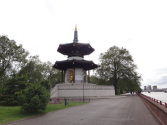
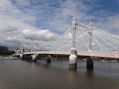
Go through the gate to enter the park. Follow the Carriage Drive South for a short distance, then turn right down a path through the park. This curves to the left before ending at another path. Turn right down this path, and soon afterwards right again to take a curving path that ends at the Carriage Drive North, with Chelsea Bridge a short distance away to the right. Head across a narrow area of grass to reach the riverside promenade. Turn left and follow the promenade westwards for two-thirds of a mile, passing the unmistakeable Peace Pagoda. Immediately after the promenade curves to the left at the western end of the park, turn right to reach a pedestrian gate that leads out onto the approach road to the Albert Bridge at TQ270772.
Carefully cross the road, and on the other side take a sloping path that leads to another riverside promenade. Follow this west for a fifth of a mile until it reaches Battersea Bridge. Climb some steps onto the bridge, cross the road and descend some steps on the other side to reach another riverside promenade. Follow this as it curves slowly to the left for a quarter of a mile until the promenade ends; here turn left to take a narrow path that squeezes past a church on the right to reach Battersea Church Road.
Turn right to pass the church, then right once more down a path that passes a slipway on the right. This path leads to a riverside promenade that heads towards the Battersea Railway Bridge. Once at the bridge, turn left to walk alongside the viaduct to reach Lombard Road. Turn right to pass through an arch under the viaduct, and after about a hundred yards turn right down a path that leads to another stretch of riverside path. Follow this south and cross a footbridge over an old dock before reaching a building ahead. Pass the gable end of the building and then turn left along a narrow path that ends at a bend in Bridges Court Road at TQ266761.
Turn right to follow the road south, passing a heliport and then the Verta Hotel on the right. Shortly after this turn right across a plaza between buildings to rejoin the riverside path. Continue along this path as it passes a series of new buildings before reaching Wandsworth Bridge. Turn left and then right to pass under a new (2012) underpass that leads out onto Pier Terrace. Follow this along, and when it ends turn right past The Ship pub to reach another stretch of riverside promenade. Just before the end of the walkway is reached, turn left to follow a wall on the right, with a waste depot on the other side of the wall. The walkway ends at Smugglers Way.
Turn right and follow Smuggers Way westwards past the waste depot. Do not enter the depot and continue along the road; when the road ends continue on along a track that crosses a couple of streams on bridges. On the other side, cross a road and head straight on to join Enterprise Way. Follow this road; as it ends turn right down Osiers Road. This soon curves to the left; just before it ends turn right and follow a path through the new development to reach a riverside path. The promenade passes an area of moored boats on the river before entering Wandsworth Park.
Follow the riverside path through the park; at the western end of the park, turn left for a few yards, then right through a gate and under a couple of archways that span between buildings. Cross a road and continue on along Deodar Road. This road passes under a railway bridge before curving to the left; as it does so, turn right down a dead-end road. When this ends after a few yards, angle left down a footpath that leads between buildings to a riverside path. Turn left and start following this along until Putney Bridge is reached. Just before St Mary's church is reached before the bridge, turn left and then right to pass to the south of the church and reach the A219 road immediately to the south of the bridge.
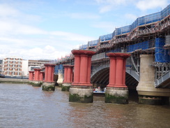
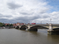
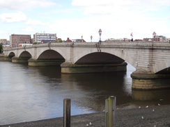
Carefully cross the A219 and join the pavement on the right-hand side of the A206 which parallels the river. Soon a minor road called The Embankment angles off to the right; follow this as it passes Putney Pier and continues on. The road eventually ends and is replaced by a good path. After 1.7 miles this reaches the A306 Hammersmith Bridge. The path heads under the bridge and continues looping around to the left; eventually it runs parallel to the A350 road and after 1.7 miles reaches Barnes Bridge.
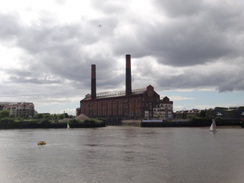
The walkway skirts under Barnes Bridge and continues on with the river still on the right and a floodwall guarding the road on the left. The path passes a large brewery building on the left and then becomes a road called Thames Bank beside a pub called The Ship. Continue along this road, and soon another path starts on the right. Follow this as it passes between the road and river; Chiswick Bridge is reached 0.8 miles after Barnes Bridge. Follow the path under Chiswick Bridge and continue along the riverside path for another 0.85 miles until it reaches Kew Rail Bridge at TQ195774.
Here the Thames Path is left behind. Do not pass under the bridge and instead turn left along a footpath that heads south-southwestwards with the railway embankment to the right. The path joins a road, and after a quarter of a mile reaches a junction with the A205 road. Turn left along the A205 and use a pedestrian crossing to cross it, before taking the first road off to the right, Burlington Avenue. This slowly curves to the left to take a more southerly course, before ending at a T-junction with West Park Road. Turn right along this for a few yards to reach the entrance to Kew Gardens station at TQ192767, where this walk ends.
 |
 |
|
Distances
| From | To | Distance (m) | Ascent (ft) | Descent (ft) |
|---|---|---|---|---|
| Woolwich Arsenal station | Greenwich (Cutty Sark) | 6.7 | 112 | 144 |
| Greenwich (Cutty Sark) | Tower Bridge | 6.1 | 89 | 85 |
| Tower Bridge | Battersea Park | 5.6 | 69 | 69 |
| Battersea Park | Hammersmith Bridge | 5.6 | 135 | 131 |
| Hammersmith Bridge | Kew Gardens station | 4.1 | 46 | 36 |
This makes a total distance of 28.1 miles, with 451 feet of ascent and 465 feet of descent.

For more information on profiles, ascents and descents, see this page
Transport
Kew Gardens lies on the District Line's Richmond branch, from where regular tube services run into the centre of London. Woolwich Arsenal is serviced by both overground trains and the DLR's Woolwich extension.
 |
 |
|
 |
 |
|
 |
 |
|
 |
 |
|
 |
 |
|
 |
 |
|
 |
 |
|
 |
 |
|
 |
 |
|
 |
 |
|
 |
 |
|
 |
 |
|
 |
 |
|
 |
 |
|
 |
 |
|
 |
 |
|
 |
 |
|
 |
 |
|
 |
 |
|
 |
 |
|
 |
 |
|
 |
 |
|
 |
 |
|
 |
 |
|
 |
 |
|
 |
 |
|
 |
 |
|
 |
 |
|
 |
 |
|
 |
 |
|
Disclaimer
Please note that I take no responsibility for anything that may happen when following these directions. If you intend to follow this route, then please use the relevant maps and check the route out before you go out. As always when walking, use common sense and you should be fine.
If you find any information on any of these routes that is inaccurate, or you wish to add anything, then please email me.
All images on this site are © of the author. Any reproduction, retransmissions, or republication of all or part of any document found on this site is expressly prohibited, unless the author has explicitly granted its prior written consent to so reproduce, retransmit, or republish the material. All other rights reserved.
Although this site includes links providing convenient direct access to other Internet sites, I do not endorse, approve, certify or make warranties or representations as to the accuracy of the information on these sites.
And finally, enjoy your walking!
Nearby walks
| # | Title | Walk length (miles) |
|---|---|---|
| 50 | Paddington to Mile End | 8.3 |
| 51 | Mile End to Enfield Lock | 12.7 |
| 60 | Slough to Alperton | 16.7 |
|
|

|