Walk #167: Brampton to Lowestoft
 |
 |
|
General Data
| Date Walked | 24/11/2001 |
| County | Suffolk |
| Start Location | Brampton Station |
| End Location | Lowestoft Station |
| Start time | 09.31 |
| End time | 14.10 |
| Distance | 12.3 miles |
| Description | This walk was a combination of road and muddy footpath walking northwards from the station at Brampton to the centre of Lowestoft. |
| Pack | I carried a 30-litre daysack containing coat, trainers, digital camera and a spare top. |
| Condition | I am slightly fatigued after this walk, but not enough to be worried about. I walked for over five hours with no stop which is good going and may explain this fatigue. My legs, feet and back are fine and I am more than ready for another walk tomorrow. |
| Weather | Today's weather was overcast with a very gentle breeze. It was fairly mild for the time of year, and I could have walked without my coat on if it had not been for the slight rain in the wind at various times. Fortunately this was not strong enough to get me wet as it never hardened into continuous rain. |
| OS map | Landranger number 156 (Saxmundham, Aldeburgh & Southwold) and Landranger number 134 (Norwich & The Broads, Great Yarmouth) |
 |
 |
|
Map of the walk
Maps courtesy of Google Maps. Route for indicative purposes only, and may have been plotted after the walk. Please let me have comments on what you think of this new format. For a detailed table of timings for this walk, please see the table file.
Notes
I had originally set out to do this walk in the early months of this year, but awful weather persuaded me to head back to Cambridge without doing it. Because it was a walk that promised to be quite boring with much road walking to be done it was not high on my priority list, and only the rapidly approaching end of the year and the need to finish off my walk around East Anglia spurred me on to do it.
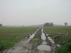
The majority of today's walk was along roads, which was lucky as the footpaths that I had to walk along were exceedingly muddy. I also encountered the autumn curse of walkers - ploughed fields which cause boots to gain a half-inch thick cake of mud on the bottom and make them much heavier. Autumn does have some benefits, however, as the late start of the season this year meant that there were some lovely golden colours on the leaves of the trees.
When I was walking through Mutford I cam across a little shop and post office which I decided to enter so that I could buy some snacks. I ended up chatting for five minutes to the nice lady who owned it. It sounded as if the shop was not doing that well unlike the post office which was a shame as she was nice, friendly lady.
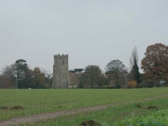
A major feature of this walk was the park at Sotterley, the western and northern sides of which I walked past. As is often the case with halls there was not much visible from the road with even the church being hidden behind a dark cloak of trees. Apparently the church is very nice, but I did not feel like going to visit the church itself - especially as there was no access to the public down the driveway to the church, the public having to use a muddy footpath a few yards to the north.
When I got to Lowestoft I paused for a minute immediately to the south of the bridge over the entrance to Lake Lothing to take a photo of a statue commemorating the RNLI servicemen in Lowestoft. I was most saddened to discover than rather being metal as I expected it turned out to be, from the sound of tapping it, either plastic or fibreglass. As I was taking the photo a siren sounded and the bridge behind me started to lift. I have always liked bridges, and so seeing this bridge lift was an interesting sight although it did delay the end of my walk by five minutes.
I decided to drive from Lowestoft to Cromer after the walk so that I would be in the right place to start tomorrow's walk. When I was walking down to the pub for some food in the evening it was slightly misty, and as I walked along the road at the top of the cliffs above the sea I could see the light from Cromer lighthouse shine ethereally through the night sky in a magical manner.
Cromer is quite a nice little town, and I have been quite impressed by the friendliness of the people around the town. After a couple of pints of Wherry Bitter at the Anglia Court Hotel I walked back to the B&B via the front, looking out over the misty sea and listening to the sound of the waves crashing onto the beach below me. It was a lovely sound, and I would have stayed there longer if it had not been for the wind that was giving me a slight chill.
I have now walked all the way from Cambridge to Ipswich and then up to Mundesley in Norfolk, and have only two day's walking to do to finish off my walk around East Anglia; Cromer to Mundesley (which hopefully I shall do tomorrow) and from Ely to Littleport. Completing this circular walk was one of my aims for this year, so it is nice to be this near completion with over a month of the year left to go.
Directions
This walk starts at Brampton Station, one stop south of Beccles. Leave the station and head onto the road. Turn left up the road and head uphill for a short distance until a driveway leading to a farm is reached on the left, leading to Brampton Old Hall. Use the driveway to enter the farm, and when you reach the courtyard turn left and then right to head northeastwards up a bridleway along a track. When the track takes a sharp left-hand bend continue straight on across a field.
A short way down the field the footpath takes a sharp 90-degree jink to the left, to head towards the corner of a little wooded area to the left. The path winds through this woodland, emerging from the bottom edge. The path then crosses a field downhill to cross a stream to meet a track. Note that on the OS 1:50,000 maps the stream is shown as being on the other (northern) side of the track; in reality it is on the southern.
Turn right down the track to head east. Continue straight on when a track comes in from the right and skirt the northern edge of Titsal Wood. A short distance after the end of Titsal Wood is passed a footpath heads off to the left northwards beside a stream. When I walked this the fields had been ploughed so I took what I thought was an obvious path on the western side of the stream; however when I got to the top of the field it turned out there was no way though the hedge or across the stream, so it is probably better to head uphill along the eastern side of the stream.
The footpath head across a couple of fields to meet a track neat Park farm. Turn right along the track and follow it a short distance to the farm. Go through the farmyard and follow a footpath east across a field to the A145 road.
Cross the A145 road and take a footpath on the opposite side of the road that heads eastwards for a mile before it ends at a bend in a road. Continue straight on along this road to the east. At a road junction turn half-left along a road for a short distance until it ends at a T-junction in Sotterley.
Turn left along a road to head north past the entrance to Sotterley Hall. The road continues for a couple of miles, curving around the western and northern sides of the Sotterley estate. It then climbs up Jay's Hill before descending to meet the B1127 road near a public house.
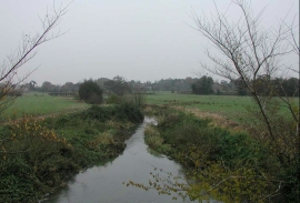
Turn left down the B1127 for a short distance, crossing a bridge over the Hundred River. Almost immediately after the bridge there is a road junction guarded by an impressive second-world war pillbox. Turn right down this road and follow it north-eastwards towards the village of Mutford.
Head straight through Mutford, passing initially a small shop and post office and then the attractive village church. At a road junction just past the church continue straight on to head northeastwards along a quiet country lane that winds past Mutford Little and Big Woods before it emerges a couple of miles later at a T-junction with a road on the outskirts of Carlton Colville. Head almost straight on along the road until it reaches the church at the road junction with the B1384.
Turn right onto the B1384 for a short distance until it bends sharply to the right. When it does this continue straight on up Uplands South road, passing to the right of a hospital. The road then becomes Uplands Close, and when it bends around to the right and joins Ashburnham Way take an old road (now disbarred to traffic) that heads straight on to the northeast.
After a short section of pedestrianised road, it becomes usable to cars once more as it becomes Uplands Road North. When this ends continue straight on along Cotmer Road. When Cotmer Road ends at a roundabout with the A1117, continue straight over and follow Colville Road northeastwards until just before the A146 is reached, where Dell Road East can be followed for a short distance eastwards. At the end of Dell road a cycle path can be taken that heads eastwards through the town and avoids walking along the busy main road.
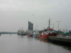
When the cycle path ends follow the signs northwards towards the town centre. Eventually the A146 Belvedere Road is reached, which can be followed to a busy junction. Turn left at this junction and cross over the entrance to the Docks by means of a lift bridge. Lowestoft station is immediately to the left on the northern side of the bridge.
Distances
| From | To | Distance (m) | Ascent (ft) | Descent (ft) |
|---|---|---|---|---|
| Brampton Station | Osterley | 3.5 | 82 | 135 |
| Osterley | Carlton Colville | 5.4 | 167 | 174 |
| Carlton Colville | Lowestoft Station | 3.4 | 46 | 72 |
This makes a total distance of 12.3 miles, with 295 feet of ascent and 381 feet of descent.
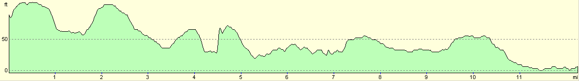
For more information on profiles, ascents and descents, see this page
Transport
There are regular train services running from Lowestoft to Brampton Stations. Since Brampton is a fairly remote locality I doubt whether there are any bus services that could be used instead.
Accommodation
I stayed at The Knoll Guest House, at 23 Alfred road in Cromer, tel. 01263 512753. This was a quite nice little B&B, and they were kind enough to give me a twin en-suite room for only twenty pounds as they did not have any single rooms left. I had dinner at the Anglia Court Hotel on Runton Road which had been recommended and turned out to make very nice food and served Wherry bitter, which was quite a sweet bitter that I have never had before.
Disclaimer
Please note that I take no responsibility for anything that may happen when following these directions. If you intend to follow this route, then please use the relevant maps and check the route out before you go out. As always when walking, use common sense and you should be fine.
If you find any information on any of these routes that is inaccurate, or you wish to add anything, then please email me.
All images on this site are © of the author. Any reproduction, retransmissions, or republication of all or part of any document found on this site is expressly prohibited, unless the author has explicitly granted its prior written consent to so reproduce, retransmit, or republish the material. All other rights reserved.
Although this site includes links providing convenient direct access to other Internet sites, I do not endorse, approve, certify or make warranties or representations as to the accuracy of the information on these sites.
And finally, enjoy your walking!
This walk was mentioned in the following routes:
| A walk around East Anglia |
Nearby walks
| # | Title | Walk length (miles) |
|---|---|---|
| 135 | Darsham Station to Brampton Station | 12.3 |
| 136 | Lowestoft to Caister-on-Sea | 14.4 |
| 259 | Gorleston-on-Sea to Southwold | 18.1 |
|
|

|