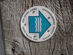
Walk #947: Trent Valley Way: Holme Pierrpont to Thrumpton and return
 |
 |
|
General Data
| Date Walked | 30/03/2012 |
| County | Nottinghamshire |
| Start Location | Holme Pierrepont |
| End Location | Holme Pierrepont |
| Start time | 08.09 |
| End time | 15.28 |
| Distance | 20.4 miles |
| Description | This was a lovely walk along the TRent Valley Way through Nottingham. |
| Pack | Today I carried my 30-litre Karrimor rucksack, filled with water, my waterproofs, a book and other odds and ends. |
| Condition | I feel absolutely fine after this walk. |
| Weather | Today's was dominated by beautiful sunshine, and it was quite warm for the time of yeat. It was a superb day for an easy stroll. |
| OS map | Landranger number 129 (Nottingham & Loughborough, Melton Mowbray) |
 |
 |
|
Map of the walk
Maps courtesy of Google Maps. Route for indicative purposes only, and may have been plotted after the walk. Please let me have comments on what you think of this new format. For a detailed table of timings for this walk, please see the table file.
 |
 |
|
Notes
I had to visit a friend in Nottingham this afternoon, so it seemed like a good excuse to get a walk done in the unseasonal warmth. I had long been casting covetous eyes at the Trent Way, and so I decided to do one of the two upstream branches of the trail today. The drive went well, and surprisingly there were no queues at any of the petrol stations - it seems as though the fuel panic is firmly in the medias frenzied imagination.
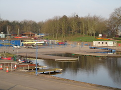
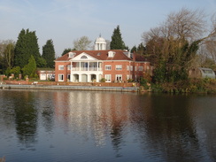
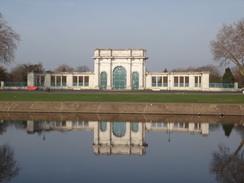
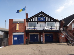
I visited the National Watersports Centre at Holme Pierrepont many years ago with a friend to watch some dragonboat racing. I knew there was a public car park, but after driving to and fro for five minutes I couldnt find it. Instead I decided to park by the main building where there were some spaces alongside the road. A map on the building indicated that these were parking spaces, but I had no idea if they were meant for the public. Feeling slightly guilty, I locked my car and set off on the walk.
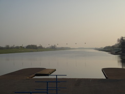
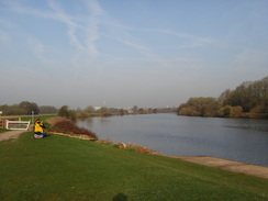
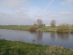
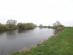
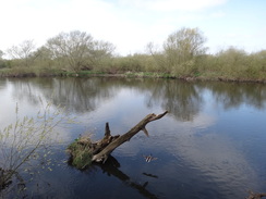
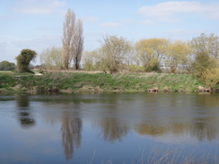
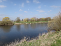
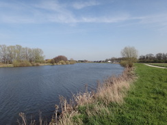
Initially I walked around the western end of the 1.3-mile long rowing lake, passing over the concrete roof of some boat sheds before joining a road that, it turned out, led into the public car park. This gave me my first glimpses of the Trent which gleamed in the warm sunshine. I was wearing shorts, which meant that I could expect some cloud during the day.
A good path led me westwards along the southern bank of the river; Nottingham Racecourse was out of sight on the other bank. The path underfoot was very good and firm, and several people cycled past, presumably on their way into work. Greens windmill, a well-known Nottingham landmark, was clearly visible across the river.
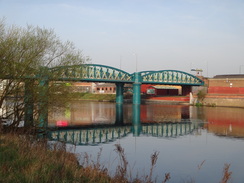
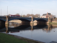
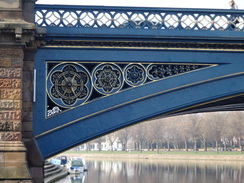
The first bridge I came to was the Lady Bay Bridge; this was a surprisingly elegant structure of three bowstring spans painted in eggshell blue. It was reminiscent of various Victorian-era rail bridges I have seen and the reason became obvious when I got home - it once carried the Midland Railways line from Melton Mowbray over the river, and got converted to road use after the railway closed.
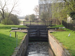
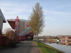
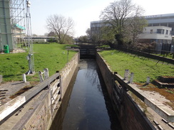
A short but pleasant stroll took me on to a little bridge over the river lock of the Grantham Canal. The lock was dilapidated but seemed to be in a better state than many on this disused canal. Work is ongoing to reopen the canal to boats, but due to development since the canals closure it is unlikely that the outfall into the Trent will be in this, its historic position. A little further on the path went under one of the stands of the City Ground, the home of Nottingham Forest Football Club. Meadow Lane, the home of their rivals Nottingham City, was visible across the river.
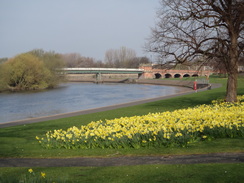
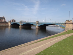
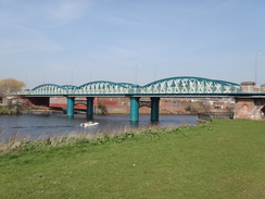
Some high spotlights to my left marked another sport - Trent Bridge, the home of Nottinghamshire cricket and a test ground. Liking neither football or cricket, I had never had reason to visit any of these places and probably never would. Things improved when I reached the rather pleasant Trent Bridge, a bridge of three elegant arches that spans the river. This was completed in 1871, replacing an earlier medieval structure.
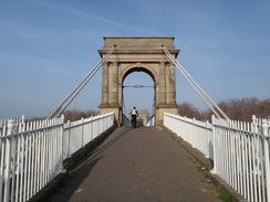
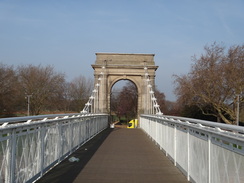
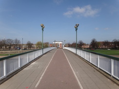
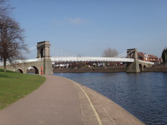
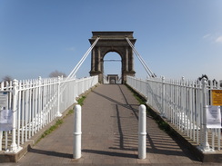
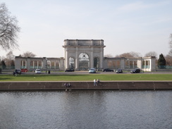
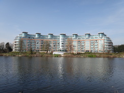
The path took me past the County Hall before reaching a wonderful suspension bridge across the river. This was the Wilford Suspension Bridge, which opened in 1906. Unusually it is technically not a footbridge as it first appears; its true purpose is hinted at by its owners - Severn Trent Water. The bridge was actually constructed as an aqueduct to provide water to the centre of the city, with a pedestrian walkway above. It must be said that the water and gas mains are kept well out of view, giving the bridge a beautiful and aesthetically pleasing look.
I had to cross the river at the bridge, after which the trail followed the top of the concrete walkway beside the river, with a park to the right. The river curved around and soon I came to the spot where the bridge carrying the Great Central Railway over the river used to be. I remember this from my teenage years but there are now few signs of it - the bridge and the surrounding embankments having been demolished in the early 1990s, despite it being shown on my map.
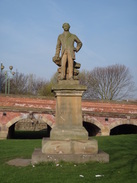
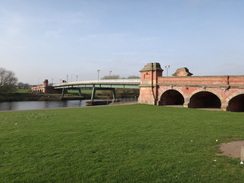
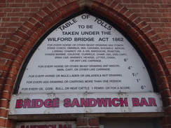
Soon a rather good statue came into view, commemorating Sir Robert Clifton who built the Clifton Toll Bridge that stands behind the statue. The bridge appears to be an unusual structure, with elegant brick arches and abutments on each bank joined by a narrower concrete bridge. The bridge was built with cast-iron spans in 1860 to carry traffic from a colliery. Later the cast-iron spans were replaced with the current foot bridge, and this in turn will be replaced when the Nottingham Tram System is extended south of the river. A couple of men were surveying the bridge as I passed, presumably in relation to this work. I hope the keep the character of the remaining brick parts of the bridge which features a list of old tolls on the tollhouse.
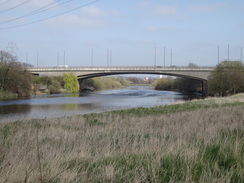
Here the Trent Valley Way forks; one branch follows the northern bank whilst the other takes the southern. I had walked the northern branch before on several occasions, so today I planned to do the southern. The path headed south along a road before climbing up to follow a flood wall. Soon traffic noise indicated the approach of the twin concrete bridges that carry the A52 over the river. There are actually two bridges here, made several years apart. Although the concrete arches are somewhat graceful, they have none of the beauty of the earlier bridges.
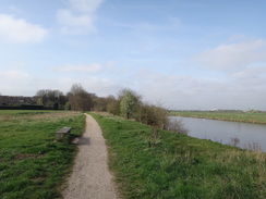
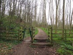
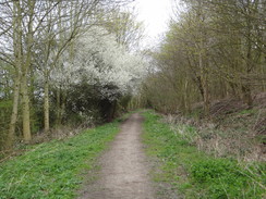
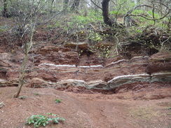
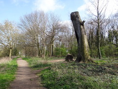
Now the character of the walk changed - initially the trail followed the southern bank of the river across fields, before going through the first of many gates to enter some woodland. When I was planning the walk I was expecting houses to be visible through the trees, but this was fortunately not the case as a large, steep bank stretched up on the left. This had the added advantage of keeping the heat of the sun off me, meaning that I was not going to get sunburnt. It was a surprisingly enjoyable stroll - cool and sheltered amongst the trees with occasional pleasant glimpses over the river to the right.
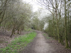
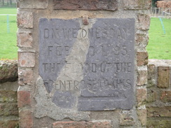
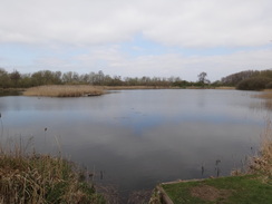
All good things have to come to an end, and this time it did so as the river curved away to the right. The path continued in the shade of the cliff past a marl pit that had been converted into a lake, which proved well worth a diversion. Slowly the cliff to the left became a bank, and then the path burst out of the trees and passed a couple of fields before entering Brandshill Wood. Again this was a pleasantly shaded walk, but all too soon the path erupted out of the trees once more and crossed fields to reach the pretty little village of Barton in Fabis, passing a roadside brick column that featured a plaque marking the heights of various floods.
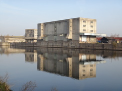
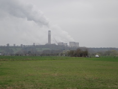
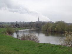
My feet were starting to overheat by now and I wished that the trail ended in this village instead of a mile and a half further south. The clouds started to gather as I crossed the floodplain directly towards the high chimney of Ratcliffe-on-Soar power station, one of the largest stations in the UK. This opened in 1968 and generates 2GW of power. It is a familiar sight from my journeys north along the M1, and it was interesting to see it from this angle, with the bulk of a hill obscuring most of it. The skies were thoroughly clouded over by this time and the headwind grew strong enough to be annoying, if not hindering.
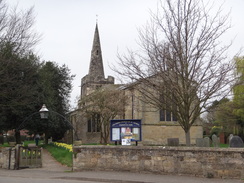
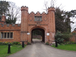
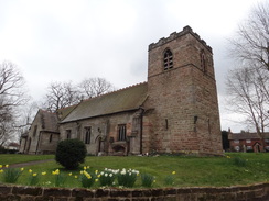
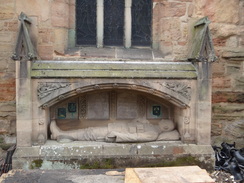
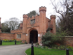
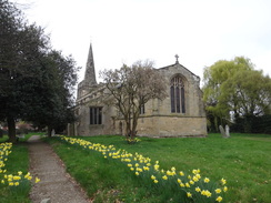
The trail flirted with a bend in the river before heading inland to reach the trailhead in the little village of Thrumpton. On the way it passed the rather magnificent brick gatehouse belonging to Thrumpton Hall. The house itself was out of sight, but the gatehouse was a real treat. The church, which I took to be the trailhead, was a short distance uphill. A rather unusual war memorial is inset into the exterior wall of the church, the only such example I can remember seeing. Sadly the church was locked so I walked around the exterior to find a man on a ladder, apparently pointing the stonework.
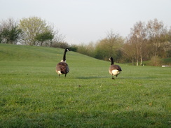
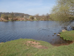
From here it was simply a case of retracing my steps back to Holme Pierrepont. I really hate there-and-back walks but I am starting to wonder why as the return journey absolutely flew. The headwind had become a tailwind that pushed me along the open sections, and I was bathed in sunshine as the clouds parted. At Holme Pit I came across a couple and their fierce-looking dogs - the man was carrying a menacing BB gun; I was very glad when I left them behind.
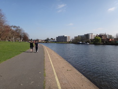
Surprisingly todays walk passed only one pub, The Ferry near the Clifton Toll Bridge. As I had made good time on the return trip I decided to nip in for a quick drink and to rest my feet. I sat outside in the sunshine, thinking of what had so far been a rather good days walk. All too soon I set off once again, passing a woman exercising on old-fashioned four-wheel roller skates before crossing the suspension bridge and heading back towards my car. Before I knew it I was unlocking my car. My feet had really suffered on my last walk but they had been fine on this one, with no particular problems. Fortunately I had finished earlier than I expected, which meant that I got to spend more time with my friend.
 |
 |
|
Directions
This walk starts off at the main building of the National Water Sports Centre at Holme Pierrepont, to the southeast of Nottingham. From the main building I walked past the end of the rowing lake to reach the public car park; however a better route is described below. Leave the main building and walk down the approach road and through the gate to reach Adbolton Lane. Turn right and follow this lane as it heads southwestwards, slowly curving to head in a more westerly direction. After nearly half a mile, turn right down a surfaced road that is signposted for the country park. This heads eastwards before curving to the left to reach a large public car park at SK609388.
Walk through the car park to reach the southern bank of the River Trent, then turn left to start following the riverside path westwards. Continue along the path for 1.6 miles, passing through a country park. At the end of the park the path becomes surfaced and continues on to reach the A1066 Lady Bay Bridge is reached at SK584386. The path passes under the bridge and continues on, soon reaching the entrance lock to the disused Grantham Canal. It crosses this on a little bridge and then heads towards the western stands of the City Ground - the home of Nottingham Forest Football Club. The path passes under a stand in company with a road and continues on; a third of a mile after Lady Bay Bridge it reaches Trent Bridge.
Just before Trent Bridge is reached, turn right off the road down a path that dives through an arch under the bridge. On the other side follow the path as it curves up to reach a path; turn right to follow a curving path that descends to reach the riverside once more. After another third of a mile the path reaches the Wilford Suspension Bridge; at the bridge follow a path off to the left for a few yards and then right to reach the eastern end of the bridge.
Cross the suspension bridge to reach the western side of the river. Turn left onto the Victoria Embankment and then left once again across grass to reach the riverside path. Follow this away from the bridge; it sweeps to the right and after 0.8 miles it reaches the Clifton Toll Bridge at SK569381. Do not pass under the bridge and instead turn right to cross the grass beside a statue to reach the northern end of the bridge at SK569381.
Cross the bridge to reach the southern side of the river, then follow the road south for a fifth of a mile until the Ferry Inn is reached on the right. Continue along the road southwards; after a quarter of a mile the pavement goes up a bank to the right and follows a floodwall on the right, with the river far below. After a short distance the road curves away to the left and the path curves to the right through a cycle barrier to follow a flood bank. When the track forks take either the top-most cycle path along the top of the bank or the lower footpath at its base.
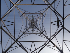
Both paths rejoin and head under the large concrete spans of the Clifton Bridge. Almost immediately take a path that leads off to the right that heads away from a car park for river users. This path joins a cycle path and crosses a bridge over a stream before heading across the floodplain. Follow this southwestwards; it passes near to an electricity pylon and continues on with the river a short distance away to the right. After 0.7 miles it goes through another bike barrier and enters an area of woodland, with a hillside stretching off to the left.
Here the Trent Valley Way climbs the hillside to the left; a better walk is to continue along the path at the base of the hillside. After a mile it joins a track plunging down from the hillside to the left at SK540349. Turn right along this track and once it forks once more, take the left-hand fork to continue along a path with the hillside off to the left. Continue along this path in company with the slope; it passes a flooded marl pit called Holme Pit, crosses a track at SK535341 and leaves the woods before entering another area of woodland.
After a mile and a half the path leaves the woodland and curves to the right, following a fence on the left. It crosses a pedestrian gate beside a field gate. When the fence curves to the left, head half-left across the field aiming for a pedestrian gate beside a field gate in the far corner. Go through this and continue along a track to another pedestrian gate beside a field gate. On the other side continue on for a few yards until the path ends at a T-junction with a road at SK525327.
Turn right to follow the road as it heads into the village of Burton Fabis. At a crossroads take the left-hand fork, Manor Road, and follow this as it curves to the right and then the left to reach Burton Fabis Church. Continue along the road past the church before taking the first road to the right, Rectory Place. Follow this past a farm on the left before taking a path that leads off to the left across a stile beside a field gate. On the other side cross a small concrete apron to reach a stile beside another gate.
Cross this to enter a field; head across the field, angling slightly away from the farm on the left. The path crosses a flood bank and continues straight on to the corner of the field beside an overgrown patch of land that hides a pond. Cross a field bridge over a stream into another field. Ignore a direct path that goes straight on the other side and turn left to follow the scrub. When the scrub ends turn right to continue along the edge of the field; it soon curves to the right once more and then the left to rejoin the direct path.
Go through a bridleway gate in the corner of the field and continue on with a hedge on the left and a fence on the right. When the fence ends, go through another bridleway gate and continue on with a hedge still to the left. The path approaches a track beside the river; go through a bridleway gate beside two field gates and join the unsurfaced track, keeping the river to the right. Either walk along the track or the grass between the track and the river; as it approaches a static caravan park on the left, rejoin the track and cross a stile beside a double field gate.
Continue on along the track; it soon goes through a gate and becomes a surfaced road. This soon curves to the left to head south into Thrumpton; the road curves to the right to approach the magnificent brick gatehouse belonging to Thumpron Hall. Here the road curves to the left to head slightly uphill to reach Thrumpton Church at SK509311.
From here it is simply a case of retracing your steps back to Holme Pierrepont.
From Thrumpton Church, follow the road downhill towards the brick gatehouse of Thrumpton Hall. Here the road curves to the right and then the left before curving gently to the right. The surfaced road ends at a gate; continue straight on through the gate along a rough track to reach a stile beside a double field gate. Cross through this to pass a static caravan park on the right. Immediately after this turn left to leave the track and walk along the grass between the River Trent on the left and the track on the right; at the end of the field turn right to rejoin the track once more.
Go through a bridleway gate beside a double field gate to enter a field. Immediately turn half-right to start following a hedge on the right northeastwards. At the end of this field it goes through a bridleway gate to enter another field. Follow hedge on the right to reach another bridleway gate. Go through this and continue following the hedge. The path soon curves to the right to follow a ditch on the right, then the left to reach an area of scrub woodland.
At the trees it curves to the left once more, keeping the trees on the right, before curving to the right to reach a field bridge over a ditch at SK517324. On the other side head diagonally across a field, aiming for a flood bank ahead that is just to the right of a church tower. Cross the flood bank and continue straight on across another field, aiming for the far corner. Cross a stile beside a field gate with a barn on the right, then across a small concrete apron to reach another stile that leads out onto Rectory Place in Burton in Fabis.
Turn right to head down Rectory Place for a short distance until it ends at a T-junction with Manor Road. Turn left to follow the road northeastwards; it soon passes the church on the left and then curves to the right and left to reach a crossroads. Here turn right up New Road. Follow this eastwards for 170 yards past a farm on the left, then turn left down a track to reach a bridleway gate beside a field gate. Go through this and continue on for a short distance to reach another bridleway gate that leads into a field.
On the other side turn half-right to head northeastwards across the field, aiming for a wooded hillside ahead. It meets the corner of the field on the right and then curves right to follow a hedge on the right. Soon it goes through a bridleway gate beside a field gate and continues between hedges. It goes through another bridleway gate to reach the base of a wooded hillside; here the path curves to the left to head northwards, with the slope of the hill to the right. It goes through a series of small gates; after 0.6 miles it emerges out of the trees at SK532337. It heads on past a couple of fields on the right. At the end of the second field it heads into Clifton Wood and crosses a track. Half a mile after the track it meets another track that comes in from the left; follow this for a short distance until it curves up to the right to ascend the hillside.
Here the Trent Valley Way heads up the hillside; my route is slightly different. At the start of the ascent turn left through a bike gate and follow the path as it heads northeastwards along the base of a wooded hillside, with the River Trent a short distance away to the left. After a mile it emerges out of the trees when the Trent Valley Way comes from the hillside from the right. Continue along the obvious path along the floodplain with the river a short distance away to the left; it passes close to an electricity pylon.
Shortly after the pylon, the path curves to the right to cross a bridge over a stream at SK560365. The path forks on the other side; take the lesser left-hand fork away from a car park on the right; it soon meets another path. Turn left along this and follow it for a few yards as it passes under the two Clifton bridges that carry the A52 overhead. Soon afterwards the path forks again; take either the left-hand fork that goes along the base of a flood bank or the right-hand one that runs along the top. Eventually the lower path climbs up the bank and joins the upper one. Follow the combined path along until it reaches a bike stile that leads out to run between a flood wall on the left and a road on the right.
Continue along the path with the wall on the left; soon the path descends past a bike gate to join the road in West Bridgford. Head north along this road; it curves gently to the right and then the left before passing the Ferry Inn on the left. Continue along the road past the pub for a fifth of a mile to reach the Clifton Toll Bridge. Cross this and on the northern side of the river turn right and head down the grass, passing a statue to reach the riverside promenade. Follow this for 0.8 miles as it follows a large bend in the river to reach the western end of the Wilford Suspension Bridge at SK579376.
Just before the bridge is reached, turn left up the grass to reach the western end of the bridge, then turn right to cross it. On the eastern bank turn left and then immediately left once more to reach the riverside promenade. Turn right and follow the promenade northwards with the river on the left for a third of a mile to reach Trent Bridge. Just before the bridge is reached turn left down a path that leads under an arch of the bridge. On the other side the path climbs to meet a road on the right. Follow this as it heads under a stand of the City Football Ground and crosses a bridge over the mouth of the disused Grantham Canal. Shortly after this the path heads under the A6011 road bridge.
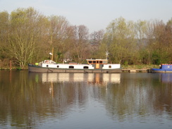
Follow the riverside path eastwards with the river on the left. After 1.3 miles it reaches a boatyard at SK605386; it crosses a bridge over a ditch to reach a gate. Do not go through the gate and instead turn right to follow a path with a fence and the boatyard on the left. It curves to the left to head south for a short distance before emerging onto Adbolton Lane. Turn left along the lane and follow it in a rough eastwards direction for about half a mile until the entrance to the main building of the National Water Sports Centre is reached at SK613386. Turn left along the driveway and follow it as it curves to the left to reach the main building, where this walk ends.
 |
 |
|
Distances
| From | To | Distance (m) | Ascent (ft) | Descent (ft) |
|---|---|---|---|---|
| National Water Sports Centre | Thrumpton church | 10.5 | 321 | 282 |
| Thrumpton church | National Water Sports Centre | 9.9 | 230 | 269 |
This makes a total distance of 20.4 miles, with 551 feet of ascent and 551 feet of descent.
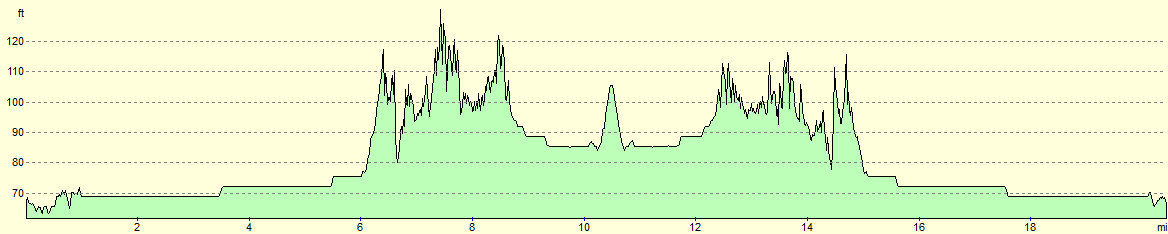
For more information on profiles, ascents and descents, see this page
 |
 |
|
 |
 |
|
 |
 |
|
 |
 |
|
 |
 |
|
 |
 |
|
 |
 |
|
 |
 |
|
 |
 |
|
 |
 |
|
 |
 |
|
 |
 |
|
 |
 |
|
 |
 |
|
 |
 |
|
 |
 |
|
 |
 |
|
 |
 |
|
 |
 |
|
 |
 |
|
 |
 |
|
 |
 |
|
 |
 |
|
 |
 |
|
 |
 |
|
 |
 |
|
 |
 |
|
Disclaimer
Please note that I take no responsibility for anything that may happen when following these directions. If you intend to follow this route, then please use the relevant maps and check the route out before you go out. As always when walking, use common sense and you should be fine.
If you find any information on any of these routes that is inaccurate, or you wish to add anything, then please email me.
All images on this site are © of the author. Any reproduction, retransmissions, or republication of all or part of any document found on this site is expressly prohibited, unless the author has explicitly granted its prior written consent to so reproduce, retransmit, or republish the material. All other rights reserved.
Although this site includes links providing convenient direct access to other Internet sites, I do not endorse, approve, certify or make warranties or representations as to the accuracy of the information on these sites.
And finally, enjoy your walking!
Nearby walks
| # | Title | Walk length (miles) |
|---|---|---|
| 64 | Long Eaton to Willington | 14.0 |
| 66 | Melton Mowbray to Bingham | 16.1 |
| 76 | Bingham to Nottingham | 13.5 |
|
|

|