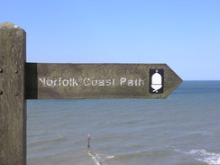
Walk #903: Wells-next-the-Sea to Sheringham
 |
 |
|
General Data
| Date Walked | 24/05/2011 |
| County | Norfolk |
| Start Location | Wells-next-the-Sea |
| End Location | Sheringham Station |
| Start time | 08.27 |
| End time | 16.02 |
| Distance | 19.8 miles |
| Description | This walk follows the North Norfolk Coast Path as it heads eastwards along the coast, including a long stretch of walking across shingle. |
| Pack | Today I carried my 30-litre Karrimor rucksack, filled with water, my waterproofs, a couple of books and other odds and ends. |
| Condition | I feel absolutely fine after this walk. |
| Weather | This was the second windy day in a row; unlike yesterday the breeze was chilly, which meant that overheating was less of a problem. It was mostly a sunny day, and a good one to be out an about on the coast. |
| OS map | Landranger number 132 (North West Norfolk, King's Lynn & Fakenham) and Landranger number 133 (North East Norfolk, Cromer & Wroxham) |
 |
 |
|
Map of the walk
Maps courtesy of Google Maps. Route for indicative purposes only, and may have been plotted after the walk. Please let me have comments on what you think of this new format. For a detailed table of timings for this walk, please see the table file.
 |
 |
|
Notes
I awoke early after a good night's sleep, and as the campsite's gates did not open until seven I lay down and read for an hour. It was an unusual place to sleep - instead of being in my tent, I was lying in the awning of my parent's caravan, which at least gave me much more headroom. It had not been a cold night, but I was still thankful for the cup of tea that my mum offered me when they got up.
Because of the tea and general faffing, I did not drive off until after half past seven. This was a bad thing because I was still considering walking the rest of the Norfolk Coast Path as far as Cromer, which I would have to complete by half five in order to get the Coasthopper bus back. To make matters worse, I had a half-hour drive just to get to the start point in Wells-next-the-Sea. The roads were quiet and I was soon parked at the quayside. Some more faffing, including a visit to a local shop, meant that I was not on the trail until nearly half eight. The car park cost four pounds for all the day.
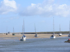
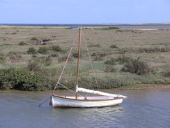
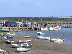
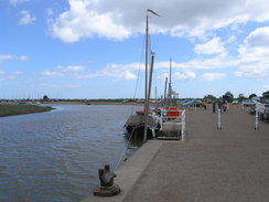
Pretty soon I gave up on the idea of reaching Cromer today and settled on a target of Sheringham. This decision meant that I could take a more relaxed pace than I had the day before and I started to dawdle as I strolled along. I have always likes the seafront at Wells, with its ever-present tall ship, the Albatros and its long quayside, above which hangs a green structure out of an old warehouse. The large expanse of mudflats that stretch out to sea makes it hard to imagine that ships can reach open water, but large ships such as the Albatros can still reach the quay.
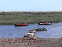
The quay was just starting to wake up, with people arriving to work as I strode along. A good path led me eastwards with large expanses of mudflats off to the left. It was an easy, enjoyable stroll, and I found myself wondering where the walker I met yesterday was on the path - had he started earlier or later than me, and was he ahead or behind? Such varied and random thoughts helped me cover the miles over scenery that was good, if not spectacular. A birdwatcher would have been in heaven, but there was not much of interest to me.
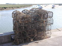
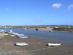
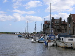
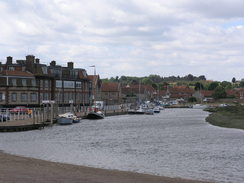
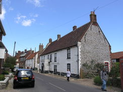
Eventually the quayside at Morston was reached. This was fairly busy and I considered going into the shop to buy some crab sandwiches to eat. Instead I walked on, joining a path that headed eastwards along the top of a flood bank. Eventually the bank petered out and the path continued with fields on the right to enter Blakeney. Again the small quayside was busy and the car park nearly full, a sign that the tourists were out and about and that the day was progressing.
A strong, blustery wind had been the main feature of yesterday's weather, and the wind was only slightly less gusting today. Unfortunately whereas yesterday's breeze had been warm today's felt much colder. This became a problem for the first time as the path headed along the flood bank around the Fresh Marshes. It felt awfully cold and I tried to walk fast to keep myself warm.
The course of the flood bank seemed very different from that of the map, and the reason soon became clear - the flood bank underfoot was new, constructed inland of the old bank. On my coastwalk I had walked along the old bank, which had now been fairly well obliterated. This work had been done to avoid silting of the channel that ran towards the sea; the old channel had been too narrow to avoid the shingle bank from occasionally blocking it. I could understand the reasons but I felt sad nonetheless; I would never be able to reproduce that particular part of my coastal walk of nine years earlier.
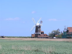
I battled through the headwind as the flood bank turned south to head towards Cley. The famous Cley windmill grew larger in front of me, then receded behind as the banking led me towards the main road through the village. The views on this stretch were superb, and only the wind stopped me from dawdling to make the most of them.
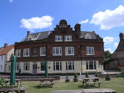
The trail follows the main road for a short distance through the village, and care needs to be taken as the road is narrow, a fact made worse by the cars that park on the roadsides. Now that I was not in a hurry it seemed sensible to stop, so I nipped into the George Hotel in the village to get a pint of bitter shandy and some snacks. I was hardly the only walker in the place despite the early hour, and tea and coffee seemed much more popular than alcohol.
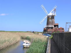
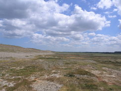
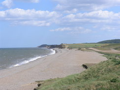
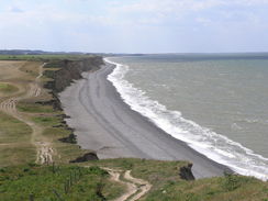
Back on the trail, I passed the windmill before joining a flood bank that headed north up towards Cley Eye. Once at the car park I was greeted with the shingle bank that stretches for several miles west to Blakeney Point, protecting the marshes in front of Morston and Blakeney from the worst that the sea could offer. It is a spectacular place, but my route took me eastwards along the shingle bank.
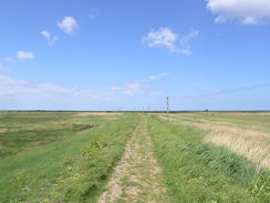
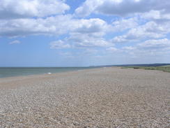
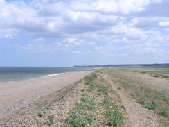
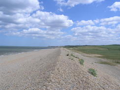
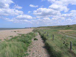
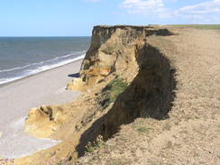
Shingle is my second-least favourite substance to walk over, only beaten by soft sand. Initially I followed a distinct path that ran behind the shingle ridge, but soon I was forced onto the loose shingle at the top of the ridge. The local authorities have more or less given up on protecting this stretch of coast, and a new path has been created further inland for when the shingle bank is breached, as it has been several times in the past.
I must admit that it was a spectacular walk, but the views out to sea were not worth the hard walking over the shingle. I left the shingle to climb over the first of three low hills, half eroded b the sea, but soon I was back on the shingle. My only company were a few bird watchers whose gait was all too familiar; they would walk for a few yards, pause and lift binoculars to their eyes, then walk for another few yards. I made for slow walking, and I wondered what birds were attracting so much of their attention. Not for the first time I wished that I knew more about the bird life that lives or visits our wonderful island.
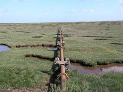
Of more interest to me were the tracks inland, which form part of the land of the Muckleburgh Collection, Britain's largest private collection of military vehicles. The tracks looked as though they were well-used, showing that people often had fun with the tanks and other vehicles. Nearby the masts of a wireless station stroked the sky.
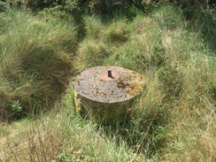
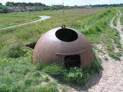
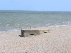
So far I had passed two or three concrete World War II spigot bases for mortars, a fairly unmistakable device that can be seen all over the country. The weapon designed to fit on them had been far from successful and the Home Guard must have been glad that they never needed to be used. A base on the shingle had been eroded and turned on its side, allowing me to see exactly how deep the foundations for it went. More metal dominated other stretches of the beach; old rails had been planted vertically into the beach, presumably as a means of stabilising the shingle. The exposed metalwork showed that the scheme had failed.
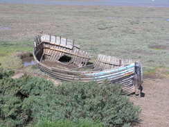
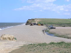
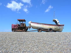
The shingle beach became busier as I approached a small car park near Weybourne, then quieter as I let it behind. The other two small sea-eroded hills gave me temporary respites, but it was a relief when I reached Weybourne Hope, where the path finally climbed up onto the cliffs that would take me into Sheringham. Three old tractors stood at the end of the beach. They had all been heavily battered by the weather and were obviously being used to haul boats up the beach. One in particular looked as though it would fall apart the moment that it started.
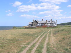
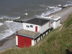
Soon the path had to divert inland of some old coastguard cottages; at one time it went to the shoreward side, but erosion had destroyed that path. There was no obvious erosion from the last time I had walked this route, and I guess that the cottages are safe for another few years. The cottages acted as a large wind break and so I stopped, sitting down on the grass as I munched on a chocolate bar.
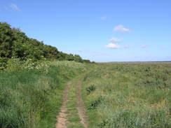
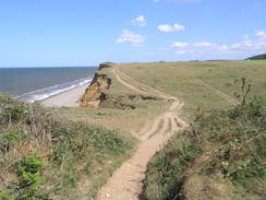
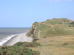
I soon set off once again, following a stretch of path that has long been one of my favourite clifftop walks. It slowly climbs and falls, with good views out to sea all the time. There were few golfers about on the golf course, perhaps due to the fierce breeze.
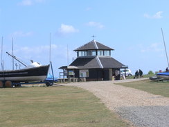
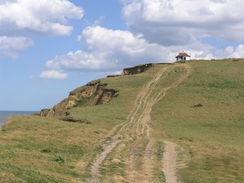
A couple of Hercules circled overhead, their pilots heading inland and then out to sea. People were stopping to watch, and I paused too as one came close overhead. Eventually the path climbed up to the Coastwatch lookout, from where there were superb views in both directions along the cliffs. This marked the start of the descent down into Sheringham.
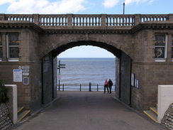
The trail's route through the town is not obvious; I continued high along a surfaced path before descending down through an elegant bridge to reach the promenade. I did not stay on it for long before climbing back into the town proper. Sheringham is a fairly attractive place that is let down slightly by having a few too many amusement arcades. The town was bustling as I made my way through towards the station, where I hoped that I could catch the Coasthopper bus.
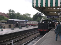
I immediately noticed one change from the last time I was in the town - a level crossing had been made to connect the preserved North Norfolk Railway with the national railway network. When the railway line to Holt was closed, BR created a new station on the other side of the road to remove the need for a level crossing. This allowed the North Norfolk Railway to use the old station as their base, but they had always wanted a connection with the national network so they could accept incoming tours. It now looked as though they had achieved their aim.
A couple of other people were waiting for the Coasthopper bus, and as there were a few minutes to go before the bus arrived according the timetable I went into the station. A steam train pulled in, and I took some photographs before heading back to the bus station. The scheduled time came and went; in the end the next bus arrived half an hour later. It turned out that the timetable on the post is the summer one, which only comes into effect next week!
I enjoyed the ride back to Wells on the bus, although it was sad that a woman in front of me left her bright-pink iPod on the seat. I handed it to the driver as I got off the bus, ready for the drive back to the campsite. It had been another good day's walk; I could perhaps have continued to Cromer and got there to get the last bus, but I was glad that I had been able to take a more relaxed stroll.
 |
 |
|
Directions
This walk starts at the car park on The Quay in Wells-next-the-Sea at TF915438. Follow The Quay eastwards, passing under the spectacular green gantry that juts out from the old granary. As the road curves to the right turn left to continue on down another road called East Quay, which continues to parallel the foreshore. When the road curves to the right after a fifth of a mile turn half-left down a rougher track keeping a couple of huts to the left. As the track curves to the right climb up onto a floodbank.
Continue along the flood bank as it heads in a rough easterly direction; after a third of a mile it turns to the right and then the left past the end of a creek. Here the flood bank ends; turn left to follow a path that heads north through a small patch of trees before curving to take a more easterly direction with marshland to the left. After half a mile it jinks to the right and then the left to continue eastwards. The trail eventually joins a track at TF956438; turn right to join this for a short distance. As the track curves to the left turn right to rejoin the rough path with a field on the other side of the rough scrub on the right. Finally the path reaches a car park at the end of Green Way at TF964438.
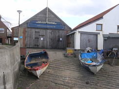
Turn right through the car park and then turn left to continue eastwards along another footpath, still keeping the edge of the marshland to the left. At first the path is more of an unsurfaced track; at TF987440 it approaches a lake on the left; here the path climbs up onto a flood bank. Go through a wooden squeeze-stile and continue on along the top of the bank. When the bank ends go past a metal gate and then turn left to descend down onto a good track that runs along the foreshore. This curves to the right towards some stored boats; walk between the rows of boats.
When the track forks at TF996442 take the left-hand fork and follow the path around. Before a house at TG003442 turn left to climbs some steps over the floodbank. Head straight on along a path across some grass to join a track near some stored boats, and then turn left to head northeastwards to reach the end of Quay Lane in Morston at TG006441, with the car park on the left.
Pass the black cafe building on the left and cross a track to reach a flood bank. Follow this eastwards towards the tower of a church straight ahead; when the bank curves to the right after 0.6 miles descend some steps and continue straight on, keeping fields on the right. Keep the marshland to your left for another 0.6 miles; as it approaches a large house on the right the path joins a track. It passes the house on the right before turning to the right; after a few yards turn left to head diagonally across some grass to reach The Quay in Blakeney at TG026440.
Walk eastwards along the quay, keeping the water to the left. When a car park is reached walk through it with the road to the right. Soon a flood bank is reached; climb this and turn left. The path remains on the floodbank for the next 2.3 miles; initially it heads northwards for 0.6 miles before curving to take a more easterly course towards Blakeney Eye. The route here has changed in recent years; the construction of a new channel inland means that the flood bank now heads further inland. After another half a mile it curves to the right to head east-southeastwards, finally meeting the western bank of the River Glaven at TG044449. Here the path turns right to head south for another three-quarters of a mile; ignore a flood bank that leads off to the left to reach a sluice over the river.
The flood bank approaches a road at TG042438; cross a stile beside a gate. Do not join the road and instead turn left to follow the flood bank that parallels it. This crosses a footbridge over a stream beside a sluice before descending down some steps to reach the road. Turn left to follow the road into Cley-next-the-Sea; it turns sharply to the left. Care needs to be taken here as the road through the village is narrow and often partially blocked by parked cars. Shortly after the bend and just before the George Hotel is reached, a path leads off to the left opposite a phone box. This path leads a short distance between houses to reach a concrete sea wall; turn right and start following the seawall northwards.
The path is narrow; it soon climbs some concrete steps and descends the other side. Soon it curves to the right and ends at a car park belonging to the Cley windmill. Cross the small car park and continue on, keeping the windmill to the left. At the end of the car park go through a wooden gate and follow a fence on the left and a wall on the right to some wooden steps. Climb these wooden steps and down some more on the other side.
On the other side turn right to follow a flood bank to the right; when the garden on the right ends the path climbs up some steps onto the top of the flood bank. The path soon curves to the left and then the right to head northeastwards. It approaches the road leading to Cley Eye and then turns to the left to follow the road northwards for half a mile until the car park at Cley eye is reached at TG047452.
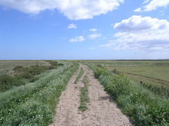
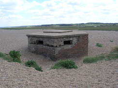
The next four miles of the trail follows the shingle beach and bank east-southeastwards. Try to find whichever route is easiest; the official route initially heads behind the shingle bank, passing the square shelter before leaving via the southeastern corner of the car park. It passes to the south of a small pond on the left to reach an old World War II pillbox. From here continue on either along the top of the shingle bank (where walking can be difficult) or along an intermittent path that runs behind the bank. The profile of the bank is constantly being reshaped by the sea, so any paths are at best intermittent. Find the best route you can, and ensure that your boots have good ankle support.
There are three small and heavily-eroded intermediate hills, but these do not last long before you are dropped back onto the shingle beach. After four miles Weybourne Hope car park is reached at TG110436; go through the car park to reach the start of the cliffs. The path climbs up the cliffs, sticking close to the edge on the left. After nearly a third of a mile some coastguard cottages are reached; turn right to walk to the inland end of the cottages and turn left. Pass the end of the cottages, go through a wooden clappergate and turn left past the cottages towards the cliff edge. Turn right through another gate to rejoin the clifftop path.
Continue eastwards for another 2.3 miles; it passes Sheringham Golf Club on the right before climbing up to pass the Coastwatch building at the top of Skefling Hill. Eventually the path joins a surfaced path on the western outskirts of Sheringham. Pass a boating lake on the right and continue on for about fifty yards until the path passes over a bridge. Turn right to join the top of the slope and then left to follow the slope as it heads under the bridge to meet the promenade. Turn right and follow the promenade eastwards until a footbridge over a slipway is reached ahead.
Cross this bridge and continue on along the promenade. Take a concrete track that slopes up to the right to meet the end of the High Street by the Two Lifeboats Hotel. Turn right to follow the High Street southwards. When this soon ends at a T-junction by The Lobster pub, turn right to follow this new road south-southwestwards. When the road curves to the right near the town cross turn left to continue straight on along Station Road. Just before a level crossing is reached, turn right down Railway Approach. The CoastHopper bus stop is on the left, just before the North Norfolk railway station and the Tourist Information Office.
 |
 |
|
Distances
| From | To | Distance (m) | Ascent (ft) | Descent (ft) |
|---|---|---|---|---|
| Wells-next-the-Sea | Morston | 6.9 | 164 | 161 |
| Morston | Blakeney | 1.5 | 49 | 36 |
| Blakeney | Cley-next-the-Sea | 2.8 | 43 | 56 |
| Cley-next-the-Sea | Weybourne Hope | 5.1 | 164 | 161 |
| Weybourne Hope | Sheringham station | 3.5 | 453 | 390 |
This makes a total distance of 19.8 miles, with 873 feet of ascent and 804 feet of descent.
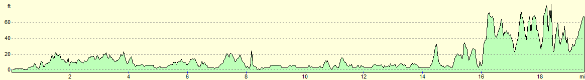
For more information on profiles, ascents and descents, see this page
Accommodation
I spent the night at the West Runton Camping and Caravanning Club site. TThe facilities at the site were good, and as always with the camping and cravanning club sites, the toilets and showers were clean and tidy.
Transport
I used Norfolk Green's excellent Coasthopper service to get back from Wells-next-the-Sea to Hunstanton. This service runs regularly, especially in the summer.
 |
 |
|
 |
 |
|
 |
 |
|
 |
 |
|
 |
 |
|
 |
 |
|
 |
 |
|
 |
 |
|
 |
 |
|
 |
 |
|
 |
 |
|
 |
 |
|
 |
 |
|
 |
 |
|
 |
 |
|
 |
 |
|
 |
 |
|
 |
 |
|
Disclaimer
Please note that I take no responsibility for anything that may happen when following these directions. If you intend to follow this route, then please use the relevant maps and check the route out before you go out. As always when walking, use common sense and you should be fine.
If you find any information on any of these routes that is inaccurate, or you wish to add anything, then please email me.
All images on this site are © of the author. Any reproduction, retransmissions, or republication of all or part of any document found on this site is expressly prohibited, unless the author has explicitly granted its prior written consent to so reproduce, retransmit, or republish the material. All other rights reserved.
Although this site includes links providing convenient direct access to other Internet sites, I do not endorse, approve, certify or make warranties or representations as to the accuracy of the information on these sites.
And finally, enjoy your walking!
Nearby walks
| # | Title | Walk length (miles) |
|---|---|---|
| 134 | Burnham Deepdale to Wells-Next-The-Sea | 9.5 |
| 160 | Wells-Next-The-Sea to Cley-next-the-Sea | 11.1 |
| 165 | Cley-next-the-Sea to Cromer | 13.1 |
|
|

|