Walk #895: Bottesford to Ancaster
 |
 |
|
General Data
| Date Walked | 18/04/2011 |
| County | Leicestershire, Nottinghamshire, Lincolnshire |
| Start Location | Bottesford Station |
| End Location | Ancaster |
| Start time | 08.00 |
| End time | 15.05 |
| Distance | 20.3 miles |
| Description | This was a very pleasant walk; the first three miles took me up to the Viking Way in Long Bennington, after which the trail is followed along good paths as far as just north of Ancaster. A final stroll south along Ermine Street took me down to Ancaster. |
| Pack | Today I carried my 30-litre Karrimor rucksack, filled with water, my waterproofs, a couple of books and other odds and ends. |
| Condition | I feel absolutely fine after this walk. |
| Weather | The day was warm and sunny, with scarcely any clouds in the sky. It was not overly warm, however, and the heat did not effect my walking. |
| OS map | Landranger number 130 (Grantham, Sleaford & Bourne) |
 |
 |
|
Map of the walk
Maps courtesy of Google Maps. Route for indicative purposes only, and may have been plotted after the walk. Please let me have comments on what you think of this new format. For a detailed table of timings for this walk, please see the table file.
 |
 |
|
Notes
It looked like there was going to be good weather for the next couple of days, so it seemed like a good opportunity to do some more walks along the Viking Way. At first I planned a circular walk, but later I noticed that it would be possible to do a linear walk from Bottesford to join the Viking Way in Long Bennington, and follow it as far as just above Ancaster. The only problem was that Ancater station has very few train services, so I would have to reach the station by ten past four.
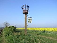
I parked up at Bottesford Station and faffed around for a while getting my kit together. There were various routes that could be taken to Long Bennington, but my initial plan of following footpaths was soon discarded for a long road walk, so that I would be able to visit a shop in the village. However there was one worthwhile diversion, and that was to climb up Beacon Hill. A trig pillar and replica beacon dominate the hill, which should have had fantastic views over the Vale of Belvoir.
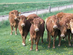
Unfortunately the views were hazy despite the cloudless skies, and soon I plodded off down the hill. Some cows entered a field as I was about to leave it, and for a few minutes there was a worrying situation where they tried to nuzzle me, and as they ran around it was impossible not to keep from getting between calves and their mothers. I sighed with relief when I finally reached the road in Normanton.
The road walk north was fairly uninteresting; it passed close to the old RAF Bottesford, which appeared to be being used for storing cars, their windscreen glinting in the sunshine. A little later the road left Leicestershire to enter Nottinghamshire for about a hundred yards, before leaving it to enter Lincolnshire.
A bridge took me over the A1(T), and more roads took me into the heart of Long Bennington. I was hoping to find a shop, and there was one just a short distance of my route. From the outside this looked small, but it was deep and well-stocked. I munched on a packed of crisps as I left the shop and rejoined the road.
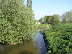
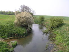
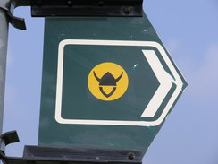
The Viking Way took me east from Long Bennington, following a stretch of the trail that I walked last week. It was turning into a warm day, and the waters of the River Witham glinted deliciously. I was in seventh heaven as I strolled across the floodplain into Westborough. Another crossing of the river took me into fields and then to the road where I had left the Viking Way on my previous walk.
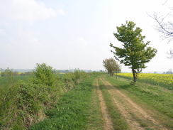
Further long stretch of paths and tracks took me eastwards for a couple of miles; the views were not particularly expansive but that hardly mattered in the glorious sunshine. Farmers were busy working in fields, spraying the crops. Eventually the tracks entered Marston, where the village pub was shut, but a notice made it look as though it would soon reopen.
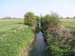
More tracks and paths took me southeastwards out of the village, with the Witham unseen to the north. Soon a large expanse of waterlogged ground started on the left, complete with patches of reed beds. The track was good and firm, however, and it led me past a sewage farm to reach a bridge under East Coast Main Line.
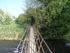
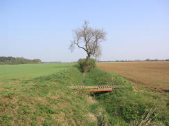
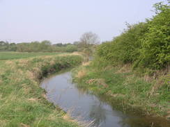
Shortly after this the trail joined a wonderful stretch of the Witham, with the water rushing along beside me. It was a superb change from the many miles of plodding along paths and tracks between fields, and it seemed a shame when the trail climbed up a slight hill away from the river. The views more than made up for the climb, however, and again it felt like a shame when the trail fell to cross the river once more by a large metal bridge.
A track took me up onto the hillside to the north of the river, and this led down to a road that again climbed uphill, with a shock-red house on the hillside to the right. Another track took me eastwards, and as I had made very good time I started looking for somewhere to have a rest. There was not going to be a pub for the rest of the day, so I found a flat patch of grass at the entrance into a field and lay down, covering my face with my hat.
I took my boots off to allow my feet to cool down; it was a rather unremarkable place for a rest but enjoyable nonetheless. There was still a few miles to go, however, and I wanted to make sure that I reached Ancaster for the only train of the afternoon.
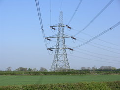
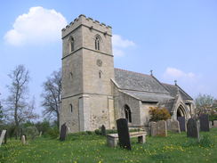
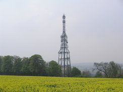
As I passed Carlton Scroop church a lady said hello, and she pulled me in to look at some of the stained glass in a window, which is apparently unique in Britain. It was an interesting diversion but I was keen to press on. An old railway line as crossed on a bridge, and the golf course below was bustling and the car park full. A track led up past the massive Mecanno-like aerial of the PO repeater station to reach Carlton Scroop Heath.
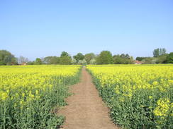
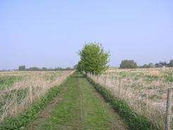
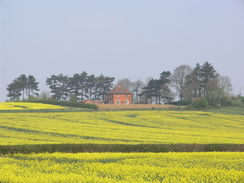
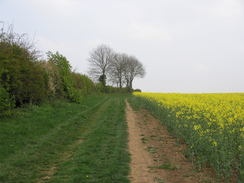
Unfortunately the next couple of miles across the heath were fairly uninteresting as it followed tracks between fields. In dreary weather the walk would have had little to commend itself, but the sunshine added a vitality to the views; the blue of the sky contrasting with the greens and yellows of the oil-seed rape. With a spring my step I walked on to reach the B6403 road. This is the old Roman road between London and York, Ermine Street.
Here the Viking Way turned left to head north alongside the road; my route lay south along the road to Ancaster. Initially there was a wide grassy area on the right; this was filled with lots of road kill, presumably animals that got hit and crawled into the grass to die. It was a sad sight, and acted a warning when the grass ended and I was forced to walk along the road.
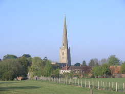
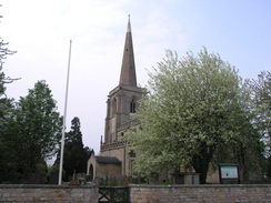
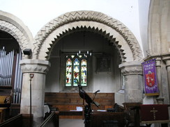
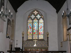
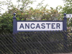
I reached Ancaster station with well over an hour to go before the one train of the afternoon. The pub at the bottom of the station approach was closed, and so I strolled down into the village. A bus was just leaving a stop as I arrived, and this was to Sleaford. Sadly there was no bus to Grantham - from where I could get a train back to Bottesford - for well over an hour. The other pub in the village was shut, and so I strode down to the crossroads at the southern end of the village and entered the church.
This proved to be an entertaining diversion; a large display had details of many of the artefacts found around the once-Roman town, including bodies disinterred from the graveyard. It was good to see that the village was firmly proud of its history. Having looked at everything there was to see, I strolled back up to the station and soaked up the sun as I waited for my train. It was six in the evening by the time that I reached my car in Bottesford, and I was still faced with a long journey home. This stretch of the Viking Way had not been the most stellar walk in the world, but the weather had made it a very pleasurable day's walk.
 |
 |
|
Directions
This walk starts off at Bottesford railway station. Leave the station and turn right to follow a road westwards; as it curves to the left turn right along a track that crosses the railway line on a level crossing. Continue up the track as it climbs uphill with a hedge on the right; after passing a trig pillar and beacon start descending to meet a hedge. Go through the hedge, and on the other side turn left across a stile through the hedge on the left. This heads downhill north-northwestwards; aim for the far left-hand corner of the field. Go through a gate and continue to a stile in the far corner; this leads onto a road in Normanton.
Turn right to head north-northeastwards along the road for about three miles. It crosses the A1(T) on a bridge; immediately after this turn right down Vicarage Lane. This heads south with the A1(T) on the right; it soon curves to the left to head eastwards into Long Bennington. When the road ends at a T-junction with Main Road, turn right to head south-southeastwards down this road. After a sixth of a mile turn left down Church Street, and then turn right to continue southeastwards down the same road. A junction with the Viking Way is reached after a quarter of a mile, immediately after Woods Close is passed on the right. Turn left to head down a track.
The track heads northeastwards, soon reaching a footbridge over the River Witham. Cross the bridge and go through the pedestrian gate on the other side. Continue eastwards along an obvious path across the field, keeping the river bank about fifty yards away to the right. Go through a small wooden gate and then immediately cross a footbridge over a stream. On the other side continue straight on to head diagonally across the next field; when a hedge is reached on the left turn half-right to follow the hedge eastwards, keeping the hedge on the left. When the hedge on the left curves left, continue straight on across the field to reach a stile in the next hedge. Do not cross this stile, but turn left along a path that follows a green lane that runs northwards between hedges. This soon curves to the right to head east-southeastwards for 150 yards, becoming the surfaced Baker's Lane that ends at Witham Way in the village of Westborough. Turn right to head south along Witham Way for 100 yards; as it approaches the church it curves to the left to head east-southeastwards once again. The lane soon curves to the left; continue straight on along a grassy footpath that heads southeastwards for a few yards to reach a footbridge over the Witham.
Cross the footbridge and on the other side turn half-left, to join a footpath that cuts cross fields southeastwards. It goes through broad gaps in two hedges; at the second turn half-right to follow the path across the third field. A short distance into this field it crosses another footpath; turn left and follow this footpath as it heads east for a third of a mile across the field. Hedges appear on both sides before the path ends at Fallow Lane at SK860439. Turn right and follow Fallow Lane south for a fifth of a mile until before North End Farm is reached. Turn left to go through a gate to head eastwards along a track with a hedge on the left. At the end of this field go through a gate and continue straight on as the hedge ends. The track turns to the left and almost immediately to the right to continue eastwards with no hedges. After passing one field on the right it crosses a track and heads on across another field to reach a footbridge over a ditch at SK871437.
Cross the footbridge and immediately turn left to head northwards with the ditch on the left. After 150 yards turn right through a pedestrian gate to follow a path eastwards with a smaller ditch on the left. Go through a gate to join a concrete track called Stonepit Lane; the ditch ends and is replaced by a hedge. The lane continues on for a little over a mile, passing Westfield Farm before ending at a T-junction with Main Street in Marston.
Turn right to head south down this road for a few yards, before turning to the left to head eastwards along School Lane, passing the eponymous school on the right. After a couple of hundred yards the road curves to the right to head south for a fifth of a mile, and then turn left down the surfaced Hougham Mill Lane.
Continue southeastwards along the lane for half a mile; as the road curves to the left to head towards the mill, turn right to follow a path southeastwards between a hedge on the left and fence on the right for 250 yards until a T-junction with a rough track is reached. Turn left and follow this track eastwards for a third of a mile with a prominent hedge on the right until it ends at a concrete track. Turn left to follow this track northwards; it soon curves to the right to head eastwards passing a sewage farm on the left. The track forks at the sewage farm; take the right-hand fork and keep a hedge and the sewage farm on the left. A fifth of a mile after the bend the track crosses under a railway line on a bridge at SK910426.
Cross under the bridge and continue straight on for a few yards. Turn left to head north for a short distance with some trees on the right, and then turn right to head eastwards with a drain on the left. After 300 yards the path turns to the left to head north with a drain on the right, then when the southern bank of the Witham is reached it turns to the right, crossing the ditch. Continue along the path as it follows the southern bank of the river for a fifth of a mile. Just before a right-hand bend in the river turn right to climb up a rough track. The track heads across the middle of a field before turning to the left to heads eastwards, again across the middle of the field.
The track descends slowly to reach a metal bridge over the river; cross this and continue slightly south of east for a sixth of a mile until it meets another track called Drift Lane at SK923428. Turn left to follow this lane northwestwards uphill with a hedge on the right; after a fifth of a mile it reaches some woodland on the left and curves to head in a northerly direction. Continue along the track for a third of a mile as it passes the ruins of Barkston Gorse Farm on the left until it reaches a T-junction with Frinkley Lane at SK920435.
Turn right and follow this lane as it runs eastwards between two hedges for two-thirds of a mile, descending slowly until Hough Road is reached. Turn left to follow this road northwards, climbing steeply before passing Carlton Ashes Farm on the left. After nearly a mile at SK927450 turn right down a surfaced track called Howdale Lane. The surfacing ends by a cottage on the left, and a rough track continues on, passing through a couple of gates on the way. Aim for the PO transmitter tower visible on the hillside ahead. Follow Howdale Lane eastwards for 1.2 miles until it ends at a T-junction with Hough Lane Turn right to head south down this lane for a couple of hundred yards u[hill until a junction with a road is reached on the left; turn left and follow this eastwards until it reaches the A607 near the church in Carlton Scroop.
Follow the A607 northeastwards through the village, crossing a bridge over an old railway line on the way; there is a pavement on the left. After a third of a mile the road curves sharply to the left; here turn right up the surfaced Heath Lane. This heads east-northeastwards for a third of a mile, climbing uphill onto Carlton Scroop Heath and passing the mast on the right. The surfacing ends at the mast and a rough track continues on. At the top of the hill turn left to head north along a path with a hedge on the left; it turns to the right to head east-northeastwards, still with the hedge on the left. It follows the hedge as it turns to the left to head northwards for 150 yards before yet again turning to the right. It heads east-northeastwards; the hedge on the left becomes a ramshackle wall, which is then replaced by an intermittent hedge. After two miles until it ends at a junction with the B6403 High Dike at SK987469.
Turn right to start following the B6403 southwards; after 1.5 miles it passes under a railway bridge; the railway station is up the road to the left immediately before the bridge. I carried on southwards through the village for another half mile until I reached the crossroads just to the south of the church.
 |
 |
|
Distances
| From | To | Distance (m) | Ascent (ft) | Descent (ft) |
|---|---|---|---|---|
| Bottesford station | Long Bennington | 4.9 | 180 | 226 |
| Long Bennington | Marston | 4.0 | 52 | 26 |
| Marston | Carlton Scroop | 6.2 | 364 | 299 |
| Carlton Scroop | Ancaster church | 5.5 | 299 | 308 |
This makes a total distance of 20.3 miles, with 895 feet of ascent and 859 feet of descent.
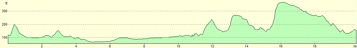
For more information on profiles, ascents and descents, see this page
Transport
A few trains a day run call at Ancaster station; these run betrween Sleaford and Grantham. To return to your start point, you will need to catch a train to Grantham and then change for one of the Bottesford trains. Some bus services also call at Ancaster on their way to Grantham, but these too are infrequent.
 |
 |
|
 |
 |
|
 |
 |
|
 |
 |
|
 |
 |
|
 |
 |
|
 |
 |
|
 |
 |
|
 |
Disclaimer
Please note that I take no responsibility for anything that may happen when following these directions. If you intend to follow this route, then please use the relevant maps and check the route out before you go out. As always when walking, use common sense and you should be fine.
If you find any information on any of these routes that is inaccurate, or you wish to add anything, then please email me.
All images on this site are © of the author. Any reproduction, retransmissions, or republication of all or part of any document found on this site is expressly prohibited, unless the author has explicitly granted its prior written consent to so reproduce, retransmit, or republish the material. All other rights reserved.
Although this site includes links providing convenient direct access to other Internet sites, I do not endorse, approve, certify or make warranties or representations as to the accuracy of the information on these sites.
And finally, enjoy your walking!
Nearby walks
| # | Title | Walk length (miles) |
|---|---|---|
| 66 | Melton Mowbray to Bingham | 16.1 |
| 593 | Sleaford to Bottesford | 23.3 |
| 594 | A circular walk between Bottesford and Bingham | 19.2 |
|
|

|