Walk #896: Ancaster to Lincoln
 |
 |
|
General Data
| Date Walked | 19/04/2011 |
| County | Lincolnshire |
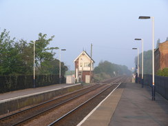
| Start Location | Ancaster station |
| End Location | Lincoln station |
| Start time | 07.00 |
| End time | 14.41 |
| Distance | 20.6 miles |
| Description | This walk was a very pleasant stroll along the Viking Way. The first few miles followed the course of Ermine Street, before clinging to the top of a ridge for some good views over the plains to the west. |
| Pack | Today I carried my 30-litre Karrimor rucksack, filled with water, my waterproofs, a couple of books and other odds and ends. |
| Condition | I am slightly footsore after this walk, but are otherwise fine. |
| Weather | Today was another gloriously sunny day, with scarcely a cloud in the sky. It was perfect weatehr for walking. |
| OS map | Landranger number 130 (Grantham, Sleaford & Bourne) and Landranger number 121 (Lincoln & Newark-on-Trent) |
 |
 |
|
Map of the walk
Maps courtesy of Google Maps. Route for indicative purposes only, and may have been plotted after the walk. Please let me have comments on what you think of this new format. For a detailed table of timings for this walk, please see the table file.
 |
 |
|
Notes
I woke up early this morning, feeling fine after yesterday's walk. As the forecast was for more sunny weather, it seemed sensible to do another day's walk. The transport on that walk had been problematic with only one train in the afternoon from Ancaster; today's proved to be even more so, as I would have to finish the walk much earlier in the day in order to catch that same train from Sleaford. I therefore set off at 5.30 for the long drive to Ancaster, arriving just before seven.
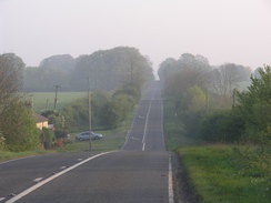
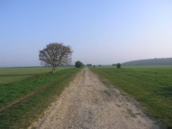
I did not spend my usual time faffing at the station car park, and instead shouldered my rucksack and set off down the road. The first mile and a half were a repeat of the walk I did yesterday, heading up the B6403, which follows the course of the old Roman road between London and York, Ermine Street. Thankfully the road was not too busy, and I could easily step onto the verge for the little traffic there was.
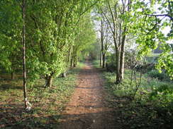
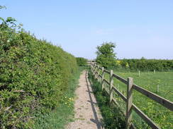
Despite this, it was still a relief when I reached the point where the Viking Way comes in from the left across Normanton Heath. This is where I had left the trail on the previous walk, and I would now be following it for the rest of the day. Fortunately there is a good, grassy path running along the left-hand side of the road, sometimes slightly below the road and hidden slightly from it. This path was much preferable to walking along the tarmac, although the views were not particularly good as the road headed arrow-straight northwards.
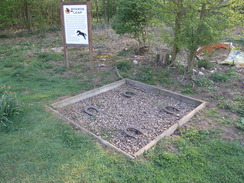
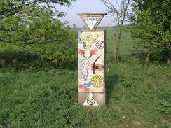
Eventually the main road ended at the A17(T) at a place called Byard's Leap. This slightly-odd name was explained on a board, below of which were four horseshoes in a gravel pit. A legend says that a horse called Byard made a fantastic 60-foot leap whilst its rider killed an equally-fantastical witch. As usual, I liked the fact that a local legend was so well commemorated for passers-by to discover.
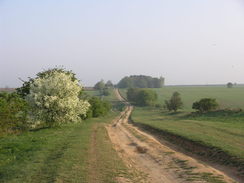
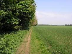
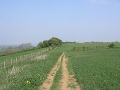
Although the main road was left behind, the trail continued northwards along the course of Ermine Street. The track was wide, and it was easy to avoid the badly-rutted stretches. The home of the RAF College, RAF Cranwell, was off to the right, although the only thing visible was the top of a brick tower topped by a distinctive dome. Over the next few miles the trail headed straight over the rolling hills, before joining a road to continue in the same direction.
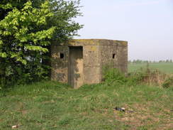
A large and imposingly-placed concrete pillbox sat beside the track just before the road, and this marked the edge of RAF Wellingore, a Second World War fighter airfield. A series of similar pillboxes lined the road, including one that is apparently the remains of a Headquarters block.
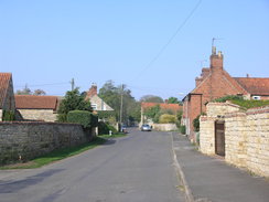
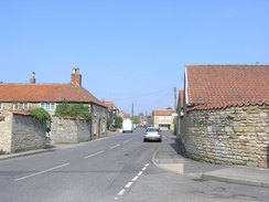
Eventually the trail left the course of Ermine Street and headed off into the village of Wellingore, with the stump of a windmill visible in the distance. A large military airplane circled in the distance, sadly too far away to take any decent pictures of it. I must admit that I really liked Wellingore; the houses are invariably pretty, with rosy stone walls and red-tile roofs. Even the newly-built houses had been made in a similar style, even if some were slightly spoilt by white plastic window frames.
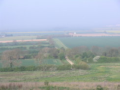
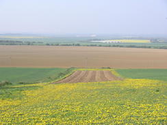
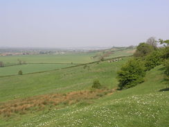
The trail left the village via a path that skirted the edge of an escarpment and from here I got the first good views of the day, with plains stretching off westwards into the distance. Unfortunately the haze that spoilt the views yesterday was still present; it would certainly be a stunning place to be on a truly clear day.
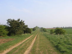
Sadly this stretch soon had to end, and it did so by diving into the village of Navenby. Here I got off course slightly as the waymarkers - so good for much of the trail - appeared to have disappeared. After a little staggering around I found the correct path, and followed the escarpment northwards into Boothby Graffoe, again with some good, if hazy, views to the east.
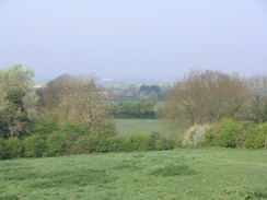
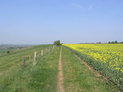
Similar views were visible from the next stretch of path to Coleby; sadly the trail left the edge of the escarpment north of that village and followed a track across fields. I had some difficulty here; the map shows the Viking Way heading straight across a field with a parallel track about a hundred yards away; there was a white pedestrian gate, but this would not open. I went through a nearby gap in the hedge to head across the field, and managed to pass an area of nettles and brambles to reach the road on the other side with a little difficulty. A little further on I reached the place where the track met the road, where a Viking Way signpost pointed off down the track. Obviously the path has been rerouted along the track, but that was not obvious when coming from the other direction. Slightly annoyed, I headed on along the road towards the village of Harmston.
The sight of an airplane circling in the distance above RAF Waddington cheered me; it was too far away to take a decent photo, but it was obviously a World War Two design; my initial impression that it was a Dakota seems to be corretct as the Battle of Britain Memorial Flight contains a Dakota. It appeared to be doing a series of touch-and-go landings along the runway, and was a magnificent sight.
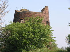
The trail remained away from the edge of the escarpment as it headed north towards the village of Waddington. On the way it passed a trig pillar before reaching the brick stump of an old windmill. So many windmills have either been demolished, restored to working order or cosmetically restored with or without sails, and it was good to see a literal ruin, with loose brickwork and weeds growing around it. I could not help but feel that it would be interesting to let it continue to decay, for it to slowly become little more than a pile of weed-covered rubble for future archaeologists to uncover.
I was glad to find that the Three Horseshoes pub in Waddington was open, and I went in for a break. By my reckoning I had a little over an hour to spare for my train, so it seemed a good idea to have a break after fifteen miles over sun-hardened ground. The barmaid was friendly, and I took my boots off so my feet could cool down as I supped my bitter shandy. I was really enjoying the walk, and it was annoying that I would not have the time to extend the walk once I reached Lincoln - I would have loved to have walked an extra three or four miles around the city.
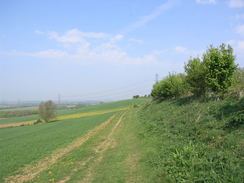
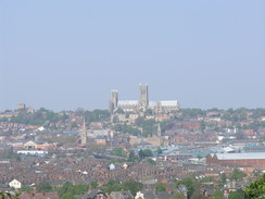
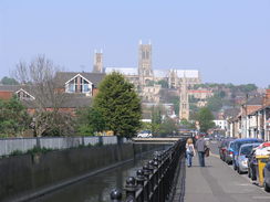
Fortunately the trail returned to the edge of the escarpment as it headed north out of Waddington, but the views were somewhat limited by the hedges to the left. Some housing started in the distance on the right, but these were never quite reached as the path continued on. Occasional glimpses of Lincoln Cathedral could be seen over the hedge. This was imposing on top of its hill, but must have been even more so when it was the tallest building in the world for 250 years, an honour it lost when its spire collapsed in 1549.
I had to take care in crossing the A15, and on the other side the trail continued along the edge of the escarpment. Unfortunately most of the views were blocked out by the woodland that clung to the hillside, but I enjoyed the stroll nonetheless. I met a cyclist on the path, and we chatted about off-road biking before we continued on together, chatting as we went. He was well protected, with knee, shoulder, elbow and back guards; evidently he was going to be tackling some steep and rough terrain.
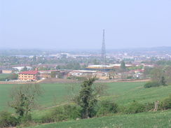
All good things come to an end, and soon the trail descended down the hillside to reach the outskirts of Lincoln. It crossed one of the many old railway lines that crisscrossed the city (indeed, Lincoln St Marks station closed as recently as 1985) before reaching a football stadium at Sincil Bank.
Roads took me northwards into the city centre, the cathedral being visible for much of the time. The area around the station was bustling, and I headed into the station to buy my ticket with a little over half an hour to spare - the very early start this morning had paid off, allowing me to have a more relaxed pace and a break during the day. The train journey back to Ancaster went well, and I arrived at the car before half four, ready for the drive home. This stretch of the Viking Way was by far the best so far, and I am really looking forward to following it further east and north.
 |
 |
|
Directions
This walk starts off at Ancaster railway station. Leave the station and head down the statopn approach; when it meets the B6403 road turn left to follow the road northwards; there is no pavement but the verges are wide.After 1.5 miles the junction with the Viking Way is reached on the left at SK987469.
Turn left to follow the B6403 road northwards for 1.5 miles; there is a good path on the left-hand side of the road that allows you to avoid the traffic. As it starts to curve to the right to meet the A17(T) turn left along a track to essentially continue straight on, passing a garage on the left to reach the A17(T) at Byard's Leap. Carefully cross the main road and continue north along a broad track on the other side. Follow this arrow-straight northwards for three miles, crossing two roads, one after 1.4 miles and the other a mile later. It joins a road at SK993543; join this and continue on northwards along the road for a little over a mile until it reaches a crossroads; here turn left to head westwards. After half a mile it meets a junction with another road; here turn right to head northwards. There is a pavement on the left. After a fifth of a mile take the first road to the left, Sleaford Road, and follow this as it curves gently to head westwards through Wellingore to reach the A607.
Turn right to head north along the main road through the village for about 150 yards before turning left down West Street. Just before this curves to the left, turn right to head north up Memorial Hall Drive. As it reaches a red-brick hall ahead, turn left to walk with the hall on the right. It crosses a grass playing field with a childrens' playing area to the right. Go through a hedge and continue on along a narrow field; when a hedge is reached on the right turn right through a wooden clappergate to head north along a footpath with a hedge on the right and a slope on the left. The path curves slightly to the right, still following the hedge for a little under half a mile, crossing through a couple of pedestrian gates on the way.
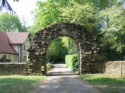
When another gate is reached by the edge of some woodland at SK981574 turn right to head eastwards with a hedge on the right; after 150 yards the hedge and path turn to the left and then the right, passing around a house on the right and entering Naveby. Shortly after the path passes a pond on the right turn left to descend a track called The Smoots. Follow this as it winds downhill to the north, soon becoming a footpath. It approaches a stream; turn left alongside the stream and then almost immediately to the right, passing through a metal gate to head uphill along a narrow path between hedges. At the top of the path there is another gate; go through this to join a green track. Turn left along this track and follow it as it curves to the right to meet a road at SK984577.
Turn left to follow this lane northwestwards for about fifty yards; as the lane swings to the left turn right to head east-northeastwards uphill along a rough track. After a couple of hundred yards a footpath leads off to the left; join this and follow it as it heads northwards up some steps and through a clappergate, initially with a driveway on the right. The path jinks to the left and then the right to continue northwards. It enters a field and continues with a hedge on the right; the hedge is eventually replaced with a patch of woodland. Go through two hedges; the second guarded by a gate. When the woodland on the right ends the path squeezes through a hedge and continues on with trees on the right. Half a mile after leaving the track it passes close to Boothby Graffoe church on the right; the path turns to the right and then the left, becoming a track that ends at a bend in Main Street in the village.
Continue straight on along the road through the village for 0.4 miles; when Main Street curves to the right continue straight on down Far End. When this road ends, turn left through a metal gate to head diagonally westwards to the opposite corner of the field. Go through a wooden clapper gate in the hedge and then turn right to head north-northwestwards for 0.7 miles with hedges on the right and a slope to the left. It squeezes past some houses; when a track is reached turn left and then right to continue northwards with a hedge on the right until a triangular road junction is reached at SK975603.
Head north along the High Street, passing 'The Tempest' pub on the way, When the church is reached on the left follow the road as it swings to the right. Just after Blind Lane comes in from the right, turn left before a post box to head across some grass with a wall on the left. This heads slightly west of northwards, skirting some trees on the left before emerging out into a field. It crosses a track and then continues northwards between fields with a hedge on the right. Cross two fields by going through gaps in the hedges, and then turn right to head eastwards until the A607 road is reached at SK977616.
Turn left and follow the A607 northwards for a little over a third of a mile until a junction with the B1178 is reached; there is a pavement on the left-hand side of the road. At some traffic lights turn left down Church Lane for a couple of hundred yards, and then turn right across a stile to head across some grass with a hedge a few yards away on the left. Head straight on across a field as the hedge on the left ends; it goes through a clappergate and stile in another hedge before continuing northwards across a second field. Cross another stile to reach Vicarage Lane.
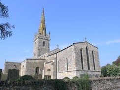
Cross Vicarage Lane and continue on northwards along a track between hedges. The hedge on the left soon ends as the path enters a field. Continue northwards across a couple of fields; after the first field go through a clappergate and continue with a hedge on the left. After a short distance cross a stile and continue with a hedge on the right. The path passes the shell of a windmill on the right; cross a clappergate to approach some bungalows. Head on with a hedge on the left rather than the right; the path follows a series of tarmac paths past the houses. The paths end at Millers Road; follow this for a short distance until a crossroads with Tinker's Lane is reached in Waddington. Cross the lane and continue northwards along the High Street for a fifth of a mile; Waddington church is on the right.
Continue north from the church for a short distance; when the road forks head straight on along Moxon's Lane; when this ends at a T-junction with Far Lane, turn left along Far Lane. Follow this as it curves to the left, and then immediately turn right to go through a wooden gate and join a footpath with a hedge on the left (do not join a wide surfaced track). Follow this path northwards across a series of fields, for most of the time with a hedge on the left. After four-fifths of a mile the path jinks to the right for about fifty yards and then to the left through a wooden clappergate, heading north through the trees with a pond below and to the left.
The path emerges from the trees to go through a wooden clappergate and continue northwards across a field; soon it goes through another clappergate and joins a hedge on the left. When this hedge ends continue along the path north-northwestwards between fields for a mile until a junction with a track is reached at SK974675. Continue straight on along the top of the slope, skirting but never reaching some houses on the right. Keep the slope on the left; after a while the path turns to the right to head eastwards with houses on the right. Just before it meets the A15 London Road, turn left to head northwards across some grass, paralleling the road. At the end of the field go through a hedge and down some steps to join the end of Waldo Road; head down this for about thirty yards until it ends at a T-junction with Conningsby Crescent. Turn right to follow this road eastwards until it soon ends at the A15(T).
Turn left along the A15(T); carefully cross the road to reach the pavement on the other side of the road. After about eighty yards turn right through a clappergate to join a narrow path that heads northwards with trees on the left and an open field beyond a hedge on the right. It slowly curves to the right to take a more northeasterly course; after nearly a mile it approaches the B1188 road. The path turns to the left to start angling downhill to the north, paralleling the road downhill.
Take the first road to the left, Kingsway and South Park Avenue for about 150 yards, and then turn right along a surfaced path that runs between low brick walls. It crosses the course of an old railway line on a footbridge, and on the other side crosses a small patch of grass to reach the A15. Cross this road using the pedestrian crossing and continue on along a surfaced path with green railings on the left. This passes the end of another road and follows the railings to approach another road, St Andrews Close. Before the road is reached turn left and follow a surfaced footpath, keeping the road on the right and the railings on the left.
When the path meets the end of Cross Street with a football stadium on the left, turn right down the road and follow it northwards until Scorer Street is reached. Turn left along Scorer Street and follow it for 150 yards until Sincil Bank is reached, with a stream ahead. Turn right and follow Sincil Bank northwards for a little over a quarter of a mile; when the road curves to the right continue straight on along a cycle path. This soon ends at Tentercross Street; turn left and follow this road westwards until it ends at a junction with High Street in Lincoln.
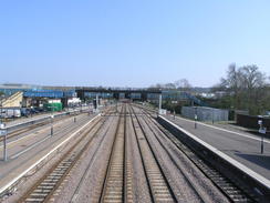
Turn right and follow the road northwards through the city; cross a level crossing and immeditely turn right along another road. A church is passed on the right, and then Lincoln railway station is reached. This walk ends at the railway station.
 |
 |
|
Distances
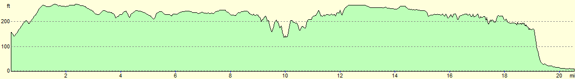
| From | To | Distance (m) | Ascent (ft) | Descent (ft) |
|---|---|---|---|---|
| Ancaster station | Wellingore | 8.4 | 328 | 249 |
| Wellingore | Waddington | 6.6 | 404 | 394 |
| Waddington | Lincoln station | 5.6 | 259 | 492 |
This makes a total distance of 20.6 miles, with 991 feet of ascent and 1135 feet of descent.
For more information on profiles, ascents and descents, see this page
Transport
A few trains a day run call at Ancaster station; these run betrween Sleaford and Grantham. To return to your start point, you will need to catch a train to Sleaford and then change for one of the Ancaster trains. Some bus services also serve Ancaster, but these too are infrequent.
 |
 |
|
 |
 |
|
 |
 |
|
 |
 |
|
 |
 |
|
 |
 |
|
 |
 |
|
 |
 |
|
 |
 |
|
 |
 |
|
 |
Disclaimer
Please note that I take no responsibility for anything that may happen when following these directions. If you intend to follow this route, then please use the relevant maps and check the route out before you go out. As always when walking, use common sense and you should be fine.
If you find any information on any of these routes that is inaccurate, or you wish to add anything, then please email me.
All images on this site are © of the author. Any reproduction, retransmissions, or republication of all or part of any document found on this site is expressly prohibited, unless the author has explicitly granted its prior written consent to so reproduce, retransmit, or republish the material. All other rights reserved.
Although this site includes links providing convenient direct access to other Internet sites, I do not endorse, approve, certify or make warranties or representations as to the accuracy of the information on these sites.
And finally, enjoy your walking!
Nearby walks
| # | Title | Walk length (miles) |
|---|---|---|
| 592 | Boston to Sleaford | 19.2 |
| 593 | Sleaford to Bottesford | 23.3 |
| 600 | Newark on Trent to Lincoln | 19.5 |
|
|

|