Walk #679: Otford to Strood
 |
 |
|
General Data
| Date Walked | 19/06/2005 |
| County | Kent |
| Start Location | Otford |
| End Location | Strood station |
| Start time | 07.51 |
| End time | 15.55 |
| Distance | 19.8 miles |
| Description | This was a pleasant walk following the North Downs Way northeastwards into the Medway Valley. |
| Pack | Today I carried my 70-litre Craghoppers WildPlaces 70-litre rucksack, carrying spare clothes, laptop and a variety of other items, weighing about 20 kilograms. |
| Condition | I am very fatigued after this walk, which is more a result of the high temperature than the difficulty of the walk. I appear to have no blisters, and aside from a slight ache in my left knee I had no other problems. |
| Weather | If anything today was even hotter than yesterday, and this was made worse by the fact that, unlike yesterday, there was no cloud at any times. Occasionally there was a slight breeze that helped me to cool down, but mostly it was an extremely warm and sultry day for walking. |
| OS map | Landranger number 188 (Maidstone & The Weald, Royal Tunbridge Wells) and Landranger number 178 (Thames Estuary, Rochester & Southend-on-Sea) |
 |
 |
|
 |
 |
|
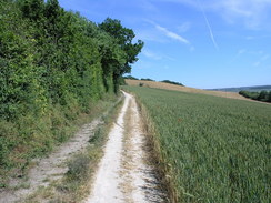
Map of the walk
Maps courtesy of Google Maps. Route for indicative purposes only, and may have been plotted after the walk. Please let me have comments on what you think of this new format. For a detailed table of timings for this walk, please see the table file.
 |
 |
|
 |
 |
|
Notes
I awoke this morning in the bed in my B&B after a very restful night's sleep despite the hot and sticky night, most of which I had spent on top of rather than under the covers to try and keep cool. The landlady had kindly agreed to make breakfast for myself and the Canadian lady at a quarter past seven, which would allow them to go to the nearby church for morning service. This early breakfast suited me fine, and after typing up some more notes I headed on down for my breakfast. The Canadian lady proved to be very good company and we had a nice chat as we ate; this delayed things somewhat, and after we had finished I had to run upstairs to finish packing my rucksack so that I could leave at the same time as the landlady. Yesterday I singularly failed to buy any suntan lotion, and as I was afraid of getting sunburnt on another hot day I decided not to wear shorts and short-sleeved t-shirt, as I had yesterday, and instead chose trousers and a long-sleeved shirt.
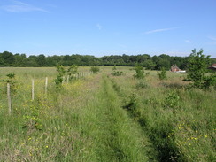
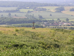
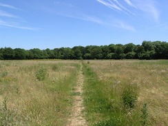
The walk from the B&B down to the station in Otford was far better than it had been the previous evening as the road was far quieter, only a couple of cars passing me before I reached the safety of the pavement. Once at the station I followed the North Downs Way as it headed steeply up Otford Mount; despite the early hour it was warm, and I was soon sweating as I made my way up the hill. Once at the top there was a slight breeze, and this helped me to cool down as I made my way across a field filled with long grass, across which I made a diversion to visit a trig pillar that sat proudly near one edge. It was my second pillar of the weekend, although unfortunately due to the nearby trees the views were far from good. The path continued on, rejoining the edge of the escarpment immediately to the north of Kemsing. At a gap in the trees there were superb views over the plains to the south, and I could not help but to pause for a few minutes as I studied the views. In the far distance I was sure that I could make out the hills of the South Downs, a short distance behind which is the sea. I found myself resolving to walk the South Downs Way later this year, and the thought of another challenge spurred me on.
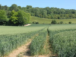
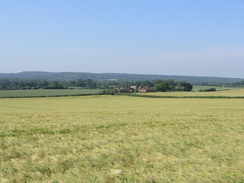
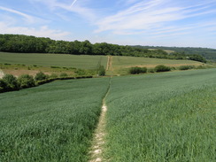
The next few miles were fairly pedestrian as I followed the Way eastwards along the top of the escarpment. Occasionally good views were available through gaps in the trees, but for most of the time these were blocked by trees. The best views were to be had when the path diverted downhill past Chalk Pit Wood; here the plains to the south were gloriously laid out in front of me, and I could not help but let my eyes wander as my feet crossed the field. There then followed a walk along a track that headed eastwards along the bottom of the escarpment. This was a pleasant walk, and before too long I found myself reaching the little village of Wrotham.
By this stage I was feeling slightly tired, and so when I came across a bench shaded by trees I stopped, took my rucksack off and sat down beside it. The feeling of bliss that came from taking the weight off my feet was indescribable, and I let my eyes wander over the green grass of a playing field in front of the bench. People were out walking their dogs, and in a tennis court off to my left some children were playing. It was a tranquil scene, and it was with a certain reluctance that I got up to continue the walk. Almost immediately I crossed the M20 on a road bridge, and this was followed by a long road walk as the Way headed northeastwards past Hognore Farm. I was quite relieved when the Way left the tarmac and started heading uphill along a rough track, passing through Hognore Wood before reaching the A227 road The climb was quite hard in the heat, and once I reached the top I stood still for a couple of minutes, trying to let myself cool off in the breeze.
The next stretch of the Way took me through Trosley Country Park, and there were lots of people strolling about under the trees. Some of these were eating ice creams, and I looked on enviously, wondering exactly where they had got them from. The Way through the park followed a track through the trees, and although at first this was enjoyable, by the time that I had gone a mile it was all getting rather similar and boring, It was therefore a relief when the track met another one, and I could follow this back down the escarpment onto the valley floor, emerging from the woodland in the process. The Way followed the bottom of the escarpment eastwards for a couple of miles, before heading up hill once more, crossing a road near Holly Hill Lodge and joining another road to head northwards. I nipped into a car park on Holly Hill to see if there was an ice cream van there, but aside from a handful of cars and some cyclists it was empty. Disappointed I walked on, and as my feet were once again aching, I stopped at a point where the road ended and a track plunged through trees.
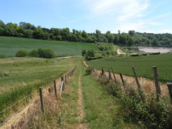
There was a handy log on which I could sit, and yet again a feeling of bliss came over me as I took the weight off my feet. It was a reasonable place to have a rest, and the slight breeze blowing along the track helped me to cool off somewhat. There was not that much to look at, so I entertained myself by listening to Radio Five on my Walkman, before eventually getting up, shouldering my rucksack and heading on off down the track as it headed through the trees. The next few miles consisted of long stroll through various woods, punctuated by short stretches of treeless path between them. It was quite enjoyable and the going was relatively flat before the path left Wingate Wood, where it descended down into a dry valley. To the left was a quarry, and as I followed the path back uphill I got some pleasant views over the hillside that I had just traversed.
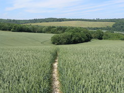
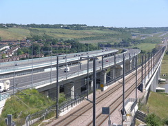
The Way headed through North Wood before descending down into the little hamlet of Upper Bush, which was complete with some nice houses, including an exquisite timber-framed example. Unfortunately I could not get a very good photo of this due to the angle of the sun, so I headed off as the path skirted the western end of Cuxton, before climbing up to cross a railway line and skirting on towards the farm at Ranscombe. From here I got my first glimpse of he Medway Valley, and I could just make out the two bridge across the valley - the nearest carrying the new Channel Tunnel Rail Link, and the other the M2. The Way joined the A228, and immediately after the road crossed the M2 on the very western edge of the Medway Bridge, I left the Way as it headed off to the right to cross the bridge. All that was left was for me to continue on to Strood Station where I had parked my car yesterday; unfortunately this was easier said than done, as it meant a long, two mile road walk in the hot sun. I was very relieved when I passed a petrol station, as it was the first shop that I had seen all day. I nipped in and bought an ice cream and a can of Red Bull, and these did not last long. Feeling refreshed I continued on into Strood; I eventually reached the railway station and got into my car, relieved that this strenuous walk on a boiling hot day had finally been completed.
Directions
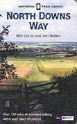
The walk is also covered in detail in the North Downs Way National Trail Guide, by Neil Curtis and Jim Walker, ISBN 1 85410 853 0, published by Aurum Press Ltd.
There are two exceptions to this. I started the day at the Darenth Dene B&B; to get back to the North Downs Way near Otford railway station I had to walk south along Shoreham Road through the village for three-quarters of a mile until I reached the railway station.
The other diversion as at the end of the walk; at the Medway Bridges the North Downs Way turn to the right to cross the Medway via the motorway bridge; instead of doing this I continued on down the A228 Cuxton Road as it headed northeastwards. After about a mile the road jinks to the right to pass under a rail bridge; immediately on the eastern side of the bridge turn left and continue northeastwards along a road until it reaches the A2 London Road. Turn right and follow the A2 as it heads eastwards towards the Medway; the road curves to the right slightly. Just before a rail bridge is reached turn left to walk northeastwards up the B2002 Station Road; Strood railway station is ahead on the right.
Distances
| From | To | Distance (m) | Ascent (ft) | Descent (ft) |
|---|---|---|---|---|
| Otford B&B | Otford station | 0.7 | 33 | 82 |
| Otford Station | Wrotham | 5.8 | 846 | 643 |
| Wrotham | Holly Hill | 5.4 | 823 | 758 |
| Holly Hill | Medway Bridge | 5.9 | 476 | 902 |
| Medway Bridge | Strood station | 2.0 | 69 | 190 |
This makes a total distance of 19.8 miles, with 2247 feet of ascent and 2575 feet of descent.
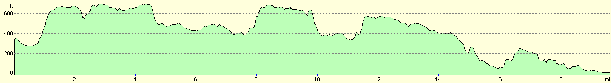
For more information on profiles, ascents and descents, see this page
Disclaimer
Please note that I take no responsibility for anything that may happen when following these directions. If you intend to follow this route, then please use the relevant maps and check the route out before you go out. As always when walking, use common sense and you should be fine.
If you find any information on any of these routes that is inaccurate, or you wish to add anything, then please email me.
All images on this site are © of the author. Any reproduction, retransmissions, or republication of all or part of any document found on this site is expressly prohibited, unless the author has explicitly granted its prior written consent to so reproduce, retransmit, or republish the material. All other rights reserved.
Although this site includes links providing convenient direct access to other Internet sites, I do not endorse, approve, certify or make warranties or representations as to the accuracy of the information on these sites.
And finally, enjoy your walking!
This walk was mentioned in the following routes:
| The North Downs Way |
Nearby walks
| # | Title | Walk length (miles) |
|---|---|---|
| 161 | Gravesend to Dartford | 7.2 |
| 176 | Gravesend to Rochester | 17.2 |
| 281 | Stanford-le-Hope to Wennington | 16.9 |
|
|

|