Walk #626: Bletchley to Bedford
 |
 |
|
General Data
| Date Walked | 28/08/2004 |
| County | Buckinghamshire, Bedfordshire |
| Start Location | Bletchley Station |
| End Location | Bedford Station |
| Start time | 09.45 |
| End time | 16.54 |
| Distance | 19.9 miles |
| Description | This was a fairly nice walk between the two towns, with a surprising amount of countryside to be found between the two. |
| Pack | Today I carried my 30-litre Karrimor HotRock rucksack, which was filled with water bottles, my waterproofs, a fleece and various electronic gadgets. |
| Condition | Aside with yet more pain from the underside of my left foot I feel fine after this walk, and I could easily have walked further if I had needed to. However, I really need to find out why I am having trouble with the underside of my left foot as it is proving to be extremely annoying. |
| Weather | The day was cloudy with some periods of sunshine. The cloud never grew thick enough to produce rain, and I was quite glad that it never got too warm; all in all I have walked on far worse days. |
| OS map | Landranger number 152 (Northampton & Milton Keynes) and Landranger number 153 (Bedford & Huntingdon, St Neots & Biggleswade) |
 |
 |
|
 |
 |
|
Map of the walk
Maps courtesy of Google Maps. Route for indicative purposes only, and may have been plotted after the walk. Please let me have comments on what you think of this new format. For a detailed table of timings for this walk, please see the table file.
Notes
Sam wanted to visit Woburn Safari Park today, and whilst I like animals (particularly on my dinner plate with a nice French red wine) I do not like them enough to spend the day doing continuous tours of a safari park. So whilst Sam went to the park, I decided that I would walk from Bletchley to Bedford, thus filling in a nice gap in the walks that I have done in the past. Sam dropped me of at Bletchley Station before ten, and we agreed to meet at Bedford at around five in the afternoon, which meant that I would not have much time to dally if I was going to get there in time. There were queues of people outside Bletchley Station waiting for bus services; the West Coast Main Line through the town has been shut for maintenance work over the long bank holiday weekend. I had a quick glance inside the actual station to see if there was a shop open where I could buy some chocolate, but the small branch of W.H. Smiths was shut. The walk out of Bletchley, passing under the large concrete railway viaduct that carries the freight-only line to Oxford, and past the bus station, was fairly boring, and could be well summed up by the large leisure centre that I passed on the way, an ugly concrete monstrosity that was only marginally improved by being beside a lake.
Fortunately Fenny Stratford was a little nicer, and a small group of musicians was getting ready to play in the bandstand that is situated in the pedestrian precinct. I walked on, passing a petrol station where I used the toilet and bought some chocolate bars for the rest of the walk, before heading down a road to a bridge over the Grand Union Canal. I had walked along this canal a couple of years ago, and from her/ eon in I was in territory that I had never walked before. On the other side of the bridge there was a gay and lesbian club with an extremely colourful rainbow sign, and shortly beyond this I joined a footpath for the first time in the day. This led along a track and then a path to the River Ouzel, and then passed under a high railway bridge and a lower bridge carrying the A5(T) over the river. On the other side of the A5(T) bridge there was a reasonably attractive lake, although I did not see this for long before the path dived back under the railway line. The path ended at a road, and I diverted a few yards off the path to have a look at Bow Brickhill Station, which was merely a small halt some distance away from the village itself, which I walked to next.
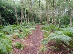
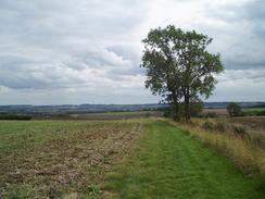
I quite liked Bow Brickhill and it had some nice buildings in it, but I did not like the road that led steeply out of the village to the southeast. Before I reached the church I turned to the left into a little unsurfaced car park amongst the trees, and started following footpaths through the trees on the hillside. I had noticed a trig pillar marked on the Ordnance Survey map, and I diverted off to see if I could find it, but unfortunately I could not see it; I had a feeling that it was submerged in the tall bracken that surrounded the path, and I really could not be bothered trying to find it this early in the walk. When I got home and downloaded my GPS track log I found that I had passed straight over the middle of the pillar, so it must have been very close by my route and I still had not seen it. The maze of tracks and paths through the woodland were slightly confusing and I followed a combination of them to make my way northeastwards, before descending out of the woodland and joining a road in Woburn Sands. For the next few miles I followed roads to Aspley Guide, which I found to be a pretty village, and then headed north past the railway station to the A421 road.
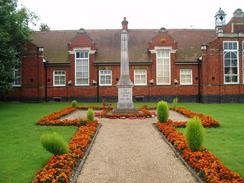
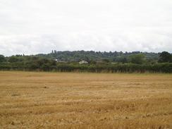
The A421 road proved quite hard to cross as it was very busy with traffic, but after waiting for a few minutes I eventually found a safe gap and sprinted across to the other side. Once there I followed a path that climbed up to a bridge over the adjacent M1 and down to Aspley Hall. More footpaths then took me northeastwards, passing Hulcote Church before crossing several boring fields before eventually meeting the John Bunyan Trail, a 75-mile circular waymarked path, near Holcot Wood. I found the walk along the way down into the small village of Cranfield to be quite enjoyable, and there were a few timber framed houses with interesting warped wooden frames to look at as I entered. There was a pub marked on the map, and I decided that as I was about halfway through the walk it would be a good idea to have a rest. Before I reached the pub, however, I passed the church and I decided to enter the churchyard to take some photos. I got some shots off, but I then realised that there was a wedding going on and the happy couple were surrounded by a multitude of well-wishers on the roadside.
Wanting to leave them to their celebrations, and I exited the churchyard by the same gate that I entered it, and then went around them to reach the centre of the village. I was pleasantly surprised to find that there were two pubs to choose from; I quickly decided to nip into the first one, The Swan. The inside of the pub was quiet, and the choice of beers was lamentable, with only IPA being available. I decided to lower my standards and I ordered a pint and sat down at a table. I had a quick chat with a local who was reading a book and seemed to be well settled in for the day, before reading a newspaper that was lying around. I sunk the first pint down quickly, and it was soon followed by yet another, which I must admit was not a bad way of spending a Saturday afternoon; I could easily have spent the whole day in the pub as the ambiance was just right for my mood.
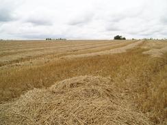
After half an hour I realised that I was going to find it tight to meet Sam in Bedford as scheduled, and so I drunk up the last dregs of my pint and went outside. I walked northeastwards through Cranfield, still following the John Bunyan Trail, before reaching the edge of the village. The way marking was not too good, and it took me a minute to realise that the footpath headed alongside a track before cutting across a field. After this the way became much easier to follow as it skirted hedges before joining a track near a farm that was bustling with tractors and trailers during this belated harvest time. I had a quick chat to some of the farm labourers and made sure that all the drivers has seen me before I crossed the yard, and then headed on. The track underfoot slowly decreased in quality until it became a grassy bridleway that turned to head northeastwards. More nondescript fields followed, and the bridleway became a footpath as it passed under power lines and eventually deposited me out on a minor road.
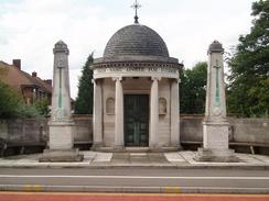
Meeting this road meant that I had finished all the footpath walking for the day, and the long walk into Bedford was going to be a long and reasonably boring road walk. The road led me on eastwards, through Wood End and Gibraltar before eventually reaching the A5134 road in Kempston. From here on into Bedford the wayside buildings slowly deteriorated, the lowlight being the Saxon Shopping Centre, a blocky and undoubtedly ugly building that showed the worst architecture of the entire walk (and considering that I had started the walk near Milton Keynes, that is saying something). Things got slightly better nearer Bedford, where there were some interesting buildings, including the gateway leading into the site of the old Bedford ironworks, which was now cleared and had houses being built on it. On top of the gateway there was an ornate clock tower; if only modern factories could be persuaded to add such flourishes onto their functional and faceless buildings.
As I approached the centre of Bedford I gave Sam a phone, and we reiterated out agreement to meet at the Midland railway station at five. I realised that I was going to get to the station a little early, so for the first time since my lunch break I slowed my pace down and relaxed a little. I crossed the River Great Ouse using the County Bridge, and the attractive views from this bridge proved to be a highlight as the rest of the walk to the station was dreary, with nothing much to really take any joy in. I reached the station and immediately went in to see if I could find the toilets, but unfortunately these were situated on the other side of the ticket barriers, a massive annoyance. The station itself is quite an ugly building, and I left to wait for Sam on the road outside. I still felt fit, and if I could I would have walked on; I felt as though I could have walked for another few hours. Sam saved me from this, and after she picked me she regaled me with stories about her visit to the safari park; monkeys jumping on her head and other exciting incidents.
Directions
This walk starts off at Bletchley railway station, on the West Coast railway line. Leave the main station building and once in the forecourt turn immediately to the left, to head south along a service road for a short distance before the road ends, and here go down a short flight of steps to reach the B4034 Buckingham Road (alternatively, leave the station along the main entrance spur onto Sherwood Drive, and then turn left along that road until it joins the B4034). Once on the B4034 turn left and follow it eastwards for a short distance downhill, passing under a railway bridge and then a high railway viaduct before a roundabout is reached. At the roundabout turn left and follow the road northwards for a dew yards, and then carefully cross the busy road and walk past the bus station until a road is reached. Turn left and follow this northward until Prince Way, which leads off from a roundabout on the B4034 is reached, and then turn right to follow Princes Way. This slowly curves to the right to pass a leisure centre, and when a pedestrianised road is met on the right turn left along Queensway.
Queensway heads eastwards for a few hundred metres, and when it ends turn left along Aylesbury Street, which heads northwards until reaching the junction with High Street in Fenny Stratford. Turn right and follow the High Street as it heads southeastwards, crossing the Grand Union Canal on a bridge before passing a gay club. Take the first road on the left, Belvedere Lane, follow this for a hundred yards until it ends at the gates of a house, and then turn right past the entrance to Belvedere Nurseries. Here the track ends and a footpath continues onwards, and is easy to follow as it heads northwards to pass under a railway bridge high overhead and reach the River Ouzel. Turn to the right, and follow the River Ouzel for a short distance as it passes under the A5(T), and once on the other side turn right and follow the railway embankment eastwards until a little underbridge is reached on the right. Pass under the bridge, and once on the other side turn left and follow a footpath that skirts the base of the railway embankment eastwards until it reaches a road, with Bow Brickhill railway station a short distance to the left.
Do not visit the station, but cross the road and head straight on along Station Road, which heads eastwards for a little over a kilometre into the little village of Bow Brickhill. Follow the road through the village, and when the road turns sharply to the left turn right along a smaller road that heads steeply uphill to the southeast. When the road forks take the left-hand fork, and follow it onwards up the hill; just before the church is reached turn left into an unsurfaced car park. From here a network of footpaths radiate out into the surrounding woodland on the hillside; it proved difficult to follow precisely the one that I was meant to be following on the ground, so I just took a series of them that led me in the correct direction, mainly because of my decision to alter the route slightly to visit a trig pillar, which I did not succeed in finding. Basically initially head in a rough easterly direction, making sure that you gain and not lose height, and after about half a kilometre join the Milton Keynes Boundary Walk, which was not particularly well waymarked, and again I found that I followed paths through the woodland that led in the correct direction.
The path eventually started descending downhill to the northeast, and emerges from Wavendon Wood before ending end-on with Woodland Way. Follow this downhill for a couple of hundred yards until it ends at a T-junction with The Leys, and turn right and follow this road as it swings to the left and ends at the A5130 road in Woburn Sands. Turn right and then almost immediately to the left, to follow Aspley Hill (which becomes West Hill) eastwards for a mile into the village of Aspley Guise. When the village square is reached turn left up Church Street, and follow it as it heads northwards towards the church, before descending downhill to the railway station. Cross the level crossing over the railway line and continue on along Salford Road; when this turns sharply to the left turn right along a bridleway that runs northwards along a track for a hundred yards, before turning slightly to the right to head northeastwards to the busy A421 road. Carefully cross the road, and once on the other side take a footpath that climbs steeply up onto a bridge over the M1.
On the other side of the bridge descend down a track; after a short distance when Aspley Hall is reached turn to the right and follow a road that winds around to the northeast. Just past the next set of houses turn left along a footpath that cuts across a couple of fields to another road. Cross this road, and take another footpath that heads northeastwards across fields, soon passing Hulcote Church and skirting the boundary hedge of a house. From here the path descends down the hill, and is easy to follow as it crosses fields, always staying near to hedges, northeastwards. When the footpath ears the northwestern corner of Holcot Wood leave the footpath and join another one that leads off to the left; this is the waymarked John Bunyan Trail, and will be followed for the next few miles. The footpath heads across fields, initially heading slightly west of north before turning sharply to head northeastwards to Wood End Farm. At the Farm join Wood End Road, and follow it as it heads downhill, becoming Court Road as it enters the village of Cranfield and passing the church before reaching the crossroads in the centre of the village.
At the crossroads in Cranfield turn right and follow the High Street as it curves around in a rough northeasterly direction. When the road ends at a T-junction with Bedford Road heads straight on along a footpath that heads between some fences to another road; cross this road, and then follow a bridleway that heads away slightly to the right from the access track to Moat Farm. The bridleway heads slightly to the south of Moat Farm and continues in a northeasterly direction; it makes a slight detour for fifty yards to the southeast before continuing on the northeasterly course until a track is reached next to Roxhill Manor Farm. Turn right and head down this track for a few yards past a large farm shed, and then turn left to join another track that heads through a yard and heads away from the farm to the northeast. After a little under a kilometre the track turns to the left to head in a more northerly direction past Ashbrook Farm. Here the track descends in quality and becomes much rougher as it heads through some trees; when a clearing is reached by an extremely derelict and totally collapsed barn turn right to follow another bridleway eastwards.
After a few hundred metres the bridleway ends and a footpath continues onwards, slowly curving to head on a northeasterly course. The path is easy to follow as it skirts the edge of a patch of woodland and passes under two sets of high-tension power lines; shortly after this the John Bunyan Trail dives off to the right and we leave the trail; continue straight on along the footpath until it ends at a road. Turn left along this road for a few yards to a T-junction; turn right and start walking northeastwards along this road into Wood End. From here the route on into Bedford is all along roads; follow the road as it heads eastwards into and out of Gibraltar and on towards Kempston. On the western edge of Kempston the road joins the A5134, and this can be followed through the village for a little under a kilometre until it turns away to the right; continue straight on along the B531 as it heads northeastwards towards the centre of Bedford. The road rises up to cross a bridge over the Midland Main railway line and descends on the other side; a few hundred yards later it rises up once again to cross the railway line that leads to Bedford St Johns railway station.
When a road junction is reached soon after the bridge turn left to follow the A5141 Prebend Street as it heads across the River Great Ouse via County Bridge. The road continues onwards for another few hundred yards before curving sharply to the left (remain on the level and do not take Ford End Road which climbs steeply up to the left), and then to the right to head northwards once more. Bedford railway station is a couple of hundred yards further along on the left, and that is where this walk ends.
Distances
| From | To | Distance (m) | Ascent (ft) | Descent (ft) |
|---|---|---|---|---|
| Bletchley Station | Bow Brickhill | 3.8 | 305 | 89 |
| Bow Brickhill | Cranfield | 7.3 | 413 | 545 |
| Cranfield | Bedford Midland Station | 8.8 | 125 | 390 |
This makes a total distance of 19.9 miles, with 843 feet of ascent and 1024 feet of descent.
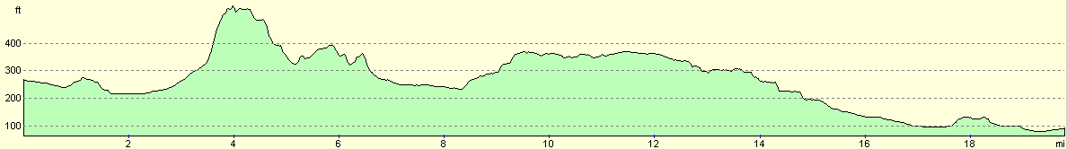
For more information on profiles, ascents and descents, see this page
Transport
There are regular train services between Bedford and Bletchley stations, with the journey taking about three-quarters of an hour. See the National Rail Enquiries website for further information.
Disclaimer
Please note that I take no responsibility for anything that may happen when following these directions. If you intend to follow this route, then please use the relevant maps and check the route out before you go out. As always when walking, use common sense and you should be fine.
If you find any information on any of these routes that is inaccurate, or you wish to add anything, then please email me.
All images on this site are © of the author. Any reproduction, retransmissions, or republication of all or part of any document found on this site is expressly prohibited, unless the author has explicitly granted its prior written consent to so reproduce, retransmit, or republish the material. All other rights reserved.
Although this site includes links providing convenient direct access to other Internet sites, I do not endorse, approve, certify or make warranties or representations as to the accuracy of the information on these sites.
And finally, enjoy your walking!
Nearby walks
| # | Title | Walk length (miles) |
|---|---|---|
| 143 | Cheddington Station to Bletchley Station | 13.3 |
| 146 | Bletchley to Wolverton | 11.9 |
| 157 | Wolverton to Bugbrooke | 16.6 |
|
|

|