Walk #162: Braunston to Leamington Spa
 |
 |
|
General Data
| Date Walked | 27/10/2001 |
| County | Northamptonshire, Warwickshire |
| Start Location | Braunston Church |
| End Location | Leamington Spa |
| Start time | 09.45 |
| End time | 15.55 |
| Distance | 16.6 miles |
| Description | This was a nice walk along the towpath of the Grand Union Canal, heading west towards Birmingham. |
| Pack | I carried a 30-litre daysack containing coat, trainers, digital camera and a spare top. |
| Condition | I feel okay after this walk. I was slightly fatigued at the end, but I could had walked on further if it had been necessary to do so. The underside of my left foot was aching fir some short periods during the walk, but his was nowhere near as bad as it has been in the past when I have worn my Saloman X Adventure 7's. Generally I feel fine, which is nice after a relatively long walk. |
| Weather | Today's weather was quite fine, with scattered high cloud leading to some long sunny periods. The wind was quite strong and also fairly chilly, so I decided to walk with my coat on to stop myself getting chilled. Unfortunately this meant that when I was in sheltered areas I ended up getting too hot. There was never any sign of rain, which was nice because the previous week and been very wet. |
| OS map | Landranger number 151 (Stratford-upon-Avon, Warwick & Banbury) and Landranger number 152 (Northampton & Milton Keynes) |
 |
Map of the walk
Maps courtesy of Google Maps. Route for indicative purposes only, and may have been plotted after the walk. Please let me have comments on what you think of this new format. For a detailed table of timings for this walk, please see the table file.
Notes
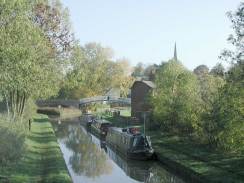
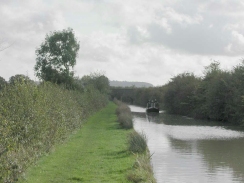
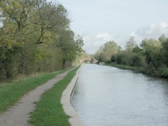
The canal towpath on this walk was very muddy in places, in particular along the stretch between Braunston and Napton. In a few places the towpath narrowed to as little as six inches in width, with the grey waters of the canal lurking menacingly underneath. This was by far the worst stretch of canal so far, and it made progress fairly slow in places. The mud could partially be blamed on the very wet weather that we had had the week before, but the bad state if the towpath did not help.
Near the start of this walk I passed the abutments of an old bridge that carried the Grand Central Railway over the canal. This railway was the last trunk one to be built in Britain prior to the Channel Tunnel Rail Link, and was opened in 1899 and shut in stages up to 1968. I went up the embankment to stand on the old alignment of the railway, and it was clear to see that it was indeed an express railway. There are currently some plans to reopen this line in the distant future as a freight railway to continental loading gauge, and I hope they succeed as it seems sad that the railway has closed whilst the canal continues on.
There were three flights of locks on this walk; the first being the three locks of the Calcutt flight with a drop of 16 feet 3 inches, the second being the large Stockton flight of ten locks and a drop of 54 feet and 8 inches, and the last being the Bascote flight of 4 locks which have a drop of 26 feet and 8inches. The latter of these featured a fairly unusual staircase locks, where one pair of lock gates leads directly into another set, with no intervening pound. I cannot recall having seen this before, and it made me think about how they would have to be operated.
The locks on this stretch had an old set of narrow gates beside them, dating from the time that the original narrow locks on this stretch of canal were replaced with broad locks to match the rest of the canal. When this was done earlier this century they kept the original narrow locks for narrow boats. These locks are now out of use, and many conceal pumps installed a few years ago to raise water up to the top locks as there was shortage of water on the flights.
I stopped for a drink at the Two Boats Inn in Long Itchington, which was a nice little canal-side pub. I sat outside and had a lovely pint of Abbott's Ale, which unfortunately went straight to my head and made the next half an hour quite interesting. Alcohol always seems to effect me more if I am out walking than if I am at home or in the pub.
I now have only twenty-seven miles and two days walking to do to get to Gas Street Basin in Birmingham and the end of this walk. I am now through the worst of the walk public transport-wise, and should be able to catch trains or busses to the start of the walks with little difficulty so less planning should be necessary.
Directions
This walk starts at the church in Braunston. Directly across the road to the south of the church is a footpath, that leads to the southwest down a hill. Follow this footpath for a short distance until it meets the A45(T) road. Turn left down the A45(T) for a short distance until it crosses over the Grand Union Canal. Cross the road after the bridge and take a path that leads to the right past a gate into a private house to the canal towpath.
Turn left at the canal and follow it to the junction with the northern section of the Oxford canal. Do not cross over the elegant double-arched bridge, but turn left and follow the southern bank of the Grand Union canal southwestwards. After a couple of hundred yards a bridge is met, and the towpath used this to cross over from the southern to the northern side of the canal.
The towpath then follows the northern side of the canal past the Northamptonshire - Warwickshire border, and onwards to the abutments of a long-removed bridge that used to carry the Great Central Railway from London over the canal. It is possible to climb up to the old trackbed on the northern side of the canal and view how straight and flat this last of the main line railways was.
The canal starts to veer southwestwards until it meets and crosses under the A425 road at Lower Shuckburgh. Within a kilometre it crosses under it again, and within another kilometre Napton Junction is reached, where the Oxford Canal southern section leaves to head to Banbury. Do not cross over the canal at the junction but turn right to head down the Grand Union Canal.
The next kilometre is dead straight as it heads northwards along a pretty stretch of canal, with a reservoir being visible on the other side of the canal. This section ends at the topmost of the Calcutt flight of locks. After the descent down this short flight the canal turns to head northwestwards, crossing over a bridge that gives access to a new marina and crossing under two road bridge until it reaches the bridge that carries the A426 road over the canal to the north of Stockton.
After this bridge the canal turns to head westwards, and soon meets the top of the Stockton flight of locks. Descend down the locks, and pass under a road bridge. Shortly after the last of the Stockton locks comes Long Itchington Lock and a road bridge carrying the A423(T) road over the canal. There is the nice 'Two boats' inn by this bridge where it is possible to sit outside and watch the boats pass.
The canal then passes through some fairly remote scenery to reach the small Bascote flight of locks. Once these are dispensed with the next major obstacle reached is the road bridge carrying the B4455 road over the canal. A couple of locks then follow over the next two kilometres, and the approach to another lock and road bridge is signalled by a magnificent brick-arch railway viaduct passing overhead. The road bridge leads southwestwards to the village of Radford Semele, but the canal continues to the west, passing to the north of the village in the process. The canal then continues west for another kilometre, crossing under the A425 road as it reaches the eastern-most outskirts of Royal Leamington Spa. After another kilometre it passes under another railway bridge, this one actually in use and carrying trains from the town south towards Stratford-upon-Avon. Another road bridge follows, after which is another that carries the B4087 northwards. Leave the canal at this bridge and follow the B4087 north. Cross over the A425 Old Warwick Road and the railway station is immediately to the left on the other side of the B4087. The bus stop for services to Rugby is in the Upper Parade, but there is one nearer opposite the tourist information office. From the station continue up the B4087 for a short distance until it turns to the right, and after a short distance it turns to the left again. The road then crosses the River Leam by means of a bridge. The tourist information office and the baths are just on the northern side of the bridge, whilst the main bus stop in Upper Parade is a few hundred metres further up the hill, just past a shopping centre.
Further information
|
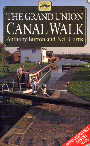
The walk is also covered in detail in the Grand Union Canal Walk, by Anthony Burton and Neil Curtis, ISBN 1 85410 244 3, published by Aurum Press Ltd. Click on the image to the right to go the Amazon page for this book.
For more details on the Grand Union Canal see Jim Shead's canal pages. |
|
Distances
| From | To | Distance (m) | Ascent (ft) | Descent (ft) |
|---|---|---|---|---|
| Braunston Church | Stockton Top Lock | 8.6 | 190 | 279 |
| Stockton Top Lock | Wood Lock | 3.8 | 89 | 184 |
| Wood Lock | Leamington Spa | 4.2 | 135 | 161 |
This makes a total distance of 16.6 miles, with 414 feet of ascent and 824 feet of descent.
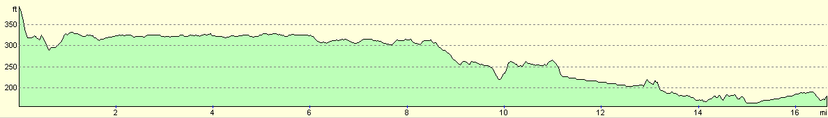
For more information on profiles, ascents and descents, see this page
Transport
Getting public transport between Braunston and Royal Leamington Spa can be problematic. There are bus services that run between Rugby and Daventry, calling at Braunston en route, and bus services between Royal Leamington Spa and Rugby. The former is the Geoff Amos Coaches GA1 service, and one of the latter services is the Stagecoach Midland Red 64. Since the service to Braunston stops running relatively early in the evening, I decided to park in Rugby and catch that bus at the beginning of the journey, which meant that I only had to catch a bus back from Royal Leamington Spa to Rugby.
Disclaimer
Please note that I take no responsibility for anything that may happen when following these directions. If you intend to follow this route, then please use the relevant maps and check the route out before you go out. As always when walking, use common sense and you should be fine.
If you find any information on any of these routes that is inaccurate, or you wish to add anything, then please email me.
All images on this site are © of the author. Any reproduction, retransmissions, or republication of all or part of any document found on this site is expressly prohibited, unless the author has explicitly granted its prior written consent to so reproduce, retransmit, or republish the material. All other rights reserved.
Although this site includes links providing convenient direct access to other Internet sites, I do not endorse, approve, certify or make warranties or representations as to the accuracy of the information on these sites.
And finally, enjoy your walking!
This walk was mentioned in the following routes:
| Grand Union Canal Walk |
Nearby walks
| # | Title | Walk length (miles) |
|---|---|---|
| 158 | Bugbrooke to Braunston | 15.1 |
| 164 | Royal Leamington Spa to Solihull | 20.9 |
| 598 | A circular walk from Badby via Lower Shuckburgh | 21.4 |
|
|

|