Home  1999-2001  2002-3  2004-6  2007-9  2010-17  2018  2019  2020
 Coastwalk  LE-JOG  Counties  Random Search within km of
Hiking in Britain

Walks in North Yorkshire

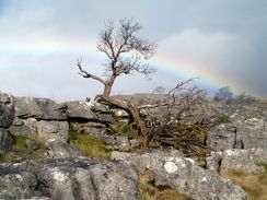
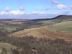
North Yorkshire is a massive county, and as such it contains some truly beautiful landscapes - the North Yorkshire Moors and the Yorkshire Dales lie fully or partly within the county's borders. There is a short but beautiful patch of coastline that includes some picturesque towns and villages, including Whitby, Staithes, Ilkley, Grassington and many more.

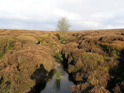
As can be expected, it is a walker's paradise. Many trails pass through the county - the Pennine Way tickles its western edge, whilst the Dales Way starts its journey in Ilkley. Part of the Cleveland Way runs along the coast. It features some beautiful lowland walking and some hard, unyielding moorland. The latter can be unforgiving places in poor weather.

It is truly a jewel of a county, and one that does not get the attention it deserves in comparison with the Derbysire Peaks or the Cumbrian Lakes.


Below is a map showing all the walks that I have completed in North Yorkshire.

Completed walks in North Yorkshire

 
Hartoft Beck.

Limestone pavement and a rainbow.

The view east from Cowhouse Bank.


List of walks in North Yorkshire

Walk No. Description Distance (miles)
1036 Leeds and Liverpool Canal: Gargrave to Burnley22.3
1035 Leeds and Liverpool Canal: Saltaire to Gargrave21.9
1029 Ebor Way: York to Wetherby23.3
963 Cleveland Way: Robin Hood's Bay to Filey Brigg25.3
962 Cleveland Way: Boulby Cliffs to Robin Hood's Bay21.2
961 Cleveland Way: Kildale to Boulby Cliffs22.9
960 Cleveland Way: Oakdale Upper Reservoir to Kildale22.1
959 Cleveland Way: Helmsley to Oakdale Upper Reservoir21.0
716 A circular walk from Rosedale around Wheeldale Moor17.4
715 A circular walk from Rosedale to Hutton-le-Hole20.8
714 A circular walk from Helmsey to Rievaulx Moor20.2
659 Swarthgill to Sedbergh20.0
658 Grassington to Swarthgill18.0
657 Ilkley Moor to Grassington18.9
627 Horton in Ribblesdale to Kingsdale via Ingleborough and Whernside14.1
607 High Moor to Knaresborough10.6
606 Rain Stang to High Moor20.2
605 Burnsall Fell to Rain Stang19.1
604 Ilkley to Burnsall Fell21.0
568 York to Selby15.2
239 Cayton Bay to Flamborough North Landing via Filey16.9
238 Robin Hood's Bay to Cayton Bay via Scarborough18.7
237 Runswick Bay to Robin Hoods Bay14.9
236 Redcar to Runswick Bay17.2
39 Keld to Baldersdale15.0
38 Hawes to Keld12.9
37 Horton in Ribbesdale to Hawes14.0
36 Malham to Horton in Ribbesdale14.7
35 East Marton to Malham9.2
34 Ponden to East Marton13.4

This was a total of 542.4 miles in 30 walks (an average of 18.07 miles per walk).


Back to counties index. Back to counties index 


Please visit my ramblings blog at: https://walkerramblings.blogspot.com/


Hosted by Spellings.net