Walk #1035: Leeds and Liverpool Canal: Saltaire to Gargrave
 |
 |
|
General Data
| Date Walked | 17/02/2019 |
| County | West Yorkshire, North Yorkshire |
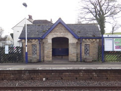
| Start Location | Saltaire station |
| End Location | Gargrave station |
| Start time | 07.28 |
| End time | 14.31 |
| Distance | 21.9 miles |
| Description | This was a pleasant and easy walk, following the Leeds and Liverpool Canal as it heads northwestwards along the Aire valley. |
| Pack | Today I carried my 30-litre Karrimor rucksack, filled with water, my spare waterproofs, a book and other odds and ends. |
| Condition | I have a little hotspot at the rear of my right heel; otherwise I feel fine. |
| Weather | The day started off very sunny, with few clouds in the sky. The clouds soon started gathering, although there were still some sunny periods. There were a few drops of drizzle in the early afternoon, but it was otherwise dry. At times there was a fairly fierce breeze, although it was incredibly mild for mid-February – it was nine degrees at five in the morning, and probably 13 or 14 by midday. |
| OS map | Landranger number 104 (Leeds & Bradford, Harrogate & Ilkley) and Landranger number 103 (Blackburn & Burnley, Clitheroe & Skipton) |
 |
 |
|
Map of the walk
Maps courtesy of Google Maps. Route for indicative purposes only, and may have been plotted after the walk. Please let me have comments on what you think of this new format. For a detailed table of timings for this walk, please see the table file.
 |
 |
|
Notes
My parents are looking after Robert for a few days, so I decided to head away to do some walking. I set off from their house in Derbyshire at about five in the morning, and parked up in Saltaire just after seven – despite having to turn back after a few minutes because I forgot my wallet! In Saltarie I got a pleasant surprise, in that the car park near the station is free on Sundays.
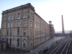
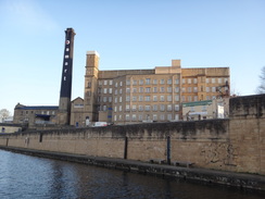
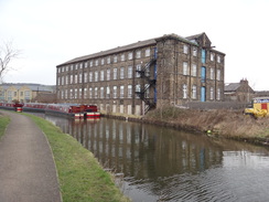
I have a little personal connection with Saltaire, in that I used to work for Pace, who were based in Salt’s Mill in the village. I used to make trips up here every so often, and in fact a couple of early walks on this website were based on such trips.
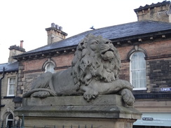
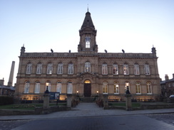
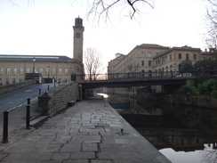
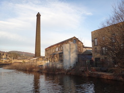
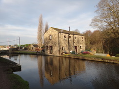
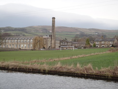
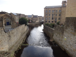
The village is a superb place, with beautiful sandstone buildings around the massive mill at the bottom of the hill. Titus Salt took over his father’s small wool business, and by the 1850s had expended it to be Bradford’s largest employer – he also served time as Bradford Mayor and MP. In 1851 he decided to move all his businesses into one place, and chose an area slightly outside Bradford. Thus the model village of Saltaire came into being. It is now a UNESCO World Heritage Site.
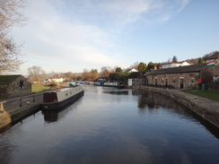
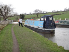
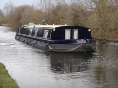
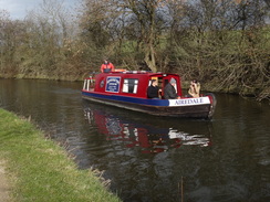
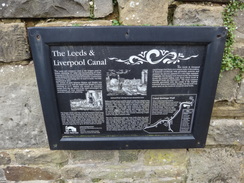
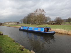
But today’s trip was nothing to do with computers or cloth: I want to spend a few days walking the Leeds and Liverpool Canal towards Liverpool – though I won’t reach the sea on this trip. Today was a 22-mile stroll northwest along the canal, paralleling routes I had walked before, to Skipton and then on to meet the Pennine Way in Gargrave.
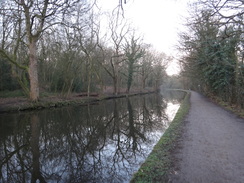
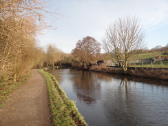
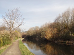
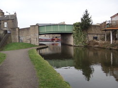
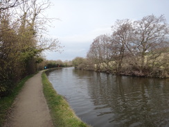
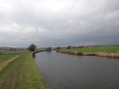
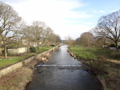
The sun was still rising behind me as I set off along the canal, and I was soon in a very pleasant area, with the River Aire down to my right and a wooded hillside across the canal on the left. Single, double and quad sculls sped past on the river below, but all too soon the canal crossed a large aqudeuct over the river at Dowley Gap, where the towpath swapped over to the other side of the river.
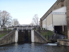
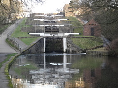
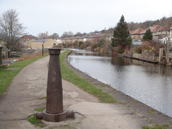
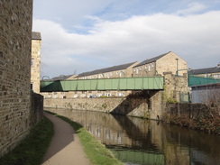
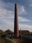
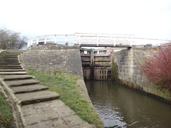
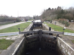
The terrain became less rural as the canal approached Bingley, although it was never urban or unpleasant, even when tower blocks were visible across the water – although the road noise was a little more intrusive. The canal, road and railway squeezed close together for a short while in the centre of Bingley (in fact, a short section of the canal was diverted when the new main road was built), before the canal entered a three-lock staircase. A short stroll on took me to the larger five-lock staircase; the steepest flight of locks in the country.
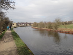
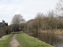
I made good time as the canal headed north and then northwest past a ribbon housing estate that never seemed to end, the houses mostly remaining out of view. It did mean that Bingley became Crossflats, which in turn became Riddlesden, without my ever knowing where one ended and the other began. It was a bit of a relief when countryside finally began. Silsden barely registered with me, and soon I was back into countryside until Kildwick, and then High Farnhill.
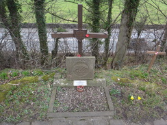
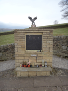
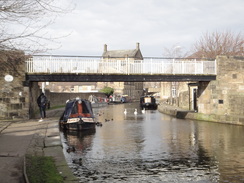
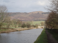
The canal then followed a main road for a while, the noise of which made it a far from pleasant stretch despite the warm weather, so I just put my head down and tried to ignore the noise as I walked. A couple of memorials commemorated the crew of a Wellington bomber which crashed on the canal’s banks in 1943. Shortly afterwards, the canal diverted away from the road for a short distance to pass Low Bradley, but all too soon rejoined it. It passed an industrial and retail area on the southern outskirts of Skipton, before heading towards the centre of town.
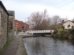
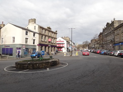
Skipton is a lovely little place, with some pretty stone buildings and its famous castle. I climbed some steps off the canal and diverted into the centre of town to ‘join’ up with a route I walked years ago from Ilkley. I then rejoined the canal and followed it as it looped through the town. I ignored a short branch that headed off north towards the castle, and instead plodded on.
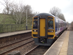
Trains from Gargrave are not plentiful on a Sunday, and there was one at a quarter to three. If I missed that one, then there would be a two-hour wait for the next. I sped up, choosing to ignore a little hot-spot on my right heel. I overtook a few groups of people enjoying a Sunday afternoon stroll, and was thankful that this stretch of canal was quieter.
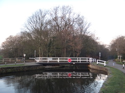
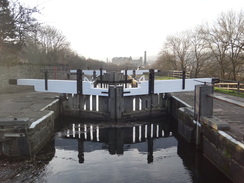
Eventually I approached Gargrave, passing the first lock since Bingley, which felt like an eternity ago. I left the canal at a bridge that carries the Pennine Way across the canal and headed south towards the station. All memories of Gargave had vanished in the twenty years since I did that walk, which is a shame as it seemed a pretty little place.
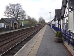
I reached the station with about ten minutes to spare: a little too close form comfort, but at least I made it. It had been a very pleasant stroll, and a good start to this short trip.
 |
 |
|
Directions
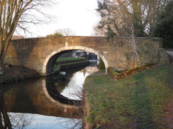
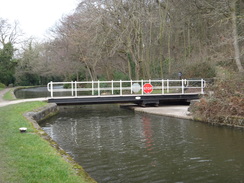
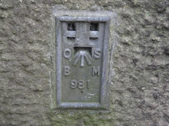
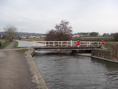
The directions for this walk are simple: from Saltaire station at SE13933803, climb up a ramp to join Victoria Road, and turn left to head downhill for a short distance to reach bridge over the canal. Cross the bridge, and then turn left down a ramp to join the canal towpath and start following it westwards, with the water on the left. After 1.9km it crosses an aqueduct over the River Aire and reaches bridge 206 at SE12093828. Here cross the canal using the bridge and continue along the towpath, with the water to the right.
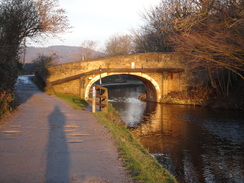
Simply continue along the canal for 2.6km, as it passes through Bingley, passes a two-lock staircase flight, then a three-lock one, and finally the famous Bingley five-lock flight, to reach the top of the flight at SE10744002.
Continue along the canal as it passes Crossflats and Riddlesden, before finally leaving Bingley behind and entering countryside. After another 10.2 km bridge 191A is reached in Silsden at SE04174613. Continue along the towpath as it heads westwards to Kildwick, and then starts to head northwestwards. 10.7km after Silsden, Belmont Bridge no. 178 is reached in the centre of Skipton at SD98785157.
Here I climbed up steps onto Belmont Road above the bridge, and turned right to quickly visit the centre of Skipton; alternatively you can just continue along the canal. Skipton railway station is a short distance away to the left down Belmont Road, whilst the bus station can be found in the other direction.
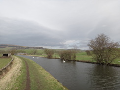
Continue along the canal as it winds westwards out of Skipton, still with the water to the right. It soon curves to take a more northwesterly direction, and after 6.7km Holme Bridge lock (no. 30) is reached. Continue past this, and follow the canal as it heads west towards Gargrave, passing more locks. After another 1.3km Higherland Bridge (no. 170) is reached at SD93115438. Here this walk leaves the canal.
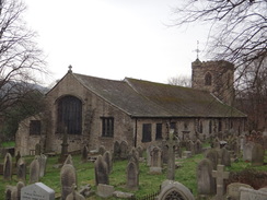
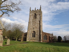
Climb up onto the bridge and turn left to follow it downhill south along the road. This immediately passes houses, and soon ends at a bend in another road. Continue straight on down the road, passing Gargrave Village Hall on the left, before it ends at the A65 High Street. Buses back to Skipton call at a bus stop here. Carefully cross the road, turn right for a few metres, and then left along a road that heads south, immediately crossing the River Aire on a bridge. The road continues south, soon passing St Andrew’s church on the left, and then starts to climb uphill. Gargrave station is reached on the right at SD93205358, 500 metres after the main road.
 |
 |
|
Distances
| From | To | Distance (m) | Ascent (ft) | Descent (ft) |
|---|---|---|---|---|
| Saltaire station | Bingley 3-rise locks | 2.6 | 85 | 46 |
| Bingley 3-rise locks | Silsden | 6.7 | 89 | 46 |
| Silsden | Skipton | 6.8 | 35 | 35 |
| Skipton | Gargrave station | 5.8 | 85 | 52 |
This makes a total distance of 21.9 miles, with 294 feet of ascent and 17.9 feet of descent.
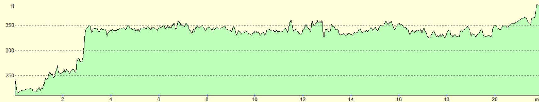
For more information on profiles, ascents and descents, see this page
Transport
Regular (usually hourly) train services run from Saltaire to Skipton, where you can change for a train back to Saltaire. Note that not all trains from Skipton to Leeds call at Saltaire. See the National Rail Enquiries website for more details.
 |
 |
|
 |
 |
|
 |
 |
|
 |
 |
|
 |
 |
|
 |
 |
|
 |
 |
|
 |
 |
|
 |
 |
|
 |
 |
|
 |
 |
|
 |
 |
|
 |
 |
|
 |
 |
|
 |
 |
|
 |
 |
|
 |
 |
|
 |
 |
|
 |
 |
|
 |
 |
|
 |
 |
|
 |
 |
|
 |
 |
|
 |
Disclaimer
Please note that I take no responsibility for anything that may happen when following these directions. If you intend to follow this route, then please use the relevant maps and check the route out before you go out. As always when walking, use common sense and you should be fine.
If you find any information on any of these routes that is inaccurate, or you wish to add anything, then please email me.
All images on this site are © of the author. Any reproduction, retransmissions, or republication of all or part of any document found on this site is expressly prohibited, unless the author has explicitly granted its prior written consent to so reproduce, retransmit, or republish the material. All other rights reserved.
Although this site includes links providing convenient direct access to other Internet sites, I do not endorse, approve, certify or make warranties or representations as to the accuracy of the information on these sites.
And finally, enjoy your walking!
Nearby walks
| # | Title | Walk length (miles) |
|---|---|---|
| 33 | Mankinholes to Ponden | 12.7 |
| 34 | Ponden to East Marton | 13.4 |
| 35 | East Marton to Malham | 9.2 |
|
|

|