Walk #1036: Leeds and Liverpool Canal: Gargrave to Burnley
 |
 |
|
General Data
| Date Walked | 18/02/2019 |
| County | North Yorkshire, Lancashire |
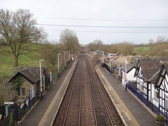
| Start Location | Gargrave station |
| End Location | Burnley Holiday Express |
| Start time | 08.33 |
| End time | 16.21 |
| Distance | 22.3 miles |
| Description | This walk followed the Leeds and Liverpool canal as it crossed the Pennine watershed, leaving North Yorkshire and entering Lancashire. |
| Pack | Today I carried my 30-litre Karrimor rucksack, filled with water, my spare waterproofs, a book and other odds and ends. |
| Condition | I was fairly footsore for long periods of today’s walk, and have got a couple of blisters on my little toes. Aside from these little issues I am fine. |
| Weather | The walk started off dry, but soon rain started for about an hour. After this it was dry for a few hours, after which it was a case of suffering sunshine and showers. It was surprisingly mild for mid-February, and the wind was much gentler than yesterday. |
| OS map | Landranger number 103 (Blackburn & Burnley, Clitheroe & Skipton) |
 |
 |
|
Map of the walk
Maps courtesy of Google Maps. Route for indicative purposes only, and may have been plotted after the walk. Please let me have comments on what you think of this new format. For a detailed table of timings for this walk, please see the table file.
 |
 |
|
Notes
I was unsure of the best way to get from my hotel in Burnley to Gargrave, where I ended yesterday’s walk. Trains would take two hours, and I would have to walk a mile to get from the hotel to the station. Eventually I scoffed down a quick breakfast – a few sausages, bacon and beans in a digestion-worrying seven minutes, put my boots and rucksack on, and walked through a quiescent Burnley to the bus station. The bus took an hour to get to Skipton – I sat next to a man who was going for his first day of work at Rolls Royce in Barnoldswick – and I then had to run from Skipton bus station to the railway station, where I caught a train to Gargrave. This kaffufle saved me half an hour, and I set off through the village to reach the canal.
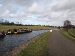
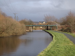
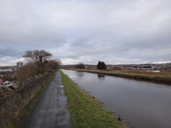
The forecast for this week had been for dry and unseasonably warm weather; it was therefore a shock to see rain on the bus’s window on the way to Skipton. Fortunately the rain had stopped by the time I started the walk, and the first stretch of walk along the canal was very pleasant. It passed more of the Gargrave locks – all still climbing, and I wondered when I’d reach the summit level, as the River Aire was left well behind.
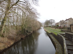
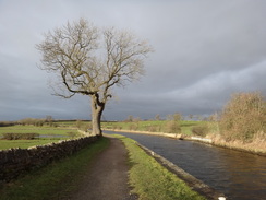
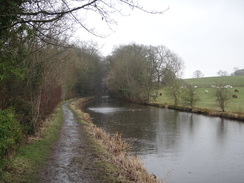
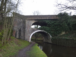
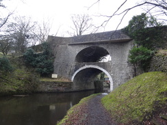
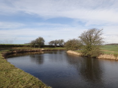
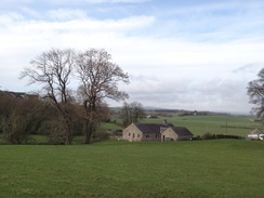
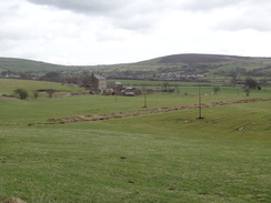
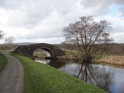
More locks continued to climb on the Bank Newton flight, after which it started to drizzle. It started to rain a little harder as the canal wound past a TV transmitter; I stopped to put my coat on, though it was so mild I also took my fleece off. The canal continued south into East Marton, where I had camped during my Pennine Way stroll twenty years ago, and under the double-arch bridge, which is exactly as its name suggests. After this the going became slightly more rural, with some occasional snatched glimpses of grand views across verdant green landscapes – a welcome change after the slightly suburban nature of much of yesterday’s walk. The rain also ended, and I was rewarded with the sight of a rainbow.
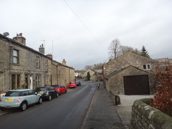
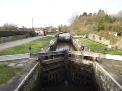
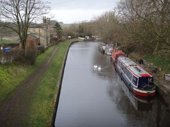
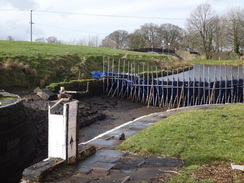
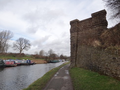
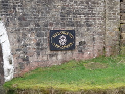
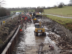
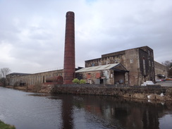
Soon afterwards the canal crossed the county border into Lancashire and passed some lockes that were under repair. It then led me to Barnoldswick, which is dominated by a large Rolls Royce plant. It seems odd to have such a high-tech plant in this rather remote location: the plant was originally owned by the Rover car company, and when they failed to make a reliable jet engine during the war the government gave the task to Rolls Royce. Many Rolls Royce jet engines are numbered RB, which stands for Rolls Barnoldswick. Hence this small place is commemorated all around the world! The canal also passed a factory belonging to Esse stoves and many people will have slumbered on Silentnight Beds made in the town.
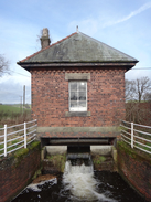
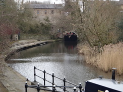
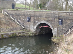
The canal continued south to Foulridgde Wharf and the northern portal of the nearly mile-long Foulridge Tunnel. There is a walkway over this, but it is not well waymarked and I found it difficult to find the route. Eventually I found a rather faded sign pointing up a gravel track, but this seemed to peter out in a housing estate. Rather than wander around aimlessly, I followed roads and eventually made my way down to the tunnel’s southern portal.
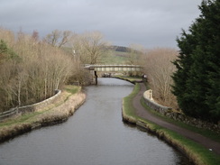
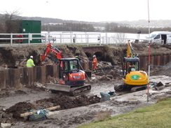
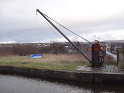
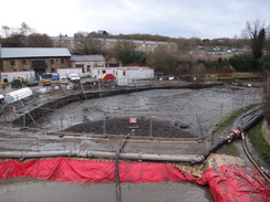
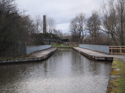
This annoyed me, as did the fact I was feeling rather tired and footsore despite having many miles left to walk. Just before the canal was rejoined, the path passed the trackbed of the old Colne to Skipton railway line, which is a strong candidate for reopening. Soon afterwards the canal reached Barrowford Locks, which were also under repair – fortunately they had made a path in an adjacent field so people could walk past the works. It’s always interesting to see canals dewatered so you can see how they were made.
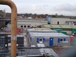
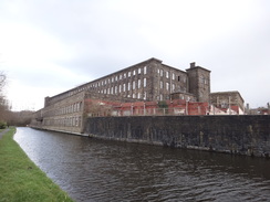
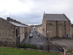
After passing under a motorway bridge, the canal entered the town of Nelson – one of those places that had never really entered my consciousness before. Some large mill buildings stood beside the canal, but the proximity of the M65 made this a stretch more to endure than to enjoy. I tried to speed up as the canal passed Brierfield and became slightly more rural in nature again – though the low thrum of the motorway was always present. A group of lads in hoodies were blocking the towpath under one bridge, and I was thankful they wordlessly moved to let me pass – though not before I’d got a smell of exactly what they’d been smoking.
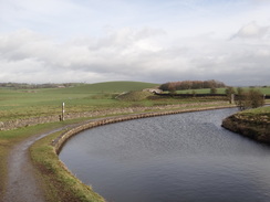
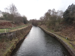
The canal eventually entered Burnley, around which it took a rather indirect route, going around two sides of a triangle. This included a large embankment that apparently caused much trouble during construction. It was a surprisingly pleasant stroll as the canal was elevated at this point, so I got good views over the town’s rooftops on one side and the distant Pennine hills on the other. However the towpath and canal were soon blocked by more works on the canal, forcing me onto a road.
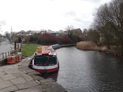
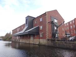
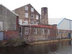
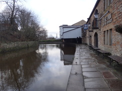
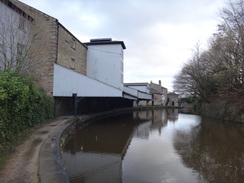
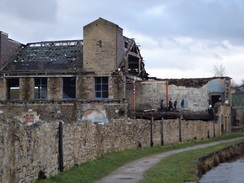
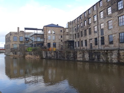
I guessed the correct route that took me back to the towpath, and what followed was an excellent urban canal walk. A canalside pub was sadly closed, but its adjacent building – an old covered wharf – was brilliantly preserved, and a real gem of its type. Further on, some children were clambering about a ruined building that had been half demolished – not exactly a safe thing for them to be doing. Another mill building on the other side of the canal had evidently recently been converted and was spick and span, but all too soon the canal passed back under the M65, and my hotel became visible a short distance away.
It had been a pleasant day’s walk despite the weather, but is not one I will necessarily want to repeat any time soon – though parts of it are well worth redoing as parts of other walks.
 |
 |
|
Directions
This walk starts off at Gargrave station at SD93205358. Leave the station and exit onto the road, and then turn left to follow the road north as it heads downhill. It passes St Andrew’s Church on the right, and then crosses the River Aire on a bridge. After 500 metres the road ends at a T-junction with the High Street in Gargrave Bus services to Skipton run from a bus stop here. Cross the main road, turn right for a few metres, and then left up West Street. This passes the village hall on the right, and when it curves right, continue straight on up North Street. This soon reaches Higherland Bridge (no. 170) over the Leeds and Liverpool Canal at SD93115438.
Immediately before the canal bridge, turn left past a gate to join the towpath, with the water on the right, and pass Higherland Lock (no. 32). Follow the canal as it heads in a rough westerly direction through and out of Gargrave, after which it curves to take a more southwesterly course. It passes under a railway bridge and crosses an aqueduct over the River Aire, and after 1.6km Bridge 168 is reached at SD91765373.
Follow the towpath as it passes under the bridge; it then curves up and ends at the road beside the bridge. Turn left to cross the bridge, and follow the road as it curves left to run alongside the canal. After about 100 metres, go through a pedestrian gate to rejoin the towpath, which now runs with the canal to the left. Follow it as it passes the Bank Newton locks, and after another 1.2km Bridge no. 165 is reached at SD91225283.
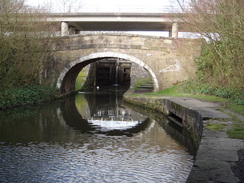
The towpath passes under the bridge and curves right to climb up to end at a road. Turn right to cross the bridge over than canal, and on the other side follow the road as it curves right. As the road approaches a farm after about 50 metres, turn right past a pedestrian gate to rejoin the towpath, now with the water on the right. The canal winds around as it heads south; after another 3.6km the double-arched A59 bridge is reached in East Marton at SD90925086.
Head under the bridge and continue following the canal south, still with the water on the right. After 3.6km Bridge 158 is reached; here the towpath turns right to cross the bridge, and then curves left to keep the water on the left. It then passes the Greenberfield Locks, and after another 2km Coates Bridge (no. 154A) which carries the B6252 overhead is reached in Barnoldswick at SD88184738. The centre of Barnoldswick is about 800 metres away to the right.
Continue under the bridge, and follow the canal on the left southwards. After another 650 metres Long Ing Bridge (no. 153) is reached; just before the bridge, go through a gate on the right to join a road, and turn left to follow it for a few metres to the bridge. Turn left over the bridge, and on the other side turn right past a cycle barrier to rejoin the towpath, now with the canal on the right. Continue south along the canal for another 4.7km until Foulridge Wharf is reached at SD88854252.
The towpath passes a converted wharf building, and then as the canal curves right, leave it and follow Warehouse Lane which heads straight on uphill. When this ends at a T-junction, turn right up Station Road. Follow it westwards; when it curves right after 500 metres, turn left along Reedymoor Lane. This heads southwestwards, roughly following the line of the canal tunnel below. When the lane curves left after 570 metres, head straight on through a gate to continue on along a track. This ends at a road; turn right along the road for a short distance, and then turn left down a driveway, with a stream to the right. The track soon reaches a squeeze by a field gate; go through this and head on to a little bridge over a stream. Follow the path as it curves left; as it does so angle right down a path that descends to join the towpath by the southern portal of Foulridge Tunnel at SD87504163.
Continue along the towpath, with the canal to the right. It passes the Barrowford locks and then heads under the M65; 3km after the tunnel, it crosses Swinden Aqueduct and continues on to reach Swinden Bridge (no. 142). Here the towpath rises up to meet the bridge; turn right to cross the bridge, and then turn left through a stile in a wall to rejoin the towpath, now with the water on the left. Continue southwestwards along the towpath for another 1.7km until Bridge 141A is reached, which carries the B2649 Carr Road overhead at SD85643800. The town of Nelson and its railway station are 600 metres away to the left.
Continue under the bridge and follow the towpath as it winds past Nelson and Brierfield, before entering Burnley. After 7.2km it reaches the start of Burnley Aqueduct which passes above the centre of Burnley; after another 1.1km the canal passes under a bridge and turns right, winding around in a rough northwesterly direction. After another 1.9km it crosses an aqueduct over the M65. When bridge 129 is reached immediately after the motorway aqueduct, turn right through a squeeze-style in a wall to join a track. Turn left up this for a few metres until it ends at a road, and then turn right along the road to reach the entrance to the Holiday Inn Express at SD83153312, where this walk ends.
Distances
| From | To | Distance (m) | Ascent (ft) | Descent (ft) |
|---|---|---|---|---|
| Gargrave station | East Marton | 4.7 | 187 | 112 |
| East Marton | Barnoldswick | 3.5 | 66 | 49 |
| Barnoldswick | Foulridge | 3.5 | 82 | 36 |
| Foulridge | Nelson | 4.1 | 82 | 184 |
| Nelson | Burnley Holiday Inn Express | 6.5 | 49 | 65 |
This makes a total distance of 22.3 miles, with 466 feet of ascent and 446 feet of descent.
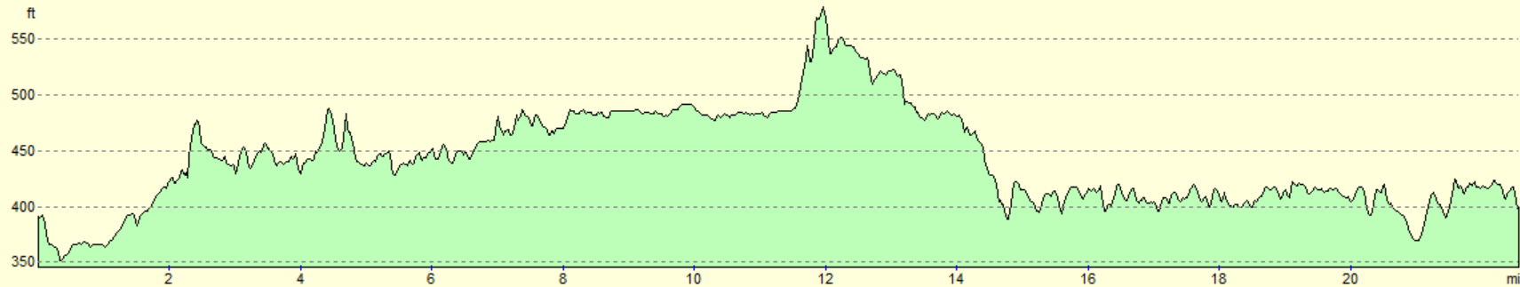
For more information on profiles, ascents and descents, see this page
Accommodation
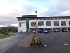
I spent the night at the Burnley Holiday Inn Express, which is situated just off the canal a mile to the north of Burnley. This was an excellent hotel, with early breakfasts ideal for those who are keen to get on the trail.
Transport
It is possible to go directly from Burnley to Gargrave by train, by traveling from Burnley Manchester Road station to Leeds, and then catching a train up to Gargave - this trip takes two hours or more.
There is a quicker route : the X43 Witch Way bus route runs regularly from Burnley bus station to Skipton, from where you can either walk to the railway station to catch a train to Gargrave, or the Dalesbus 580 Craven Connection service towards Settle, or a Dalesbus 210/211 service towards Malham, both of which call at Gargrave,
See the National Rail Enquiries website for more details of the train services.
 |
 |
|
 |
 |
|
 |
 |
|
 |
 |
|
 |
 |
|
 |
 |
|
 |
 |
|
 |
 |
|
 |
 |
|
 |
 |
|
 |
 |
|
 |
 |
|
 |
 |
|
 |
 |
|
 |
 |
|
 |
 |
|
 |
 |
|
 |
 |
|
 |
 |
|
 |
 |
|
 |
 |
|
Disclaimer
Please note that I take no responsibility for anything that may happen when following these directions. If you intend to follow this route, then please use the relevant maps and check the route out before you go out. As always when walking, use common sense and you should be fine.
If you find any information on any of these routes that is inaccurate, or you wish to add anything, then please email me.
All images on this site are © of the author. Any reproduction, retransmissions, or republication of all or part of any document found on this site is expressly prohibited, unless the author has explicitly granted its prior written consent to so reproduce, retransmit, or republish the material. All other rights reserved.
Although this site includes links providing convenient direct access to other Internet sites, I do not endorse, approve, certify or make warranties or representations as to the accuracy of the information on these sites.
And finally, enjoy your walking!
Nearby walks
| # | Title | Walk length (miles) |
|---|---|---|
| 34 | Ponden to East Marton | 13.4 |
| 35 | East Marton to Malham | 9.2 |
| 36 | Malham to Horton in Ribbesdale | 14.7 |
|
|

|