Walk #36: Malham to Horton in Ribbesdale
 |
 |
|
General Data
| Date Walked | 14/08/1999 |
| County | North Yorkshire |
| Start Location | Malham |
| End Location | Horton-in-Ribblesdale |
| Start time | 09.00 |
| End time | 16.00 |
| Distance | 14.7 miles |
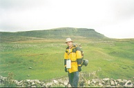
| Description | This was a great day's walk, taking in both Fountain's Fell and the summit of Pen-y-ghent. |
| Pack | Today I carried full camping gear. |
| Condition | My back is fine, as are my legs. However my ankle is giving me a slight amount of gip - I feel as though I may have slightly bruised the left side of my left foot going over all the rocks today. Unless it deteriorates overnight I will go onto Hawes in the morning and see how it goes from there. |
| Weather | There was much rain today, with some periods of sun, although it was mainly overcast. Once we had climbed up onto Pen-y-Ghent we were in cloud. I did not really get that wet though - by the time we reached the bunk barn in Horton the only things that were wet was my t-shirt and the inside cuffs of my jacket. A grey day, but an enjoyable one nonetheless. |
| OS map | Outdoor Leisure number 2 (Yorkshire Dales - Southern & Western Areas) |
Map of the walk
Maps courtesy of Google Maps. Route for indicative purposes only, and may have been plotted after the walk. Please let me have comments on what you think of this new format. For a detailed table of timings for this walk, please see the table file.
Notes
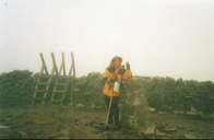
Today was an interesting day, the highlight of which was the climb up to the summit of Pen-y-Ghent. It was a shame that the summit was totally obscured in high cloud when we were up there.
I walked all day with Sam, and two-thirds of the day with Tony, whom we met last night at Malham YHA and is walking the PW as far as Hadrian's Wall - he walked it all with his daughter about nine years ago.
The going today was very hard - large parts were on limestone boulders and it is my belief that that has contributed to this slight injury to my ankle. I will see the condition of it in the morning before deciding what to do, although at the moment my favoured option is to press on to the YHA in Hawes tomorrow and then re-evaluate.
Directions
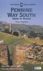
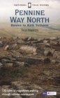
I am not going to bother giving any directions for any of the stages of the Pennine Way; there are many route descriptions produced that will better anything that I could produce. The main guides I used were the OS National Trail Guides, which come complete with strip maps of the route. Click on one of the links below to go to the Amazon page for each guide.
|
| 
|
| |
| |
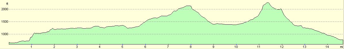
Distances
| From | To | Distance (m) | Ascent (ft) | Descent (ft) |
|---|---|---|---|---|
| Malham | Malham Tarn | 3.6 | 820 | 249 |
| Malham Tarn | Fountain's Fell | 4.1 | 1112 | 262 |
| Fountain's Fell | Pen-y-ghent | 3.7 | 965 | 791 |
| Pen-y-ghent | Horton-in-Ribblesdale | 3.3 | 89 | 1581 |
This makes a total distance of 14.7 miles, with 2986 feet of ascent and 2883 feet of descent.
For more information on profiles, ascents and descents, see this page
Disclaimer
Please note that I take no responsibility for anything that may happen when following these directions. If you intend to follow this route, then please use the relevant maps and check the route out before you go out. As always when walking, use common sense and you should be fine.
If you find any information on any of these routes that is inaccurate, or you wish to add anything, then please email me.
All images on this site are © of the author. Any reproduction, retransmissions, or republication of all or part of any document found on this site is expressly prohibited, unless the author has explicitly granted its prior written consent to so reproduce, retransmit, or republish the material. All other rights reserved.
Although this site includes links providing convenient direct access to other Internet sites, I do not endorse, approve, certify or make warranties or representations as to the accuracy of the information on these sites.
And finally, enjoy your walking!
This walk was mentioned in the following routes:
| My sectional Land's End to John O'Groats walk |
| My Pennine Way Walk, 07th to 26th August 1999 |
Nearby walks
| # | Title | Walk length (miles) |
|---|---|---|
| 35 | East Marton to Malham | 9.2 |
| 37 | Horton in Ribbesdale to Hawes | 14.0 |
| 605 | Burnsall Fell to Rain Stang | 19.1 |
|
|

|