Walk #1037: Leeds and Liverpool Canal: Burnley to Cherry Tree
 |
 |
|
General Data
| Date Walked | 19/02/2019 |
| County | Lancashire |
| Start Location | Burnley Holiday Express |
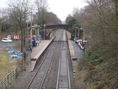
| End Location | Cherry Tree station |
| Start time | 07.19 |
| End time | 14.33 |
| Distance | 21.0 miles |
| Description | This was a nice walk, following the Leeds and Liverpool Canal westwards through Lancashire. |
| Pack | Today I carried my 30-litre Karrimor rucksack, filled with water, my spare waterproofs, a book and other odds and ends. |
| Condition | I am slightly footsore after this walk, but I otherwise feel fine. |
| Weather | The day started off damp, with occasional showers of light rain. It dried up and there were even a few isolated sunny periods, but it was mostly cloudy. There were a few spots of rain later on, but not enough for me to put my hood up. The wind was quite bitter at times, despite it being mild for the time of year. |
| OS map | Landranger number 103 (Blackburn & Burnley, Clitheroe & Skipton) |
 |
 |
|
Map of the walk
Maps courtesy of Google Maps. Route for indicative purposes only, and may have been plotted after the walk. Please let me have comments on what you think of this new format. For a detailed table of timings for this walk, please see the table file.
 |
 |
|
Notes
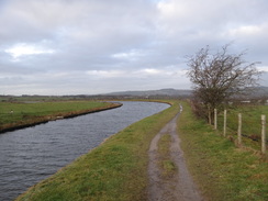
I ate a hearty breakfast early this morning, and set off from the hotel just after first light. The forecast was mixed, with showers due to be followed by heavier rain after mid-afternoon. The ground showed that it had rained overnight, and there was still some rain in the air as I joined the canal and headed west.
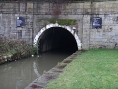
I soon reached a portal of the Gannow tunnel, which pierces through a hillside to the northwest of Burnley. A ramped path led straight on, eventually reaching a large roundabout. The path above the tunnel had been well waymarked, but I took the wrong subway exit; I soon realised my mistake and headed through more underpasses that stretched under the motorway to reach the other tunnel portal – and a steep slope leading down to the towpath.
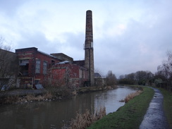
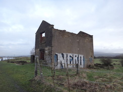
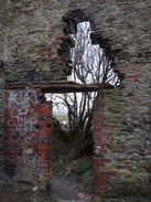
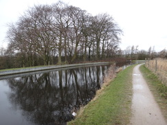
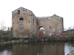
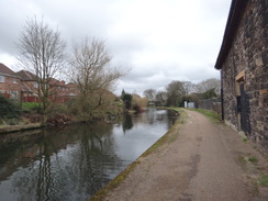
The canal wound around as it headed west, dipping under the motorway on a couple of occasions. Unfortunately the motorway was a little obtrusive, although when it was further away the walk could be pleasant – if hard underfoot. An old ruined building stood by a swing bridge, and I nipped inside to take some photographs, despite the wooden lintel that held up tonnes of stone being nearly rotted through. I fear there will not be many more winters until a large part of the building falls.
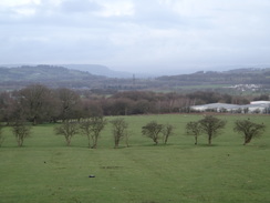
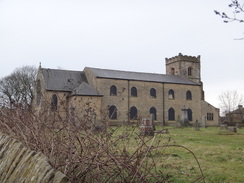
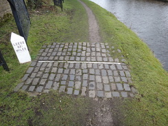
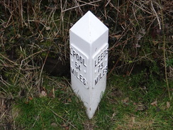
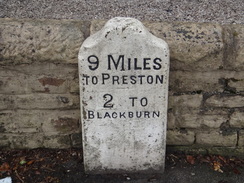
I did not get to see much of Clayton-le-Moors as the canal passed through and started heading south towards Acrington. On the way it passed a rather imposing, blocky church, immediately beyond which was a special milepost marking the canal’s midpoint. I stood there for a minute, although its power was somewhat dissipated by the fact I had not started this trip in Leeds, and that I would not be going to the other end in Liverpool. A little further on, I paused to take a photo of an interesting-looking decrepit building, when I noticed a man in running gear squatting down. He pulled up his trousers, gave an embarrassed smile, and ran on, leaving a certain deposit behind.
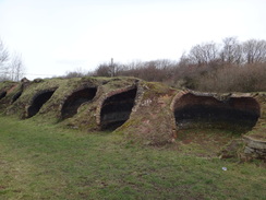
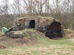
The canal makes a big loop south towards (but not through) Accrington, before heading back north up the other side of a valley; a slightly annoying diversion. On the way I passed the site of some small brick kilns, now half-broken and grass-covered. These are known locally as ‘fairy caves’, and are the remains of old coking ovens that once belonged to Aspen Colliery – this whole area was involved with coal mining, although these ovens were the only direct evidence I saw on this trip.
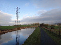
The canal passed under the motorway once again, and then passed around the north of Rishton. I strode on as the scenery became slightly more rural, until an office building and then a retail estate marked the approach to the eastern side of Blackburn.
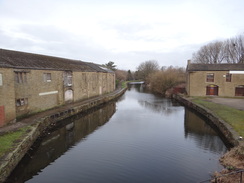
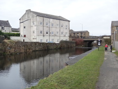
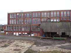
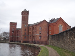
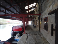
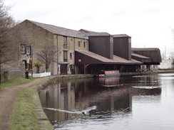
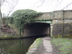
I quite enjoyed the stroll through the town, which featured some interesting old mill buildings – including Imperial Mill, whose lower-floor windows had lights in, but those on the floors above were smashed. There was also a covered wharf (Eanam Wharf), similar to the one I encountered yesterday in Burnley – they are always a structure I love to see, as they have a certain magic. Like the one in Burnley, this appeared to have been very sympathetically restored.
As I left the outskirts of Blackburn I realised that I might just be able to get a train from Pleasington in an hour if I pushed. However I did not have much ‘push’ in me, so I decided to just walk and see if I made it or not. Large stretches of canal were bounded by new housing, even on an old railway trackbed, whereas the bridge abutment on the other side was still intact.
Eventually I reached the bridge where I was to leave the canal, and a road took me north towards Pleasington. It was clear that I wouldn’t reach the station in time, so I decided not to risk it, and instead decided to extend the walk slightly by aiming for the next station. A petrol station provided me with some sandwiches – the first shop I had directly passed all day – and I continued on to Cherry Tree station, where I had to wait 45 minutes for the next train.
It had been a reasonable day’s walk, although after three days I am getting slightly bored with canal walking – especially as I have passed through some areas where more scenic walks are available just off the canal.
 |
 |
|
Directions
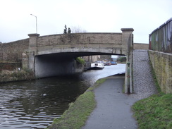
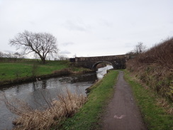
This walk starts off at the Burnley Holiday Inn Express, located just off Junction 10 of the M65 at SD83153312. Leave the hotel, pass through its car park and out onto Pendle Way. Turn left along this for a short distance towards bridge 129 over the Leeds and Liverpool Canal. Immediately before the bridge, turn left down a short track for a few metres, and then turn right through a squeeze-style in a wall to join the canal towpath.
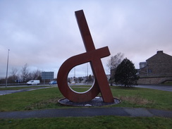
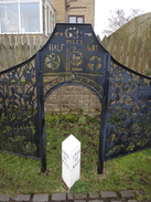
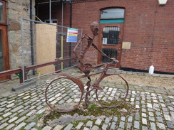
Turn right to follow the towpath, with the canal to the left as it immediately passes under bridge 129. The canal turns left, and after 500 metres a portal of Gannow Tunnel is reached. Follow the towpath as it climbs steps that ends at Ighten Road. Cross the road, and continue straight on along a sloping path that continues climbing. It passes the end of Shale Street on the left, before the path ends at some steps that lead down to Pendle Way. Cross this, and follow a path across some grass, passing a sculpture on the right before it soon ends at a stub road. Turn left along this and then immediately right, to join another short path that leads to a sliproad leading down towards the M65. Cross the sliproad, and on the other side turn right down a path that heads through an underpass to reach the centre of a roundabout at SD82523276.
In the middle of the roundabout, curve left to reach a second underpass leading out of the roundabout, and then immediately curve left to reach a third. The path emerges from this for a few metres, before plunging into a fourth, longer, underpass under the motorway. Immediately after it emerges from this, do not continue on towards a rail bridge ahead, and instead turn right down a very steep path that leads to the towpath beside the other portal of Gannow Tunnel at SD82423256.
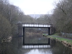
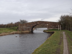
Follow the towpath away from the tunnel, as it immediately passes under the motorway once again. Continue for 9.8km as the canal heads westwards, with the motorway a short distance away to the south, until bridge 114B is reached in Clayton-le-Moors at SD74863093.
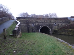
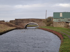
Pass under the bridge, and continue following the canal on the left south for another 500 metres until bridge 114A is reached, which carries the A678 across the canal. Here climb the slope leading up onto the road bridge, turn left to cross the canal, and on the other side turn left down a curving path that slopes down to rejoin the towpath, which is now on the other side of the canal. Continue south along the towpath, with the water now to the right as it immediately passes under the M65. It enters the northwestern outskirts of Accrington, passes a large church on the right, and then a marker for the midpoint of the whole canal. Shortly afterwards, and 2.2km after bridge 114A, bridge 112 is reached at SD74002909.
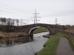
Pass under bridge 112, and then immediately follow the path as it curves left to reach some steps that lead up onto the bridge. At the top, turn left across the bridge, and on the other side turn left down more steps to join the towpath, which is now on the right-hand bank of the canal, with the water to the left. Follow it as it heads south, west, and then north, for another 3.9km, passing over an aqueduct over the motorway to reach bridge 108A in Rishton, which carries the A678 over the canal at SD72913032. The centre of Rishton is a short distance away to the left from the bridge.
Continue following the canal; it soon curves left to head westwards out of Rishton, and then left once more to head south and then southwestwards. After 7.1km bridge 103 is reached in Blackburn at SD68712794. The centre of Blackburn is a short distance away to the right.
Continue following the canal as it passes through the southern suburbs of Blackburn in a southwesterly direction, soon descending a series of locks with the canal to the left. It curves to take a more westerly course, and after another 4.2km bridge 95 is reached at SD65932635. If you require Cherry Tree railway station directly, then it lies a short distance to the north. Follow the towpath under the bridge and on for another 1.7km until bridge 93B is reached at SD64802526.
Here leave the canal to join the A6062 Livesey Branch Road. It slowly curves right, and after 550 metres ends at a mini-roundabout with the A674 (Pleasington station is now about 900 metres away to the left, and then right up Pleasington Lane). For Cherry Tree station, turn right at the roundabout to follow the A674 eastwards; after 1.6km it crosses a bridge over the railway line. On the far side of the bridge, take the first road to the right, Green Lane, and after a few metres turn sharply right to walk down the station approach to Cherry Tree station at SD65872643, where this walk ends.
 |
 |
|
Distances
| From | To | Distance (m) | Ascent (ft) | Descent (ft) |
|---|---|---|---|---|
| Burnley Holiday Inn Express | Clayton-le-Moors | 7.2 | 141 | 144 |
| Clayton-le-Moors | Rishton | 4.1 | 46 | 49 |
| Rishton | Blackburn | 4.5 | 23 | 36 |
| Blackburn | Higher Broadhalgh | 3.7 | 33 | 62 |
| Higher Broadhalgh | Cherry Tree station | 1.5 | 62 | 102 |
This makes a total distance of 21.0 miles, with 305 feet of ascent and 393 feet of descent.
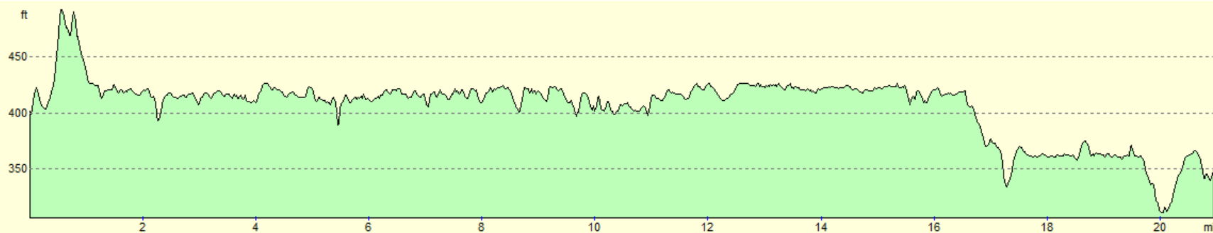
For more information on profiles, ascents and descents, see this page
Accommodation
I spent the night at the Burnley Holiday Inn Express, which is situated just off the canal a mile to the north of Burnley. This was an excellent hotel, with early breakfasts ideal for those who are keen to get on the trail.
Transport
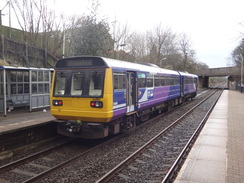
Regular train services run between Cherry Tree and Blackburn Central or Blackburn Barracks stations, on the Preston to Colne service. Please note that Blackburn Barracks is a request stop.
See the National Rail Enquiries website for more details of the train services.
 |
 |
|
 |
 |
|
 |
 |
|
 |
 |
|
 |
 |
|
 |
 |
|
 |
 |
|
 |
 |
|
 |
 |
|
 |
 |
|
 |
 |
|
 |
 |
|
 |
 |
|
 |
 |
|
Disclaimer
Please note that I take no responsibility for anything that may happen when following these directions. If you intend to follow this route, then please use the relevant maps and check the route out before you go out. As always when walking, use common sense and you should be fine.
If you find any information on any of these routes that is inaccurate, or you wish to add anything, then please email me.
All images on this site are © of the author. Any reproduction, retransmissions, or republication of all or part of any document found on this site is expressly prohibited, unless the author has explicitly granted its prior written consent to so reproduce, retransmit, or republish the material. All other rights reserved.
Although this site includes links providing convenient direct access to other Internet sites, I do not endorse, approve, certify or make warranties or representations as to the accuracy of the information on these sites.
And finally, enjoy your walking!
Nearby walks
| # | Title | Walk length (miles) |
|---|---|---|
| 1036 | Leeds and Liverpool Canal: Gargrave to Burnley | 22.3 |
| 1038 | Leeds and Liverpool Canal: Cherry Tree to Wigan | 20.2 |
|
|

|