Walk #1038: Leeds and Liverpool Canal: Cherry Tree to Wigan
 |
 |
|
General Data
| Date Walked | 20/02/2019 |
| County | Lancashire, Greater Manchester |
| Start Location | Cherry Tree station |
| End Location | Wigan North Western station |
| Start time | 07.12 |
| End time | 13.48 |
| Distance | 20.2 miles |
| Description | This was another pleasant canalside stroll, following the Leeds and Liverpool canal south through Lancashire and into greater Manchester. |
| Pack | Today I carried my 30-litre Karrimor rucksack, filled with water, my spare waterproofs, a book and other odds and ends. |
| Condition | I am slightly tired after this walk, but otherwise feel fine. |
| Weather | Today’s forecast was for light rain until two, but fortunately it was only occasionally wet, with drizzle or brief minutes of rain until near the end, when it started to rain heavily. It was quite a warm day for mid-February, and the brisk wind of the last few days seemed to have dissipated. |
| OS map | Landranger number 102 (Preston & Blackpool, Lytham St Anne's), Landranger number 108 (Liverpool, Southport & Wigan) and Landranger number 109 (Manchester, Bolton & Warrington) |
 |
 |
|
Map of the walk
Maps courtesy of Google Maps. Route for indicative purposes only, and may have been plotted after the walk. Please let me have comments on what you think of this new format. For a detailed table of timings for this walk, please see the table file.
 |
 |
|
Notes
Today’s forecast was for light rain until two in the afternoon, and I was unsure that I wanted to spend my last day on this trip walking in the rain (yes, I am a lightweight). It had rained heavily overnight, but I had an early breakfast, checked out of the hotel and decided to drive to the start of the walk to see what the weather was like. I parked up in one of the few spaces at Cherry Tree station and put on my gear just as dawn was breaking. Since it was dry, I decided to head off.
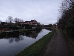
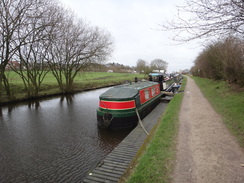
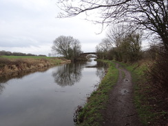
The first mile repeated a final section of yesterday’s walk, following the canal westwards to where I had left the canal for the walk back to Cherry Tree. Today my route continued westwards, soon leaving canalside housing behind me and entering what would have been pleasant countryside had it not been for the rush-hour drone of traffic on the M65. I pushed on fast, as I was keen to finish the walk so that I could tackle the drive back to my parents’ house before it got dark.
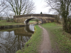
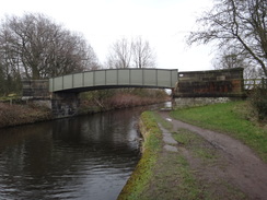
The motorway was always a companion – audibly, if not visually – and it was a relief when the canal turned to head southwestwards, passing under the road to enter countryside. However the noise of a road soon intruded once more as the roar of the M61 started to make itself known – I had swapped one motorway for another. The first lock of the day was reached at Lower Copthurst, and more locks on the Johnson’s Hillock flight passed until a bridge over a spur canal was reached to the north of Great Knowley – though I have no idea what purpose or industry the spur used to serve as it seems to end in the middle of nowhere near the motorway. (Later edit: it turns out that the spur was part of the Lancaster Canal. A stretch of the Leeds and Liverpool Canal south from the Johnson Hillock flight was originally part of the Lancaster Canal; the stretch of the Lancaster Canal going north towards Preston was obliterated by the M61.)
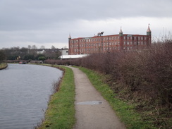
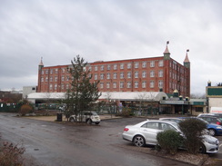
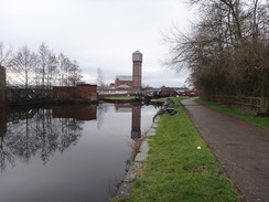
A light, occasional drizzle started; enough to force me to raise and lower my hood occasionally. The canal passed an old mill – now repurposed into the Botany Bay shopping centre. This is in the middle of closing, to be replaced with an outlet village. If you are wondering what the difference is, then it is that an old and interesting building is being demolished to be replaced with an uninteresting one that plays a pathetic homage to the original mill, whilst enabling hundreds of homes to be built around it. Heritage be damned!
To divert away from walking for a bit: what annoys me isn’t that the mill is being demolished, and 150 years of history with it: though with the addition of the housing it does seem a bit like an endeavour to make money. It is the fact that artist impressions of the replacement is a pastiche, a horrible homage to the original mill. I bet they even name streets to create that illusion. If you admire the old, keep it; restore it, repurpose it. But if you want to build new, build new: don’t create a poor pastiche of the past.
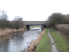
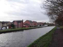
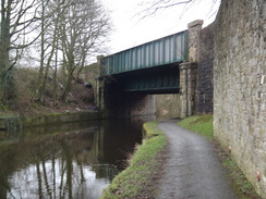
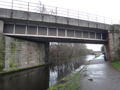
The canal passed under the motorway at a skew, meaning the bridge felt more like a tunnel, and then passed a string of new housing built along the other side of the canal – presumably to house customers for the outlet village. The canal headed down the eastern side of Chorley, between the town and the motorway, and I did not get to see much of either. The canal passed under a railway line and continued south, passing the abutments of an old railway bridge that once led to the Chisnall Hall coal mine in Coppull to the west, which closed in 1967.
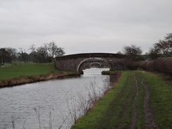
Chorley ended, and was soon replaced with Adlington, although again I did not get to see any of it from the towpath. It continued south in what was a rather rural area, although I kept my head down in the rain. It passed a moated house just visible through trees near Wigan golf course on the right, and crossed the old Blackburn and Boars Head railway (closed in 1971) at Red Rock.
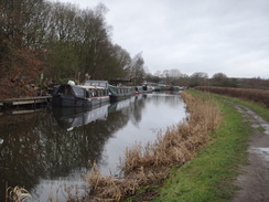
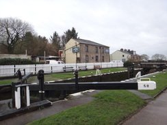
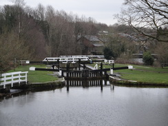
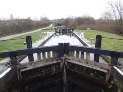
I really wanted to finish the walk early as I needed to drive back down to southern Derbyshire, so I put my head down and tried to walk fast – not as easy as it should have been, given I was on the fourth day of this trip. Houses and buildings soon appeared on the right, and the canal turned sharply right at Top Lock – accurately named, as it was the top lock in a series that plunged southwestwards down into Wigan. The rain grew heavier as I headed down the flight, passing a number of fishermen sheltering under umbrellas.
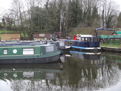
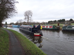
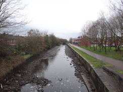
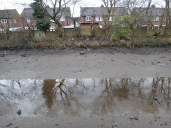
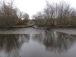
Two lock chambers were drained, revealing the muddy shallow-U profile of the canal bed. A sign on one asked boaters to close the lock gate paddles after use, and I wondered if someone had failed to do so. Two swans, their bottoms dirty, waddled from a drained canalside pond into what little water remained in the canal. The canal recrossed the old railway line once more, before the locks ended near the centre of Wigan. I passed the junction of canal arm that links to the Bridgwater Canal as the rain got heavier – fortunately right at the end of a trip.
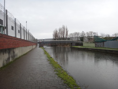
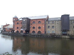
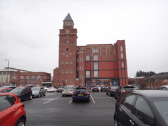
I’ve read Orwell’s ‘The Road to Wigan Pier’ several times, but have never visited the town. I was surprised to find that the part of the town the canal passes through now seems a world away from the one Orwell described. I actually liked it: unlike Blackburn or Burnley, the town appears to like its canal – perhaps because of its link with Orwell’s work.
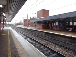
I arrived at the railway station about half an hour before the next train to Preston was due, and as I waited I realised I looked rather muddy and messy. There was not much I could do about it, and received some odd looks as I boarded the train to Preston. A Pacer train then jostled and jolted me back to Cherry Tree station – as the unloved Pacers are going out of service soon, this might be my last journey on one.
It had been an enjoyable trip, and whilst it would have been nice to continue for another day and a half to Liverpool, I’ve had a little bit too much of canals for the moment!
 |
 |
|
Directions
This walk starts off at Cherry Tree railway station at SD65872643. Leave the station by the main approach road, which soon ends at Green Lane, and then turn right along the lane. It immediately crosses the railway line on a bridge, and then continue on for 100 metres to reach bridge 35 over the Leeds and Liverpool Canal at SD65932635.
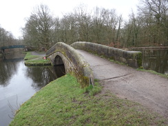
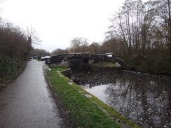
Immediately before the bridge, turn right down a path that leads to a squeeze-style. Go pas this to join the canal towpath. Turn right to head west, with the canal on the left. After 1.7km bridge 93B is reached at SD64802524; head under this and continue on. The canal winds around to the north of the M25, before eventually plunging under it and heading southwestwards through a more rural area. 8.3km after bridge 93, the top of the Johnson’s Hillock locks are reached near Lower Copthurst; continue along the towpath past these for another kilometre until the towpath turns right to cross a bridge over the canal at SD59122067, with a disused stretch of the Lancaster Canal away to the right. On the other side of the bridge, turn left down a ramp to rejoin the towpath.
Continue south along the towpath, still with the canal on the left. It passes Botany Bay, and then heads under the M61 motorway before skirting between Chorley and the motorway. After 8.5km White Bear Bridge (no. 69) is reached at SD59921298. Adlington railway station is 350 metres to the east.
Follow the towpath south, still with the canal on the left as it passes Red Rock. After 7.9km, Wigan Top Lock (no. 65) is reached at SD60810680.
Follow the towpath as it curves sharply to the right at the top lock, and starts descending southwestwards, still with the canal on the left. It passes about 20 locks as it heads towards Wigan, and after 3.3km reaches the junction with the Leeds and Liverpool (Leigh branch) at SD58380493. Continue straight on along the towpath for another 700 metres until Pottery Bridge is reached at SD57730521, which carries the A49 Pottery Road overhead, immediately before Wigan Pier.
Follow the towpath as it heads under the bridge and then curves right to reach the road by the bridge. Turn left to follow the road northeastwards. After 400 metres the road curves right; cross the road at traffic lights and head straight on under a railway bridge. Immediately after passing under the bridge, Wigan North Western railway station is a short distance away to the right at SD58140540.
 |
 |
|
Distances
| From | To | Distance (m) | Ascent (ft) | Descent (ft) |
|---|---|---|---|---|
| Cherry Tree station | Johnson's Hillock bottom lock | 7.0 | 42 | 88 |
| Johnson's Hillock bottom lock | Chorley | 1.8 | 0 | 7 |
| Chorley | Adlington | 3.6 | 16 | 20 |
| Adlington | Wigan Top Lock | 4.9 | 23 | 13 |
| Wigan Top Lock | Wigan North Western station | 2.9 | 30 | 226 |
This makes a total distance of 20.2 miles, with 111 feet of ascent and 354 feet of descent.
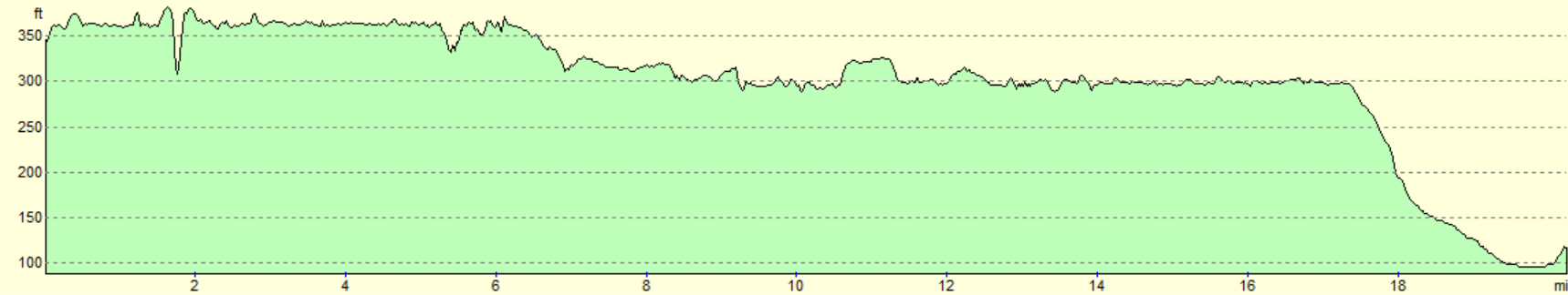
For more information on profiles, ascents and descents, see this page
Accommodation
I spent the night at the Burnley Holiday Inn Express, which is situated just off the canal a mile to the north of Burnley. This was an excellent hotel, with early breakfasts ideal for those who are keen to get on the trail.
Transport
It is fairly easy to get from Wigan to Cherry Tree or Blackburn by train; you need to take a train from Wigan North Western station north to Preston. and then change for a train east to Cherry Tree on the Preston to Colne line.
There are intermediate stations on this walk at Chorley and Adlington, but the journey back from these stations may involve another change, for instance by going via Bolton and Blackburn.
See the National Rail Enquiries website for more details of the train services.
 |
 |
|
 |
 |
|
 |
 |
|
 |
 |
|
 |
 |
|
 |
 |
|
 |
 |
|
 |
 |
|
 |
 |
|
 |
 |
|
 |
 |
|
 |
 |
|
 |
 |
|
 |
 |
|
Disclaimer
Please note that I take no responsibility for anything that may happen when following these directions. If you intend to follow this route, then please use the relevant maps and check the route out before you go out. As always when walking, use common sense and you should be fine.
If you find any information on any of these routes that is inaccurate, or you wish to add anything, then please email me.
All images on this site are © of the author. Any reproduction, retransmissions, or republication of all or part of any document found on this site is expressly prohibited, unless the author has explicitly granted its prior written consent to so reproduce, retransmit, or republish the material. All other rights reserved.
Although this site includes links providing convenient direct access to other Internet sites, I do not endorse, approve, certify or make warranties or representations as to the accuracy of the information on these sites.
And finally, enjoy your walking!
Nearby walks
| # | Title | Walk length (miles) |
|---|---|---|
| 422 | Southport to Preston | 24.7 |
| 1037 | Leeds and Liverpool Canal: Burnley to Cherry Tree | 21.0 |
| 1044 | Wigan to Maghull | 23.5 |
|
|

|