Walk #1044: Wigan to Maghull
 |
 |
|
General Data
| Date Walked | 20/10/2019 |
| County | Greater Manchester, Merseyside |
| Start Location | Wigan North Western station |
| End Location | Maghull station |
| Start time | 07.32 |
| End time | 15.05 |
| Distance | 23.5 miles |
| Description | This was a pleasant canalside stroll, although the day was slightly spoiled by some difficulties with trains at the end. |
| Pack | Today I carried my 30-litre Karrimor rucksack, filled with water, my spare waterproofs, a book and other odds and ends. |
| Condition | My left knee gave me no major problems, and the biggest issue I have is that my feet ache slightly, because I did not use my usual walking socks. |
| Weather | The day started off cloudy, but these soon parted to leave me with sunshine and pretty cloudless skies. However in early afternoon a front passed, and light drizzle was soon replaced with half an hour of heavier rain. After this there was mostly cloudy, with some sunny periods. It was not too cold given it is mid-October. |
| OS map | Landranger number 108 (Liverpool, Southport & Wigan) |
 |
 |
|
Map of the walk
Maps courtesy of Google Maps. Route for indicative purposes only, and may have been plotted after the walk. Please let me have comments on what you think of this new format. For a detailed table of timings for this walk, please see the table file.
 |
 |
|
Notes
It is Robert’s half term this week, and my parents had kindly agreed to take him for a few days so I could escape to the countryside. So given the opportunity, where did I pick to go? The heavenly delights of the Lakes? The boggy moors of the Pennines that I so love? The Tors of Devon?
No, I chose the wonders of Wigan. Many years ago, I walked the very eastern stretch of the Leeds and Liverpool Canal, and earlier in the year I walked for a few days westwards along it as far as Wigan. This trip, I decided to finish the canal, linking it up with my coastal walk, and finish with a couple of other walks in the area.
My knee still hasn’t fully healed from its injury, so it was with some trepidation that I set off from my parents house at 04.30 for the drive north. This went well, except for not being able to find the station car park in Wigan. Instead I drove at ever-increasing speed around the town’s one-way system, before finding a random car park a few minutes walk from the station. I parked up, paid, and then couldn’t find my mobile phone. I scrabbled around for a few minutes before finding it under the passenger seat - fortunately it was not yet dawn, so I did not waste any walking time, which would be a fortunate factor later.
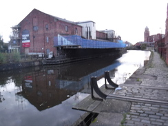
A man waiting outside the station told me that it did not open until nine, punctuating his words by spitting on the ground. Apparently the other station a short distance up the road also did not open until that time, meaning that he and another woman who soon turned up were trapped in Wigan. Fortunately for me, my route took me down to the canal, and then along past the infamous Wigan Pier.
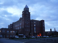
I’m unsure how to feel about Wigan. It certainly feels very run-down and depressed, more so than other northern towns I have walked through. Many other towns and cities have embraced their canals, and used them a focus for regeneration. Whilst Wigan does have some redeveloped areas - the conversion of the Trencherfield Mill is an example - the effect were slight. Even the area around the DW rugby stadium seemed more fitting to a bleak 70s crime drama than the 21st Century. Orwell would probably not recognise the modern Wigan Pier, which in his time would have been bustling, but would he have recognised the deprivation? I found it all a little depressing, although I do not claim to have any answers.
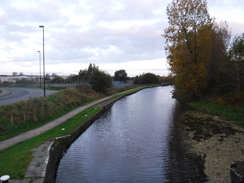
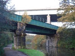
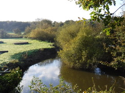
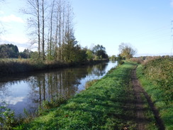
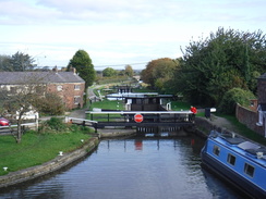
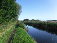
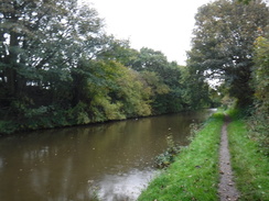
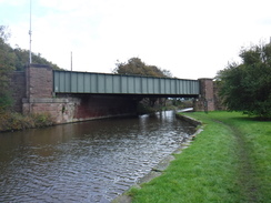
Fortunately for me, if not the inhabitants of Wigan, the views soon improved, with the River Douglas burbling merrily away to my left whilst the canal took a straighter route. It passed under the M6, which spanned high overhead on a massive viaduct, with a rail bridge underneath it at a skew - three transport systems, each one supplanting the other as they go higher. By this stage the walk was quite pleasant, and my knee was fine, aside from occasional twinges. I had settled into the walk, which was just as well, as there was still a long way to go.
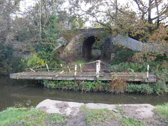
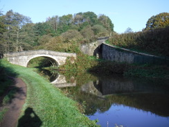
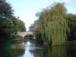
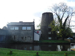
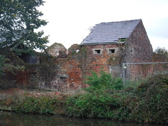
By the time it reaches Appley Bridge, the canal was heading west-northwestwards, whereas Liverpool and the canal’s end lay southwestwards, so it felt a though I was somewhat heading in the wrong direction. The canal did not allow me to see much of either Appley Bridge or the next village of Parbold, aside from a particularly pretty stretch of canal, with what looks like an old windmill stump beside the water. Parbold was also where the towpath changed sides, and for the rest of the day I would be walking with the water to my left.
As I walked, I noticed something unusual about the Leeds and Liverpool canal: the bridges are numbered from west to east, so they were decreasing in number as I headed west, whilst the locks are numbered from east to west, and were therefore increasing. I would have expected them to have been numbered in the same direction: although perhaps it was done to give neither Liverpool or Leeds supremacy!
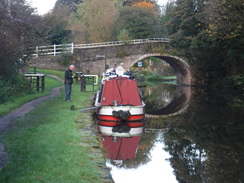
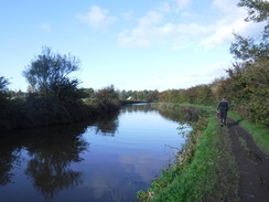
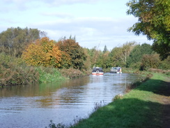
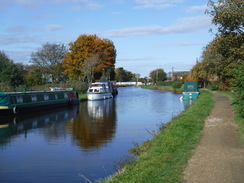
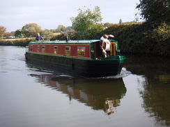
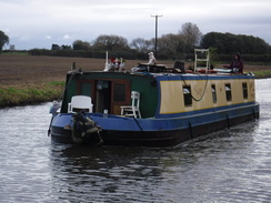
The canal became more rural as it headed west, and I saw a narrowboat depart its mooring just ahead of me. As usual I tried to catch up with it - something I sometimes manage - but this particular boat was soon out of sight. I eventually caught up with it as it was delayed by a swing bridge, just before it turned to take a branch of the canal that leads to Rufford and Tarleton. I eyed this branch greedily, as it would provide another short link to connect this walk up with my coastal one.
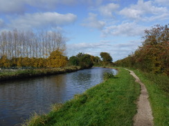
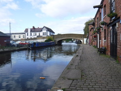
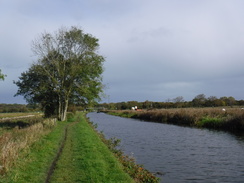
The branch junction marked the approach to the town of Burscough, and again I did not see much of the settlement from the canal. The urbanised and suburban area proved a short interruption, and soon I was striding through a rural area once more. Canalside pubs became more frequent, and the skies, which had been clear and sunny, started clouding over. A light drizzle started: not enough to force me to put my coat on, and I allowed my fleece to soak it up, especially as I could see clear skies in the distance. However the rain eventually became heavier, and I sheltered under a large parasol outside a pub to put on my coat.
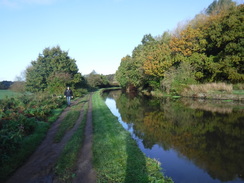
In places, the towpath was busy with anglers, with one man (and they were all men) seated every few metres. Almost all of them had unfeasibly long poles, which they attached in sections in order to access the water near the far bank. When they were not over the water, they lay across the towpath, meaning they had to be angled away or lifted whenever anyone approached along the path. This made me almost feel like royalty, with the rods lifting to allow me to pass. This should have been an annoyance, but they all seemed to sense me approaching and did not delay me unduly.
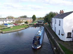
At Pinfold the canal started heading southwestwards, and as I was within a couple of hours of finishing the walk, I decided to look up train times. I had done this earlier in the week and seen there were regular services between Maghull and Wigan, changing in Liverpool. However the online train times showed that two trains were cancelled, meaning I would not get back to Wigan until very late.
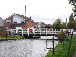
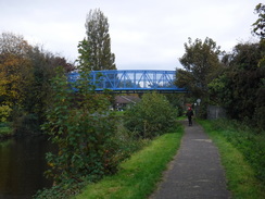
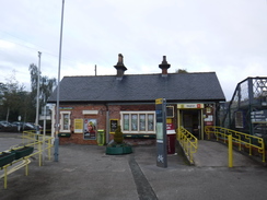
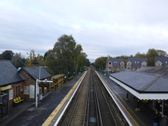
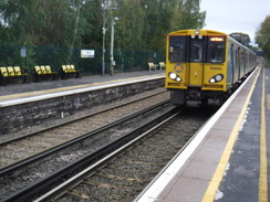
I thought I might be able to catch the 14.49 train, whose connection was not cancelled, and I decided to risk yomping despite my knee. I stopped when it became obvious I had too far to go, but still walked quickly to try to catch the next service, half an hour later. The canal passed through Maghull without seeing much of it, and soon a footbridge took me over the canal and on to the station, which I reached with about ten minutes to spare. After finding that the ticket office-cum-shop was open on a Sunday, I crossed the footbridge and waited for my train.
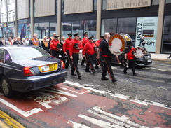
This got me into Liverpool Central, and I hurried towards Lime Street, hoping to catch the connection to Wigan that I would have caught with the earlier train. This took me past a few people walking through the town, with one man banging an overlarge drum - what turned out to be a parade by the Liverpool Provincial Orange Order Lodge. Leaving their commotion behind, I entered the station and went to the correct platform, where a very new Class 331 EMU unit was waiting. I’d never seen one of these before, yet alone been on one, and I chatted to a gricer on the platform about the problems theyd been having with the new units.
The journey back to Wigan was fairly unremarkable, aside from having to stand most of the way due to overcrowding. The journey could have been much worse due to Northern’s cancellations, but I reached Wigan North Western station just before five, ready for the short walk back to my car. It was then a drive to the hotel, a shower, and a meal washed down with a couple of pints. It had been a good days walking along the canal, although I could have done without the added stress I gave myself at the end.
 |
 |
|
Directions
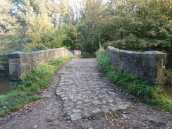
This walk starts off at Wigan North Western railway station at SD58140541. Leave the station by its main entrance, and turn left to follow the road downhill, almost immediately passing under a rail bridge. Keep to the left-hand side of the road. The road ends under the bridge at a bend in another road; use a pedestrian crossing to cross the road ahead, and then head straight on down Wallgate, keeping the road to the right. As the road approaches a bridge over the canal, with the car park for Trencherfield Mill on the left, turn right to cross the road on a pedestrian crossing, and then left to continue along the road towards the bridge. After a few metres, turn right to go through a gap in the bridge’s wall and then left to reach a pedestrian bridge over the canal (alongside the road bridge) at SD57710520.
Follow the path as it curves right off the footbridge to join the towpath, and then follow the canal as it heads in a rough northwesterly direction. The towpath is on the left, with the water to the right. After 11km Parbold is reached, and the towpath climbs up to reach Mill Lane in the town at SD49131051. Carefully cross the road ahead, turn right to cross the canal on the bridge, and on the other side turn left down an access track to reach the towpath, which now runs with the canal on the left. Follow the canal as it heads through Burscough and slowly curves left to take a southwesterly, and then a southerly course, passing through Lydiate and then Maghull. After 25km a blue footbridge is reached at SD38070142.
Turn right to reach the bottom of the footbridge ramp, and then turn right to climb the ramp and cross the footbridge over the canal. Descend the ramp on the other (eastern) side of the canal, and continue straight on up Rutherford Road. When this soon ends at a T-junction with Station Road, turn right to follow Station Road southeastwards. Maghull railway station is 150 metres away, on the left at SD38340148.
 |
 |
|
Distances
| From | To | Distance (m) | Ascent (ft) | Descent (ft) |
|---|---|---|---|---|
| Wigan North Western station | Appley Bridge | 5.4 | 16 | 115 |
| Appley Bridge | Burscough | 5.9 | 10 | 20 |
| Burscough | Haskayne | 6.8 | 0 | 7 |
| Haskayne | Maghull station | 5.4 | 2 | 5 |
This makes a total distance of 23.5 miles, with 28 feet of ascent and 147 feet of descent.
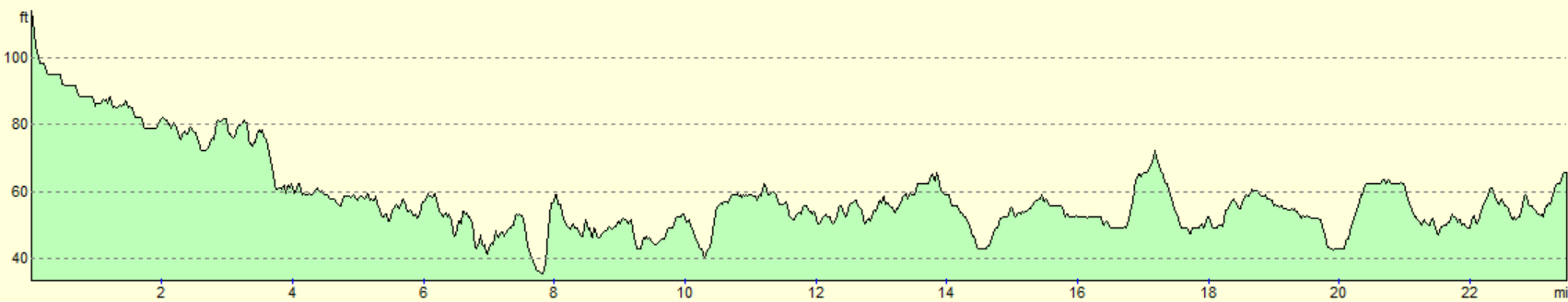
For more information on profiles, ascents and descents, see this page
Accommodation
I spent the night at the Holiday Inn Express in Wigan. This was a pleasant place to spend the night, with the added bonus of a very early breakfast, allowing me to get out of the door and walking at first light. It is not as characerful as a B&B, or as cheap as camping, but it is comfortable, clean and does what it does well.
Transport
There are several ways to get back to Wigan from Maghull by train; I chose to get a train to Liverpool Central, then walk to Liverpool Lime Street, and then get a second train to Wigan. It is possible to remove the walk by adding another change, for instance between Moorfields and Lime Street. See the National Rail Enquiries website for more information.
 |
 |
|
 |
 |
|
 |
 |
|
 |
 |
|
 |
 |
|
 |
 |
|
 |
 |
|
 |
 |
|
 |
 |
|
 |
 |
|
 |
 |
|
 |
 |
|
 |
 |
|
 |
 |
|
 |
 |
|
Disclaimer
Please note that I take no responsibility for anything that may happen when following these directions. If you intend to follow this route, then please use the relevant maps and check the route out before you go out. As always when walking, use common sense and you should be fine.
If you find any information on any of these routes that is inaccurate, or you wish to add anything, then please email me.
All images on this site are © of the author. Any reproduction, retransmissions, or republication of all or part of any document found on this site is expressly prohibited, unless the author has explicitly granted its prior written consent to so reproduce, retransmit, or republish the material. All other rights reserved.
Although this site includes links providing convenient direct access to other Internet sites, I do not endorse, approve, certify or make warranties or representations as to the accuracy of the information on these sites.
And finally, enjoy your walking!
Nearby walks
| # | Title | Walk length (miles) |
|---|---|---|
| 418 | Hoylake to Ellesmere Port | 20.0 |
| 420 | Hale to Crosby | 19.5 |
| 421 | Seaforth to Southport | 20.0 |
|
|

|