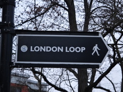
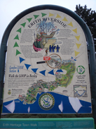
Walk #1033: London Loop: Erith to Farnborough, and then on to Chiselhurst
 |
 |
|
General Data
| Date Walked | 19/01/2019 |
| County | London, Kent |
| Start Location | Erith station |
| End Location | Chislehurst station |
| Start time | 07.59 |
| End time | 16.17 |
| Distance | 23.5 miles |
| Description | This was a very pleasant walk, following the London Loop from its start in Erith along the Thames, to Crayford Ness, and then down the River Cray to Foots Cray. Parkland and residential streets then head on to Farnborough, after which I followed roads and paths back towards the centre of London. |
| Pack | Today I carried my 30-litre Karrimor rucksack, filled with water, my spare waterproofs, a book and other odds and ends. |
| Condition | I feel absolutely fine after this walk. |
| Weather | Today was a cold, grey day; there were not many glimpses of the sun and the wind was chilly when I was exposed to it. There were also a few spots of rain. However the weather did not spoil the stroll. |
| OS map | Landranger number 177 (East London, Billericay & Gravesend) |
 |
 |
|
Map of the walk
Maps courtesy of Google Maps. Route for indicative purposes only, and may have been plotted after the walk. Please let me have comments on what you think of this new format. For a detailed table of timings for this walk, please see the table file.
 |
 |
|
Notes
I had originally planned to do a stretch of the London Loop to High Barnet today, but instead I decided to do the one from Erith. I drove to Loughton and caught tube and trains to reach Erith, just as dawn was breaking.
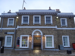
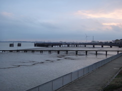
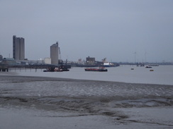
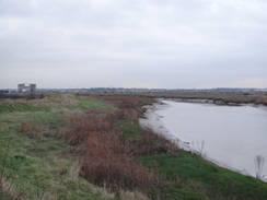
Erith station building is quite pretty, which is surprising given its setting right beside a main road. Roads took me to the riverfront, and I wondered if this part of the estuary was still the river or was now the sea – I decided on the former. The riverside park is pleasant enough, although as ever with estuaries when the tide is out, the many metres of mudflats somewhat spoilt it, as did the views across the river to the waste tip at Rainham.
The path left the park to follow a road for a while, before joining a riverside promenade past Erith Pier, which is apparently London's longest pier. I was tempted to take a walk along it, but instead I nipped into an adjacent Morrisons to buy some snacks. Sadly the promenade soon ended, and the trail joined a road that headed through an industrial area, before going down a narrow road to join a path that ran along the floodbank. I walked this stretch on my coastal walk, and as often happens on such occasions I wondered about what messages I would give my younger self if I was to encounter him.
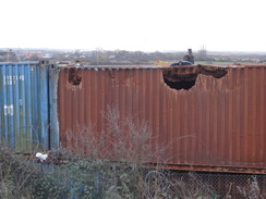
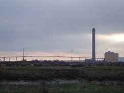
The path led to Crayford Ness, and then on to the mouth of the River Darent, with the QEII bridge over the Thames visible in the distance. The area around the point is filled with industry, which seems strange for such a remote location. However a glance at maps shows that a hundred years ago the site was part of the Thames Ammunition Works, a concern opened in 1879 that used the river to transport its products to Woolwich. An explosion in 1924 sadly killed 12 workers. The concern closed in the 1970s, and was replaced with the current industrial estate.
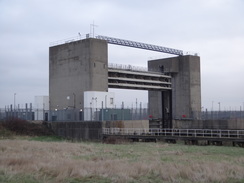
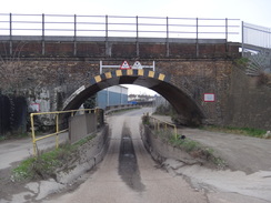
A short distance down the Darent was the Dartford Creek Tidal Flood Barrier, a massive gate that can descend to protect the river upstream from flooding. It is a fairly spectacular structure, and when I was on my coastwalk I was annoyed that there was no footpath or bridge over it, meaning I had to make the long diversion downstream to cross the river. Today, however, I enjoyed the stroll upstream. A river confluence was reached, and my route took me off the Darent and down the Cray. Eventually this led to a road in an industrial area, and under a rail bridge where the road had been dug down a few feet to create enough height for lorries to get under.
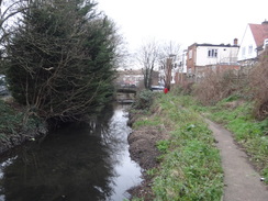
This road soon ended at a main road in Barnes Cray, where the trail rejoined the River Cray. It was not classic riverside walking, with power lines soaring alongside the water. A bridge took the path across to the other side of the river, where it squeezed between a series of garages and back gardens – again, not the most pleasant stroll on a gray winter's day.
The riverside path met the A226 in Crayford, where there was a pleasant riverside garden squeezed between roads. I had walked the A226 many years ago as part of a stroll from the centre of London to Dartford, and this time I followed it in the opposite direction, before following another road past a garage forecourt that was flanked by two ornate columns – according to my guidebook, the only remnants of a cinema that was once on the site. The trail then headed down the side of some playing fields where children were practicing football, and rejoined the River Cray.
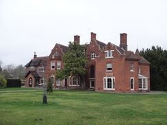
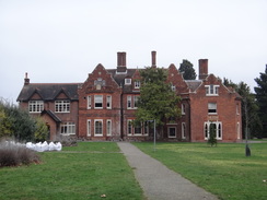
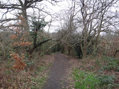
The next stretch of the riverside path towards Hall Place was much more pleasant, with some good views over the water. Sadly it had to end, and the trail passed the side of Hall Place's gardens before climbing up to cross a railway line on the A2 bridge. It then descended to pass under the A2 and plunged into Churchfield Wood. The path only skirted the bottom edge of the woodland, but I still enjoyed the stroll despite the rather gloomy atmosphere woods can have in winter. The path took me out onto another that led towards Bexley, where a church had an unusual octagonal 'hat' on top of its spire.
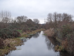
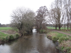
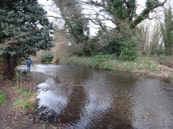
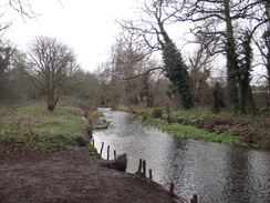
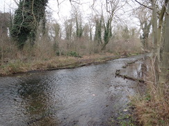
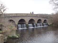
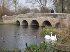
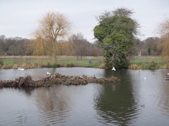
I was starting to feel a little lethargic, so I nipped into a shop in Bexley to buy some snacks. The trail then headed away from Bexley across what might be a landscaped area of landfill. This took me back to the Cray, and a sublime stretch of walk alongside the river. If it looks this good on a slightly gloomy winter's day, it must be superb in spring or summer. The water was crystal clear, reminding me of Hampshire rivers such as the Test, and the path was easy to follow. I overtook a group of women who were walking a stretch of the trail, and then reached a beautiful bridge across the river – the 'Five Arch' bridge which, unsurprisingly, has five arches. This was designed by Capability Brown, along with its lake upstream, and it certainly seems a well-designed landscape.
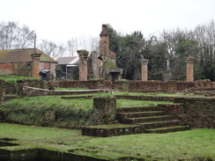
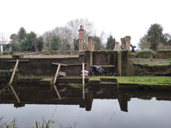
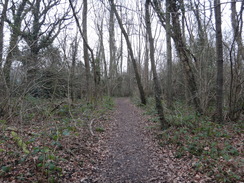
The riverside walk sadly had to end, and I said goodbye to the Cray as the trail joined a road into Foots Cray. I went slightly wrong on a path, but eventually found the correct route that led on to Sidcup Place and then past a hospital to reach a couple of underpasses under the A20. The trail then took paths through woodland, including a short diversion to reach the ruins of Scadbury Manor, complete with its moat. It is a very picturesque location, and a family were making the most of it by having a picnic.
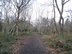
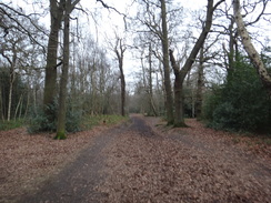
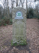
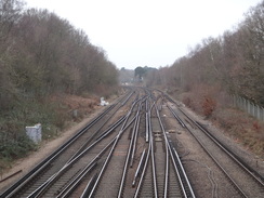
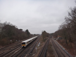
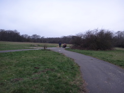
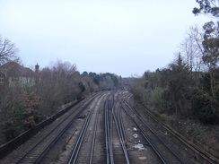
The trail continued on through the trees of Scadbury Park, descending down to cross the A208 road before diving into Petts Wood. By this time I was fairly bored of walking through woodland, and I strode on quickly through the trees. Once out of the trees, three railway bridges took me over different railway lines in the space of about 300 metres, before entering the Jubilee Country Park, with Petts Wood station a short distance away. The trail did not stay in the park for long, before following roads through suburban Petts Wood.
I had burnt through my earlier lethargy and was feeling very fit. It was a bit of a relief when the trail left suburbia and entered some woodland, although the waymarking was not as clear as it could have been. It emerged from the trees, crossed a main road, and dived through suburbia once more before heading down a grassy hillside to reach the A21 in Farnborough.
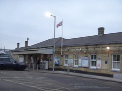
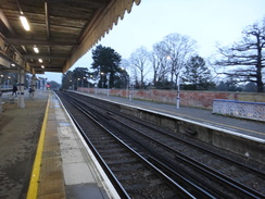
Here I left the trail; I felt fit enough to walk on, but the next railway station was about five miles away, and there was not enough time to complete that distance before dusk. Instead I followed a road down to Orpington station, where I was surprised to find a museum on the site of Roman villa. There was still daylight left, so I followed a path that paralleled the railway line northwestwards, before taking roads past Petts Wood station and on through the Jubilee Country Park, crossing the route I had walked earlier. Eventually I decided to stop at Chiselhurst station, having run out of daylight if not energy – and I'd also come to the edge of my printed map.
It had been a very pleasant day's walk, and I would certainly do some stretches of the River Cray again in the future. It's just a shame that the lack of daylight stopped me from walking further.
 |
 |
|
Directions
This walk starts off at Erith station at TQ51157809. Leave the main station building and turn right along a brick-paved access road. This soon turns left to head through an underpass under the A2016 dual carriageway, and then swings left to reach a roundabout. Turn right along Stonewood Road; when this soon ends at a T-junction, head straight across to join a short spur road that soon ends at Erith High Street. Turn right along the High Street for a few metres to reach a pedestrian crossing on the left at TQ51327821.
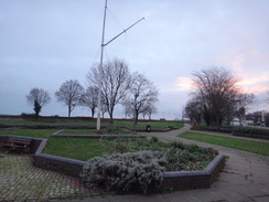
On the other side of the crossing, head straight on to enter a riverside garden. Turn right to follow the path through the gardens, with the road off to the right; you can divert off the path to look across the river if you want. This path all too soon ends back at Erith High Street at the far end of the garden; turn left to follow the road eastwards. The road starts to curves right; after nearly 100 metres pass the Cross keys pub on the left, and then take a small road leading off to the left, passing the pub on the left. The road narrows and becomes a path as it heads down to reach a riverside promenade at TQ51617810.
Turn right to follow the riverside promenade eastwards; it passes the entrance to Erith Pier on the left, with a large supermarket away to the right. After 350 metres the promenade ends; turn right for a few metres along a path that soon meets the end of a dead-end road. Head straight on along this road, passing the supermarket's car park on the right. Take the first road off to the left, Wheatley Terrace Road for a few metres, and then turn right up Appold Street. This crosses over an old railway line that used to lead to a brickworks. Appold Street soon ends at a T-junction with Manor Road. Turn left to head east down the road as it heads through an industrial area. After 750 metres, and just after passing the Manford Industrial Estate on the left and just before the road curves to the right, a track leads off left at TQ52637761.
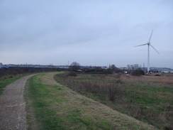
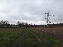
Turn left down this narrow track, immediately passing a vehicle barrier. The track heads north, skirting a fence and industrial buildings on the left, and then fairly soon curves right, climbing slightly. When it soon curves left, go past a squeeze-stile to head straight on along a path that runs along the top of a flood bank. The path follows the Thames downstream; an industrial area starts on the right, and it curves right past Crayford Ness, where a small radar system stands on a pylon within the industrial area. Shortly afterwards it curves right once more, leaving the Thames and joining the River Darent. Go past a cycle barrier and an open gate; 1.9km after joining the bank, a flood barrier is reached at TQ53947778.
Cross the road leading to the barrier, and continue south along the foodbank, with the Darent on the left. Continue along the bank for a short distance to and through a second gateway. After another 2.1km the river splits, with the main river Darent heading south, whilst the path turns right to continue along the floodbank beside the River Cray. After another 800 metres go past a cycle barrier and follow the path as it curves right away from the floodbank to a second cycle barrier. Go past this, and follow a fence on the left to a third barrier. The fence and path soon join an access road in an industrial area. Follow this as it heads under a railway bridge and ends at the A206 Thames Road in Barnes Cray at TQ52627536.
Turn left along the A206 for a few metres to reach some pedestrian lights, and then turn right to carefully cross the road. On the other side, turn left to walk a short distance to a large roundabout. Here turn right up Crayford Way for a few metres to another pedestrian crossing, and use it to cross Crayford Way. On the other side, turn left back towards the roundabout and rejoin the A206, which immediately crosses the Cray on a bridge. On the other side of the bridge, turn right down a short track that leads to a vehicle barrier. Go past this to join a gravel path that follows the Cray on the right. The river and path slowly curve right, and after nearly 600 metres go past a vehicle barrier to join Maiden Lane at TQ52377494.
Turn right along the road, crossing a bridge over the Cray, and then take the first road off to the left, Barnes Cray Road. When this curves right, head straight on, passing in front of some garages on the left and past a vehicle barrier, to join a track that heads west, with the river to the left and occasional garages to the right. Just before the track curves right and then left, turn left to continue straight on along a riverside path. Go through two clappergates and, 650 metres after leaving Cray Road, the B2186 Crayford Way is reached at TQ51537486.
Carefully cross the road, and immediately turn left to cross a bridge over the Cray. On the other side, turn right through a gateway to enter a small area of parkland. Follow a path through the park, keeping the river to the right. It passes a footbridge over the river, then goes under an interesting sculpture and through a gate to reach the A207 Crayford High Street. Use a pedestrian crossing immediately ahead to reach a little traffic island, and then left once more across another crossing to reach the southern side of the A2000 Roman Way at TQ51457476.
Head up this road, immediately passing the Bear and Ragged Staff pub on the other side of the road. When a road soon leads off to the left, use a pedestrian crossing to continue straight on west along the A207. 400 metres after the pub, turn left along the A223. After 300 metres this passes a garage forecourt on the left, and immediately after this turn left down some steps to reach a clappergate that leads into a recreation ground at TQ50827469.
Follow the left-hand boundary down the recreation ground, with playing fields off to the right. At the corner, turn right for about ten metres, and then left to join a path that soon curves right to join the Cray's northern riverbank. Ignore a footbridge over the river, and at the end of the playing fields go past a vehicle barrier into a car park. Head across the car park towards a sports pavilion, and then curve left to reach a little footbridge over the river at TQ50387425.
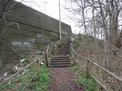
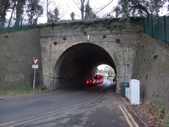
Cross this, and on the other side turn left to follow the river downstream for a short distance until it enters some parkland, and then turn right to start following a boundary fence on the right southwards, with Hall Place Gardens beyond. The path crosses a little footbridge over a dry ditch, and when the path approaches a railway line ahead, follow the hedge as it curves right. This leads to a clappergate and then a slope and steps that lead up onto the A2 dual carriageway. Turn left to cross the bridge over the railway line, and immediately on the other side turn left down a surfaced ramp. At the bottom, ignore a path leading on alongside the railway line, and instead turn hard left along a path with the railway line on the right, to reach the underside of the A2 bridge at TQ50387391.
On the other side of the bridge the path turns left, and when it immediately forks, take the right-hand lower branch, away from the main road. The path starts to rise, paralleling the main road on the left; after 200 metres turn right across a stile to join a path that enters Churchfield Wood. The path heads southwestwards at the bottom of the wood, with a fence on the right. After 700 metres the path curves left to reach a squeeze-stile that leads to a surfaced path at TQ50137331.
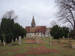
Turn right to follow the path westwards; it passes a cemetery on the right and after 350 metres a clappergate is reached that leads out onto Manor Road directly in front of Old Bexley church. Turn left down Manor road for a few metres until it ends, and then right along the A223 Bexley High Street. This passes under a railway bridge and then curves left at a mini-roundabout. Just before a right-hand bend is reached, turn left down Tanyard Lane at TQ49437355 (the entrance to Bexley station is a few metres further on)
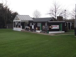
The lane soon ends, and a path continues on under a railway bridge, curving right between fences to parallel the railway line on the right. The path curves slightly away from the railway, following a fence on the left to enter a small car park and pass Bexley Cricket Club. The path passes some houses on the right, and then ascends a bank. Go through or past a clappergate at the top and continue along a path across a field, with the railway line away to the right. The path descends down another bank; at the bottom of the slope go through a clappergate and continue along the path as it heads under powerlines. It passes a fence on the left guarding a pumping station, and reaches a couple of small bollards at the end of a road at TQ48477279.
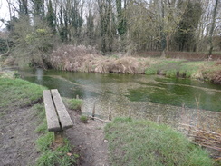
Head straight on along the road. After about 100 metres, turn left past a bollard to join a path that runs between walls. The walls become fences, and the path twists around to reach a footbridge over the Cray. Cross this, and on the other side go through a clappergate and then turn right to a second clappergate that leads out onto a riverside path. Follow the river upstream on the right. After 1km Five Arch Bridge is reached at TQ48237186.
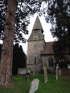
Cross the surfaced path leading to the bridge and continue on. Keep a lake and then the river to the right; cross a little footbridge over a ditch, and nearly 800 metres after Five Arch Bridge the path curves right to a little arched bridge over the river. Cross this and follow a path away from the river. When the path forks after twenty metres, take the minor left-hand branch that soon joins a palisade fence on the left. When this path meets a T-junction, turn left along a bigger path, with the palisade fence away to the left. Angle slightly right across grass to reach a clappergate that leads out onto Rectory Lane at TQ47567121, with All Saints' church a few metres away to the right.
Turn left along the lane, and after 300 metres it ends at a T-junction with the A211. Use a pedestrian crossing on the left to cross the road, and then continue on up the A224 Cray Road. After 170 metres turn right down Suffolk Road; when it ends turn left down a path between fences. After about 20 metres this reaches a clappergate that leads out into an open area of grassland. Follow a surfaced path with a hedge on the right. At the end of the hedge, bear right through a clappergate beside bollards and continue on along a surfaced path between fences. Go past another clappergate and continue along the surfaced path, which soon curves left, with garages to the right and then allotments to the left. It then curves right to approach, but not join, Warwick Road on the right at TQ46647127.
Continue on to a clappergate; go through this and head on through trees into Sidcup Place Park. Head up a slope through the park, roughly paralleling a hedge to the right. When the hedge on the right ends, head straight on across grass to a gap in a hedge ahead. Go past this towards a children's play area; angle left alongside this, and then at its corner turn right and then left, aiming for the end of a road ahead at TQ46247131.
Do not go past a barrier onto the road, and instead angle left along a path that curves right to meet another surfaced path that heads along a terrace above a ha-ha. Just before the terrace ends, turn right along a brick path that passes a walled garden on the right. When the brick path ends, head straight on through trees, past tennis courts on the right to reach a gap in a fence that leads onto the A222 at TQ46097124.
Turn left to follow this road south; after 300 metres it approaches a large roundabout over the A20. At the roundabout, angle left down a sloped path, and then turn right through an underpass. On the other side turn left up steps and join a path that turns left and then curves right across a bridge over the A20. On the other side, the path curves right; immediately afterwards turn left down steps, and at the bottom turn left to a second underpass. Head through this, and on the other side turn left along a path that climbs to meet a sliproad coming off the A20 on the left. After about twenty metres, turn right past a clappergate at TQ46027087 into Scadbury Park.
Follow the path as it winds around and descends in a rough southeasterly direction through the trees; the path then climbs slightly through the trees. Go past a clappergate beside a vehicle barrier to join a track. Follow the track as it curves right to head southwards; pass a little pond on the left, where the track curves right. About twenty meters before the track reaches a gate, turn left along a path through the trees. After about fifty metres the path meets a bigger one, turn left along this and follow it as it descends; about three meters after a chin-link fence starts on the left, turn right down a broad path through the trees, away from the fence. The path descends to a little wooden causey and then curves right uphill, signposted for a 'moated manor'. After about fifty metres turn right along a path that heads to reach the site of Scadbury Moated Manor at TQ45957003.
Turn left to pass the southern edge of the moat on the right. The path then curves left back through the trees, and soon descends to meet a track. Turn right along this track and follow it west-southwestwards through the trees. 950 metres after the manor, turn left down a minor path off the main track. This heads west through the trees; after a short distance this meets another path; turn right along this path. This in turn soon ends at a track; turn left along the track for a short distance until it goes past a barrier and ends at the A208 road at TQ44936961.
Carefully cross the A208 and go past another barrier to join a path that heads south through the trees. When the path immediately forks, take the left-hand branch to continue south. When the path forks 400 metres after the main road, take the left-hand branch to enter Petts Wood. Continue south through the trees; just before a railway bridge is reached ahead after another 900 metres, turn right along another path that heads west through the trees, with the railway away to the left. Follow this path as it drops down and emerges from the woods, and after 500 metres it reaches a footbridge over the Kyd Brook. A boardwalk then leads on for a short distance to a footbridge over the railway at TQ44266854.
Turn left to cross the bridge, and on the other side continue on along a footpath between fences that soon reaches a second footbridge over another railway line. On the other side, follow a surfaced path alongside a fence on the right. The surfaced path reaches a road called Little Thrift; cross this and continue along the surfaced path with a fence to the right. This then curves left to reach a third footbridge over a railway line; cross this, and on the other side follow the path as it heads between fences to reach a clappergate at TQ44016801.
Go through this into the Jubilee Country Park, and continue along the path; after about twenty metres, turn left along a good unsurfaced path, with trees away to the left. Follow the path along as it slowly curves left to head south, sometimes in the trees, and sometimes in clearings. It goes past a farm gate to join a track beside a school. Turn right down this track until it ends at Southborough Lane at TQ43746753.
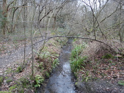
Cross the road, and head straight on Down Oxhawth Crescent. When this road ends, cross the road ahead and continue on down Farringdon Avenue. After 750 metres Farringdon Avenue ends at a dead end. Turn left along a path, initially following a fence on the left. When the fence ends continue on along a path through Sparrow Wood. Continue straight on along the path east-southeastwards; after 450 metres cross a little footbridge over a stream and continue straight on. When the track forks after another 470 metres, take the left-hand branch through the trees that leads into a little clearing. Head straight on to reach a surfaced path in front of a stream. Turn right to follow this path as it heads south, with the stream away to the left. Go past a vehicle barrier and continue along the path to reach the A232 Crofton Road at TQ44106584.
Turn left along the main road for a few metres, and then carefully cross it. On the other side head straight on along a surfaced path that runs between fences. It passes the end of Highwood Close on the right and continues on, still between fences, until it emerges out onto Lovibonds Avenue. Cross this and head straight on along Crofton Avenue until a triangle of grass is reached on the right at TQ44406538.
Turn right across the grass, passing a fence and houses on the right. The path then runs between fences; when they end the path continues south through the woods. 350 metres after leaving the road, turn sharply left and then angle right along a broad unsurfaced path through a band of trees, with a tennis centre away to the left. The path then emerges from the trees into a clearing; angle right to head downhill across the grassland. At the bottom turn left, with a vehicle barrier away to the right. In the corner of the field descend three steps and then turn right along a surfaced path that goes through a narrow band of trees to reach the A21 Farnborough Way at TQ44626463.
Here the London Loop is left for the day. Turn left to follow the main road for about fifty metres until it reaches a roundabout, and then take the first road off to the left, Tubbenden Lane. Follow this road as it heads downhill northeastwards; after 1.4km it passes under a very long railway bridge and ends at a T-junction with the A232. Turn left along this road, crossing over to the right-hand side at traffic lights. After a short distance the road passes under another railway bridge, after which the entrance to Orpington Station is reached at TQ45476581.
Pass the station's entrance, and then turn right along a path, with the station car park away to the right. The path climbs up steps and a slope, following the railway line in a cutting to the right. The path then slowly descends, and after 1km the path ends in a little park. Turn left to parallel Crofton Lane on the right, and at a mini-roundabout turn right down Towncourt Lane. This road immediately curves left. When a roundabout is reached after 700 metres, continue straight on along Queensway. After another 350 metres the entrance to Petts Wood station is reached on the right at TQ44366753.
Continue straight on along the road, and when it starts to curve left, head straight on along Crest View Drive. This soon curves left, and shortly after the bend turn right down Tent Peg Lane. Just before it reaches a car park, angle left along a surfaced track that skirts the car park on the right. When the track curves left, head straight on down a surfaced path. This then curves left over a little bridge over a ditch to reach a clappergate encountered earlier. Go through the gate into the Jubilee Country Park, and as the London Loop soon branches off to the left, continue on along the surfaced path through the park. On the far side of the park, go past a field gate to reach a car park on the left at TQ43546820.
Head straight on down the car park's access road, which soon becomes Thornet Wood Road. When this road ends, turn right to head north along Blackbrook Lane. This crosses over a railway line, and shortly afterwards reaches a mini-roundabout. Head straight on along Bickley Park Road, which curves right and descends down to pass under a double railway bridge. Immediately on the other side, turn left up Station Approach to reach Chislehurst station at TQ43196938, where this walk ends.
 |
 |
|
Distances
| From | To | Distance (m) | Ascent (ft) | Descent (ft) |
|---|---|---|---|---|
| Erith station | Crayford | 6.2 | 12 | 5 |
| Crayford | Foots Cray | 5.2 | 180 | 102 |
| Jubilee Country Park | 5.0 | 440 | 292 | |
| Jubilee Country Park | Farnborough | 2.9 | 200 | 128 |
| Farnborough | Chislehurst station | 4.2 | 210 | 338 |
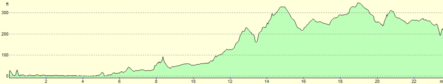
This makes a total distance of 23.5 miles, with 1042 feet of ascent and 865 feet of descent.
For more information on profiles, ascents and descents, see this page
Transport
The easiest way to get from Orpington, Petts Wood or Chislehurst stations back to Erith is by train. Take a train towards London to either Hither Green or Lewisham, and then change for trains to Erith. During the week the journey should take under an hour. See the National Rail Enquiries website for more details.
TFL route 229 runs between Erith and Queen Mary's Hospital, if you want to finish the walk early at about 13 miles.
 |
 |
|
 |
 |
|
 |
 |
|
 |
 |
|
 |
 |
|
 |
 |
|
 |
 |
|
 |
 |
|
 |
 |
|
 |
 |
|
 |
 |
|
 |
 |
|
 |
 |
|
 |
 |
|
 |
 |
|
 |
 |
|
 |
 |
|
 |
 |
|
 |
 |
|
 |
 |
|
 |
 |
|
 |
 |
|
Disclaimer
Please note that I take no responsibility for anything that may happen when following these directions. If you intend to follow this route, then please use the relevant maps and check the route out before you go out. As always when walking, use common sense and you should be fine.
If you find any information on any of these routes that is inaccurate, or you wish to add anything, then please email me.
All images on this site are © of the author. Any reproduction, retransmissions, or republication of all or part of any document found on this site is expressly prohibited, unless the author has explicitly granted its prior written consent to so reproduce, retransmit, or republish the material. All other rights reserved.
Although this site includes links providing convenient direct access to other Internet sites, I do not endorse, approve, certify or make warranties or representations as to the accuracy of the information on these sites.
And finally, enjoy your walking!
Nearby walks
| # | Title | Walk length (miles) |
|---|---|---|
| 123 | Mile End to Dartford | 15.0 |
| 161 | Gravesend to Dartford | 7.2 |
| 217 | Greenwich to Whyteleafe | 17.9 |
|
|

|