Walk #1006: Banbury to Woodford Halse
 |
 |
|
General Data
| Date Walked | 13/07/2018 |
| County | Oxfordshire, Northamptonshire |
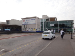
| Start Location | Banbury station |
| End Location | Woodford Halse High Street |
| Start time | 07.59 |
| End time | 14.47 |
| Distance | 17.4 miles |
| Description | This was a pleasant walk of two halves. The first half followed the Oxford Canal north from Banbury to Cropredy, which I have alked to before, and then along roads to meet the point I left the Jurassic Way in Chacombe. The second half followed the Jurassic Way northwards to the village of Woodford Halse. |
| Pack | Today I carried my 30-litre Karrimor rucksack, filled with water, my spare waterproofs, a book and other odds and ends. |
| Condition | I am fairly tired after this walk (then again, I was tired when I started), but otherwise have no problems. |
| Weather | The morning started off overcast but warm; it remained bearable until late morning, when it became a little too warm, and this worsened as the clouds parted in the afternoon to leave sunny skies. |
| OS map | Landranger number 151 (Stratford-upon-Avon, Warwick & Banbury) and Landranger number 152 (Northampton & Milton Keynes) |
 |
 |
|
Map of the walk
Maps courtesy of Google Maps. Route for indicative purposes only, and may have been plotted after the walk. Please let me have comments on what you think of this new format. For a detailed table of timings for this walk, please see the table file.
 |
 |
|
Notes
Family obligations and the very hot weather had prevented me from walking over the past few weeks, and I was keen to do another stroll. I had a spare day today, and I decided to turn my attention away from the Nene Way back to the Jurassic Way. Public transport is not simple on this southern stretch of the trail, but hourly buses run between Daventry and Banbury, calling at Woodford Halse on the way. I had reached Chacombe on my last trip along the trail, and instead of walking directly there, I decided to follow the Oxford Canal north to the village of Cropredy, and thus also complete my last remaining unwalked section of the Oxford Canal.
I set off early for the drive to Woodford Halse, and arrived over half an hour before the bus was due. It proved hard to find a place to park, and so I used a spare space on the narrow High Street (which also seems to be rather off the beaten track) and waited. The bus arrived promptly, and deposited me in the centre of Banbury forty minutes later.
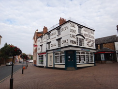
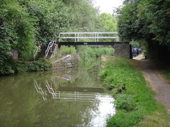
I walked into the town for a few minutes to have a quick look around, and quite liked what I found – there are some attractive buildings, and the area was clean and tidy. After this I walked to the railway station to start the walk. A few metres later I realised the batteries on my dictafone were flat, so I changed them and walked back to the station to restart – much to the amusement of the waiting cabbies. The Oxford Canal runs right past the station, and within a couple of minutes I was following the towpath northwards.
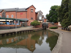
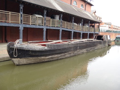
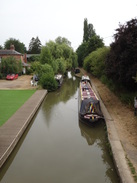
A boating museum nestles rather incongruously below a modern shopping centre in the centre of town, and a wonderfully derelict narrowboat was moored nearby. It was draped in a banner saying it had been acquired for restoration – I can only hope they manage to keep some of its character. Soon afterwards the towpath passed under a bridge named after L.T.C. Rolt, the man who helped save the canal network in the 1940s and 1950s. Road noise intruded as the canal paralleled a main road, and unusually the noise lessened as the canal left that road behind to pass under the M40.
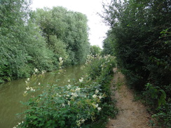
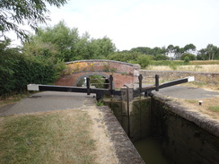
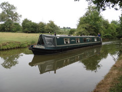
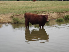
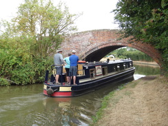
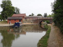
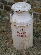
Not much happened over the next few miles; the towpath was slightly overgrown in places, and the first wild blackberries of the year were black and succulent, ready for tasting. A few boats were moving along the canal, and I managed to overtake one just before I reached Cropredy Bridge. I had walked the stretch of the Oxford Canal south to here previously, and this meant that I had now walked the entirety of this canal. I climbed up onto the bridge, ignore the adjacent shop, and started on the walk southeastwards towards the Jurassic Way. This was along roads that proved thankfully quiet, and again there was little of interest to note.
I soon arrived at Chacombe, which I had reached on a previous stroll along the trail. I walked a few metres to 'meet' the place I had previously left the trail, and then started following it northwards. I almost immediately made a mistake, continuing down a road for a short distance when the trail headed into a field. A gaggle of schoolgirls stood in the field, being lectured in something or other by a teacher, but my route took me down to cross a stream and then under the old Great Central link line between their main line and the Great Western at Banbury. The bridge was surprisingly substantial, and comprised two separate arches divided by an abutment wall.
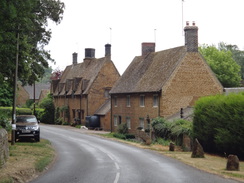
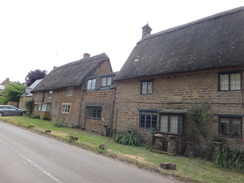
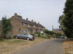
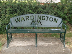
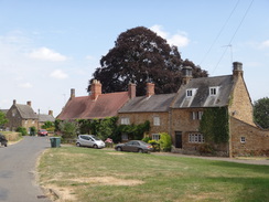
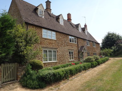
The trail headed north across fields to Upper Wardington, where it made a seemingly pointless loop to Wardington and then back, ending a couple of hundred metres from where it started. This included a narrow stretch between a fence and hedge that was filled with nettles. Sadly the picturesque stone houses in the village did not compensate me for the nettle stings that got through my trousers!
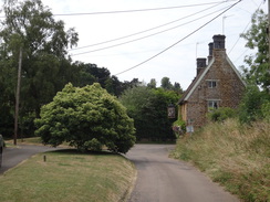
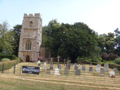
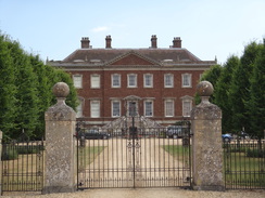
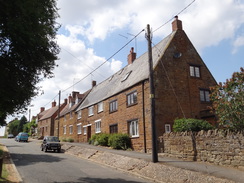
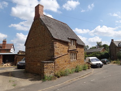
The trail left Upper Wardington and climbed uphill before falling once more to join a road that took me too Edgcote church and the adjacent impressive house. In 1642 the house was used as a headquarters by Charles I for the Battle of Edgehill, the first battle of the civil war.
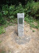
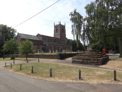
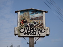
A good track led on to a crossing of the River Cherwell; here little more than a stream, and on past a small memorial to a bomber that crashed nearby in 1945. Soon afterwards I reached Chipping Warden. From the vegetation growing outside it I assumed the first pub was permanently closed, but the second - the Griffin Inn - was open. It was early afternoon and very hot, so I went in, sat down, and took my boots off. A pint of shandy and a second of orange and lemonade disappeared quickly, and I chatted to the landlady as my feet cooled off. I could not spend too long, and so I reluctantly shrugged my rucksack back on and headed out into the heat – hitting my head on the doorway in the process!
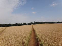
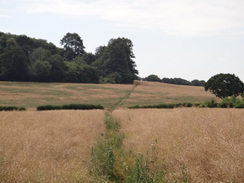
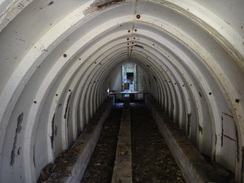
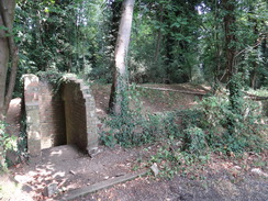
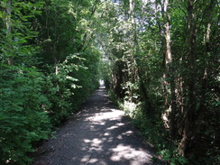
The clouds that had helped keep the temperature down in the morning had mostly dissipated, and the sun bore relentlessly down on me. A short stretch of road walking was followed by a track that led to an ordinary-looking spinney. Inside, however, were a few ruined buildings and what appeared to be brick foundations of others. This turned out to be part of the old Chipping Warden airfield, the main bulk of which lay half a mile to the west. The buildings were part of the airfield's headquarters area, which had been built in the woodlands to prevent it being observed from the air. What I had thought of as brick foundations were actually shelters, and a short distance further on was a gem – a Stanton air-raid shelter that was substantially complete and open. I went in, took a few photos, and wondered what it must have been like to have been inside during an air raid. The woods are now used for airsoft – similar to paintballing – which is probably why the shelter is still accessible.
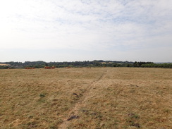
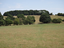
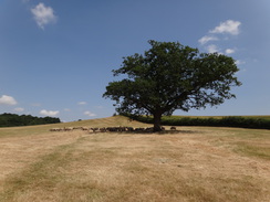
The trail soon emerged from the woods, crossed a road, and ascended a hill. The ascent was not too steep, but the heat meant I was soon panting for breath. Fortunately there was a slight breeze at the top, and I strode on past woodland to a point where the Macmillan and Jurassic Ways part. The route here was unclear, but rather than press downhill through crops I stuck to a track that ran around the edge of a field – and a waymarker at the bottom showed it was the correct route.
The sound of fast jets repeatedly cut through the air, although I could not see any sign of them. Eventually a tiny contrail became visible ahead, extending fast across the sky, and I wondered if all this activity was due to Trump's visit to the UK.
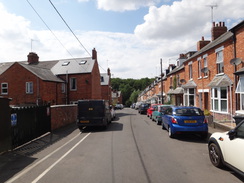
Eventually the trail joined a road, and then another path took me northwestwards, crossing the old East and West Junction Railway on a footbridge and approaching Woodford Halse. The village was a small backwater before the arrival of the Great Central in 1899, who built a large loco depot in the village on a raised site. I headed under twin railway bridges (including a bricked-up doorway that once led to the station above), and headed up the road into the centre of the village.
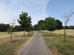
My car was a short distance away, but instead I continued downhill past rows of old railway cottages towards and past the site of the old shed, which is now a community woodland. At the next road I left the trail, and followed it as it looped around to return to the centre of the village and my car. It had been a very enjoyable day's walk despite the heat, and in an area that deserves further visits.
 |
 |
|
Directions
This walk starts off at Banbury railway station at SP46184044. Leave the station and walk down the approach road; it crosses the Cherwell on a bridge, and immediately after passing the West B car park, turn left down a steep, short path to join the towpath of the Oxford Canal. (This path appears to be unofficial, but saves having to cross the busy road ahead). Turn right to start following the towpath northwards through Banbury, with the canal to the left.
Follow the canal for 4.7 miles, passing several locks until Cropredy Bridge (number 153) is approached at SP46934651. Climb up the steps from the bridge to join the road at the top, and then turn right to start following a road southeastwards away from the bridge. The road climbs uphill and enters the village of Williamscot; after nearly a mile on the road, and as the road curves left to leave the village, turn right down a dead-end road. This curves left and ends at the A361 road at SP48194520. Go through a gap in the fence between the roads and carefully cross the A361 to reach the verge on the other side.
Turn right and carefully follow the A361 southwestwards for a couple of hundred metres until a road leads off to the left. Turn left down this road, and follow it east-southeastwards for half a mile until it ends at a triangular junction. At the junction turn right to follow a road south, descending until it ends at a T-junction in Chacombe after half a mile at SP48994378.
Here the Jurassic Way is joined. Turn left along the road towards the village, and after about a hundred metres turn left down Thorpe Road, passing a little area of grass on the right. When the George and Dragon pub is reached on the left, turn left down Silver Street; as this curves right, turn left through a pedestrian gate beside a field gate to enter a field. Turn right to head northwards downhill, paralleling a field boundary on the right. Cross a footbridge over a stream at the bottom and continue to a longer footbridge over a second stream; on the other side turn right to follow a path that runs between fences. Cross a track and then head under two bridges under an old railway line at SP49164422.
On the other side of the bridges, cross a stile to enter a field. Follow a field boundary on the left up a slight slope; at the corner of the field, cross a stile beside a field gate and follow a fence on the right for about a hundred metres to a second stile beside a field gate. Cross this stile and angle a few degrees away from the fence on the left to reach a third stile beside a field gate, about a hundred metre from the field corner. Cross this stile and follow a hedge on the left uphill. In the corner of the field cross a stile and angle a few degrees to the left across another field. At the end of the field, cross a stile through a hedge and cross a track on the other side, and head straight on across another field. Cross another stile through a hedge and follow a hedge on the left. At the next corner, cross a stile beside a field gate and head diagonally across a field towards the corner of the field and houses ahead. At the corner go through a tall clappergate beside a field gate to join a road in Upper Wardington at SP49734575.
Turn left to follow the road northwards for a little over a hundred metres; just before the garage of the first house on the left is reached, turn left to cross a stile beside a field gate to enter a field, and turn right to follow a wall and then a hedge on the right. In the corner of the field, cross a stile and continue between fences to another stile. Cross this into another field; angle slightly to the right, aiming for a building ahead. In the corner go through a gap and follow a fence on the left; this leads to a stile and path between a wall and a fence that soon emerges on a road at SP49294593.
Turn right along the road, and then after a few metres turn left down Mount Pleasant Road; there is a pavement on the right that soon swaps over to the left. After a fifth of a mile, and just before the church, turn right across some grass, pass the end of a little stub road and continue along a grassy path, following a wall on the left. Follow this path downhill; go through a clappergate and follow a fence on the right as it curves right; do not go up the hill to the left. Go through a second clappergate and head on through a wooded area, following a fence on the right with a stream below it. Go through a third clappergate and continue between fences to a fourth clappergate, still following the stream on the right. Cross a grassy area to reach a road in Upper Wardington at SP49604611, with a house on the left.
Continue along this road for a few metres; when a triangular junction is reached, take the right-hand branch and then head on along a track between Laurasia House on the left and a red-brick house on the right. The track soon curves to the left and then right for a few metres between a hedge and stone wall to reach a clapper gate. Go through this, and then turn half-left across a field, aiming for the far corner. In the corner, go through a field gate and then another a few metres away to enter another field. Climb uphill across this field, aiming for a gap in the trees at the top at SP49914645.
At the top, cross a stile beside a field gate and then turn half-left diagonally across a field, angling away from a track on the right. At the far side of the field the path joins a track; turn left through a broad gap in a hedge and head diagonally across another field, aiming for the left-hand side of the trees in Ladshill Spinney. The path falls as it skirts the trees, descending down to reach a track. Cross the track, and immediately go through a gap in a hedge. Head on in the same direction across another field, aiming for a house ahead. At the far side of this field, go through a gap in a hedge to join a road at SP50134755.
Turn right to follow the road northeastwards; when the road curves right after a sixth of a mile, turn left to head straight on along another road. This curves left, passing Edgcote church on the right, and then Edgcote House on the same side. As the road starts to curve right just past the house, turn left down a track. Go through a pedestrian gate and continue on down the track, going through a second gate as the track falls to reach a bridge over the Cherwell. The track continues uphill; at the top go through a gate and then head straight on along Mill Lane into Chipping Warden. The road passes the church on the left, and continues on to reach a bend in the A361 road at SP49924883.
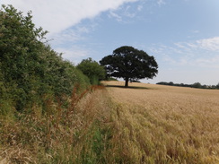
Immediately turn right down Culworth Road, and follow it as it heads eastwards out of the village. After a third of a mile turn left up a broad track that heads northwards towards an area of woodland called Calves Close Spinney; the track curves right to reach a stile beside a field gate that leads into the woods. Cross the stile, and when the track immediately forks, take the right-hand branch that heads east through the trees. As the track curves left near the eastern end of the woods, continue straight on along a path to a stile through a fence that leads into a field. Head straight on eastwards across the field, aiming to reach the point where a stream meets the far hedge. A the hedge, turn left to cross a farm bridge over the stream, and then follow the hedge on the right to reach a field gate that leads out onto a road at SP51164917.
Cross the road and go through a field gate on the other side into a field. Heads straight on up the field, meeting and following a hedge on the right. At the top corner of the field, go through a field gate to join a rough track that heads straight on northwards, following a sparse hedge on the left. This passes a couple of cottages on the other side of the hedge before joining a surfaced track; head straight on along this as it passes the western end of some woodland. After a short distance, before the track curves left, angle right off it to join a rough track that skirts the woodland on the right. Continue following the trees, and then a hedge, on the right for a quarter of a mile until a T-junction with another track is reached at SP51895015.
Turn right along another track, and follow it as it curves left and falls downhill with a hedge on the right. At the bottom, go through a gap in a hedge and head straight on across a field; it climbs a slight rise and falls down the other side to reach a farm bridge over the adolescent River Cherwell. Enter a field on the other side of the bridge, pass a field gate on the left, and then turn left, following a hedge on the left with a field away to the right. When the hedge on the left ends, continue straight on across the field; angling slightly towards a hedge on the left. At the far end of the field drop down to join a rough grassy track, with the Cherwell and trees away to the right and a field to the left. Continue on northwards to reach a field gate that leads into another field; head straight on northwards across this field, paralleling a hedge on the right to reach a pedestrian gate beside a field gate the leads out onto a road at SP52515111.
Turn right along the road and follow it as it curves to the left; when a triangular junction is reached on the right after a third of a mile, turn right down a surfaced track. When the track curves to the right, turn left to cross a stile beside a field gate to enter a field. Immediately pass a row of houses on the left, and when the wall guarding them ends, curve left to reach a stile in the far hedge. On the other side angle slightly right across a field, aiming to the right of a distance house. Cross a footbridge over a stream guarded by stiles, and on the other side turn left to follow a path that runs between a fence and a hedge to reach a stile that leads out into a field. Heads straight on across this field to reach a stile beside a field gate that leads out onto a road at SP53275165.
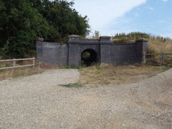
Turn right down the road for about twenty metres, and then turn left past the end of some garages to reach a stile beside a field gate. Cross the stile into a field, and on the other side head northeastwards uphill; at the top cross a stile beside a field gate and continue on along a path that runs between a fence and a hedge. Go through a pedestrian gate, cross a bridge over an old railway line, and then go through another pedestrian gate to enter a field. Follow a fence on the left; at the corner of the field go through a field gate and follow a rough track that meets a hedge on the left. Go through a field gate and continue along the track, with a hedge on the right. Go through another field gate and follow a hedge on the left. At the corner of the field go through a pedestrian gate beside a field gate and continue on between hedges to reach a road in Woodford Halse at SP53965246.
Turn right and follow the road as it heads northeastwards. It soon passes under twin old railway bridges and continues uphill into the village. At the top the road curves to the left slightly, and a third of a mile after joining the road, and shortly before it curves right, turn left down Castle Road. This descends past rows of houses; when it ends continue along a track that immediately curves left and then right to reach a footbridge over a stream. On the other side turn right along a path that follows the stream on the right. The path emerges out onto Byfield Road opposite an industrial estate at SP54135302.
Here the Jurassic Way is left. Turn right along the road and follow it eastwards; it curves to the right and after nearly half a mile ends at a T-junction. Turn right to follow Scrivens Hill uphill to the west, back into Woodford Halse; after a couple of hundred metres the High Street leads off to the left. Turn left down High Street, passing a school on the left, to reach the end of this walk on the High Street at SP54435265.
 |
 |
|
Distances
| From | To | Distance (m) | Ascent (ft) | Descent (ft) |
|---|---|---|---|---|
| Banbury | Cropredy | 4.9 | 72 | 3 |
| Cropredy | Chacombe | 2.4 | 114 | 116 |
| Chacombe | Chipping Warden | 4.6 | 400 | 322 |
| Chipping Warden | Woodford Halse (with loop at end) | 5.5 | 371 | 310 |
This makes a total distance of 17.4 miles, with 957 feet of ascent and 751 feet of descent.
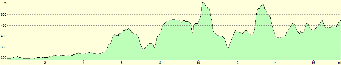
For more information on profiles, ascents and descents, see this page
Transport
Stagecoach in Oxfordshire runs a useful bus service (route 200) between Daventry and Banbury, calling at Woodford Halse and Chipping Warden on the way.
 |
 |
|
 |
 |
|
 |
 |
|
 |
 |
|
 |
 |
|
 |
 |
|
 |
 |
|
 |
 |
|
 |
 |
|
 |
 |
|
 |
 |
|
 |
 |
|
 |
 |
|
 |
 |
|
 |
 |
|
 |
 |
|
 |
 |
|
 |
Disclaimer
Please note that I take no responsibility for anything that may happen when following these directions. If you intend to follow this route, then please use the relevant maps and check the route out before you go out. As always when walking, use common sense and you should be fine.
If you find any information on any of these routes that is inaccurate, or you wish to add anything, then please email me.
All images on this site are © of the author. Any reproduction, retransmissions, or republication of all or part of any document found on this site is expressly prohibited, unless the author has explicitly granted its prior written consent to so reproduce, retransmit, or republish the material. All other rights reserved.
Although this site includes links providing convenient direct access to other Internet sites, I do not endorse, approve, certify or make warranties or representations as to the accuracy of the information on these sites.
And finally, enjoy your walking!
Nearby walks
| # | Title | Walk length (miles) |
|---|---|---|
| 598 | A circular walk from Badby via Lower Shuckburgh | 21.4 |
| 625 | A circular walk from Southam | 22.2 |
| 631 | A circular walk from Cropredy | 17.8 |
|
|

|