Walk #1005: Nene Way: Whittlesey to Wisbech
 |
 |
|
General Data
| Date Walked | 22/06/2018 |
| County | Cambridgeshire |
| Start Location | Whittlesey Station |
| End Location | Wisbech bus station |
| Start time | 06.05 |
| End time | 12.16 |
| Distance | 18.2 miles |
| Description | This is an easy walk following the Nene Way northeastwards out of Wisbech; the first half of the walk follows Moreton's Leam, and the second follows the River Nene itself. |
| Pack | Today I carried my 30-litre Karrimor rucksack, filled with water, my spare waterproofs, a book, trainers and other odds and ends. |
| Condition | Aside from a minor and very unusual case of hayfever, I feel absolutely fine after this walk. |
| Weather | Today was very sunny and fairly hot, with few clouds in the sky. Fortunately I got the majority of the walk done before the hottest part of the day. |
| OS map | Landranger number 142 (Peterborough, Market Deeping & Chatteris) and Landranger number 131 (Boston & Spalding) |
 |
 |
|
Map of the walk
Maps courtesy of Google Maps. Route for indicative purposes only, and may have been plotted after the walk. Please let me have comments on what you think of this new format. For a detailed table of timings for this walk, please see the table file.
 |
 |
|
Notes
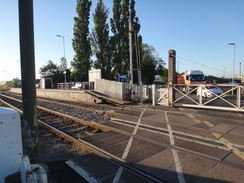
I did not fancy a long drive after last week's trip, so early this morning I drove up to Whittlesey to do the next leg of the Nene Way. I parked in a free long-stay car park, and decided that instead of following the trail from the centre of the town, I would walk down to the station where I had ended the last walk, and start from there. This started to feel like a mistake as the station was further away from the town centre than I remembered, and it took me over ten minutes to get there. The level crossing was down awaiting a freight train, and so I turned around and headed back towards town.
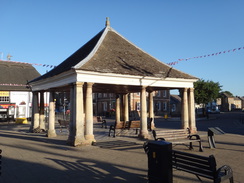
It was now just after six, and Whittlesey was starting to wake up. A man was setting up a fruit and veg stall near the Butter Cross in the market square. The butter cross dates back to 1680, and is a perfect addition to what is a fairly attractive area of the town. I diverted off route to a shop, only to find it was not yet open, and as I headed back I took a wrong turn for a short distance from the roundabout, despite knowing the town reasonably well. Soon I was back on the correct route, following a stretch of trail I had followed at the end of the previous walk.
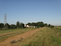
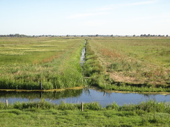
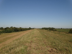
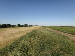
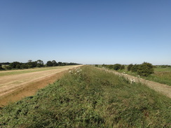
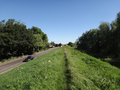
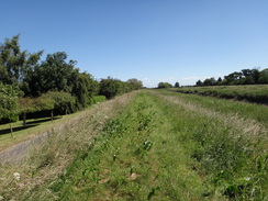
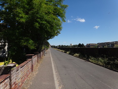
The outskirts of Whittlesey are fairly unremarkable and suburban; the main point of interest being the Straw Bear pub, named after a local festival that is held every January. The road became narrower as the houses ended, and several sharp curves took me past some woodland along a path that led past a farm and up onto a floodbank. This was not the floodbank of the Nene, but of Moreton's Leam, one of the first Fenland drainage schemes, constructed from the 1470s. Later on, a new course for the Nene itself was dug to the north, and the area between the two became washes to store floodwater. It feels slightly odd for the Nene Way to be following the leam rather than the Nene itself, but I can only assume that there are no proper rights of way alongside the latter.
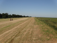
It was a fairly straight walk and some might even call it boring; however I quite enjoyed it, helped by blue skies in which clouds barely made an appearance. The sound of fast jets ripped through the air, but I rarely saw the source of the sound in the cloudless sky. I did see two jets spiralling around each other: they were occasionally invisible, occasionally dark darts, and occasionally gleaming white, depending on their orientation to the sun. It was a lovely display.
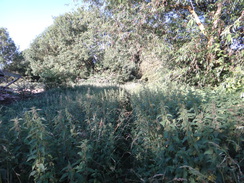
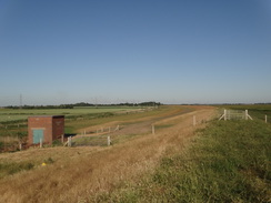
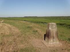
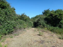
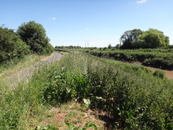
An unexpected trig pillar came into view, and I took a few pictures of it before continuing along the bank. My fears of it being overgrown were mostly proved false, with either low grass across the bank or a strip of low grass between taller vegetation. There were a couple of exceptions, including one stretch of about half a kilometre when I had to wade through tall vegetation - and I was very glad that I had not worn shorts!
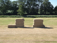
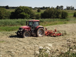
I soon developed a sore throat and my nose started to run. I had been fine earlier on, and I guess that it was a (for me) highly unusual case of hayfever. I have only ever had this once or twice before, and only after wading through similar long grass. Whilst unpleasant, the symptoms were not too bad, and lessened when I stopped walking through the grass. A tractor was turning hay on the strip of land between the floodbank and the leam, and was leaving behind it a large cloud of grey-brown dust. There were still not many clouds in the sky, and the temperature was slowly rising.
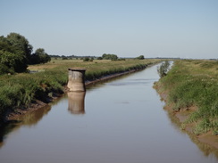
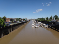
Eventually the leam and bank turned left and crossed the course of the old March to Spalding railway line, a viaduct of which could be glimpsed. This was closed in 1982, and was hence one of the last major railway closures in the country. The closure is now seen to have been a mistake: it could have been a useful diversionary line from the east coast ports to the north, yet sadly the costs of reopening would be very high. A short distance on was Guyhirn, and it took me a few minutes to safely cross the A47 and get my first glimpse today of the Nene - after about ten miles, it feels odd to only just be seeing the river the trail is named after.
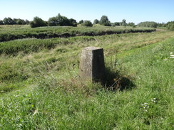
The trail follows the western riverbank north through Guyhirn, which is an oddly-shaped village stringing along two of the roads leading out. One of these lay below the floodbank I was on, and people were out and about doing their daily chores as I strode past. I met another unexpected trig pillar, which I photographed before heading on. The A47 runs along the other side of the river, and the tops of lorries sped past, the rest of them out of view below the far floodbank.
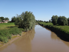
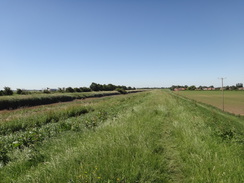
Near the north end of the village the trail dropped down to follow a road northeastwards. The tarmac was narrow, and I stepped in a pothole that was in the bank's shadow and slightly twisted my right ankle. I gave a quick curse at my silliness and limped on; fortunately the injury was minor and I was soon walking normally. At the end of this road the trail rejoined the floodbank, with the ebbing river revealing mudflats. Again, some might have found this walk boring, but I quite enjoyed it.
It wasn't quite clear on my map whether the trail followed the top of the floodbank or the road alongside, and I diverted from one to the other when the going on the top seemed reasonable. Whilst descending the bank to the road in one place I grasped some grass to stop myself sliding, only to realise that it was some nettles and gained a dot-to-dot display of nettle stings on my hand.
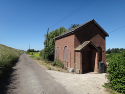
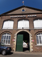
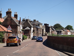
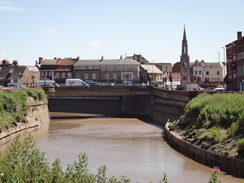
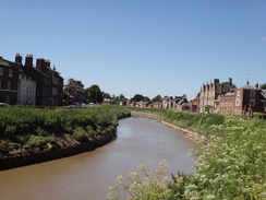
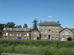
A chimney of an old pumping station was partially blocked from view by trees, but there was little else to note as the road headed towards Wisbech. I passed Elgood's Brewery, and decided not to nip into its shop, and then reached Wisbech riverside, which is filled with interesting buildings slightly spoilt by the high floodwall that separates it from the river. The route through Wisbech is slightly confusing on the map; it shows the trail passing a road and then heading between buildings. I walked along this route but could find no way through, and so headed back to the road.
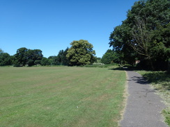
It was still early in the day, and I was tempted to continue walking north as far as Long Sutton. However that was nine miles away, and I had already done a good distance. Instead, I followed the trail past a recreation ground before heading back into the centre of the town, from where I had vague notions of catching a bus back to Peterborough and then on to Whittlesey. There was a Gregg's bakery by the bus station, but a bus to Peterborough arrived just as I was considering going in for a snack. I got on and went up to the top deck, from where I got some good views on the journey and could contemplate a walk that, whilst not a classic, had been enjoyable.
 |
 |
|
Directions
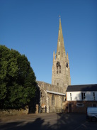
This walk starts off at Whittlesey railway station at TL27639627. Leave the station and turn right to head northwestwards up the B1093 Station Road. After a little over half a mile it passes the village church on the left and reaches the Market Square, with the Buttercross in the middle. Turn left for a short distance, and when opposite the Buttercross, carefully cross the road and head up Queen Street. When this ends at a T-junction, turn left down Syers Lane for a short distance until it ends at a roundabout at TL26859721.
Turn right at the roundabout to head north up the B1040 Orchard Road, and when traffic lights are reached after a quarter of a mile, turn right down Bassenhally Road. This curve sharply left to become Drybread Road, and then turns right to head eastwards. It passes a school on the right and the Straw Bear pub on the left. After half a mile it curves half-left to head north-northeastwards, soon becoming single-track. Ignore a road leading off to the right and continue straight on. The road curves slightly right and then sharply left to head past some woodland. It then turns right once more to reach a pedestrian gate beside a farm gate at TL28739860.
Cross the stile and follow a path that curves to the left, with the woodland on the left. When the track turns left into the woodland, continue straight on along a path with a bank and Bassenhally Farm off to the right. The path goes climbs up the bank and curves right to reach a clappergate that leads out onto a flood bank at TL28689878.
Follow the path along the top of the floodbank; Moreton's Leam is soon joined on the left. Go through a series of clappergates. After 7.4 miles the floodbank curves to the left, crosses the course of the old March to Spalding railway line, and then drops down to parallel the A141; cross a stile to join the pavement beside the road to reach a roundabout at TF39830298.
Turn left along the A47 to immediately reach a bridge that carries it over the Nene. Carefully cross the road to reach the northern side; there is no pedestrian crossing and the road is busy, so take care. Cross the bridge, and on the western side turn right down a short track, and after a couple of metres turn left and climb up to reach a squeeze-style on the top of a floodbank. Continue straight on along the floodbank, between the Nene on the right and a local road to the left. When the road curves to the left after 0.9 miles, angle left down a ramp to reach a field gate at TF40540416.
Skirt the gate, and pass a stile on the left to reach a minor access road that runs along the base of the bank. After passing the last house on the left, climb up a ramp and go past a field gate to rejoin the top of the bank. After 0.8 miles the path angles left down the floodbank and passes a couple of field gates to meet a bend in Mouth Lane at TF41630519. Follow the road northeastwards, keeping the bank to the right; after 1.8 miles the road ends at a T-junction at Cold Harbour Corner at TF42810627.
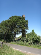
Turn right and follow the road as it soon curves left, climbing onto the top of the floodbank and passing a large chimney on the left. Continue following this road; the floodbank eventually becomes a sheet-pile wall, and as Wisbech is approached, a pavement starts on the left. It passes Elgood's Brewery on the left, and 2.8 miles after Cold Harbour Corner, the road ends at a T-junction at TF45540938.
Turn right to follow North Brink northeastwards through Wisbech; there is a pavement on the left. After 250 metres Chapel Road leads off to the left; turn left to follow it away from the river. The road curves to the right and soon ends at a T-junction; turn right to follow a wall and then houses on the right. Turn left into Chapel Road car park and aim for the far right-hand corner, where a surfaced path leads north alongside a hedge on the right, and with a playing field to the left. When the field ends, continue along the surfaced path until it squeezes past cycle barriers to reach the A1101 Leverington Road at TF45731037.
Here the Nene Way is left. Turn right to follow Leverington Road back into the centre of Wisbech; the road curves to the right and passes an Asda superstore on the right. When possible, cross over to the pavement on the left-hand side of the road and follow it as it curves left to cross the Nene on a bridge. On the far (eastern) side, turn right to carefully cross the road, and walk on a few metres to a roundabout. Cross the first road on the right, the B198, and head on to the second exit. Turn right down this road, Horse Fair, and follow it past a car park on the left; Wisbech Horse Fair bus station is a short distance away on the left at TF46250981.
 |
 |
|
Distances
| From | To | Distance (m) | Ascent (ft) | Descent (ft) |
|---|---|---|---|---|
| Whittlesey railway station | Guyhirn | 10.7 | 52 | 49 |
| Guyhirn | Wisbech bus station | 7.5 | 59 | 66 |
This makes a total distance of 18.2 miles, with 111 feet of ascent and 115 feet of descent.
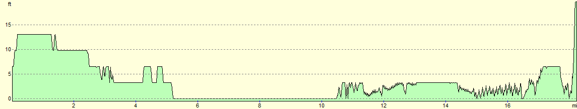
For more information on profiles, ascents and descents, see this page
Transport
There are two ways of getting back from Wisbech to Whittlesey:
1) I caught the Excel bus from Wisbech Horse Fair bus station to Peterborough, and then the 33 service to Whittlesey. Both these services run at regular times through weekdays, and the entire journey takes up to 90 minutes.
2) You can catch the 56 bus from Wisbech Horse Fair bus station to March, and then catch a GreaterAnglia train service to Whittlesey. These services run far less frequently through the day, but can take a little less time.
 |
 |
|
 |
 |
|
 |
 |
|
 |
 |
|
 |
 |
|
 |
 |
|
 |
 |
|
 |
 |
|
 |
 |
|
 |
 |
|
 |
 |
|
 |
 |
|
 |
Disclaimer
Please note that I take no responsibility for anything that may happen when following these directions. If you intend to follow this route, then please use the relevant maps and check the route out before you go out. As always when walking, use common sense and you should be fine.
If you find any information on any of these routes that is inaccurate, or you wish to add anything, then please email me.
All images on this site are © of the author. Any reproduction, retransmissions, or republication of all or part of any document found on this site is expressly prohibited, unless the author has explicitly granted its prior written consent to so reproduce, retransmit, or republish the material. All other rights reserved.
Although this site includes links providing convenient direct access to other Internet sites, I do not endorse, approve, certify or make warranties or representations as to the accuracy of the information on these sites.
And finally, enjoy your walking!
Nearby walks
| # | Title | Walk length (miles) |
|---|---|---|
| 54 | Ely to March | 22.9 |
| 55 | Peterborough to Whittlesey | 8.6 |
| 56 | Peterborough to Stamford | 16.5 |
|
|

|