Walk #956: Suffolk Coast Path: Lowestoft to Dunwich Forest
 |
 |
|
General Data
| Date Walked | 07/08/2012 |
| County | Suffolk |
| Start Location | Lowestoft Station |
| End Location | Dunwich Forest |
| Start time | 09.43 |
| End time | 19.26 |
| Distance | 22.8 miles |
| Description | This was a very pleasant walk, roughly following the Suffolk Coast Path south from Lowestoft towards Southwold and beyond. |
| Pack | Today I carried my Macpac Glissade rucksack containing my North Face Westwind tent, spare clothes, waterproofs, water, and enough food to last two days. In total it weighed about thirty-three pounds. |
| Condition | I am very tired after this walk, but have otherwise suffered no direct ill-effect of the walk. During the evening's camp I have been bitten multiple times however, which will lead to some discomfort during the night's sleep. |
| Weather | Today's weather was a mixture of sunshine and cloud, with one very heavy rainstorm in the middle of the afternoon. |
| OS map | Landranger number 134 (Norwich & The Broads, Great Yarmouth) and Landranger number 156 (Saxmundham, Aldeburgh & Southwold) |
 |
 |
|
Map of the walk
Maps courtesy of Google Maps. Route for indicative purposes only, and may have been plotted after the walk. Please let me have comments on what you think of this new format. For a detailed table of timings for this walk, please see the table file.
 |
 |
|
Notes
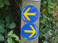
I had yet to do a backpack this year, and I fancied something coastal. As I only had three days, I could not go too far away. I soon settled on doing the Suffolk Coast Path, which runs from Lowestoft in the north to Felixstowe in the south. I had walked part of this trail before, both on my coastal walk and whilst doing the Sandings Walk, and had many fond memories. This trail used to be known as the 'Suffolk Coast and Heaths Path', but had recently been renamed as the 'Suffolk Coast Path' and rerouted in places. This led to some confusion as there were several different waymarkers pointing in different directions; a fact not helped by the lack of any guides on the web, For this reason my walk is my own interpretation of the trail.
Sencan dropped me off at Cambridge station early this morning, ready for a train to Norwich and then Lowestoft. As often happens on my first backpack of the year I was more than a little nervous, but this evaporated as I shouldered my rucksack, got off the train and made my way out of Lowestoft station. The forecast had been for some reasonable weather with decent sunny periods, and so it was a disappointment to find a curtain of cloud hanging overhead.
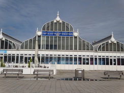
It was easy to find the start of the trail near the South Pier and the magnificent East Point Pavilion; on the way I was passed on the pavement by a man cycling, a can in beer in one hand and a cigarette in the other. I stepped onto the road momentarily to avoid his wild ride, and a man shouted after him with a choice phrase. This aside I was feeling good: my pack felt fine as I strode off along the promenade, enjoying both the views out to sea and the easy stroll.
A funfair was set up on a green, although it was quiet at this time of day. The shops and stalls around Claremont Pier were just opening, but there were too many miles left to afford the time to stop. The promenade ended near a church, and the path continued along the top of the cliffs before heading inland towards the A12. Here I met a man on a bike who asked if I was a footpath officer; he wanted to report a blocked path. We had a pleasant chat about the state of the local paths before we parted.
The next couple of miles followed the A12 southwards, and were boring and hardly worthy of a named trail. A pavement protected me from the traffic on the road, but it was still far from pleasant and there was little to see of interest. There were not even any views of the coast - a prerequisite of a coastal path. It passed a burnt-out house on the left, guarded by fences and a sign stating that it was going to be the site of a new holiday park. It was adjacent to another holiday park, leaving me to wonder if it was just an extension to the existing park or a competitor.
It was a relief when the trail left the road and followed tracks and paths into Kessingland. A tiny glimpse of the sea became visible before the path headed along tracks parallel to the coast into the village. Here a Suffolk Coast Path sign pointed down some steps onto the beach, but my map showed the Suffolk Coast and Heaths Path continuing on along a track. As I had not yet realised that the former had replaced the latter, I decided to continue along the track. The two routes soon met up on a promenade in Kessingland, and this was easy to follow southwards.
I ignored a tempting coastal pub, and instead headed on along a good path on the beach. It was an enjoyable stroll that passed seaward of a little lake; a second lake shown on the map seemed to have been lost to coastal erosion and shingle build-up. On my coastal walk I followed the cliffs and beach into Southwold; in the previous ten years coastal erosion in this area had taken its toll, and perhaps for this reason the trail takes a long and rather tortuous diversion inland. Initially this followed a farm track westwards before joining a road that almost reached the village of Wrentham before heading back towards the sea. About a mile of my walk was unnecessary as the Suffolk Coast Path took a track between two woods instead of the old Heaths and Coast route I was following.
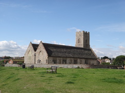
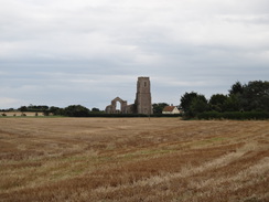
My feet were aching by now, and I took my first rest of the day on a bench near the ruined church at Covehithe, just a relatively short hop, skip and a jump from the coast. I did not want to leave my rucksack to explore the church, and I certainly did not want to carry it over, so instead I took my boots off and munched on some nuts and raisins whilst watching people walk past.
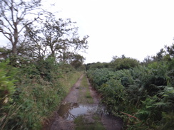
As usual my feet and legs complained once I set off after the short rest, but after a few minutes I was absolutely fine. Sadly the route headed inland once more, although fortunately the hated roads were soon replaced by a track. A sign and map at the junction said that due to flooding the coast path took a new route, going inland as far as Frostenden Corner. Most of this diversion was along roads and looked far from appetising. Instead I decided to risk the old route, which initially followed a footpath along the edge of fields, an easy if somewhat uninspiring stroll.
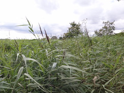
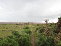
Things changed at the edge of Pottersbridge Marshes, where a sign said that frequent flooding may have damaged the wooden causey and bridges. As the sign did not specifically say that the path was closed I pressed on, soon walking through high reeds at the edge of the marsh. I managed to get only fifty yards before I decided to turn back: progress through the reeds was difficult and my footing on the ground uncertain.
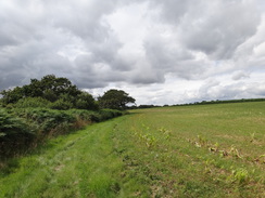
Once back in the field I was faced with a choice: to head all the way back and take the long and boring diversion, or trespass. In the end it was an easy decision and I walked along the field past the reed beds. There was no sign of the path or bridges through the reeds, indicating that I may have made the right decision. The path slowly climbed uphill before meeting a track that led to the road.
The road was busier than I hoped, but it did not take me long to reach the point where the path through the marshes joined it. A quick look showed that I made the right decision: the reeds were thick enough to hide both the path and a footbridge over a stream. An uncomfortable few hundred yards along the pavementless man road was followed by a path that led into Reydon.
It started to spit with rain as I entered the village but I decided not to put my coat on; a mistake as the drizzle soon became rain and then a proper downpour. I nipped into a bus shelter where a woman was already cowering with two children and their bikes. We chatted for a while as the heavens opened. When it appeared the rain was not going to slacken off I donned my coat and rucksack cover, only to see the rain stop almost immediately afterwards.
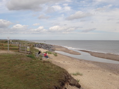
A path took me due east back to the coast immediately to the north of Southwold, the first time I had seen the sea in far too many miles. A sign nailed to a fence stated that the concessionary footpath along the top of the cliffs had been shut due to erosion; a shame, but understandable given the way this stretch of coast is eroding so quickly. It felt good to be beside the sea once more after such a long and tortuous inland diversion.
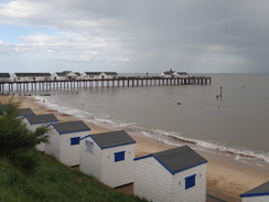
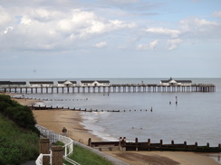
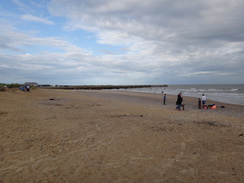
All my previous visits to Southwold had been in glorious sunshine, and it was a shame that today's weather was overcast and damp. I did not stop to explore the pier and instead of following the promenade, took the pavement that followed the road over the cliffs, which granted some glorious views up and down the coast. The trail soon left the cliffs and skirted the southern edge of the town before following a flood bank past Havenbeach Marshes; this also marks the northern end of the Sandlings Walk, which I did last year.
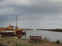
The path ended at the eastern bank of the River Blyth, which was busy with people walking to and fro. Some heavy machinery was working on reconstructing the north seawall, keeping the area safe for the future. The little ferry across the river appeared to be doing a roaring trade, but most of the shops were shutting up for the day. I love this area of Southwold; it is good to see a resort that has none of the arcades and tourist shops that blight so many seaside towns. Instead small independent shops in rustic sheds sold freshly-caught seafood.
There were still a few hours to go until it got dark, and I felt like there was only another three or four miles left in my legs. Since I was going to have to wildcamp and did not want to set up my tent too early, I decided to nip into the riverside Harbour Inn for a drink. The staff were very welcoming, and I shrugged my pack and boots off onto the stone slabs before ordering some a meal. The food - sausage and mash - was succulent and welcome, but a little too rich and I felt a little ill as I scoffed it down; so much so that I left the last part of the sausage on my plate.
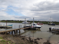
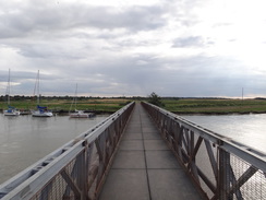
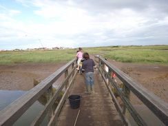
After about an hour I put my boots and rucksack back on and made my way to the pedestrian bridge over the river, which uses one of the piers of the old Southwold Railway. The path on the southern bank of the river towards Walberswick granted me good views over the boats moored in the harbour, and the ferry boat was just finishing for the day as I passed. Walberwick was still fairly busy, and two families were crab-fishing from the footbridge over the Dunwich River. The path across the sand dunes to the beach was difficult to cross with my heavy pack, and it was a relief when the trail left the beach and headed to another footbridge over the Dunwich River.
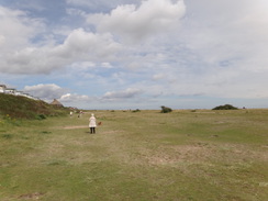
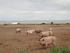
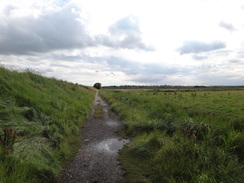
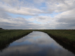
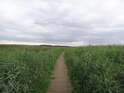
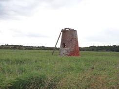
My feet miraculously stopped aching as I followed the path and boardwalks along the northern bank of the river. I had walked the shingle bank that stretches between Walberswick and Dunwich on several occasions, and this route through the marshes was, if longer, an easier walk and in some ways more enjoyable. It passed the stump of an old windmill, and then I started looking for somewhere to pitch my tent for the night. There were no suitable flat and dry areas on the marshes, and the better spots revealed themselves on flat grassland near Great Dingle Farm. Although there were a few spots that were out of the way, I was not happy with the farm's close proximity, and as I still had some energy left I walked on.
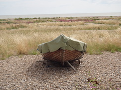
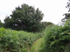
There were a couple more spots that looked reasonable to camp on, but I soon discounted them for various reasons. A track took me up into Foxburrow Wood before curving south towards Dunwich. I realised I had to find a place to camp soon, as there was not going to be much more daylight and I knew there would be few suitable places nearer Dunwich. Soon I came across a field of long grass off to the left, with some good views over the marshes towards the sea. I went through the gate and shrugged my pack off before resting for a few minutes. A few insects buzzed about, and after ten minutes with no-one passing I decided the spot was secluded enough and decided to erect my tent.
About halfway through the process all hell broke loose with many large insects and mosquitoes suddenly attacking me. The tent was completed in record time and I threw my rucksack and all my kit into it before scrambling in. Soon the tent was covered in hundreds of flies; there were some mosquitoes and many that looked like large house flies. The buzzing noise they made was loud and annoying. Fortunately the meal I had eaten in Southwold meant I did not have to go out of the tent to eat, and instead I spent a few weary minutes splatting flies with a copy of the Times I had bought earlier.
Unfortunately I had been bitten several times, and with dismay I realised I had got rid of the out-of-date tube of antihistamine cream out of my medical kit and stupidly not replaced it. Itching and uneasy about the location of the wild camp, I went to sleep shortly after it got dark.
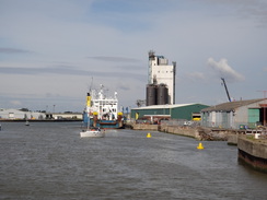
This walk starts off from Lowestoft railway station at TM547928. Leave the station and turn right down Denmark Road. When a junction is reached after a few yards, turn right down Station Square, initially keeping the high wall of the station building on the right. Immediately after the station the road curves slightly to the right. Cross Commercial Road (which leads into the docks) and head on towards the bridge over the harbour entrance. On the other side of the bridge, use a pedestrian crossing to cross the road and continue past the Harbour Inn on the right.
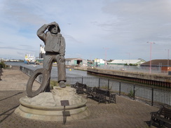
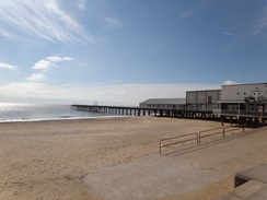
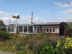
Head across a little plaza, passing a statue and some water jets on the right to reach the South Pier. At the entrance to the pier, turn right to start following the promenade, passing the East Point Pavilion on the right. After 0.4 miles the promenade passes Claremont Pier; continue on for another 0.9 miles until the main promenade ends at TM540906. Just before the end of the promenade, turn right up a concrete track on the right that climbs up the low cliffs. At the top turn left to follow a clifftop path south, immediately passing Pakefield church on the right. A third of a mile after the church the path heads past a bollard to reach the end of a track at TM537899, immediately before an old railway carriage that has been converted into a cottage.
Turn right to follow the track inland. It passes the Pakefield Caravan Park on the left and ends at a bend in a road called Arbor Lane. Continue straight on along Arbor Lane; when this road curves to the left continue straight on along an unadopted road which becomes narrower and goes past a couple of sets of barriers before becoming a public road once again. Cross the entrance to a McDonalds on the left to reach a roundabout on the A12 at TM532897.
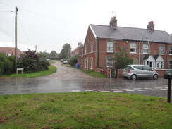
Turn left to start following the A12 south. When the road curves to the right to head towards a roundabout after a quarter of a mile, continue straight on along the pavement past a terrace of houses on the left. The pavement rejoins the A12 on the southern side of the roundabout. When a second roundabout is reached after another half-mile follow the pavement as it bypasses the roundabout once more. The pavement joins up not with the A12, but with the B1437 road.
Follow the B1437 road south for a quarter of a mile. Immediately after passing a row of houses on the right-hand side of the road, turn left down Cliff Farm Lane. After a quarter of a mile the track enters a caravan park; just before a gate is reached, turn right down a footpath. This curves to the left for a few yards to parallel the track, and then right to enter a field. Head south along the edge of a field, initially with some trees on the right. The path curves to the right and left, before following a ditch and then a hedge on the right. When the field ends at TM532871, go through a gap in the hedge to enter another field and immediately turn left.
Follow a hedge on the left eastwards. At the corner of the field continue straight on along a path that enters an area of scrub woodland. Continue east-southeastwards along this path, which is narrow in places, until it meets a rough track at TM535870 with a house on the left. Turn right to follow this track south for a quarter of a mile as it becomes a surfaced access road, turn left down a track that heads eastwards between fences to reach some steps at the top of a cliff. Descend these steps to reach the beach, and then turn right to follow the cliffs southwards.
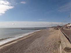
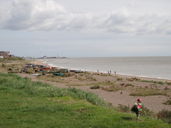
Soon a promenade starts; remain on the beach / promenade for about 0.6 miles until the end of the B1437 road is reached at Kessingland Beach at TM536858, with a car park, toilets and the Sailors Home pub a short distance away. Continue along the promenade until it ends below a caravan park, and then continue along the beach. 0.8 miles after the road, the path meets a pumping station at the end of the Hundred River at TM536845. Either carefully cross the outfall on the beach (not advised), or head inland towards the building. Just before the building, cross the outfall on a bridge guarded by gates, then turn left to rejoin the beach.
Continue south along the beach; erosion has more or less obliterated the seaward of two lakes shown on the map; continue on with the other, inland lake on the right. Shortly after this ends, turn right to head inland and join the end of a rough track at TM534838. Follow this track inland; as Beach Farm is approached on the right it joins a surfaced track that continues westwards away from the sea. It curves slightly to the right, and a mile after leaving the beach it reaches a junction with a road at TM518841.
Turn left to follow the road in a rough southerly direction; after 0.8 miles it curves sharply to the right with some woodland called Craft Plantation away to the left at TM512831. Here the Suffolk Coast Path turns left along a track, which soon curves to the right to head south. The trees on the left end and the track crosses a stream, before running alongside another area of woodland called Holly Grove on the right. After 0.6 miles this track ends at a road at TM512822.
However I took a longer road route instead of this section of track. At the first bend follow the road around as it heads westwards for half a mile until a road junction is reached on the left, with a track coming in from the right. Follow this road south for a quarter of a mile until it ends at a T-junction, then turn left along Mill Lane. This road soon curves sharply to the right and then left to take a more southeasterly course. It skirts the southern edge of Holly Grove on the left and after two-thirds of a mile the official route is rejoined at TM512822.
Follow the road as it heads east-southeastwards for two-thirds of a mile until it ends at a T-junction with another road at TM521818, immediately to the west of the ruined church at Covehithe. Here turn sharply to the right to follow a road west-southwestwards for nearly half a mile, until a footpath leads off to the left through a gap in a hedge.
Here the official route takes a long diversion inland, but I chose to follow the official route as much as possible. The path heads south-southeastwards away from the road between scrubby hedges before entering a little patch of woodland. It crosses a small bridge over a ditch and then leaves the trees to continue straight on until a track is reached at the end of the field. Turn right to follow a rough track southwestwards for a couple of hundred yards to reach a track junction at TM516810, immediately to the east of Porter's Farm.
Turn left to follow a track in a rough southerly direction for nearly a fifth of a mile. Well before a house is reached ahead, turn right down a good-quality track that leads away to the southwest. This passes the ends of two hedges on the left before reaching a track junction with a barn on the right. Here turn left to head south down another track, immediately passing the end of a band of trees on the right. The trees are replaced by a field, and this ends as the track approaches some woodland, with a house on the left at TM514798.
Follow the track as it swings to the right to take a westerly course away from the house, with a field on the right. Initially there is woodland on the left, but this is replaced by an intermittent hedge. Just before some trees are joined on the left, turn left to follow a path with another intermittent hedge on the left and a field on the right. The path starts to fall slightly; at the bottom corner of this field the official route squeezes through a hedge, crosses a plank bridge over a ditch and then curves to the right to head westwards across the reed beds on Pottersbridge Marshes.
However the path was a little too overgrown for my liking, so I decided to take a different route. Instead of going through the hedge, at the corner of the field I turned right to head westwards with the hedge and marshes on the left. I followed the edge of the field; this winds around before curving to the right, with the marshes on the left. The edge of the field starts climbing a slight slope until the northwestern corner of the field is reached with some trees ahead. Here turn left down a rough track with the trees to the right; the path soon curves to the right to enter the trees. Go past a gate to reach a junction with a better track; here turn left and follow the track as it heads southwestwards, climbing up a slight slope between hedges before ending at a T-junction with the B1127 road at TM504795.
Turn left to carefully start following the road southeastwards; after a fifth of a mile it passes a road coming in from the right, and then rejoins the official route that comes off the marshes on the left. Care needs taking on this narrow road which has narrow verges. The road crosses Potter's Bridge over a stream, then curves to the right and starts climbing uphill. Just before a left-hand bend at the top of the hill, turn right through a gap in the hedge. The path heads westwards between fences, losing all the height that had just been gained. The fences are replaced by scrubby land on either side as the path heads uphill, following a fence on the right. The path ends at a pedestrian gate with a field gate to the right. Go through the gate and head on towards Smear Farm at TM502784.
Join a concrete track at the farm and follow this between the farm buildings; it curves to the right and left before ending at a T-junction with a bend in Rissmere Lane East. Turn left to follow this road south for a quarter of a mile as it approaches the village of Reydon. The road ends at a triangular junction; here turn left to head southeastwards down Covert Road. After a third of a mile this road ends at a triangular junction with the B1127 road. Carefully cross the B1127 road to reach the pavement on the other side, and then turn left. After a few yards turn right down a track.
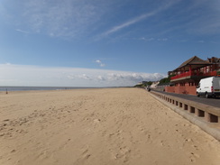
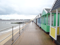
The track passes a house on the right and becomes a footpath before broadening out once more. At the end of the track, brush past a stile and head on along a narrow path that runs between fences, heading for the seawall ahead. Cross a track and head straight up the concrete bank to meet a walkway that runs along the top of the seawall beside Sole Bay at TM512772. Turn right to follow the seawall south; when the top of the bank is blocked by a fence, drop down the bank to enter a car park. Walk through this; after a while you can rejoin the top of the seawall and follow it past (in summer at least) a series of beach huts. When the promenade ends drop back down into the car park and continue on for a short distance to reach Southwold Pier.
Continue along North Parade as it passes the pier and heads up the low cliffs, leaving the promenade below and to the left. As the road curves to the right, continue straight on along a promenade that runs along the top of the cliffs. Once this reaches an area of grassland on the right between houses, turn right along Primrose Alley, keeping houses on the left. This soon curves to the left; head diagonally across a small area of grass to reach Queen's Road at TM508759.
Turn left and follow this road as it immediately swings to the right and descends downhill; as the road curves to the left, continue straight on down a good path that runs past a hut on the left. Follow this path as it parallels a flood bank; it goes through a small band of trees and after about half a mile climbs up onto a concrete flood bank. Drop down the other side onto the unsurfaced Ferry Road, with the River Blyth ahead. Turn right and start following Ferry Road northwestwards with the river on the left; after half a mile it passes the Harbour Inn on the right and then swings to the right. At the bend continue past a field gate to join a footpath that continues along the eastern bank of the river for another fifth of a mile until a footbridge over the river is reached at TM494758.
Turn left to cross the bridge, and on the other side turn left to start following the southern bank of the river southeastwards, with the river on the left. After 0.6 miles it approaches Walberswick; it passes some beach huts on the left and then curves to the right across grass. It soon crosses a gravel stretch of car park and reaches Ferry Road in Walberswick. Cross the road and continue through a larger car park, with a bank to the right. At the end of the car park cross a footbridge over the Dunwich River and follow the path on; at a junction turn right along an indistinct footpath that heads southeastwards towards the sea. It climbs over some dunes and reaches the beach at TM502747.
Turn right to follow the beach southwestwards. After half a mile at TM496740, turn right to head off the beach and join a footpath that heads across the marshes to reach a footbridge over the Dunwich River. Immediately on the other side of the river, turn left to walk along the river's northern bank. At times this stretch of path may be flooded, in which case a diversion will have to be made through Walberswick. When the path forks take the left-hand branch, still following the river on the left. The path crosses a series of boardwalks, then finally crosses a footbridge and climbs up some steps to meet a track at TM487736 near to an old windmill stump.
Turn left to follow the floodbank south; it soon swings to the left and then the right as it follows a river on the left. As the river curves to the left once more, turn right to join a gravel path across an area of reeds; it curves to the right and then the left before joining a low flood bank and heading towards some trees ahead. As it approaches the trees the path curves to the left, keeping the trees on the right for a few yards to reach a pedestrian gate. On the other side continue straight on along an obvious path.
When the path forks, take the larger left-hand branch that heads across grassland. This meets a track; turn left to follow this track. It passes a gate as it continues west-southwestwards, slowly climbing as it does so. The track enters Foxburrow Wood and curves to the left, passing a house off to the right. Continue past a stone wall and house on the left and then cross a cattle grid and continue south. My walk ended at about TM474718, immediately to the north of Little Dingle, where I camped for the night.
This makes a total distance of 22.8 miles, with 574 feet of ascent and 557 feet of descent.
Please note that I take no responsibility for anything that may happen when following these directions. If you intend to follow this route, then please use the relevant maps and check the route out before you go out. As always when walking, use common sense and you should be fine.
If you find any information on any of these routes that is inaccurate, or you wish to add anything, then please email me.
All images on this site are © of the author. Any reproduction, retransmissions, or republication of all or part of any document found on this site is expressly prohibited, unless the author has explicitly granted its prior written consent to so reproduce, retransmit, or republish the material. All other rights reserved.
Although this site includes links providing convenient direct access to other Internet sites, I do not endorse, approve, certify or make warranties or representations as to the accuracy of the information on these sites.
And finally, enjoy your walking!
Directions
Distances
From To Distance (m) Ascent (ft) Descent (ft) Lowestoft station Kessingland Beach 5.7 236 226 Kessingland Beach Covehithe 5.3 82 75 Covehithe Southwold Pier 6.0 105 128 Southwold Pier Dunwich Forest 5.8 151 128 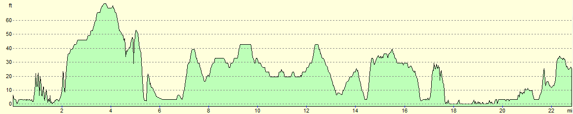
For more information on profiles, ascents and descents, see this page


Disclaimer
Nearby walks
| # | Title | Walk length (miles) |
|---|---|---|
| 132 | Wickham Market Station to Darsham Station | 12.7 |
| 135 | Darsham Station to Brampton Station | 12.3 |
| 136 | Lowestoft to Caister-on-Sea | 14.4 |
|
|

|