Walk #955: Essex Way: Manningtree to Harwich
 |
 |
|
General Data
| Date Walked | 02/08/2012 |
| County | Essex |
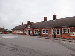
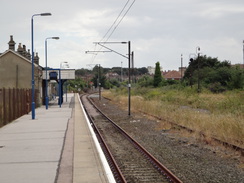
| Start Location | Manningtree railway station |
| End Location | Harwich Town railway station |
| Start time | 07.51 |
| End time | 15.07 |
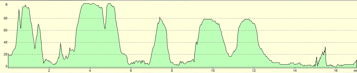
| Distance | 17.0 miles |
| Description | This was a very plasant walk following the Essex Way as it roughly parallels the southern bank of the Stour Estuary. |
| Pack | Today I carried my Macpac Glissade rucksack containing my North Face Westwind tent, spare clothes, waterproofs, water, and enough food to last two days. In total it weighed about thirty-three pounds. |
| Condition | I feel absolutely fine after this walk, and could easily have walked further if necessary. However due to the load I was carrying, I decided that a shorter day was wise. |
| Weather | Today was pleasantly warm, with a little breeze at times to help cool me down. Although the skies were mostly overcast, there were some sunny periods. |
| OS map | Landranger number 169 (Ipswich & The Naze, Clacton-on-sea) |
 |
 |
|
Map of the walk
Maps courtesy of Google Maps. Route for indicative purposes only, and may have been plotted after the walk. Please let me have comments on what you think of this new format. For a detailed table of timings for this walk, please see the table file.
 |
 |
|
Notes
I am intending to get a long-distance walk done soon, and have filled my large rucksack with all my camping kit. However I am not yet used to the weight, and so wanted to do a trial walk with it. Ideally I wanted a route with good transport so I could bail early if necessary, with a few modest hills and some coastal views. A few weeks ago I did a short stretch of the Essex Way near Colchester, and soon settled on doing the easternmost stretch of the trail between Manningtree and the sea at Harwich, which follows the Stour Estuary.
The drive to Manningtree went well, and I was soon parked up in the rather dark, newly-built multi-storey car park by the station. This was rather costly but was very popular despite the early hour - I guess people use it for commuting to London. It did not take me long to get my kit together and soon I was strolling off down the station approach.
An unexpected climb up a hill rather shocked my muscles, and it was not too pleasant toiling uphill alongside the rush-hour traffic. This soon changed when I joined the Essex Way, which led me across some green spaces before joining a track on the outskirts of Manningtree. This skirted a railway line, and soon afterwards I made my first mistake, heading down the wrong road. I soon realised my mistake and was back on the proper route.
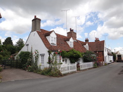
The suburban dreariness of Manningtree was replaced with some interesting architecture as a road took me down into the centre of the village. There are some fine Georgian buildings in the town, which as well as being one of the smallest towns in Britain, also was once home to Matthew Hopkins, the Witchfinder General.
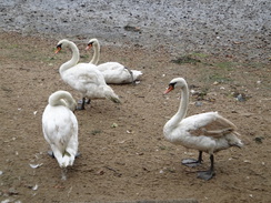
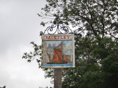
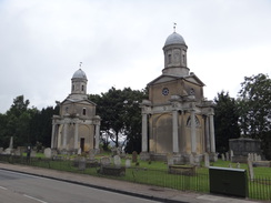
As I walked through the town I thought of all the poor women killed by Hopkins, who can only be classed as a truly evil man. My mood improved as I followed a road alongside the Stour Estuary; the views were interesting although not stellar, and I remembered them from my coastal walk ten years before. A road took me out of the village and on towards Mistley and the rather spectacular Mistley Towers, the only remains of a neoclassical church designed by the famous architect Robert Adam. The rest of the church was demolished in Victorian times in an act of cultural vandalism; the surviving towers are superb pieces of architecture. Swans and geese sat on the muddy foreshore as if awaiting the tide; on my previous visit I had come across a swan tapping on the window of a parked car, asking to be fed!
My legs felt fine despite the heavy load on my back, and I nipped into a little shop in Mistley where the very pleasant shopkeeper sold me a few snacks. The trail headed uphill for a short distance before heading past a large old industrial building that houses a malting - the smell in the air was fantastic. Shortly afterwards I went wrong again, somehow missing the waymarkers and passing some houses before realising my mistake. Making a mistake twice in an hour is unusual, especially on a well-waymarked trail. I was more tired than I realised, last night's sleep having been rather intermittent.
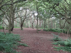
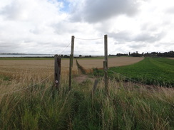
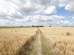
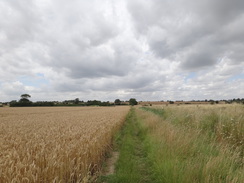
The next mile or so took me through a pleasant stretch of deciduous woodland, near (although out of sight of) a military bunker on Furze Hill. The trees soon gave way to fields of crops, and I could find no trace of a ruined church that was marked on the map (mainly because I was looking in the wrong place). More paths led onto a road in Bradfield, after which a path angled downhill across fields between electric fences. There was something I had not seen before - in a couple of places the electric fence spanned the path, being taken high overhead on poles.
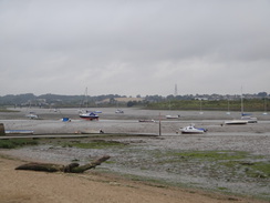
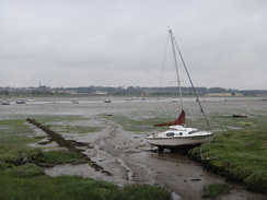
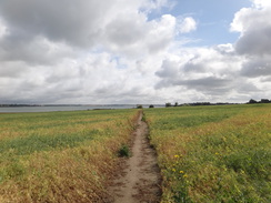
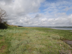
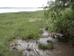
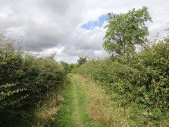
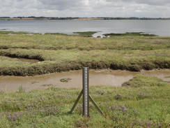
After passing under the railway line and crossing a field, the Stour Estuary was reached once more. I well remembered this stretch of path from my last visit, a decade not having dimmed them. It was as bad as I remembered; the path tries to follow the narrow gap between fields and marshland. The path was boggy and hard to negotiate, especially where a tree had fallen across it, forcing me to wriggle through the branches with my large pack on my back. The views across the marsh and the estuary more than made up for the difficulty of the walk, and not for the first time I wished I knew more about all the birds I could see.
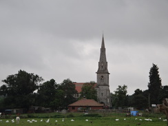
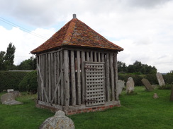
Eventually the trail left the foreshore and followed surfaced paths through the Wrabness Local Nature Reserve, winding and twisting through the vegetation. One of these turns sent me on the wrong course despite the waymarking, although fortunately this mistake was soon corrected. The trail crossed a flood bank past an inland lake before taking a rather boring path uphill across fields to reach the tiny hamlet of Wrabness. Here I came across the church, which I greeted with joy - it has a separate bell tower in a wooden cage set aside from the church, an unusual feature. I had been overjoyed to find this ten years ago, and it was good to see that it was just as I remembered.
Shortly afterwards a track took me down past a caravan site and back to the shore. Fortunately the going was easy as the trail chose to keep to the field side of the shoreline. On a short stretch of flood banking I came across a crowd of 25 walkers approaching in the opposite direction - I can be sure of the number as they took care to tell me. They were all very cheery as they passed, and we exchanged several puns as I became a trail troll for a while.
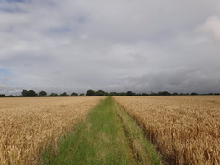
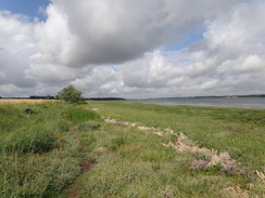
There were several people out and about, enjoying the sunshine. By now I was starting to feel the heavy weight on my shoulders and I was in need of a rest. After passing most of Copperas Bay, the trail headed inland past a nature reserve, meeting a road. This was followed for a while before a rather unspectacular stretch of path took me towards the hamlet of Ramsey. One stile in particular was hard to negotiate as it was closely overgrown with brambles that were lower than my head, yet alone my rucksack.
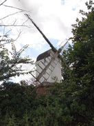
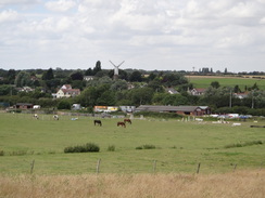
Soon something came into sight that improved my mood - the wooden sails of a windmill. These were skeletal, but all four were still present. I had seen the windmill marked on the map but am used to these being just stump towers, with no remnants of the sails. It was therefore good to see a windmill still with sails, even if they were in poor repair.
The Castle Inn in Ramsey proved too tempting to resist, and I nipped in for a couple of pints of bitter shandy. Unsurprisingly the Olympics were playing on the TV in the bar, and I watched a couple of rowing races as I supped my drinks. On a wall nearby were a couple of newspapers dating from 1979, when a young man had kept customers hostage in an armed siege. Sadly the siege ended in his death and a policeman's injury.
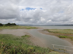
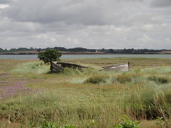
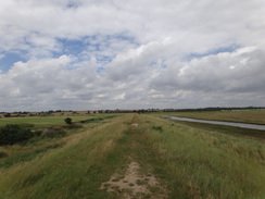
Paths took me southeastwards towards Little Oakley, before diverting off to cross the B1414. From here it was simply a descent down onto the marshes, after which a path took me to the flood bank that prevented the sea from reclaiming the marshes. To the southeast I could just about make out some wind turbines out at sea, and what looked like oil or gas rigs were just visible on the horizon. I had to stop at a clapper gate to allow a large family through, the two small children on bikes, and then strode off along the top of the bank.
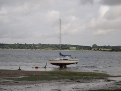
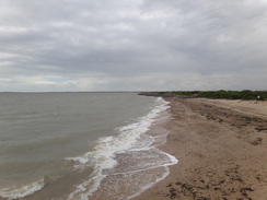
Earlier in the day I had been following parts of my coastal walk in the direction I had taken ten years ago, but due to the vagaries of the Essex Way I was now walking in the opposite direction, north into Harwich. Eventually a wide expanse of sand and gravel appeared on my right, replacing the marshland, and then a sea wall began. A few people were standing by the wall with their children, fishing for crabs, a few of which sat at the bottom of small plastic buckets. I always like this scene which reminds me of crab-fishing as a child off the pier in Shaldon, Devon.
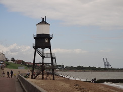
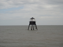
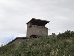
It started to rain as I passed the Dovercourt lighthouses, which comprise of a tall cast-iron light by the shore and a shorter one out to sea. These guide ships into Harwich, and replace the earlier lights that I was soon to come across. Fortunately the rain did not last too long, and soon I was striding past a long breakwater, inland of which were the bunkers and observation posts of a large Second World War military complex.
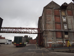
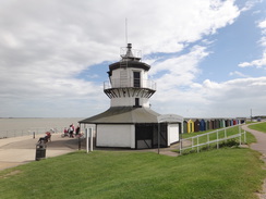
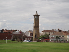
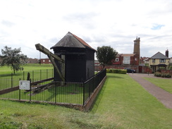
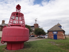
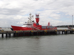
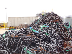
Soon I was striding through the outskirts of Harwich, passing the old low lighthouse, now a museum. A tall, Egyptian-looking brick lighthouse inland was its pair; both fell out of use and were replaced by the Dovercourt lights after the channel silted up. By now there was more to see than I could take in: from a well-preserved dockside crane to a lifeboat museum, and then the Electric Palace, which is one of the oldest cinemas in the country. Soon I reached the lifeboat station, next to which was a lightship that was open to the public. The area around the Ha'penny Pier was bustling but I resisted the temptation to stop, wanting to continue on. Nearby were the headquarters of Trinity House, which maintains the lighthouse and beacons around England's coasts, and some brightly-painted buoys sat in the yard alongside massive piles of chains.
By now I had done about seventeen miles, and although I felt fit I decided to call it a day. A train was due in about twenty minutes, and I felt like I'd gone far enough with my full backpacking kit on. Another option was to walk for about three miles to Harwich International station that lies within the port, but I had no idea if there was public pedestrian access to that station. Instead I diverted along the streets for a short distance to Harwich Town station. As I was still feeling fine, I went through the station to look at the old high lighthouse, which is a magnificent brick structure that is somewhat incongruously situated next to a modern toilet block.
It had been an enjoyable day's walk, and one that not only brought back memories of my earlier trip along this stretch of coast, but also induced a desire to do more coastal walking. The only question is where I head next...
 |
 |
|
Directions
This walk starts at Manningtree railway station at TM093321. Leave the station and follow the approach road eastwards until it ends at a T-junction with the A137 road. Turn right to immediately reach a roundabout; continue straight on along the A137 as the road starts to climb uphill; there is a pavement on the right. After nearly a third of a mile the gradient starts to slacken; when a little lay-by is reached on the right, carefully cross the road to join the Essex Way.
The trail squeezes through gap in a hedge and starts following a fence on the right. The path curves to the left and then the right before settling on a rough easterly course, with a hedge on the left. Near the bottom of the hill turn right beside a bench to pass a slope on the right and scrubland on the left. It crosses a plank bridge over a stream and then curves to the right, clambering up a slight slope and passing through a narrow band of trees before emerging out into a field. Head straight on across the field, approaching houses on the left. Cross the end of a track to enter a field, with a housing estate immediately on the left. Although an obvious path heads half-right diagonally across the field, the official route heads along the edge of the field with the houses to the left. At the corner of the field turn right, still keeping houses on the left. Just before a hedge is reached on the left, turn left to join a surfaced path. Follow this eastwards for about a quarter of a mile, passing a school on the way. It curves slightly to the right and descends down to reach Colchester Road at TM103316, with a railway bridge to the left.
Carefully cross the road and continue along Mill Hill road on the other side. Follow this east-southeastwards as it descends into a dip and climbs up the other side; after a sixth of a mile the road ends at a T-junction with Brook Street. Turn left down Brook Street, immediately crossing the railway line on a bridge. Take the first road off to the right; South Street. This soon curves to the left beside an imposing Methodist church to head downhill. The road soon curves to the left and right, reaching the High Street at the bottom of the hill. Carefully cross the High Street and continue on down South Street. This soon curves to the right and becomes Quay Street.
After a couple of hundred yards the road ends at a T-junction with the B1352, with the sea wall on the left. Follow this road as it follows the shoreline eastwards; after half a mile it passes Mistley Towers on the left. Continue past the towers and head on up a slight hill; just before a large building is reached at TM117318 turn right to walk through a maltings, keeping the main factory building on the left. Walk through the factory following the walkway marked on the ground, being aware of the vehicles that scuttle about.
The yard descends slightly and narrows to reach a pedestrian gate through a high fence. Go through this and follow a narrow path that runs beside the fence. When the path forks beside a large metal tank on the other side of the fence, take the smaller path that heads off to the left. This path heads through some scrubland to reach some steps. These lead up to a bridge under a railway line; go through this and then descend more steps, go through a clapper gate and down the last few steps to reach a field. Head straight across the field southwards, keeping the hedge on the left about the same distance away. When a hedge is reached ahead, go through a field gate, cross a rough track that runs between hedges, then a second field gate to reach another field. Continue on in the same direction until a fence is reached beside a clapper gate at TM116311.
Do not go through the clapper gate, and instead turn left to follow the fence eastwards. It soon crosses a stream and the fence is replaced by an intermittent hedge before the path reaches a clapper gate that leads into the woodland on Furze Hill. At an immediate branch in the paths, take the one that leads off slightly to the left, climbing uphill. Try to keep to the main path; soon a row of old fenceposts appear on the left. Follow these along; a playing field becomes visible through the trees on the left. This is soon replaced by more trees before the path emerges out into a field.
The path follows a hedge; it squeezes through a gap in a hedge on the left and continues on. It slowly becomes a track that passes a farm on the right, before curving to the left to reach a road in Mistley Heath at TM128309. Turn right along the road and follow it as it immediately curves to the right, and then turn left down a driveway leading to a cottage. After a few yards turn left to reach a metal clapper gate to join a path, with a fence separating it from the driveway and the cottage. This path enters a field; follow the field boundary on the right to reach a clapper gate. Go through this and head through an area of scrub woodland with a pond to the right to reach a stile. On the other side enter a field; the path curves half-right to head east-southeastwards.
At the end of the field cross a plank bridge over a ditch and then through a gap in a hedge to enter a second field. The path continues across a second field to reach a bend in a second hedge; turn left to follow this hedge on the right for a few yards, then turn right through a gap to enter a third field. Head eastwards across this for a fifth of a mile; it descends down a slight slope to reach a large gap in a hedge. Go through this to reach a road at TM139306. Head straight on eastwards along this road; it crosses a stream and climbs uphill before the gradient flattens. After a quarter of a mile it ends at a T-junction with a road in the little village of Bradfield.
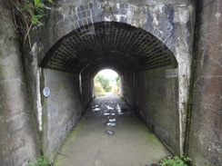
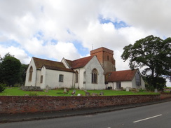
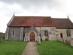
Turn left along this road to follow it north past St Lawrence church on the right. Immediately after the church, turn right along the B1352. The road curves to the left and then shortly afterwards to the right. Look for a footpath leading off to the left immediately after a house; initially this passes a hedge guarding it from a garden on the left to reach a clapper gate. Go through this to enter a field; the path runs between fences as it heads northeastwards, slowly heading downhill. It crosses a fence into a second field and continues on unfenced across another field. At the bottom of the field it crosses a rough track and then a bridge under a railway line at TM150312.
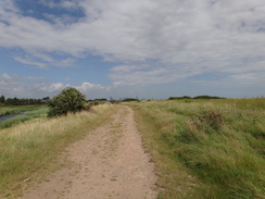
On the other side of the bridge turn half-right to head northeastwards across another field. When this reaches the far corner of the field, ignore all the tracks and squeeze through a hedge to enter marshland beside the estuary. Turn right and follow the edge of the marshes eastwards; progress can be difficult, and at very high tides the path may be impassable. Care needs taking as it is all too easy to slip into a muddy or watery pool. The path passes Ragmarsh Farm on the right; pass another field on the right, and when this ends at TM158315 turn right off the marshes through a gap in a hedge to join a path that leads into the Wrabness Local Nature Reserve.
Almost immediately turn left along a narrow surfaced path that runs parallel to the shore. It crosses another path that leads down onto the marshes, and then curves to the right to head slightly inland. This path curves slightly to the left and then right; shortly after the right-hand bend take a path off to the left. This descends a couple of flights of steps; a zig-zag path to the left avoid the steps. At the bottom the path meets a track heading away to the right; here turn left along another path that heads through scrubland. Almost immediately the path curves to the right and crosses a little footbridge over a stream, then climbs steps up onto the top of a floodbank at TM163317
Turn right to follow the floodbank. It immediately curves to the left to head northeastwards; when it ends, turn right down some more steps to meet the end of Wall Lane, which at this point is unsurfaced. Cross the end of the track and take a footpath that squeezes through a gap in a hedge before continuing straight on between two more hedges. It climbs slowly eastwards, crossing a track on the way. After nearly half a mile the hedge on the right is replaced with a fence guarding it from a house; soon afterwards the path ends at a junction with a track. Turn right down this track for a short distance until it ends at a field gate. Go through this to reach Church Road in Wrabness at TM171318.
Turn left to follow the road eastwards through the hamlet, passing the church and its detached belltower on the left. After a quarter of a mile, turn left past a traffic barrier to head down an unsurfaced track called Shore Lane. Follow this lane north-northeastwards for a third of a mile, passing a caravan site on the left. Just before another traffic barrier is reached at the bottom, turn right along a green track that parallels a hedge and the foreshore on the left. As a field gate at Shore Farm is approached at the end of the first field, the path curves left up onto the top of a flood bank. Follow this southeastwards past the farm and into another field. The flood bank ends about halfway across the field; continue on with a hedge on the left. At the end of the field cross a footbridge to enter an area of woodland.
The path emerges from the woodland into a field; at the corner of the field it goes through a tall clapper gate and runs between fences that protect some gardens to the right. At the end of the gardens the path emerges through another tall gate into a narrow field. Head along this, keeping the hedge and foreshore on the left. At the end it goes across a footbridge over a ditch to enter an area of sparse woodland. After a short distance the path curves to the right slightly, then to the right again. Follow the path uphill to reach a gate; squeeze past this to reach a bridge over the railway line at TM198316.
Cross the bridge and join a track that heads uphill in a rough southerly direction, with a field through trees to the right. After a quarter of a mile the track ends at a field gate that guards a T-junction with the B1352 road. Turn left and follow the road eastwards for a quarter of a mile; as it passes under some power lines, turn right up a track that follows a hedge on the left. It passes the ruined Seagar's Farm on the left and continues on to pass the end of a hedge at the corner of the field. Continue straight on across the middle of another field to reach a stile in another hedge. On the other side turn left to walk east with a hedge on the left, heading towards a windmill in the distance.
Cross a second stile into a paddock, and continue on to reach a third stile; when the hedge curves away to the right, continue straight on across the field. When it meets another hedge, cross a fourth stile and then head diagonally across another field to the far corner, where a fifth stile leads back into the field. Head straight on towards the windmill. When a hedge is reached in front of the windmill, turn left to follow the hedge on the right. The hedge and path soon curve to the right to head southeastwards; at the corner of the field head straight on between fences. The path becomes a surfaced track that ends at The Street in Ramsey at TM210303.
Turn left up The Street; immediately after passing the Castle Inn on the left the road curves to the right at a triangular junction. At the junction turn right to follow the B1352 southeastwards out of the village; there is a pavement on the left. The road soon ends at a roundabout with the A120. At the roundabout turn left down the A120 for a few yards, and when the safety barriers end, carefully cross the main road. On the other side turn right and then left to follow the B1352 uphill for about thirty yards, then cross the road and take a path that passes a metal cycle barrier and continues between hedges.
Cross a plank bridge over a stream, and then a boggy area of ground to reach a field. Turn left to start following an area of trees uphill with a fence away to the right; when the woodland curves away to the left, continue straight on uphill across a field, still with the fence away to the right. The path skirts a small copse on the right and then follows a hedge southeastwards. When a corner of the field is reached, turn right through a gap in the hedge and cross a bridge over a ditch, then left to follow an unfenced path between fields.
When a junction with another footpath is reached at TM219295, with houses starting away to the right, turn left and follow this new footpath as it crosses the field. Soon a hedge is joined on the right, and the path leaves the field through a gap in a hedge and continues on to enter a small car park. Follow a track through the car park and past a building on the right; the track soon ends at the B1414 road.
Turn left up the B1414 for a few yards, then carefully cross the road and turn right along a gravel footpath that runs between fences (note this route is different to the one marked on earlier OS maps, which went on the other side of the farm buildings). This path soon curves to the left to meet a hedge at the corner of a field. Turn right to follow the hedge southeastwards. A corner of the field is reached after a quarter of a mile; turn left to join a rough track for a short distance. Soon, turn right down some steps to join a footpath that heads southeastwards between fields.
A hedge starts on the right; when the hedge curves away to the right, continue straight on across the field. At the end of the field pass through a gap in the hedge and continue on with a field boundary on the left. As the path approaches a bend in a flood bank the path curves slightly to the right, then left to climb the bank, reaching the top at TM235287.
Turn left to start following the flood bank northwards, with marshland and the sea to the right. After 0.3 miles it turns to the right to take a northeasterly course. Go through this and continue northeastwards for another half a mile, passing a couple of clapper gates. The path curves to the right and then left in quick succession, and the marshland on the right is replaced with rough grassland as the path broadens. It squeezes past a field gate to reach a car park beside a road at TM246300. Turn right to join the start of a promenade; it soon curves to the left to head north-northeastwards.
Follow the promenade as it heads through Dovercourt and past the two Dovercourt lighthouses; after 1.4 miles the promenade curves to the right, passing an old fort inland to the left to reach a large breakwater. Here the promenade curves sharply to the left to take a more northerly course. It reaches the old Low Lighthouse (now a museum); pass this and head on with a green on the left. Just before the treadle crane is reached on the left, turn left across the green to reach St Helen's Green Road. Join this and keep the green on the left until you reach the Old High Lighthouse, which is where the Essex Way ends.
The railway station now lies slightly to the west across the B1352 road, but my route takes in some other scenic parts of Harwich. Turn around and follow St Helen's Green Road back towards the treadle crane, and then turn left. When this road ends turns right along Wellington Road. This swings to the left and then right, becoming King's Quay Street. Follow this road until it reaches the sea at the lifeboat station, and then turn left to follow The Quay to reach Ha'Penny Pier on the right. Continue along the road as it curves to the left to pass the Trinity House Depot. As the road swings to the right, turn left down George Street. Pass a brick wall on the right, then head through a gap in the wall to reach a path that leads south to Harwich Town railway station at TM259324, where this walk ends.
 |
 |
|
Distances
| From | To | Distance (m) | Ascent (ft) | Descent (ft) |
|---|---|---|---|---|
| Manningtree station | Bradfield | 5.1 | 377 | 299 |
| Bradfield | Ramsey | 5.5 | 226 | 305 |
| Ramsey | Harwich Town station | 6.4 | 171 | 184 |
This makes a total distance of 17.0 miles, with 774 feet of ascent and 788 feet of descent.
For more information on profiles, ascents and descents, see this page
Transport
Regular train services run between Harwich Town and Mannigtree stations on the Mayflower Line. See the National Rail Enquiries website for more information.
 |
 |
|
 |
 |
|
 |
 |
|
 |
 |
|
 |
 |
|
 |
 |
|
 |
 |
|
 |
 |
|
 |
 |
|
 |
 |
|
 |
 |
|
 |
 |
|
 |
 |
|
 |
 |
|
 |
 |
|
 |
 |
|
 |
 |
|
 |
 |
|
 |
 |
|
 |
 |
|
 |
 |
|
Disclaimer
Please note that I take no responsibility for anything that may happen when following these directions. If you intend to follow this route, then please use the relevant maps and check the route out before you go out. As always when walking, use common sense and you should be fine.
If you find any information on any of these routes that is inaccurate, or you wish to add anything, then please email me.
All images on this site are © of the author. Any reproduction, retransmissions, or republication of all or part of any document found on this site is expressly prohibited, unless the author has explicitly granted its prior written consent to so reproduce, retransmit, or republish the material. All other rights reserved.
Although this site includes links providing convenient direct access to other Internet sites, I do not endorse, approve, certify or make warranties or representations as to the accuracy of the information on these sites.
And finally, enjoy your walking!
Nearby walks
| # | Title | Walk length (miles) |
|---|---|---|
| 263 | Bawdsey to Waldringfield | 17.9 |
| 264 | Waldringfield to Nacton via Felixstowe | 19.6 |
| 265 | Nacton Church to Shotley Gate | 14.2 |
|
|

|