Walk #957: Suffolk Coast Path: Dunwich Forest to Boyton Dock
 |
 |
|
General Data
| Date Walked | 08/08/2012 |
| County | Suffolk |
| Start Location | Dunwich Forest |
| End Location | Boyton Dock |
| Start time | 05.35 |
| End time | 17.29 |
| Distance | 25.0 miles |
| Description | This was a very pleasant stroll following the Suffolk Coast Path as it roughly follows the coast south from Dunwich, with frequent diversions inland to negotiate rivers. |
| Pack | Today I carried my Macpac Glissade rucksack containing my North Face Westwind tent, spare clothes, waterproofs, water, and enough food to last two days. In total it weighed about thirty-three pounds. |
| Condition | I feel absolutely fine, although tired, after this stroll. |
| Weather | The day started off genreally clouds with sunny periods; as the day progressed the clouds parted to levae sunshine. There were occasional bouts of drizzle early on, but these were not prolonged or intense. |
| OS map | Landranger number 156 (Saxmundham, Aldeburgh & Southwold) and Landranger number 169 (Ipswich & The Naze, Clacton-on-sea) |
 |
 |
|
Map of the walk
Maps courtesy of Google Maps. Route for indicative purposes only, and may have been plotted after the walk. Please let me have comments on what you think of this new format. For a detailed table of timings for this walk, please see the table file.
 |
 |
|
Notes
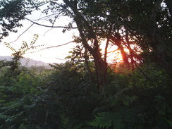
Last night's insect bites had swollen by the time I awoke from an uneasy night's sleep, and I spent a few minutes scratching whilst giving the evil eye to the motionless insects on my tent's flysheet. It was just after five, and there seemed little reason to hang about. I packed up my rucksack within the tent so I would have to spend as little time as possible amongst the insects that were rapidly waking up from their slumbers. I threw my rucksack over the gate and then rapidly pulled my tent down, separating the damp flysheet from the inner and stuffing the both into the sack. Then, just after half past five, I headed off with only a few extra bites for my trouble.
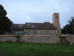
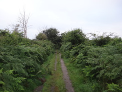
A long track led towards Dunwich church, from where a road led past the museum and the village hotel into the centre. The trail misses the beach car park and cafe, but I made a short diversion to the cafe so I could sit down and take stock. The usually-bustling car park was virtually empty aside from a fisherman carrying his gear onto the beach. I took my rucksack off on a bench and started rearranging the hastily-packed gear. The flysheet in particular was wet so I shook it out and then lay it on the patio to roll it up - a mistake as it picked up a sheen of coarse sand.
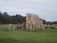
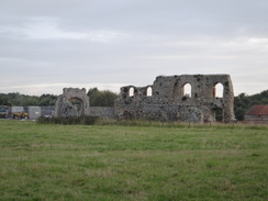
The cafe was not due to open for hours so I hefted my rucksack onto my back and returned to the trail in the centre of the village. The trail takes a rather unnecessary climb through woodland before descending nearly back to the road once more; the climb used to be the start of the clifftop path, but the trail has been diverted due to erosion. Another diversion soon followed as the trail passed the ruins of Dunwich Priory which is now near to the cliff edge. The small hamlet of Dunwich was once a large and thriving port, most of which has now been lost to the sea.
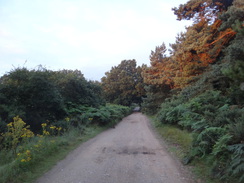
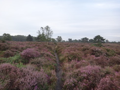
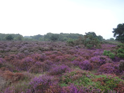
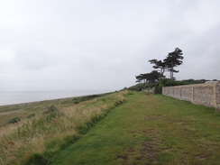
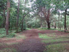
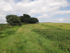
After joining a road, the trail headed through some woodland before crossing Dunwich Heath. I always enjoy walking across this stretch of heathland, but today it was particularly special as the heather was in empurpled bloom. Sadly there was a slight drizzle in the air, but the view was still spectacular despite the lack of sunshine. I gave Sencan a phone as I passed the old coastguard cottages on Minsmere Cliffs, an area that had also not yet woken up for the morning. It was great to chat to her for a while as I descended down the hill onto the foreshore.
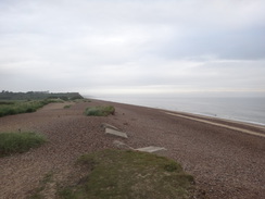
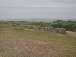
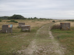
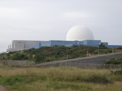
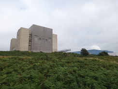
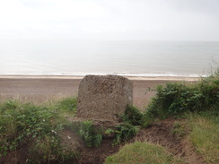
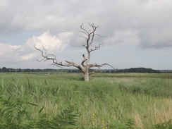
This stretch of walk was flat as it followed the rear of the beach that protected the low-lying Minsmere Nature Reserve from the sea. Sadly the sand and gravel proved energy-sapping to walk on with a heavy pack, and so I diverted from side to side to try and find firmer areas of sand. The giant white dome of the Sizewell B power station dominated the view ahead, and behind it lay the rather less attractive concrete hulk of the older A power station. I passed lines of concrete anti-tank blocks, remnants of the many defensive structures that were built on this stretch of coast during World War Two.
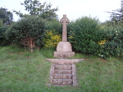
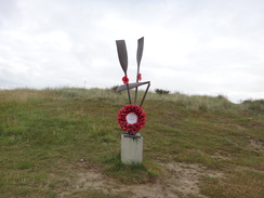
Slowly the path underfoot became firmer and grassier, giving me an easier stroll. I passed the power stations and their associated buildings. The A power station is now being decommissioned, but the B power still has a long life ahead of it. Shortly afterwards the trail climbed up into a car park and passed a cafe. Although the cafe was not due to open for a while it seemed like a good spot to stop, so I sat on a bench for a while and studied a memorial that stood nearby. It comprised of a series of oars standing vertically, one of which was broken: it commemorated the 32 Dutchmen who attempted to row the 130 miles across the North Sea in 1941 to escape the German occupation. Sadly only eight of the men made it to land at Sizewell Beach, and the monument was a sombre if fitting memorial to their brave task.
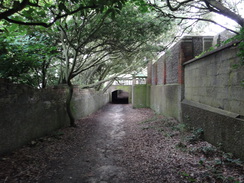
It did not seem worth waiting longer for the cafe to open, so I continued south along the trail. This climbed up onto the low cliffs and passed by what appeared to be a rather well-appointed caravan site. Shortly afterwards it dipped under a long concrete tunnel, above which was situated a patio belonging to a Hall. Steps led down from the patio towards the beach; it was a curious feature, and I wondered how long it would last before it too was claimed by the sea.
Shortly afterwards a sign indicated that the trail headed inland. I had walked the coastal path the previous year with no problem, and this was obviously a diversion due to feared coastal erosion. A path led through trees to a track that also carried the Sandlings Walk; this was significantly more rutted and damaged that it had been last year, and I had to take care in a couple of places to avoid large puddles.
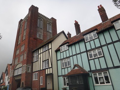
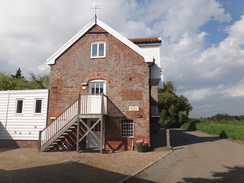
The Sandlings walk was soon left behind as another track took me down into Thorpeness. This village's rather strange architecture is a result of it being built between the wars by the Ogilvie family, whose ideas were charming: the village is not as manic or weird as Portmeirion, but has a rather pleasant air. The different styles of buildings do not seem out of place as expected, aside from the spectacular 'House in the Clouds', which disguises a water tower.
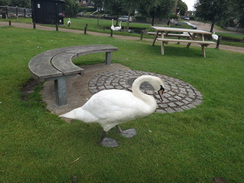
The cafe in the village was open, and I stopped off to buy a bacon sandwich and a hot chocolate. I sat outside and watched the very friendly and well-fed swans waddle around between the benches. It started drizzling once more, but I decided to risk carrying on without my coat. I had walked the next few miles of trail a few times before and knew it well. Initially it followed the shingle bank south from Thorpeness towards Aldeburgh, but instead of visiting that friendly town it headed off inland across a flood bank past marshes, and over an old railway trackbed.
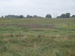
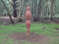
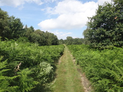
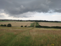
The next couple of miles were rather uninteresting, if only because I had walked them several times before: the trail crossed a golf course and followed a track to reach the main road leading into Aldeburgh. There was no pavement alongside the road and it was busier than I remembered it, but the verge was wide enough to allow safe passage. It was a relief when the trail left the road and joined the old Sailor's Path, which heads westwards parallel to the northern bank of the River Alde, which always remained firmly out of view. I remembered this couple of miles fondly, and it was as rewarding as I remembered: after crossing some low-lying marshland it entered Black Heath Wood, which has some clay sculptures within it. There did not seem to be as many of these as I remembered, but a tall sculpture was still present and complete.
Eventually the trail burst out of the woods and continued along a track towards Snape. Just before it reached a road, the trail followed a path past some heathland to reach the northern bank of the Alde. The next stretch was along a flood bank alongside the river. Another bank stood a few yards away across the water, but this was broken in a couple of places, although the OS map still shows a right-of-way crossing it. Anyone attempting to walk that particular path would have a hard task ahead of them, and perhaps it would be better for the authorities and the OS to acknowledge the path is now impassable.
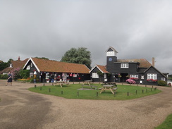
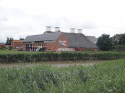
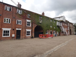
I saw a strange phenomenon as I stood on the flood bank; a low ripple of water heading up the river. This was, I assume, a tiny tidal bore caused by the changing of the tides. It was low and barely noticeable, and sadly was not visible in any of my photographs. Soon the massive buildings of Snape Maltings grew ahead as I approached. The industrial purpose of these buildings has now been replaced by a concert hall, and the whole complex has become a tourist honeypot. After crossing Snape Bridge I made my way to the pub and dropped my rucksack off on a bench outside.
This pub is rather posh, and was busy with people eating. Well aware of my muddy, dishevelled and more than a little smelly attire I went in and ordered a drink. The staff were very friendly and I considered ordering some food; however I was not particularly hungry and did not want to spend the money on their highly-priced, if lovely, food. Instead I sat outside for a wheel as I slowly rehydrated. I used the time to check up The Froize pub at Chillesford, near which I intended to wildcamp. Sadly it turned out that the pub was now a restaurant and would not be open this evening. I spent a few minutes reconfiguring my plans. It was still early in the afternoon and there was plenty of time left for me to walk further, so Chillesford seemed to be a minimum target. The barmen kindly topped up my water bottle once again and I headed off along the trail.
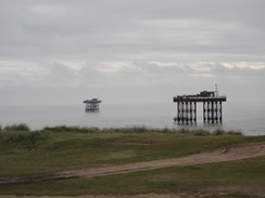
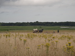
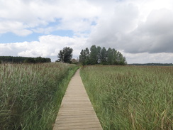
It followed a road for a short distance before joining a path that headed behind the maltings complex. Some construction work was being done near the large car park, presumably the conversion of more of the complex to some other purpose. The path soon started paralleling the southern side of the Alde; what appeared to be a horse and cart was standing near to the river, although its motionless stance made me wonder if this was real or just some form of statue. A stretch of boardwalk crossed a boggy area before the path ran along the shoreline. Some kayakers were paddling upriver; these had been hired from a little hut that houses a well-stocked canoe and kayak hire shop.
Soon the main trail left the shore, whilst the Orford loop continued along. My route reached a road and continued uphill. I had felt fine on the walk along the shore, but this rather uninspiring stretch of farmland lowered my spirits somewhat. This got worse as the trail crossed another road and plunged into some woodland. I immediately took the wrong path and had to turn back and guess the right route to take. Fortunately I guessed correctly and was soon striding through the trees. Eventually the trees ended and I reached the road in Chillesford opposite The Froize. As expected this was shut, so I walked up to the road and sat down on a bench at a bus stop. Soon I was lying down on the bench with my boots off, airing my feet as I let the sun soak into my skin.
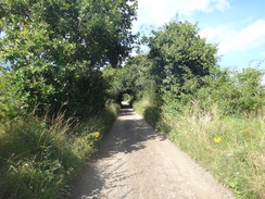
I had reached my target for the day, but I still felt fit and had many hours of daylight left. It was too early to find a campsite for the night and a quick glance at the map made me decide to camp somewhere by the remote banks of the Butley River another few miles on. I shrugged my rucksack onto my back and followed a road down towards Butley Mills. Fragmented memories returned from when I had walked this route ten years before, including some views of the mills and a tall sculpture of a flower emerging from a broken pot.
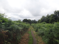
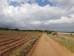
A long and boring track took me southwestwards past what my nose told me was a large piggery; some silos at the farm were marked as containing feed for 'lactating' and 'dry' sows. It was hardly the most scenic stretch of trail and my feet soon started niggling me once more. It was a relief when the track curved to join a road at Butley Low Corner; I followed this for a short distance until I found a couple of ladies talking over a garden gate. Sensing an opportunity, I asked if they could fill up my half-empty water bottle. The householder kindly did so as her dogs yapped around my feet, and I thanked her profusely before continuing along the trail.
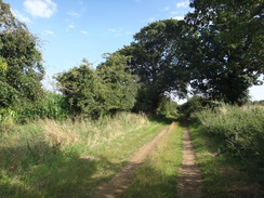
I was now reaching a remote area, and soon I was in campsite-hunting mode. A track led past some woodland before curving to head towards Burrow Hill. Although it is only ten metres high, the low-lying surrounding land made the hillside look impossibly steep for tired legs. Fortunately it was not as bad as it looked and I was soon on the flattish plateau at the top of the hill. I considered camping at the top of the hill, but it was quite near a farm and I still felt fit enough to continue. Instead I descended down the hill.
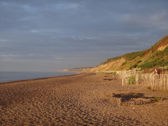
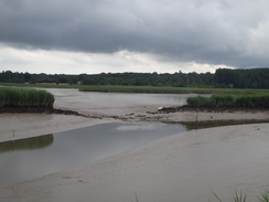
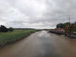
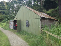
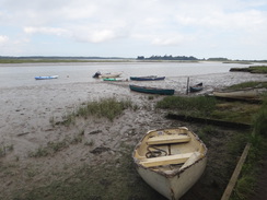
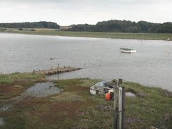
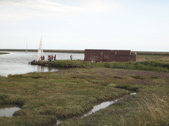
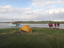
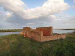
A short stroll took me to the western bank of the Butley River next to the hut used by the Butley Ferry, allegedly the smallest licensed ferry in Europe. This only operates at weekends over the summer season, and so the area surrounding the hut and the small jetty was deserted. I started following the flood bank south; after half a mile a low roofless brick building became visible on the left. This was Boyton Dock, from where limited amounts of clay and corprolite were exported in the past. A few people were milling around and there was a small yacht moored by the dock; I descended to the flat area of grass and asked if they minded if I joined them.
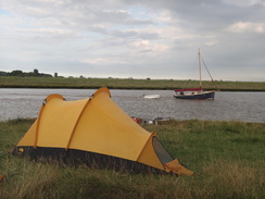
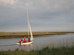
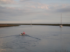
I lay down on the grass as children played around me; unlike the previous night's sleep there were no flies around, and the views up and down the river were superb. I took my time putting my tent up as some kids mudlarked. One family left, and I chatted to the others as sausages sizzled on a barbecue. Eventually they loaded up their yacht and motored away, leaving me to finish erecting my tent and cook my own dinner. I had just finished eating when a dinghy motored up to the dock and a man carried a dog up the ladder; he was from one of the yachts moored in the river and had to take his dog for its evening stroll.
Once he left I was on my own, and I watched the sun going down over the flatlands to the west. This was a far better place to wilcamp than the insect-ridden site I chose last night, and I went to sleep happy at a long and rewarding day's walk.
 |
 |
|
Directions
This walk starts off from a track at TM474718, immediately to the north of Little Dingle, where I had camped for the night. Head south down the track, soon crossing a cattle grid near Little Dingle. After about three-quarters of a mile the track passes The Phoenix Centre (based near a farm) and ends at a T-junction with a road. Turn left down this road and follow it as it swings to the left, passing Dunwich church on the right. Continue eastward along this road for a quarter of a mile until it passes the Ship Hotel on the right and swings to the right at a triangular junction. At the junction, turn left for a few yards to reach the road that leads down to the beach and car park.
Cross the road leading down to the beach and then head straight on along a footpath that climbs uphill through an area of woodland. The path curves to the right and climbs steps; however cliff erosion means that the path is soon diverted. When the path forks, take the right-hand branch that leads down some steps to end at a junction with another path. Turn left to follow the path as it skirts a fence on the right. It approaches the ruins of a friary and turns to the right, with some woodland on the left; after a short distance it turns to the left to enter the woodland. When the path forks after a few yards, take the wider right-hand branch. This path heads through the trees before ending at an unpaved track, with a small bridge on the left. Turn right to head westwards along the track through the trees; it passes through a gateway to reach a bend in a road at TM473700.
Continue on westwards along this road for a short distance and then turn left down a gravel track. This curves to the left and then right through the trees to head in a rough southerly direction past houses; after passing the last house it becomes a path. Go through a bridleway gate and follow the path as it curves to the right and crosses a track, heading southwestwards before ending at Minsmere Road at TM473693.
Cross the road and continue southwestwards along the road for a quarter of a mile until a junction with another track is reached; here turn left to follow a path that heads south-southeastwards across Dunwich Heath. The path heads through bracken and joins a track; turn left along this and when it immediately forks, take the right-hand branch which soon curves to the right and then sharply to the left.
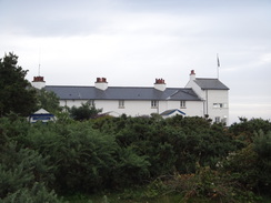
Continue along the obvious path, aiming for the white coastguard cottages that become visible ahead. The path ends at a clearing beside a track near some picnic benches; here turn left along the track to join a surfaced road beside the Coastguard Cottages at TM476678.
Turn right and follow this track past the cottages; as it curves to the left turn right past a vehicle barrier to continue straight on down a sandy track. Leave the track at the bottom and turn half-left to follow a good footpath that runs south with a flood bank off to the right. Follow the path as it heads southwards behind the beach for two and a half miles; the path splits on several occasions; just roughly follow the dunes and beach on the left, or walk along the beach itself. Shortly after passing the massive Sizewell nuclear power stations, the path curves to the right off the track to join an area of boardwalk that leads on to some steps that climb up to a car park. Turn left through the car park to end at the road at Sizewell Gap (TM475628).
Continue straight on along the road past houses on the right; as the road soon curves to the right towards the Vulcan Arms, continue straight on along a gravel track. As this curves to the right towards a house, turn left to continue straight on along a grassy path that passes behind some huts before climbing up onto the low cliffs. It follows a fence guarding a caravan site on the right and then passes through a tunnel that heads under the patio belonging to Sizewell Hall, after which it follows a wall on the right.
Shortly after this the clifftop path is subject to erosion, so the official route turns right to run just inside a band of trees, passing two curious circular huts on the right. The path curves to the right to join a track leading away from a house, and shortly afterwards ends at a T-junction with a track at TM473617, with the end of a public road on the right.
Turn left and follow this track as it heads in a rough southwesterly direction; it crosses a track and then curves slightly to the right. Nearly half a mile after joining the track turn left down another, smaller track that heads southeastwards. This passes an area of woodland on the left. When a track is reached at the end of the woodland, turn right to follow this new track straight on across Thorpeness Common. When the path forks at about TM472603, take the minor left-hand branch that heads across the common to reach the northern outskirts of Thorpeness.
This track soon joins a better track; turn left down this to meet another track. Turn right down this track and then immediately left down another which runs between houses before ending at a bend in a road in Thorpeness. Cross the road and continue along a gravel track called The Sanctuary, which runs south-southwestwards between houses before ending at the B1353 road in Thorpeness at TM471595, with a lake called The Meare away to the right.
Turn left and long the road for a few yards, and then right down another road, passing the Beach House on the left. Immediately after this turn left to enter a car park, then turn right through the car park. At the end of the car park turn left to join a path that heads along a boardwalk, passing between cottages to reach the beach. Walk southwestwards along the beach, initially passing a series of houses on the right. When the houses end, angle slightly to the right to head towards a road, aiming to join it at TM467582.
Carefully cross the road and continue westwards along a good path. This initially runs between hedges before joining the top of a flood bank with a ditch to the left. The flood bank ends and the hedges restart as the path curves to the right and then the left. The hedges end on the left-hand bend, and the path continues southwestwards between fences before descending down to cross an old railway cutting. Turn left for a few yards along the old cutting, then right to climb up the other side. The path joins a good-quality track that heads southwestwards past some large houses on the left, becoming firmer and better-quality as it goes, eventually ending at the B1122 road at TM456580.
Carefully cross the main road and go through a pedestrian gate to join a footpath that continues southwestwards on the other side, squeezing through a narrow band of scrubland to reach a golf course. The route across the golf course is well marked; just head straight across. At the other side of the golf course, go through another pedestrian gate to reach a track; turn right to follow it southwestwards for a third of a mile until it reaches the A1094 at TM450575.
Turn right and follow the main road northwestwards for a little over half a mile; there is no pavement, but the verges are generally wide enough to allow you to safely avoid the traffic. Near the South Warren car park at TM442581, turn left to join a sandy track. Follow this track as it passes some cottages on the left. When the track turns left into the last cottage continue straight on for a short distance along a grassy path until it meets another track. Turn left down this track and follow it as it heads through the Cliff Plantation.
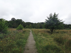
As the track curves to the left, continue straight on along another footpath. The path goes through a clapper gate beside a field gate and continues on. It approaches a house on the left and then curves to the right to reach a footbridge guarded by a pedestrian gate. An area of marshy land is crossed, with boardwalks and footbridges carrying the path over the worst bits, before the path enters Black Heath Wood.
Follow the obvious path through the woods westwards; the track becomes surfaced after leaving the woods and 2.6 miles from the car park approaches a surfaced road at TM401583. Just before the road is reached turn left down a footpath that heads southwards down a narrow path, initially with a fence guarding a house on the right. When this path approaches the northern bank of the River Alde after half a mile, turn right and follow the northern bank of the river as it winds westwards for two-thirds of a mile until it meets the B1069 road to the south of Snape at TM391576.
At the road turn left and cross the river Alde on the road bridge. On the southern side of the river pass the Snape Maltings and continue along the road up a slight hill, then turn left down another road. Stay on this for a few yards and then turn left through a gap in a hedge to join a footpath that passes the malting complex and its car park on the left, heading back towards the estuary. As the hedge on the left ends, the path curves to the right to take a more southeasterly course between fields.
At the end of the field go through a hedge to join a boardwalk through the reedbeds. This crosses a footbridge and joins trees on the left and a field on the right. Follow the edge of the field on the right and go through some trees to join another boardwalk. When the boardwalk ends a good path continues on; this curves to the right and the left to head east-southeastwards alongside a hedge on the left.
The path goes through a hedge and passes a car park and picnic area before continuing along a track with a fence on the right. It passes a weatherboarded hut on the right and then curves slightly to the right. When it meets a track turn left along the track, and then immediately left again to follow a path with a hedge on the left and a house on the right. This path joins the foreshore of the river, and this stretch may be impassable at high tides. The path is narrow in places as it skirts below a wooded hillside on the right; it passes a little hut that hires canoes and continues on. When the trees on the right end, turn right up some steps to join a path. This path ends at a track, turn left up the track until it ends after a short distance at Tunstall Road at TM403559.
Turn right down this road for a few yards, then left along a track with a fence on the left. This heads downhill to the south, soon curving to the left in front of a barn. Shortly after the bend the track becomes surfaced. Pass some trees on the right and then turn right along another track with a reservoir out of sight through the trees. The path passes a barn on the left and follows the trees uphill to the southwest before curving to the left, still with trees on the right.
When the trees end the path meets a track. Turn right to head south, still following the trees on the right. When they end, turn right through a gap in the trees, and then immediately left through a gap in another hedge to head south-southeastwards along a track with a field on the right. At the end of a second field the path goes through a band of trees ahead and then turns sharply to the right to follow a band of trees southwestwards. When the trees on the right end, the path curves to the right and then immediately left. After a short distance it goes through another band of trees to reach a road at TM402542.
Cross the road and take a path that enters trees on the other side; almost immediately turn left down a minor path. This heads southwestwards through the trees; when it forks take the left-hand branch. This path soon joins a wider track. Turn left down the track, and when it curves to the right after a sixth of a mile continue straight on along a path through the woods. The path meets another track below power lines; continue straight on until it passes a fence to reach the B1078 road at TM395532.
Carefully cross this road and follow a bridleway through the woodland. After a quarter of a mile the path emerges from the trees and continues along the edge of a field, becoming a track. At the end of the field cross through a gap in a hedge and turn right to follow a track westwards. When a junction is reached with another track after 250 yards, turn left to follow this track south until it ends at a T-junction with the B1084 road in Chillesford at TM390522.
Turn left to follow the B1084 westwards for a quarter of a mile, and then turn left along Mill Lane. This winds in a rough southerly direction, passing Butley Mills. After half a mile, turn left on a bend to join a rough track. This heads south-southwestwards, passing Low Farm on the left. Shortly after the farm the main track curves to the right; here head straight on along another track. A mile after leaving Mill Lane the path passes Carmen's Wood on the left, and then curves to the left to join another track that heads south-southeastwards. After a few hundred yards this track ends at a road in Butley Low Corner at TM739496.
Turn left along the road and follow it past a few houses until it soon ends near Coulton Farm. When it ends, turns right to join a track that heads southeastwards. After a quarter of a mile it curves slightly to the left and passes the western edge of Bush Covert; ignore other tracks leading off on either side. When the trees end the track curves away to the left; here continue straight on across a low-lying field for 0.3 miles as the flank of Burrow Hill appears ahead. The path goes through double field gates to climbs steeply up the flank of the hill to reach the plateau at the top.
Cross the plateau southwards, then go through a field gate and follow a track that curves slightly to the right to head due south down the slope. Cross a stile beside a gate at the bottom of the hill and turn left along another rough track. This track heads eastwards for a couple of hundred yards towards the flood bank ahead. Go through a field gate to immediately reach a stile beside another gate. Pass a hut on the left and then climb up a flood bank at TM391481, with the ferry landing across the Butley River ahead. Turn right to follow the floodbank south for half a mile until the ruins of a brick building are reached at Boyton Dock at TM392474, where this walk ends.
 |
 |
|
Distances
| From | To | Distance (m) | Ascent (ft) | Descent (ft) |
|---|---|---|---|---|
| Dunwich Forest | Sizewell Car park | 7.1 | 210 | 217 |
| Sizewell car park | Thorpeness | 2.5 | 66 | 72 |
| Thorpeness | Snape Maltings | 6.8 | 161 | 161 |
| Snape Maltings | Chillesford | 4.9 | 164 | 144 |
| Chillesford | Boyton Dock | 3.7 | 115 | 135 |
This makes a total distance of 25.0 miles, with 716 feet of ascent and 729 feet of descent.
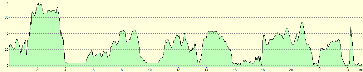
For more information on profiles, ascents and descents, see this page
Accommodation
I spent the night wildcamping at Boyton Dock beside the Butley River; this was a wonderful spot for a wild camp, aside from the lack of fresh water.
 |
 |
|
 |
 |
|
 |
 |
|
 |
 |
|
 |
 |
|
 |
 |
|
 |
 |
|
 |
 |
|
 |
 |
|
 |
 |
|
 |
 |
|
 |
 |
|
 |
 |
|
 |
 |
|
 |
 |
|
 |
 |
|
 |
 |
|
 |
 |
|
 |
 |
|
 |
 |
|
 |
 |
|
 |
 |
|
 |
 |
|
 |
Disclaimer
Please note that I take no responsibility for anything that may happen when following these directions. If you intend to follow this route, then please use the relevant maps and check the route out before you go out. As always when walking, use common sense and you should be fine.
If you find any information on any of these routes that is inaccurate, or you wish to add anything, then please email me.
All images on this site are © of the author. Any reproduction, retransmissions, or republication of all or part of any document found on this site is expressly prohibited, unless the author has explicitly granted its prior written consent to so reproduce, retransmit, or republish the material. All other rights reserved.
Although this site includes links providing convenient direct access to other Internet sites, I do not endorse, approve, certify or make warranties or representations as to the accuracy of the information on these sites.
And finally, enjoy your walking!
Nearby walks
| # | Title | Walk length (miles) |
|---|---|---|
| 131 | Ipswich to Wickham Market Station | 16.7 |
| 132 | Wickham Market Station to Darsham Station | 12.7 |
| 135 | Darsham Station to Brampton Station | 12.3 |
|
|

|