Walk #944: A circular walk between St Ives, Warboys and Somersham
 |
 |
|
General Data
| Date Walked | 27/01/2012 |
| County | Cambridgeshire |
| Start Location | St Ives (Cambridgeshire) |
| End Location | St Ives (Cambridgeshire) |
| Start time | 08.06 |
| End time | 16.39 |
| Distance | 25.2 miles |
| Description | This walk sets off from St Ives to join the Pathfinder Long-Distance Route in Houghton. It then takes a long loop northwards, passing through King's Ripton, Broughton and Warboys, before starting to head southeastwards to Somersham, Colne, and Bluntisham. After this it joins the River Great Ouse for a short distance before joining the guided busway on the outskirts of Swavesey, which can then be followed for the last three miles back into St Ives. |
| Pack | Today I carried my 30-litre Karrimor rucksack, filled with water, my waterproofs, a book and other odds and ends. |
| Condition | I feel very tired after this walk, but have no significant problems to report. |
| Weather | The weather today was bright and sunny, with a fairly stiff breeze from the northwest. It started to cloud over as the afternoon wore on, but the heavy rain only started once I was driving back home. |
| OS map | Landranger number 153 (Bedford & Huntingdon, St Neots & Biggleswade), Landranger number 142 (Peterborough, Market Deeping & Chatteris) and Landranger number 154 (Cambridge & Newmarket, Saffron Walden) |
 |
 |
|
Map of the walk
Maps courtesy of Google Maps. Route for indicative purposes only, and may have been plotted after the walk. Please let me have comments on what you think of this new format. For a detailed table of timings for this walk, please see the table file.
 |
 |
|
Notes
I have had some significant problems with my feet during the last couple of walks, and so I was rather nervous about this walk around the northern half of the Pathfinders Long Distance Walk. It did not take long to drive to St Ives, and it cost only a couple of quid to park in the car park by the bus station. The skies were clear as I headed through this pleasant town and - joy of joys - a bakers' shop was open so I could nip in to get a couple of sausage rolls to munch on as I walked.
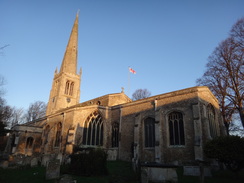
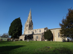
For the first couple of miles I was following the Ouse Valley Way to Houghton, where I had left the Pathfinders Trail on the previous walk. It took me past the parish church, where apparently the spire has been rebuilt many times, including once after an aircraft crashed into it, and followed a steady stream of schoolchildren heading along the path. A woman ran past pushing a pram with a young child in it; she soon came past heading in the other way - it looked like far too much like hard exercise for my liking.
A good path took me along the path, initially with the river off to the left. It was a pleasant walk along a rough-surfaced, path that eventually led me past Houghton Mill's campsite to reach the centre of Houghton. The post office was open so I bought myself a few snacks before heading off along the Pathfinders Trail. Sadly this part of the trail is mostly along roads, and after crossing the main road another minor one took me uphill, with some good views unfolding behind and to my left. Care had to be taken as there was some ice in sheltered spots of the road, and so it was a relief when the road met the B1090 opposite RAF Wyton.
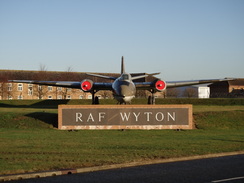
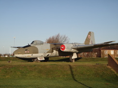
The stroll along the pavement was fairly uninteresting, although there were occasional good vistas off to the left. Soon after passing right past a large water tower - like most in the area painted brilliant white - I came to a roundabout at the entrance to the RAF base. One of my favourite aeroplanes is the Canberra, and it was good to see an example as the gate guard for the base. I went up to it to take some photos and noticed a sign telling drivers approaching the guard house to turn off their headlights, presumably to stop the guards from being glared. The Canberra on display - XH170 - entered RAF service in 1960 and was based for most of its life at this base.
A training aircraft - a Tutor - was flying circuits overhead as I walked on. Sadly the base is not particularly busy nowadays and large aircraft rarely fly from it, but it is good to see that some flying still goes on. After crossing a main road another road took me past some laboratories that were guarded by larger fences than those of the RAF base, with several rolls of razor wire making it extra secure. I assume, although have no proof, that this is the home of Huntingdon Life Sciences, which has been the target of animal right activists over the years.
Soon a track took me off the road towards a farm, after which the first unpaved path led towards the village of Kings Ripton. It skirted the main part of the village before passing close to the picturesque little church and leaving the village. A footpath headed northeastwards out of the village following a stream past what were very large fields, one nearly a kilometre in length. I went slightly wrong on the last short stretch that headed uphill to reach the village of Broughton, having followed the wrong side of a fence.
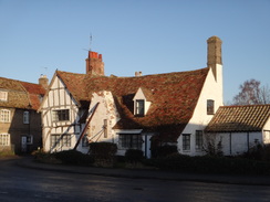
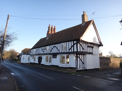
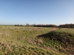
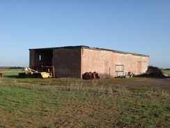
This was another Cambridgeshire village that I had never visited before and I found it a pleasant place, with a pub next to the church and an unusual feature, a village lock-up where drunkards and ner-do-wells would be locked up. A lane led me out of the village before paths took me across a bumpy area of ground - marked on the map as being an old moat - before leading up towards the old Warboys airfield. The going was muddy in places and it was a relief when I finally joined the old perimeter track around the airfield.
Soon a high-pitched whirring became visible overhead and I came across an area of grass that is used by a model aircraft club, small scale having taken over the airfield from their larger prototypes. A sign warned walkers to ring a bell to allow the pilots know you presence, but no bell could be seen. Instead I walked on as a large model performed spectacular aerobatics overhead - there was obviously an expert in control.
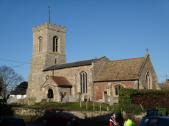
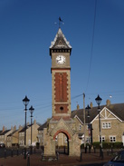
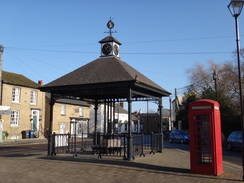
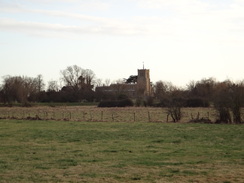
Sadly the signage was not too good around the airfield and I ended up taking the wrong track towards the road; this was no real problem and I soon rejoined the trail as it headed past the large church to enter Warboys. This was too large a village to be truly attractive although there were some pleasant features, such as a clock tower. It was just before twelve and I was tempted to wait for a pub to open so that I could have a rest, but instead I pressed on, keen to reach my 12-miles-by-midday target. I achieved this with just a couple of minutes to spare as the trail plunged downhill out of the village onto the outskirts of the Fens.
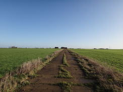
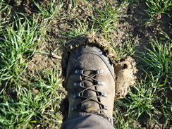
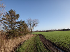
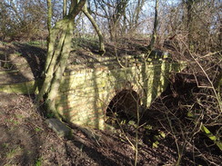
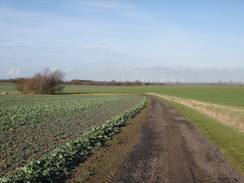
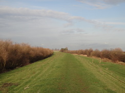
Unfortunately this meant that the going became muddier as the trail crossed fields, some of which had been ploughed. Soon I had inch-wide cakes of mud on my boots and my feet felt far heavier than usual. It was tough going that only ended when the trail reached a minor road. This took me up towards Sidings Farm. As the name suggests this was on the course of an old railway line; in this case the Ramsey East to Somersham line. This opened in 1889 and closed completely in 1964, the last passengers having been carried in 1930. The trail followed the old trackbed for quite a distance as it crossed a golf course; sadly there were no indications of the railway until the very end, when a brick culvert carried a stream under a low embankment.
A winding path took me southeastwards into Somersham. By this stage I was starting to feel a little tired but none of the pubs seemed to be open, so I satisfied myself with nipping into a shop to buy a bottle of Ribena to ease my rapidly-depleting water supply. A track took me south and across the trackbed of the old St Ives to March railway line, which ran along a high embankment. Thankfully the going was far drier and less muddy than the earlier stretches and I found it easy to stroll along towards Colne.
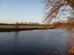
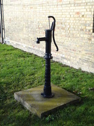
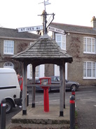
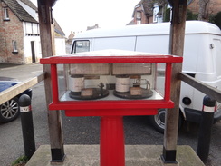
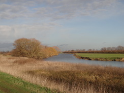
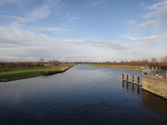
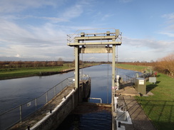
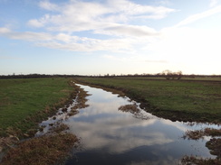
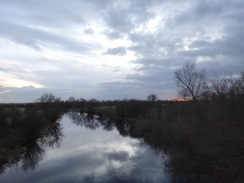
The trail skirts the village before joining a road to its south; this road is followed towards Bluntisham, where I was amused to find a weather station sitting under a covered wooden market cross. It was a pleasant addition to the scene and I studied at the paper traces before striding on. Soon the course of another old railway line was crossed as the trail head south to reach the western bank of the Great Ouse. This granted me some good views across the water until Brownshill Lock and Sluice was reached. Here the trail crossed the river, although the first footbridge over the floodplain was locked out of use.
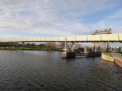
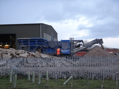
I spent a while at the lock as I walked around trying to get some good photographs, a task made harder by a large conveyer belt that spanned the river immediately upstream. This took sand and gravel from one side of the river to a plant on the other, and its noise was fairly intrusive. Soon I crossed another bridge across the floodplain and started walking south. After crossing a dead-end road the trail headed away from the river, crossing fields on the floodplain to reach a muddy track that took me down to the old Cambridge to St Ives railway line just outside Swavesey.
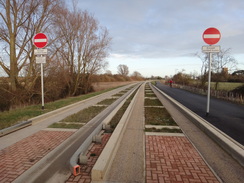
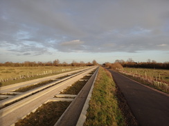
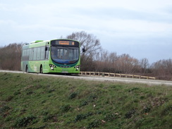
I had walked along this old trackbed many years before, when the tracks had been in place but overgrown with bushes that towered overhead. They had now been ripped up and replaced with a massively expensive guided busway. It had been my intention to get the bus back to St Ives, but as there was still an hour of daylight left it seemed sensible to just follow the track that runs along the busway instead. Many busses passed me as I strolled along, although I would have preferred to see trains running instead. I crossed the Ouse Viaduct over the river which was a new concrete structure, the graceful brick viaduct having been judged unsuitable for the busway. This marked my approach into St Ives, and I was soon heading through the town back to my car. It had been a good and long day's stroll, although hardly a classic walk.
 |
 |
|
Directions
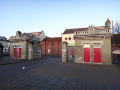
This walk starts off from the long-stay car park near the bus station in St Ives at TL316712. Leave the car park and head towards the bus station; pass through this and between two prominent stone gate posts to reach Market Road. Turn left down the road for a few yards to reach a crossroads; here turn right to start following Market Hill northwestwards. Continue along the road as it becomes the Broadway and then The Waits as it passes the Norris Museum on the left.
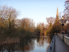
The road skirts the Great Ouse on the left; as the road curves to the right shortly afterwards continue straight on along a paved footpath that leads through the churchyard of St Ives Parish Church. The path squeezes between the church on the right and the river on the left before curving to the right to reach a gateway that leads out onto Church Street with a bridge over the river to the left. Ignore the bridge and the road, and instead turn half-left to take a narrow footpath that squeezes between a wall on the right and the river on the left.
After a sixth of a mile the path meets the end of a track at TL307717 beside a scout hut, with a school off to the right; here turn slightly to the left to continue on along the surfaced path. It skirts the river on the left for a while, and as the river curves away to the left continue straight on along the surfaced path through a wooded area called St Ives Thicket. It emerges from the trees and continues on west-northwestwards; a junction with another track is reached a mile after the scout hut.
Turn half-left; do not take the footpath that heads off to the left. Follow the surfaced path as it curves to the right to continue westwards; the path becomes a surfaced track that passes gardens on the right; after a fifth of a mile it curves gently to the right. As it does so turn left up a footpath with a fence to the right; this soon curves to the right and continues westwards with the fence to the right and the Houghton Mill campground to the left. After a fifth of a mile the path emerges onto Mill Street directly opposite Houghton Church. Turn right to head north along Mill Street for a short distance until the centre of Houghton is reached at TL281721.
Pass the Three Horseshoes pub on the right and continue north along St Ives Road. This curves slightly to the left and after a fifth of a mile ends at a T-junction with the A1123. Turn left to walk west along the road for about fifty yards; there is a pavement on the left-hand side of the road. When Mere Way comes in from the right, carefully cross the main road and start following Mere Way northwards. It heads uphill for a little over half a mile before it ends at a T-junction with the B1090 road at TL284734.
Carefully cross the B1090 road to access the pavement on the other side, then turn left to start following the road northwestwards. After a third of a mile it passes a large water tower to reach a roundabout at the entrance to RAF Wyton; continue on along the B1090. Sadly the pavement soon ends and you have to continue along the verge. Two-thirds of a mile after the roundabout, the road swings to the left and then right to reach a roundabout with the A141 at TL272745. Care needs taking in cross the main road; once across continue straight on along the B1090. There is no pavement, but the verges are wide and the traffic is light. After a mile turn right, skirting past some gates to join a track that heads northwards towards Glebe Farm with a hedge on the left and a field on the right.
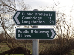
When the track curves to the right after a third of a mile, turn left through a clapper gate. Continue across a paddock with a hedge on the left for about ten yards to reach a second clapper gate. Go through this and on the other side head across the middle of a field towards some housing ahead. When a fence is reached turn right to keep the fence on the left; when the fence ends continue on across the field towards the church tower. A hedge soon starts on the left. At the end of the field turn right for about ten yards and then left down a path that runs between gardens to reach a gate that leads onto a road in Kings Ripton at TL261765, with the church to the left.
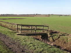
Turn right down the road for a few yards, then turn left down a footpath that heads between hedges and a fence to reach a clapper gate. Go through this and follow a hedge on the left across a field to reach a wide bridge over a stream. On the other side turn right to start following the stream on the right. It soon passes through a gap in the hedge ahead and then passes Glebe Farm before curving to the left to take a more northwesterly course. Keep the stream on the right for three-quarters of a mile until the path curves to the left at the end of the field to reach a footbridge over a ditch on the right.
Cross the footbridge and a gate on the other side. Turn right and then immediately left to continue along the path with a hedge on the right. It passes the end of a ditch on the left before reaching a stile beside a field gate in a hedge ahead (TL276774). Cross the stile into the corner of a field and turn left to start heading uphill northeastwards, angling slightly away from the hedge on the left. At the top of the field cross a stile and head on to up the field to reach a second stile across a fence. Cross this and head on towards a double-stile through a hedge. Cross this and continue on directly across a paddock to reach a gate. Go through this and follow a path that runs between gardens; the path ends at School Road in Broughton at TL279779.
Turn right to follow School Road towards the church; when it ends at a T-junction beside the church turn left along another Causeway Road, which passes the end of the church and the old village lock-up on the right. Continue along this road as it winds before curving to the right to head towards a bridge over a stream. Just before the bridge is reached turn left down a track called Illings Lane. This soon curves to the left before passing Illings Farm on the left. Soon afterwards the surfacing ends and the lane curves sharply to the left.
Do not follow the lane around to the left, and instead cross a stile beside a field gate to enter a bumpy field that once contained a moat. Cross the bumpy field to reach a stile across a fence as the old buildings on Warboys airfield become visible on the hill ahead. Head straight on across another field to reach a footbridge across a ditch. The path the climbs up a slight slope towards a hedge; at the end of this field the path crosses a long footbridge. On the other side turn half-left to head across a field. The path crosses a track and a narrow field to reach another track that was part of the old Warboys airfield perimeter track.
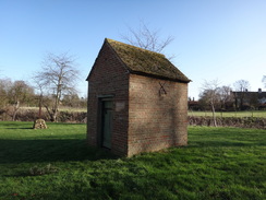
Turn left and follow the track as it immediately curves to the right. The track curves around; it becomes wider before it approaches two small brick buildings. Immediately in front of the buildings turn left to skirt in front of them and head across the field, aiming for a small square of trees. Skirt to the left of the trees and follow the path as it heads along a wide strip between two fields. The path curves to the left along a green track that curves to the right to join a rough track. Do not turn left down the track and instead turn right to follow the rough track southeastwards. There is a grassy path beside the track that is easier to walk along.
After half a mile the track curves to the left before ending at a T-junction with the B1040 road at TL302794. Turn left to follow the B1040 northwards; there is a pavement on the left. It passes Warboys Church and after a third of a mile reaches a triangular junction beside the clock tower in Warboys. Take the right-most branch to follow the road eastwards through Warboys. When a junction is reached after a third of a mile beside the village sign and pond, continue straight on up the High Street until it ends at a T-junction with Station Road at TL311802, with the Royal Oak pub to the right.
Turn left to head north along the road for a short distance before turning right down Wilthorne Road. Follow this as it curves to the right; immediately after the bend turn left down a surfaced path that runs between gardens. At the end of the path go through a gate and carefully cross the A141 road to reach a gate on the other side. Go through the gate and angle half-left to reach a footbridge over a small ditch. Cross this and then head straight on with a hedge on the right as views unfold ahead. When a little ditch is reached turn right along a path through some rough scrubland. Soon this curves to the left to emerge into a field beside a bench.
Follow the path downhill to the east with a ditch to the right. At the bottom of the field cross a footbridge over a ditch and head straight on across a second field. At the end of the field cross a field bridge over another ditch and turn slightly to the left to head diagonally across a third field, angling away from the hedge on the right. This field ends at a footbridge over a drain; cross the bridge to reach a track on the other side. Turn left along the track for a few yards, then right through a gap in the hedge and start following a hedge and ditch on the right. The track becomes firmer and curves to the right as another track comes in from the left; shortly afterwards turn left along another track called Buss Drove which follows a drain to the right.
Buss Drove continues east-southeastwards. After half a mile a junction with another path is reached; here turn left to follow a hedge and ditch on the right. The path curves to the right and the left; shortly afterwards turn right down a path that runs between two fields. This then follows a hedge on the left. At the end of the field climb a bank to reach Fen Road at TL339795 beside Sidings Farm.
Turn left to follow Fen Road north past the farm; after 150 yards turn right down another track that carries a footpath through the middle of a golf course. The track heads southeastwards; when it peters out beside a wooden hut turn right through a gap in some trees, then immediately left to join a footpath that continues on through the trees. The path crosses a footbridge over a ditch and continues on to reach two sections of boardwalk. Continue on through the trees with the golf course off to the left; the path soon emerges out of the trees for a short distance before heading back in, following the old railway embankment.
At a footpath junction above an old underbridge turn right down the embankment and cross a stile into a field. Follow a drain on the left as the path heads southwards; it curves to the right and then the left to reach a clump of trees on the right. Shortly afterwards the path curves to the right to join an unsurfaced track. Continue on up a slight slope with a drain on the left. As it curves to the right towards some barns, turn left along a path that follows a ditch on the right. This passes under some power lines and then curves to the left to join an intermittent hedge. After a few yards turn right through the hedge to join another hedge on the left.
Follow the hedge east-southeastwards as the path joins a track. Skirt past a field gate and continue along the track; this curves to the right and then the left to become a surfaced lane that passes some houses. This lane eventually ends at a T-junction with King Street in Somersham at TL359779. Turn right down King Street for a few yards until it too ends at a T-junction with the B1086 High Street. Turn left and follow High Street eastwards for a short distance until a crossroads is reached beside the village cross in the centre of Somersham at TL360779.
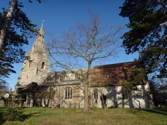
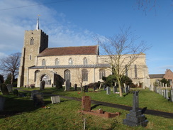
Turn right to head south down Church Street, passing Somersham Church on the right. Shortly after a road called Hammond way comes in from the left, turn left down a track that heads eastwards before turning right down a public footpath. This soon curves to the left to reach a clapper gate that leads into a field. Follow a hedge on the right as it curves to the right to reach two gates guarding a footbridge. Go through this and head along the field, still with the hedge on the right to reach a clappergate. Some steps on the other side lead up to the top of the embankment that once carried the old St Ives to March railway line.
Cross the trackbed and descend steps on the other side to reach a little footbridge that leads to a clapper gate. Go through this and follow a hedge on the right to a second clapper gate. Continue on along the path that runs between two fields; as the path curves to the right, cut left across a field to reach a little footbridge with handrails. Cross the footbridge and then follow a hedge on the right; at the end of the field the path curves to the right and then the left to follow an avenue of trees on the right, although these may soon be cut down.
When the field ends, cross a field bridge across a drain and continue straight on between two fields towards some barns ahead. Aim just to the left of some barns; pass the barns and continue on to reach a vehicle barrier. Pass this and then turn left along a track called Old Church Lane that crosses a bridge over a stream. Follow the lane; just before it curves to the left, turn right along a path. After a few yards turn left to follow a hedge on the left. The path crosses a little footbridge over a stream and continues on, skirting a wooden hut and some brick barns on the left. Immediately after the barns turn left down a concrete track to reach a road in Colne at TL370754.
Turn right to follow this road south for 0.4 miles as it enters Bluntisham. When this road ends at a T-junction turn right along East Street; this immediately curves to the left and continues on to reach a triangular junction with the High Street. Turn left to follow the High Street south for another quarter of a mile until it ends at a T-junction with the A1123 at TL367744.
Turn right for a short distance and then carefully cross the main road before turning left down a track that runs alongside a building. Follow a hedge on the right; go past a field gate and turn right along the course of another old railway line. Turn right to parallel the trackbed; the path soon curves to the left to follow a hedge on the right. Head on towards a water tower straight ahead. At the end of the field cross a ditch on a field bridge and continue on alongside a fence on the left. Continue on towards the River Great Ouse. Once it is met, turn right to start walking along the top of the flood bank.
Go through a clapper gate to cross a sluice beside a pumping station, then through a gate on the other side. Continue southwards along the flood bank for another third of a mile until a long white bridge across part of the floodplain is reached on the left. Either walk across the floodplain or along the bridge to reach some steps that lead up to the bridge over a weir and Brownshill Lock at TL369727. Cross to the eastern side of the river and then take a long walkway that leads across to reach a gate.
Cross a stile beside the gate to access the top of the flood bank. Turn right towards a large overhead conveyor, but before this is reached drop down to join a track to the left. Pass under the conveyor before turning right to climb back up onto the bank. Follow this southwestwards for nearly a mile until a pedestrian gate leads down onto Chain Road at TL362713. Cross the road and go through a clapper gate on the other side to rejoin the flood bank. Follow this southwards for another 250 yards; as the flood bank turns to the left turn right to cross Webbs Hole sluice gate to join another flood bank.
Follow the flood bank on the western side of the sluice; it curves to the left, then as it curves to the left once again continue straight on along another bank towards the river. About halfway along the bank turn left to cross a footbridge over a ditch and then turn half-right to head across the floodplain. Aim for the far hedge, about two-thirds the way between the low bank on the left and the river bank on the right.
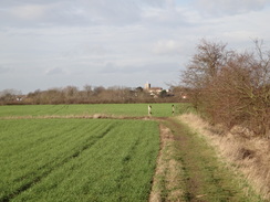
Cross a couple of stiles before crossing a footbridge over a ditch. Head on towards a church tower ahead. The path crosses an intermittent hedge line, then aim for a stile about thirty yards to the right of a couple of gates in the corner of the field. Cross this stile and pass a dewpond on the right before cutting across the corner of the field to reach a clapper gate. Go through this and climb some steps to reach a track called Middle Fen Drove.
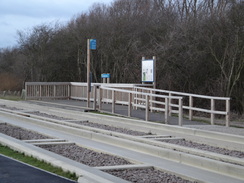
Turn right to follow this track south-southwestwards for a third of a mile until it climbs up to reach the guided busway that runs along the course of the old Cambridge to St Ives railway line at TL359695; carefully cross the busway to reach the cycle path on the other side. Here the walk leaves the Pathfinder Long Distance Walk. If you want to cut the walk short by three miles then you can turn left to walk the short distance to the Swavesey bus stop, from where regular buses travel to St Ives.
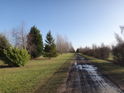
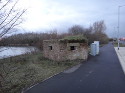
If you want to walk then turn right to follow the cycle path alongside the guided busway for nearly three miles; it slowly curves to the right to take a northwesterly course . It crosses a viaduct over the Ouse and continues past the St Ives Park and Ride site on the right. Shortly after passing a pillbox, turn right to cross two carriageways to reach a pavement on the northern side, then turn left to head along the pavement to reach the A1096 road on the outskirts of St Ives at TL317710. Cross the main road using the pedestrian crossing and continue along Station Road, passing a Waitrose Store on the right. Pass this, and just before the bus station is reached on the right, turn right into the car park where this walk started from.
 |
 |
|
Distances
| From | To | Distance (m) | Ascent (ft) | Descent (ft) |
|---|---|---|---|---|
| St Ives car park | Houghton | 2.6 | 72 | 66 |
| Houghton | Broughton | 5.5 | 171 | 135 |
| Broughton | Somersham | 7.7 | 157 | 177 |
| Somersham | Swavesey busway | 6.3 | 82 | 98 |
| Swavesey busway | St Ives car park | 3.1 | 20 | 26 |
This makes a total distance of 25.2 miles, with 502 feet of ascent and 502 feet of descent.
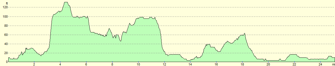
For more information on profiles, ascents and descents, see this page
 |
 |
|
 |
 |
|
 |
 |
|
 |
 |
|
 |
 |
|
 |
 |
|
 |
 |
|
 |
 |
|
 |
 |
|
 |
 |
|
 |
 |
|
 |
 |
|
 |
 |
|
 |
 |
|
 |
 |
|
 |
 |
|
 |
 |
|
 |
 |
|
 |
 |
|
 |
 |
|
 |
Disclaimer
Please note that I take no responsibility for anything that may happen when following these directions. If you intend to follow this route, then please use the relevant maps and check the route out before you go out. As always when walking, use common sense and you should be fine.
If you find any information on any of these routes that is inaccurate, or you wish to add anything, then please email me.
All images on this site are © of the author. Any reproduction, retransmissions, or republication of all or part of any document found on this site is expressly prohibited, unless the author has explicitly granted its prior written consent to so reproduce, retransmit, or republish the material. All other rights reserved.
Although this site includes links providing convenient direct access to other Internet sites, I do not endorse, approve, certify or make warranties or representations as to the accuracy of the information on these sites.
And finally, enjoy your walking!
Nearby walks
| # | Title | Walk length (miles) |
|---|---|---|
| 108 | Waterbeach to Huntingdon | 21.6 |
| 119 | Huntingdon to St Neots | 11.8 |
| 142 | Huntingdon Station to Hargrave | 17.3 |
|
|

|