Walk #917: Angles Way: Thetford to Diss
 |
 |
|
General Data
| Date Walked | 19/08/2011 |
| County | Norfolk, Suffolk |
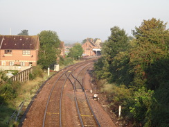
| Start Location | Thetford Station |
| End Location | Diss station |
| Start time | 07.04 |
| End time | 15.33 |
| Distance | 23.6 miles |
| Description | This was a long walk, following roads east from Thetford to reach the end of the Angles Way at Knettishall Heath. After this it follows the Angles Way all the way to Diss, crossing the watershed of the Little Ouse and Waveney rivers before following the latter downstream. |
| Pack | Today I carried my 30-litre Karrimor rucksack, filled with water, my waterproofs, a couple of books and other odds and ends. |
| Condition | I feel relatively fine after this walk. The rest in Fair Green helped me recuperte slightly, and I could easily have squeezed another four or five miles out of my legs. I twisted my right ankle slightly about ahlfway through the day, but this caused little more than an ache at the end of the day. |
| Weather | Today was a brilliantly sunny day, with few clouds to be seen for most of the day. It was suitably warm, which was a shame as I had forgotten my Tilley hat. |
| OS map | Landranger number 144 (Thetford & Diss, Breckland & Wymondham) |
 |
 |
|
Map of the walk
Maps courtesy of Google Maps. Route for indicative purposes only, and may have been plotted after the walk. Please let me have comments on what you think of this new format. For a detailed table of timings for this walk, please see the table file.
 |
 |
|
Notes
After completing the Hereward Way with a marathon walk at the end of last week, I was unsure what to do next. My mind was wandering towards the Stour Valley Path from Newmarket when I found a trail guide for the Angles Way on my bookshelf. I had bought this over ten years ago and had never walked the trail, despite it being very near to Cambridge. On an impulse I traced the route out and printed the maps.
The first problem was that the trail starts essentially in the middle of nowhere at Knetishall Heath, near the trailheads of the Peddar's and Icknield Ways. There is very little public transport to the start point so there was little option except to walk or get a taxi. Fortunately I noted that the town of Diss was about fifteen miles away from the start of the trail, and the start about six miles from Thetford; I could therefore walk from Thetford to Diss and get the train back via Norwich.
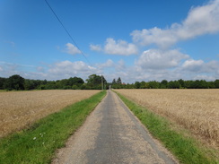
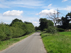
There is a set route from Thetford to Knetishall Heath, but this is a massively indirect fifteen miles long. Instead I chose to take a more direct route along roads that I had walked on several other occasions. After parking at Thetford railway station I started following roads away from the town. On the way I nipped into a petrol station to buy some chocolate, and the two ladies serving seemed to take a great interest in what I was doing - I seemed to have at least one fan.
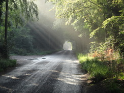
Fortunately a little path beside the A1075 prevented me from having to spend too much time on the road, and this took me past a massive Tesco store before joining the Kilvestone Road. This took me eastwards for a few miles, and fortunately was very quiet. There were some fantastic crepuscular ways streaming through the trees from the low sun; the recent heavy rain still lay on the fields and vegetation, although the sky overhead was fairly cloudless. On a previous walk I had noted that it was roadkill alley, and today was no exception - in places there was a dead animal or bird every few yards. Unusually there was even a small dead bat on the tarmac.
It is a shame that there is no direct footpath route from Thetford to the trailheads; perhaps following the River Thet east from the town would be a suitable route, although some trespass signs indicate that the estates that line the river may not be amenable. Such a path would allow walkers to reach the Peddars, Icknield and Angles Ways from the nearest station without risking their lives on roads.
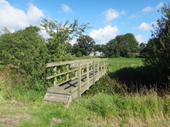
It was surprising how much I could remember from my previous walks, including the stables beside the road at Langmere Boxes. Eventually my route took me off from this road and past Brettenham church to the A1066. I had to battle the traffic along this busier road for a short distance before a minor road thankfully took me away to join the Peddar's Way. This was the first real footpath of the day, and it took me southwards along the edge of some woodland, curving only to cross the Little Ouse on a footbridge.
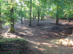
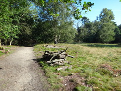
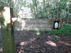
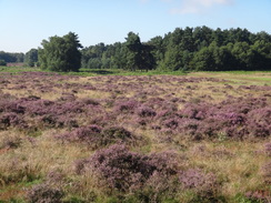
Eventually I came to the start of the Peddar's Way, which is nestled by a car park in the trees on Knettishall Heath. It also marks the end of the Icknield Way on its journey from Ivinghoe Beacon, meaning that the quiet spot is a surprisingly major junction in paths. A pleasant walk along a quiet road followed, passing heathland that was empurpled by heather.
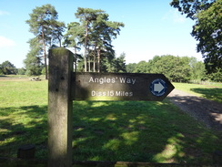
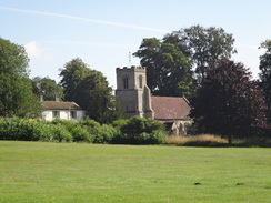
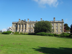
Soon I reached the main car park of the Knettishall Heath area, beside which was a waymarker showing the Angles Way. All the walk so far had been to reach this point, and the rest of the day would be spent along this trail. After re-crossing the Little Ouse on a bridge, a track took me towards and past Riddlesworth Hall School. This was a magnificent Georgian-style house that had been sympathetically converted into a school. Fortunately the Angles Way granted me a dramatic view of the impressive frontage and of the church that stands nearby.
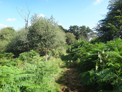
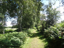
Tracks took me through Gasthorpe and on to Lodge Farm, where a path led to a footbridge over the Little Ouse. Another path crossed the floodplain to approach Hopton Fen. What followed was a rather messy stretch of path that was constantly twisting and turning, at times through scrubland at others along the edge of fields. It was a relief when it finally met the road in the village of Hopton.
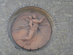
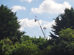
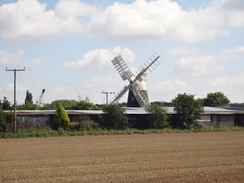
It was obviously too early for the village pub or chip shop to be open and so I continued along the trail. A track and path took me on towards Spring Farm. A couple of tall telescopic handlers protruded above the hedges, and I could not work out why they were being kept so high with no-one around them. Soon the magnificent Thelnetham windmill became visible off to the left, a view that was sadly partially blocked by the intervening farm. The fantail of the mill had been painted with concentric circles, and these simple adornments added a certain something to the structure.
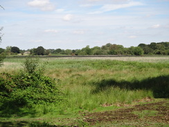
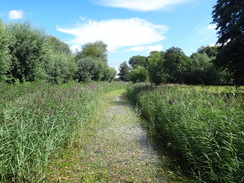
The trail did not enter Thelnetham, and instead bypassed the village using roads and paths that skirted the southern edge of Thenetham and Hinderclay Fens. The views over the reed-strewn fens were not particularly brilliant, but there were several paths that led off through the nature reserves. Eventually the path led away from the fens, passing a stinking area between some chicken sheds and a pig farm. It was more than a relief when a road took me speedily away from them.
A few yards north of the B1113 road is an unusual spot; the source of the Little Ouse lies on the western side of the road, and that of the Waveney on the eastern. These two rivers more or less form the southern boundary of Norfolk and aside from a few yards to tarmac could well turn it into an island. Indeed at 26 metres above sea level it is hardly very high, showing that the Angles Way that lay ahead of me will probably not have too many gradients.
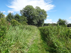
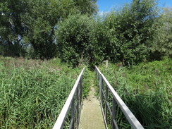
The road was soon left behind and a wonderful stretch of path took me along the southern edge of Redgrave Fen. Although the views were not particularly magnificent, my spirits were soaring and I started humming to myself as I bounced along. Soon a footbridge led across the tiny Waveney before following its northern bank, although the river mostly remained out of view because of the reeds within. Another footbridge led back across the river, and a footpath headed south to a road. At this point I gave my right ankle a slight twist, causing me to curse and hobble for a few minutes.
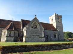
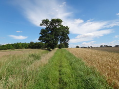
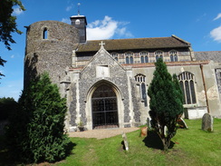
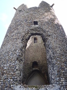
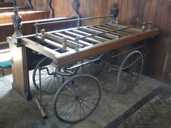
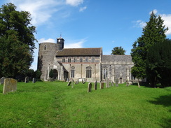
I gave Sencan a phone as I hobbled eastwards along the road. After passing a farm more paths took me south and then east across fields, slowly climbing to reach another road. Tracks and paths took me on towards Wortham church, which is in a fairly remote location that is some way north of the village that gives it its name. I stopped off to have a look around, if only because of the spectacular round tower that sits at its western end. This is the largest round church tower in the country, and although ruined is still fairly tall and impressive. It sheer size meant that some people think that it was a watch tower, and it is indeed marked as such on the map. The interior of the church was less impressive, although I was fascinated by what appeared to be a coffin trolley that sat beside the door.
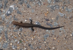
The last path of the day headed through the churchyard, soon joining a track that curved to the right before ending at a road in Wortham Ling. This took me eastwards across more heathland that was also picturesque in places, with the Waveney out of view to the north. I found a lizard - scarcely two inches long - basking in the middle of the road, and I shepherded it off to safety at the verge before taking some photographs of it. It was tiny and fascinating; black with what looked like three spiny ridges running down its back. Eventually I tore myself away and continued on down the road.
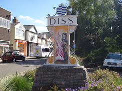
Fortunately this was not too busy and fairly straight, meaning that I did not have to worry too much about traffic. It crossed the Waveney at Denmark Bridge before entering the Fair Green area of Diss. Soon I came across a pub on the right; I had walked over twenty miles and had not had a break, but the railway station was only a couple of miles away. On an impulse I decided to go into the pub, where a friendly barman served me as he asked me about my stroll. I find it amusing that people think twenty miles is a long distance to walk - it seems perfectly ordinary to me and not utterly unworthy of note. I quickly supped my drink and, afraid that a long rest would cause my legs to seize, headed off once more.
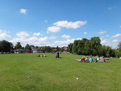
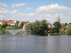
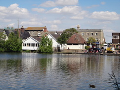
I had walked through Diss several years before as part of a walk from Stowmarket to Norwich, and I remembered being impressed by The Mere, a large natural lake in the middle of the town. As was to be expected, the grass around the lake was heaving with people in the sunshine. Children were feeding the ducks on the lake as I strode past and the little cafe was doing a roaring trade in ice cream. Instead of taking a direct route to the railway station I decided to continue along the Angles Way as it headed east along roads out of the town.
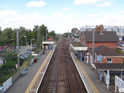
I left the trail immediately after it passed under the railway line to Norwich, and I started following a road south beside the railway line despite not knowing if there was a path linking this road to the station; if not then I would have to head south to the main road to access the station approach. A new industrial development started on the left; it was not marked on the map, and neither was another housing development a little further on. This proved to be my saviour, and the access road into the development led straight towards the station. I bought a ticket and crossed the footbridge to wait for my train, looking back on what had been a surprisingly pleasant walk and a good introduction to the Angles Way.
 |
 |
|
Directions
This walk starts off at Thetford railway station. Leave the station and head down Station Road, immediately passing a pub on the left. After a short distance turn left along a wide, surfaced track that heads between houses, becoming a path that emerges out into a small area of car parking. Head through this and then turn left and immediately right to head down Ben Culey Drive, which soon ends at a T-junction with Croxton Road. Turn left to follow Croxton Road northwards; it crosses a railway line on a bridge before the road ends at a dead-end.
Turn half-right to follow a surfaced path that descends to reach an underpass under the A1066. On the other side follow the path as it climbs up to reach Croxton Road once more. Turn left and follow a pavement that immediately curves to the left to join the A1066. Continue eastwards along the 1066 as it immediately crosses the railway line once more; after a third of a mile it reaches a large roundabout with the A1075 road.
Take the first road to the left, the A1075 Norwich Road, and follow it as it heads northeastwards. The pavement on the left ends shortly after a petrol station; carefully cross the road and start following the pavement on the other side. Soon a rough little path starts through the trees on the right, paralleling the road; this is a far preferable route. The path is interrupted by a roundabout before eventually ending at a path leading to the large Tesco store in Kilverstone.
Turn right and follow this path across the car park and past the entrance to the shop. Continue across zebra crossings on the other side until it heads through a band of trees to reach a path. Turn left down this path and follow it as it heads northeastwards for a short distance to reach Charlock Road. Cross the road and take the path on the other side that continues northeastwards, passing a house on the left before ending at Kilverstone Road at TL887842.
Turn right and follow the Kilverstone Road as it heads eastwards for about 2.8 miles; there is no pavement but the road is relatively straight and there is little traffic. When a road junction is reached on the right at TL930836 in the hamlet of Brettenham, turn right down this road. It curves to the left to pass Brettenham Church on the right, before crossing the River Thet on a bridge and twisting a little. Half a mile after leaving Kilverstone Road, this new road ends at a T-junction with the A1066.
Unfortunately there is little choice here except to follow the A1066 for a short distance. Turn left and follow the road east-northeastwards; as it slowly curves to the right after a quarter of a mile continue straight on down a minor road for another quarter of a mile. Immediately after trees start on the left, turn right through a gap in a small bank to join the Peddar's Way. Follow this south for a couple of hundred yards along an old surfaced road before it crosses a gap in another small bank to reach the A1066 road.
Carefully cross the main road and continue south along the Peddar's Way with a field on the left and a band of woodland on the right. Nearly a mile after leaving the main road the path curves to the right to reach a footbridge over the Little Ouse River. Cross this and follow the path as it curves to the left to continue southwards for another half a mile before going through a gate to reach a road at TL943807, which also marks the trailhead of the Peddar's Way.
Turn left and follow the road eastwards for 0.8 miles until a crossroads is reached with another road at TL956805. Turn left to head north along the other road; after a short distance a track to the left leads into Knettishall Heath car park; this marks the start of the Angles Way, which will be followed for the rest of the day.
Continue along the road as it crosses the Little Ouse River on a bridge and head on until it approaches a band of woodland. Just before the trees are reaches, turn right along a rough track; this immediately passes an attractive brick and flint house on the left. The track soon curves to the right to head eastwards. The track turns to the left as it enter some woodland after half a mile; immediately before the trees turn right along a path that runs beside a poorer track; both keep the woodland on the left. As the woodland ends the path joins the track to continue eastwards past the frontage of Riddlesworth Hall School.
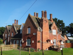
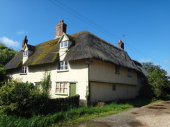
Some trees soon start on the left; shortly afterwards the path turns left to head diagonally through the trees before ending at a track to the east of the school at TL967812. Turn right and follow this track east-southeastwards for 0.6 miles until it ends at a junction with another road in Gasthorpe at TL976808, with some lovely thatched cottages on the right.
Turn left along this road for a few yards and then turn right down another surfaced track, immediately passing a phone box on the left. The track approaches Lodge Farm after nearly half a mile; pass a large barn on the left and then turn right onto a path just before some large silos. This path immediately goes through a metal pedestrian gate; on the other side turn half-left across a concrete hard-standing to reach a metal field gate. Go through this and continue down the path to reach a footbridge over the Little Ouse.
On the other, southern, side of the footbridge turn left to follow an obvious path eastwards with a fence on the left. The path soon crosses a small footbridge over a stream and runs between fences and a hedge to reach a stile. Cross this to join the end of a green track. Turn right to head along this for 250 yards until another track is reached on the right. Turn right through a metal field gate and follow this new track south-southwestwards between fences for a short distance until it approaches Hopton Fen. The track curves to the right and then the left.
Do not turn right down the obvious track that leads to a field gate into the fen, and instead turn left along a footpath that heads past trees on the right. It soon curves to the right to cross a footbridge over a ditch and heads on with a fence on the right. The path jinks to the left and then, after only ten yards, to the right once more.
Soon afterwards the path plunges away to the right away from the field, heading through a scrubby area that skirts the eastern edge of the fen on the right. The path heads through a wooden clapper gate beside a metal field gate. Go through this to continue along the path. Shortly afterwards the path curves to the left to heads eastwards across a field with a hedge on the left.
This path climbs slightly uphill before ending at a track. Turn right along this track, keeping another hedge to the left, and after a couple of hundred yards turn left down another path that runs between fields, heading towards houses in the distance. When this reaches a hedge turn right and keep the hedge on the left; it soon curves to the left to reach the end of a path. This heads between walls to reach the B1111 in Hopton at TL994791.
Turn left to follow the B1111 northeastwards for a fifth of a mile until a track leads off to the right, initially across an unpaved parking area before entering a field. Soon a patch of woodland starts on the left, and this is followed eastwards towards Spring Farm. At the end of the field follow the hedge as it turns to the right, and then go through a gap in a hedge ahead. On the other side turn left to follow the new hedge on the left, with the farm beyond it. Once past the last barn on the left, turn left down a path for a few yards to reach a track that leads out of the farm at TM004791.
Turn right to follow this track as it heads eastwards for half a mile, reaching a road a short distance to the south of Thelnetham Windmill. Cross the road and continue straight on along the surfaced Fen Lane for a third of a mile until it curves to the right. Do not follow it around the bend and instead turn left along a green and sometimes muddy track that runs between hedges. This soon curves to the right to head eastwards along the southern edge of Thelnetham Fen, with water-filled ditches on either side of the path.
After a while the path curves to the right to head across a rough clearing towards trees ahead. As it enters the trees it crosses a footbridge over a stream. Follow the obvious path through the trees, which soon meets a fence on the right. Keep the fence on the right; it crosses a track and heads on into another clearing. Eventually it re-enters the woodland to reach a narrow footbridge over a ditch. Cross this and follow some trees on the right; scrubland soon starts on the left.
Soon afterwards the path curves to the right to head southeastwards with some barns beyond a hedge on the right. This ends at Hinderclay Road at TM037784 after another third of a mile. Turn left and follow this road east-northeastwards; it soon crosses the B1113 road. Cross this and follow Fen Street on the other side for a sixth of a mile. A track leads off to the left at TM043787, just before a slight right-hand bend in the road.
Turn left along this track and follow it through a metal field gate and then through a clapper gate beside another field gate. The field soon becomes a path that curves to the right; again it is easy to follow as it heads in a rough east-northeasterly direction across scrubland, with Redgrave Fen off to the left. The paths heads through another clapper gate as it heads past Redgrave Fen. A mile after leaving the road the path curves to the left to reach a footbridge over the River Waveney.
Cross the footbridge and on the other side turn immediately to the right, with the river immediately on the right. After half a mile the path turns right to cross the river on another footbridge; on the other side turn right for a few yards and then left along a footpath, keeping a fence to the left. The footpath heads due south to end at Low Road at TM061797.
Turn left and follow this road as it curves to the right and then the left before settling on an easterly course. It passes Dashes Farm on the left; immediately after the farm turn right down a rough track with a ditch on the left. The track soon crosses the ditch and continues south with the ditch on the right. 0.4 miles after leaving the road, the path leaves the track turns to the left to head eastwards with a ditch on the left, and later a hedge on the right. The path passes a newly-planted area of woodland on the left and then becomes a firmer track that runs between hedges. The hedge on the left ends and a house is passed on the left before Slade Lane is reached at TM073792.
Turn left to follow Slade Lane northwards for a short distance until a track leads off to the right. Follow this track as it heads east-southeastwards between fields. A hedge soon starts on the right; this ends at a crossing with another track. Head across this track and continue eastwards along the track until a hedge is reached ahead. Follow the track as it curves to the right to head south with the hedge on the left; when the track curves sharply to the left continue straight on south-southeastwards across a field. At the southern end of the field it goes through a gap in a hedge and descends a bank to reach Magpie Hill road at TM081787.
Turn left to follow this road eastwards. It soon passes Wortham church on the left; at the eastern end of the churchyard hedge turn left and then immediately left through a pedestrian gate to enter the churchyard. Head along a path diagonally across the churchyard towards the church, but before the church is reached turn right down another path that passes the eastern end of the church.
The path leaves the churchyard and goers through a gate to enter a small field; turn half-right to head diagonally across this field to cross a concrete bridge over a stream that leads into another field. Continue diagonally across this to reach a band of trees on the right. At the end of this field near the trees, cross a stile beside a gate, and continue on northwards with the trees on the right. The path crosses a series of stiles as it slowly curves to the right to take an easterly course, eventually squeezing between gardens to end at a road at TM091792.
Cross the road and head straight on along a road opposite. After a quarter of a mile this reaches a junction with another road; turn right to follow this road eastwards for another mile until it ends at a T-junction with Denmark Hill road at TM111793. Turn left and follow this new road as it crosses the Waveney at Denmark Bridge, continuing on past Fair Green until it ends at a T-junction with the A1066 on the western edge of Diss.
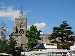
Turn right and follow the A1066 eastwards towards the centre of the town. After passing a car park on the left, turn left to head diagonally across an area of parkland to reach the southern edge of a lake called The Mere. Turn right and follow the surfaced path around the Mere to reach Mere Street. Turn left down Mere Street and follow this northwards to the Market Place in the centre of the town. Pass the museum on the right and then turn right down Church Street, immediately passing the church on the left.
Church Street becomes Frenze Road as it heads east through the town; the pavement soon ends, but the road is not too busy. 0.8 miles after the church the road curves to the right to head through a bridge under a railway line. Here the Angles Way is left behind; turn right to head south down Sandy Lane with the railway line to the right. The road slowly angles away from the railway with a factory lying between the two; cross a roundabout leading to an industrial estate on the left and continue on south to a second roundabout. Take the first road to the right, Nelson Road, and follow this as it heads west towards the railway line. When the road ends turn right along a short path that leads out onto Station Road directly opposite Diss railway station, where this walk ends.
 |
 |
|
Distances
| From | To | Distance (m) | Ascent (ft) | Descent (ft) |
|---|---|---|---|---|
| Thetford station | Start of Angles Way | 7.9 | 279 | 299 |
| Start of Angles Way | Hopton | 4.1 | 121 | 79 |
| Hopton | Wortham church | 7.5 | 171 | 144 |
| Wortham church | Diss railway station | 4.1 | 79 | 108 |
This makes a total distance of 23.6 miles, with 650 feet of ascent and 630 feet of descent.
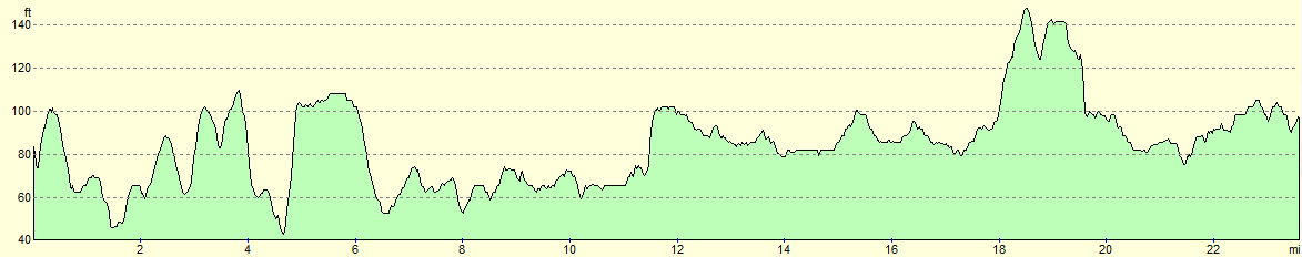
For more information on profiles, ascents and descents, see this page
Transport
It is easily possible to travel between Diss and Thetford by train; however you need to change at Norwich, which at £15.00 (in 2011) makes it a rather expensive journey. See the National Rail website for more information.
 |
 |
|
 |
 |
|
 |
 |
|
 |
 |
|
 |
 |
|
 |
 |
|
 |
 |
|
 |
 |
|
 |
 |
|
 |
 |
|
 |
 |
|
 |
 |
|
 |
 |
|
 |
 |
|
 |
 |
|
 |
 |
|
 |
 |
|
 |
 |
|
 |
 |
|
 |
 |
|
 |
Disclaimer
Please note that I take no responsibility for anything that may happen when following these directions. If you intend to follow this route, then please use the relevant maps and check the route out before you go out. As always when walking, use common sense and you should be fine.
If you find any information on any of these routes that is inaccurate, or you wish to add anything, then please email me.
All images on this site are © of the author. Any reproduction, retransmissions, or republication of all or part of any document found on this site is expressly prohibited, unless the author has explicitly granted its prior written consent to so reproduce, retransmit, or republish the material. All other rights reserved.
Although this site includes links providing convenient direct access to other Internet sites, I do not endorse, approve, certify or make warranties or representations as to the accuracy of the information on these sites.
And finally, enjoy your walking!
Nearby walks
| # | Title | Walk length (miles) |
|---|---|---|
| 207 | Shippea Hill to Thetford | 20.2 |
| 208 | Thetford to Attleborough | 16.9 |
| 212 | Bury St Edmunds to Thetford | 17.8 |
|
|

|