Walk #916: Hereward Way: Brandon to Harling Road and on to Wymondham
 |
 |
|
General Data
| Date Walked | 12/08/2011 |
| County | Suffolk, Norfolk |
| Start Location | Brandon Station |
| End Location | Wymondham station |
| Start time | 06.55 |
| End time | 18.04 |
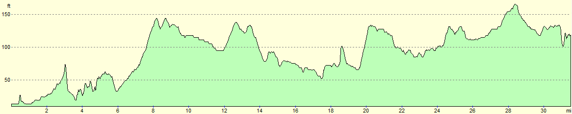
| Distance | 31.5 miles |
| Description | This was a very long walk, the first half of which was along the eastern end of the Hereward Way. After that a long stretch ofg road walking took me northeastwards through Allteborough to tyhe Norfolk town of Wymondham. |
| Pack | Today I carried my 30-litre Karrimor rucksack, filled with water, my waterproofs, a couple of books and other odds and ends. |
| Condition | I feel very tired after this walk, and have some slight chaffing on my waist. Given the distance walked I feel reasonable, and if I had taken a little extra care to prevent chaffing then I could have walked further. |
| Weather | The skies today were mostly covered with a grey veil of cloud, allowing only occasional glimpses of the sun. There was a small amount of spitting rain in the air early on, but this did not last long. It could have rained at any time, and indeed there had been heavy rain in Brandon once I returned there by train at the end of the day. |
| OS map | Landranger number 144 (Thetford & Diss, Breckland & Wymondham) |
 |
 |
|
Map of the walk
Maps courtesy of Google Maps. Route for indicative purposes only, and may have been plotted after the walk. Please let me have comments on what you think of this new format. For a detailed table of timings for this walk, please see the table file.
 |
 |
|
Notes
I had only one walk left to do before I had finished the Hereward Way, and I was understandably keen to get on and complete the trail. There were only fifteen miles to be walked to reach the trails end at Harling Road station, and unfortunately the trains back from that station are very infrequent. For this reason I decided to extend the walk to Attleborough, whose station has more frequent services, even if that extended the walk to well over twenty miles.
I am cursed by being an early riser, in direct contrast to my wife who can easily slumber on into the late morning. This curse can be useful when it comes to walks, however, and I was on the road in the early morning for the drive to Brandon; the only problem I had was finding the station car park which was situated a little around the houses.
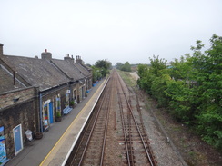
Brandon was just starting to wake up as I headed down the main road to join the Hereward Way; even the swans on the Little Ouse seemed to be asleep. Fortunately a shop in the town was open and I nipped in to buy some food for the day, including, unusually, a pack of my favourite malted milk biscuits. It is unusual for me to eat biscuits on a walk, but I had a feeling that today was going to be a special day.
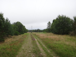
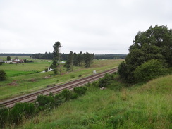
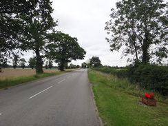
The trail left the town by following a road and tracks eastward, with houses on the right and a series of paddocks on the left. I had walked the first few miles of todays walk on several occasions but the familiarity walked in my favour - it really is not a bad stroll. Indeed three named trails all share this area - the Hereward Way, the Little Ouse Path and St Edmunds Way join and split several times in the first few miles. There was a little drizzle in the air, but this was light and hardly bothersome; I was only concerned about it getting worse.
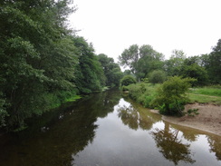
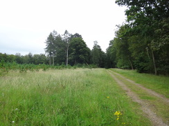
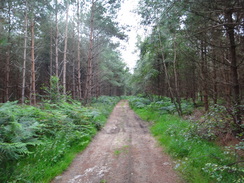
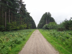
After leaving the track behind, the trail dived through part of Thetford Forest, using tracks and paths to reach the small settlement of Santon Downham. This village is surrounded by the forest on three sides and the Little Ouse on the other; it has always seemed a quiet, rather exclusive sort of place. The trail follows a road through it, passing the church before diving through the forest once more along tracks, leaving it to cross the river on a bridge to reach a car park. A moat is marked on the map and I could just about make out ditches overgrown with nettles.
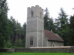
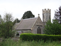
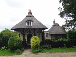
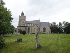
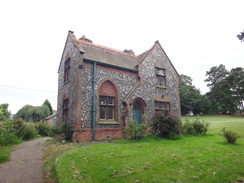
A little further on was Santon church, a perfect little round-tower building. It was open so I went in for a little look around and to take some photographs. Although I am not religious, there is something about ecclesiastical architecture that I find positively breathtaking and this church was no exception. There was nothing particularly remarkable about it but I loved it nonetheless.
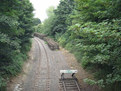
The trail crosses a railway line and then started eastwards through the forest. On the way it passes the site of an old Saxon church, St Helens. There was no trace of this on the ground aside from a series of lumps and bumps. Nearby is a holy well, and it is more than possible that the church was purposefully placed beside the spring.
Sadly this pleasant stretch of walk soon had to end, and it ended in a very bad way as the trail follows the busy A134(T) southeastwards. The verges were narrow and it felt dangerous; however after a while I noticed a path through the trees to the right and this provided a much safer route. It was a relief when I could finally cross the road and follow another track eastwards through the outskirts of the forest. This ended at a road immediately to the north of Croxton.
What followed was more road walking, although thankfully the road was exceptionally quiet as it headed through more of the forest; the only people who passed me were a couple of cyclists and a jogger. There were some curious circular depressions in the trees to the left of the road that look strangely like they might have been bomb craters, although goodness knows how the landscape changed when it was forested.
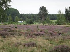
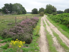
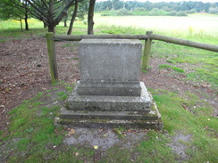
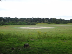
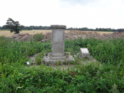
I had walked this road before as part of a circular walk from Thetford, and I knew that the Devils Punchbowl was a short distance away to the left. This large circular depression is a mere whose water level varies according to the local water levels. Here the trail left the road and started to head eastwards through the forest once more. Eventually a depression became visible to the left; Langmere, which was almost dry. A few yards off the track, and overlooking the mere, was a stone memorial to a naturalist. As if to please him, the track leading towards the A1075 was bordered with empurpled heather.
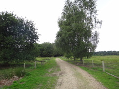
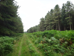
After crossing the main road the trail headed across Wretham Heath, a lovely patc of heathland that, unusually for the immediate area was not forested. This did not last long and soon the trail plunged into another area of woodland, disjointed from the main body of Thetford Forest. It passed between the abutments of a bridge that once carried the old Thetford to Swaffham branch railway line overhead. Soon I was passing a compound filled with goats and turned left to start following the Peddars Way northwards. This National Trail mostly follows the course of an old Roman Road, and I first walked it in 2003. A roaring sound filled the air around me, slowly growing to a crescendo as two A10 planes scudded overhehad, sadly too quickly for me to take any photos of it. They returned a few minutes later and I managed to get a snatch shot.
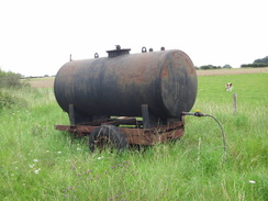
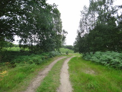
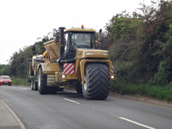
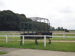
The trail seemed to want to spend as long as possible within the woodland, and the Peddars Way was soon left behind as the trail skirted the edge of more woodland. A long watering system stretched across a field to the left, an unwieldy sort of machine that I have only ever seen in the flatlands of East Anglia. The path headed through a broad gap in the trees before joining a track that took me towards a large metal structure; on the OS map this is marked as a Fire Tower (I assume that this is to watch for fires in the surrounding lands), but the tower was now covered in telecoms mast. Indeed a nearby mast belonged to the Airwave system.
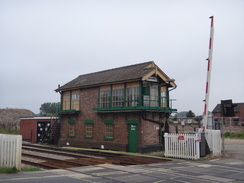
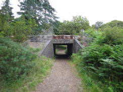
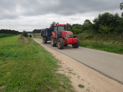
The track that took the trail down towards the A11 was busy with tractors pulling trailers filled to the brim with onions, the heavy machines throwing up clouds of choking, sandy dust. Fortunately an underpass saved me from having to cross the busy main road on the level. Soon afterwards the track reached a level crossing over a railway line, and I stopped to close the gate for one of the tractor drivers.
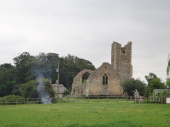
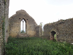
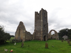
Soon a ramshackle stone structure became visible beyond some lumps and bumps in the field to my left. The bumps were part of the medieval village of Roudham, the majority of which no longer exists, and the stonework was the remains of Roudham church. I stopped at the church to take a look, and thankfully there were a series of signboards to give me some information. In 1736 workmen repairing the lead roof of the tower let ash fall onto the thatched roof, and the resulting fire destroyed the church. It is somewhat surprising that the remaining stonework has remained so extant and the stonework not removed to e used in building, but perhaps the fire occurred late enough for the picturesque movement to take hold?
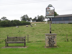
I was approaching the end of the Hereward Way, but sadly the last couple of miles followed roads. A complex of industrial buildings were passed on the right, and there were some more about a mile later. This rural area felt like an unusual place for such a complex of buildings, and plaques on the village sign at the end of the road told me why: there used to be an airfield here in the First World War.
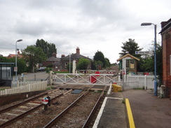
All that remained was to walk up a road for a short distance to reach Harling Road railway station. On the way I passed a gigantic three-wheeled tractor queuing at the level crossing, a sort of vehicle that I cannot recall having seen before. I passed the traffic and crossed the road to reach the station; the gate onto the platform seemed as good a place as any to call the end of the trail. I shuffled onto the platform as my mind wandered back over the highs and lows of this little-known or regarded trail.
I had a remarkable four hours to wait for the next train, and so I decided to continue with my plan to extend the walk to the town of Attleborough, which has more frequent train. Initially this meant following the B1111 southeastwards to the village of East Harling, and fortunately there was a pavement beside the road. Suddenly I felt a sharp bang to my head and my hat flew askew on my head as a car sped in front of me. My ear started ringing and as I looked down I could see a grape rolling across the tarmac. Obviously someone in the car had thrown it out of a window and had had a direct hit. Annoyed and with ringing ears, I strode on.
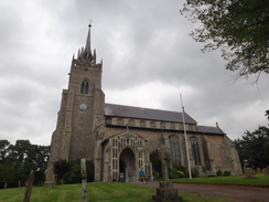
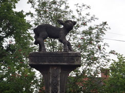
East Harling church has a spire made of lead-lined wood, giving it an airy, spacious look from the outside. The door was open so I went in to be greeted by a lady sitting at a desk. She invited me to sign the guestbook and I then went for a look around. Nearby was East Harlings rather unique village sign - a carved lamb standing atop a post. After leaving I diverted off my planned route to find somewhere to take a break; I was about eighteen miles into the day and had yet to have a rest. The first pub I saw did not appeal from the outside, but a few yards further on was the George and Dragon.
I went in and ordered my usual drinks and, as a treat for having completed another trail, a meal. The food was plentiful and nice and the service first-rate. My ill temper from the grape incident lifted as my stomach filled. The only downside was that I was sitting inside and could not take my boots off to let me feet breathe.
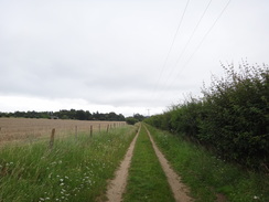
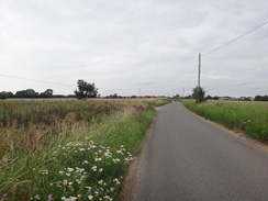
For the rest of the day I would be following roads. There was not much to note in east Harling and I strode quickly through, taking the Quidenham Road before diverting off northwards. This road crossed the railway line but the growing roar was a very different form of traffic - cars racing around the Snetterton motor racing circuit. Sadly nothing could be seen due to large banks around the course (for the spectators, perhaps?).
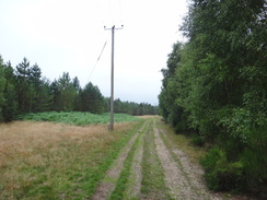
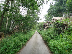
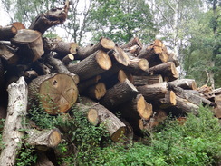
My planned route was to follow roads towards Eccles Road station, another of the ones on this line that is poorly served by trains. Surprisingly, however, the first road was little more than a track, hundreds of yards of which was lined with wood of all sorts - massive tree trunks resting on top of stacks of branches, massive hunks of timbers finished square and old, weathered tree stumps. Most of the piles were higher than my head giving the track an enclosed, gloomy feeling. If trees had souls then this was indeed an arboreal graveyard.
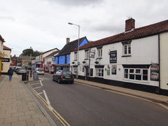
A better road continued on after the path crossed the railway line once more. There was not much of interest on the next short stretch of road until it reached the tiny station at Eccles Road; indeed there was not much to note for the next couple of miles as I followed a rural road northeastwards into the town of Attleborough.
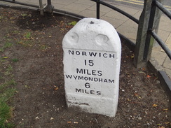
A quick reckoning showed that I only had a few minutes spare to get to the station. That felt a little tight, and besides a little plan was forming in my mind. I have only ever done one walk exceeding thirty miles in all my logged walks, and I was feeling fine. The next station with any services was in the town of Wymondham, about six miles further on towards Norwich. I had the time and I had the fitness; I decided to do it.
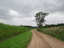
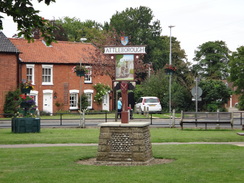
I stopped off at a shop in Attleborough to buy an ice lolly that I scoffed as I headed out of the town and crossed the bridge over the A11, a task made slightly more dangerous due to the road works on the bridge. A minor road then took me through a small village after which I had a decision to make. The most direct route was along the B1172, but that would involve more traffic than a less direct route through Suton Street. As there was plenty of time before the 6.52 train, I decided to take the latter. First I diverted off the road to see a memorial stone to a man who paid for the road to be restored; this left me wondering if memorial stones were being placed beside modern roads to thank the taxpayers who paid for them.
Eventually the minor road rejoined the B1172 on the outskirts of Wymondham. The twin towers of Wymondham Abbey were visible to the left and I seriously considered visiting it as I had plenty of time before the train; however my willpower was lacking and instead I crossed the bridge over the Mid-Norfolk preserved railway and headed down to the station. The cafe at the station had shut an hour before and there did not appear to be a pub, so I crossed the footbridge and sat down on a seat. It had been an exhilarating days walk; there had been too much road walking after completing the Hereward Way, but despite this and the grape incident it had been a stellar day. My longest ever walk in a day, a record that I think may stand for some time.
 |
 |
|
Directions
This walk starts off at Brandon railway station. To reach the Hereward Way in the town, head out of the station and walk up to the A1065 main road. Turn left to follow the road south; you may need to cross the level crossing if you arrived on an eastbound train. The road soon crosses a bridge over the Little Ouse; cross the entrance to a Lidl superstore and then turn left down White Hart Lane.
White Hart Lane soon ends and Gashouse Drove continues on, running eastwards behind houses and gardens on the right and paddocks on the left. When the surfacing ends a good track continues on. A walls atrts on the right, protecting gardens behind. The houses and walls end after three-quarters of a mile after leaving Brandon, but a path continues straight on between fences. The fence on the right ends and is replaced by woodland.
When the path ends at a track at TL800869 turn right to follow it southwards. After a hundred yards turn left past a metal vehicle barrier to continue along another path through the trees. This immediately becomes a broad track; it soon crosses a track guarded by two metal vehicle barriers, with some power lines above and to the right. As the track starts to curve to the right, turn right up a path through the trees. This soon curves to the left and emerges out onto the end of a surfaced road in Santon Downham, with a wooden social club off to the right.
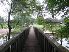
Follow the road as it continues on, passing a red phone box on the right. When the road soon ends cross a patch of grass to reach another road. This heads in a rough easterly direction, slowly curving to the right through the hamlet for a third of a mile, passing the flint-walled church on the left. At TL817874 turn left down a track, immediately passing a vehicle barrier. Follow the track as it heads in a rough easterly direction through the woodland with some paddocks on the left. When the track forks after nearly half a mile, take the larger left-hand fork that heads north between paddocks; this soon reaches a footbridge over the Little Ouse; cross this and continue on for a short distance until a T-junction with a surfaced track is reached.
Turn right and follow this track as it heads eastwards for nearly a third of a mile; shortly after it passes Santon Church on the right the track curves to the left past a vehicle barrier; after a short distance it heads through a low bridge under a railway line before reaching a vehicle barrier guarding a T-junction with a track. Turn right and follow this track eastwards for a little over a mile through the forest until it goes through another vehicle barrier to meet the A134(T) at TL848874.
Turn right and follow the A134(T) southeastwards for half a mile until a track leads off to the left at TL854868. This is not the best walk; however a path soon starts running through the trees on the right; when a road is reached with a level crossing on the right, turn left up this to rejoin the main road. Carefully cross the road and join a track; as this curves to the right continue straight on past a metal vehicle barrier. Follow the track eastwards; it passes a house at Field Barn on the left before emerging out of the trees and past fields. A little over a mile after leaving the A134(T) the track ends at a road at TL871871 to the north of Croxton.
Turn right down the road for a few yards, and then left along another road, immediately passing a house on the left. Initially the road heads east-northeastwards, before curving to the left to take a more north-northeasterly course. Continue along this road for 1.4 miles until a T-junction with another road on the left is reached at TL882890, immediately to the east of the Devils Punchbowl.
At the road junction turn right and follow a track that heads east-southeastwards through woodland; it slowly curves to take a more easterly course and becomes a better track before ending after nearly two miles at the A1075 road at TL911882. Carefully cross the road and continue along the track on the other side as it skirts East Wretham Heath. The track soon enters the woodland of Roudham Heath and passes between the abutments of an old railway bridge; 1.5 miles after the A1075 it joins the Peddars Way beside a railway line at TL933874.
Turn left to start following the Peddars Way northwards as it passes through woodland. As it emerges from the trees after half a mile and before it reaches a gas compound, turn right past a wooden electricity pole to join a path that skirts through the trees on the right. After a quarter of a mile it meets a bridleway coming in from the left; here turn right to head southeastwards for a little over half a mile. The path soon becomes a rough track through a broad gap in the trees.
The track ends at a T-junction with a better quality track at TL942881, with a field ahead. Turn left to follow the good track eastwards with some woodland on the left. As the good track turns to the right continue straight on, passing an Airwave telecoms mast and heading towards a large metal firewatch tower. Climb a little bank to reach the tower and then turn right to head south along a good track with the woodland on the right.
Follow the track as it heads through an underpass below the A11(T) and continue south along a track to reach a level crossing. Carefully cross this and continue south along the track, which becomes concrete as it curves to the left, passing a couple of houses at Shepherds Barn on the left. The track continues on for another quarter of a mile before ending at a bend in a road at TL955870 opposite Roudham Farm, with the ruins of Roudham Church to the left.
Turn left and follow this road as it winds eastwards for 1.6 miles before it ends at the B1111 road; cross the road to the pavement on the other side and turn left to follow the B111 northwestwards for 300 yards to reach the end of the Hereward Way at Harling Road railway station at TL978879.
Turn around and head back the way you came, heading southeastwards for nearly 1.5 miles as it enters the village of East Harling. Follow the road as it curves around to the right in the village, passing a couple of pubs on the right. The road soon curves to the left; when it curves to the right shortly afterwards head straight on down King Street.
Take the first road to the left, Gallants Lane, and follow this as it heads slightly east of north through the village, passing a primary school on the right. When it ends at a T-junction turn right and follow Quidenham Lane northeastwards. When a junction with Beccles Road is reached on the left at TM002867 after a third of a mile, turn left and follow this road as it heads northeastwards. It curves around a little before settling on a northerly course, crossing a railway line on a bridge.
Continue northwards along the road as it approaches the Snetterton motor-racing circuit on the left; ignore the first road off to the right and a few yards later take the second at TM010893. This heads northeastwards through woodland, slowly becoming little more than a path. As it approaches a house on the left turn left along a path between fences. This reached a surfaced road by some houses; turn left to reach a gated crossing over a railway line,
Carefully cross the railway line and on the other, western, side heads on along a surfaced road for a quarter of a mile until it ends at a T-junction with Station Road opposite a primary school at TM018896. Turn left and follow Station Road as it heads northwards, soon crossing a level crossing by Eccles Road station. Shortly afterwards the road curves to the right to take a northeasterly course; 0.8 miles after the station the road ends at a T-junction with another road at TM022912.
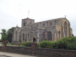
Turn right along this road as it crosses a bridge over a stream, and then turn left to follow Hargham Road as it heads northeastwards. After a couple of miles it enters the southern outskirts of the town of Attleborough. Continue on for another 0.8 miles until the road ends at a T-junction with the High Street in the town. Turn right down this road and follow it as it heads northeastwards; when it forks take the left-hand branch to a triangular junction. Take the right-hand branch along the B1077; this soon passes St Marys church on the right to reach a complex junction.
Turn left to follow Norwich Road northeastwards; after a mile it rises up to cross the A11(T) on a road bridge. On the other side the road curves to the right; take the first road off to the left, Norwich Road, and follow this as it curves to the right to take an east-northeasterly direction. Follow the road for nearly a mile and a half until a roundabout is reached at TM080977.
At the roundabout turn left to follow the B1172 northeastwards. After a fifth of a mile turn right down another road that soon ends at another roundabout beside the A11(T). Take the first road to the left, Chepore Lane, and follow this for a little over half a mile until it ends at a T-junction in Suton Street. Turn right and then immediately left down another road called Suton Street. Follow this northeastwards for three-quarters of a mile until it ends at a T-junction with Suton Lane at TM101992.
Turn left to follow Suton Lane northwards for a mile until it reaches a roundabout with the B1172 on the outskirts of Wymindham. At the roundabout turn right and follow the B1172 as it heads northeastwards into the town. After a quarter of a mile it crosses bridge over the Mid-Norfolk railway; immediately on the other side of the bridge turn right down Cemetery Lane. This curves to the left and then the right before reaching Wymondham railway station at TG114009, where this walk ends.
 |
 |
|
Distances
| From | To | Distance (m) | Ascent (ft) | Descent (ft) |
|---|---|---|---|---|
| Brandon station | Croxton | 7.0 | 236 | 184 |
| Croxton | Harling Road station | 9.5 | 213 | 217 |
| Harling Road station | Attleborough | 8.4 | 230 | 171 |
| Attleborough | Wymondham | 6.6 | 141 | 144 |
This makes a total distance of 31.5 miles, with 820 feet of ascent and 716 feet of descent.
For more information on profiles, ascents and descents, see this page
Trasnport
Regular railway services run between Wymondham and Brandon. Note, however, that many of the intermediate stations - for instance Harling Road and Eccles Road - have far less frequent services, and care needs to be taken not to leave yourself with long waits. See the National Rail website for more information.
 |
 |
|
 |
 |
|
 |
 |
|
 |
 |
|
 |
 |
|
 |
 |
|
 |
 |
|
 |
 |
|
 |
 |
|
 |
 |
|
 |
 |
|
 |
 |
|
 |
 |
|
 |
 |
|
 |
 |
|
 |
 |
|
 |
 |
|
 |
 |
|
 |
 |
|
 |
 |
|
 |
 |
|
 |
 |
|
 |
 |
|
Disclaimer
Please note that I take no responsibility for anything that may happen when following these directions. If you intend to follow this route, then please use the relevant maps and check the route out before you go out. As always when walking, use common sense and you should be fine.
If you find any information on any of these routes that is inaccurate, or you wish to add anything, then please email me.
All images on this site are © of the author. Any reproduction, retransmissions, or republication of all or part of any document found on this site is expressly prohibited, unless the author has explicitly granted its prior written consent to so reproduce, retransmit, or republish the material. All other rights reserved.
Although this site includes links providing convenient direct access to other Internet sites, I do not endorse, approve, certify or make warranties or representations as to the accuracy of the information on these sites.
And finally, enjoy your walking!
Nearby walks
| # | Title | Walk length (miles) |
|---|---|---|
| 207 | Shippea Hill to Thetford | 20.2 |
| 208 | Thetford to Attleborough | 16.9 |
| 211 | Attleborough to Norwich | 17.0 |
|
|

|