Walk #915: Hereward Way: Ely to Brandon
 |
 |
|
General Data
| Date Walked | 09/08/2011 |
| County | Cambridgeshire, Norfolk, Suffolk |
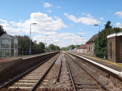
| Start Location | Ely Station |
| End Location | Brandon Station |
| Start time | 07.15 |
| End time | 14.23 |
| Distance | 23.1 miles |
| Description | This was very much a walk of two halves; the first half was a pedestrian and uninteresting plod along tracks and roads, with little to commend it aside from the first couple of miles in Ely. The second half, however, is much better as the Hereward Way follows paths and floobanks eastwards, often in company with the Little Ouse river. |
| Pack | Today I carried my 30-litre Karrimor rucksack, filled with water, my waterproofs, a couple of books and other odds and ends. |
| Condition | The underside of my feet ache slightly because I used liner socks instead of thick socks to try and prevent my feet overheating. Aside from thus I feel fine, and could easily have walked further. |
| Weather | The day was a mixture of sunshine and cloud with a brisk wind that took the edge off the sun. There was no sign of any rain. |
| OS map | Landranger number 143 (Ely & Wisbech, Downham Market) and Landranger number 144 (Thetford & Diss, Breckland & Wymondham) |
 |
 |
|
Map of the walk
Maps courtesy of Google Maps. Route for indicative purposes only, and may have been plotted after the walk. Please let me have comments on what you think of this new format. For a detailed table of timings for this walk, please see the table file.
 |
 |
|
Notes
Yet again my plans to go further afield had been foiled by events out of my control, and so I decided to do another leg of the Hereward Way. I therefore parked up in Ely station car park just after seven, before nipping into Tescos to buy a pack of crisps and a pork pie to eat on the way - I live healthily, you see...
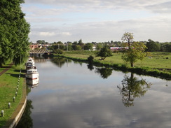
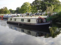
The first mile and a half repeated the end of the last walk, following the Great Ouse northwards away from the station. Few people were about at the early hour and even the geese at the feeding station seemed half-asleep. Unfortunately the sun was too low to get some good photos from certain directions and so I was forced to pause occasionally to get the best angles. A narrow boat came past as I strode along, the family inside seemingly enjoying themselves.
My feet have been overheating on the last few walks, and I therefore decided this morning to wear a thin pair of Thousand-Mile liner socks rather than my normal thicker pair. The liner socks are far less cushioning, and it will be interesting to see how my feet last on what is going to be a long walk.
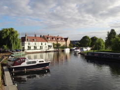
This short stretch of the Great Ouse is one of the better walks that I know, and one that I enjoy in all weathers and seasons. Today I put myself on autopilot and did not particularly look out over the river or back towards the cathedral. Eventually the path joined a surfaced track that took me past a factory to reach the Cuckoo Bridge, a pedestrian bridge built in 2000 that takes both the Hereward Way and the Fen Rivers Way over the entrance to the Roswell Pits, old gault pits. The impervious material from the pits was used to construct and waterproof many of the flood banks in the area; the flooded pits are now a nature reserve.
Another path took me to a long metal footbridge that carried the combined paths over the Great Ouse. This northeastern edge of Ely is surprisingly industrial, with factories, railway lines and warehousing all hidden to one extent or another by trees. On the other side of the bridge the trail met a road and said goodbye to the Fen Rivers Way, which would stick close to the Great Ouse on its way to King's Lynn. My route followed the road south for a short distance before heading off along a track.
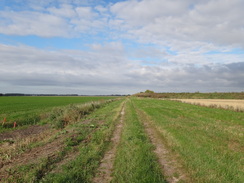
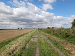
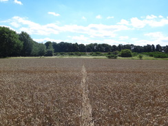
Initially there was a large bank to the left, behind which is, according to the map, some reservoirs. This soon ended and the track continued on across the flat landscape. The going underfoot was good and I managed to keep up a very good pace. Unfortunately it was also fairly boring, although the skies were magnificent with white clouds scudding across the blue sky, blown by a fairly brisk wind.
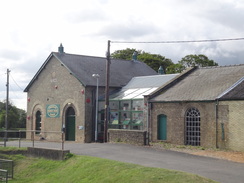
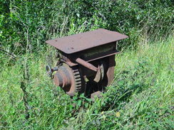
The track became a surfaced road that burped me out onto the main road in the small village of Prickwillow. This is so like so many other Fenland village, with a few houses scattered around a couple of roads. There is one unusual feature, however: a museum. The Prickwillow Drainage Museum is dedicated to some of the engines that have helped keep the Fens dry over the years. It is frequently open during the Spring and Autumn.
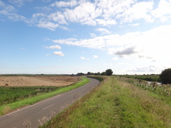
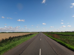
This was the high-point of the next five or six miles, which proved to be a sadly infuriating road walk. The tarmac could be avoided for the first half-mile by taking the floodbank of the River Lark; after that it was a case of crossing a level crossing and plodding along the road. A brisk northwesterly wind was blowing, and this was accentuated into a hammerblow when a lorry streamed past me. Fortunately the wind was warm and so my bare arms were not getting chilled.
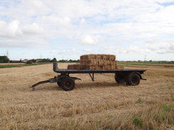
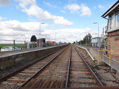
The traffic on the first road was light, but this all too soon ended at the A1101. I had to follow this for a couple of miles, and it soon became obvious that the traffic was coming towards me in burps; the road for quiet for a while and then many cars would rush along the road like a snake. One of these snakes was headed by an overlarge combine harvester, a van with orange lights ahead of it to warn oncoming traffic. It was an uncomfortable and forgettable stroll, and I was all too glad when I reached the level crossing by Shippea Hill Station.
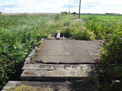
On the map a track called Station Road follows the railway eastwards; I looked down the track to see a rather old farm bridge with missing planks. I have walked this route several times before, but the last time was many years ago and I was quite certain that the bridge had not been in such a bad state. As I was staring at it with something akin to concern a lady came across the road. She and her husband were walking the Hereward Way as well, the first other walkers I had seen doing this little-known trail. They were waiting for a bus back to Ely and she told me that the next stretch got much better.
And so it did. Initially the track was a little overgrown, but soon it opened out. A couple of trains roared past along the low embankment to the left, and all too soon I was passing a barn near Lodge Farm, where a lorry was being filled from a silo. Roads and a track took me southeastwards in what looks like, on the map, an utterly unnecessary diversion to cross Lakenheath New Lode. The roads were quiet and the walk was not unpleasant, but I was still desiring some good scenery.
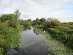
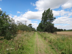
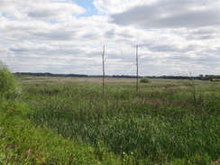
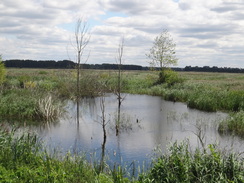
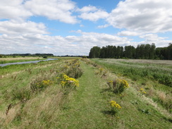
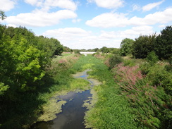
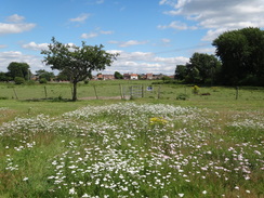
My wish was soon fulfilled. The trail eventually left the road and started heading northwestwards along a track towards the Little Ouse River. After crossing the railway line it became a path; the going was eased by the fact that some kind person had cut the tall vegetation, granting me an easy walk. The land to the west was flooded and skeletal grey trees stuck up out of the water. Rippling waves of reeds responded to the touch of the breeze, the brown seeds looking like a flowing velveteen blanket. Suddenly the annoyances of all those miles along roads were forgotten.
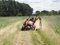
The trail passed a little cottage seemingly in the middle of nowhere before turning to the right to join the southern bank of the River Lark. It crossed a drain by a pumping station and continued on. Soon I came across a machine cutting the vegetation off the bank; the driver kindly shuffled to one side to allow me to pass, and behind was another machine cutting the sides with a mower on the end of a long hydraulic arm. The removal of the vegetation was very handy and I was glad I had come along after it had been done rather than before, as it would have meant wading through the grass. I can only assume that the work is being down by the RSPB to give birdwatchers an easier walk around the banks.
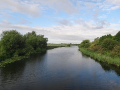
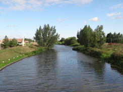
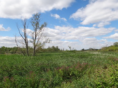
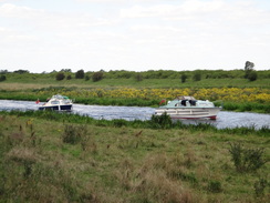
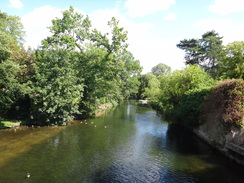
Sadly the river was initially out of view to the left; to the right, however, was a magnificent flooded landscape. It was hard to tear my eyes away from it as I walked along, although strangely there were few birds about - I assume most were hiding amongst the reeds. Soon I overtook three walkers who were ambling ahead of me, their hands filled with cameras and expensive-looking zoom lenses, and two had tripods strapped to their backs. A couple of boats came cruising down the river, so close to each other that the crew on the decks were chatting amiably away. They would draw nearly side-by-side on the straights, only for one or the other to draw back around the bends.
A lake on the other side of the river was not marked on the map, and seemed to be home to hundreds of white birds; swans and geese, I thought. This marked the start of the end, and after passing close to a large car park and visitors centre (belonging to the RSPB and not marked on the map), the path ended abruptly at the B1112 road. The trail headed south along this for a short distance, crossing the railway line and passing a farm before heading off along another track.
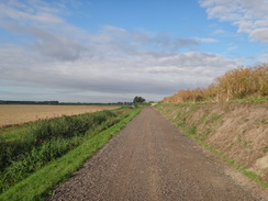
This soon crossed the Cut-Off Channel, a 25-mile drain built after World War II to collect floodwaters from local rivers and divert them to the Great Ouse at Denver Sluice. It looked particularly tranquil as I passed, a thick layer of green weed and scum showing that there was very little flow in it. After the wonderful last few miles alongside the Little Ouse the track was a slight let-down; however it was still an enjoyable stroll.
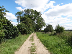
The nature of the land also became slightly different; the track underfoot was slightly sandy, showing that I had left behind the Fens and was now entering the Brecklands. As if confirming the fact, the track started to rise slightly. Eventually the track became firmer as it diverted away from the railway line; a combine harvester working in the field to my left covered me with a fine dust that was blown through the hedge as it offloaded its grain into a trailer.
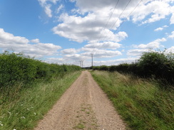
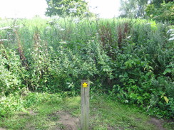
The last few miles of the day were rather confused as the trail wound eastwards towards Brandon. At no stage was it unpleasant, although at one part I went slightly off-course as a signpost pointed off through vegetation that was nearly as tall as myself. I knew that there were hourly trains back to Ely but I had not noted the times; I therefore decided to push myself for the last mile or so to reach the station as early as possible.
An exceptionally overweight family were out for a stroll on the outskirts of Brandon, shuffling along in baggy clothes; they looked at my pack and then me as if I was some sort of crazy creature (they were obviously very good judges of character). I reached the main road in the town and started heading north, soon reaching the bridge over the river. I could see that the barriers at the railway station were down and people were streaming out of the station.
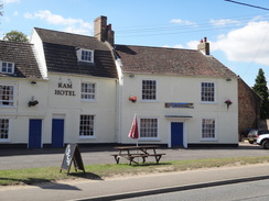
As I turned right to enter the station, a train pulled out. I had missed it by two minutes at most. My annoyance was somewhat tempered by the fact that there was a hotel right beside the station and I went in to buy a drink whilst I read a book outside. The roar of unseen jets overhead - from either of the USAF bases at Lakenheath or Mildenhall - acted as a pleasant backdrop to my reading. It had been a day of two halves; the first half was an utterly unforgettable walk that I really would not want to do again, having already done it twice. The second half, however, was much better and one that was well worth doing. All in all it had been a good day.
One last note: the experiment of using liner socks had mixed results. My feet did not overheat and I had no ankle rash; however, my feet did ache from the punishment they received from the tarmac. All in all I think I shall stay with my normal socks in future.
 |
 |
|
Directions
This walk starts at Ely railway station. Leave the station and turn right to walk down Station Road to reach the main road at the bottom. Turn right to cross the railway line; you can either walk along a pavement through the underpass or cross the level crossing; either way care needs taking. On the other side of the level crossing continue on for a short distance to reach the bridge over the River Great Ouse. Carefully cross the road (if not already there) to reach the northern side of the bridge.
Do not cross the bridge and instead turn left to join a path that runs northwards with the river on the right; the path also carries National Cycle Network Route 11. The path dives under a railway bridge and crosses the entrance to a marina and a boatyard before reaching the Maltings, which is now a prettified commercial area, with some lovely views along the river. Walk past the Maltings for a short distance along Quayside, passing a little inlet on the right. Pass the top of the inlet and then turn right to head towards a bridge over the river.
Do not cross the bridge and instead turn left to start following the riverside path eastwards, initially squeezing between the river and a waterside building containing an art gallery. After a few hundred yards it passes under a low railway bridge and curves to the left to take a more northeasterly course, going through a metal clappergate to join a gravel path. This parallels the river before curving away from the river bank, following a hedge on the left to approach the grounds of a factory. Here turn left through another clappergate to follow a surfaced footpath that runs north for a short distance with a car park on the right; this soon ends at a T-junction with a track called Kiln Lane.
Turn right and follow KIln Lane as it passes a factory on the right. The track soon curves to the right whilst a path continues on between palisade fences to reach a footbridge called Cuckoo Bridge that leads over some flooded clay pits known as the Roswell Pits. Soon after the bridge the path jinks to the right, following a chain-link fence on the left, and then to the left to rejoin the riverbank. Head northeastwards for a few yards to reach a metal footbridge over the Great Ouse at TL561805. Use this to cross over to the eastern bank of the river, and then climb up onto the road.
Turn right to follow the road southwestwards for a couple of hundred yards; just before it curves to the right turn left along a track. This heads northeastwards; as the track curves to the right continue straight on along a footpath. It winds as it heads in a rough northeastwards direction; always stay on the track and avoid turnings off to the right and the left. On the way it passes a couple of farms and passes under some power lines. A little over two miles after leaving the road, the track becomes surfaced and becomes Old Bank Road at TL590817. This road winds northwards for a third of a mile until it ends at a junction with a minor road in Prickwillow; turn left along this for a few yards until it merges with the B1104; the combined roads soon end at a junction with the B1382.
Turn right and follow the B1382 as it heads eastwards through Prickwillow; there is a pavement on the left-hand side of the road. After a third of a mile the road crosses the River Lark at Prickwillow Bridge. Follow this road northeastwards; for the first stretch there is a path on top of the flood bank to the right. When the floodbank curves sharply to the right you have to drop down onto the road. Cross the end of another road and continue along the road as it crosses a railway line on a level crossing and heads on in a northeasterly direction. 1.6 miles after the level crossing, the B1382 road ends at a T-junction with the A1101. Turn right and follow this road east-southeastwards; after 1.7 roads it curves sharply to the right to head south for a sixth of a mile to reach the level crossing beside Shippea Hill railway station at TL641840. Care needs taking on this section as the verges are narrow and the road can be busy.
Cross the level crossing by the station and then immediately turn to the left, crossing a ramshackle bridge over a drain to join a track. This heads eastwards with the railway line to the left. After a little over a mile a barn is reached on the right; here the track curves to the right and passes through Lodge Farm to become a surfaced public road called Sedgefen Road. Follow this road; when it curves sharply to the right continue straight on along a minor road for another half mile until it curves sharply to the left.
Do not follow the road around the bend and instead continue straight on along a good track. When this forks at a house continue straight on along a rougher track; a quarter of a mile after the house it curves sharply to the right to head south for a fifth of a mile before reaching a cottage on the left. Squeeze past the cottage gates on the right to reach another road at TL683837.
Turn left and follow this road as it immediately curves to the right. It heads southeastwards, passing Russell Farm on the right. After half a mile it curves sharply to the left to head northeastwards for a quarter of a mile. At a sharp right-hand bend turn left along another track that heads in a rough northwesterly direction. When this fork after a few yards take the right-hand fork; this soon curves to the right to head northwestwards with Lakenheath Old Lode mostly hidden to the left. After a mile the track reaches a gate guarding a railway line. Go through the gate, carefully cross the railway and then through the gate on the other side to join a footpath that runs along the top of a floodbank. Follow the path for 0.4 miles until it reaches a little cottage on the right.
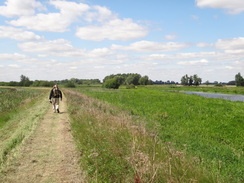
Here the path turns right, temporarily joining a track that crosses the drain next to a pumping station. As the track curves to the right once more, turn left to continue straight on along a footpath that heads along the top of a flood bank. This winds eastwards alongside the river for about 3.5 miles; it is easy to follow along this remote section as it goes through four metal clapper gates. The path eventually ends at the B1112 road immediately to the south of Wilton Bridge. Turn right and follow the B1112 south for nearly 300 yards until it reaches a level crossing over a railway line, with Lakenheath station immediately to the right.
Cross the railway line and continue south for 150 yards, passing Hiss Farm on the left. Immediately after the last barn turn left down a good-quality track. This heads eastwards for a little under half a mile before it curves to the left and then right to reach a bridge over the Cut-Off Channel. Cross the bridge and continue eastwards along the track between hedges.
1.5 miles after the cut-off channel, the track curves to the right to head east-southeastwards; after another half-mile it curves to the left to continue eastwards, passing a farm and an electricity substation on the right. At TL767864 the track curves to the right; here turn left to go through a metal pedestrian gate to join a bridleway that follows a rougher track northwards through trees for a quarter of a mile. As the hedge on the left ends and the track curves to the right, turn left to leave the track for about fifty yards and then turn right to head a short distance across a field; a waymarker shows the correct place. At the end of the field it continues between hedges, soon ending at a T-junction with another footpath. Turn right and follow this eastwards towards some trees. Go through a clappergate and follow the path as it heads through the trees with a fence on the right. This then meets a track called Smallfen Lane at TL770868.
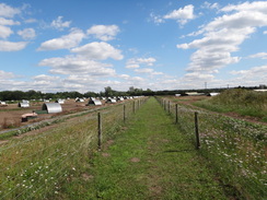
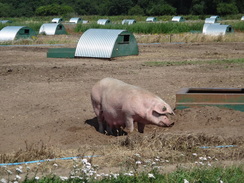
Turn right to follow this lane southeastwards for 250 yards; just before it curves to the right turn left through a gap in a hedge to join a footpath that heads eastwards between fences. The path curves slightly to the left and the fence on the right becomes a hedge and fence; at the current time (2011) this stretch heads through a pig-farm.
The path curves to the right, keeping a fence on the right, and then curves to the left to reach a wooden footbridge on the left. Cross this, and on the other side turn right across some grass to reach a track. Cross this and head straight on across a recreation ground to reach a metal clappergate in a fence. Go through this and continue across a paddock to reach another clappergate. This leads on to a third clappergate and finally a pedestrian gate to reach Coulson Lane on the outskirts of Brandon.
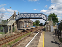
Turn left and follow the lane as it heads northwards with a wall on the left. Just after the last house on the right, turn right down a narrow gravel path between walls to reach the A1065. Turn left to follow this road northwards; it soon crosses the Little Ouse on a bridge before reaching Brandon railway station on the right, where this walk ends.
 |
 |
|
Distances
| From | To | Distance (m) | Ascent (ft) | Descent (ft) |
|---|---|---|---|---|
| Ely station | Prickwillow | 4.7 | 43 | 49 |
| Prickwillow | Shippea Hill station | 4.3 | 23 | 20 |
| Shippea Hill station | Lakenheath station | 9.0 | 7 | 7 |
| Lakenheath station | Brandon station | 5.1 | 92 | 82 |
This makes a total distance of 23.1 miles, with 165 feet of ascent and 158 feet of descent.

For more information on profiles, ascents and descents, see this page
Transport
Trains run between Brandon and Ely roughly every hour during the week. Both railway stations are an easy walking distance away of the Hereward Way. See the National Rail website for more information. Note that the intermesiate stations at SHippea Hill and Lakenheath are less frequently served - indeed at the moment Shippea Hill only has one train per day stopping at it.
 |
 |
|
 |
 |
|
 |
 |
|
 |
 |
|
 |
 |
|
 |
 |
|
 |
 |
|
 |
 |
|
 |
 |
|
 |
 |
|
 |
 |
|
 |
 |
|
 |
 |
|
 |
 |
|
 |
 |
|
Disclaimer
Please note that I take no responsibility for anything that may happen when following these directions. If you intend to follow this route, then please use the relevant maps and check the route out before you go out. As always when walking, use common sense and you should be fine.
If you find any information on any of these routes that is inaccurate, or you wish to add anything, then please email me.
All images on this site are © of the author. Any reproduction, retransmissions, or republication of all or part of any document found on this site is expressly prohibited, unless the author has explicitly granted its prior written consent to so reproduce, retransmit, or republish the material. All other rights reserved.
Although this site includes links providing convenient direct access to other Internet sites, I do not endorse, approve, certify or make warranties or representations as to the accuracy of the information on these sites.
And finally, enjoy your walking!
Nearby walks
| # | Title | Walk length (miles) |
|---|---|---|
| 3 | Littleport to Downham Market | 14.0 |
| 7 | Waterbeach - Burwell - Swaffham - Waterbeach | 17.1 |
| 15 | Waterbeach circular via river and Long Drove | 7.4 |
|
|

|