Walk #918: Viking Way: Donington on Bain to Tealby and back
 |
 |
|
General Data
| Date Walked | 29/08/2011 |
| County | Lincolnshire |
| Start Location | Donington on Bain |
| End Location | Donington on Bain |
| Start time | 07.53 |
| End time | 15.19 |
| Distance | 22.0 miles |
| Description | This walk follows the Viking Way northwestwards from Donington on Bain, passing through Ludford to reach Tealby. The second half of the day follows the same route back to the start point. |
| Pack | Today I carried my 30-litre Karrimor rucksack, filled with water, my waterproofs, a couple of books and other odds and ends. |
| Condition | I feel fine after this, with no problems to report. |
| Weather | Today started off sunny with few clouds; it was very windy, however, and as this was a northwesterly it was very chilly. The clouds stared to gather as he day went on, althouth thankfully the wind started to die down a little. |
| OS map | Landranger number 122 (Skegness & Horncastle), Landranger number 121 (Lincoln & Newark-on-Trent) and Landranger number 113 (Grimsby, Louth & Market Rasen) |
 |
 |
|
Map of the walk
Maps courtesy of Google Maps. Route for indicative purposes only, and may have been plotted after the walk. Please let me have comments on what you think of this new format. For a detailed table of timings for this walk, please see the table file.
 |
 |
|
Notes
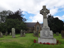
It had been several months since I was last on the Viking Way, and as Sencan was away for a week in Switzerland it seemed like a good opportunity to get away. On my last trip I had reached the small Lincolnshire village of Donington on Bain, and I decided to make a trip of it and packed up all my camping gear into the car. I set off at just after half past five in the morning, and the bank holiday meant that the roads at this early hour were eerily quiet. I eventually pulled up at Donington on Bain and tried to find somewhere to park. There were no spaces outside the church (my usual place to try to park), and I ended up pulling up on a residential road nearby.
I had somehow injured my left ankle whilst out on a short walk around Wimpole Hall the previous weekend, and it had been giving me gip ever since. Wearing trainers caused me pain as it pressed against the bone, but a test walk yesterday in my boots had worked out fine if they were tightly laced. I was concerned that it might continue to give me pain during this walk, and I took some strapping with me just in case it did.
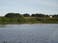
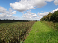
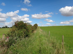
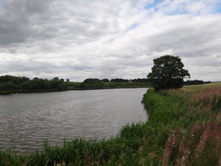
The Viking Way initially followed a road out of the village before heading along an easy, level path with scrubland off to the left. Geese were noisily flying overhead, and the reason became obvious as a large and picturesque lake soon emerged on the left. A flock of geese were floating on one end of this, and the resident swans and ducks were at the other, as if they wanted nothing to do with each other.
A large mast on the skyline to the left - the Belmont Transmitting Station - would be visible all day. Until 2010 this was 385 metres in height, and was the tallest structure in the entire EU; however it was shortened last year to be just 351 metres in height, apparently due to the digital switchover. I am glad I am not one of the men who have to climb such masts.
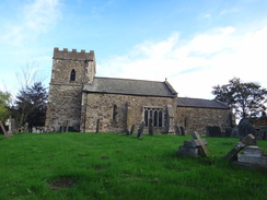
Another short stretch of path took me past the church at Biscathorpe. This tiny structure was set amongst trees, with only the rather ornate lantern visible above. It seemed to be rather a quiet church and no wonder - the only house nearby was boarded up. The area was utterly deserted with no-one about, the boards over the houses windows giving the scene a surprisingly bleak air, despite the pastoral surroundings.
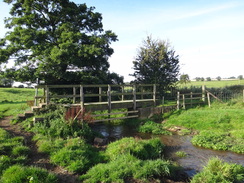
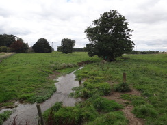
The first climb of the day came after crossing a footbridge over the River Bain, which was little more than a stream. The climb was not too bothersome either, but unfortunately it dumped me out onto a road which I had to follow northwards for a mile or so. Loud roaring noises had been assaulting my ears for some time, and the reason soon became clear - hoards of motorcyclists were heading towards a round of the British Superbike Championship at nearby Cadwell Park. It took a while for a gap in the traffic to come along before I could dash over. Sadly an eighteen year old rider died at the meeting, an indication of quite how dangerous the two-wheeled form of motorsport can be.
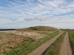
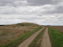
A track took me onwards after crossing the main road, and this soon passed a rather large and prominent tumulus called Grims Mound. It certainly did not look grim in the sunshine, and indeed it seemed a rather pleasant setting.
It was still early and the sun was not quite warming - I had purposefully left my fleece in the car, and this turned out to be a mistake as the full force of a northwesterly breeze hit me. It was chilling despite the sunshine and did not even lapse when the trail dipped down to cross a stream. This led onto a minor road near a place that is marked on the map in italics as Medieval Village of East Wykeham; there are many of these deserted villages strewn across Lincolnshire (another example was at Biscathorpe), and it led me to wonder why it had disappeared. Was it the Black Death or changing fashions in use of the land? Or perhaps some previous owner of Wykeham Hall had unseated them so they did not spoil his views.
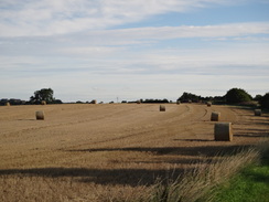
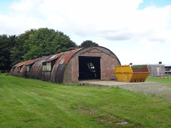
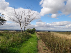
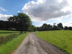
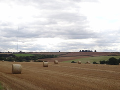
A long track took me westwards; initially this was gravel and rough, although I was still making very good time as I strolled along. The track became surfaced as it led me down to a road, which was then followed northwards for a mile. Off to the left was the site of Ludford Magna RAF base, which had operated Lancasters during the war. The only indication of its previous use were a couple of concrete tracks leading off the road; the cornfields that had replaced the airfield seemed too agrarian, as if they were laughing contemptuously at mans follies. Where Lancasters once took off loaded with young men and bombs on their way to Germany, corn now rippled in the wind.
Only a couple of cars passed me as I headed north along this minor road, but this changed when it ended at the A631 immediately to the east of the village of Ludford. Fortunately there was a pavement that saved me from risking my life as I followed it west through the village. The small church looked pretty from the outside and I was tempted to go in, but there was still a long way to go. Instead I walked past two pubs - the White Hart and the Black Horse - before passing a cafe that catered for the passing Viking Way trade. It seems that this trail is fairly well walked, and I can see why - it is not a classic, but it is not a bad stroll in a county that contains few named trails.
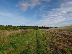
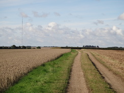
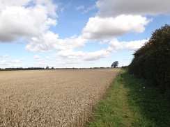
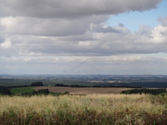
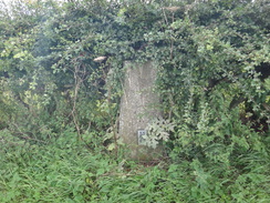
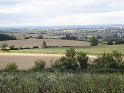
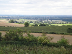
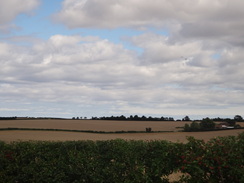
I ignored the cafe and headed on. Tracks and paths took me to the B1225, and after this came a very bitty and uninteresting stroll along the edges of fields. The direction seemed to constantly change, left, then right, then left once more. Only the expansive views that started to unfold to the west added any interest, even when I diverted off the trail to visit a nearby trig pillar. A strange brown plume lifted into the sky in the distance, not unlike the trail given off by a missile. It was nowhere near the two Trent Valley power stations that I could see in the distance, and the smoke took a distinctly different form to the chimneys condensation plumes. I watched fascinated as the trail curved into the sky before making a tight ninety-degree turn.
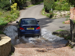
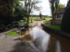
The path continued to twist and turn as it descended; I passed an attractive girl walking in the opposite direction who seemed to be in a world of her own before the trail met a stony track. Initially the stones were awkward to walk along, but thankfully the track became better quality as it passed the site of a third medieval village and approached a ford over a stream. I stepped to one side to allow a car past, and got a good photograph of it as it threw a cascade of water to each side.
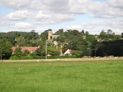
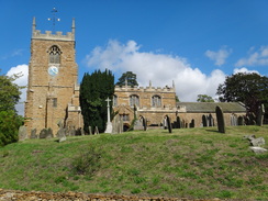
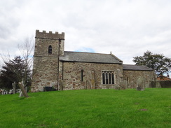
Tealby church was visible ahead and above me, and I climbed up towards it, passing a community shop on the way. Whereas Ludford had been utterly underwhelming, Tealby was a superb place, with lots of houses made out of a rosy stone - a noticeboard says that there are twenty listed buildings in the village, and it shows. At the top of the hill I passed the church to reach the point where tomorrows walk was planned to meet the Viking Way.
Here I was faced with a choice; I could either head back the way I had come, or take a walk mainly along roads to turn it into a circular walk. I had actually quite enjoyed following the trail today, so it was an easy decision to eschew the road and head back the way I came. I soon stopped at the community shop and went in to buy an ice lolly - there were two other walkers ahead of me in the queue, one of whom was grasping a pub walks book. We stopped outside to chat about the local area, which I have the feeling will really improve tomorrow as I get properly into the Lincolnshire Wolds. It was very pleasant to chat after the somewhat Trappist walk so far and I ended up spending much longer than I had expected before we eventually parted.
Another car was splashing its way through the ford as I approached, and the climb up the stony track proved to be just as annoying as the descent had been. I put myself onto autopilot for the next couple of miles as the trail took me back towards Ludford, where I was planning to take a break in one of the pubs. Again I was tempted to nip into the cafe, especially as the enticing scent of sausages hung in the air, but a pint was more enticing. The first pub looked shut despite it being past midday on a bank holiday Monday so I walked on, only to find that the second was also shut.
Annoyed, I was tempted to walk the half-mile back to the cafe, but instead I plodded on. I put myself back onto autopilot as I strolled and the miles just flew by. Fortunately the northwesterly wind had died down slightly, and was also now coming from my back rather than my front and so was much more bearable.
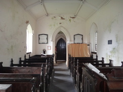
I was surprised to see ten cars parked on the grass in front of Biscathorpe church, and many people were out and about, including children playing with nets in the stream. It was a remarkable contrast to the solitude I had encountered earlier in the day, especially as the sun had now been replaced with a thick layer of cloud. As I had plenty of time I nipped into the church to have a look around. It was a Victorian structure and was in slight ill-repair; as usual I had the Church Conservation Trust to thank for it being open at all. I am not particularly religious but we should thank them for their work in keeping so many magnificent structures open to the public.
Several groups of people were following the path to Donington on Bain, and at a footbridge over a stream I stopped to chat to a man who was walking with a cane. He told me that this was a popular place for people to come, and at some times thirty cars could be parked on the grass near the church. I slowed down considerably after this, taking my time as I walked back past the lake, one end of which was still filled with noisy geese.
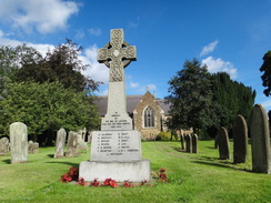
I stopped off to quickly explore Donington on Bain church. This was fairly unremarkable aside from the arches in the exterior walls that were the remains of old aisles that had been demolished. After this I strode back the short distance to my car where I scoffed much of a potato salad that I had forgotten to take with me. It was a superb impromptu meal.
My last task of the day was to get to the campsite that I had booked myself into to the north of Caistor. On the way I stopped off in the town itself for a look around. The parents of a friends husband have moved from the glorious Peak District to live here, and I wondered why - the impression of Caistor I got from my short stroll around was of a small market town, but hardly remarkable at all. I nipped into the Co-Op to buy some food and then the chip shop. There was no fish ready so I just had a tray of tasty chips before heading to the campsite.
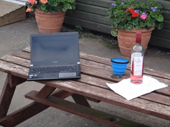
The campsite I booked into is a fishery campsite, meaning that the pitches are set around lakes. The facilities are basic but clean, and sadly the cafe was shut when I arrived. I pitched my tent and then sat on a bench near a lake to type these notes, which were lubricated by a rather nice bottle of Rose wine. I know some hikers who take bottles or casks of wine into the hills with them, a habit I have never got into. Car camping allows me to take a bottle with me, and I really enjoyed this evening despite the growing cloud.
 |
 |
|
Directions
This walk starts off at Donington on Bain church (TF235829). Follow Main Road northwestwards from the church; it soon curves to the right and becomes Mill Road as it heads north-northwestwards out of the village. As the road curves to the left after a quarter of a mile, turn right at a triangular junction to head up Wellsdale Road past a house on the left. After a few yards turn left across a stile beside a field gate to join a green track. This track heads northwards with a fence on the right; at the end of the first field pass through a clappergate beside a field gate and follow the track as it curves to the left across a second field. At the end of this field, squeeze through a gap in a hedge to enter a third field, with a boggy area of ground to the left.
At the end of this field cross a footbridge over the end of a ditch with a little pond to the left, and continue on to emerge out onto the edge of another field. A lake soon starts on the left; when this ends the path turns to the right to take a more northerly course with a boggy area of ground to the left. As the hedge curves to the right at the northern end of this long field, turn left through a wooden clappergate and continue on with a fence on the left. After a couple of hundred yards a footbridge over a stream is reached on the left; cross this and take a path on the other side that runs with a fence on the right. Go through a clappergate and continue on with the low churchyard wall on the left. The path leads onto an unfenced road near the church at TF229849.
Cross the road and turn half-right across some grass to reach a footbridge over a small stream. On the other side of the footbridge, head north-northwestwards uphill across a rough and bumpy field, aiming for the left-hand edge of a clump of trees on the crest. The path goes through a clappergate to enter the edge of the woodland; an obvious path leads through the trees to another clappergate that leads out onto a road at TF227853. Turn right and follow this road north-northeastwards as it climbs slowly uphill for 0.9 miles until the A157 road is reached at TF231866.
Carefully cross the main road and continue north-northeastwards along a good track. This runs along the crest of a hill, passing right beside a tumulus called Grims Mound. The track becomes increasingly rougher as it heads on; after 0.9 miles a junction with another footpath is reached at TF238878. Turn left and follow this new footpath west-northwestwards downhill with a hedge on the right for a quarter of a mile to reach a steam. Cross this stream and continue uphill on the other side; it crests the hill and descends slightly until it reaches a field gate with a house on the left. Go through the gate to reach a surfaced track at Wykeham Park at TF227882.
Turn left to head south along this track; as it curves sharply to the right continue straight on downhill along a rougher track, immediately crossing a cattle grid and passing a house on the right as it descends. The path curves to the right and the left whilst descending down to cross a stream on a bridge. On the other side of the bridge it heads uphill to the south; after 250 yards it curves to the right to head westwards with a hedge on the right. Soon woodland starts on the left. After half a mile Kirsby Top Farm is passed on the right; the track then becomes a surfaced road called Wykeham Lane for another third of a mile until it ends at a T-junction with another road at TF211876.
Turn right and follow this road north-northwestwards for a little over a mile until it reaches a T-junction with the A631 road at TF204892. Carefully cross the A631 to reach the pavement, and then turn left to follow this road west-southwestwards for three-quarters of a mile through the village of Ludford.
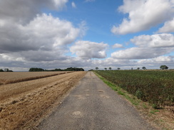
Continue along the A631 as it heads westwards through the village. Pass a road junction on the left and continue on for another 250 yards, passing a cafe before turning right up a concrete track. This passes some barns on either side before becoming a rough track that emerges into fields. The first field ends after nearly half a mile; here turn left to head slightly south of westwards with a hedge on the right. Cross three fields (separated by gaps in hedges) to reach a stile that leads onto the B1225 road at TF181894.
Turn right to follow the B1225 northwards for a couple of hundred yards. Opposite High Street Farm turn left through a metal vehicle barrier to head down an unsurfaced track. At the end of the first field, turn right to head slightly west of north along this field, keeping a hedge on the right. Go through a gap in a hedge ahead and turn left to follow the hedge downhill on the left. Go through a gap in a hedge ahead and turn right to head northwestwards, following the hedge on the right.
The path continues on, going through another gap in a hedge into a field. As the field on the left ends, turn right to go through a hedge and then immediately left through a gap in a hedge to head down a small bank. On the other side turn left to start heading downhill with a hedge on the left. The path immediately squeezes through a gap in a hedge to enter another field. Keep the hedge on the left; at the bottom of the field it curves to the right, dropping down into a dip and climbing up the other side before it ends at a rough unsurfaced track at TF168902.
Turn left to follow this track for three-quarters of a mile; initially it heads westwards steeply downhill before the gradient slackens and it curves to head northwestwards. It becomes surfaced before dropping down to cross a ford over a stream; there is a footbridge to the right. On the other side a surfaced road called Back Hill climbs up through the village of Tealby. It passes the village hall and community shop on the right before ending at a T-junction with the B1203 Rasen Road at TF157908.
Turn left to follow the B1203 in a rough westerly direction, passing the church on the right. The road curves to the left, and when the pavement on the left ends it is time to turn back and head the way you came; directions are detailed below.
Turn around and follow the B1203 eastwards. Shortly after it passes Tealby Church on the left, turn right down Back Lane. This heads downhill through the village, passing the village hall on the left. As the road curves to the right, continue straight on, still along Back Lane, to reach a ford over a stream. On the other side of the ford the road continues on towards Bayons Lodge; shortly afterwards it becomes unsurfaced, crosses another track and turns to the left to climb uphill to the east. It passes Top Lodge and then crests the hill; drop down for a short distance on the other side and then turn right past a metal vehicle barrier, keeping a hedge on the right.
The path falls into a little dip and climbs up the other side; follow the hedge as it curves sharply to the left to climb uphill. Go through a gap in a hedge and, about thirty yards later, turn right to climb up a small bank and through a gap in a hedge. On the other side turn right and then left to start following a hedge on the left southwards. Pass through a gap in a hedge on the left and continue on until a rough green track heads uphill from a small building some distance downhill to the right; here turn left through a gap in a hedge and continue on with a hedge on the right.
At the top of the field, turn right through a gap in a hedge and follow another hedge on the left southwards until it meets a rough track. At the track turn left and follow it east-northeastwards for a sixth of a mile until it ends at the B1225 road directly opposite High Street Farm. Turn right and follow the road southwards; after a couple of hundred yards turn left to enter a field. Keep a hedge on the left as you heads eastwards, passing through gaps in two hedges ahead. At the end of the third field turn right, keeping a hedge on the left as the path heads south-southeastwards. It leaves the field and becomes a track that passes barns on the right; the track becomes concrete before it ends at the A631 road in Ludford at TF191888.
Turn left to follow the A631 eastwards through Ludford for 0.9 miles; when a junction with Girsby Lane is met on the eastern side of the village at TF204892, turn right down Girsby Lane. Follow this as it winds in a rough southerly direction for a little over a mile until Wykeham Lane leads off to the left before a band of trees. Turn left and follow this lane eastwards; at Girsby Top Farm it becomes an unsurfaced track. Half a mile after the farm the track curves to the left to head downhill; it crosses a stream and starts climbing up the other side, passing a house on the left to reach a cattle grid. On the other side the track becomes surfaced. Continue uphill for a few yards until a house is passed on the right.
Immediately after the house turn right through a field gate to enter a field. Keep a hedge on the left as the path ascends a slight slope as it heads east-southeastwards, descending into a little valley to cross a stream at the bottom. It then climbs up the other side of the valley. When a hedge is reached at the top, turn right to follow a rough track, keeping a hedge on the left. The track heads southwestwards, slowly becoming firmer underfoot. It passes a tumulus called Grims Mound on the right before ending at the A157 road at TF231866.
Carefully cross the main road and continue south along a minor road for 0.9 miles. At TF227853 turn left through a clappergate to join a path that runs through a patch of woodland. It soon leaves the woodland through another clappergate before heading off downhill to the south-southeast, aiming directly for a footbridge at the bottom of the hill. Use this to cross a stream and then angle half-left to reach an unfenced road beside a house on the right.
Turn right and start following a low wall on the right that guards the churchyard. This leads to a clappergate. Go through this and turn left along a footpath that runs between fences to reach a footbridge over another stream. On the other side turn right to start heading south; it soon reaches another clappergate. Continue on with some boggy ground on the right; this soon deepens to become a lake. When the lake ends continue on to a hedge and turn right to cross a footbridge over a ditch, with a pond on the right.
On the other side head across a series of fields, squeezing through gaps in a couple of hedges to reach a clappergate beside a field gate. Go through this and follow a broad track southwards until it ends at a stile. Cross this to join a road to the north of Donington on Bain; turn right and follow this road for a short distance, passing a house on the left to reach a triangular junction. Here turn left and follow the road southwards for a quarter of a mile until Donington on Bain church is reached on the left at TF235829, where this walk ends.
 |
 |
|
Distances
| From | To | Distance (m) | Ascent (ft) | Descent (ft) |
|---|---|---|---|---|
| Donington on Bain | Ludford | 7.1 | 449 | 295 |
| Ludford | Tealby | 3.9 | 207 | 354 |
| Tealby | Ludford | 3.9 | 354 | 207 |
| Ludford | Donington on Bain | 7.1 | 295 | 449 |
This makes a total distance of 22.0 miles, with 1305 feet of ascent and 1305 feet of descent.
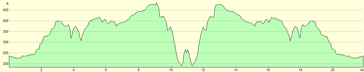
For more information on profiles, ascents and descents, see this page
Accommodation
I spent the night at the Caistor Fisheries campsite, situated about a mile to the north of the town. This had good, basic facilities and cost only eleven pounds for the night.
 |
 |
|
 |
 |
|
 |
 |
|
 |
 |
|
 |
 |
|
 |
 |
|
 |
 |
|
 |
 |
|
 |
 |
|
 |
 |
|
 |
 |
|
 |
 |
|
 |
 |
|
 |
 |
|
 |
 |
|
 |
 |
|
 |
Disclaimer
Please note that I take no responsibility for anything that may happen when following these directions. If you intend to follow this route, then please use the relevant maps and check the route out before you go out. As always when walking, use common sense and you should be fine.
If you find any information on any of these routes that is inaccurate, or you wish to add anything, then please email me.
All images on this site are © of the author. Any reproduction, retransmissions, or republication of all or part of any document found on this site is expressly prohibited, unless the author has explicitly granted its prior written consent to so reproduce, retransmit, or republish the material. All other rights reserved.
Although this site includes links providing convenient direct access to other Internet sites, I do not endorse, approve, certify or make warranties or representations as to the accuracy of the information on these sites.
And finally, enjoy your walking!
Nearby walks
| # | Title | Walk length (miles) |
|---|---|---|
| 608 | Market Rasen to Lincoln | 24.1 |
| 901 | A circular walk between Fulletby and Donington on Bain | 17.4 |
|
|

|