Walk #870: A circular walk between Salisbury and Middle Winterslow
 |
 |
|
General Data
| Date Walked | 25/10/2010 |
| County | Wiltshire |
| Start Location | Central car park, Salisbury |
| End Location | Central car park, Salisbury |
| Start time | 08.33 |
| End time | 16.23 |
| Distance | 17.3 miles |
| Description | This was a very pleasant stroll, following in part both the Clarendon Way and the Monarch's Way, taking in Old Sarum on the way. |
| Pack | Today I carried my Macpac Glissade rucksack containing my North Face Westwind tent, camping gear, waterproofs, water, and foor for one day. |
| Condition | I feel absolutely fine after this walk. |
| Weather | Today was a lovely, sunny day, with scarcely a cloud in the sky. It was warm for the time of year, but there was a brisk breeze that proved to be quite chilly. |
| OS map | Landranger number 184 (Salisbury & The Plain, Amesbury) |
 |
 |
|
Map of the walk
Maps courtesy of Google Maps. Route for indicative purposes only, and may have been plotted after the walk. Please let me have comments on what you think of this new format. For a detailed table of timings for this walk, please see the table file.
 |
 |
|
Notes
After my (failed) attempt to walk the entire Clarendon Way last week, I decided to try to walk the easternmost stretch of it today. Instead of heading back the same way, it seemed like a good idea to combine this with a visit to Old Sarum, which I have visited, but never walked to, before. The drive to Salisbury was easy, and I was soon parked up in the Central car park. I was using my large rucksack once more, and was carrying a totally unnecessary full load of camping gear. Salisbury was just starting to warm up as I walked towards the cathedral, and I nipped into Reeves to buy a couple of sausage rolls. These were well and truly snaffled down by the time I reached the main entrance to the cathedral.
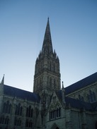
Salisbury cathedral looked spectacular in the early morning sunshine; a layer of frost covered the shaded areas of grass. I had already walked a mile, and the pack felt absolutely fine on my shoulders. I found the first Clarendon Way marker on a lamppost on the High Street, but after that I had to use my knowledge to find the route out of town. It was a pleasant stroll out of town, up until I passed under the ugly concrete bridge that carries the dual-carriageway ring road overhead. A hill then took me uphill past the youth hostel, the stiff climb nicely warming me up.
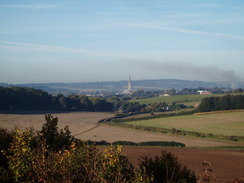
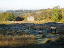
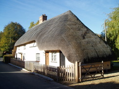
A long track took me eastwards, before a stiff climb up a track took me up towards the site of Clarendon Palace. Near the top there was a viewpoint, and the spire of Salisbury cathedral could just be seen in the distance. A picture-perfect thatched cottage nestled at the top of the hill, a wonderful place to live. The palace was originally a hunting lodge, which late became a palace for King Henry II and IIII. The Constitutions of Clarendon were developed at the palace, and these led to the fallout between King Henry II and Thomas Becket. Unfortunately the remains of the palace are exceptionally fragmentary, with only a couple of walls sticking above the bumps on the ground.
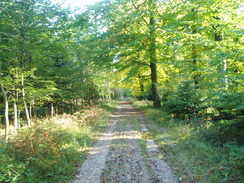
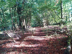
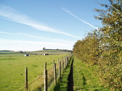
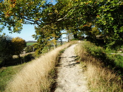
I did not spend much time examining the ruins, and instead plunged on into Clarendon Forest. The main track was soon left behind, a small waymarker pointing off down a narrow path. It was a great deal cooler within the trees, and I was glad that I had put my fleece on. The path was easy to follow along an obvious track that eventually descended, leaving the trees and approaching the farm at Four Cottages. A simple walk took me along the edge of the fields, before passing a sewage pumping station and entering the village of Pitton.
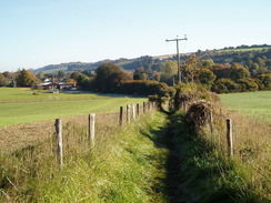
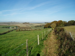
There is a pub and a little shop in Pitton, and I nipped in to buy a pack of crisps and a couple of chocolate bars, useful fuel for the rest of the day. The next few miles were rather bitty; a track led out of the village before climbing steeply uphill. There were no waymarkers to show where the point led off the track, but a kind man pointed me in the right direction. The actual path was overgrown, but it was easy to walk on a few yards to a gap in the hedge, which seems to be the route everyone else takes. The path to the church at West Winterslow offered some of the most expansive views of the day to the northwest, and I felt my heart lift. Five or six people passed me on the path, all admiring the views, and this must be a favourite dog walking route for the locals.
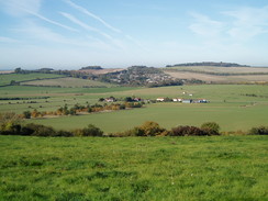
I did not bother to nip into West Winterslow, and instead took a path that led across a series of narrow stiles, each separated from the next by a metal gate. It was hard to find the proper route, and I ignored a waymarker that headed diagonally across a field, instead following the edge. This turned out to be correct, and the path soon entered an area of woodland before plummeting down to meet a track, where I joined the route I had done the previous week. A steep climb took me up into Middle Winterslow, where I hoped to find the pub open. Unfortunately it turned out to be shut; Mondays being the one day of the week when it does not open at lunchtime. The adjacent shop was open, however.
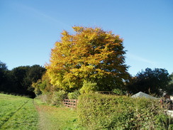
Soon I was retracing my steps, heading down the hill through the woodland. I was starting to feel a little tired, the heavy pack weighing me down. The next stretch of the old Roman Road to Dunstable Corner was heavily rutted, which again slowed me down. I stopped off on a bench beside a little play area by the village of Firsdown; I took my rucksack off and got a book out. The bench was fully in the sun, and I soon started to warm up. It was a lovely place to stop.
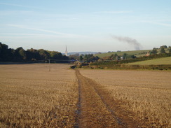
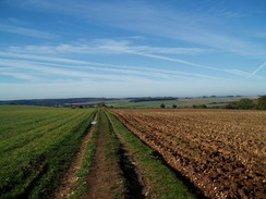
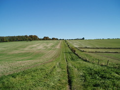
Eventually I put my rucksack on and headed off once again. A gently slope led up, entering a small area of woodland. I imagined myself being a Roman Legionnaire route-marching to Old Sarum, and this helped the next few miles fly by. As is usual with Roman roads, there were no obvious signs of the past aside from the arrow-straight route. Eventually the A30 is reached, and a road descended to the A338 and a railway bridge. Workmen were doing some work by the bridge, protected by four-way traffic lights.
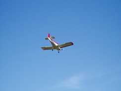
The River Bourne was crossed, and a road then headed uphill, again following the course of the Roman Road. A light aircraft repeatedly flew overhead as my legs starting to stiffen slightly. The plane kept on making approaches to the grass runway of the airfield immediately to the north; I can only assume that it was training a pilot. The A345 road was surprisingly busy, and I had to wait for a few minutes before a safe gap in the traffic. Ahead lay the access driveway to Old Sarum.
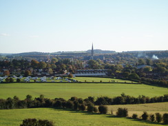
Old Sarum is a famous landmark in the area; an old hillfort that was used by the Romans (several Roman roads lead here, including the one I had just followed). Later on it became a significant Anglo-Saxon settlement, and the Normans built a castle on the site. A Cathedral soon followed. Unfortunately a number of factors made the site unworkable; the limited space on the exposed hilltop; the shortage of fresh water and the close proximity of religious (cathedral) and military (castle) institutions. In the early thirteenth century the cathedral and inhabitants moved a couple of miles to a new settlement, New Sarum, which is now called Salisbury. The ruins of the castle and the footprint of the cathedral are in the care of English Heritage.
Instead of going into the interior, I followed a footpath that followed the top of the outer bank. It was a very pleasant stroll, with some good views. I still had a couple of hours before I had to pick Sencan up from work, so I found a convenient place and took my rucksack off. I lay down on the grassy bank and started reading my book. A steady stream of people passed me, their dogs unvaryingly coming up to take a sniff at my rather sweaty clothes. It was a wonderful place to stop for a rest; the history of the ancient monument mixing with the light aircraft and helicopters that flew overhead. The book was finished all too soon, and I reluctantly shouldered my rucksack and started off along the remaining stretch of ramparts. Just before the entrance road, a path led off to the right, and from this another track headed down towards Stratford sub Castle.
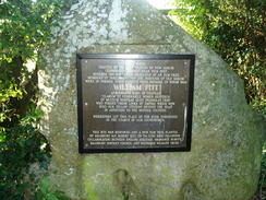
On the way there was a memorial stone on the right, on which was a plaque It commemorated the 'parliament tree', an elm tree under which the electors of Old Sarum met to choose their representative at parliament. Old Sarum was the most famous of the 'Rotten Boroughs', constituencies with only a handful of men able to vote. William Pitt was the most famous of Old Sarum's MPs. Such constituencies became increasingly obscene with the industrial revolution, where cities such as Manchester would have only a couple of MPs for many thousands of people. Old Sarum and the other rotten boroughs were finally abolished with the Great Reform Act in 1832. One of the great things about walking is finding these surprising echoes of history.
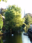
The rest of the walk from Stratford sub Castle to the car in Salisbury was along roads, and did not have much to commend it. When I got home I found a path that runs alongside the river, and that may well make a better route. I was feeling fine when I reached the car, and as there was still plenty of time before I needed to pick Sencan up, I went for a stroll around the centre of Salisbury. It had been an enjoyable day's walk, and put a lie to those who say that walking is no fun between October and March.
 |
 |
|
Directions
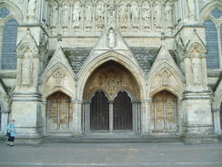
This walk starts off at the long-stay Central car park in Salisbury. Head south through the car park, passing the toilets and following a walkway with a stream on the left and the multistory car park on the right. When some shops are reached ahead, turn left to cross the stream along The Maltings. This soon curves to the right to head south, with a stream on the left. It curves to the left to cross the stream, and then right to and at a crossroads. Cross the road, and start heading south down the High Street. This crosses another road and then heads under an archway to approach the cathedral. When the road ends, continue straight on to reach the main doors at the western end of Salisbury Cathedral.
The next seven miles of this walk follow the Clarendon Way. From the main entrance of the cathedral, retrace your steps northwards along the path and the the road; pass under the archway and onto the High Street. Head straight on across the first crossroads with New Street, before turning right down New Canal. This heads in a rough easterly direction through the centre of Salisbury, eventually reaching the bridge that carries the A36 dual carriageway overhead.
On the other side of the bridge, the road becomes Milford Hill. Follow this uphill, passing the youth hostel on the left; at the top of the hill the road curves to the right, becoming Shady Bower. This passes a school on the right before crossing a railway line and descending, curving to the left. At the bottom of the hill turn right down Milford Mill Road. This heads eastwards; cross a narrow bridge over a stream and follow the road as it curves to the left, becoming Queen Manor Road.
Follow Queen Manor Road eastwards; when it ends it becomes a track that continues on. Pass Ranger's Lodge Farm and head on eastwards. As the track curves gently to the left at SU170298, go through a gap in a hedge and continue straight on diagonally across a field, rejoining the track at SU174298. This track soon starts to head uphill eastwards, curving to the right and passing a pretty thatched cottage on the left. Immediately after the cottage turn left along another track that heads eastwards; across a fence to the left is Clarendon Palace.
As this track curves to the left at the eastern end of the palace site, continue straight on along another track for abut fifty yards; keep your eye our for a low wooden post, on which is a marker pointing off to a path to the left. This heads through the woodland in a rough northeasterly direction, and is easy to follow once you have found it. Eventually it starts to descend, and emerges into an open area. It joins a hedge on the left, which is followed until the track ends at Four Cottages.
Cross a track, and continue on along a track that heads gently uphill, initially with a cottage's garden on the right. It skirts some woodland on the right and fields on the left; it finally emerges from the trees and continues on between fields. At the end of the next field, the path turns to the right and heads down with a hedge on the left to reach a road beside a small sewage pumping station. Turn left and follow the road northeastwards for a couple of hundred yards until a crossroads is reached in Pitton.
Cross the road, and continue straight on along the High Street. Pass the post office on the left, and just before the church is reached on the left, turn right up a surfaced path. Initially there is a wall on the left, then a hedge, as it passes a play area on the right. The path soon ends at a road called The Green. Turn left to follow The Green northeastwards; as this curves to the left, turn right up a slope to join a path. This heads northeastwards between hedges before joining a track.
The path meets a T-junction with a track at SU216316; turn right and start following this track as it heads uphill. A footpath leads off to the left between hedges at the top of the hill at SU220318. If this footpath too overgrown, continue on for a few yards to a gap in the hedge on the left. The path follows the edge of a field northeastwards along the top of an escarpment. Eventually it becomes a track and cuts inland away from the edge of the escarpment. It reaches a farm; continue straight on and pass a barn on the right to reach a track. Turn left down this road for a couple of yards to reach a road in West Winterslow.
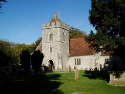
Cross the road and head up the access road towards West Winterslow church. Keep the graveyard to the left and pass the church on the same side to go through a metal clappergate to reach a field. Keep the hedges on the left as you pass northwards through a series of clappergates in rapid succession. The path reaches some woodland at SU228328; here it turns to the left to head downhill for about fifty yards before turning to the right and entering the woodland.
The path is easy to follow through the woodland; it eventually turns to the left to head downhill through the trees to a metal clappergate. Go through this and descend a few yards to a track; turn right up this track and follow it as it climbs uphill, curving to head uphill eastwards. The track ends at a surfaced road; continue eastwards along this for a few yards, before turning right along a road called The Flood. Continue straight on to reach the Lord Nelson pub in Middle Winterslow.
The first part of this walk retraces your route as far as the metal clappergate in the woodland; head down The Flood, and when it ends turn left to join the surfaced track continue straight on along a track called Cobb Lane. This starts to descend and curves to the left. Near the bottom of the hill the track curves sharply to the right at SU231331; instead of going through the clappergate, continue on along the track westwards. It soon emerges from the trees and is heavily rutted before it ends at a road at SU224331.
At the road turn right to head northwestwards for a hundred yards until a crossroads is reached at Dunstable Corner; here turn left down another road southwestwards. Immediately after a farm on the right, a path leads off to the right between fences. This immediately curves to the left and takes a westerly course to join a green track. Follow this path westwards for a little over two miles as it climbs and falls, before ending at a minor road at SU187331. Go through a wooden gate, cross the road and continue on along the track on the other side. After a few hundred yards this ends at the A30 road.
Carefully cross the A30, and on the other side start following Old Malthouse Lane downhill. After a mile this turns sharply to the left and reaches the A338 by a railway bridge. Turn right to cross the bridge, and then turn left down another road. This descends into the valley of the River Bourne; it curves sharply to the right and ends at a T-junction with another road. Continue straight on along this road, immediately crossing a bridge over the Bourne. On the other side, follow the road as it heads uphill westwards for 1.3 miles, passing the little village of Ford before reaching a minor road. turn right down this road for a few yards to reach the A345 road.
Carefully cross the A345 road and start up the access road into Old Sarum. This soon curves to the left; when it turns to the right once more, turn sharp-right and join a footpath that runs along the top of the outer bank that guarded Old Sarum. Walk for just under a mile around the banks; just before the access road is reached, turn right down a footpath that angles down a bank that joins a track that heads southeastwards for a few yards towards the A345 road. Just before this is reached, turn right down another footpath. This heads southwestwards, initially with a hedge on the right.
As the hedge starts to curve to the right, head straight on along a narrower path that enters an area of scrub woodland; after a few yards a narrow tree-lined track is reached. Follow this downhill for a third of a mile until the track ends at a road at Stratford road in Stratford sub Castle. Turn left and start following this road southeastwards for two-thirds of a mile until it ends at the A345 road. Turn right to follow this southwards for a short distance to the Castle Roundabout. To the right, a subway leads under the roundabout. In the centre, turn right to head to the western side of the roundabout. Once back at the surface, turn left to start following Castle Street southwards. This passes under a railway line; at SU143304 turn right to take Mill Stream Approach westwards, crossing the mill stream to reach the Central car park once more.
 |
 |
|
Distances
| From | To | Distance (m) | Ascent (ft) | Descent (ft) |
|---|---|---|---|---|
| Salisbury Central car park | Middle Winterslow | 8.1 | 787 | 443 |
| Middle Winterslow | Old Sarum | 6.4 | 420 | 617 |
| Old Sarum | Salisbury Central car park | 2.8 | 148 | 299 |
This makes a total distance of 17.3 miles, with 1355 feet of ascent and 1359 feet of descent.
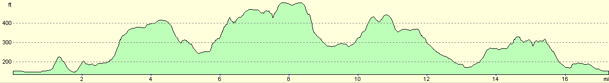
For more information on profiles, ascents and descents, see this page
 |
 |
|
 |
 |
|
 |
 |
|
 |
 |
|
 |
 |
|
 |
 |
|
 |
Disclaimer
Please note that I take no responsibility for anything that may happen when following these directions. If you intend to follow this route, then please use the relevant maps and check the route out before you go out. As always when walking, use common sense and you should be fine.
If you find any information on any of these routes that is inaccurate, or you wish to add anything, then please email me.
All images on this site are © of the author. Any reproduction, retransmissions, or republication of all or part of any document found on this site is expressly prohibited, unless the author has explicitly granted its prior written consent to so reproduce, retransmit, or republish the material. All other rights reserved.
Although this site includes links providing convenient direct access to other Internet sites, I do not endorse, approve, certify or make warranties or representations as to the accuracy of the information on these sites.
And finally, enjoy your walking!
Nearby walks
| # | Title | Walk length (miles) |
|---|---|---|
| 788 | Romsey to Salisbury | 23.1 |
| 789 | A circular walk from Mottisfont to Fullerton | 21.4 |
| 790 | A circular walk from Salisbury | 24.0 |
|
|

|