Walk #851: Westbury to Warminster
 |
 |
|
General Data
| Date Walked | 26/04/2010 |
| County | Wiltshire |
| Start Location | Westbury station |
| End Location | Warminster station |
| Start time | 07.55 |
| End time | 15.17 |
| Distance | 19.6 miles |
| Description | This was a vey pleasant walk, basically following the Wessex Ridgeway along the western and southern sides of Salisbury Plain. |
| Pack | Today I carried my 30-litre Karrimor rucksack filled with waterproofs, my walking poles, a book and other odds and ends. |
| Condition | I have a couple of small blisters on my toes; aside from these, I feel fine. |
| Weather | Today's forecast was for sunshine, but unfortunately this di dnot prove to be the case. A light drizzle started falling in the morning, although it was a warm day and my fleece coped. As the day progresed the sun started to appear and the cloud break up, leaving a fairly warm and sunny day. |
| OS map | Landranger number 184 (Salisbury & The Plain, Amesbury) and Landranger number 183 (Yeovil & Frome, Shaftesbury & Shepton Mallet) |
 |
 |
|
 |
 |
|
Map of the walk
Maps courtesy of Google Maps. Route for indicative purposes only, and may have been plotted after the walk. Please let me have comments on what you think of this new format. For a detailed table of timings for this walk, please see the table file.
 |
 |
|
 |
 |
|
Notes
I did not manage to get any walks done last week, due to an unexpected but welcome visitor (a victim of the ash cloud that had prevented air travel). I therefore was keen to get a good walk done as early in the week as possible, especially as the weather at the end of the week looks to be wet. I wanted to continue my rather elongated walk along the Wessex Ridgeway, and it soon became obvious that the best way of doing the next stretch was to walk between the railway stations at Westbury and Warminster, then catch the train back. Since both of these stations are on the railway line from Romsey, Sencan dropped me off at Romsey station so that I could catch the 07.00 train.
It was the first time in years that I had got to the start of a walk by train rather than driving, and it felt very pleasant - I sat back in the seat, munching on a muffin as I read Ronald Turnbull's the book of the bivvy'. The train was fairly busy for such an early hour, including one man in naval uniform who had a large and official-looking manual on the desk in front of him.
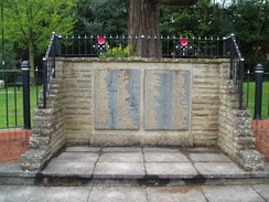
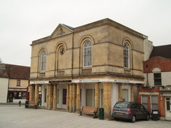
The train pulled into Westbury before eight, and I shouldered my rucksack and started strolling through the town. I was not very impressed - there were few buildings of note, and the place looked dreary and unspectacular. Things improved when I passed the church and reached the old market square, which was surrounded by some pleasant old buildings.
My route took me eastwards out of town, heading for Bratton Camp on top of the hill, where I reached on the last walk. The main road was fairly busy and the pavement ended too soon, so I diverted off along a green lane called Lower Westbury Road' (presumably the main road was the Upper Westbury Road'. The forecast had been for sunshine and cloud, so it was disappointing to see a thick grey veil of cloud overhead and a light drizzle falling. It was so light that I could manage without my coat on.
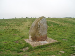
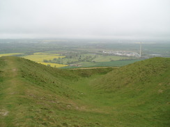
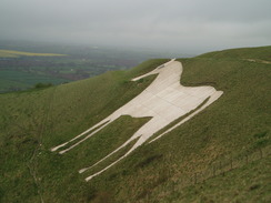
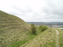
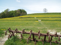
Unfortunately the weather meant that the views were foreshortened, and the photos I took of the Westbury white horse on the hillside below the camp turned out poorly. I climbed uphill and then walked along the ramparts, passing a sarsen stone commemorating a battle that King Alfred won nearby in 878. My hopes for some good views from here were spoiled by the weather, and soon I was heading off on what was, for me, virgin territory.
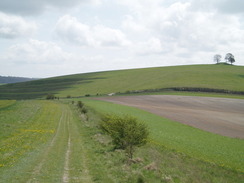
The path headed along the edge of Westbury Hill, dropping down and then climbing to reach a massive chalk quarry that belonged to the cement works in the valley below, marked by a tall chimney that dominated the local area. Unfortunately the Wessex Ridgeway chose to fall and climb again, heading through some woodland instead of sticking to a more obvious route along the top of the hill. Eventually it rejoined the track along the top as it climbed up onto Upton Cow Down.
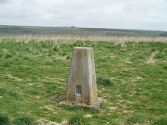
I diverted off here for a few minutes to visit the trig pillar, and then headed back to the path, which soon started diving down a steep-sided valley - so steep in one place that I considered getting my walking poles out, and in wet weather the bare chalk would be extremely slippery. After passing a couple of barns the path rose again and skirted the top of a hill, giving me my first glimpse of Battlesbury Hill off to the left.
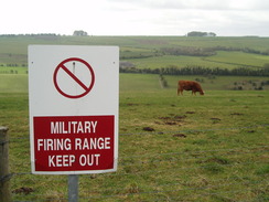
After passing a dry valley with the glorious name of Kidnappers Hole', the path descended alongside a golf course to reach a road. Ahead was the army barracks, and the housing took on a suitably austere look. I stopped to look at a signboard as I passed the entrance to the Warminster Training Centre, at which point a guard carrying a rifle approached. We chatted about walking for a few minutes before I started off once again - it is hardly the first time army guards have quizzed me about what I am doing - my appearance with my walking gear on is hardly usual.
I had walked this stretch of the Wessex Ridgeway in the opposite direction a few years ago, and familiar sights struck me as I climbed up the steep slopes onto Battlesbury Hill, the first of three hillforts in a row. The ramparts of the hill were impressively large and steep, and the views south towards Warminster showed line upon line of camouflaged army vehicles. The Way took me around three sides of the ramparts, and when I reached the eastern end I went through the entrance and clambered up to the trig pillar.
By now the sun was making increasingly frequent attempts to burst through the cloud. A path led down to a wide concrete track - more like a dual carriageway than a farm track. I sat down nearby and admired a superb view over Salisbury Plain as I munched on my sandwiches. A large military vehicle roared past along the track, showing the reason it was there - as a main route between the army camp and the plain. From my vantage point I could see several joggers making their way down from Battlesbury Hill and they were soon passing me; several were obviously in the army, but a couple were not.
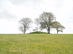
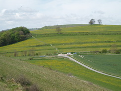
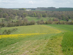
Some of the best examples I have ever seen of Strip Lynchets marked the flanks of the next hill, perhaps obviously called Middle Hill. On the map the Way headed through a fence and skirted the edge of the hill, but there was no obvious hill so I took a slightly higher route, skirting near to the solitary tumulus that marks the summit. Another descent and ascent took me onto the last of the hillforts, Scratchbury Hill, which was flanked with some spectacular ramparts. By now the sun was well and truly out and the views were becoming spectacular. It was a shame that the weather had not been so good earlier on, but that just means that I will have to walk this route again sometime - hardly a hardship.
After Scratchbury Hill the Way headed across a ploughed field and then headed up towards the tumulus on the summit of Cotley Hill. After this the path descended down towards Heytesbury. The descent was steep and I then noticed something strange occurring with my GPS - it was reporting rapidly-varying positions, far worse than I get under tree cover, and I was in the open air. (At home I discovered that the track log was very strange, more like a spider than the straight line I expected). With a conspiracy theory hat on, I wonder if the army had been using their GPS-jamming technology on the plain?
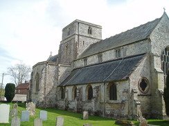
In Heytesbury I left the Wessex Ridgeway. I took a quick look at the church before heading into the post office, where I bought a large bottle of water. I had planned to take a bus from the village to the station in Warminster, but instead I decided to walk the three miles back. Instead of taking footpaths and roads that would lead me through Norton Bavant, I continued straight along the B3414 road, which had a good pavement alongside it. This granted me good views northwards towards the three hillforts, and fortunately there was not too much traffic to disturb me.
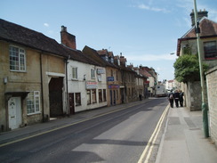
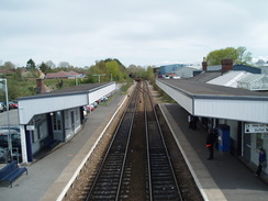
By now my feet were starting to ache, and it was a relief when the outskirts of the town came into view. Large gaggles of schoolchildren joined me as I walked down the road, their boisterous laughs and chatter amusing me as I approached the town centre. It seemed like a much prettier place than Westbury, with a broad main street lined with buildings. I did not get to see these, however, as my route took me down to the railway station. I had fifty minutes to wait for the train, so I took my boots off and lay down on a bench, basking in the sun as I read a book. It had been a mixed day's walk; the Wessex Ridgeway had been a good walk, but the stretches to and from it had been fairly uninteresting. Yet again I found myself wishing that I was doing the Wessex Ridgeway in one long go.
 |
 |
|
 |
 |
|
Directions
|
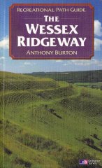
This walk starts off at Westbury Station. Leave the station and turn left to walk down Station Approach. Shortly after a lake on the right, it joins Station Road. Head south down this road, crossing over one roundabout and past another crossroads. Follow this road as it curves sharply to the left, becoming the A350 road (note, I took a slightly different route here through the town center). When the A350 turns to the left, turn right down a road and then immediately to the left, taking Alfred Street. This curves to the left and climbs uphill before ending at the B3098 Bratton Road. Turn left and follow the B3098 road as it heads eastwards; shortly after the pavement ends there is a car park. Turn left to start following a green lane called Lower Westbury Road eastwards for one and a half miles. When it ends at a junction with a road on the outskirts of Bratton, turn right up this road for a short distance to reach the B3098 once more. Cross the road, and on the other side take a bridleway that heads uphill to the south. It soon curves to the right; continue on along the obvious bridleway as it joins a road. Turn right and head on up the hill. It soon passes the northernmost ramparts of Barton Camp; it joins the Wessex Ridgeway at the southernmost ramparts. The route of the Wessex Ridgeway is detailed in the 'Wessex Ridgeway Recreational Path Guide', by Anthony Burton, ISBN 1 85410 613 9 published by Aurum Press Ltd. |
 |
This walk leaves the Wessex Ridgeway by the church in Heytesbury. Turn back to head westwards along the road through the village; when this meets a roundabout on the A36(T) carefully cross the roads and start taking the B3414 northwestwards. There is a pavement, which makes the walking easier. Three miles from the roundabout the road reaches the centre of Warminster; at ST876450 turn right to head down towards Warminster station, where this walk ends.
Distances
| From | To | Distance (m) | Ascent (ft) | Descent (ft) |
|---|---|---|---|---|
| Westbury station | Bratton Camp | 4.5 | 643 | 187 |
| Bratton Camp | Heytesbury | 11.3 | 1552 | 1880 |
| Heytesbury | Warminster station | 3.8 | 240 | 171 |
This makes a total distance of 19.6 miles, with 2435 feet of ascent and 2238 feet of descent.
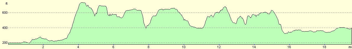
For more information on profiles, ascents and descents, see this page
Transport
There are regular train services running between Warminster and Westbury.
 |
 |
|
 |
 |
|
Disclaimer
Please note that I take no responsibility for anything that may happen when following these directions. If you intend to follow this route, then please use the relevant maps and check the route out before you go out. As always when walking, use common sense and you should be fine.
If you find any information on any of these routes that is inaccurate, or you wish to add anything, then please email me.
All images on this site are © of the author. Any reproduction, retransmissions, or republication of all or part of any document found on this site is expressly prohibited, unless the author has explicitly granted its prior written consent to so reproduce, retransmit, or republish the material. All other rights reserved.
Although this site includes links providing convenient direct access to other Internet sites, I do not endorse, approve, certify or make warranties or representations as to the accuracy of the information on these sites.
And finally, enjoy your walking!
Nearby walks
| # | Title | Walk length (miles) |
|---|---|---|
| 72 | Bath to Devizes | 19.3 |
| 629 | Shrewton to Warminster | 16.7 |
| 800 | A circular walk from Hindon to Ludwell | 20.6 |
|
|

|