Walk #852: A circular walk from Heytesbury to Hindon
 |
 |
|
General Data
| Date Walked | 28/04/2010 |
| County | Wiltshire |
| Start Location | Heytesbury |
| End Location | Heytesbury |
| Start time | 09.05 |
| End time | 16.12 |
| Distance | 16.5 miles |
| Description | This was a pleasant walk following the Wessex Ridgeway south from Heytesbury, returning by tracks further to the west. |
| Pack | Today I carried my 30-litre Karrimor rucksack filled with waterproofs, my walking poles, a book and other odds and ends. |
| Condition | I had a couple of small blisters after Monday's walk, and although they had been burst, they caused me a little discomfort throughout the day. This caused me to develop a slight limp, which in turn put extra strain on me through the day. Therefore what should have been an easy stroll became a bit of a marathon. |
| Weather | Today was the hottest day of the year so far, although the sky was often obscured by cloud. There was a slight, warm breeze that helped me keep cool on the ascents. |
| OS map | Landranger number 184 (Salisbury & The Plain, Amesbury) |
 |
 |
|
 |
 |
|
Map of the walk
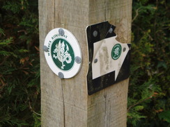
Maps courtesy of Google Maps. Route for indicative purposes only, and may have been plotted after the walk. Please let me have comments on what you think of this new format. For a detailed table of timings for this walk, please see the table file.
 |
 |
|
 |
 |
|
Notes
The weather for the rest of the week looked to be wet, so I decided to get in one more day of walking in. My route was obvious: the next section of the Wessex Ridgeway, heading south from Heytesbury, where I ended Monday's walk, to Hindon, which I had walked south from a couple of years ago. It was only an eight-mile stretch, so even as a return journey it was going to be a short day. I burst a couple of small blisters on my little toes last night - the usual place I get them - but this morning one on my right foot was aching, a bad sign. I taped them up and set off on the drive to Wilsthsire.
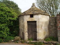
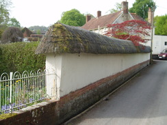
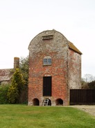
I parked on the roadside near the primary school, in a long queue of cars that were disgorging children ready for their day. Soon I was strolling down the road in the pretty village. A woman wearing walking boots was sitting on the doorstep of a B&B, a walker waiting for a taxi to take her to the start of a walk. Opposite was a curious round building with a conical roof, the old village lock-up. Small and windowless, it must have been a cold and miserable place to stay.
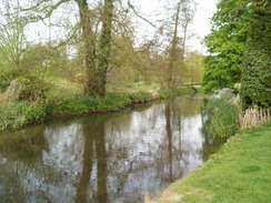
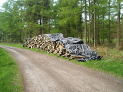
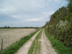
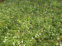
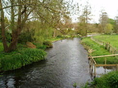
The Way left the village alongside a gently-flowing chalk river, the Wylye. It was a remarkably pleasant stretch of path, and it was a shame when it ended at a pond beside an old mill. The next stretch of path headed across fields, cutting out a bow in the river. Unfortunately the path was not particularly visible on the ground, and the route indicated on the map was guarded by no entry' signs. The diversion was not onerous, and the views back towards Cotley Hill were pleasant. Then the path headed between two hedges, with a series of metal gates blocking the way, some only a few yards apart.
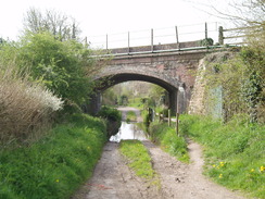
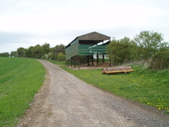
Soon afterwards the river was left behind and the Way dived under a railway line (with a flooded section that looked more like a canal, with a dry path squeezing alongside. On the other side was a faintly ecclesiastical stone building. The owner was outside, and he told me that it was heavily converted - the windows had been split into two to allow an upper floor to be inserted, and the grand porch had been moved from the end of the building to the side facing the road. In the process it seemed to have lost a great deal of its character.
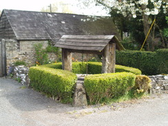
Corton was another picturesque village, with lots of houses that I would love to live in; thatched, white-walled, brick and stone; it was all here, and all pleasant. Unfortunately all too soon I was heading steeply up along a track onto Barrow Hill. At the top a narrow lane was reached, and the views started to unfold as it climbed. Behind me were the hills I had walked across yesterday, with no indication that beyond them lay the vast sparseness of Salisbury Plain. A digger blocked the lane halfway up, and a solitary, elderly farmer was shovelling dirt out of the bucket into the verge, filling in the gap between a new layer of tarmac and the grass. It looked like a long, hard job, on what was becoming a surprisingly hot day.
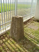
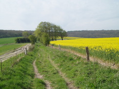
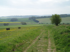
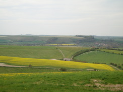
The ascent was long and gently, and more views started to unfold to the west; a patchwork quilt of green and yellows, and it was a shame that the skies were slightly hazy. Soon I was looking around for a trig pillar that was marked beside the map, which was quickly located in what appeared to be in a newly-built secure compound. I went around the side and took a few photographs before continuing the climb, the views unfolding all the time.
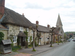
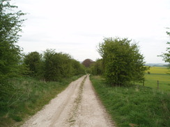
Rowdean Forest was nice and cool, although it was a shame that the views were restricted. Coniferous forest can make for boring walking, and this was the case here, the monotony only being broken by patches of ground where trees had recently been cleared. It was a relief when I started to hear the noise of traffic, and the Way started its descent down towards the A303. The road was not too busy and was easy to cross; on the other side a track and then path took me up to join a road for the descent down into Hindon. I remembered this as being an appealing village, but there was no sign of this as I headed down the hill. Only when I reached the main street did I get the full effect.
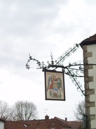
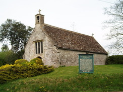
I headed past the church, looking for a place that I could have a break. One hotel looked close, so I went to an inn on the corner. The interior turned out to be far more elegant than I had intended, and I felt slightly out of place as I stood at the bar. Some of the food on offer was tempting, so I ordered a bowl of mushroom soup and sat down in a corner, trying to keep out of the way. The soup was absolutely delicious, and left me wanting more. Unfortunately time was pressing, so I supped up and got ready to go.
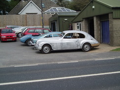
A road took me uphill out of the village, and a track then deposited me down to the A303. On the opposite side of the road was a classic car restoration company, with several expensive-looking cars being worked on. This was at the base of a stiff climb that took me uphill, before another drop into a valley. My blistered toes were starting to ache more by this point, and I looked at the following ascent with something akin to regret. I hobbled up the hill along a good track before deciding to slightly extend the walk. Instead of heading along the track past Little Sutton Wood, I decided to follow another track that headed towards the A350, before turning to head northeastwards.
Unfortunately the views were not as good as they had been on the Wessex Ridgeway, and I started to wish that I had returned by the same route I had taken in the morning. The jib of a large crane towered above the trees in the distance, and I soon reached it; it had just taken a large cylindrical tank of a low loader. I waited as they took the chains off, then headed along another track.
I stopped for a breather at a junction in the tracks; a superb spot with spectacular views to the north. Two dogs came running up to me and tried to lick my face, and its owner shortly made an appearance. We chatted about the views and farming, before I was left alone once again. I could easily have stayed there for hours, but instead I pulled my kit together and headed off down the track. It started to spit heavy goblets of warm rain, but the solitary cloud was surrounded by blue sky and it soon ended.
Tracks led down into the little village of Tytherington, which had a small and ancient church and another tall, narrow building that I could not derive the purpose of - it had a door off the ground, and what looked like holes for doves to enter near the roof. Puzzled, I walked on, following roads back to Heytesbury where I arrived footsore and tired. It felt good to have finally connected up the walks I have been doing this month with an earlier walk along the Wessex Ridgeway, although I am going to have to take more care of my feet.
 |
 |
|
 |
 |
|
Directions
|
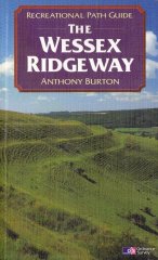
This walk starts off by the church in Heytesbury, and follows the Wessex Ridgeway for the first eight and a half miles to Hindon. The route of the Wessex Ridgeway is detailed in the 'Wessex Ridgeway Recreational Path Guide', by Anthony Burton, ISBN 1 85410 613 9 published by Aurum Press Ltd. |
 |
The walk leaves the Wessex Ridgeway in Hindon. Head back northwestwards up the road through the village; after two-thirds of a mile the road curves to the left; take a track that leads off to the right. This road descends downhill for half a mile until it reaches the A303(T).
Carefully cross the A303(T) and start climbing uphill once more up Bocker Hill, before descending steeply through trees into a valley. Another climb follows along a track. When a junction is reached near Botley Oak Brake at ST 897365, turn left along a track that heads northwestwards for a mile to a junction beside the A350 at ST889382. Turn right to follow another track northeastwards; after a mile and a quarter it turns to the right to head eastward down to a junction with another track.
Turn left and start following this track northeastwards for a mile. As a stables is reached, turn left along a track that climbs uphill before dropping down to end at a road in Tytherington. Turn right to follow this road northeastwards; when the church is reached, turn left down another road. This crosses a railway line; after a mile another junction is reached. Continue straight on and follow this road as it curves to the left and then right, to cross the River Wylye. Continue northwards for a short distance to reach the church in Heytesbury, where this walk ends.
Distances
| From | To | Distance (m) | Ascent (ft) | Descent (ft) |
|---|---|---|---|---|
| Heytesbury | Hindon | 8.5 | 682 | 581 |
| Hindon | Heytesbury | 8.0 | 682 | 783 |
This makes a total distance of 16.5 miles, with 1364 feet of ascent and 1364 feet of descent.
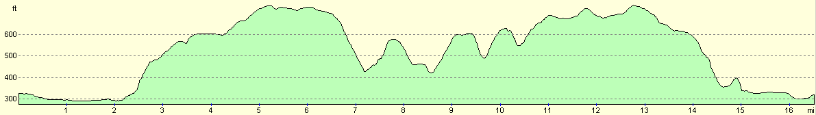
For more information on profiles, ascents and descents, see this page
 |
 |
|
 |
 |
|
 |
 |
|
 |
 |
|
Disclaimer
Please note that I take no responsibility for anything that may happen when following these directions. If you intend to follow this route, then please use the relevant maps and check the route out before you go out. As always when walking, use common sense and you should be fine.
If you find any information on any of these routes that is inaccurate, or you wish to add anything, then please email me.
All images on this site are © of the author. Any reproduction, retransmissions, or republication of all or part of any document found on this site is expressly prohibited, unless the author has explicitly granted its prior written consent to so reproduce, retransmit, or republish the material. All other rights reserved.
Although this site includes links providing convenient direct access to other Internet sites, I do not endorse, approve, certify or make warranties or representations as to the accuracy of the information on these sites.
And finally, enjoy your walking!
Nearby walks
| # | Title | Walk length (miles) |
|---|---|---|
| 629 | Shrewton to Warminster | 16.7 |
| 790 | A circular walk from Salisbury | 24.0 |
| 799 | A circular walk from Broad Chalke to Win Green Hill | 23.0 |
|
|

|