Walk #831: A circular walk from Hythe to Beaulieu
 |
 |
|
General Data
| Date Walked | 23/02/2009 |
| County | Hampshire |
| Start Location | Hythe (Hampshire) |
| End Location | Hythe (Hampshire) |
| Start time | 08.31 |
| End time | 16.57 |
| Distance | 21.9 miles |
| Description | This was a very pleasant walk, following the Solent Way to Beaulieu, before looping northwards through the New Forest. |
| Pack | Today I carried my 30-litre Karrimor rucksack, filled with waterproofs, a book and other odds and ends. |
| Condition | I feel absolutely fine after this walk. |
| Weather | Today was a cloud day with scarcely any sign of the sun. |
| OS map | Landranger number 196 (The Solent & The Isle of Wight, Southampton & Portsmouth) |
 |
 |
|
 |
 |
|
Map of the walk
Maps courtesy of Google Maps. Route for indicative purposes only, and may have been plotted after the walk. Please let me have comments on what you think of this new format. For a detailed table of timings for this walk, please see the table file.
 |
 |
|
 |
 |
|
Notes
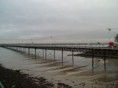
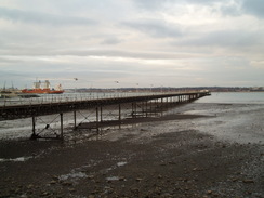
As part of my plan to walk all the named trails in Hampshire, I had parts of the Solent Way to walk. I had done much of this route as part of my coastwalk, but this stretch, from Hythe to Beaulieu, goes inland and does not follow the sea. It did not take me long to drive down to Hythe, and once I parked my car I strolled down to Hythe Pier. This 700-yard structure stretches out into Southampton Water, and was opened in 1881. Passenger ferries till run from the pier head across to Southampton, and a small train runs along the structure, carrying passengers to the ferries. It is good to see a pier still being used for its original purpose. The centre section was destroyed when a drunken mate steered a ship into it, but this section has been lovingly restored.
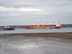
I nipped into a shop to buy some food for the day before heading off along Shore Road. This soon passes large industrial buildings on the left, which I believe are part of the old Supermarine flying boat works. After crossing the railway line that serves the nearby oil refinery at Fawley, I started on down a long track that took me past the start of the refinery works at Hardley.
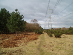
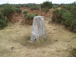
After this a pleasant (if slightly boggy) stretch of footpath took me past Fawley Inclosure; unfortunately the noise from the nearby A326 road intruded. The path then joined the B3054 road, aside from taking a little dog-leg off to the east for a few hundred yards - I wonder why the Solent Way does this? After the dog-leg the road became easy to walk down; it is not too busy, and the verges are wide (indeed, non-existent; there is no separation between the road and surrounding heathland. I diverted off at one point to try and find a trig pillar a short distance away to the west; this proved easy to find, despite being partially hidden amidst gorse bushes.
This has to be one of the more enjoyable main road walks in the south of England; the views were actually enhanced by the tall chimneys of the Fawley oil refinery to the east, and the bleak moorland seemed attractive to me, at least. Eventually the road descended down into Baeulieu, an attractive New Forest village. I had started and ended a walk here a few weeks before, so I did not dawdle, and instead followed a series of roads that led past Beaulieu cemetery to reach East Boldre.
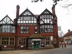
By this time I had only walked about nine miles, but by the time I passed the Turfcutters Arms in the village I decided to have a rest, if only because there was not going to be another place to stop for refreshment for some time. It turned out to be a brilliant decision. I cannot help but like a pub which, along with the usual ancient tomes, also has a book on applied cryptography and Ben Goldacre's 'Bad Science' books on the public bookshelves. A friendly dog played around, and a barmaid busied herself making a fire. I had only intended to stay for twenty minutes, but in the end I was there for the best part of an hour, chatting away to the barmaid and the owner whilst supping three pints of bitter shandy. In the end I really had to drag myself away.
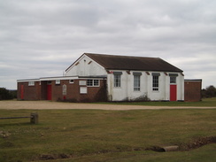
I left in a slightly more lubricated state and made my way along the road that runs through the long, linear village. Off to the left was a white building; now part of the village hall, but once part of an airstrip on Bagshot Moor, set up before the First World War. A little way along here I opened a gate to allow a woman to go down the long driveway to her house, and then, just a couple of hundred yards further on, took some photographs for a group of workmates who piled out of a minibus. Two good deeds in less than ten minutes; not bad going!
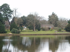
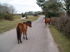
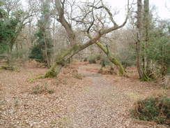
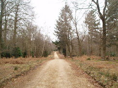
The car park beside Hatchet pond was unsurprisingly busy, the expanse of water being fairly attractive. After this a road led me towards Furzey Lodge, and I headed off into woods once more. Initially the path underfoot was good; part of a cycle path to Brockenhurst, but soon that was left behind and I plunged onwards through the woodland. For a while some ponies followed behind me, but these eventually turned off and I was left to plunge on through the woods. The path became increasingly boggy, and I had to scale a fence blocking a boggy stretch of track to reach a railway line.
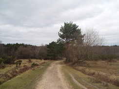
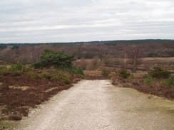
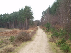
On the other side of the line, a good track led me uphill through Denny Lodge Inclosure, but soon afterwards I was out onto open heathland. The area all around was brown, yet close to the ground there was a myriad of life to be seen. The track was very sandy, the poor soil being the reason why the land was not turned over to agricultural use. As I walked along I felt glad that this landscape had been preserved; although I daresay that even what we see today has been moulded by man in different ways.
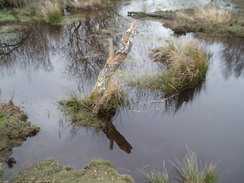
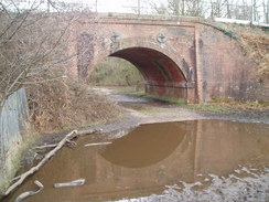
A main road was crossed near to Beaulieu Road station, and the track continued northwards, slowly becoming fainter on the ground. After about a mile it turned down to a bridge under the railway line, and here I was faced with a problem; the area leading up to the bridge was one large pool of water, of indeterminate depth, and with no verges that could be walked along. Fortunately someone had obviously had similar problems, because some tree branches had been placed alongside the bridge abutment. I carefully tested my weight on one, then made my way quickly across.
The going was easier after that, aside from an area of very boggy land that I had to divert around. I walked through Longdown Inclosure, then reached a car park. From here I followed a series of paths that were very boggy in places, the only exception being the climb up onto Fox Hill. In places I had to divert around wide morasses, although this always proved possible, even with a little difficulty. What would have been a very pleasant walk on a hot summer's day became a bit of an assault course.
Despite this I managed to keep my feet dry, at least until I diverted down past Sleepy Holly in the Marchwood Inclosure, the last section of path walking of the day. The road was visible in the distance when my left boot went halfway up my knee in a boggy patch. I cursed, and as I pulled my foot out I could feel dampness soaking down into my boot. The end of the day was so near that it really didn't matter, so I plodded on.
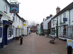
As I approached Hythe I decided to extend the walks slightly by not taking the direct route back to the pier, and instead taking a looping walk through the town. There was not much to see during this diversion, but it did add an extra mile onto the day's walk. I considered extending further by walking out into Buttsash (worth visiting for the name alone), but the hours were closing in. Instead I headed back to the pier, and spent a few minutes walking along the short but elegant promenade; sadly, this is not connected to the pier. AS I walked I looked back on a tiring and boggy day, but one that had nonetheless been very enjoyable.
 |
 |
|
 |
 |
|
Directions
This walk starts at Hythe Pier, and for the first 6.8 miles follows the Solent Way. Leave the pier head and follow a shopping street southeastwards until a Waitrose is reached, then turn left down another road. This passes a church on the right; when the road turns to the right, continue straight on down Shore Road. This passes factories on the left, before joining the foreshore for a short period. After this it curves to the right to head southwards, crossing a railway line on a level crossing. A fifth of a mile after the level crossing the road curves to the left; here turn left down another road. This heads southwards, passing a pub on the left. The road ends at the pub, continue on through a gate and along a lane that heads southwards for another three-quarters of a mile. The path passes to the left of a factory fence, then joins the access road to the factory. Follow this down to a road in Hardley.
Cross the road and continue up a road on the other side. Take the right-most path, which soon leads out onto the A326 road. Cross the road, and on the other side follow a track that curves to the right to soon reach an access road into an industrial estate, a few yards away from a large roundabout. Cross this road, and continue on along the track on the other side. This heads on with a large building to the left, before reaching a stile that leads out into open heathland. Turn left to walk southwestwards for about fifty yards, then when some power lines are reached, turn right to start heading west-northwestwards for a little over a mile across Fawley Inclosure, following the line of the power lines and with trees on the left and the main road on the right.
The path ends at the B3054 just southwest of a large roundabout. Squeeze through a gap, then turn left to follow the B3054 southwestwards. When a cattle grid is reached, turn left to follow a rough track southwards; when a better track is reached, turn right to head back to the B3054. This little diversion off the B3054 is the official Solent Way route, but need not be walked. Continue on southwards along the B3054; at a road junction near a pub it turns to the right to head southwestwards, dropping down into Beaulieu.
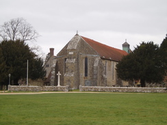
Cross the Mill dam in Beaulieu, then once the Montagu Arms Hotel is passed, turn left up a road that heads uphill through the village. When this ends at a T-junction, turn left for a few yards, and then turn left along another road. This heads southwards, climbing up over Bunkers Hill. Just after Beufre Farm is passed, turn right down another road. This heads southwestwards to Beaulieu cemetery, where it curves sharply to the left to head southwards for a third of a mile. At another junction turn right and start heading west along Cripple Gate Lane for a little over half a mile until it ends at another road junction near the church in East Boldre.
Turn right and start following this road northwestwards, passing the lovely Turfcutters Arms on the way. After 0.8 miles the road ends at a T-junction with the B3054; turn left and carefully follow this road northeastwards for a few hundred yards, with Hatchet Pond on the left. When the road forks take the left-hand fork, and follow this for a short distance up to the B3055. Cross this road, then continue on for 0.4 miles through Furzey Lodge. After the last house on the left, turn left along a good track that soon passes a car park. Follow this track northwestwards; when the cycle path heads off to the left, continue straight on as the track becomes boggier and less substantial.
1.5 miles after the car park, the track reaches a pedestrian crossing by some railway crossing. Carefully cross the railway line, and on the other side take a better-quality track that continues on northwestwards. After half a mile a complex junction of five tracks is reached in Denny Lodge Inclosure; here turn right to head northeastwards along another track. After a third of a mile this erupts out of the woods; continue on along the same track as it curves around, heading northeastward across Bishop of Winchester's Purlieu, then heads north. A mile after leaving the woods, the track reaches the B3056 road near Beaulieu Road station.
Cross the road, and on the other side follow a track that heads northwards, with the railway line off to the right. After half a mile it curves slightly to the left, away from the railway, then after another 0.4 miles curves to the right to pass under a railway bridge at Fulliford Passage. Pass under the bridge, and on the other side take a footpath that heads northeastwards, climbing uphill over heathland before entering the trees of Longdown Inclosure. 0.4 miles after entering the trees, when the track forks take the right-hand most fork and follow a track that curves around toe the left, then turn right down another track that descends to the southeast to cross a stream. On the other side of the stream, turn left along another track that heads northeastwards for a third of a mile to reach a car park.
From the car park, follow the edge of the heathland southeastwards, keeping the trees of the Ipley Inclosure away to the right. The path climbs up Fox Hill, then descends. Again, continue on with the boundary to the left. A road is crossed near Hanger Corner; continue straight on along a narrow, boggy track, with the Marchwood Inclosure to the right and a track to the left. As the track climbs uphill, angle away to the left, heading southeastwards another road at SU395072, passing Sleepy Hollow on the left. When the road is reached, turn left to head eastwards towards a roundabout on the A326 road.
On the northern side of the roundabout there is a cycle path; use this to cross the A326. On the other side follow Sizer Way northeastwards. When this reaches another roundabout, turn right down Clay Pits Lane, and follow this as it curves to the left to make a more northeasterly course. Remain on this road past a series of junctions until it ends at a T-junction with Southampton Road. Turn right and follow Southampton Road eastwards towards Hythe; it slowly curves to the right to head southeastwards. When South Street is reached on the left, turn left and follow this road northwards towards the centre of Hythe. When this road ends, turn left to walk past the church towards Waitrose, then turn right and left, ending by walking along the High Street towards the pier, where this walk ends.
 |
 |
|
 |
 |
|
Distances
| From | To | Distance (m) | Ascent (ft) | Descent (ft) |
|---|---|---|---|---|
| Hythe | Beaulieu | 6.7 | 213 | 213 |
| Beaulieu | Beaulieu Road station | 7.4 | 364 | 278 |
| Beaulieu Road station | Hythe | 7.8 | 285 | 371 |
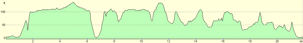
This makes a total distance of 21.9 miles, with 862 feet of ascent and 862 feet of descent.
For more information on profiles, ascents and descents, see this page
 |
 |
|
 |
Disclaimer
Please note that I take no responsibility for anything that may happen when following these directions. If you intend to follow this route, then please use the relevant maps and check the route out before you go out. As always when walking, use common sense and you should be fine.
If you find any information on any of these routes that is inaccurate, or you wish to add anything, then please email me.
All images on this site are © of the author. Any reproduction, retransmissions, or republication of all or part of any document found on this site is expressly prohibited, unless the author has explicitly granted its prior written consent to so reproduce, retransmit, or republish the material. All other rights reserved.
Although this site includes links providing convenient direct access to other Internet sites, I do not endorse, approve, certify or make warranties or representations as to the accuracy of the information on these sites.
And finally, enjoy your walking!
Nearby walks
| # | Title | Walk length (miles) |
|---|---|---|
| 306 | Browndown to Bursledon | 12.9 |
| 307 | Bursledon to Southampton | 9.2 |
| 308 | Southampton to Fawley | 16.4 |
|
|

|