Walk #827: A circular walk from Coombe Bissett
 |
 |
|
General Data
| Date Walked | 21/01/2009 |
| County | Wiltshire, Hampshire, Dorset |
| Start Location | Coombe Bissett |
| End Location | Coombe Bissett |
| Start time | 08.15 |
| End time | 16.29 |
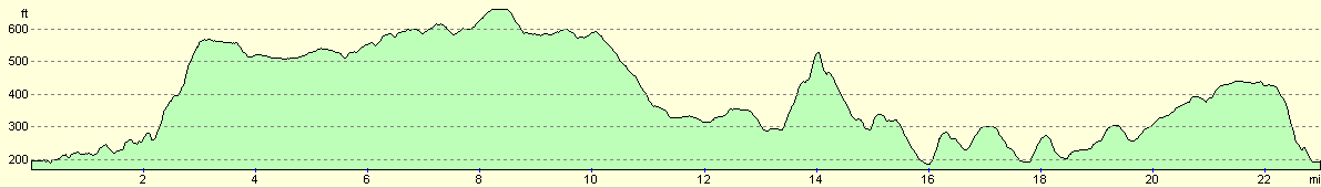
| Distance | 23.0 miles |
| Description | This was a long and highly pleasant walk around the southern hills of Wiltshire. |
| Pack | Today I carried my 30-litre Karrimor rucksack, filled with waterproofs, a flask and other odds and ends. |
| Condition | I was very tired after this walk, but have no significant problems - not even any blisters. My thighs feel tired, which is unusual - an indication that I have not been doing much walking recently. |
| Weather | The day started off cold and sunny, with scarcely a cloud in the sky. As the afternoon started, the clouds started to form and sporadic, light showers dominated the last hour of the walk. |
| OS map | Landranger number 184 (Salisbury & The Plain, Amesbury) |
 |
 |
|
 |
 |
|
Map of the walk
Maps courtesy of Google Maps. Route for indicative purposes only, and may have been plotted after the walk. Please let me have comments on what you think of this new format. For a detailed table of timings for this walk, please see the table file.
 |
 |
|
 |
 |
|
Notes
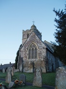
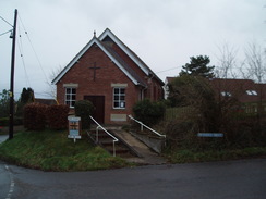
I wanted to day's walk to be something a little nearer to home, and I also wanted it to be something high, to keep away from the rain-sodden valley floors. I soon settled on doing this walk, which would cover some of the ground to the south of Salisbury that I had not walked before. The drive went well, but when I reached the little village of Coombe Bissett I could find nowhere to park. There were a few parking space beside the post office, but I did not want to use up their spaces when I would not be using their services. There was a small parking area behind the church, but this was marked as being private. In the end I parked on the roadside near the church, near to a road junction. It was not ideal, but it would have to do.
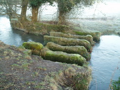
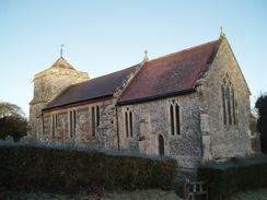
The initial stretch of the day took me west along the southern bank of the River Ebble. This was a pleasant enough stroll, and it was not too cold a day. In one place there were long stones placed lengthways against the current; too wide to be steeping stones, and too narrow to be bridge piers. This path led onto the hilariously-named village of Stratford Tony. This just appeared to be waking up, and some women were scraping the ice off their cars.
A path led up past the small church, and then a track took me on towards Throope Bottom Cottages. On the map the bridleway leaves the track and rejoins it at the cottages, but I chose to continue on along the track, an easier and clearer route. Certainly the farmer who came past on a quad bike did not complain. The cottages were little more than long barns, constructed out of alternating layers of flints and bricks.
A long climb followed; initially joining an old Roman Road. Ont he map this was denoted as being a clear track, but once the top of the climb was reached, it entered a ploughed field. From here it proved difficult to find the route, but I used a reservoir that was marked on the map, and soon reached a junction in the tracks. After climbing a stile I started following another path southwards. After a while I diverted off to visit a trig pillar that lingered in the corner of a field. This proved easy to reach; a gap in the hedge allowed me access to the other field.
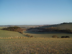
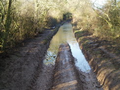
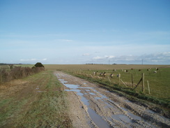
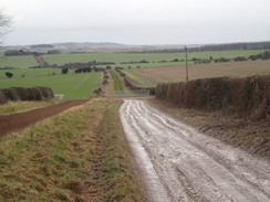
There followed an easy walk of four and a half miles along tracks and roads along the top of the ridge. In places this was very easy going, but in others the surface was a flooded and boggy morass. There was little to see or do on this stretch I passed a very smelly pig farm, and at one point I chatted to an elderly man with an off-road buggy. They are trying to stop four-wheel dries from using these tracks, apparently they are churning up the ground badly. Hopefully once they are restored the man will be able to use his buggy once more on the tracks.
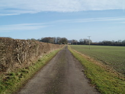
It was a relief when finally I stopped my westwards progression and followed a road southwards for a short distance before doubling back on myself, heading eastwards. This meant that I was at least heading back towards the car, although I was much less than halfway through the day. A short stretch of road was rejoined, and then the followed a pleasant tree-lined track that headed southeastward towards Vernditch Chase. Initially this was an easy, if slightly boggy, walk, but then I went off on the wrong track. As often occurs in forested areas, it was not easy to see where I should be walking. After a short distance I realised that I had gone wrong, but I decided to press on along the rutted forestry track until it emerged out at the southern end of the woodland.
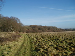
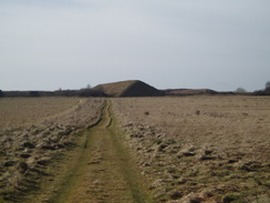
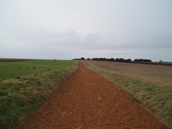
From here a bridleway angled across a field, a lovely stretch of grassland. Instead, II followed a rough track that ran along two edges of the field. After crossing the A354 I planned to take a bridleway that headed southwards across Martin Down; however, a sign showed that it had been diverted around the edge of the down. As this was a much longer route, instead I cut across southwestwards across the down. This was a wonderful walk of the sort I usually love; unpathed and wonderful. There were slight hills and declines; eventually I joined a track that took me towards a large mound that was the rear of an old rifle range.
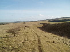
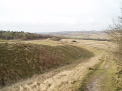
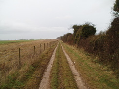
Here I got my first sight of Bokerley Ditch; a Romano-British defensive ditch that dates back to 367 CE, and was constructed to keep the Saxons out of Dorset. This was far grander than I expected; a deep ditch with a high earthen bank behind it. This is one of the great things about walking; the surprises that you see on the way. I had seen it marked on the map, but I had no idea that it would be so impressive. As I followed the ditch southeastwards I tried to imagine a wooden palisade along the top of the bank, and armed men patrolling up and down.
The path descended down to a band of trees and the start of the Jubilee Trail, then started a steep ascent uphill. About halfway up I stopped for a break, sitting down on a map case whilst I ate my sandwiches. I had forgotten to add milk to the tea in my flask, but the warm liquid was welcome nonetheless. Eventually I headed off once again, my legs stiff as the climb continued. At the top of Blagdon Hill Bokerley Ditch ends; the older Grim's Ditch curves away to the left at the top of the hill. After this a steep and narrow bridleway headed southeastwards, eventually opening up to end at a road beside a milestone.
There were some reasonable views as the road climbed and fell for a mile northeastwards. At Tidpit it crossed a road, and on the other side a road and then a track headed on towards Toyd Down. This marked the start of a series of neolithic mounds and long barrows; I was going to go and visit Knap Barrow long barrow, but a farmer was walking around it. His dogs barked at me and yapped at me as I plodded on. There were some good views to be had back to the south and west, over towards some of the other neolithic monuments in the area.
A long descent took me down to another road, and then there was another climb uphill to the Duck's Nest long barrow, which could scarcely be seen below its covering of trees. By this stage I was starting to feel more than a little tired, and when the track ended near Northhayes Farm I had to continue onwards across fields. On the way I crossed a horse-run; obviously there are stables nearby. The rain that had threatened to fall all day started, fortunately from behind me, so I stopped for a minute to put my coat on.
After this a long track walk took me northwards, skirting through the Great Yews woodland before joining tarmac at Tottens Down Barn. By this time I was fairly well done in; it was the longest walk that I had done for some months, and my feet and legs were suffering. I was glad that there was tarmac under my feet as the rain eased.
I soon got back to my car outside the church; just before I reached it I chatted to a couple of ladies by a garden gate; the first people I had talked to all day. The car was a welcome sight, and I could look back on what had been an interesting day's walk. It felt really good to have completed a twenty-mile plus day, but less good to have suffered quite so much.
 |
 |
|
 |
 |
|
Directions
This walk starts off by the church in the village of Coombe Bissett. Cross the A354 main road opposite the church, and on the opposite side take the right-most of two footpaths; this follows a driveway before crossing a stile and heading westwards, with the formative River Ebble near to the right. After a mile it joins a track that heads on for a short distance, passing a series of bridges to the right.
Just before Stratford Tony church is reached, turn left; walk on with the church on the right, climbing, then take a stile and walk diagonally across a field towards another stile. Cross this and join a track; turn right and start following this track as it heads westwards. This descends down to a farmyard; turn right through the farmyard and then left to continue along the track. This curves to the left to meet a road. Continue on along this track as it climbs uphill to the southwest, passing Throope Farm on the left. This track curves to the left and starts to descend; three-quarters of a mile from the road it reaches the barns at Throope Bottom Cottages.
At the cottages turn right to climb uphill westwards, keeping a hedge on the right. This ends at a gate; go through the gate, then turn left to start climbing southwards along the track. After half a mile the track curves away to the left; continue straight on across a field, passing to the right of a small buried reservoir. When the western end of the field is reached, go through a gate, then turn left to start heading southwards for half a mile along a bridleway with a hedge on the left.
When the bridleway ends at a T-junction with a track, turn right to start walking westwards. Follow this track for four and a half miles along the top of the ridge before it reaches a road at SU007213. Here turn left down the road, heading south for 0.4 miles. Once some barns are met on the left near Middle Chase Farm, turn left along a track. Follow this track eastwards for three-quarters of a mile until it ends at a bend in a road near East Chase Farm. Continue on eastwards along this road for half a mile until a bend in the road is reached at Cutler's Corner.
Here leave the road by turning right and joining a bridleway that heads southeastwards for half a mile, initially skirting through a little copse. This then enters the woodland on Vernditch Chase. Keep on the main track as it heads southeastwards through the trees. Here I went wrong; find a route on the map and follow it to the A354 and Bokerley Ditch.
The route I took was different; at SU033208 I turned left for a few yards, then right to join a track that headed through the trees. This emerged out of the southern edge of the trees at SU039206. I then turned left to follow the edge of the trees, then curved to the right along the edge of the common to reach the A354 road near SU045206.
After crossing the A354 I headed southwestwards across Martin Down, eventually aiming for the large bank that marks the end of a disused rifle range. I have left these directions vague, as you will probably want to find your own way to the ditch.
Once at the ditch, turn left and follow it southeastwards for about a mile and a half. Initially it heads downhill, then passes a band of woodland on the right and starts to climb. It climbs steeply up to the top of Blagdon Hill, where the ditch is left behind. Continue on southeastwards along a bridleway, and when it opens out into a small field angle across eastwards to the far corner, the left-hand edge of some trees. Go through a gate, then follow a track southeastwards until it ends at a road.
Turn left and follow this road northeastwards for a mile; the road climbs and falls before crossing the Allen River and reaching a crossroads in Tidpit. Cross the road and continue on uphill along another road to the northeast; after a third of a mile the road ends at King Barrow Farm. From here, follow a track that heads northeastwards for nearly half a mile across Toyd Down, then turn right to take another track that heads eastwards. This passes Knap Barrow and Grans Barrow, before starting a long descent down to a road.
Cross this road, and on the other side take a bridleway that climbs uphill to the east, reaching a summit by the Duck's Nest long barrow. The track then descends downhill, before climbing uphill once more. Cross a cross-track near Northhayes Farm, then climb uphill along another track. When this ends at a T-junction with another track, continue straight on eastwards along a footpath that crosses a field. This crosses a horse-run; aim for a corner in tracks.
At the corner cross a stile and turn left to start following a track northwestwards. Initially thus climbs, before descending slightly. After about a mile it enters a patch of woodland called Great Yews, skirting just within the trees. It then continues on uphill before reaching a tarmac road near Tottens Down Barn. Join this road and follow it for a mile as it descends downhill to the north. It ends with a T-junction with a road next to a chapel; turn left and follow this road westwards for half a mile as it heads through Coombe Bissett towards the church, where this walk ends.
Distances
| From | To | Distance (m) | Ascent (ft) | Descent (ft) |
|---|---|---|---|---|
| Coombe Bissett | Cow Down Hill | 7.5 | 692 | 298 |
| Cow Down Hill | Blagdon Hill | 6.5 | 423 | 512 |
| Blagdon Hill | Coombe Bissett | 9.0 | 689 | 994 |
This makes a total distance of 23.0 miles, with 1804 feet of ascent and 1804 feet of descent.
For more information on profiles, ascents and descents, see this page
 |
 |
|
Disclaimer
Please note that I take no responsibility for anything that may happen when following these directions. If you intend to follow this route, then please use the relevant maps and check the route out before you go out. As always when walking, use common sense and you should be fine.
If you find any information on any of these routes that is inaccurate, or you wish to add anything, then please email me.
All images on this site are © of the author. Any reproduction, retransmissions, or republication of all or part of any document found on this site is expressly prohibited, unless the author has explicitly granted its prior written consent to so reproduce, retransmit, or republish the material. All other rights reserved.
Although this site includes links providing convenient direct access to other Internet sites, I do not endorse, approve, certify or make warranties or representations as to the accuracy of the information on these sites.
And finally, enjoy your walking!
Nearby walks
| # | Title | Walk length (miles) |
|---|---|---|
| 788 | Romsey to Salisbury | 23.1 |
| 790 | A circular walk from Salisbury | 24.0 |
| 796 | Romsey to Salisbury via Dean Hill | 23.6 |
|
|

|