Walk #797: A walk from Wickham to Old Winchester Hill
 |
 |
|
General Data
| Date Walked | 12/11/2007 |
| County | Hampshire |
| Start Location | Wickham |
| End Location | Wickham |
| Start time | 07.56 |
| End time | 15.27 |
| Distance | 23.1 miles |
| Description | This was a mixed walk, with a fairly boring plod along an old railway trackbed mixing with a pleasant walk to the South Downs Way on Old Winchester hill. |
| Pack | Today I carried my 30-litre Karrimor rucksack, filled with waterproofs, a book and other odds and ends. |
| Condition | I feel absolutely fine after this walk. |
| Weather | Today was mostly sunny, although bitterly cold first thing in the morning. As the day wore on it grew warmer until it was a very pleasant day for a walk. |
| OS map | Landranger number 196 (The Solent & The Isle of Wight, Southampton & Portsmouth) and Landranger number 185 (Winchester & Basingstoke, Andover & Romsey) |
 |
 |
|
 |
 |
|
Map of the walk
Maps courtesy of Google Maps. Route for indicative purposes only, and may have been plotted after the walk. Please let me have comments on what you think of this new format. For a detailed table of timings for this walk, please see the table file.
 |
 |
|
 |
 |
|
Notes
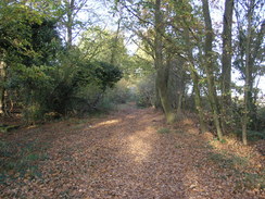
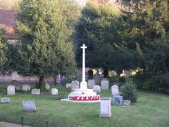
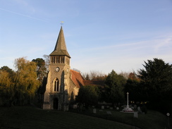
I fancied doing a relatively local and flat walk today, and whilst studying the map I noticed an old railway line above Portsmouth which now carries a footpath. This ends near the South Downs Way, and I realised that I could incorporate that into the walk. It was bitterly cold this morning, and I scraped ice off the car before starting the drive towards Wickham. It took me longer than expected to get there, and I soon pulled up in the car park by the old station in the village. It was a sunny day, but it was still chilly as I started strolling northwards along the old line.
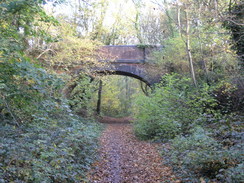
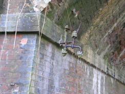
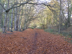
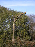
It soon became a standard, if slightly chilly, railway walk; at various times the line was either in cuttings or on embankments, with the surrounding vegetation blocking off most of the views. There were occasional pieces of ironwork that reminded me that this was an old railway line, such as old telegraph brackets on the underside of bridges. The most obvious thing being an old loading gauge by a widened part of the trackbed; old sidings, I guessed.
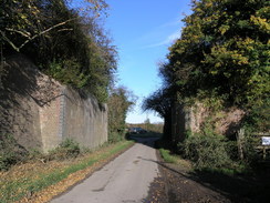
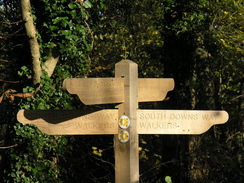
The trackbed crossed the course of the King's Way, and then the Wayfarer's Walk at Droxford, a walk that I want to do sometime. Finally the South Downs Way was crossed, and I smiled at the memory of that enjoyable walk. A couple of bridges over roads had been removed, but otherwise the trackbed was remarkably intact. Soon a car park was reached at West Meon, a few hundred yards away from the end of the path in the village. The railway line used to continue on through a couple of tunnels to Alton; it is a shame that it is not possible to walk all of the way.
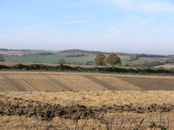
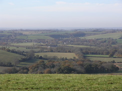
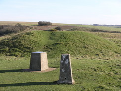
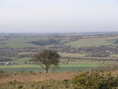
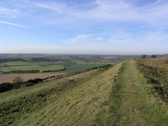
At the car park I left the footpath and followed a road that climbed uphill to the south. As I gained height the views started to expand, giving me the first real views of the day. And they were truly superb views, well worth the effort of the climb. At the top of the hill I met the South Downs Way, and I followed the path that runs alongside the road. This path then turned off to the right to climb up onto Old Winchester Hill. I walked to the trig pillar and toposcope and took in the expansive views. The banks of an iron age hillfort surrounded me, the grass-lined banks still very impressive. It is a lovely spot, and it was very tempting to stop here for a while.
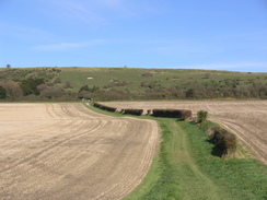
Instead, I walked back to the entrance to the fort and started heading south along a footpath. Initially this steeply descended down from the hill, before the gradient slackened. The path took me to Stocks Cottage, and from there roads took me on southwards. It was a glorious day, although it was still not a warm day.
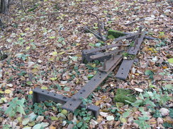
I followed toads down towards Soberton, and I rejoined the old trackbed in the little village of Soberton. The walk back to Wickham could have been boring; I generally do not enjoy there-and-back walks, but this walk flew, and I soon found myself approaching the car park in Wickham. I was still feeling fit, however, so I decided to continue on southwards along the old line until it ended at the junction with the still-extant railway line that heads north from Fareham. It was an enjoyable stroll, although again it was fairly enclosed with few good views to be had. Near the junction there were some remaining metalwork, with an old point crank looking remarkably intact. This led me to wonder why the scrapmen had chosen to leave it behind.
The walk back to Wickham flew, although it was starting to get a little late by the time I reached the car. It had been an enjoyable day's walk, although the highlight was definitely the short section over Old Winchester Hill.
 |
 |
|
 |
 |
|
Directions
This walk starts off from the car park in Wickham at SU574116. The initial stretch of this walk is fairly simple; walk from the car park and join the old railway line. Turn left, and start following it northwards for over nine miles until it ends at a car park to the southeast of West Meon at SU642236. Pass the car park and take the access road that leads out to a road. Turn right and follow the road as it crosses the old railway line on a bridge and heads south, climbing uphill for 1.3 miles until it reaches a junction with the South Downs Way. Continue south along the road; there is a footpath section just off to the right, to avoid the traffic. After half a mile the path turns off to the right, heading southwestwards towards the ramparts of Old Winchester Hill. Go through a gate, and follow the South Downs Way to the trig pillar in the middle of the old fort.
From the trig pillar retrace your steps to the eastern ramparts, and then turn right, skirting the bottom of the ramparts for a short distance before heading steeply downhill to the southwest. This meets a track, head south along this track, passing Stock's Cottage and continuing on to end at a road at SU635194. Turn left along this road and heads south for nearly half a mile until it ends at a T-junction near a patch of woodland; here head southwestwards along Sheardley Lane for nearly a mile until a main road is met. Cross this, and continue on southwestwards along another lane for well over a mile into Soberton. At the next crossroads continue straight on along West Street, and then turn right to head westwards for a short distance to meet the old railway line once more.
Climb up onto the old railway line and turn right to start following it southwards for 5.5 miles; it passes back through Wickham and continues on until the trail ends at an old junction with an old railway line. From here, turn around and head back up the line for a couple of miles to the car park in Wickham, where this walk ends.
Distances
| From | To | Distance (m) | Ascent (ft) | Descent (ft) |
|---|---|---|---|---|
| Wickham car park | West Meon | 9.3 | 653 | 459 |
| West Meon | Old Winchester Hill | 2.6 | 459 | 98 |
| Old Winchester Hill | End of track | 9.5 | 377 | 955 |
| End of track | Wickham car park | 1.7 | 66 | 43 |
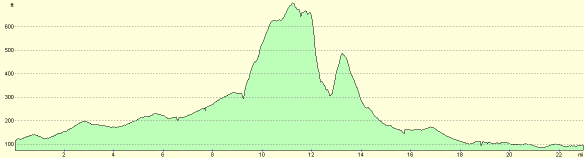
This makes a total distance of 23.1 miles, with 1555 feet of ascent and 1555 feet of descent.
Note: As usual, the ascent and descent values for the walk along the old railway line are overestimated.
For more information on profiles, ascents and descents, see this page
 |
 |
|
 |
Disclaimer
Please note that I take no responsibility for anything that may happen when following these directions. If you intend to follow this route, then please use the relevant maps and check the route out before you go out. As always when walking, use common sense and you should be fine.
If you find any information on any of these routes that is inaccurate, or you wish to add anything, then please email me.
All images on this site are © of the author. Any reproduction, retransmissions, or republication of all or part of any document found on this site is expressly prohibited, unless the author has explicitly granted its prior written consent to so reproduce, retransmit, or republish the material. All other rights reserved.
Although this site includes links providing convenient direct access to other Internet sites, I do not endorse, approve, certify or make warranties or representations as to the accuracy of the information on these sites.
And finally, enjoy your walking!
Nearby walks
| # | Title | Walk length (miles) |
|---|---|---|
| 305 | Tipner to Browndown | 18.9 |
| 306 | Browndown to Bursledon | 12.9 |
| 307 | Bursledon to Southampton | 9.2 |
|
|

|