Walk #981: Ouse Valley Way: Wolverton to Olney
 |
 |
|
General Data
| Date Walked | 16/02/2018 |
| County | Buckinghamshire |
| Start Location | Wolverton Station |
| End Location | Olney market square |
| Start time | 07.53 |
| End time | 13.13 |
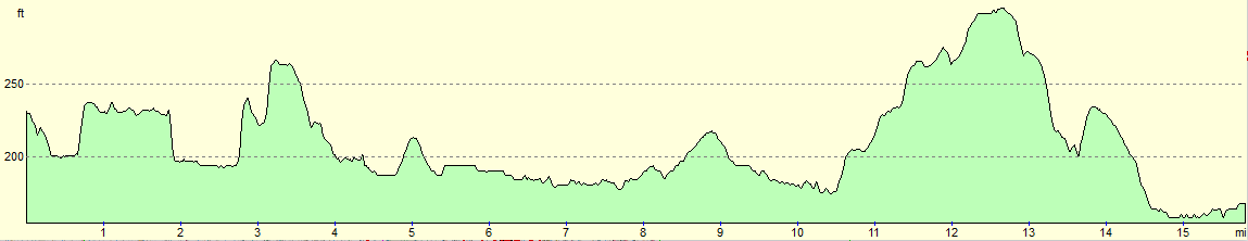
| Distance | 15.8 miles |
| Description | This walk follows the Ouse Valley Way as it heads downstream from the outskirts of Milton Keynes towards Bedfordshire. |
| Pack | Today I carried my 30-litre Karrimor rucksack, filled with water, my waterproofs, a book and other odds and ends. |
| Condition | I am very tired after this walk, and my left foot has a hotspot where a seam in my new socks has rubbed aggainst my sole. |
| Weather | Today started off sunny but bitterly cold. As the day progressed, the clouds gathered and the temperatureds rose until it was a nearly perfect winter's day for walking. |
| OS map | Landranger number 152 (Northampton & Milton Keynes) |
 |
 |
|
Map of the walk
Maps courtesy of Google Maps. Route for indicative purposes only, and may have been plotted after the walk. Please let me have comments on what you think of this new format. For a detailed table of timings for this walk, please see the table file.
 |
 |
|
Notes
It had been three weeks since my last walk; I had wanted to complete this western side of the Ouse Valley Way before the end of January, but life had got in the way of walking. The loop-walk I did last time had set me up for a pleasant fifteen-mile stroll from Wolverton to Olney, with convenient public transport between the two places. However I set off late from home this morning, and as the bus from Olney was at 06.41 I had to hurry on my drive over. I arrived under ten minutes before the bus was due, and although I had scouted out a car park on the council's website, I could not see any 'parking' signs. I had little choice to risk parking there, and could only hope that it was allowable. On the positive side, a council-style bin indicated that it was a 'public' space.
I had a few minutes, so after checking where the bus stop was, I headed across the market place to a Tescos. There was one sole lady serving behind the counter, and the minutes ticked away as she served the customers in front of me - the shop was surprisingly busy for the early hour. Eventually I went to the self-service counter, bought the snacks, and arrived at the bus stop just as it was arriving. The bus took me to Milton Keynes Central station, where I bought another ticket for Wolverton, the next step up the line. My hands started feeling very cold during the wait on the platform, and so I slid my gloves on and paced around a little as the sun slowly rose.
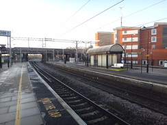
The train arrived at Wolveton on time, and I got out ready to start my walk. I had visited the station twice during one of my Grand Union Canal campaigns seventeen years ago, and I could remember nothing about it: it is an anonymous, boring block jammed between roads and railway line. My first task was to join the Ouse Valley Way, which runs a few hundred yards from the station. Unfortunately this proved difficult, and I wandered to and fro beside an underpass before realising that the trail went along the other side of the road. By this time my fingertips were numb despite being in my gloves, and I almost wished the sun higher in the sky so I could feel its warmth.
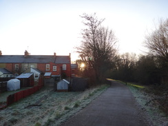
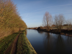
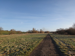
Initially the trail passed through a small local park that squeezed between houses and the busy road; fortunately the road scarcely made its presence known. On the way I got stopped by a man for a chat, who turned out to be an old military tank driver. Feeling warmed by the friendly conversation, I continued on to a slope that led up to the Grand Union Canal. The sails of a windmill loomed somewhat incongruously over the nearby roofs, but the canal took me away. Glass-like shards of part-melted ice patterned the water, and I started to feel a little warmer.
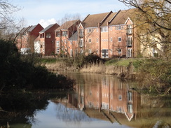
I have walked the full Grand Union Canal a couple of times, and it felt good to be back on its towpath after so many years. There is an odd phenomena in canal towpath walking: you can be in a suburban or even urban environment, and yet you are somewhat insulated from that environment. If I looked ahead I saw tree-lined water; only by looking through the trees and shrubbery that lined the canal did I see the low-rise flats that lay alongside. Only the gentle roar of distant traffic anchored me in the reality that I was near a city. Canals can truly be green oases. I strode on, past a new housing development on the other bank, and after only a mile reached the point where the trail left the canal.
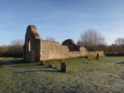
A path led down to some low stone ruins - the remains of St Peter's Church, a twelfth century church that was still in use as late as 1927. Some heavily weathered gravestones stuck out of the ground like rotten teeth, but the rosy yellow stone gave the ruins an almost friendly appearance, rather than one of decay. At least the church has fared better than the adjacent manor house, which now only exists in the form of a few lumps and bumps in the ground.
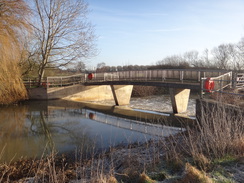
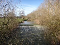
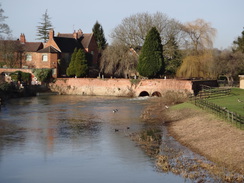
A track led on, curving around to parallel the River Ouse; the first time I had seen it today, and one of the sadly few times the trail would spend any time in its company. An industrial-style pipe bridge incongruously spanned the river, and a little further on a bridge took me over a weir and past an old mill that was being redeveloped. An overlarge but useful sign at the top of the lane showed that this was both the Ouse Valley Way and the Midshires Way, which is just another of the multitude of trails in this area.
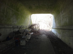
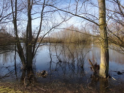
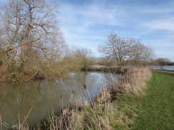
There followed a long and fairly boring road walk; fortunately the verge was wide and the traffic light. After about a mile the road was left, and a path took me down to a long and gloomy tunnel under the M1; the tunnel was filled with old agricultural implements, some looking almost antique. Given the growth of vegetation around both entrances to the tunnel, I can only guess that they have been there for some time. This path led down to meet the river, which was crossed by a footbridge, and not the much larger bridge that had evidently been built to allow access to the sand or gravel pits on the other side. Once across the bridge, the land was slightly flooded with water from the pits, and I had to make a wide diversion to get to what appeared to be the shallowest patch. Fortunately my boots remained dry, and I started along a muddy track that led uphill past the old pits. An overgrown sign warned of heavy vehicles: perhaps it was now somewhat out of date!
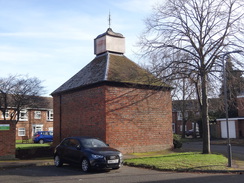
I got a little lost on the outskirts of Newport Pagnell, but it was a good sort of lost, as I passed a dovecote that stands in the middle of an area of flats. I soon realised my mistake, and headed back to a lane to find the path that led on to Bury Field. This seemingly uninteresting area of land actually has a rich history; it was part of a fort during the civil war, and carries earthworks for a 'railway that never was', a line that was part-constructed, but never opened. The path across the field led me out onto a road just before the main bridge over the river; the trail only gives Newport Pagnell a brief flirtation, as if it is slightly ashamed of the town. If so, then it is undeserved.
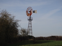
Another long road walk (this time fortunately with pavement) took me to Sherington bridge over the river, and paths took me north towards the village. Again I made a little mistake, and I turned back to find the proper route. Sadly waymarking for this trail in Buckinghamshire is a little hit and miss, and it seems parts of the trail are not frequently walked. The trail stayed in Sherington for about fifty yards, before heading out of the village along another road. The path past a farm proved difficult to find (again, I could find no waymarkers), but eventually I got on the right path. This stretch of trail felt a little pointless; it heads west with the river mostly out of view, before reaching a road in Tyringham. Only two things of note occurred; the path passed right by a large wind pump, and there were some distant view of the elegant Tyringham Bridge over the river.
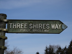
This couple of miles westwards feels a little pointless; the trail reaches the road at Tyrringham (with a stately home a short distance away), before joining the Three Shires Way and heading away from the river, passing through some woodland before entering a field that had a long and well-maintained horse-run in it. The horse-run had a loose surface of a spongy material that felt a little like shredded newspaper, but was almost certainly something more resistant. There were some good views in front and behind over the river valley, which loops around the ridge I was walking over.
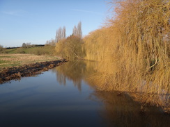
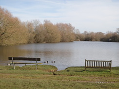
The trail met the road in Filgrave before heading on along muddy paths and tracks, eventually descending towards Emberton Country Park. The path passed through a static caravan park before following a good track past lakes. An unexpected diversion occurred when an Ouse Valley Way waymarker pointed off the track and through a rally field to a pleasant riverside path. This was perhaps today's best stretch of path, and a good way of ending the walk. Sadly the river was left behind, and a narrow path between lakes led to the main road leading into Olney.
Olney, which had been quiescent in the morning, was bustling at lunchtime. I walked past shops back to the market place, where I was relieved to find that my car was not clamped or ticketed. It had not been a classic day's walk; the sections of the trail further east towards Bedford are much more pleasant, with attractive villages and good paths. As is the case with many trails that follow rivers, the path actually spends long periods away from its eponymous river.
I now have only one-and-a half days walking to do to complete the full western end of the Ouse Valley Way; the next walk should see me easily get from Buckingham to Wolverton after which an eight or nine mile stroll should be enough for the stretch from the trailhead at Syresham to Buckingham. Hopefully those two walks will be slightly more pleasant that today's.
 |
 |
|
Directions
This walk start off at Wolverton railway station. Leave the main station entrance, cross the forecourt, and climb a few steps up onto Stratford Road. Turn left to follow the road for thirty yards until Stonebridge roundabout is reached at SP82204152. Carefully cross Stratford Road to the pavement on the other side, and take the first road off to the right. The pavement angles away from the road, and curves to the right to reach an underpass. Go through this, and on the other side turn left to follow a path for a short distance to reach Newport Road, where the Ouse Valley Way is joined.
Turn around and head back along the path towards the underpass. Instead of heading back through the underpass, turn left down another path and follow it as it parallels a road to the right; it curves sharply to the left to cross a bridge over a stream. Immediately after the bridge, take the first path off to the right that runs past some trees on the right to enter New Bradwell Local Park. Do not be tempted onto any paths leading into the housing estate, and continue on as the path roughly parallels the road to the right. By a children's playground, take another path off to the right. Eventually the path skirts the road and approaches a viaduct carrying the Grand Union Canal overhead. Just before the viaduct, turn left along a path that slopes uphill to meet the canal's towpath at SP82924111; ignore the footbridge over the canal, and instead head towards the canal's towpath.
Turn left to follow the towpath, with the water away to the right; it immediately passes under the footbridge. It passes under two road bridges and heads out into open countryside. A mile after joining the canal, it curves to the right beside a long concrete overflow sluice; on the bend at SP83594243 turn left through a wooden clapper gate to enter Stanton Low Park. Follow a grassy path downhill northwards, keeping a fence on the left, towards a ruined church. Go through a wooden clapper gate before the church, keeping a low stone wall guarding the church on the right. Continue on for a few metres to reach a concrete track; turn left to follow this track northwards. The track slowly curves to the right, meeting the river away to the left, and after half a mile the track curves to the left to reach a gate guarding a bridge over the river at Haversham Weir at SP83854347..
Go through the gate, cross the bridge, and walk on past an old mill. The track rises, goes through a farm gate and becomes a road; a fifth of a mile after the bridge, the track ends at a T-junction with another road by Hill Farm. Turn right and follow the road northeastwards; ignore another road coming in from the right in Little Linford. The road has no pavement, so care needs to be taken. After nearly a mile on the road, a track joins from the right at SP84564465, with a gate through a low brick wall. Pass the track, and then cross a stile beside a farm gate to enter a field. Turn half-left to head diagonally across the field, aiming for the far corner of a hedge guarding a house on the left.
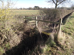
At the corner, go through a stile to enter another field and then turn left, keeping a fence and some paddocks on the left to reach a metal clapper-gate. On the other side, the path enters an area of woodland to reach a tunnel under the M1. Go through this, and continue on for nearly a third of a mile through the trees and along the edge of a field until a double metal field gate is reached. Go through this to reach a track. Turn right down this for a few metres, and then turn right to leave the track , and instead follow a path alongside a fence on the right. The path crosses a farm bridge over a stream to reach a footbridge over the river immediately downstream of Gayhurst Weir at SP85324503. Ignore the larger bridge a short distance downstream.
Cross the bridge, and on the other side angle slightly to the left across a field. A better track is reached; cross this (do not join it) and continue on across the field aiming for a bridleway gate guarding a second bridge over a lesser river stream. On the other side of the bridge, turn left to walk between the river stream on the left and a lake on the right. As the edge of the lake curves away to the right, follow it to reach another bridleway gate. On the other side, the path heads uphill between hedges. After half a mile the track becomes a surfaced road called Lakes Lane beside a white house at SP86314450.
Continue on along Lakes Lane. When it curves to the right after half a mile, pass a driveway leading to Linford Grange on the left, and immediately afterwards turn left down a narrow path that runs between fences. If you reach a road called Dovecote on the left, then you have gone too far along the road. The path emerges out past a clapper gate into Bury Field Common; follow a hedge protecting gardens on the right as the path slowly curves to the right. Just before a clapper gate is reached leading into a car park, turn left to follow a rougher path that passes the car park on the right, soon reaching a clapper gate beside a wall. Go through the clapper gate to join a lane that becomes Mill Street before it ends at a roundabout in Newport Pagnell at SP87774405.
Turn left to head north along the B526, immediately crossing the Great Ouse on a bridge; there is a pavement on the left-hand side of the road. When a junction with Sherington Road is reached on the right after a fifth of a mile, turn right to follow Sherington Road northeastwards; there is a pavement on the left. After three-quarters of a mile it crosses Sherington Bridge over the river; continue on for fifty metres, and just before the road curves to the right, turn left to cross a half-hidden stile near a wooden field gate. Walk on for five metres to a second stile.
Cross the stile and turn slightly to the right to head diagonally across a field, aiming for a stile in the far corner. Cross the stile, and continue on across a field with a hedge on the right, and a surfaced track beyond the hedge. After about twenty metres, and just before a cattery is reached, turn right to cross a stile through the hedge to reach the track. Turn left along the track for a few metres, and as it curves to the right, turn right across a stile to enter another field. Turn left to follow a hedge on the left past the cattery. At the end of the field, cross another stile to reach a rough track. On the other side of the track, cross a plank bridge over a ditch and another stile to enter a field. Head straight on across the field, following some overhead lines.
At the far end of the field, turn right for about twenty metres to reach a gap in the hedge on the left. Turn left, following a hedge on the left for about fifty metres to reach a clapper gate beside a field gate. Continue on, following a fence on the right. Go through another clapper gate and head between fences for about ten metres to reach another clapper gate. A surfaced path leads on until High Street in Sherington is reached at SP88784637.
Turn left along the High Street for about fifty metres, and then turn left down Water Lane. This passes houses and becomes a track that leads out of the village. When End Farm is reached after half a mile, ignore the track as it curves to the left, and instead walk straight on past the farm on the right, and join another track that continues in roughly the same direction. After fifty metres the track curves slightly to the right to follow a hedge and ditch on the left past a field. At the corner of the field, cross a farm bridge over a ditch and continue on, following a hedge on the left past another field. At the corner of this field, cross another farm bridge over a ditch and go through a gate into another field. Follow some trees on the left, with the river beyond.
At the end of the field go through a gap in a hedge ahead and pass a wind pump. Follow a fence on the right to reach a wooden gate that leads into another field. Follow the hedge on the left, and about a hundred metres before the end of the field, angle half-right away from the trees and river, cutting the corner off the field. Go through a wooden farm gate in a hedge to enter another field, and then follow a fence on the right. Cross a field gate and head on between fences. The path curves to the left to reach a field gate that leads out onto a road at SP85944684, with Tyringham Church a short distance away to the left.
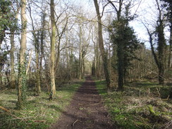
Turn right to head uphill along the road; when it curves sharply to the left after 150 metres, turn right along a track that runs between fences (signposted 'Three Shires Way'). Go through a metal field gate beside some houses and continue along the track. Just before it reaches Fence Farm after a third of a mile, pass a house on the left, and then turn left to go through a wooden field gate to enter a garden area. Pass a wooden post, with the house on the left, and cross a tiny ditch and turn right to follow a hedge on the right uphill towards an area of woodland called Hill Plantation. Just before the corner of the field is reached, turn right through a field gate in the hedge and angle half-left towards a gap in the woodland. Go through this to join a broad track that heads through the trees.
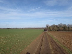
After a third of a mile the track emerges out through a broad gap into a field. Turn right to start following a hedge on the right downhill away from the woodland. This meets a horse-run near the far end of the field; cross the horse-run to reach the far corner of the field, and then turn left to follow a hedge on the right northeastwards. When the horse-run ends at a turning circle after a third of a mile, turn right to go through a gap in a hedge into another field, and then left to start following a hedge on the left. At the corner of this field, turn left through a broad gap in the hedge to join a rough track that follows a band of trees on the left northwards. After a fifth of a mile pass a vehicle barrier to reach a road in Filgrave at SP88034820.
Turn left to follow the road as it heads downhill to the west. When a left-hand bend is reached after 200 metres, turn right up a concrete track that climbs towards a farm. Just before the farm's grand gates are reached, turn left through a bridleway gate and angle slightly to the right across a field. The path meets a low bank on the right, and then curves to the right to reach a bridleway gate beside a field gate. On the other side continue on with a hedge on the right downhill. At the bottom of the field the track curves to the right beside an area of woodland called Blackwell Spinney on the right at SP87724938. Here turn sharply left to head uphill along another track.
This track soon curves to the right to head westwards across a field. When it curves to the left 250 metres after the bend, turn right along another track, and follow this as it heads between fields, ignoring any tracks that lead off. A sparse hedge is met on the left; when this soon ends, continue straight on along the green track, following a hedge on the left. At the corner of this field, go through a gap in the hedge ahead and follow a rough track as it curves slightly to the right straight across a field. At the bottom of the field, cross a bridge over a stream and go through a bridleway gate to enter a static caravan park.
Turn left along a surfaced track for a few metres, and then right along another surfaced track to reach a bridleway gate beside a farm gate. Go through this, and just before a lake is reached ahead, turn left along a good path that curves around the northern side of the lake. Shortly after passing a boat landing area on the right, turn left past a farm gate to enter a large rally field. Continue along the edge of the field past willow trees to join the riverbank. The path winds alongside the river for a short distance before rejoining the track by a second lake.
When a narrow band of land between two lakes is reached on the right, turn right to follow a path between the lakes. Angle half-right across a track ahead, pass a gate and climb a bank to reach the A509 road. Turn left to follow the road as it heads north towards Olney; there is a pavement on the left-hand side. The road crosses two bridges over streams of the river, and enters Olney. A few yards further on the Ouse Valley Way crosses the road to heads towards Olney church; my route took me a short distance north into the town to the market place on the right, where I ended the day's walk.
 |
 |
|
Distances
| From | To | Distance (m) | Ascent (ft) | Descent (ft) |
|---|---|---|---|---|
| Wolverton station | Newport Pagnell | 6.7 | 430 | 236 |
| Newport Pagnell | Olney | 9.1 | 259 | 272 |
This makes a total distance of 15.8 miles, with 689 feet of ascent and 508 feet of descent.
For more information on profiles, ascents and descents, see this page
 |
 |
|
Transport
Regular bus services (hourly during the day) run from Olney to Milton Keynes Central on the Redline #21 service. From Milton Keynes Central, regular trains run north one stop to Wolverton station.
 |
 |
|
 |
 |
|
 |
 |
|
 |
 |
|
 |
 |
|
 |
Disclaimer
Please note that I take no responsibility for anything that may happen when following these directions. If you intend to follow this route, then please use the relevant maps and check the route out before you go out. As always when walking, use common sense and you should be fine.
If you find any information on any of these routes that is inaccurate, or you wish to add anything, then please email me.
All images on this site are © of the author. Any reproduction, retransmissions, or republication of all or part of any document found on this site is expressly prohibited, unless the author has explicitly granted its prior written consent to so reproduce, retransmit, or republish the material. All other rights reserved.
Although this site includes links providing convenient direct access to other Internet sites, I do not endorse, approve, certify or make warranties or representations as to the accuracy of the information on these sites.
And finally, enjoy your walking!
Nearby walks
| # | Title | Walk length (miles) |
|---|---|---|
| 143 | Cheddington Station to Bletchley Station | 13.3 |
| 146 | Bletchley to Wolverton | 11.9 |
| 157 | Wolverton to Bugbrooke | 16.6 |
|
|

|