Walk #1023: Bulwell to Mansfield via Hucknall, Rainworth and Clipstone
 |
 |
|
General Data
| Date Walked | 23/10/2018 |
| County | Nottinghamshire |
| Start Location | Bulwell station |
| End Location | Mansfield station |
| Start time | 07.24 |
| End time | 15.44 |
| Distance | 23.5 miles |
| Description | This was a long plod, initially northwards past Newstead Abbey, before making a loop eastwards through Rainworth and Clipstone before heading west to Mansfield. |
| Pack | Today I carried my 30-litre Karrimor rucksack, filled with water, my spare waterproofs, a book and other odds and ends. |
| Condition | I feel very fatigued after this walk; the last half was an unenjoyable plod, more due to fatigue than the terrain or scenery. I think this may be down to my not having eaten enough yesterday. |
| Weather | Today was very windy, and it started off cloudy. There were some brighter patches as the day progressed, although the wind never really abated. |
| OS map | Landranger number 129 (Nottingham & Loughborough, Melton Mowbray) and Landranger number 120 (Mansfield & Worksop, Sherwood Forest) |
 |
 |
|
Map of the walk
Maps courtesy of Google Maps. Route for indicative purposes only, and may have been plotted after the walk. Please let me have comments on what you think of this new format. For a detailed table of timings for this walk, please see the table file.
 |
 |
|
Notes
I had intended to do a walk in the Peak District today, but I was greeted with a fierce wind blowing along a little rain as I walked to my car. Instead, I wimped out and chose to do a walk I had planned in Nottinghamshire, which I hoped would be better if the weather got worse. It did not take me long to get to the start of the walk in Bulwell, and I parked by the railway station and tram stop, which surprisingly had a free car park. It was still dark when I arrived, and I spent some time looking around the town as people busied themselves setting up market stalls. A Gregg’s shop was open, so I bought some breakfast and returned to my car to await dawn.
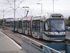
I set off whilst it was still gloomy, rightly thinking there would be little of interest to photograph for the next few miles. Despite this I quite liked Bulwell; it was clean and tidy, and felt alive even at the early hour. A long road walk took me north, and I chatted for a few minutes to a woman who was pushing a pram as we walked. The roads took me into Hucknall, although rather than visit the town centre I diverted along new roads towards the railway station, which also marks the northern terminus of Nottingham’s tram network. I’ve visited Nottingham many times over the years, and have had friends who live there, but have never managed to get a chance to ride on one of the trams. Today was not going to be an exception, and I walked back to the road and carried on.
Children were walking to school, and several were carrying small model volcanoes. Most of the parents seemed harassed, and I rather unkindly wondered if they had been up all night making the models. The road led down towards a little stream, and I had intended to follow a road northwards. Instead, I took a path that led off through a nature reserve in roughly the right direction. The path followed the top of a high man-made bank, and I wondered what it could have been. Fortunately a handy information board told me that it had been part of a series of ponds that had provided a reliable head of water for mills further downstream.
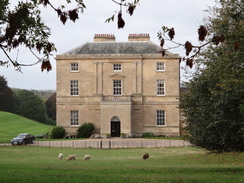
The stroll through the trees sadly soon ended, dumping me on a road in Papplewick. Another road took me north past a seemingly never-ending queue of traffic heading south towards the city. The magnificent Grade-I listed Papplewick Hall was visible between trees, nestling down below the road as if it was trying to hide from the traffic. I could not blame it: although there was a pavement, I was glad to leave the traffic behind and start following a track that carries the Robin Hood Way as it winds north from Nottingham.
The track was wide and easy to follow, aside from a couple of small, yappy dogs who took a little too much interest in me. Off to the left, and mostly hidden from sight by trees, were the grounds of Newstead Abbey, once an Augustinian Priory, and then the home of ‘mad, bad and dangerous to know’ Lord Byron, whose antics the priors would probably not have approved of. I have visited the abbey several times before, but the trail eschews it, preferring to stay by the trees.
I made a silly mistake shortly after the trail squeezed past a house. Instead of following a waymarker that pointed through the trees, I continued along the track, as I thought the marker was misplaced. The track continued uphill before ending at a series of rather large houses, many of which were gated. Instead of turning back I plodded past them, only to reach a gate blocking the track ahead. A rather grand and new-looking house stood behind the gate, so I diverted over the fence on my right and headed through the trees for a few metres to reach the proper path. The next stretch of path was not too enjoyable as it squeezed past fences designed to keep people out, but which also made me feel rather unwelcome. I am unsure whether Lord Byron would have been building the fences or tearing them down.
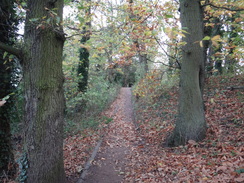
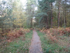
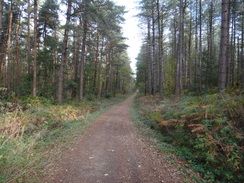
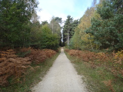
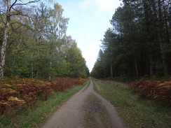
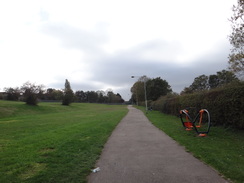
It was a relief when the path ended at a main road, which was followed for a short distance before another path dived off through Nomanshill Wood and then Thieves’ Wood – the latter seemingly apt given the area’s connections with Robin Hood. I tried to imagine strolling through the forest with Robin and his Merry Men, but the trail underfoot was a little too perfect to maintain the illusion.
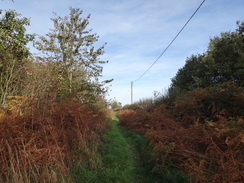
The path left the forest and headed across a field until some steps suddenly led down to a main road. This was not on my rather out-of-date map, having been built in the last couple of decades, and I decided to follow it rather than continuing along the path. It was only a small diversion, and I soon reached the Old Newark Road. This marks the southern edge of Mansfield, although not for long, as a new housing development is being built between the old and new roads. After crossing another newly-built road, the Old Road continued on, eventually joining a roundabout. A rather unininteresting road walk followed into the village of Rainworth, where I nipped into a Co-Op to get some sandwiches.
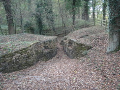
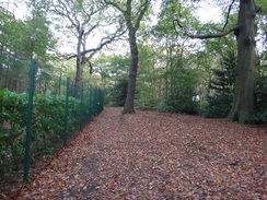
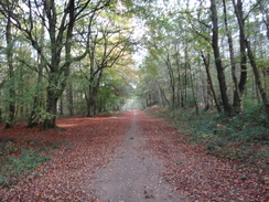
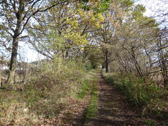
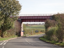
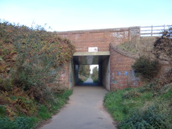
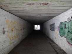
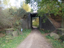
The road led out of the village, where I could join an old railway line – one of the many old colliery lines in the area. I had expected a small bridge, but instead there was a long and rather impressive viaduct that now carries a cycle path. A zig-zag path led up to the top, after which it continued north. At one point the path passed through a deep cutting, with the strata very visible, but all too soon it descended, and passed through a culvert under the embankment to enter some woodland.
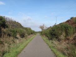
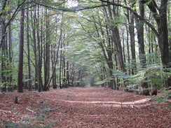
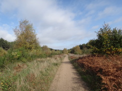
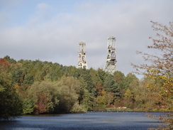
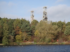
The route of the path through the forest has changed since my map was printed, but fortunately it was very well waymarked. It was also a rather boring walk, and it was not improved by the fact I was seriously running out of energy. I had not eaten enough food on yesterday’s walk, meaning that by this stage, two-thirds of the way through the day, I was struggling. The stroll through the trees seemed to take forever, but the path eventually left the trees and passed under, or along, the routes of a couple of old railway lines – again old colliery lines. Two large metal structures soon came into view – the old headstocks of Clipstone Colliery, which closed in 2003. Even from a distance they seemed gargantuan, impressive objects, and a fitting memorial to the men and lifestyle that is now sadly defunct in the area.
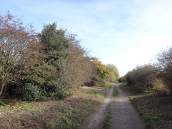
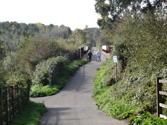
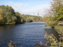
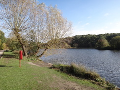
They also contrasted with the next stretch of path that passed Vicar Pond, which sits in the middle of a country park. Both the lake and headstocks are man-made objects, but both were welcome sights. A long track took me westwards, and I was so out of energy by this stage that I just wished the walk was over. The track ended at the eastern edge of Mansfield, after which a cyclepath took me past a recreation ground. A road then led down into the town centre.
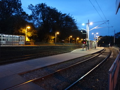
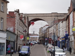
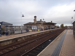
Mansfield is dominated by a large viaduct that carries the current railway line overhead through the town. The town’s station closed in 1964, and for many years the town was the largest in England without a station. It was eventually reopened in 1995 as part of the Robin Hood Line between Nottingham and Worksop. If the people waiting for trains whilst I was there is anything to go by, it is a popular and useful addition to the network.
This will never be a classic walk, but it should have been more enjoyable than it was – and that was down to my own stupidity in not eating enough.
 |
 |
|
Directions
This walk starts off in the car park by Bulwell station and tram stop at SK54084499. Leave the car park and head across the bridge over the River Leen to reach Main Street in Bulwell. Carefully cross the road (there is a pedestrian crossing a few metres away to the left), and then turn right to follow the road away from the bus station. The road immediately starts to curve to the right, and on the apex, take the second road ahead to the left, Holborn Place, which becomes Montague Street before it ends at a crossroads at SK54054537.
Turn right to follow Main Street north-northeastwards; cross a roundabout with a road leading off to an industrial estate on the right. 700 metres after joining Main Street, the large A6002 comes in from the left. Continue straight on from this junction to a large roundabout with the A611 after another 1.2km. Head straight on from this roundabout as the road enters the outskirts of Hucknall; when a roundabout is reached after another 1.8km turn right down Ashgate Road. This soon curves left at a mini-roundabout to head northwards, passing a Tesco store on the left and curving left to end at a roundabout on Station Road. Turn right to head east-northeastwards for a short distance to a road bridge over a railway line at SK53984935, with Hucknall railway station and tram stop down steps to the right.
Continue along the road off the bridge for a short distance to a roundabout, and take the first road off to the left, Papplewick Lane. This slowly curves to the right past houses to take a northeasterly course, gently falling. 1.4km after the roundabout the road crosses a bridge over the River Leen and curves right; on the bend turn left past a gap in a fence to join a path that climbs up onto a bank. Follow the path as it follows the top of the bank northwards through trees; after 600m it emerges onto Linby Lane. Turn right to follow the road eastwards; change over to the northern (right-hand) side of the road when you can. After 250m the road ends at a crossroads in Papplewick at SK54865108.
Turn left to start following the B683 Main Street northwards through Papplewick. The road curves sharply right and then left in the village before resuming its northwards course, passing Papplewick Hall away to the left. After 800 metres the road curves right and starts to climb uphill; turn left on the bend to follow a surfaced track called Hall Lane. Go past a farm gate and pass a barn on the right, as the track curves right. As it turns left towards a house, continue straight on through a farm gate to join a gravel track, with a hedge on the right. The track heads northwards; 720 metres after the gate, the gravel track turns right across fields. Continue straight on along a grassy path between wide-set hedges. After another 350 metres a metal clapper gate between two stone posts is reached at SK54735313.
Go through the clappergate and follow a hedge on the right through a slightly overgrown area, with a house away to the right. Squeeze past another stone post to join a surfaced driveway. Head up this driveway as it runs past the eastern edge of some woodland, with parkland on the left. After 830 metres at SK54465393 the track curves gently to the left. Note: I went wrong here; the following directions are for the correct route. Keep an eye out for a waymarker in the trees on the right, and take a footpath that leads off to the right, initially with a fence on the right. The path heads northwards through the trees, soon reaching a surfaced track at SK54425413.
Cross the track, and angle half-right along a path that heads northeastwards up through the trees. A security fence is reached on the left, guarding a house. Follow the fence north through the woods downhill; another fence soon starts on the right. At the bottom the path goes past a small estate boundary wall to enter a field. Continue straight on up a slope, following another stone wall on the right. At the end of the field, continue straight on along a path between a fence on the left and the wall on the right. 280 metres after leaving the field, go through a bridleway gate into a more open area, still following the wall on the right. The path soon curves left away from the wall; after a few metres turn right along a path that soon runs between fences to reach a bridleway gate that reaches the B6020 road at SK54435549.
Carefully cross the road, and turn left to follow it westwards. After 170 metres, turn right along the B6139 as it heads downhill. When the road curves to the left after 220 metres, turn right down a footpath that enters Nomanshill Wood. The path immediately curves slightly to the left to head north through the wood, soon passing a car park on the left. After 800 metres the path joins a gravel track. Turn right along the track and follow it northeastwards; after 530 metres turn left along a path through the trees. When a corner fence is reached, turn right down another path through the trees; do not join the fence. After nearly 200 metres this path joins a track; turn right down this track for a few metres until it ends at a crossroads, and then turn left to head north-northeastwards down another track. After 430 metres this crosses an access track at SK54385761.
Angle slightly right across the track to reach a path that heads north between hedges, with a large house behind the hedge on the left. The hedge on the left ends; continue straight on across a rough area before emerging out into a field. Follow the field boundary on the left; at the corner of the field, go through a gap into a second field, and follow a hedge and fence on the right. At the end of the second field, go through a gap in a fence and descend down some steep steps to reach the A617 Sherwood Way South. Turn right to head east along the road, and when you can, change over to the left-hand (northern) side of the road. A crossroads with the A60 is soon reached at SK54485822.
Turn left to follow the A60 northwards towards Mansfield If you wish to shorten this walk, you could just continue north along the road into the town. Change over to the right-hand side of the road when you can, and then take the first road to the right, Old Newark Road. When this soon curves to the left, turn right to continue along Old Newark Road, which is now just an access road. It passes between houses on the left and fields on the right (the latter will soon be a housing estate), and becomes a rough track. After 1.4km the track angles right to reach the A6117 road at SK55765868.
Carefully cross the road (there is a pedestrian crossing a few metres way to the right), and continue along the path on the other side. This curves left and then right to join a surfaced road (still called Old Newark Road) that heads east with houses on the left. When this soon curves left, head straight on along a path, still heading eastwards. The path curves to the left slightly, and 950 metres after leaving the road, ends at a dual carriageway. Turn right along the road for a few metres to a roundabout, and carefully cross the A617 coming in from the right to head straight on down the B6020 Southwell Road East towards Rainworth. The road approaches the centre of the village, and 1.6km after the roundabout, a road junction is reached in the centre of the village at SK59045838.
Continue along the road; do not turn right down Warsop Lane. It starts to climb and gently curves to the left; after 1.3 km an old railway bridge is approached ahead. Just before the bridge, turn left up a cycle path that zig-zags up to the top of the bridge and then turn right, to follow the cycle path north away from the bridge. Follow the cycle path as it passes under the A617 and then curves to the left. After 2km the path descends down from the railway embankment; at the bottom, turn right to pass under a long culvert under the embankment at SK60335961.
On the other side, continue along the cycle path (National Cycle Network 6) as it follows a stream on the right; the path soon becomes unsurfaced. The path curves left past some boulders as it enters some woodland. 750 metres after the culvert, the path turns left to head north-northwestwards through the trees. After another 650 metres it curves right to meet another track; turn right to follow this track eastwards, and after another 200 metres turn left along a path northwards. This crosses another track (once an old railway line), and shortly afterwards turn left along a rough track. Follow this westwards; when it curves right after 350 metres, turn right to head along another track that soon reaches another track at SK60536088.
Turn left to follow the new track as it heads uphill, slowly curving to take a north-northwesaterly course. Continue along this track as it crosses a couple of other tracks; after 1.6km turn left down another track, which soon merges with another track coming in from the right. The track falls to reach a high bridge under an old railway line. When the track forks immediately afterwards, take the right-hand branch. The track passes under power lines and when it forks, once more, with a golf course off to the left, take the right-hand branch. Shortly afterwards go past a cycle barrier and curve right, still following National Cycle Network 6, and then turn right, with a country park off to the left, following a good path with power lines above and to the left. This path then curves left, passing under the power lines, following a fence on the right. When a junction is reached, turn left down a path through Collier’s Plantation. This curves left, past a small picnic area, and then right and left to meet the end of Vicar Pond. Follow the water on the left to reach a farm bridge over a stream and then a car park at SK59546290.
Here the National Cycle Network 6 is left. Turn left from the car park to follow its access road westwards along the northern edge of the lake. When the lake ends, continue on along the access road. When the road curves right into a car park after nearly 700 metres, continue straight on past a vehicle barrier and down a footpath. This passes a smaller lake on the left; when this ends, go past another vehicle barrier, cross the end of a road and continue on along the path, which becomes a track as it passes houses off to the right. Continue straight on along the track until it ends at another road at SK57726224.
Cross this road, and continue along a track. This becomes a road (Newland Road) as it passes more houses on the right, and after 1.6km ends at a T-junction with the A6117. Carefully cross the road, and on the other side head down a path. When this soon ends at a road, head straight on down Pump Hollow Lane. This curves to the right; as it curves to the right for a second time, turn left down a surfaced path past two sets of bollards to reach the end of another road (still called Pump Hollow Lane). Turn right down this road and follow it until it ends at a T-junction with Eakring Road at SK56066106.
Turn right to follow this road westwards towards the centre of Mansfield, but after 150 metres turn left along a surfaced path that heads southwestwards across a grassy area, with a hedge on the right. Go through a gate and continue along the track, past tennis courts and then a recreation ground on the right. Just before the end of a road is reached ahead, turn right along a surfaced path that runs along the south side of the recreation ground. This path soon ends at Selwyn Street. Follow Selwyn Street westwards for a short distance until it ends at Southwell Road West at SK55166041.
Turn right to follow the main road northwestwards as it descends down towards the centre of Mansfield. After 1.2km it ends at a junction with the A60 St Peters Way dual carriageway; use the pedestrian crossing to cross the dual carriageway and continue along Church Street, which soon curves to the left past a church on the left. After passing the church it curves right, becoming Midworth Street, which soon ends at a T-junction. Turn right up Albert Street and follow this as it heads under a large railway viaduct. Immediately on the other side of the viaduct, turn left up Station Road. This passes Mansfield bus station on the right; as it curves right, turn left to head up a path that leads to Mansfield train station at SK53716084.
The platform for trains south back to Bulwell is on the other side of the line, and can be accessed through an underpass.
 |
 |
|
Distances
| From | To | Distance (m) | Ascent (ft) | Descent (ft) |
|---|---|---|---|---|
| Bulwell station | Hucknall station | 3.2 | 171 | 79 |
| Hucknall station | B6020 near Ravenshead | 4.6 | 417 | 223 |
| B6020 near Ravenshead | Rainworth | 5.4 | 367 | 499 |
| Rainworth | Vicar Pond, Clipstone | 5.7 | 433 | 512 |
| Vicar Pond, Clipstone | Mansfield station | 4.6 | 361 | 213 |
This makes a total distance of 23.5 miles, with 1749 feet of ascent and 1526 feet of descent.
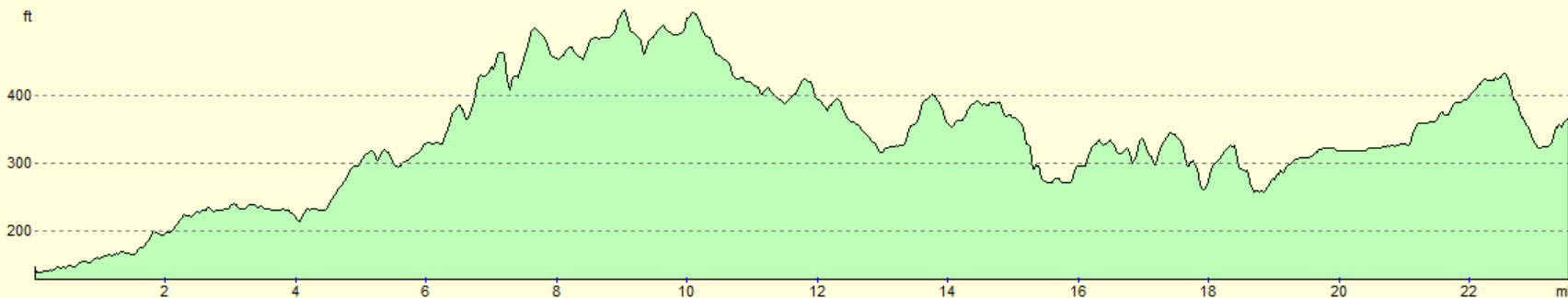
For more information on profiles, ascents and descents, see this page
Transport
Regular (roughly hourly during the week) train services run direct between Mansfield and Bulwell. See the National Rail Enquiries website for more details.
 |
 |
|
 |
 |
|
 |
 |
|
 |
 |
|
 |
 |
|
 |
 |
|
 |
 |
|
 |
 |
|
 |
 |
|
 |
 |
|
 |
 |
|
 |
 |
|
 |
 |
|
 |
 |
|
 |
 |
|
Disclaimer
Please note that I take no responsibility for anything that may happen when following these directions. If you intend to follow this route, then please use the relevant maps and check the route out before you go out. As always when walking, use common sense and you should be fine.
If you find any information on any of these routes that is inaccurate, or you wish to add anything, then please email me.
All images on this site are © of the author. Any reproduction, retransmissions, or republication of all or part of any document found on this site is expressly prohibited, unless the author has explicitly granted its prior written consent to so reproduce, retransmit, or republish the material. All other rights reserved.
Although this site includes links providing convenient direct access to other Internet sites, I do not endorse, approve, certify or make warranties or representations as to the accuracy of the information on these sites.
And finally, enjoy your walking!
Nearby walks
| # | Title | Walk length (miles) |
|---|---|---|
| 76 | Bingham to Nottingham | 13.5 |
| 95 | Nottingham to Long Eaton | 10.3 |
| 597 | Mansfield to Matlock | 21.2 |
|
|

|