Walk #1020: Kingham to Bourton-on-the-Water, and then north to Moreton-in-Marsh
 |
 |
|
General Data
| Date Walked | 29/09/2018 |
| County | Oxfordshire, Gloucestershire |
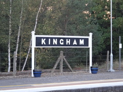
| Start Location | Kingham station |
| End Location | Moreton-in-Marsh station |
| Start time | 07.11 |
| End time | 15.17 |
| Distance | 20.5 miles |
| Description | This was a very pleasant walk, following the Oxfordshire Way to its western trailhead in Bourton-on-the-Water, and then following the Heart of England Way north from its southern trailhead in the village to near Moreton-in-Marsh, before heading down to the station there. |
| Pack | Today I carried my 30-litre Karrimor rucksack, filled with water, my spare waterproofs, a book and other odds and ends. |
| Condition | I had some problems with the toes on my right foot, and it turned out that this was because the nails were too long. A silly mistake that caused me more than a little discomfort during what should have been a very pleasant stroll. |
| Weather | Today started off surprisingly chilly after a very hot summer, with frost on the ground in sheltered places. However the cloudless skies meant it soon warmed up, and by mid-morning it was too warm for my fleece. There was not much of a breeze, and absolutely no sign of any rain. |
| OS map | Landranger number 163 (Cheltenham & Cirencester, Stow-on-the-Wold) and Landranger number 151 (Stratford-upon-Avon, Warwick & Banbury) |
 |
 |
|
Map of the walk
Maps courtesy of Google Maps. Route for indicative purposes only, and may have been plotted after the walk. Please let me have comments on what you think of this new format. For a detailed table of timings for this walk, please see the table file.
 |
 |
|
Notes
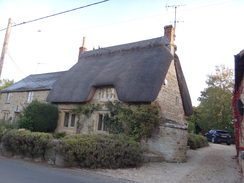
It has been a few weeks since my last walk. Now that my son has started school, I only get weekends to walk, which is also when family events tend to happen. To make matters worse, the autumnal nights are starting to draw in, and that means that I have to either drive to, or from, walks in the dark. Despite this, I decided that another walk in the Cotswolds was in order. The air outside my home was chilly, but not cold, when I set off, although by the time I parked up in Kingham there was a frost on some cars and a distinct nip in the air.
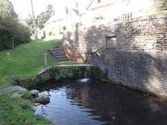
The first half-mile retraced my steps from the last walk, heading west towards Bledington, passing what was obviously an old mill on the way. My hands were soon cold and I shoved them into my trouser pockets as roads took me through the village. I soon realised I had made a slight mistake, but this was no loss as it took me through a splendid area of the village near the pub, where a stream runs near the road, and expanses of grass stretch up towards Cotswold stone buildings. I soon reached the proper route near the church, and diverted off along the trail and back to reach the point I went wrong.
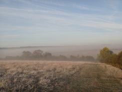
A path led through the churchyard and then down into a little valley. The skies overhead were bright blue, but the plain below was wreathed in mist – though at such times I find the distinction between 'mist' and 'fog' to be confusing. The mist soon ended as I followed the trail westwards, although a heavy frost sat on the ground. Whilst a little chilly, the white sheen added a little magic to the vegetation.
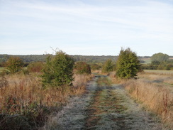
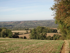
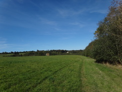
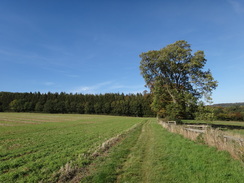
There was a place where an Oxfordshire Way path met a track, and a waymarker pointed straight on across the track into thick vegetation. Instead, I turned off down the track, and it soon became clear that this was the correct route. The track led on, before climbing uphill through woodland to pass a farm at Gawcombe. The track continued on steeply uphill – it felt like the steepest climb I've done for some time, after which roads and paths took me over the hill's crest. A trig pillar was visible on a mound in an adjacent field, but there was no easy way over the fence and I decided to give it a miss. Instead, I was treated to some grand views down over towards Bourton-on-the-Water to the west.
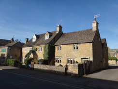
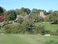
Another path led downhill; at first this was easy to follow, but I soon reached a field where the route was not obvious. Eventually I found a gate in the bottom corner of the field, although I was not sure it was correct until I checked my route on my map when I got home. The fields led me down into the pretty village of Wyck Rissington, which had houses built in Cotswold stone, widely spaced as if land was plentiful. A drinking fountain stood on a green, and all too soon the trail headed southwestwards out of the village.
The next stretch was fairly uninteresting, but it soon ended on a road on the outskirts of Bourton-on-the-Water. The first sign of something unusual was a large coach park off to my right, and then a large Co-Op store made of the local stone. These were hints of what lay in the centre of the town.
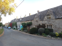
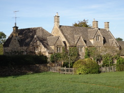
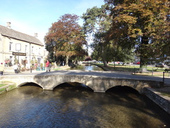
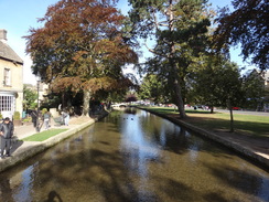
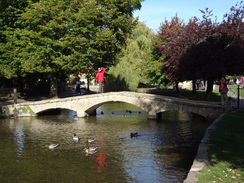
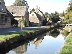
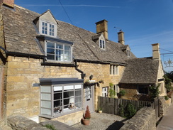
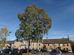
Bourton-on-the-Water is beautiful. The River Windrush runs through the middle of the village, with low bridges crossing it between the rosy-yellow stone buildings. It was my first time there, and I wanted to stop to look around rather than walk on. Instead I staggered around for a few minutes, looking here and there before somewhat reluctantly heading on out of the town. I felt like I was the only person leaving, as despite the early hour the town seemed full of tourists enjoying the sunshine.
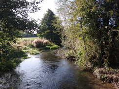
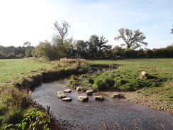
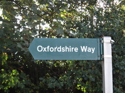
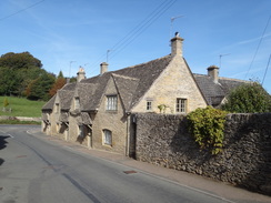
The town marks the western end of the Oxfordshire Way (which oddly is deep in Gloucestershire), and also the southern end of the Heart of England Way. I had now completed the western half of the former trail, and most of the rest of the day was to be on the latter trail, which heads north through the Midlands towards Cannock Chase. The first stretch was rather uninteresting after the splendours of Bourton-on-the-Water, but it soon took me to the tiny village of Lower Slaughter, which is, if anything, prettier than the town. A river runs through the middle of this as well, and everything seemed to glow in the sunshine.
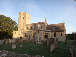
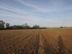
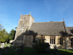
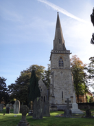
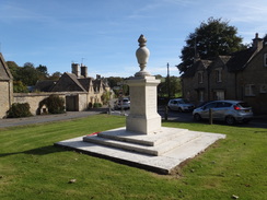
The next stretch of trail was less splendid. It headed across low ground with barely any ascents or descents, with many field boundaries to negotiate. I went wrong in one field and headed around two sides before I discovered my mistake – a horse-jump through a hedge had seemed like a stile from afar. When I found the correct route (which I had walked past), there was an obvious waymarker that I had missed. Fortunately the trail became more obvious as it continued north, and it dropped me off in the village of Lower Swell, which has more attractive buildings and a rather splendid war memorial.
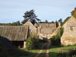
Another path led north into the village of Upper Swell, which (in my view at least) slightly less attractive than its neighbour – I can see angry emails coming in about that, so I'll just add that I live in a village with 'Lower' in its name, so I'm probably biased! The village is also tiny, and I was soon following a road that crossed the river and passed a brewery that was advertising beer for sale. Another road took me on, after which a path headed north past some woodland. It looks as though the outline of the woods have changed since my map was drawn and I thought I might have made a mistake, but soon I was on more certain ground as the path headed past a grand house. When I got home it turned out I had taken the correct route.
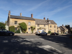
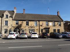
This path led into Longborough, which was another superb Cotswold village. The pub in the village was open, and I quickly did a calculation: if I pushed I could just about catch a train from Moreton-in-Marsh, but I would have to hurry. As there was another train an hour afterwards, I decided to have a rest. The pub was busy, and I ordered a shandy and a pack of nuts and went to sit outside. I was soon chatting to a local couple about the village and the trails she had walked in the past. It was a very enjoyable break, but all too soon I had to get my boots back on and start walking again.
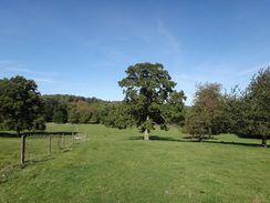
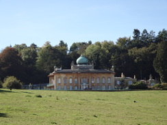
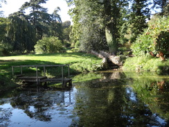
Paths took me north past a startlingly beautiful house, Sezincote, which is apparently in the neo-Mughal style. A large copper dome sat atop the house in what seems a spectacular, if rather unBritish style. The trail headed on into Bourton-on-the-Hill, where it joined a main road that led towards Moreton-in-Marsh. Since I had plenty of time, I continued along the trail as it followed a track that led to an arboretum, before heading across a field for a short distance.
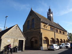
I then left the Heart of England Way and joined a path that headed east towards Moreton-in-Marsh. The papth was distinct on the ground and easy to follow, perhaps because of the many people I encountered walking along it. It dropped me off in the centre of the town, which was bustling with people. Whilst not as attractive as Bourton-on-the-Water, it is a filled with lots of beautiful stone buildings. I did not have a look around, and instead made my way to the station, where I had a little wait for my train.
It had been a very enjoyable day's stroll along two trails, through many beautiful villages and towns. I can hardly wait for my next walk through the Cotswolds.
 |
 |
|
Directions
This walk starts off at Kingham Station at SP25652270. Leave the station and head up the approach road to reach the public road, and then turn right to follow it westwards. The road crosses a bridge over the River Evenlode, and then another over a millstream, and then curves right to head into the village of Bledington. After nearly 500 metres it passes the village school on the right, and then on a slight left-hand bend, turn left down Church Street towards the church, which is reached at SP24532254.
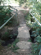
When the road curves right just before the church, head straight on along a surfaced track, passing the churchyard wall on the right. When the track soon curves left, continue following the churchyard wall on the right to reach a pedestrian gate that leads into a graveyard extension. Follow the path through the graveyard, and then exit out through another pedestrian gate. Follow a path as it curves immediately left and then right to head between a fence and hedge towards a clappergate. Go through this to enter a field. Follow a hedge on the right; the path falls to reach a clappergate and plank footbridge that lead into a second field at SP24142238.
Angle half-left to head diagonally across the field, aiming for a gap in the far hedge. Go through the gap and cross a footbridge over a ditch in the middle of the hedge to enter a second field. Head directly across this field westwards towards trees on the other side. The path meets the hedge; continue straight on alongside the hedge on the left. At the corner of this field, head straight on through a gap in a hedge to reach a clappergate. On the other side, continue straight on along a track that runs between hedges. As the good-quality track soon curves left to a bridge over Westcote Brook on the left, continue straight on along a less good track. Go through a gap in a fence and follow a fence on the right for about 100 metres to reach another gate. Go through this gate and follow the path as it curves left to a footbridge over the brook at SP22862220.
Cross the footbridge and go through a pedestrian gate that leads to a path through a small area of woodland and then a field. Follow a hedge on the left for about 350 metres until a track is reached just before the field corner. Turn right along this track; it soon curves left to leave the field and continues on west-southwestwards between intermittent hedges towards a wooded hillside ahead. It starts to climb; and after nearly a kilometer the track joins another track and curves slightly to the right, still climbing uphill. Soon afterwards it joins a more distinct track near barns in Gawcombe at SP21402150.
Continue along this track past the barns and some houses on the right. It then curves right past a barn on the left and then left, passing another barn on the right. Continue along the track as it passes the main farm buildings away to the left. The track then resumes its climb uphill, becoming partly surfaced as the gradient increases, and 500 metres after the farm, a public road is met. Continue straight on along this road for 130 metres until it ends at a T-junction with the A424 at SP20652091.
Carefully cross the road, and turn left to follow it southeastwards for a little over 50 metres, and then turn right down a sunken lane. The lane climbs slightly; go through a bridleway gate and continue on for ten metres to a second bridleway gate. Continue along the track between a hedge and a fence, and 600 metres after the main road, the track emerges out onto a road. Turn right to follow the road northwards for 450 metres until a footpath leads off to the left, just before a slight right-hand bend at SP20102116. Do not go through the field gate a few metres after the footpath.
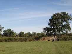
The footpath leads into a field. Head westwards steeply down the field, with a hedge on the right. At the bottom corner of the field, go through a clappergate into a second field. Head down this field, paralleling a hedge on the right. The hedge swings left to meet the path; when they meet, go through a gap in the hedge and cross a tiny little stream into a third field. Continue straight on down the field, aiming for the bottom hedge. When this is met, go through a field gate at SP19462124 into a fourth field.
Curve slightly to the right across this field, aiming for the far right-hand corner. In the corner, go through two field gates and cross a little footbridge over a stream. Head across this field to reach a pedestrian gate beside a field gate that lead into another field. Head straight on across this field, passing a barn away to the left, and then angle left to the left-hand corner of the field where a pedestrian gate leads to a footbridge over a stream. On the other side, go through a second pedestrian gate to enter a field. Head straight on across this field to another pedestrian gate that leads onto a track in front of the churchyard of Wyck Rissington church. Cross the track and got through a gate ahead to enter the churchyard; walk past the church and join the main access path that leads onto a road in Wyck Rissington at SP19122150.
Turn right to follow the road northwestwards for 550 metres. Shortly after the scattered houses on the left end, turn left through a gap (gateway?) in a hedge to enter a field. Follow a track alongside a hedge on the left. At the next corner of the field, go through a bridleway gate beside a field gate into a narrow second field. Follow a fence on the left, with woodland away to the right. Pass the end of a cross-hedge on the right, and just before a second, veer right as the field widens to join the cross-hedge on the left. Follow this on the left to reach a bridge over a stream guarded by two bridleway gates. Go through these into a third field and then turn half-left across this field, aiming for the hedge on the other side. At the far side of the field, go through a gap in the hedge to reach a footbridge over the River Dikler at SP17972154.
Continue straight on for about fifty metres across another field to reach a bridleway gate, and on the other side continue across another field as a fence angles in from the right, to reach a footbridge over the River Eye. Continue on for five metres after the bridge to a gap in a hedge on the right, and on the other side follow a hedge on the right. At the end of this field, go through a bridleway gate beside a field gate to enter another field, and then continue following a hedge on the right. At the end of this field, go through another bridleway gate beside a field gate at SP17542132.
Go through the gate and turn right along a track that is enclosed by hedges. This heads north-northwestwards; after nearly 200 metres it ends at a track called Moor Lane. Turn left along this track and follow it southwestwards. Houses start on the right, and after nearly 600 metres the lane ends at a T-junction with Roman Way. Cross the road to the pavement on the other side, and then turn left along Roman Way, which soon ends at another T-junction with Station Road. Turn left to head straight on down this road, which passes a coach park on the right and after 400 metres curves left at a junction with the High Street in Bourton-on-the-Water at SP16872057.
Turn right to follow the High Street through the centre of the town, with the River Windrush away to the left. As the river starts curving away to the left after 200 metres beside a war memorial, turn right down Moore Road. After 100 metres, turn left past vehicle barriers to join a surfaced path that heads northwestwards. This passes a churchyard on the left, and soon ends at an old road. Turn right past more barriers to join a surfaced path that runs north between fences. It passes a school on the left, and then goes past more barriers to reach the school's access road. Cross this, and then go past more barriers and continue along the path; after a short distance, ascend a small slope to join Station Road. Turn left down the road and follow it as it heads northwestwards for 450 metres until it ends at a T-junction with the A429 at SP16612164.
Turn right for a few metres to reach a traffic-light controlled crossing, and use this to access the pavement on the other side, and turn right to follow the road northeastwards. After 100 metres turn left. Do not go through gates into an equestrian centre, and instead join a good path that runs between a fence and a hedge. The fence on the left ends; continue straight on along the good path as it runs between fences. The fence on the left ends, and the path continues to a gateway. Continue along the path as it is enclosed by hedges on either side. The path curves right and crosses the River Eye before following the river on the left. Just before a road is reached ahead, turn left along a path that follows the river to the left and the road to the right to reach the Slaughers Country Inn in Lower Slaughter at SP16532255.
Follow the road as it curves around to the right, passing Lower Slaughter church away to the right. As the road soon curves left, turn right through a gap in a wall and follow a hedge on the right. After a few metres this joins a gravel track. Follow the gravel track, still with the hedge on the right. After twenty metres, just before a gateway into a house, turn left along a path that initially runs between walls to reach a pedestrian gate that leads into playing fields. Follow a fence on the right past the fields; at the far corner go through a clapper gate and continue along a path between fences. The path curves right to a field gate; go through this to enter a field and then turn left along another field, following a hedge on the left that eventually becomes some woodland. Do not go through double gates in the corner of the field, and instead turn right for about ten metres to reach a footbridge in the hedge over a ditch at SP17032334.
Cross these into a field, and then turn left back towards the field corner, and then right alongside a hedge for a short distance to reach a gate. Go through this to enter another field, and angle slightly to the right across the middle of this field, aiming for the far right-hand corner, with barns beyond. At the corner cross a stile beside a field gate to enter another field, and then turn half-right diagonally across the field for a few metres to reach a clappergate that leads onto a track. Cross the track and go through a second clappergate to enter a field. Follow a path across this field, with a hedge away to the right and farm buildings away to the left. At the far end of this field, go through a field gate into another field and turn fully left, following a hedge on the left for about fifteen metres to reach a gateway at SP17472380.
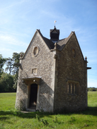
Go through the gateway into a field, and angle slightly to the right to head diagonally across the field. The path crosses a farm bridge over a ditch and then continues to a field gate in a hedge that leads into another field. Angle slightly to the right across this field, aiming to join a hedge at the far right-hand corner. Go through a clappergate in the corner and then cross a stone-slab bridge over a ditch into another field. Head straight on across this field until it meets a vague track by a farm bridge over a stream. Turn right to cross the bridge, and then angle left to reach another gateway. Go through the gateway, and on the other side curve left for about twenty metres to reach another farm bridge at SP17872437, with Hyde Mill a short distance away to the right.
Cross the farm bridge to enter another field, and head straight across this, roughly paralleling a hedge away to the left. At the far corner, cross a footbridge over a stream and continue on for five metres to a field gate. Go through this to join a track. Turn left to follow the track as it heads up a slope between wide-set hedges. As the track curves left at the top, head on for a few metres to a bridleway gate and continue on for a few metres to a second bridleway gate beside a field gate at SP17692466.
This leads to a track that heads north-northwestwards between hedges. This track passes some barns on the right and then meets another track. Turn right down this track for a few metres towards the barns, and then left along a track that runs between a stone wall and a hedge. This curves left and then right before it meets a surfaced road to the south of Lower Swell. Turn right to head north along this road for 250 metres until it ends at a T-junction with the B4068. Turn right down this road for a short distance until a triangular road junction is reached in the centre of Lower Swell at SP17352550.
Take the left-hand branch, passing a war memorial on the right, and cross a road ahead to start up another road. After about 70 metres turn right along a track that passes houses on the right and curves left to reach a pedestrian gate. Go through the gate into a field and follow a wall on the right for a few metres. When the wall curves right, angle slightly to the right across the field, heading down a slight slope. Descend down to a clappergate that leads onto a surfaced track. Turn left to follow the track north; it soon curves slightly to the right. It passes Bowl Farm on the right, and after nearly 500 metres, just before an ungated fence across the track at SP17762611, turn left through a clappergate into a field.
Angle half-right across the field, aiming to the right of a tall tree. Climb a slight slope; at the top join a fence on the left and follow this northwards, with a slope down to the River Dikler on the right. The fence and path descends to meet a clappergate. Go through this and continue following a fence on the left to reach a clappergate through a stone wall. Go through this and continue on to reach the site of a missing clappergate. Turn right along the path, and then immediately left through another clappergate to enter a field. Head on north across the middle of the field, aiming for a clappergate through a fence. Go through this and head on down this field; it slowly falls and curves slightly to the left. At the bottom corner of the field go through a clappergate and descend a path to reach the B4077 in Upper Swell at SP17752681.
Turn left and follow the road as it heads uphill west through the small village; it curves to the right to take a more northwesterly course. After 350 metres turn right down a minor road; this crosses a bridge over the River Dikler and climbs steeply; after 1km it ends at a T-junction with another road. Turn right along this road, and as it soon curves left, head straight on to head eastwards along another road. After nearly 600 metres this ends at a T-junction with the A424 at SP18022793.
Carefully cross the main road, and on the other side head on along a green track that runs between hedges. Ignore a path leading off to the left into the top corner of a field, and instead head on down the main path – now narrower and more enclosed. 300 metres after the main road, at the bottom of the slope, turn left over a stile into a field. Head north across this field, crossing the centre of the field. At the far side go through a gap in a hedge to reach a footbridge over a ditch. On the other side continue on through a small band of woodland out into a field at SP18242821.
Follow the western edge of an area of woodland on the right. At the bottom corner of the field, turn right to head through the woodland paralleling a small stream to the left. The path soon curves left to cross a farm bridge over the stream before emerging out of the trees through a field gate. Angle right across a field to reach the eastern field boundary. Do not go through a field gate, and instead turn left to follow a fence on the right north-northwestwards across a neat field – part of a park. At the end of this field, cross a stile through a fence and follow a hedge on the left to another stile. Cross this and follow a fence on the left past scrubland on the right. The path opens out onto a track. Continue along this track for a short distance until it becomes the end of a surfaced road. Follow this road as it heads north into Longborough; it ends at a triangular junction at SP17862929.
Take the right-hand branch and follow this as it passes a spring coming out of a wall on the left; it soon ends at another T-junction. Turn right to head straight on north along the High Street. Continue along this road for 200 metres until it too ends at a T-junction. Turn left up Ganborough Road, and follow it as it climbs, passing the Coach and Horses pub on the left. Shortly after the pub, and on a left-hand bend at SP17842964, turn right down a track.
The track passes some allotments on the left; when it curves left, continue straight on following a wall on the right, with a graveyard beyond. At the end of the wall, go through a pedestrian gate into a field, following a low wall on the right. At the end of this field cross a rough track and go through a broad gap in the hedge ahead into a second field. At the end of this field, go through another broad gap ahead and continue following the wall on the right towards some trees ahead. At the corner of this third field, head on, following a fence on the right through a gap in the woodland on the left to reach a field gate. Go through a pedestrian gate by the field gate and follow a path between the woodland and a fence on the right. When the fence ends, continue alongside a hedge on the left to reach a track at SP17503071.
Cross the track and go through a clappergate beside a field gate on the other side. The path heads through a band of trees to reach two gateways; go through the right-hand gateway and follow a fence on the left downhill northwards, angling slightly away from the woodland on the left. The path descends, with Sezincote House on the hillside to the left and a lake on the right. At the bottom, go through a gateway and cross a bridge, with a small lake to the left, and continue on for a short distance to another gate. Just before this gate, turn right through a pedestrian gate and follow a path between fences. Go through a pedestrian gate and follow a fence on the left across a field. It ascends a slight slope; at the crest it crosses an unfenced surfaced track at SP17463153.
Cross this and continue on for a short distance north to the next field corner. Go through a clappergate and continue on for five metres to a second clappergate. On the other side, continue on alongside a fence on the left. At the corner, cross a stile and continue following a hedge on the right and a fence on the left. The path descends alongside the fence. Near the bottom cross a stile and walk on for about twenty metres to a field gate that leads into another field. Head straight on north across the middle of this field; at the bottom, go through a field gate and continue on, at the top go through a field gate and continue on between walls. This path ends at a road in Boughton-on-the-Hill. Turn right along this road, which soon curves left to reach the A44 at SP17593250.
Turn right to follow the A44 downhill to the east; there is pavement on the left. After 650 metres turn left up a surfaced single-lane surfaced track that heads north towards Batsford Arboretum. After 350 metres it crosses a bridge over a stream; immediately afterwards, turn right to reach a pedestrian gate beside a field gate that lead into a field. Turn half-left to head diagonally diagonally across the field, towards a treeline ahead. Just before the treeline is reached, turn right, paralleling a hedge on the left and leaving the Heart of England Way. When the eastern edge of the field is reached, cross a footbridge over a ditch and then a clappergate to enter another field at SP18603299.
Follow a hedge on the left across this first field, heading southeastwards. At the far corner, go through a clappergate into a second field and continue following a hedge on the left. At the corner, cross a slab bridge over a stream and head on for about twenty metres past a third field to a plank bridge and a clappergate. On the other side, continue on across a fourth field. At the far side of this field, go through a gap in a hedge and continue on across a fifth field, paralleling a hedge away to the left. At the end of this field go through a clappergate and continue straight on across a long sixth field, still paralleling the hedge on the left to reach another clappergate at SP19663260.
In the seventh field, continue straight on to a pedestrian gate and head on across an eighth field. At the end of this field, go through a clappergate and cross a plank bridge over a ditch to enter a narrow field with hedges on both sides. After about fifty metres, turn left through a pedestrian gate into a tenth field. Turn right to follow a hedge on the right; it soon curves left to head eastwards across the field towards houses ahead. At the far side, go through a clappergate and join a track that passes some allotments on the left. This path ends at Hospital Road. Cross this road and head straight on along Corders Lane, which soon ends at the High Street in Moreton-in-Marsh at SP20443247.
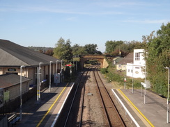
Head across the High Street to reach the Black Bear Inn. Turn right for a few metres past the pub and then left down Oxford Street, which soon ends at a T-junction with the A44. Turn left along this for a short distance, and then turn left up Station Road. When this curves to the left, turn right up an approach road to reach Moreton-in-Marsh railway station at SP20673267.
 |
 |
|
Distances
| From | To | Distance (m) | Ascent (ft) | Descent (ft) |
|---|---|---|---|---|
| Kingham station | Wyck Wissington | 6.0 | 551 | 423 |
| Wyck Wissington | Bourton-on-the-Water | 2.0 | 16 | 75 |
| Bourton-on-the-Water | Lower Swell | 4.3 | 200 | 108 |
| Lower Swell | Longborough | 3.6 | 354 | 295 |
| Longborough | Moreton-in-Marsh | 4.6 | 220 | 364 |
This makes a total distance of 20.5 miles, with 1341 feet of ascent and 1265 feet of descent.
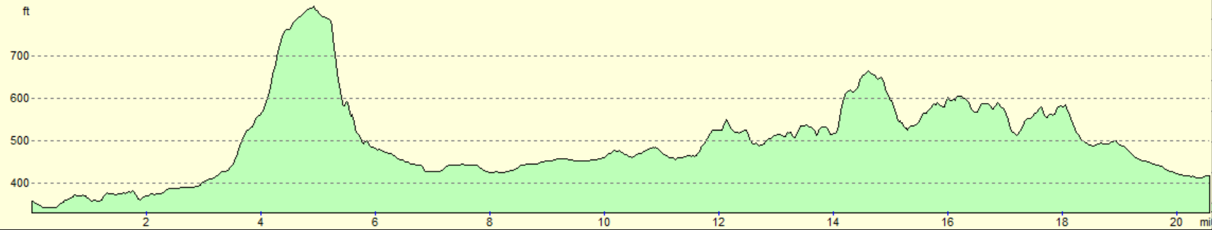
For more information on profiles, ascents and descents, see this page
Transport
There are regular train services between Moreton-in-Marsh and Kingham, on the GWR route between Worcester, Oxford and London. See the National Rail Enquiries website for more details.
 |
 |
|
 |
 |
|
 |
 |
|
 |
 |
|
 |
 |
|
 |
 |
|
 |
 |
|
 |
 |
|
 |
 |
|
 |
 |
|
 |
 |
|
 |
 |
|
 |
 |
|
 |
 |
|
 |
 |
|
 |
 |
|
 |
 |
|
 |
 |
|
 |
 |
|
 |
 |
|
 |
 |
|
 |
Disclaimer
Please note that I take no responsibility for anything that may happen when following these directions. If you intend to follow this route, then please use the relevant maps and check the route out before you go out. As always when walking, use common sense and you should be fine.
If you find any information on any of these routes that is inaccurate, or you wish to add anything, then please email me.
All images on this site are © of the author. Any reproduction, retransmissions, or republication of all or part of any document found on this site is expressly prohibited, unless the author has explicitly granted its prior written consent to so reproduce, retransmit, or republish the material. All other rights reserved.
Although this site includes links providing convenient direct access to other Internet sites, I do not endorse, approve, certify or make warranties or representations as to the accuracy of the information on these sites.
And finally, enjoy your walking!
Nearby walks
| # | Title | Walk length (miles) |
|---|---|---|
| 620 | Cotswold Way: Dowdeswell Reservoir to Stanton | 19.8 |
| 621 | Cotswold Way: Stanton to Lower Quinton | 17.0 |
| 1016 | Banbury to Shipston-on-Stour | 16.1 |
|
|

|