Walk #968: Essex Way: Marks Tey to Manningtree
 |
 |
|
General Data
| Date Walked | 16/11/2012 |
| County | Essex |
| Start Location | Marks Tey |
| End Location | Manningtree |
| Start time | 08.03 |
| End time | 16.25 |
| Distance | 23.1 miles |
| Description | This pleasant walk followed the Essex Way northeastwards from Marks Tey through Essex, eventually ending on the Stour Estuary at Manningtree. |
| Pack | Today I carried my 30-litre Karrimor rucksack, filled with water, my waterproofs, a book and other odds and ends. |
| Condition | I feel absolutely fine after this walk, with no problems to report. |
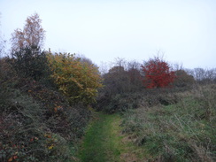
| Weather | Today was a cold, cloudy day, fitting for the time of year. It remained dry for almost all the day, except for the last half-hour when there was some heavy drizzle. |
| OS map | Landranger number 168 (Colchester, Halstead & Maldon) |
 |
 |
|
Map of the walk
Maps courtesy of Google Maps. Route for indicative purposes only, and may have been plotted after the walk. Please let me have comments on what you think of this new format. For a detailed table of timings for this walk, please see the table file.
 |
 |
|
Notes
I only had one days walk left to complete the Essex Way. I set off from home later than I wanted and traffic was starting to build up as I approached Marks Tey. Fortunately there was one solitary space left in the railway stations car park, and I parked up and paid the rather expensive fee for a days parking. A little coffee shop in the station provided me with a pain du raisin which I scoffed as I walked down the road.
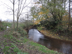
The first couple of miles took me along roads northwards through Aldham to rejoin the trail where I left it at the end of the last walk. I arrived in Fordstreet and walked through the village, passing pubs that were hours from opening. I crossed the bridge over the River Colne and immediately made a mistake, walking too far along the road. The mistake was easily corrected and a path took me behind houses to reach the trail.
A muddy walk along the northern bank of the river took me to Fordham Bridge, where I joined the walk I had done earlier in the year. An initially pleasant stroll slightly away from the river soon became very muddy, and indeed boggy as it headed through an area of scrubland. Fortunately no water leaked into my boots and my feet remained dry, although that was only due to careful and slow progress.
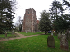
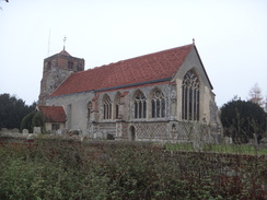
Thankfully things soon became firmer and I strode across fields, passing an old brick building before passing a farm and heading uphill. I did not bother going into a wonderful church at the top of the hill, having visited it on my last trip. Instead I followed roads into West Bergholt, passing the plain-looking church that had replaced the church I had passed earlier. Architecturally and spiritually, the new building was far inferior to the old.
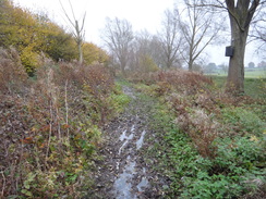
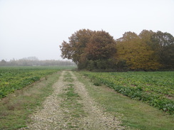
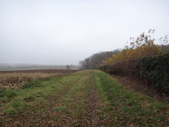
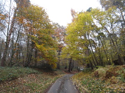
Swedes were being harvested from a field to the northeast of the village; one machine was lifting them out of the ground whilst a bigger one was picking up the resultant lines. The downside to all this activity was that the ground was very muddy, making the climb up the slight hill far from enjoyable. The going became easier as the path led into an orchard and then into Horkesley Heath. A little road walking - fortunately with pavements - was followed by a series of tracks and footpaths that led northwards. At one point I did not fancy crossing a field that was being ploughed, but a track led on close to the route of the path, making it a suitable diversion.
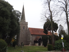
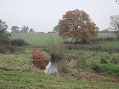
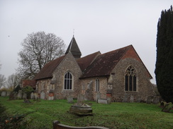
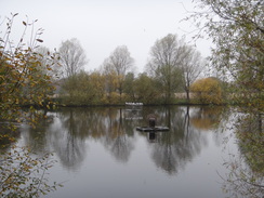
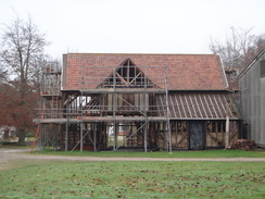
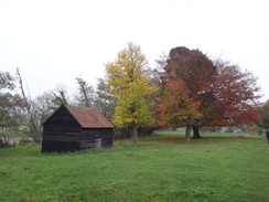
I listened to the radio as I walked, following the results of the Police Commissioners and by-election results as they came in. I am a bit of a politics nerd and lapped up every result, wondering how well the newly-elected people would do their jobs. These thoughts helped me while away a couple of fairly uninteresting miles, the high point being the scent of wine hanging in the air near a vineyard at Carters Farm. Roads and tracks led past the church at Boxted, where I considered having a break for lunch, but instead I pressed on. A track descended to pass a lake, before climbing uphill to reach a farm. The trail diverted around three sides of the farm, although it gave me some good views of a scaffolding-clad timber-framed barn that was under heavy restoration.
More roads and paths led eastwards; what I thought were views over the River Stour to my left was actually a water-storage reservoir. A climb took me to Langham church, where I shrugged my rucksack off and sat on the bench in the gateway. A beautiful inscription to someones mother was engraved on the other side of the gateway, the loving words outlasting both people. The sandwiches that Sencan made me were delicious, and for the first time in weeks I had an extra bottle of water with me, meaning that I had plenty to wash the bread down with.
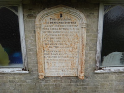
A large plaque was attached to the wall of a small building in the churchyard, stating that the structure had been used to teach girls in the parish. It seems a very small building for such an important purpose, and an indication of how far our society has come over the centuries.
Time was pressing and so I could not wait too long. I felt colder as I set off, my body having cooled down during my rest. To warm up I yomped along the track that led away from the church, the noise of the A12(T) growing larger in my ears. The road crossed the dual carriageway on a bridge, after which a track took me towards a hotel where people were unloading bags. I felt rather out of place around them, and to my embarrassment I could not find the path leading away. After walking to and fro for a couple of minutes I found the path that led down towards the River Stour.
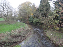
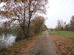
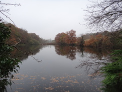
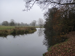
This was my second river of the day, and was by far the most attractive. Earlier in the year I had followed the Stour Valley Way along the northern bank of the river, and the water had been filled with rowing boats. In todays colder weather the merrymakers were absent, and the water silent to joyous shouts and the slap of oars.
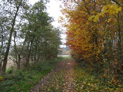
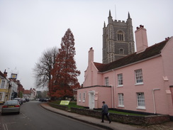
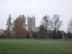
Sadly the path did not spend too long alongside the river, instead diverting off across the floodplain to reach the village of Dedham. I had never visited this village before and was very impressed. The high street is jam-packed with picturesque buildings, all set off against a rather spectacular church. The latter had an unusual feature: two large arches through the tower, allowing people to walk through it from outside without entering the church. It would not have been a cheap feature to build, leading me to wonder why it had been done.
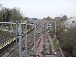
Paths led south from the village, crossing farmland before heading east to reach a railway line. I took my time crossing this, allowing two trains to pass on the electrified line before deciding it was safe. The sun was starting to sink lower in the sky and my legs were feeling heavier after the long day. Tracks and paths led on to the church near Lawford Hall, which I diverted off to take a quick look of from a distance.
Soon afterwards I reached the main road, where I had joined the Essex Way on an earlier trip. That trip had taken me along the easternmost stretch of the trail, meaning that I had now completed the whole thing. Although Manningtree railway station was only half a mile away down the road, I decided to extend the walk. Instead of heading down the road I continued along the trail, following my footsteps from earlier in the year. This turned out to be a mistake as after a few minutes it started to rain. It did not worry me too much as I was on a bit of a high, having completed yet another trail.
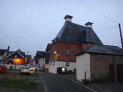
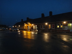
It was getting dark by the time I entered the village of Manningtree, making my plans to walk along the estuary back towards the station null and void. Instead I followed the road, sad to see that the chip shop I passed was not yet open despite the smell of frying fish hanging in the air. It was one of those times that a bag of greasy chips would have gone down very nicely. Instead I walked to the station, bought a ticket and waited for my train back to Colchester. The platform was filled with rowdy kids with cases; schoolchildren boisterously anticipating a weekend trip somewhere. I felt as happy as they looked, albeit more mucky and smelly.
It had been a pleasant walk, and my only question was which trail to do next.
 |
 |
|
Directions
This walk starts off at Marks Tey railway station at TL916239. Leave the station and turn left along North Lane; this curves to the left to cross the railway line on a bridge and then continues with houses and a pavement on the left. After a quarter of a mile the road curves to the left and the pavement and houses end; you will need to take care as you continue along the road, which swings to the right and crosses a stream to take a northerly course.
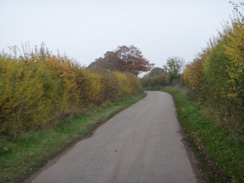
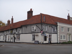
After another quarter of a mile the road curves to the right and approaches the farm at Aldham Hall, where it swings to the left once more to continue north. Half a mile on, a crossroads is reached in Aldham at TL917258. Continue straight on along the road which starts to head down a hill; after half a mile the road curves to the right, passing a nursery on the left before reaching the A1124 road in Fordstreet at TL920268. Turn left to follow the road north; when you can cross over to the right-hand side of the road. After 150 yards the Essex Way comes in from the left; continue on as the road crosses a bridge over the River Colne to reach the Shoulder of Mutton pub on the right at TL920271.
Immediately after crossing the bridge, turn right to enter the pubs car park. Keep the pub on the left and cross some grass to reach the northern bank of the river. Cross a footbridge over a stream and continue on to reach a junction with another footpath. Turn right along a path that initially follows the river on the right, but after 200 yards curves left away from the river, running between broadly-spaced fences. After a fifth of a mile the path rejoins the river, down below to the right, and follows it around. The path climbs a slight slope as the river curves away once more to the right. Continue along the path as it curves to the left slightly to reach a pedestrian gate. Go through this to reach a road at TL928272.
Cross the road and ascend a few steps through a hedge into a field. Continue straight on, initially with a garden hedge on the left. When this ends, continue straight on between widely-spaced fences. After a short distance the path curves to the left to follow a fence on the left. At the end of the field it crosses a footbridge over a ditch and curves slowly to the right, still following a fence on the left before reaching a footbridge over the river on the right at TL933275. Turn right towards the footbridge but do not cross it; instead, at the bridge turn left and cross a plank bridge over a ditch. The path parallels the northern bank of the River Colne, crossing a plank bridge with scrubland to the right.
Go through a pedestrian gate into a field and continue on with a hedge to the left. Near the end of the field, turn left through a gap in the hedge into another field. On the other side turn right to head towards the far left-hand corner. Before it reaches the corner it curves to the right and joins a rough track that heads towards a broad gap in the hedge ahead; there is a concrete bridge over a stream in the middle of the field. Continue along this track through the next long field; it passes a ruined brick building on the left and then curves left to reach a pedestrian gate beside a field gate.
Go through the gate and continue along the track, which soon curves to the right and climbs on a more easterly course. This passes between barns at Cook's Hall to reach a track junction at TL950274. Take a track that angles off to the left, which soon joins another track coming in from the right. Follow this track north-northeastwards for a fifth of a mile; it curves slightly to the left and then the right; at the left-hand curve head straight on along a footpath with a hedge and the track on the left, crossing a stile on the way. The path passes some ruined and overgrown barns on the right. As the path curves slightly to the right, turn left to cross a stile and plank footbridge to rejoin the track near West Bergholt Hall. Continue along the track for a short distance towards West Bergholt church at TL953280.
With the church to the left, turn right along a track towards some barns. After a few yards turn right and immediately left to join a footpath that follows a hedge on the left, with the track on the other side. At the corner of the first field go through a gap in the hedge, and then follow the path as it runs between two fields. As the path forks, take the left-hand branch to continue in an easterly direction between two fields. Go through a hedge at the end of the field and walk between hedges protecting gardens to reach the end of a road called Firmins Court. Cross this and continue on between fences until the path ends at Lexden Road at TL958279.
Carefully cross the road and then turn right down the road for a few yards, then left down New Church Road. This soon curves to the right to take a more southeasterly course, passing a primary school and the eponymous new church before it ends at a T-junction with Chapel Road. Turn left along this road and follow it for a sixth of a mile until it ends at a mini-roundabout with the B1508 Colchester Road at TL965277. Carefully cross the road and turn right down it, before taking the first road off to the left, Armoury Road. This soon curves to the right to take a more easterly course, passing houses on the left.
The road continues on after the houses end. Just before a farm is reached, turn left along a track, keeping the farm buildings on the right. As the track curves to the right towards a bungalow, continue on along a footpath to reach the corner of the field. Curve slightly to the right through a gap in the hedge ahead to continue northeastwards with a hedge on the right and a field on the left. When the hedge curves to the right after about 150 yards, turn left to join a footpath that heads northeastwards across the centre of the field. This reaches a summit and descends to cross a faint track and a footbridge over a stream before going through a hedge to enter another field.
Continue straight on along the middle of the field. The path crests the small hill and heads on towards a gap in the hedge ahead. Once through the gap, turn left across a farm bridge and then half-right to head diagonally across another field. When this reaches a track by a fence, turn left to follow the fence with an orchard on the left until the path ends at a junction with a surfaced path at TL976288. Turn right down this track and follow it northeastwards for 0.4 miles until it ends at a T-junction with the A134 road at TL982291.
Turn left and follow the road as it heads north-northwestwards; there is a pavement on the left-hand side of the road. Pass a mini-roundabout and head on to reach a second after 0.3 miles. Here turn right down Ivy Lodge Road, using a pavement on the right. When the pavement ends continue on along the road as it descends to cross a stream after a fifth of a mile. Immediately after crossing the stream, turn left to join a footpath that parallels the stream northwards beside a fence. This path emerges out onto a track by houses. Continue straight on along this track, passing houses on the right. The track passes a lake on the left before ending at a T-junction with another track at TL980305.
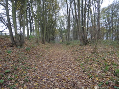
Turn right down this track, which runs between fields. Ignore a track leading off to the left, and continue on towards some woodland ahead. 100 yards after the track junction, angle a few degrees off to the left across the field, still heading towards the trees. However it may be easier to continue along the track towards the trees, then turn left to head north alongside the trees for thirty yards to reach the same point. When there, turn right to enter the coppice. An obvious path heads through the trees, with the edge of the trees about thirty yards away to the left. The woodland narrows and the path curves to the left as it leaves the trees with some buildings away to the right. Join a track, and follow this past a gateway to reach a road at TL987309.
Turn left to follow the road west; after a sixth of a mile a road junction is reached on the right. Turn right to follow this road north; after half a mile turn right along a concrete track toward a wooden barn with a red-tile roof. Pass this barn on the right, and when the track ends continue across grass to reach the end of a hedge. Follow this hedge on the right, and when it ends head straight on across a field to pass a little coppice on the right. When the coppice ends, the path angles a few degrees to the right across the field. At the eastern edge of the field, turn left to follow a hedge on the right northwards. At the end of the field squeeze through a gap in a hedge to reach a road at TL988321.
Turn right along the road for 150 yards, and then turn left up a track that leads towards Carters vineyard. The track curves slightly to the right and left, passing a lake on the right to approach the vineyard. As the track curves to the right once more towards the buildings, continue straight on to join a rough track that runs between hedges. When the hedge on the left ends, turn right down anther track for a couple of yards, then left through a gap in another hedge and across a plank footbridge to enter a field. Follow a hedge on the left and go through a broad gap in a hedge to join a road at TL990327.
Turn right to follow the road eastwards; ignore a road leading off to the right, and after a sixth of a mile turn left to follow a road called Burnt Dick Hill northwards, signposted for Nayland. After another sixth of a mile, turn right along a track. This passes a rather imposing house on the left before it forks. Take the right-hand branch which immediately curves to the right, passing stables on the left. Go through a wooden gate and continue along a track; as this curves to the right by Little Church House, turn left to follow a footpath with a hedge on the left.
At the corner of the field head straight on through a gap in the hedge to reach a minor road. Turn left down this road for a short distance, keeping Boxted Church off to the right; just before some house gates turn right down a path that follows a hedge on the left to reach a bend in a road in Boxted at TL998332.
Turn left to follow this road as it immediately swings to the right to head in an east-northeasterly direction. It curves to the left and right, and two-thirds of a mile after the church it starts falling as it approaches Lower Farm to the left. Immediately after passing a house on the right, turn right down a track which passes some woodland on the left. It descends to pass a lake on the right before curving to the left and right and climbing once more through trees. Just before it enters a farm, turn right to follow a hedge on the right. Pass a barn on the left and then turn left to pass the gable end of the barn. Continue straight on to join a minor track. Pass the end of some open-fronted barns and then immediately turn left, to walk behind the barns with a field to the right. At the corner of the field turn right, following a hedge on the left; after 150 yards turn left through a gap in a hedge to reach a triangular road junction at TM010330.
Head straight on northeastwards along Sky Hall Hill road. This soon curves to the right to take a more easterly course; as the road curves to the left after a third of a mile, turn right across a stile to enter a field. Turn slightly left to head across the field, aiming for the corner of a hedge ahead, with a farm behind the hedge. At the corner of the hedge continue on, keeping the hedge on the left. After a while turn left through a gap in the hedge to reach a track leading to the farm. Turn right down this track and follow it eastwards for a couple of hundred yards until it ends at a T-junction with a road at TM020334.
Turn left down the road northwards for about twenty yards, and then turn right up some steps to enter another field. Head straight across the field eastwards, aiming for a gap in the hedge ahead. Do not go through the gap, and instead continue on with the field on the left and a ditch and the hedge on the right. In the corner of the field cross a footbridge over a ditch to enter another field. Continue straight on across this field, aiming for a house ahead. At the end of the field, go through a gap in a hedge to reach a road beside the house at TM027337.
Cross the road and head along a track; pass a triangular junction on the right and follow the track as it curves to the left. Shortly afterwards and a fifth of a mile after leaving the road, turn right through a gap in a hedge, cross a ditch and go through a pedestrian gate to enter a field. Turn slightly to the left to head east-northeastwards across the field, aiming for the left-hand edge of some trees ahead. At the edge of the field, go through a pedestrian gate and cross a plank bridge over a ditch and continue on into another field. Follow the edge of the trees and then a hedge on the right.
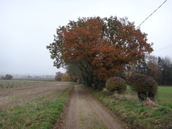
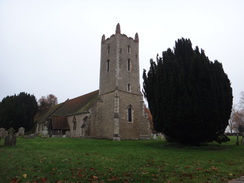
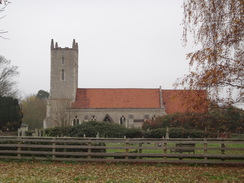
The path curves to the left and then right to reach the corner of the field, and then starts following a hedge on the left across another field. When a track is reached coming through the hedge on the left after 200 yards, turn right to start following the track uphill towards some trees. As the track approaches the trees, turn right to leave the track and then left to start following a hedge on the left. The path climbs through trees and becomes a firm track that continues on for a short distance to reach Langham church at TM034337.
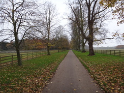
Continue along the track past the church; it curves to the right and soon reaches a complex junction of tracks. Here turn left to follow a track eastwards past an avenue of trees, with the church away to the left. The track starts to fall, and after half a mile goes through an ornate gateway to reach Gun Hill road. Turn left to follow the pavement on the left; ignore a road leading off to the left and instead follow the road as it curves to the right to reach a large triangular junction. Here turn right to follow Stratford Road as it heads southeastwards for a short distance to reach a bridge over the A12(T) at TM042332.
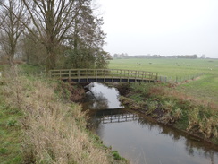
Cross the bridge and follow the road as it descends down the other side. As the road curves to the right, turn left down the access driveway to Milsoms Hotel. Immediately in front of the hotel and before the car park, turn right along a path that heads down a short, steep slope to enter some woodland. Follow the path through the woodland; it crosses a bridge over a ditch and passes a house on the right; as the path curves to the right, cross a stile beside a field gate and continue on to reach the southern bank of the River Stour.
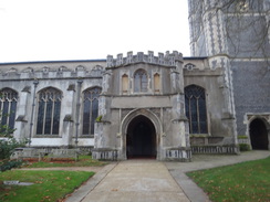
When the trees end, go through a clapper gate and follow the path as it curves to the right across parkland, heading roughly towards a church tower ahead. At the end of the park, go through the leftmost of two gateways and start following a hedge on the right. In the corner of the field go through a clapper gate and turn left to follow a hedge on the left with a field on the right. At the corner of this field the path goes through a wide gap in a hedge and joins a rough track that follows a hedge on the left. This passes a barn on the left before curving slightly to the right, continuing on between hedges. The track emerges onto the B1029 road; turn left to follow the road eastwards for a sixth of a mile, passing the church before reaching the war memorial on the right at TM057331.
Turn right to pass a small car park on the right. This becomes a surfaced path that squeezes past a vehicle barrier and houses on the right before entering some playing fields. The path passes between two playing fields and then a large pavilion on the right. Immediately after the pavilion, turn right to start following a fence on the left, initially passing the pavilion on the right. About halfway along the playing field, turn left through a clapper gate and follow a fence on the left across a field. At the corner of the field, continue straight on for five yards between fences to reach a clapper gate.
On the other side, turn slightly to the right to head across a large paddock, heading slightly downhill. Go through a clapper gate and continue across a third field to reach a clapper gate and footbridge over a ditch into a fourth field. Initially follow a hedge on the right; after about ten yards the path curves away to the left to head diagonally across the field to reach the hedge on the other side. At the far side of the field, cross a footbridge over stream and start following a hedge on the right; at the top corner of this field the hedge curves to the right to reach a stile. Cross this and continue on for five yards to reach a gate beside a house. Go through the gate to join a driveway. Go through a pedestrian gate beside a field gate to reach a T-junction with Coopers Lane at TM057322.
Turn right to follow the road south, passing houses on the right. Just before the track curves to the right after 200 yards, turn left up a gravel track. When this reaches a house, turn left in front of the house and then right along a narrow path that squeezes along the side of the house. It follows the edge of some woodland on the left; go through a clapper gate and follow the path as it curves to the left and ascends some steps. At the top of the steps cross a field to reach a bridleway gate that leads onto Castle Hill road at TM059319.
Cross the road to join the pavement on the other side and then turn right to follow the road south. After 100 yards turn left down Anchor Lane. As the lane curves to the right, continue straight on along a track that runs between hedges. As the track turns to the left towards a building, continue straight on along a green track that runs between fences across a field. At the end of the field cross a footbridge over a ditch and continue on along a cinder path between fences. Go through a pedestrian gate and continue along the cinder path as it heads downhill; several more pedestrian gates are passed before the path ends at a road at TM066318.
Turn right and follow the road as it immediately curves to the left to head east-southeastwards; it soon curves to the right. Shortly after the bend, turn left to reach a clapper gate. On the other side turn half-right to head diagonally across a field. At the end of the field go through another clapper gate and cross a plank bridge to reach another road.
Turn right down this road for a few yards, then left across another footbridge over a ditch. Follow a path that runs between fences to reach another clapper gate. The path then heads downhill southeastwards between widely-spaced fences that protect paddocks. Go through a clapper gate beside a field gate, cross a green track and then go through another clapper gate to enter a field. Continue straight on downhill across this field, keeping a fence the same distance away to the right. At the bottom of the field go through a clapper gate and then cross a stile to reach a pedestrian crossing over a railway line at TM073313.
Carefully cross the railway line, and on the other side another stile. Follow a path across a narrow field towards some trees; cross a stile and a footbridge over a stream after which the path heads on through scrubland. The path climbs up, crossing a boardwalk as it heads through the trees. At the top the path curves to the right, heading past a barn on the right, to meet a track. Turn left down this track, passing a house on the left. When the main track curves to the right head straight on; shortly afterwards the track curves to the left through a hedge and continues on north between fences.
As the track forks near a farm, take the right-hand branch that heads down to pass a house on the left to reach a gate. Go through this, and then turn right to follow a hedge on the right. The path heads down into a little dip, at the bottom of which a fence starts on the left. At the top of the dip go through a farm gate and continue on. It joins a gravel driveway for a few yards before ending at a road at TM080315.
Turn right and follow the road eastwards; after a fifth of a mile it curves sharply to the right. Immediately after this bend, turn left along a gravel track. This immediately passes a farm gate and continues on. After 300 yards turn right off the track through a clapper gate beside a field gate, and turn left to walk across the corner of a field. Go through a second clapper gate and follow a hedge on the left until the path emerges out into a parking area and then onto a road by Lawford church at TM088315.
Turn right down the road away from the church for about ten yards, then left down a track, passing a house on the left. The track becomes a path, with the church away to the left. Go through a field gate and follow the churchyard wall on the left. Just before the wall ends, the path enters a field and curves to the right to head downhill. It crosses a field bridge over a stream at the bottom, and on the other side turn half-left to take the middle of three paths towards a clapper gate. Continue on past an area of scrubland on the right. As the end of the trees are reached, the path turns to the right to climb uphill with the scrubland on the right to reach a clapper gate. Go through this and turn left along a track, passing a house on the right. Follow this track for 130 yards until it ends at a T-junction with the A137 road at TM094315.
Manningtree railway station now lies just half a mile down the road. However I extended the walk slightly by continuing to follow the Essex Way into the village of Manningtree.
Carefully cross the main road to reach the pavement on the other side, and then turn left to follow it downhill. Opposite a bench on the other side of the road, turn right through a gap in a hedge and start following a fence on the right. The path curves to the left and then the right before settling on a rough easterly course, with a hedge on the left. Near the bottom of the hill beside a bench turn right to pass a slope on the right and scrubland on the left. It crosses a plank bridge over a stream and then curves to the right, clambering up a slight slope and passing through a narrow band of trees before emerging out into a field.
Head straight on across the field, approaching houses on the left. Cross the end of a track to enter a field, with a housing estate immediately on the left. Although an obvious path heads half-right diagonally across the field, the official route heads along the edge of the field with the houses to the left. At the corner of the field turn right, still keeping houses on the left. Just before a hedge is reached on the left, turn left to join a surfaced path. Follow this eastwards for about a quarter of a mile, passing a school on the way. It curves slightly to the right and descends down to reach Colchester Road at TM103316, with a railway bridge to the left.
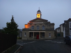
Carefully cross the road and continue along Mill Hill road on the other side. Follow this east-southeastwards as it descends into a dip and climbs up the other side; after a sixth of a mile the road ends at a T-junction with Brook Street. Turn left down Brook Street, immediately crossing the railway line on a bridge. Take the first road off to the right; South Street. This soon curves to the left beside an imposing Methodist church to head downhill. The road soon curves to the left and right, reaching the High Street at the bottom of the hill. Carefully cross the High Street and continue on down South Street. This soon curves to the right and becomes Quay Street.
Here the Essex Way is left behind. Just before the right-hand bend, turn left down North Street, which curves to the left before ending at the B1352 Station Road. Turn right and follow the road west; it passes under a railway bridge and after two-thirds of a mile ends at a roundabout with the A137 at TM096321. Carefully cross the A137 with the roundabout to the left, and then turn right for a few yards before turning left up a road that heads up to Manningtree railway station, where this walk ends.
 |
 |
|
Distances
| From | To | Distance (m) | Ascent (ft) | Descent (ft) |
|---|---|---|---|---|
| Marks Tey railway station | Fordstreet | 2.4 | 62 | 138 |
| Fordstreet | Great Horkesley | 5.4 | 253 | 167 |
| Great Horkesley | Dedham | 9.4 | 384 | 495 |
| Dedham | Manningtree railway station | 5.9 | 377 | 384 |
This makes a total distance of 23.1 miles, with 1076 feet of ascent and 1184 feet of descent.
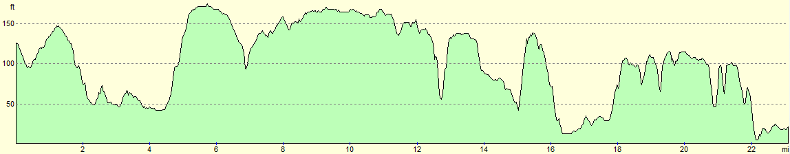
For more information on profiles, ascents and descents, see this page
Transport
Regular trains run between Manningtree and Marks Tey, calling at Colchester on the way. See the National Rail Enquiries website.
 |
 |
|
 |
 |
|
 |
 |
|
 |
 |
|
 |
 |
|
 |
 |
|
 |
 |
|
 |
 |
|
 |
 |
|
 |
 |
|
 |
 |
|
 |
 |
|
 |
 |
|
 |
 |
|
 |
 |
|
 |
 |
|
 |
 |
|
 |
 |
|
 |
 |
|
Disclaimer
Please note that I take no responsibility for anything that may happen when following these directions. If you intend to follow this route, then please use the relevant maps and check the route out before you go out. As always when walking, use common sense and you should be fine.
If you find any information on any of these routes that is inaccurate, or you wish to add anything, then please email me.
All images on this site are © of the author. Any reproduction, retransmissions, or republication of all or part of any document found on this site is expressly prohibited, unless the author has explicitly granted its prior written consent to so reproduce, retransmit, or republish the material. All other rights reserved.
Although this site includes links providing convenient direct access to other Internet sites, I do not endorse, approve, certify or make warranties or representations as to the accuracy of the information on these sites.
And finally, enjoy your walking!
Nearby walks
| # | Title | Walk length (miles) |
|---|---|---|
| 266 | Shotley Gate to Mistley | 14.2 |
| 267 | Mistley to Great Oakley | 18.0 |
| 268 | Great Oakley Hall to Clacton-on-Sea | 17.9 |
|
|

|