Walk #1001: Nantwich to Chester
 |
 |
|
General Data
| Date Walked | 12/06/2018 |
| County | Cheshire |
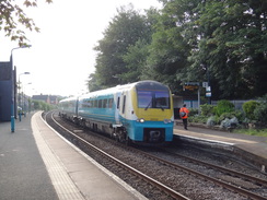
| Start Location | Nantwich station |
| End Location | Chester station |
| Start time | 07.17 |
| End time | 14.14 |
| Distance | 21.3 miles |
| Description | This was a very pleasant and easy walk following the Shropshire Union Canal west from Nantwich to Chester. |
| Pack | Today I carried my 30-litre Karrimor rucksack, filled with water, my spare waterproofs, a book, trainers and other odds and ends. |
| Condition | My feet feel very tired after this walk, and I have a slight, shallow blister on the side of my right foot. |
| Weather | Today's weather was perfect for walking; early cloudy skies eventually parted, meaning the latter part of the day was sunny. It was never too hot, and there was a slight cooling breeze. |
| OS map | Landranger number 118 (Stoke-on-Trent & Macclesfield) and Landranger number 117 (Chester & Wrexham, Ellesmere Port) |
 |
 |
|
Map of the walk
Maps courtesy of Google Maps. Route for indicative purposes only, and may have been plotted after the walk. Please let me have comments on what you think of this new format. For a detailed table of timings for this walk, please see the table file.
 |
 |
|
Notes
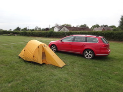
I enjoyed my last walk in Cheshire, and decided that I wanted to do a few more in the area. I have not walked much in this area, and a convenient canal - the Shropshire Union - cuts across it. However it is three hours' drive away - too far for me to drive to, walk, and drive back in a day. I also want to 'test' my camping kit, which I have not used for several years, and car-camping gives me a good opportunity to carry everything I need, plus spares. Fortunately Sencan was willing to do without me for a few days, and so early on Tuesday morning I got into my car and drove west. I arrived in a car park in the centre of Nantwich at about six forty, and quickly assembled my gear.
Since I was not carrying my tent I only required my day rucksack, and I carried it a short distance to Nantwich station, which seemed as good a place to start the walk as any. The canal lies a mile to the west, and roads and a short stretch of riverside path took me to it. A canal bridge seemed to offer the way to the towpath, but I soon had to double back to reach a gap in a hedge that led out onto the canal. I desperately needed a pee after my long drive (blame my middle-aged bladder) and I marched rather than strolled along the towpath, looking for somewhere I could discretely hide for a minute.
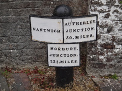
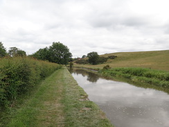
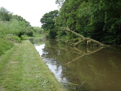
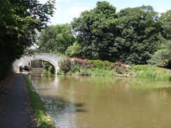
The Shropshire Union Canal is a network of canals, the 'main line' of which runs from Ellesmere Port on the Mersey to Wolverhampton. The stretch south of Nantwich was designed by Telford, and was one of the last major canals built in the UK, opening in 1835 - and as such it is much straighter and heavily-engineered than earlier canals, which tended to wind around as they followed the terrain's contours. The stretch between Nantwich and Chester was built in 1779, and is fairly straight as it crosses the Cheshire plains. It was also initially unsuccessful, and even closed before the opening of the Ellesmere Canal gave it a new lease of life.
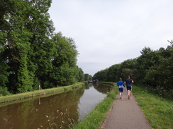
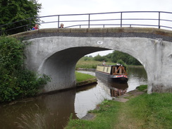
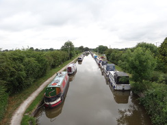
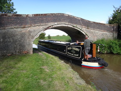
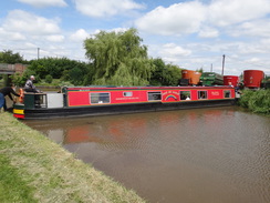
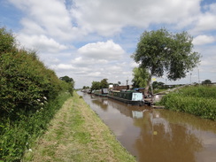
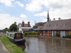
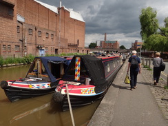
A short distance north, I came across an iron aqueduct that spans a main road; its curving black and white balustrades were attractive and its narrowness showed that, despite the canal's width, this was actually a 'narrow' canal. Many boats were moored beside the canal, and a canal centre sat on the opposite bank. The towpath was busy with joggers and walkers, although thankfully the path soon became much quieter.
Eventually Hurleston Junction was reached, where the Llangollen Canal leaves the Shropshire Union. That is tomorrow's walk, but today's took me on along the Shropshire Union towards Barbridge Junction, where the Middlewich branch heads northeastwards. Signs told me that the branch is closed due to what looks like a rather severe landslip that happened in March.
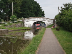
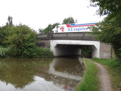
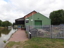
After this, the canal ran alongside of the A51 road - although as the canal was at a lower level, for most of the time the noise did not intrude. A bridge carried lorries over to a massive industrial estate on the other side of the canal, which seems a slightly remote place for it to be located. An old-style canopy projected from an old wharf building at Calveley; the building is now in use as a 'service station' for canal boats, and was a welcome piece of history on what had been a rather unspectacular stretch of canal.
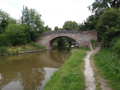
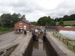
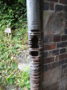
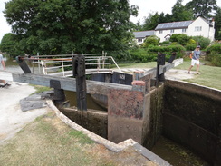
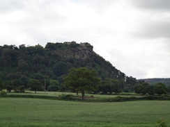
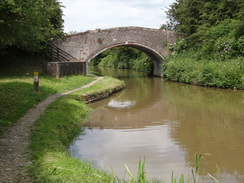
Immediately afterwards, the towpath swapped over from the canal's northern bank to the southern, where it would remain all the way to Chester. The character of the c anal changed as it headed west towards Bunbury locks; what had been fairly flat terrain became hillier and more rugged. Some earthworks on the other side of the canal and railway at Beeston looked artificial, with what seemed like old Second World War shelters embedded within it. Beyond it lay the spectacular Beeston Castle, sitting on top of a craggy hill that is part of the Cheshire sandstone ridge. There are two locks at Beeston; one the 'iron' lock, and the other the 'stone' lock, which are exactly as described. Iron was occasionally used for locks where the ground was unstable and would risk water loss.
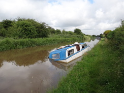
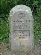
The Sandstone Trail crossed the canal at Wharton's Lock, and a string of hills started to reveal themselves behind Beeston Hill, all part of the sandstone ridge. The one behind Beeston Hill also had a castle on top - Peckforton Castle, a faux-medieval castle built as a country house in the mid-1800s and which is now a hotel. The terrain flattened out as the canal continued northwestwards; one minor amusement being a long narrowboat that had got stuck in a winding hole and which was blocking the canal to traffic. Men with poles were attempting to shift it whilst other boaters patiently waited - although I doubt they found it as funny as I did!
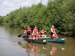
A couple of canoes carrying children and a harassed-looking teacher passed me, and were soon followed by several others, including a couple of canoes connected together side-by-side with poles. Most of the children looked as though they were enjoying themselves more than the teacher, aside from those in the last canoe, who seemed to want to stay close to the bank rather than venture further. Ten minutes later I passed another gaggle of canoes, the last of which was veering wildly from bank to bank as the teacher tried to control it.
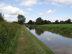
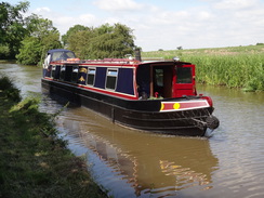
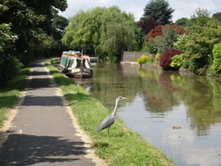
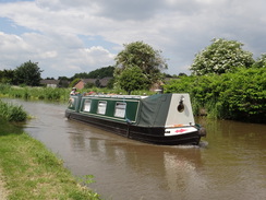
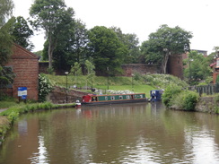
A long stretch of the opposite bank had canal boats moored, and their wide variety and colours added some interest to what was a fairly straight and uninteresting walk. My feet were starting to ache by now, and my new boots were causing a little grief to my left ankle. It was tempting to stop for a break, but I decided to continue on as the canal entered Waverton, where gardens ended at mooring decks. A couple of herons stood on the canalbank, starting out at the still waters. As I approached, the nearest would fly off, leapfrog the other, and then rest on the bank once more. They did this several times, giving me a superb display of flying.
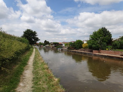
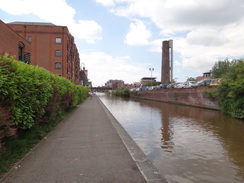
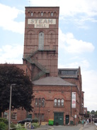
After passing Christleton I joined a stretch of canal I had walked before on a previous visit to Chester, although not on a walk on this website. The surroundings became more urban as the canal entered the eastern outskirts of Chester, and two things of note was a massive brick water tower topped with a blue tank, and a shot tower - one of the few such structures remaining in the country.
Eventually I passed the hotel that we had stayed in the previous week, and reached the point in the canal we had joined it on out walk west to the sea at Flint. Having 'joined' the walks, I joined roads towards Chester station. I was very footsore and my feet had overheated in the warm weather, but it had been an enjoyable stroll nonetheless.
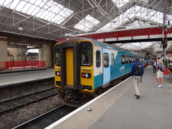
A train took me to Crewe, after which another took me to Nantwich. My campsite for this trip was at the Cotton Arms in Wendbury, a few miles to the south of Nantwich. I booked in, but the lady at the bar was unsure where to put me, so I bought a pint and read a book as I waited for someone to tell me where I could pitch my tent. The pub's food was excellent, and it proved a good base for the next few days of walking.
 |
 |
|
Directions
This walk starts off at Nantwich railway station, at SJ65265191. Leave the station, cross the B5341 road (Pillory Street), and then turn right to walk a short distance to a roundabout, with the Railway Hotel on the other side of the road. Take the first road off to the left, Water-Lode, and follow it as it passes the Love Lane car park on the other side, and then curves to the right. A short distance after the bend (and opposite the junction with Mill Street), turn left to cross the River Weaver on a bridge to enter an area of parkland.
The path immediately branches into three; take the middle one, which curves to the left across the parkland, and then curves right to reach a second, longer, footbridge over another river stream. On the other side, turn left along another path, which initially parallels a road off to the right. Shortly after the road curves to the right, a crosspaths is reached. Turn right along a path that follows a hedge on the right before ending at Queen's Drive. Turn left, and follow the road as it curves to the right. After 0.4 miles it ends at a T-junction with Marsh Lane at SJ64185166.
Turn right to head north along Marsh Lane, and follow a hedge on the left for about fifty metres until a gap is reached. Go through the gap, and turn right to join the canal towpath, with the water away to the left. Follow the canal northwards; after 2.8 miles it reaches Hurleston Junction at SJ62625530.
Continue along the canal for another 1.5 miles until Barbridge Junction with the Middlewich branch is reached at SJ61305699; cross the bridge over the canal entrance, and then head on for another 1.9 miles until Bridge 104 is reached in Calveley at SJ59035878. Here cross the bridge to reach the towpath, which now continues on the southern side of the canal, with the water to the right.
From here, simply follow the canal as it heads in a rough north-northwesterly direction into Chester; after 13.5 miles, the Lockkeeper Pub and the adjacent Bridge 123E, which carries Frodsham Street over the canal is reached at SJ40746662. Pass under Bridge 123E, and on the other side turn left to climb up steps to reach the road. Carefully cross the road to reach the other side, and the turn left along the pavement. As the road swings to the left towards the bus station, continue straight on along the pavement that soon ends at a roundabout. Use the pedestrian crossings to cross St Oswalds Way, and on the other side head straight on along Brook Street. When Brook Street meets a T-junction, continue straight on along Brook Street. At a mini-roundabout, turn right and follow Station Road for a short distance until it ends at Chester railway station at SJ41346696.
 |
 |
|
Distances
| From | To | Distance (m) | Ascent (ft) | Descent (ft) |
|---|---|---|---|---|
| Nantwich station | Marsh Lane Bridge | 1.1 | 59 | 20 |
| Marsh Lane Bridge | Hurleston junction | 2.8 | 0 | 16 |
| Hurleston junction | Barbridge junction | 1.5 | 13 | 3 |
| Barbridge junction | Wharton's lock | 5.4 | 7 | 52 |
| Wharton's lock | Egg Bridge, Waverton | 6.4 | 26 | 46 |
| Egg Bridge, Waverton | Chester railway station | 4.1 | 33 | 62 |
This makes a total distance of 21.3 miles, with 138 feet of ascent and 199 feet of descent.
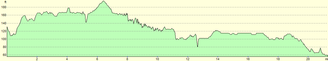
For more information on profiles, ascents and descents, see this page
 |
 |
|
Transport
To return from Chester to Nantwich by trail, you need to get a service from Chester to Crewe, and then a service from Crewe down to Nantwich. Both of these run with reasonable frequencies; see the National Rail Enquries website for more information.
Accommodation
I spent the night camping at the Cotton Arms in Wenbury, a few miles to the south of Nantchurch and right next to the Llangollen Canal. It cost me 5 pounds for the night for a single tent, and 1 pound for the shower. The food in the adjacent pub was nourishing and excellently priced.
 |
 |
|
 |
 |
|
 |
 |
|
 |
 |
|
 |
 |
|
 |
 |
|
 |
 |
|
 |
 |
|
 |
 |
|
 |
 |
|
 |
 |
|
 |
 |
|
 |
 |
|
 |
 |
|
Disclaimer
Please note that I take no responsibility for anything that may happen when following these directions. If you intend to follow this route, then please use the relevant maps and check the route out before you go out. As always when walking, use common sense and you should be fine.
If you find any information on any of these routes that is inaccurate, or you wish to add anything, then please email me.
All images on this site are © of the author. Any reproduction, retransmissions, or republication of all or part of any document found on this site is expressly prohibited, unless the author has explicitly granted its prior written consent to so reproduce, retransmit, or republish the material. All other rights reserved.
Although this site includes links providing convenient direct access to other Internet sites, I do not endorse, approve, certify or make warranties or representations as to the accuracy of the information on these sites.
And finally, enjoy your walking!
Nearby walks
| # | Title | Walk length (miles) |
|---|---|---|
| 417 | Shotton to Hoylake | 19.0 |
| 419 | Ellesmere Port to Hale | 20.5 |
| 1000 | Chester to Flint | 15.2 |
|
|

|