Walk #417: Shotton to Hoylake
 |
 |
|
General Data
| Date Walked | 18/04/2003 |
| County | Clwyd, Cheshire, Merseyside |
| Start Location | Shotton |
| End Location | Hoylake |
| Start time | 10.25 |
| End time | 18.08 |
| Distance | 19.0 miles |
| Description | This was a surprisingly enjoyable and easy walk, along roads and cycle paths along the north bank of the Dee. |
| Pack | Today I carried my 30-litre Karrimor HotRock rucksack, which was filled with my packed lunch, waterproof leggings, water bottle and a couple of spare shirts, together with the usual assortment of odds and ends. |
| Condition | I feel absolutely fine after this walk, and I could easily have walked further if I had needed to. I have absolutely no problems to report, and it is nice to have several days in a row with no problems. |
| Weather | Today was yet another glorious day, with wall-to-wall sunshine and no cloud. It was hazier than the last couple of days have been however, and I do not think that it was quite as hot. I made the most of today's weather, as the next few days are meant to be colder and wetter. |
| OS map | Landranger number 117 (Chester & Wrexham, Ellesmere Port) and Landranger number 108 (Liverpool, Southport & Wigan) |
 |
 |
|
 |
 |
|
Map of the walk
Maps courtesy of Google Maps. Route for indicative purposes only, and may have been plotted after the walk. Please let me have comments on what you think of this new format. For a detailed table of timings for this walk, please see the table file.
 |
 |
|
 |
Notes
There was a very late start to the walk today, as I had wanted to finish writing up some of the previous walks whilst I had mains power for the computer. Unfortunately when it came to burn a CD, the CD that I had left in the drive had got stuck in. I tried using tweezers to remove it, but it was too far back in the drive. Initially I could not even shut the tray of the drive, but I managed to do this by tilting the computer slightly upside down. We asked the owners of the campsite if they knew of a PC World nearby, but as they were phoning it up to see if it was open (today was a bank holiday) they said that a neighbour worked with PC's. I have brought none of my tools with me on this trip, so as he worked on opening up the PC the owner of the campsite kindly drove me into Shotton so that I could start my walk. This was very kind of the three of them, and I shall not forget their kindness.
I felt slightly ill as I set off, and my stomach was quite queasy. Fortunately this did not last long as I walked along the roads northwards out of Shotton. I passed RAF Sealand with its high barbed wire fences before leaving the main roads and taking a footpath along a track northwards. A little distance down this track I crossed over into England, and thus finished the first country of my walk. It feels quite strange to have walked around the coastline of Wales; it has taken a long time for me to finish my first country, and now that I have done it I look back on Wales with a certain fondness. Although there were some low points I generally enjoyed the walk around the principality, and the weather has been quite good for the majority of this stretch of the walk, which always makes a walk more enjoyable. Most of all what I shall take from Wales is the generosity and friendliness of the people, nearly all of whom have been marvellous.
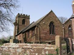
I was surprised to reach Shotwick Church and find out that it was made out of red sandstone. This is one of my favourite stones, and the church looked lovely, almost rosy in the morning sunshine. I went into the church to have a look around, and sat down to give a quick prayer of thanks for having made it seen safely around Wales. I left the church and made my way through the village until I came to a footpath that was shut off as a farmer was moving cows across the lane. I chatted to the farmer as I waited and then three other walkers joined me. They were walking from Chester to West Kirby, and as I was chatting to Sam on my mobile I asked if I could just follow them over the fields. We walked together for a couple of hours, chatting as we did so. It felt quite strange walking with people for once, as I have spent so long walking on my own, and I fear that I may have been too chatty.
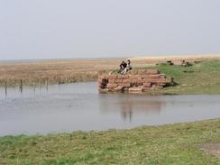
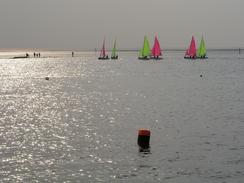
I had arranged to meet Sam in Parkgate, and as I entered the village I saw Mervan parked outside a pub. I bade goodbye to my companions and walked along to see if I could find Sam. The village was absolutely heaving, with people watching the sea come in across the marshes towards the seawall. I found her near a shop, and then we went into the first pub and asked if we could do a collection, which they were kind enough to allow. We then walked down the little promenade, collecting from people as we walked. People were being very generous, and we did quite well from this. We spent about an hour doing this, which was too much really considering how late I set off on the walk. Everyone seemed to be really enjoying themselves, and I can imagine that the ice cream sales were high as everyone appeared to be eating them. It is hard to believe that it is April - the last few days have felt more like August.
From Parkgate I walked north along the coast to join the Wirral Way, a long distance path that follows an old railway line. The path was very busy with both walkers and cyclists, and I had to avoid some of the latter who came up fast behind me. I found that I could push myself quite fats along this section of the walk, and I kept a decent pace up along it without tiring myself out.
Tomorrow I have to walk along the northern side of this little peninsular and start the walk down the eastern side towards Runcorn.
Directions
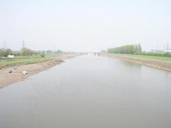
This walk starts off at the car park of the B&Q in Shotton. Turn left out of the car park and walk for a couple of hundred yards southeastwards down the B5129 road, passing the leisure centre until you reach a road leading off to the left. Turn left down this road and follow it as it passes under a railway bridge and then over the River Dee.
Continue straight on until a roundabout is reached, and at this roundabout turn half-left down a road that parallels a main road. This road passes the entrance to RAF Sealand before reaching an industrial estate on the left. Walk down the B5441 road to the left that leads into the estate, and then follow it as it curves to the right to head northwards. As this road curves around to the right to join the main road at a roundabout take a road to the left that leads under the main road.
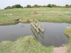
The road ends and becomes a track, which heads northwards over the Wales / England border and continues on to reach a public road by the church at Shotwick. Continue along the road for a short distance through the village before turning down a road to the left. This road soon becomes a track that heads past a farm, and when the track ends a footpath continues on.
This footpath passes under one set of power lines and then turns to the right to pass under the lines before turning to the right and heading northeastwards for a couple of hundred yards. The footpath then turns to the left and passes under another set of power lines before joining a track near Home Farm. Follow this track northwestwards for a few hundred yards until it reaches a road in the village of Puddington.
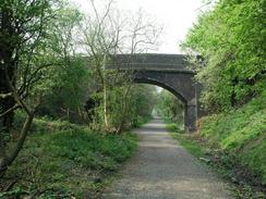
At the junction turn left and follow the road westwards out of the village. It curves around the old Hall before turning to head northwestwards until it ends at a t-junction in Burton. Turn left along another road that heads westwards through the village for about half a mile before Station Road leads off to the left. Turn left down Station Road and follow it westwards. It passes the site of an Hampston Well before heading downhill and crossing a railway line on a bridge and meeting the edge of some marshes.
The road skirts the marshes for about a hundred yards before turning sharply to the right; at this bend continue straight on down a track. This track continues on for about a mile until it reaches the southern edge of Neston, where it joins a road through the western edge of the town. This road soon becomes a footpath that can be followed along the edge of the marshes northwards.
When some bungalows are reached turn right and then almost immediately to the left, to follow a road through Neston. This road ends at the B5134 road, at which you turn to the left and meet the edge of the marshes in Parkgate. Follow the B5134 northwestwards, and when the road curves sharply to the right after a kilometre continue straight on along the edge of the marshes for about a mile until it ends at a road. At the road turn right to head northeastwards along the road for a couple of hundred yards until it climbs over an old railway bridge. On the top of a bridge a ramp leads off to the right and heads downhill to join the Wirral Way, an old railway trackbed.
Turn right and head back under the road bridge, and continue along the old railway line northwestwards for about five miles until it ends at the B5141 road in West Kirby. Turn left along the B5141 road and when it turns to the right continue straight on down another road, which almost immediately meets the seafront. Turn right and follow the road northwestwards past the Marine Lake until it turns to the right.
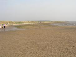
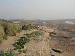
Continue straight on for a short distance along the promenade until it ends. As the tide was low I joined the beach and followed it northwestwards until it reached Red Rocks, which I walked around and turned to the right to head northeastwards along the coast. As soon as a ramp led up to the right I walked up it, to join the western end of the promenade in Hoylake, where this walk ends.
Distances
| From | To | Distance (m) | Ascent (ft) | Descent (ft) |
|---|---|---|---|---|
| Shotton | Parkgate | 9.5 | 338 | 338 |
| Parkgate | Hoylake | 9.5 | 312 | 315 |
This makes a total distance of 19.0 miles, with 650 feet of ascent and 653 feet of descent.
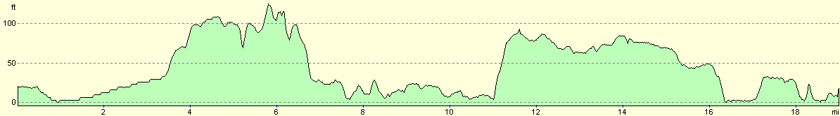
For more information on profiles, ascents and descents, see this page
Accommodation
We parked Mervan at the western end of the promenade in Hoylake, which was a quiet enough place to spend the night. We got a great view of the sandflats as the sun went down and the tide went out this evening, which was not a bad view at all.
Disclaimer
Please note that I take no responsibility for anything that may happen when following these directions. If you intend to follow this route, then please use the relevant maps and check the route out before you go out. As always when walking, use common sense and you should be fine.
If you find any information on any of these routes that is inaccurate, or you wish to add anything, then please email me.
All images on this site are © of the author. Any reproduction, retransmissions, or republication of all or part of any document found on this site is expressly prohibited, unless the author has explicitly granted its prior written consent to so reproduce, retransmit, or republish the material. All other rights reserved.
Although this site includes links providing convenient direct access to other Internet sites, I do not endorse, approve, certify or make warranties or representations as to the accuracy of the information on these sites.
And finally, enjoy your walking!
This walk was mentioned in the following routes:
| My walk around the coastline of Britain |
Nearby walks
| # | Title | Walk length (miles) |
|---|---|---|
| 415 | Rhos-on-Sea to Point of Ayr | 19.9 |
| 416 | Point of Ayr to Shotton | 17.9 |
| 418 | Hoylake to Ellesmere Port | 20.0 |
|
|

|