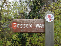
Walk #966: Essex Way: Ongar to Great Leighs
 |
 |
|
General Data
| Date Walked | 09/11/2012 |
| County | Essex |
| Start Location | Chipping Ongar |
| End Location | Great Leighs |
| Start time | 07.19 |
| End time | 14.59 |
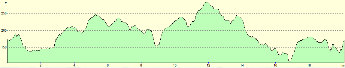
| Distance | 20.3 miles |
| Description | This walk followed the Essex Way as it headed northeastwards through a series of pretty villages in central Essex. |
| Pack | Today I carried my 30-litre Karrimor rucksack, filled with water, my waterproofs, a book and other odds and ends. |
| Condition | I feel absolutely fine after thie walk. |
| Weather | Today was a surprisingly warm day for the time of year. It started off with a mixture of sunny periods and light cloud, although there were significant periods of cloudless skies. It was a great day for a walk. |
| OS map | Landranger number 167 (Chelmsford, Harlow & Bishop's Stortford) |
 |
 |
|
Map of the walk
Maps courtesy of Google Maps. Route for indicative purposes only, and may have been plotted after the walk. Please let me have comments on what you think of this new format. For a detailed table of timings for this walk, please see the table file.
 |
 |
|
Notes
After Wednesdays enjoyable if muddy stroll along the western stretch of the Essex Way between Epping and Ongar, I felt like doing the next leg. It seemed possible to do twenty miles from Ongar to Great Leighs and gets buses back; however there were few buses in the day, and so I would need to ensure I reached Great Leighs in time. For this reason I set off early, and pulled up in the long-stay car park in Ongar a few minutes before seven and got my kit together.
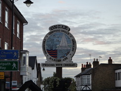
Annoyingly the Sainsburys store was not due to open for another hour, but a Tescos at a petrol station a few yards down the road was open, and I bought a few snacks for the day ahead. The village was only just starting to wake up, and the church looked resplendent in the sunshine. A little further on, a fence had been blown down in the couple of days since I last walked this route. The castle motte was out of view behind houses, and soon I left the route I had followed on Wednesday and was heading off along a new stretch of the trail.
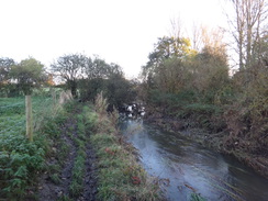
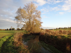
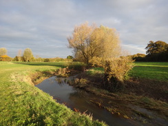
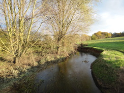
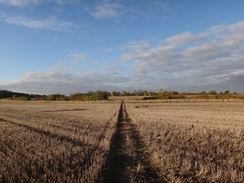
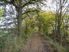
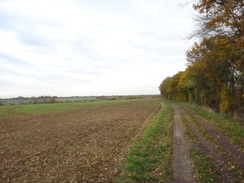
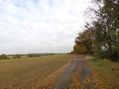
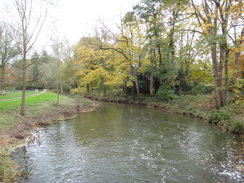
The trail crossed the A414 road and continued with the prepubescent River Roding off to the right. Soon it became obvious that I was not on the route marked on the map, which headed through a field to the left. However an Essex waymarker on a stile showed me I was on the correct route, which has obviously been moved since my map was printed; a glance on Streetmap when I got home confirmed this. It was a pleasurable walk, and there was little of the mud that had blighted Wednesdays walk.
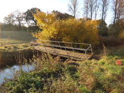
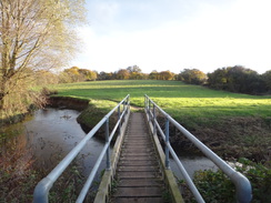
At one point there was a footbridge over the river that was tilted at a severe angle. I studied the map, wondering if I needed to cross the river, but there was no was no way I was going to risk that bridge. Instead I continued along the riverbank as it twisted and turned, and a waymarker soon showed that I was on the correct side of the river. Eventually the trail left the river and headed uphill slightly, joining a muddy track that led into Cannons Green.
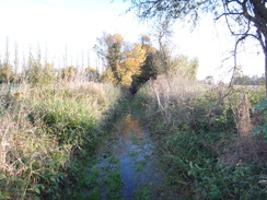
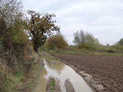
A building was being demolished by the road, the digger rolling to and fro on the piles of broken bricks. The next stretch of path could have done with some of this hardcore as it was very boggy; indeed in places the water and mud nearly reached the top of my boots. It made for a far from enjoyable or easy stroll, and it was a relief when the path led out onto another road.
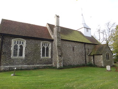
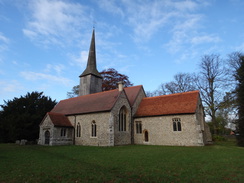
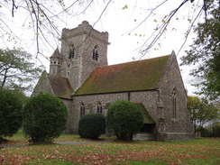
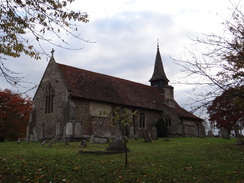
A series of drier paths and roads led me on to Willingale, which despite being a tiny hamlet has two churches standing just a few yards apart, both sharing the same churchyard. The grander one to my left was still in use, whilst the smaller, quainter one on the right with its wooden steeple is now out of use. Several stories attempt to explain how the churches came to be so close together, and most of these are apocryphal. It is very probable that as the area became richer during medieval times, instead of expanding the smaller church they built a larger one alongside. Both were operated independently, with different rectors.
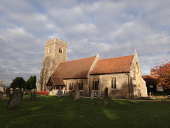
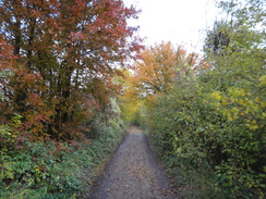
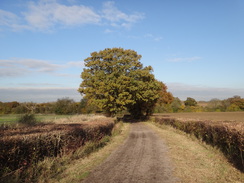
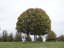
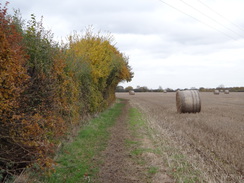
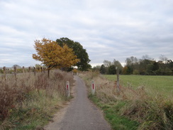
Paths led east and then north to a road, after which tracks took me in a north-northeasterly direction. The going was relatively firm, allowing me to hurry past hedges filled with wonderful autumnal colours. The tracks led me to the A1060 road, after which another track descended to meet a road near the tiny River Can. The river was crossed on a hump-backed bridge, after which more paths led uphill to the wonderfully-named village of Good Easter. The church itself was picture-perfect, and I stopped to take a few photos before heading on.
More paths led on to a road at Stagden Cross, after which tracks and roads led east to the village of Pleshey. On the way I chatted to a couple who owned a B&B in the area who catered for hikers on the trail - they were very friendly and keen on the trail.
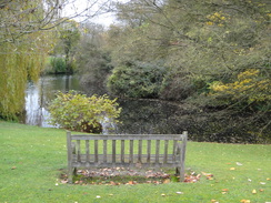
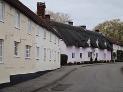
Pleshey is a fairly odd little place; the attractive buildings are arranged within the banked ramparts of the long-gone castle. A viewpoint by the moat gave good views towards the overgrown motte, but I was keen to continue on to reach my next target: the village pub. I went in, and a roaring fire persuaded me to stop for a while. I ordered a meal and chatted to a local as I waited. It was all exceptionally pleasant, and the food so excellent that I really did not want to leave.
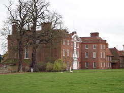
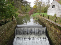
However there were only a few busses that I could catch back to Ongar, and therefore I drunk up and headed off along paths that roughly followed the Walthambury Brook eastwards. This led me to a road just north of Great Waltham, after which more paths took me across some parkland and towards the rather grand 17th-Century Langleys Hall. The trail skirted the side of the building before descending to cross the River Chelmer beside a foaming weir. By now I knew I was tight on time to catch the 15.10 bus; I therefore pressed on along paths uphill, crossing a road to reach the A130.
More paths took me northeastwards, reaching a road at Chatham Green. Soon I passed the small church at Little Leigh before roads took me on towards Great Leighs. The road soon narrowed to become little more than a tarmac path; as waned by Google Maps, a bypass that was not marked on my aged OS map lay ahead. I passed under the dual carriageway on a bridge shared with a stream, then turned left to head towards the centre of the village. Soon I reached a bus stop, and a couple of locals told me it was the correct stop. I was just in time and did not have to wait too long for the bus to come.
I had to change busses in Chelmsford, and the second bus did not appear to come. Fortunately a different service that was filled with schoolchildren arrived shortly afterwards, dropping me off back in Ongar at a reasonable time. It had been an enjoyable, if muddy, days stroll. Essex deserves to be held in better regard.
 |
 |
|
Directions
This walk starts off at the High Street in Chipping Ongar at TL552031. Follow the High Street south. After a couple of hundred yards by the town sign, turn left up a lane that passes St Martins church on the right. When the lane ends, angle half-right to join a narrow surfaced path that leads out onto Castle Street. Turn left; after a few yards the road forks. Take a path that heads down the middle of the two branches, going through a pedestrian gate to enter an area of grassland between the roads.
The path heads down the middle of the grass and curves to the left, with houses behind the hedge on the left. This path emerges out onto a track; turn left down this track for a few yards to reach a junction with a house on the left, then right along another track. This heads between fences; at the end turn right to pass a playground on the left. The path soon curves to the left, passing playing fields on the left. The path then curves to the right to enter a field, with houses to the left. Follow the hedge on the right downhill.
After about fifty yards, look out for a fingerpost in the hedge on the right. Here turn half-left to head diagonally across the field, aiming for a yellow-topped post beside a gap in the hedge at the bottom of the field. Go through the gap and turn left, following a hedge on the left along a narrow field to head towards the A404 road. When you reach a farm gate in the corner of the field, turn right to follow a hedge on the left, with the main road behind the hedge. After a short distance, turn left over a stile and climb some steps to reach the main road at TL559039.
Carefully cross the main road and descend some steps. The path curves to the right and then immediately left between hedges to reach a stile beside a field gate, which leads out onto a road. Cross this, and on the other side take a stile beside a double field gate to enter a field. Turn half-right to head diagonally across the field, aiming for the corner of a hedge ahead. Join this hedge, and keep it on the left with the River Roding a short distance away to the right. At the end of this long field cross a stile and a footbridge across a ditch to enter an area of sparse woodland.
Start following the river on the right; at the end of the woodland it crosses a footbridge over a ditch and carries on for a few yards to reach a third footbridge. Cross this and continue on, with the river to the right. Cross a fourth footbridge to enter a field. Continue following the river north; it crosses a series of bridges over ditches, but the going is easy: just keep the river on the right. 1.5 miles after leaving the road, the path reaches Tun Bridge over the river at TL571058.
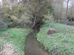
Turn right to cross the footbridge, and on the other side turn left to follow the river on the left. As the path immediately curves to the left to cross a ditch, turn right to follow a path uphill following a hedge on the left. At the top corner of the field go through the hedge, and when the path forks in the middle of the hedge turn left to join an overgrown track. Follow this overgrown path through tress; it soon becomes a little stream. The path joins an unsurfaced track that runs between hedges. This then becomes a road that leads into Cannons Green at TL574061.
Follow the road north for a short distance; as it curves to the left, turn right to join a bridleway that runs between hedges. Follow this northeastwards for a third of a mile until it reaches Willingale Road at TL578066. Turn right to follow the road northeastwards; after 200 yards turn right at a driveway. Do not go down the driveway, and instead go through a pedestrian gate and head diagonally across a lawn to reach a second gate. Cross this to enter a field. Head straight on east across the field; on the far side go through a gap in a hedge and turn half-left to head up a slight slope. At the end of this second field, go through a hedge and cross a bridge over a ditch to reach a road at TL586070.
Turn left to follow the road north. After a sixth of a mile the road curves to the left; here continue straight on down Millers Green road. After a few yards turn right through a gap in a hedge and cross a plank footbridge to enter a field. Turn left to follow the hedge; it soon curves to the right to pass a houses garden, then left past the other side of the garden. Shortly after the left-hand bend, turn right to strike downhill across the field. At the bottom, go down a couple of steps and cross a footbridge over a stream.
On the other side turn half-left diagonally across the corner of a field towards a gap in a hedge. Do not go through the gap in the hedge, and instead turn right to follow a vague track uphill, following a hedge on the left. At the top corner of the field, turn left over a footbridge over a ditch, then right to follow the ditch on the right, aiming for a church tower ahead. After a short distance go through a pedestrian gate to enter a churchyard; continue on between the two Willingale churches, then out of a gate to reach a road in Willingale at TL596073.
Turn right for a few yards, then left to join a path that runs between fences, with a white house to the left. The path emerges out into some playing fields; keep a hedge on the right, aiming for a large gap in a hedge ahead. Go through the gap to leave the playing fields and enter a field. Continue following the hedge on the right as it goes through another hedge gap into a second field. After a short distance turn right through a gap in a hedge and across a ditch to enter a field. On the other side turn left to keep the hedge and ditch on the left.
At the corner of the field at TL601071, turn left over a footbridge over the ditch and through the hedge once more to rejoin the field you were in before. Head straight on northwards with a hedge on the right. At the next corner of the field turn right through a gap in a hedge, then left to continue north with a hedge on the left. At the corner of this field turn right, following a ditch on the left. As the ditch curves to the right, turn left across a footbridge over the ditch and continue north between two fields with another ditch on the left. At the end of the field, go through a gap in a hedge ahead to reach Shellow Road at TL604079.
Cross the road and join a track that runs between hedges. Follow this track as it winds around in a rough northerly direction; the route is obvious, and the only thing to note is not to follow a driveway into Rowes Farm. After 2.1 miles the track becomes surfaced at Peppers Green and continues on north for another quarter of a mile until it reaches the A1060 road at TL620108.
Carefully cross the main road, then turn left for a few yards to reach a track leading off to the right. This track follows a hedge on the right, curving to the right to head northeastwards downhill. 0.4 miles after the main road, the track passes a farm on the left and then curves to the right before ending at a junction with Farmbridge End Road. Turn left along the road and follow it as it crosses the River Can on a bridge; pass a farm on the left, and immediately afterwards turn left along a footpath that squeezes between hedges. The hedge on the right ends, and the path turns left and then right along the edge of a field.
At the corner of the field cross a plank footbridge over a ditch to enter a second field. Turn immediately to the right to follow a hedge on the right uphill. When the hedge curves to the right, turn slightly to the left across a field, aiming slightly to the right of a church spire. The path meets a hedge just to the left of a hedge corner; cross a plank footbridge over a ditch and through a gap in the hedge to enter a churchyard. Head across the churchyard, keeping the church on the left, then go through the gateway to reach Souther Cross Road in Good Easter at TL626120.
Turn left along the road and follow it as it immediately turns to the right to head north through the village; the road then curves to the left to reach the village green. Turn right up Mill Road; after 70 yards turn left up a path for a couple of yards, then through a gap in a hedge to reach a field. Once in the field turn right to follow a hedge on the right, with houses on the other side of the hedge. At the corner of the field turn left to start following a ditch on the right northwards.
Follow the path and ditch as they curve to the right; half a mile after the village cross a plank footbridge across a ditch to join a road. Turn right and follow the road as it curves to the left and then the right. At a sharp right-hand bend, turn left up a track. Follow this as it curves to the right to head northwards downhill. When the track curves to the left after a third of a mile, turn right along a path that runs between a hedge on the left and a fence on the right. It squeezes past a barrier and the fence on the right is replaced by a hedge. Continue along this track; after nearly a mile it ends at a road in Stagden Cross at TL636148.
Turn right to follow the road eastwards; it passes a road junction on the left, and then curves to the right. After 300 yards turn left up a track that runs between hedges. Follow this as it heads in a rough easterly direction for 1.1 miles until it ends at a bend in a road at TL656151. Follow this road eastwards; when a road comes in from the left after a quarter of a mile, turn right down a bridleway. This heads south for half a mile before ending at another road to the west of the village of Pleshey. Turn left to follow the road eastwards; it passes Pleshey church on the right before reaching The Leather Bottle pub at TL665145.
Pass the pub and continue along the road as it curves to the right and leaves the village. When a track leads off to the right, turn half-right to squeeze past a chain-link fence belonging to a water compound on the right, with a ditch on the left. When the fence ends the path continues on across a field, following a stream on the left. At the end of the field squeeze past the end of a hedge and continue on. Just before the end of the second field, turn left to cross a farm bridge across the stream and then right to start following the stream on the right.
At the end of the field squeeze through a gap in a hedge and cross a plank footbridge to enter another field. Follow the stream on the right; squeeze through another hedge and continue on to reach a bridge over the stream (now called the Walthambury Brook) at TL681139. Here turn left between two fields for thirty yards, before turning right to head east along the base of a grassy bank. When the bank soon ends the path becomes a rough track. Continue along this, following a hedge on the left as it crosses a ditch to enter another field. Just before the track leaves this field and becomes firmer, turn right down a grassy path. This curves to the left with an overgrown bank to the left. The path curves to the left once more, and then the right to reach Bury Lane at TL689140.
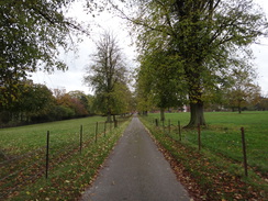
Head straight across the road and continue on through another field, following a hedge on the left. When the corner of the field is reached after half a mile, squeeze through a gap in a hedge to reach a road at TL695136, immediately to the north of Great Waltham. Cross the road to reach a clapper gate beside a house; go through this to enter some parkland. Turn half-left to head across the park, paralleling a low bank on the right. Cross a surfaced driveway protected by clapper gates and continue on across grass to reach a fourth clapper gate that leads onto a second driveway. Turn right and follow the driveway as it heads east-southeastwards to pass near to Langleys Hall at TL699137.
Follow the track as it curves slightly to the left, becoming rougher as it descends past buildings on the right to reach a bridge over the River Chelmer. On the other side of the bridge the track curves to the right to parallel the river on the right. Cross a footbridge over a stream and then turn left to follow a fence on the left as the track curves away to the right. Go through a clapper gate and continue following a hedge on the left northeastwards. At the top of the field cross a stile to reach a road at TL703141.
Cross the road and go through a broad gap in a hedge to enter another field. Follow the hedge on the left for a quarter of a mile, then cross a stile in a hedge to reach the A130 road. Carefully cross the main road and then a stile to enter another field. Follow a ditch on the left; at the corner of the field squeeze through a hedge ahead and follow a hedge on the left. In the corner of this field squeeze through a hedge and cross a stream on a plank footbridge to reach a third field. Eventually hedges enclose the path on either side; shortly afterwards the path emerges out onto a broken track by Baileys Farm in Chatham Green. Turn right down this track for a few yards to reach a road at TL715152.
Turn left and follow the road as it curves immediately to the right to take a northerly course. When the road ends at a T-junction after a third of a mile, continue straight on along a dead-end track, passing houses on the right. Go through a pedestrian gate beside a vehicle barrier and continue down the track between hedges. The track curves to the right and becomes rougher. Go pat a second vehicle barrier to enter a field. Head straight on across the field towards a pedestrian gate through a deer fence.
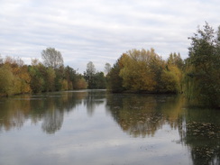
Go through a gap in a hedge to enter another field. Follow a hedge on the right; at the corner of the field turn left to pass some scrub woodland on the right. Shortly afterwards the path curves to the right to join a broad green lane, with a hedge on the left and the woodland to the right. Pass a vehicle barrier and the end of a lake on the right to reach a road in Little Leighs at TL719167.
Turn left along the road, passing the end of Little Leighs church. A few yards further on, turn right down another land that descends to cross a bridge over a stream. Continue on up a slight slope to reach a road junction at TL720169. Turn right to follow a new road southeastwards; ignore a road leading off to the left after a quarter of a mile, and instead continue along a narrow path. The path curves to the right to run parallel to the Great Leighs bypass; after a short distance it curves to the left to head under the road, with the River Ter off to the right. On the other side of the bridge turn left down a stub road to reach Main Road in Great Leighs. Here the Essex Way is left behind.
Although there is a bus stop a short distance away to the right, I turned left to follow the road north towards a bus stop in the centre of the village.
 |
 |
|
Distances
| From | To | Distance (m) | Ascent (ft) | Descent (ft) |
|---|---|---|---|---|
| Chipping Ongar | Willingale | 5.1 | 197 | 131 |
| Willingale | Good Easter | 4.5 | 131 | 164 |
| Good Easter | Great Waltham | 6.9 | 187 | 266 |
| Great Waltham | Great Leighs | 3.8 | 164 | 121 |
This makes a total distance of 20.3 miles, with 679 feet of ascent and 682 feet of descent.
For more information on profiles, ascents and descents, see this page
Transport
Regular bus services run between Great Leighs and Chelmsford, on a 'First in Essex' Colchester to Chelmsford service 70 that runs via Braintree.
Several infrequent services run between Chelmsford and Chipping Ongar, including 'First in Essex's service 46 and Regal Bus's service 7
The Traveline East Anglia website provides useful transport information in the area.
Accommodation
Acreland Green B&B provides good accommodation near the Essex Way, and offer a drop-down / pick/up service for walkers. They can be contacted on 01245 231277 or 07818 437752.
 |
 |
|
 |
 |
|
 |
 |
|
 |
 |
|
 |
 |
|
 |
 |
|
 |
 |
|
 |
 |
|
 |
 |
|
 |
 |
|
 |
 |
|
 |
 |
|
 |
 |
|
Disclaimer
Please note that I take no responsibility for anything that may happen when following these directions. If you intend to follow this route, then please use the relevant maps and check the route out before you go out. As always when walking, use common sense and you should be fine.
If you find any information on any of these routes that is inaccurate, or you wish to add anything, then please email me.
All images on this site are © of the author. Any reproduction, retransmissions, or republication of all or part of any document found on this site is expressly prohibited, unless the author has explicitly granted its prior written consent to so reproduce, retransmit, or republish the material. All other rights reserved.
Although this site includes links providing convenient direct access to other Internet sites, I do not endorse, approve, certify or make warranties or representations as to the accuracy of the information on these sites.
And finally, enjoy your walking!
Nearby walks
| # | Title | Walk length (miles) |
|---|---|---|
| 603 | Bishop's Stortford to Braintree | 18.9 |
| 615 | Harlow to Edmonton via Epping Forest | 19.4 |
| 630 | Braintree to Marks Tey | 14.4 |
|
|

|