Walk #965: Essex Way: A circular walk between Epping and Chipping Ongar
 |
 |
|
General Data
| Date Walked | 07/11/2012 |
| County | Essex |
| Start Location | Cottis Road, Epping |
| End Location | Cottis Road, Epping |
| Start time | 08.17 |
| End time | 15.12 |
| Distance | 18.5 miles |
| Description | This pleasant walk followed the Essex Way from its start point in Epping through outlying bands of Epping Forest to the little town of Chipping Ongar. Due to mud, it returned along quiet roads to the south. |
| Pack | Today I carried my 30-litre Karrimor rucksack, filled with water, my waterproofs, a book and other odds and ends. |
| Condition | I feel absolutely fine after this walk. |
| Weather | Today started off nice and sunny, if a little cold. The clear skies slowly clouded over as the day progressed, and a fairly strong, chilly breeze assaulted me on the return journey. |
| OS map | Landranger number 167 (Chelmsford, Harlow & Bishop's Stortford) |
 |
 |
|
Map of the walk
Maps courtesy of Google Maps. Route for indicative purposes only, and may have been plotted after the walk. Please let me have comments on what you think of this new format. For a detailed table of timings for this walk, please see the table file.
| |
 |
|
Notes
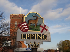
A few months ago I walked the northeastern stretch of the Essex Way between Manningtree and the North Sea at Harwich. This wet my appetite for this particular trail, and as it is relatively near to home I decided to make it one of my walking targets for this winter. The M11 was free-flowing, but traffic snarled up at the roundabout off the motorway. Eventually I reached a car park in the centre of the town, having decided (rightly, as it happens) that the tube station car park would be full.
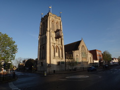
Epping seemed rather dingy despite the early-morning sunshine, and the Greggs in town gave me two cold sausage rolls to munch on as I headed down towards the tube station. The town had already woken up for the day and the streets were bustling, including a florist animatedly discussing something with a deliveryman.
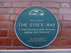
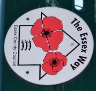
A plaque on the wall of Epping tube station marked the start point of the Essex Way, and I did not delay before setting off, using a concrete footbridge to cross the railway line. A Central Line train was in the platform, and overgrown tracks stretched northwards towards a preserved railway line that led towards Ongar. A short stroll along roads led to a footpath that descended to meet a road at Stewards Green.
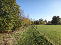
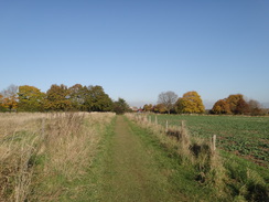
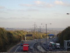
A green lane led off northeastwards; this should have been an easy and pleasant stroll despite the noise from the nearby M11 and M25 motorways. However the path underfoot was worse than muddy: in places it was fully waterlogged. It was passable, but the conditions made the going uphill hard and soon I was puffing for breath as I tried to make good progress. It was a relief when a road was reached at Coopersale Street; this was quite busy with traffic, and a pub was still slumbering until lunchtime.
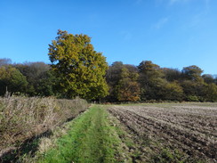
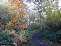
Another path soon led northwards, with lorries travelling along the M11 visible to my right. Fortunately the going underfoot was easier along the grass, and it remained good as the path plunged into woodland near the hamlet of Coopersale. The woodland was magnificent, with a carpet of newly-fallen brown leaves lying on the ground around me. Soon the noise from the motorway increased, and the path crossed it using a concrete footbridge. On the other side the path plunged into more woodland.
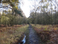
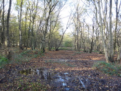
The going underfoot became more difficult, with deep mud blocking progress in places. Some enterprising people had made diversionary paths around the worst of these, but in others I just plunged straight through. Parts of the woodland were very pleasant to walk through despite the mud, and in spring and summer it must be a true joy.
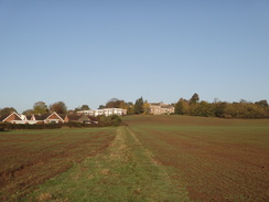
The path left the woods and headed arrow-straight across a field. It plunged down to cross a stream; the track up the other side was an absolute quagmire of churned-up ground. Fortunately the going was slightly easier in the field beside the track, and became even easier once the path levelled off. It became better still as it headed towards the road in Toot Hill.
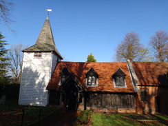
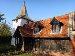
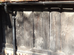
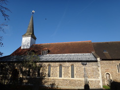
More muddy paths led eastwards, passing paddocks and crossing a road before continuing on alongside a stream to reach the famous log church at Greensted. Parts of the nave are made from vertical logs - not planks - that date back to sometime between 998 and 1063, making it the oldest wooden church in the world. Indeed, it may be the oldest wooden building in Europe still standing. The bottom of the logs rotted years ago and were replaced with a brick plinth, but the bulk remain and form a fascinating image of what a Saxon church may have looked like - quite different from the modern image of a church.
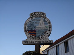
I wanted to have a look around the interior, but a sign asked people to put some provided plastic bags over muddy shoes. As my shoes and legs were slathered in mud, I decided to come back on another occasion when I might have more time. Instead I walked on, following a path that headed east across fields, descending and becoming increasingly muddy before crossing a broad stream on a farm bridge. From here a road led up past a Saisnburys store to reach Chipping Ongar.
My original plan had been to return to Epping using a long stretch of another trail called the Three Forests Way; however the muddy conditions earlier in the day rather put me off that particular idea. Infrequent busses run between Ongar and Epping, but none of these were at a convenient time for me to follow the trail further north. Instead I walked along the trail past the motte of Ongar castle, which sadly remained out of view behind houses. It is a shame that the earthworks of the motte and bailey are not open to the public.
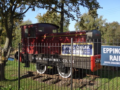
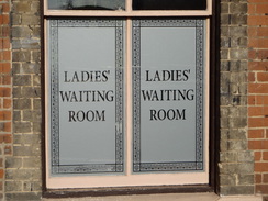
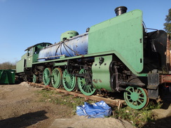
I left the Essex Way to the northeast of the town, and took a footpath back towards the High Street, and a little diversion took me to Ongar station. Until 1994 Central Line tube trains travelled to this rural Essex backwater, but the line was closed due to lack of use. I lived in South Woodford for a period in 1991/2, and I regret never having travelled on the line when it was run by London Transport. However the line has recently been reopened as a preserved railway called the Epping Ongar Railway, running as far as Coopersale, a mile from Epping. The line was closed today, but I could see a Finnish 5-foot gauge steam locomotive through the gate.
I was in need of a break, so I nipped into the Cock Inn for a rest. It was time for Prime Ministers Questions and so I listened on my Walkman as I supped a pint which was provided by a rather attractive barmaid. Eventually I shrugged my rucksack on and headed back towards the trail, stopping only to nip into Sainsburys for a bite to eat. The walk to the church in Greensted was annoying through the mud, and once at the church I decided to return to Epping along roads.
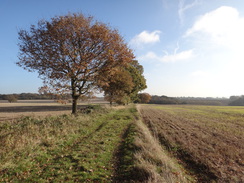
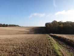
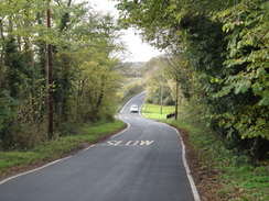
Fortunately the traffic was very light, and I felt in no danger as I strode along the Essex lanes. I headed through Clatterford End to Toot Hill, then west to Colliers Hatch. Whereas the mornings walk had taken me through some pleasant woodland, the road walk mostly eschewed the trees and crossed farmland. Eventually the motorways noise intruded, and a bridge took me back under the road and towards Epping. Instead of taking the direct route back to my car, I extended the day slightly. My walk took me to above the portal of a tunnel that carries the M25 under Epping Forest. A rather uninteresting stroll then took me back to the car in the centre of the town.
It had been a day of two halves: what should have been a glorious autumnal stroll through the northern reaches of Epping Forest to Ongar had been slightly spoilt by the mud, whilst the second half was a fairly uninteresting road stroll. I can only hope that the Essex Way improves.
 |
 |
|
Directions
This walk starts off at the Cottis Lane car park in Epping at TL459022. Leave the car park and pass the toilets on the left; this leads to a narrow lane that passes Marks and Spencers on the right before reaching the High Street in Epping. Turn right and follow the road southwestwards for 300 yards, passing a church on the right. Carefully cross to the left-hand side of the road, and then turn left down Station Road. Follow this southeastwards for 0.3 miles; just before a bridge over a railway line is reached, turn right down the access road to reach Epping tube station.
The Essex Way starts off at a plaque on the wall beside the exit to the station. Turn around to follow the access road uphill for a few yards, and then turn right to reach a concrete footbridge over the railway line. Cross the bridge and descend down to reach the end of Hillcrest Rad. Follow this southeastwards for 100 yards until it ends at a T-junction with Bower Hill. Turn right down Bower Hill for a few yards; pass the entrance to a block of flats on the left and then turn left down a path that follows a hedge. The path squeezes behind some garages on the left and then runs between hedges before emerging into a field.
Turn slightly to the right to head downhill diagonally across the field; when it meets a hedge go through a gap in the hedge and turn immediately turn left, to start following the hedge on the left. This soon curves to the right to head southeastwards; after a sixth of a mile it goes through a gap in a hedge ahead to reach Stewards Green Road at TL468009. Turn left to walk along the road for about twenty yards; immediately after passing a house on the left, turn left along a broad track that passes between houses. When the track forks, take the right-hand branch. Continue along the track as it passes between hedges, curving to the right as it heads northeastwards uphill. After 0.6 miles this lane emerges out onto a triangular road junction at TL473017.
Turn right to follow the road southeastwards, taking care as there is no pavement. Pass the Theydon Oak pub on the left; just before the road curves to the right, turn left along a footpath that follows a fence on the right. It immediately fords a small stream and squeezes past posts to enter a paddock. Head across the paddock, aiming for a gap in a hedge ahead. Go through this and follow the path as it immediately curves to the left and right, following a hedge on the left.
At the end of the field squeeze through a thick hedge ahead into another field, then turn half-left to head diagonally across the corner of the field. When the hedge to the left is reached, turn right to follow this hedge northwards. At the end of this field, go through a broad gap in the hedge, continuing to climb uphill with another field to the right. When the field ends go through a gap ahead to enter the Gernon Bushes woodland.
The path immediately crosses a footbridge over a ditch, and then turns left. Boardwalks lead to a set of steps that head uphill. As the top the path approaches a gate leading onto a road; do not go through the gate, and instead turn right to follow a hedge on the left. The path heads northeastwards through the trees; go through a clapper gate to leave the trees and enter a playing field. Follow a fence on the right. At the end of the playing fields, go down some steps to re-enter the woodland, then turn left along a path through the trees. The path is easy to follow; at the end of a boardwalk turn right to follow a track southeastwards. This leads to a footbridge over the M11 at TL482026.
Descend from the bridge and follow a fence on the left, with a field on the other side of the fence. The path becomes a track; as it soon curves to the right continue straight on, following a path with a fence on the left. This path soon enters some woodland. Ignore a gate on the left and continue straight on eastwards through the trees. After half a mile it crosses a track at TL494025 and continues through the woodland; after another third of a mile it emerges from the woods and heads on following a band of trees between fields.
The path descends downhill; at the bottom it brushes past a coppice on the right before climbing uphill. It levels off before continuing between fields, eventually descending down to meet some trees on the right at TL509026. Keep the trees on the right for about thirty yards, and as they start to curve to the left, turn right to enter the trees. Squeeze past a little fence to emerge into a field. Turn half-left to head eastwards across the field, aiming for a gap in a hedge ahead.
Go through the gap in the hedge and then follow another hedge on the left. At the corner of the field head straight on following a hedge on the right to reach a stile; cross this and turn right to enter some scrub grassland. Head on a slight diagonal across the grass, aiming slightly to the right of a house. It then heads between two fences, passing the house on the left to reach a stile beside a field gate. Cross this stile to join a road in Toot Hill at TL515023.
Turn left to head north along the road, passing the Green Man pub on the left. It passes a triangular road junction on the left, after which the road curves to the right to take a north-northeasterly course. When the road curves sharply to the left, continue straight on along a track past a couple of houses on the right. At the end of the short track, squeeze through a hedge ahead to enter a field. Turn right to follow a hedge on the right; after about twenty yards turn right across a footbridge to join a path that runs downhill between hedges.
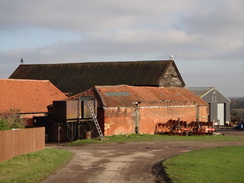
At the bottom cross a footbridge over a stream and a stile to enter a field. Follow a fence and hedge on the left; at the corner of the field cross a stile and footbridge into a second field. The path curves around as it follows a fence on the right. When the fence on the right ends, follow a hedge and ditch on the left. A fence eventually restarts on the right, protecting the path from an area of young woodland. When the new woodland ends the path passes a barn on the right, after which it emerges out into a field on the right at TL528025.
After about five yards turn left through a clapper gate in a hedge and walk north across paddocks, following trees on the right. Go through a series of ankle-biter stiles protecting paddocks. The fourth stile leads out of the paddocks; the path runs between fences and curves to the left, right, and then left once more to reach another clapper gate. Go through this and turn right, following a hedge on the right to reach Greensted Road at TL528028.
Turn left along the road for a couple of yards, and then right across a couple of plank bridges over ditches and past a fence to enter a field. At the end of the field cross a rough track guarded by farm gates, then a footbridge over a ditch to enter a second field. Continue following the hedge on the left; at the corner of the field cross a ditch using a farm bridge and follow a fence on the right past paddocks. When the fence ends, go down a couple of steps and cross a footbridge over a ditch to reach a track. Turn right up this track; it passes a large barn conversion on the left, then curves to the left and right to reach Greensted church at TL538029.
Follow the track past the church for a short distance, then turn left down a surfaced driveway. After a few yards this curves to the left; as it does so continue ahead to a pedestrian gate. Go through this to enter a field. The path angles slightly to the left to reach a hedge on the left, and continues on to reach a gap in a hedge. Go through this and follow a hedge on the left; the path curves to the right and enters some trees, crossing a rough track before emerging out into a field. Cross a little boardwalk as the path leaves the trees and follow the path across the middle of a field.
The path slowly descends down the field, slowly becoming a rough track. At the bottom of the field, go past a vehicle barrier and then cross a bridge over the River Roding. On the other side, follow a surfaced track uphill eastwards, passing a Sainsburys on the right before a junction with the High Street in Chipping Ongar is reached at TL552031.
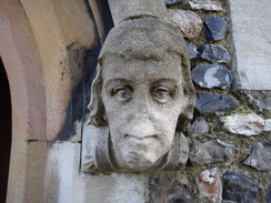
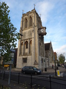
Turn right to follow the High Street south. After a couple of hundred yards by the town sign, turn left up a lane that passes St Martins church on the right. When the lane ends beyond the church, angle right to join a narrow surfaced path that leads out onto Castle Street. Turn left; after a few yards the road forks. Take a path that heads down the middle of the two branches, going through a pedestrian gate to enter an area of grassland between the roads. The path heads down the middle of the grass and curves to the left, with houses behind the hedge on the left. This path emerges out onto a track; turn left down this track for a few yards to reach a junction, then right along another track. This runs between fences; at the end turn right to pass a playground on the left. The path soon curves to the left, passing playing fields on the left.
The Essex Way is left behind as the path curves to the right to enter a field, with houses on the left. Just before the bend, turn left through a gap in the hedge to walk along the northern edge of the playing field, with a hedge and houses away to the right. At the corner of the playing fields, squeeze through the hedge ahead to join a path that runs westwards with houses away to the right. The path squeezes past a field gate to join the end of a surfaced lane. Follow this downhill for a short distance until it reaches the High Street once again. Turn left to follow the High Street south for a sixth of a mile until the junction with Bansons Lane is reached at TL552031.
From here retrace your steps back to Greensted church. Turn right to head west down Bansons Lane, passing the Sainsburys store on the left. At the bottom cross a bridge over the River Roding and squeeze past a vehicle barrier to enter a field. The path heads uphill; a hedge is joined on the left for a short period before continuing uphill unfenced between fields. When the field ends, cross a boardwalk to enter some woodland. After twenty yards the path crosses a rough track and continues with a fence on the left protecting a paddock. Continue following the fence as it curves to the left, heading for a gap in a hedge ahead. On the other side follow a hedge on the right for ten yards, before angling slightly to the left across a field. At the end of the field go through an intermittent hedge and pass a pond on the left to reach a pedestrian gate. Go through this and continue straight on down a driveway to reach Church Lane, with Greensted Church a few yards away to the right.
Turn left to follow the track south for sixty yards until it reaches a junction with Greensted Road at TL538028. Turn right to follow this road westwards; after nearly half a mile and just before a right-hand bend, turn left along another road. This heads southwards past houses on the right. After a quarter of a mile turn right to start following another road that heads in a rough westerly direction; it curves around and after 0.4 miles curves sharply to the right in Clatterford End. Continue along this road for another two-thirds of a mile until it ends at another T-junction in Toot Hill at TL515024.
Turn left to follow the road south for about 150 yards, passing the Green Man pub on the right. At a large triangular junction turn right along Epping Road. Follow this westwards as it passes a series of houses on the right; these eventually end and the road climbs and falls. After 1.1 miles the road enters Colliers Hatch and curves to the left to take a southwesterly course for 0.7 miles, after which it curves to the right and starts descending. After 0.4 miles the road curves to the left and heads downhill to the south for a third of a mile until it ends at a T-junction with Mount Road at TL483009.
Turn right to follow Mount Road westwards. After 0.4 miles it passes under the M11 and continues on through Stewards Green, passing the Merry Fiddlers pub on the left. 0.9 miles after the motorway the road curves to the right uphill towards Epping Station; here turn left to follow Brook Road westwards. This passes under a large railway bridge and climbs uphill; eventually it ends at a T-junction at TL450010. Turn right along this road; as it soon curves to the left continue straight on along a track, passing houses on the right.
As this track curves to the left, follow it to reach the B1393 road. Carefully cross the road to reach the pavement on the far side and then turn right to follow the road northeastwards into Epping. After three-quarters of a mile the centre of the town is reached; pass the Marks and Spencers shop and turn left up a narrow alley, passing the store on the left. This walk ends at the Cottis road car park at TL459022.
Distances
| From | To | Distance (m) | Ascent (ft) | Descent (ft) |
|---|---|---|---|---|
| Cottis Road car park, Epping | Toot Hill | 5.5 | 371 | 395 |
| Toot Hill | Chipping Ongar | 4.2 | 138 | 280 |
| Chipping Ongar | Toot Hill | 2.8 | 213 | 62 |
| Toot Hill | Cottis Road car park, Epping | 6.0 | 420 | 405 |
This makes a total distance of 18.5 miles, with 1142 feet of ascent and 1142 feet of descent.
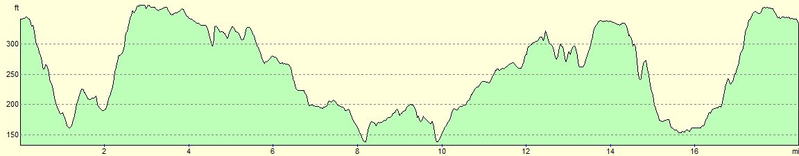
For more information on profiles, ascents and descents, see this page
 |
 |
|
 |
 |
|
 |
 |
|
 |
 |
|
 |
 |
|
 |
 |
|
 |
 |
|
 |
 |
|
 |
 |
|
 |
 |
|
Disclaimer
Please note that I take no responsibility for anything that may happen when following these directions. If you intend to follow this route, then please use the relevant maps and check the route out before you go out. As always when walking, use common sense and you should be fine.
If you find any information on any of these routes that is inaccurate, or you wish to add anything, then please email me.
All images on this site are © of the author. Any reproduction, retransmissions, or republication of all or part of any document found on this site is expressly prohibited, unless the author has explicitly granted its prior written consent to so reproduce, retransmit, or republish the material. All other rights reserved.
Although this site includes links providing convenient direct access to other Internet sites, I do not endorse, approve, certify or make warranties or representations as to the accuracy of the information on these sites.
And finally, enjoy your walking!
Nearby walks
| # | Title | Walk length (miles) |
|---|---|---|
| 51 | Mile End to Enfield Lock | 12.7 |
| 52 | Enfield Lock to Harlow Town | 12.6 |
| 53 | Harlow Town to Bishop's Stortford | 9.8 |
|
|

|