Walk #964: Trumpington to Ely via Cambridge
 |
 |
|
General Data
| Date Walked | 08/10/2012 |
| County | Cambridgeshire |
| Start Location | Trumpington park and ride |
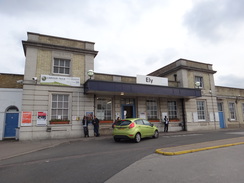
| End Location | Ely Station |
| Start time | 07.31 |
| End time | 15.30 |
| Distance | 21.5 miles |
| Description | This walk follows the Cambridge Guided Busway from Trumpington to Cambridge railway station, and then follows the easern route of the Fen Rivers Way between Cambridge and Ely. |
| Pack | Today I carried my 30-litre Karrimor rucksack, filled with water, my waterproofs, a book and other odds and ends. |
| Condition | I feel absolutely dead after this walk; both of my hips ache, my legs hurt and I have a rather large migraine-style headache. There is no partiucular reason for me to feel so bad, so I assume that it is a result of somethign aside from the walk. |
| Weather | Today's weather was a mixture of sunshine and cloud; despite a slight breeze it was never a cold day. It started to rain as I arrived back in Cambridge after the walk, meaning I just missed the poor weather. |
| OS map | Landranger number 154 (Cambridge & Newmarket, Saffron Walden) and Landranger number 143 (Ely & Wisbech, Downham Market) |
 |
 |
|
Map of the walk
Maps courtesy of Google Maps. Route for indicative purposes only, and may have been plotted after the walk. Please let me have comments on what you think of this new format. For a detailed table of timings for this walk, please see the table file.
 |
 |
|
Notes
Last year I walked the Fen Rivers Way between Cambridge and the sea at Kings Lynn, an enjoyable stroll along easy terrain. However there was one part I had not walked, and that was an eastern bank alternative between northern Cambridge and Ely. I had planned to do this last year but had never quite got around to it. Since I unexpectedly had a free day I decided to do this walk. As was going to be relatively short day, I decided to set off from the Trumpington park and ride site to the south of Cambridge and walk from there.
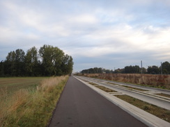
The walk from the park and ride to Cambridge railway station followed the cycle path alongside the guided busway, which in turn follows the course of the old Cambridge to Sandy railway line. The path was busy with walkers and cyclists, most of whom turned off towards the massive Addenbrookes hospital complex. It was an enjoyable early-morning stroll, although nowhere near as enjoyable as the alternative (if longer) route alongside the river from Grantchester.
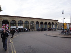
The busway dropped me off at Cambridge railway station, from where a steady stream of people was heading into the city. I joined them, and as usual felt slightly self-conscious wearing my rather out-of-place attire amongst their smart workclothes. I nipped into a shop to buy some provisions and bananas for the day ahead and headed off through the city. Cambridge is a wonderful place, but over-familiarity in this case has bred contempt and I just sped through instead of giving the architecture the time it deserved. The walk across the grass of Parkers Piece was pleasant, including passing the lamppost known as The Reality Checkpoint.
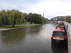
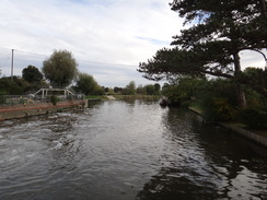
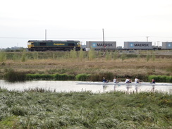
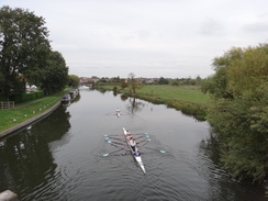
Eventually I reached Midsummer Common, which led me towards the eastern bank of the River Cam which would be roughly followed all the way to Ely. Usually the river is bustling with single sculls, fours and eights in the morning, but today it was deserted. The path passed under the large Elizabeth Way bridge and continued along a road, passing the large chimney of the industrial museum to reach Stourbridge Common.
Here I left the main Fen Rivers Way route, which crosses a footbridge to reach the western bank of the river. Instead, the eastern path headed across some grassland to reach a footbridge over a railway line, before continuing along a path I have walked many times, skirting the river before heading away to reach the small village of Fen Ditton. After passing the war memorial (which holds some funny memories for me from when I lived just down the road) I entered the recreation ground. Despite having lived in the area I had never walked this stretch of path, always preferring the adjacent route that followed the road past the pub. After leaving the playing fields the path followed the edge of the field; in my opinion the path following the road is much preferable.
The path joined the end of the road before heading north across fields, passing a cottage as the noise of the A14 intruded. Another stretch of familiar path led towards Baits Bite Lock, which remained out of view behind trees. Next came the reason why I prefer to follow the western bank of the river: the trail headed away from the river to follow a road through the village of Horningsea. I passed the village pub that I used to regularly drink in, then a friends house in which we had dinner a couple of weeks ago.
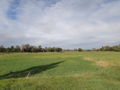
Eventually the trail left the road and crossed a series of fields that passes the site of old Roman pottery kilns which used to make Horningsea Ware. This pottery has been found as far north as Hadrians Wall, possibly exporter using the nearby Carr Dyke canal. I had never walked this particular stretch of path and I soon went wrong, following the edge of the field rather than cutting directly across it. Eventually I managed to rejoin the correct route, which passed what looked like old grassed-over pits to reach the road.
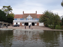
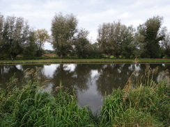
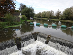
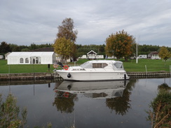
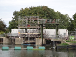
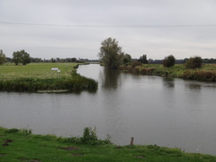
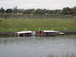
Another path headed northeastwards across fields, before heading through a farm to reach the Cam once more at Clayhithe. The marina on the other side of the river was bustling, with many boats moored alongside the bank. The path followed the riverside north to reach Bottisham Lock, the last lock on the river until Denver Sluice, many miles nearer the sea. Scaffolding clad the lock, and workmen were standing on a temporary walkway that had been built to carry people across the lock. It all looked very expensive, and the river traffic must have been severely affected by the works.
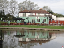
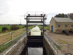
More work was being done at the lock that guards Bottisham Lode. Large diameter temporary pipes were disgorging water into the river, and a couple of workmen were fetching tools out of a van. Although it was a pleasant stroll, the path north travelled further away from the water then my preferred path along the western bank. It crossed a bridge over Swaffham Lock, which protects the entrance to Swaffham Bulbeck Lode, and continued on to eventually merge with a road that led to a bridge over Reach Lode Lock. A short stroll then took me the marvellously-named Five Miles from Anywhere but No Hurry pub.
I shrugged my pack off onto a bench outside and went in to buy a couple of pints of bitter shandy. It was my first time at the pub for a number of years and it was as friendly as ever. I took my boots off in a futile attempt to ease the ache that had developed in the last couple of miles.
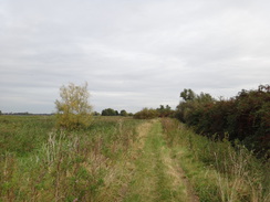
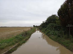
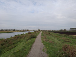
Eventually I headed off once more. The trail followed a path across fields before joining a track that headed through trees. This emerged from the trees and became better quality as it passed the low-lying fields of the fens. The last stretch before it reached a main road was very waterlogged, but it was easily possible to use the verge to get past.
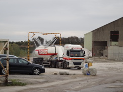
A lorry was being washed in a quarry, and a fine spray blew towards me. The track crossed a strange hump-back bridge over a drain that reminded me of a canal bridge, making me wonder if the overgrown drain underneath had once been navigable. After this it entered a nature reserve, once a quarry, and headed back to rejoin the eastern riverbank of the Cam.
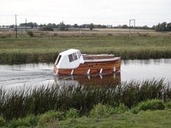
An easy walk took me to a point opposite a marina at a point where the Cam flows into the Great Ouse. The path north was equally easy, but I was starting to suffer: both of my hips were aching and I felt dog-tired. A ruined boat was half-sunken at the Little Thetford mornings, the cabin looking as though a digger had taken a chunk out of it. Two fishermen were standing by the bridge over Soham Lode, and a short distance on a cycle path climbed up from the right to join the top of the flood bank. Ordinarily this should have made the going easier, but I found the hard surface more than a little wearying.
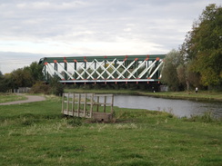
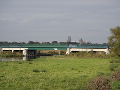
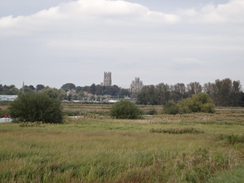
The path passed Braham Dock Drain on the other side of the river and continued on to reach Newmarket Bridge, which carries the Newmarket to Ely railway line across the river. This was destroyed by a train derailment a few years ago, and the much sturdier concrete bridge is already strewn with graffiti. This whole area may be changed in a few years, as there are plans for a bypass road to be constructed. This is rather controversial as it will spoil views towards Ely Cathedral from the south, spoiling this aspect of the Ship of the Fens.
I took my time over the next mile or so; my hips and legs were really aching despite the easy going on the surfaced path. It was a relief when I reached the main road, and I immediately dropped all my plans to extend the walk with an amble around the town. Instead I headed along the road towards the station, passing the level crossing and low bridge that are currently closed for 40 minutes out of every hour during the day, and are the main reason for the bypass.
A train was due in five minutes, so I quickly purchased a ticket and hobbled through the underpass to reach the correct platform. I had not enjoyed the walk as much as I had hoped, and it is nowhere near as pleasant as the walk along the western bank. I will not be doing it again for some time.
 |
 |
|
Directions
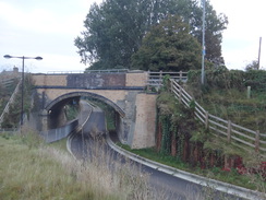
This walk starts off at the Trumpington Park and Ride bus station in Trumpington at TL442543. Leave the building and carefully make your way to the start of the busway; heading north with a car park on the left. Just before the car park ends, turn right to cross a road to access the cycle path that runs alongside the busway. This descends and curves to the right to pass under an old railway bridge. Continue along the busway; it soon passes another bridge under Shelford Road to reach the Trumpington park and ride stop.
The busway continues northwards; ignore the branch leading off to the right towards Addenbrookes Hospital and instead continue straight on to reach the bridge that carries Long Road overhead. The path diverts to the left for a short distance to reach a subway under the road before rejoining the busway once more. The area surrounding the busway becomes more built up as it heads north, passing the Cambridge University Press building on the left before heading under a bridge that carries Hills Road overhead. Shortly afterwards the busway ends and becomes a road; continue along the road as it passes some bus stops. Here cross over to the right-hand side of the road and head on for fifty yards to reach the forecourt of Cambridge railway station at TL461572.
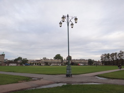
Start walking westwards up Station Road for a third of a mile until it ends at a junction with Hills Road opposite the impressive war memorial. Turn right and follow Hills Road northwestwards towards the centre of the city. The junction with the inner ring road is reached after a third of a mile at TL454577, directly opposite the Catholic church. Here turn right along the A603 Gonville Place for about fifty yards; immediately after Regent Terrace heads off to the left, turn left to join a footpath that cuts diagonally across an area of grass called Parker's Piece, immediately passing some public toilets on the right.
Head across Parker's Piece until it reaches a road called Parkside. Turn left to head northwestwards along this; it becomes Parker Street as it approaches the bus and coach station in the centre of the city. At a mini roundabout just before the bus station, turn right up Emmanuel Road, following it in a rough northerly direction for about a quarter of a mile until it reaches a roundabout with Maids Causeway at TL454587.
Carefully cross Maids Causeway, keeping the roundabout on the left. Ahead is an area of grass called Midsummer Common; cross a cattle / bike grate to join a surfaced path that leads on northeastwards across the grass. Soon the path reaches some housing on the right; here it curves slightly to the right to head directly across the common to reach the southern bank of the River Cam beside the Cutter Ferry footbridge over the river at TL459590.
Turn right and start following the southern bank of the River Cam as it winds northeastwards out of the city. It soon passes under the Elizabeth Road Bridge that carries a dual carriageway overhead. A stretch of road walk follows, passing the elegantly-curved riverside bridge on the left. Shortly afterwards a gate beside a vehicle barrier leads onto Stourbridge Common at TL466595. Here the eastern route of the Fen Rivers Way diverges from the western route.
Go through the gate; instead of continuing along the path beside the river, turn half-right along another path, passing a childrens playground on the right. Continue on for about 150 yards until it ends at a junction with another path. Turn left along this path, and after a short distance turn right along another path that heads across grass, roughly paralleling a hedge away to the right. After a third of a mile this path meets the bottom of a footbridge over the Cambridge to Ely railway line.
Cross the footbridge, and on the other side follow a path winds around before crossing a footbridge over a stream and entering the eastern part of Stourbridge Common. The path curves to the right to head across the common; care needs taking as the ground underfoot is often boggy. When a hedge is reached, turn left to keep the hedge on the right. When this reaches a surfaced cycle path, turn left along the track to heads back towards the southern bank of the Cam. Once there, turn right to cross a footbridge across a ditch and continue following the river on the left.
Continue on to reach a gap in a hedge ahead, after which the path curves gently to the right away from the river. The path continues curving to reach a clapper gate beside a field gate that leads onto the end of a track in Fen Ditton. Follow the track as it curves to the left and then right, becoming a road that passes the village church at TL482603. At the war memorial, turn left up Church Street. This passes the church on the left before curving to the right. As it curves to the left, head straight on past a gate to enter a recreation ground. Head across the playing fields towards a hedge; do not enter a play area on the left, and instead squeeze through a gap in the hedge to enter a field. Keep a hedge on the left; at the end of the field squeeze through a gap in a hedge ahead to reach a track. Turn left down this track and follow it until it reaches the end of a road at TL483610.
Turn right away from the road, pass a vehicle barrier and then go through a clapper gate. Follow a fence on the left; it passes a solitary house on the left to reach another clapper gate. On the other side turn slightly to the left to descend down a slight slope towards the river bank and a large road bridge ahead. As the path meets the river bank, go through a clapper gate and continue under the large road bridge, which carries the A14 dual carriageway overhead.
On the other side, continue north keeping the river on the left. A clapper gate leads into an area of trees; it passes the end of a barn on the left and follows a ditch on the right. When a fence on the left ends, turn right across a footbridge over the ditch to join a farm track. Baits Bite Lock lies a short distance away to the left, and is well worth a visit. Otherwise continue east along this track; when it curves to the right, continue straight on across a footbridge over a ditch into another field. Follow a hedge on the left until Horningsea Road is reached at TL491618.
Turn left to follow Horningsea Road north through Horningsea; there is a good pavement on the left-hand side. After half a mile the road curves to the right and then left; just after the left-hand bend, turn left up a farm track for a few yards before turning right to reach a pedestrian gate through a hedge. Head directly across a field to reach a second pedestrian gate with a footbridge on the other side. Head straight on across the second field; on the far side cross a footbridge over a ditch and then cross a track before continuing straight on across a third field. On the other side of the field go through a pedestrian gate through a fence and continue straight on, aiming just to the left of a white cottage. The path crosses an area of rough land, curving slightly to the left to reach a metal gate that leads back onto the road at TL497635.
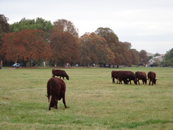
Turn right to follow the road south; take care as there is no pavement. After about 150 yards turn left through a gap in a hedge to enter a field. Follow a hedge on the left; after 100 yards turn left through a clapper gate through the hedge to enter some paddocks. Angle slightly to the right across the paddocks, aiming for the far right-hand corner. Go through a gate through a fence and angle slightly to the right, aiming for the far right-hand corner of the next paddock, where a clapper gate leads to a track.
Continue straight on to head northeastwards along the track as it heads between fields. When the track curves to the right, continue straight on along a path. At the end of the field go through a gap in a hedge and head on for a sixth of a mile until a rough track is reached. At the track, turn left to head northwestwards towards Clayhithe Farm. At the farm, pass between barns and continue on to reach a minor road. Cross the road and continue along a rough track that follows a hedge on the left. The track curves to the right past a gate, then left to reach the eastern bank of the Cam near Clayhithe Bridge at TL502644.
Turn right and follow the path along the eastern bank of the Cam, going through several clapper gates on the way; after nearly a mile Bottisham Lock is reached at TL508656. Do not cross the lock, and instead continue along the path for 200 yards to reach Bottisham Lode. This is crossed by a bridge guarded by clapper gates; on the other side continue following the flood bank alongside the river for 1.2 miles until it reaches Swaffham Bulbeck Lode at TL522671, passing through several gates and skirting a marina on the way. Cross the bridge over the lode, which is again protected by gates, and continue along the top of the flood bank, which eventually veers slightly away from the river.
After 1.3 miles go through another clapper gate to enter Tiptree Marina at TL530689. The path continues along the top of the flood bank, with the marina and moored boats away to the left. At the end of the marina it goes through another clapper gate and continues on along the top of the bank. Another half-mile further on, go through a clapper gate and descend to meet a road at TL536696. Turn left to follow this northwards; it soon crosses a bridge over Reach Lode. After passing an imposing ex-pumphouse on the right, turn left down a grassy path that curves to the right beside a flood bank to reach the Five Miles from Anywhere pub at TL536701.
Turn right through the car park, and then left along the road that passes in front of the pub. The road soon curves to the right; shortly after the bend turn left across a footbridge to enter a field. Follow a hedge on the left northwards, with the marina on the other side of the hedge. At the corner of the field go through a clapper gate and turn left down a rough track. After a few yards turn right, keeping a field on the right and scrubland on the left. At the next corner of the field turn right for 100 yards, then just before the trees on the left end, turn left to join a track that runs through the middle of the trees. The trees soon end and the track broadens out as it continues between hedges that guard fields. After nearly a mile this track reaches the A1123 Dimmocks Cote Road at TL541722.
Carefully cross the main road and continue north along a track that immediately passes a quarry on the right. After nearly half a mile the track crosses a hump-backed bridge over a ditch and shortly afterwards meets a track. Turn left down this track, passing a nature reserve in an old quarry on the right. As the track curves to the right, continue straight on to reach a pedestrian gate beside a field gate. On the other side continue straight on, following a hedge on the left. The path curves slightly to the left and then sharply to the right, with woodland to the right and a flood bank to the left.
Go through a pedestrian gate beside a field gate and head on. The track then curves to the left and right, climbing onto the flood bank to reach a pedestrian gate. Continue along the top of the bank, passing any gates you come across. It passes a marina on the other side of the river at the confluence of the Cam and Great Ouse. After a couple of miles a gate is reached at TL540764. Go through this and cross a bridge over Soham Lode; on the other side continue following the top of the flood bank.
After a few hundred yards a cycle path comes in from the right; continue along this. 1.2 miles after the lode, the path jinks to the left and right to pass under a railway bridge that spans the river. Once through the bridge, the path jinks to the right and then left to regain the top of the bank. Continue along it for another 0.7 miles until it reaches the A412 road at TL546792.
Turn left to follow the road as it crosses the river. On the other side carefully cross the railway line, using either the underbridge or the level crossing. Take the first road to the left, which leads up to Ely railway station at TL543793.
 |
 |
|
Distances
| From | To | Distance (m) | Ascent (ft) | Descent (ft) |
|---|---|---|---|---|
| Trumpington Park and Ride | Cambridge railway station | 2.5 | 20 | 20 |
| Cambridge railway station | Clayhithe | 7.6 | 66 | 108 |
| Clayhithe | Upware | 4.7 | 0 | 7 |
| Upware | Ely raiway station | 6.7 | 43 | 43 |
This makes a total distance of 21.5 miles, with 129 feet of ascent and 178 feet of descent.
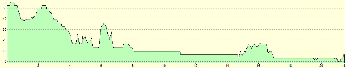
For more information on profiles, ascents and descents, see this page
Transport
Regular trains run between Ely and Cambridge raiway stations - see the National Rail Enquiries website for more details.
From Cambridge station, regular busss run along Route A of the guided busway south to Trumpington.
 |
 |
|
 |
 |
|
 |
 |
|
 |
 |
|
 |
 |
|
 |
 |
|
 |
 |
|
 |
 |
|
 |
 |
|
 |
 |
|
 |
 |
|
 |
Disclaimer
Please note that I take no responsibility for anything that may happen when following these directions. If you intend to follow this route, then please use the relevant maps and check the route out before you go out. As always when walking, use common sense and you should be fine.
If you find any information on any of these routes that is inaccurate, or you wish to add anything, then please email me.
All images on this site are © of the author. Any reproduction, retransmissions, or republication of all or part of any document found on this site is expressly prohibited, unless the author has explicitly granted its prior written consent to so reproduce, retransmit, or republish the material. All other rights reserved.
Although this site includes links providing convenient direct access to other Internet sites, I do not endorse, approve, certify or make warranties or representations as to the accuracy of the information on these sites.
And finally, enjoy your walking!
Nearby walks
| # | Title | Walk length (miles) |
|---|---|---|
| 2 | Waterbeach to Newmarket Road, Cambridge | 5.4 |
| 3 | Littleport to Downham Market | 14.0 |
| 5 | A short walk around Waterbeach to Car Dyke | 3.0 |
|
|

|