Walk #939: The Limestone Way: Castleton to the Waterloo Hotel and back
 |
 |
|
General Data
| Date Walked | 15/11/2011 |
| County | Derbyshire |
| Start Location | Castleton Car Park |
| End Location | Castleton Car Park |
| Start time | 07.23 |
| End time | 15.01 |
| Distance | 19.9 miles |
| Description | This walk follows the northern half of the Limestone Way from Castleton; it heads sotuh along the trail with a diversion to reach the A6, before returning via the trail. |
| Pack | Today I carried my 30-litre Karrimor rucksack, filled with water, my waterproofs, a book and other odds and ends. |
| Condition | I feel tired after this walk, but have no problems to report. |
| Weather | the day started off cloudy and grim, without much of a breeze to blow the cloud away. Visibility was low in the cloud, but things improved slowly during the day and the final few hours were completed in bright sunshine. |
| OS map | Outdoor Leisure number 1 (The Peak District - Dark Peak Area) and Outdoor Leisure number 24 (The Peak District - White Peak Area) |
 |
 |
|
Map of the walk
Maps courtesy of Google Maps. Route for indicative purposes only, and may have been plotted after the walk. Please let me have comments on what you think of this new format. For a detailed table of timings for this walk, please see the table file.
 |
 |
|
Notes
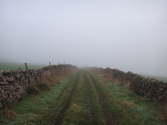
I travelled up to Derbyshire yesterday so that I could do a couple of days walking in the Peak District. My main aim is to walk the northern ten miles of the Limestone Way; I completed the southern part of the trail earlier in the month and am keen to complete it this year, even if it means camping out in November. I had a good night's sleep in my tent at the campsite in Edale, but was dismayed to wake up to find that the sunny sky had been replaced with a thick layer of cloud. The forecast when I made the decision to come on this trip was for sunshine, so the cloud was distinctly unwelcome. The weather deteriorated as I drove past Mam Tor to reach Castleton, with a thick layer of cloud causing limited visibility that reduced my speed to a trickle.
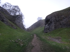
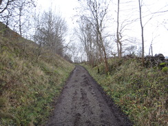
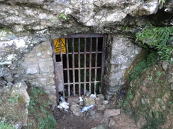
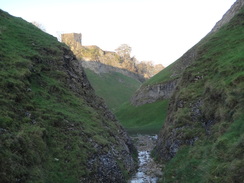
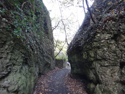
I reached Castleton just before dawn and got ready for my walk. I was soon heading through the heart of the village to reach the start of the amazing Cave Dale. The entrance to this is through a narrow crag that also marks the northern trailhead of the Limestone Way. The steep valley sides rise up towards the imposing bulk of Peveril Castle, which is perched precariously on the very edge. Cave Dale is one of my favourite Derbyshire dales, but sadly this morning's weather was far from the best to see it in. I just kept my head down and climbed uphill as the valley broadened out to reach a muddy track.
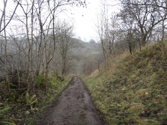
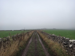
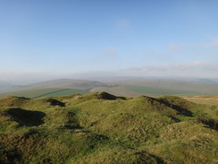
I negotiated the mud with some care, after which the going became easier as the trail followed a fence across a field. The mist was quite thick by now and plaintive moos came from cows that were securely out of sight, the sound eerie as though distorted by the moisture that hung in the air. Many old mines are dotted around the area; some are clearly shown on the map although there was little to be seen aside from grass-covered lumps and bumps off the path. What is now a quiet, rural area was once a hive of industry and the provider of jobs for many people. I could not help but wonder how many of the local farmers had distant relatives who worked under, rather than on top of, these hills.
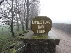
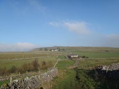
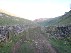
The trail reached a summit and then started to descend, passing a farm and joining a road for a short distance before eventually reaching the A623. This was fairly busy despite the early hour and the noise was unwelcome after what had been a very quiet day. Fortunately it was soon left behind as the trail headed south along a road. This passed a farm called Limestone Way Farm', and I wonder if the farm was named after the trail or vice versa? After a while the trail diverted off to go down Hay Dale, but I decided to quicken my progress and continue along the road. Only a couple of cars passed me as I passed through the small hamlet of Wheston and continued on, joining another road for a short distance before a long and steep descent took me down into Miller's Dale.
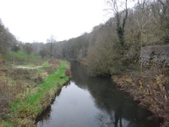
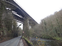
A road walk took me under the beautiful twin viaducts that once carried the old Midland Railway line between London and Manchester. This was closed now, but a path, the Monsal Trail, now runs along the top (I would walk this a couple of days later). I have seen Edwardian photographs of this scene, and it is remarkably unchanged. The viaducts and river looks just the same, whilst the road has become surfaced and cars have replaced the solitary horse and cart.
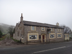
The Limestone Way continued on, crossing the River Wye and following a road uphill. There was no pavement and it was a relief when it left the road and headed uphill along a track. Near the top I passed a man who was writing up a walk for his local ramblers group; we had a quick chat before I continued on to reach the Waterloo Hotel beside the A6, where I had finished the last walk along the trail.
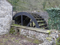
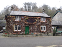
From here on it was simply a case of turning around and retracing my steps, aside from the two dales I had missed out earlier. I set myself a target of seeing if I could catch up with the man I had met earlier, who must have been at least ten minutes ahead of me. The cloud was slowly lifting to be replaced with sunshine, meaning that it was a much better day. In high spirits I descended the track and road back to Miller's Dale, where I diverted off the trail to examine an old waterwheel (part of an old meal mill) and go to the nearby pub, which was sadly shut.
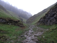
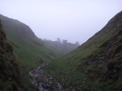
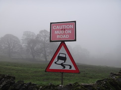
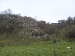
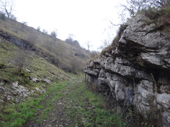
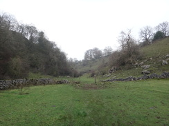
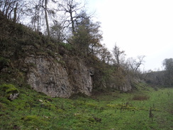
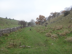
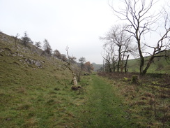
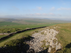
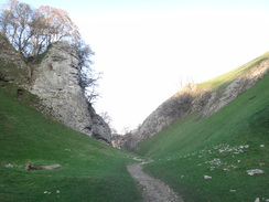
I was not looking forward to the next climb, which promised to be long and hard. Surprisingly it did not prove to be too bad and I was soon overtaking the man I had met earlier who was toiling uphill. My mood continued to lift along with the cloud and I was feeling good as the gradient slackened and the path reached a road. Here I diverted off the route I had taken earlier and followed the trail as it dove into the bottom of Peter Dale. This is a classic Peak District valley, filled with rocky outcrops and white limestone cliffs. Sadly it was not at its best after the wet weather with muddy ground underfoot and hazy views; hardly the best weather for taking photographs. I slipped and slithered along the path, and all too soon I crossed a road and entered the next dale, Hay Dale. The stroll along the grassy valley bottom was much easier, although the scenery was not quite as nice.
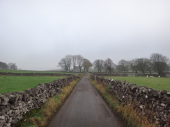
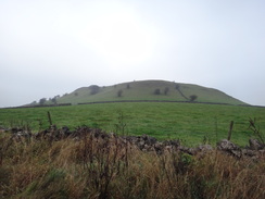
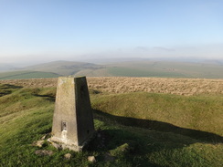
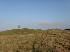
An easy track took me out of this dale, after which a road walk took me back past Limestone Way Farm to the A623. I diverted off the trail to visit the trig pillar near the old Starvehouse Mine, from where the views were superb - it is one of the better viewpoints in the Peak District and was well worth a visit despite hazy skies. The sun was well and truly out by now, adding to the magic of the moment. I descended back to the trail and headed to the top of Cave Dale; the cows that had been invisible through the fog this morning were now clearly visible and utterly unthreatening.
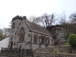
All that faced me now was a descent down Cave Dale; this morning it had been dark and gloomy because of the fog, whilst now it was dark as the low afternoon sun could not penetrate to the bottom. I exited through the bottom of the dale and went to visit a rather good walking shop in the village. There was nothing I really wanted to buy and so I headed out to return to the car. It felt good to have completed the Limestone Way for a second time, but it was a shame that the weather had not quite been as good as it could have been, and I had not seen the Peak District at its best.
I had a meal in the village before returning to Edale and my tent. The campsite was busier than it had been last night, if only because one other person had turned up! Our two small backpacking tents seemed rather insignificant in the large camping fields, a vast difference from previous visits when the campsite has been rather busy.
 |
 |
|
Directions
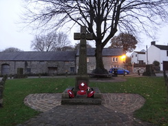
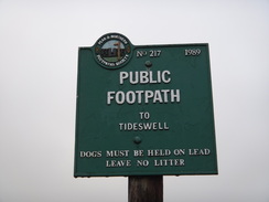
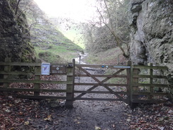
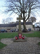
This walk starts off from the main car park in Castleton, beside the visitor's centre at SK149829. Leave the car park and pass the visitor's centre on the right to reach a mini roundabout on the A6187 road in the centre of the village. Cross the road and turn left to pass the Castle pub on the right (with the Bull's Head directly opposite on the other side of the road). Immediately after passing the Castle, turn right up Castle Street. The road curves to the left, passing the war memorial on the left and becomes Bargate. It then curves to the right and then the left; on the left-hand bend turn right up a surfaced path. This goes through a narrow rocky defile to reach a pedestrian gate that marks the northern trailhead of the Limestone Way.
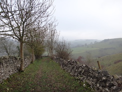
Go through the gate and follow the obvious path as it climbs up Cave Dale, with Peveril Castle soon becoming visible on the hillside to the right. The path becomes slightly wet before the valley broadens out to reach a bridleway gate. Go through this and follow a wall on the right as height is rapidly gained. Eventually the path becomes grassier; follow the wall on the right to reach another gate at SK141816. The path continues up the valley on the other side; it curves slightly to the right to reach a gate through a stone wall. Continue along the obvious path as the gradient slackens to reach a finger post at a junction of paths. Here continue straight on along the obvious path, aiming for the far right-hand corner of the field. It squeezes past a field gate on the left and passes between two walls for about thirty yards to reach a stone stile beside a field gate. Cross this to reach a track at SK135813.
Cross the track to reach a bridleway gate on the other side. Go through this and continue across a field with a wall on the right; do not follow the fence on the left. After a third of a mile the path curves slightly to the left to angle away from the wall on the right. The path soon rejoins the wall on the left to reach a field gate ahead. Go through this and continue uphill with a wall on the right. It squeezes between the wall on the right and a pond on the left; shortly after this follow the wall as it curves to the right to reach a bridleway gate. Go through this and continue with the wall on the right for a third of a mile to reach a bridleway gate at SK130800.
On the other side the path follows a track that runs downhill between walls for a fifth of a mile to reach another gate beside a stone stile, with The Cop farm ahead. Cross into a field; the path then curves slightly to the left to join a fence on the right. After a short distance turn right through a pedestrian gate through the fence to reach a surfaced track beside The Cop farm. Turn left and follow this road downhill as it passes a house on the left. As it curves sharply to the right turn left to reach a pedestrian gate; go through this and join a footpath that follows a track uphill between walls. As the track crests a hill go through a field gate and continue downhill until another gate is reached. On the other side is the A623 road at SK123788, with Mount Pleasant Farm to the left.
Carefully cross the main road and then turn left to follow the road uphill for a short distance to reach a road junction opposite the farm. Turn right to follow this road as it heads southwards; after 0.6 miles the Limestone Way heads off to the right. However this route continues along the road; 1.7 miles after leaving the main road it ends at a T-junction with another road at SK132763 in the village of Wheston. Turn left along this road for about fifty yards, then turn right to join a track, initially following a stone wall to the right. The track climbs uphill and curves to the left to head southwards for 0.3 miles before it ends at a T-junction with another road. Turn right to follow this road southwards for another third of a mile to reach another T-junction at SK137752, with a house to the left.
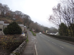
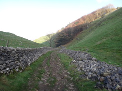
Here the Limestone Way is rejoined; leave the road and head straight on southwards along a track that runs between walls. After half a mile the walls curve to the left for a short distance before turning to the left for a second time. At the second bend turn right through a bridleway gate and continue on downhill to the south between walls. Go through a field gate and continue on between stone walls; the track curves to the left and soon passes a house on the right. Pass a little metal barrier beside the house and continue for a few yards to reach a field gate. On the other side of this turn right to join a concrete track; this curves sharply to the right and starts falling. It passes a barn; when the track curves to the left continue straight on downhill with a wall on the right. This reaches another field gate; on the other side the track continues downhill to another field gate that leads onto a surfaced road. Turn right and follow this road downhill to reach the B6049 in Miller's Dale at SK141733.
Turn right to start following the B6049 road westwards, with the River Wye to the left. It passes under the large twin viaducts of the old Midland railway line and then crosses the Wye on a bridge. There is no pavement as the road continues uphill so care needs taking. Just before the main road curves to the left after a fifth of a mile, turn left up an unsurfaced track called Long Lane. The track gradually climbs; it was once paved and the remains of the tarmac can be seen in places. After 0.9 miles it ends at a T-junction with a public road. Head straight on along this road for a short distance as it crests a hill to reach a crossroads. Here turn right to follow another road that soon curves to the left and ends at a T-junction with the A6 in front of the Waterloo Hotel at SK132714. Carefully cross the road to reach the hotel.
The journey back follows the Limestone Way, without the road diversion I made earlier. Carefully cross the A6 and take Priestcliffe Road opposite. This soon curves to the right and after a fifth of a mile ends at a crossroads. Turn left to head north along this road; after fifty yards it crests a tiny hill and curves to the left. At the bend head straight on along an unsurfaced track called Long Lane. This descends; when it curves to the right to head uphill continue straight on downhill. 0.9 miles after leaving the road, the track ends at the B6049 road at SK134731.
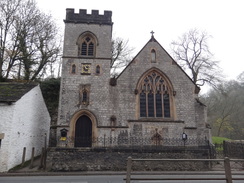
Turn right to follow the main road downhill; there is no pavement so care needs to be taken. After a fifth of a mile the gradients slackens as it reaches a bridge over the River Wye. Continue following the main road as it heads eastwards with the River Wye on the right; a pavement starts on the right. The pavement ends as the road heads under the twin railway viaducts belonging to the old Midland Railway line, and restarts on the other side. Shortly after Miller's Dale church is passed a road junction is reached at SK141733.
Turn left to follow this road which heads steeply uphill. After 150 yards turn left to join a track and immediately pass through a gate. The track climbs uphill and curves to the right; it continues climbing to reach a field gate. Follow a wall on the left as the track becomes concrete underfoot. It passes a barn on the left. After the barn turn half-left to angle towards a gate beside the house at Monksdale Farm. Go through this gate and then pass a small metal barrier to continue along the track. This heads northwestwards uphill; after a fifth of a mile it curves to the right to head northwards between walls with a steep-sided valley off to the left. Go through a field gate and continue on uphill between the walls until a bridleway gate is reached at SK138744.
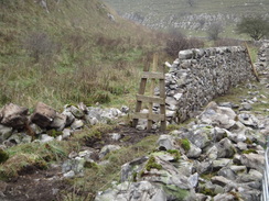
On the other side of the gate turn left to continue along the track between walls. It soon curves to the right to head north for nearly half a mile until it ends at a T-junction with a road in front of a house at SK136752. Turn left and follow to road steeply downhill; it curves to the right and after nearly half a mile curves sharply to the left to reach the bottom of Peter Dale. A short distance further on turn right through a gap in a stone wall to enter Peter Dale. Head straight on along the dale; initially it heads northwestwards before curving to the right to take a more northerly course. The path is rocky and muddy in places, but simply keep to the dale as it winds around across a series of fields separated by tumbledown wall and gateposts. After nearly a mile it heads across a flat field to reach a stone stile through a wall that leads out onto a road at SK122764.
Turn right along the road for about ten yards before turning left through a pedestrian gate. Immediately turn half-left and then right to join a path that heads north through Hay Dale. It soon curves to the left to take a more northwesterly course, following a wall on the left. The going is easier than it had been in Peter Dale; you need to go through a couple of stiles and gates on the way. After half a mile a stile is reached beside a field gate at SK118772. Cross this and turn right to follow a track that runs between walls. Continue along this track as it curves to the right and climbs uphill; after 0.7 miles it ends at a T-junction with a road at SK127777.
Turn left and follow this road as it heads north for a little over half a mile, passing the Limestone Way Farm on the left. After two-thirds of a mile this road ends at a T-junction with the A623 at SK124787 opposite Mount Pleasant Farm. Turn left to follow the main road downhill; there is no pavement although the verges are wide enough to allow safe passage with care. After a short distance carefully cross the road and turn right to join a track; this immediately goes through a field gate. Continue along this track as it heads between walls north-northeastwards for 0.4 miles; initially it climbs uphill before reaching a field gate at the crest of the hill. Go through this and continue along the track as it heads downhill. At the bottom turn left through a pedestrian gate, then right to join a surfaced road.
Follow this uphill, passing a house on the right. Just before it reaches The Cop turn right through a bridleway gate beside a field gate and turn left to reach another bridleway gate in the upper left-hand corner of the field. Go through this to join a track that heads uphill between walls. A third bridleway gate leads into a field; continue straight on with a wall to the left. This heads north-northeastwards; at the end of the field go through a fourth gate and continue on. Almost immediately the wall curves to the left; the path follows it downhill, squeezing past a pond on the right to reach a field gate at SK132806.
Go through the field gate and continue along the path on the other side. Initially this follows a wall on the left, but soon diverts slightly away to the right before rejoining the wall further on. It heads north-northeastwards for nearly half a mile across Old Moor before reaching a field gate at the far end of the field. Go through this to reach a track at SK135813.
Cross the track to reach another field gate, with a stile to the left. Cross the stile and head on between two walls for about thirty yards to reach another field gate. Squeeze past the second gate, and on the other side turn half-right across a field; do not follow the wall on the left. After a quarter of a mile a fingerpost is reached at SK138816. Here turn right and follow the path as it continues to fall eastwards. It soon reaches a pedestrian gate; go through this and follow the path to a second gate at SK141816. On the other side the path curves to the left to enter the top of Cave Dale. When the path forks take the right-hand branch downhill. It goes through another gate and steeply heads downhill as the dale twists and turns. The dale broadens out as it passes under Peveril Castle to the left before narrowing once more through a rocky defile to reach a pedestrian gate at SK150827; this marks the end of the Limestone Way.
Go through the gate and continue on; the path soon becomes surfaced before it ends at a junction with Bargate in Castleton. Turn left and follow the road as it curves to the right and then the left to pass the village's war memorial on the right. After the war memorial turn right to head north along Castle Street; this soon ends at a T-junction with the A6187 road in the village, with The Castle pub to the left. Turn left and follow the A6187 west for a short distance when a mini-roundabout is reached turn right to carefully cross the road and head up the access road into the main car park in the village at SK149829, where this walk ends.
 |
 |
|
Distances
| From | To | Distance (m) | Ascent (ft) | Descent (ft) |
|---|---|---|---|---|
| Castleton | Waterloo Hotel | 9.2 | 1709 | 1129 |
| Waterloo Hotel | Castleton | 10.7 | 1768 | 2348 |
This makes a total distance of 19.9 miles, with 3477 feet of ascent and 3477 feet of descent.
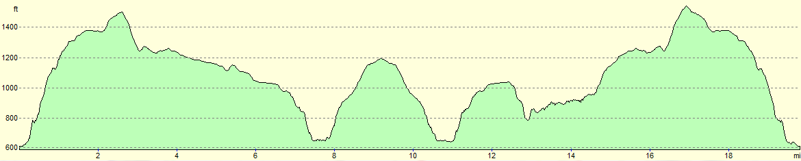
For more information on profiles, ascents and descents, see this page
Accommodation
I spent the night at the Fieldhead Campsite in Edale, which is conveniently placed for both of the pubs in the village. It cost me five pounds for the pitch and another three pounds for the car, and the water was nice and warm considering it was November. Not a bad place to spend a night.
 |
 |
|
 |
 |
|
 |
 |
|
 |
 |
|
 |
 |
|
 |
 |
|
 |
 |
|
 |
 |
|
 |
 |
|
 |
 |
|
 |
 |
|
 |
 |
|
 |
 |
|
 |
 |
|
 |
 |
|
 |
 |
|
 |
 |
|
 |
 |
|
 |
 |
|
 |
 |
|
 |
 |
|
 |
 |
|
 |
 |
|
Disclaimer
Please note that I take no responsibility for anything that may happen when following these directions. If you intend to follow this route, then please use the relevant maps and check the route out before you go out. As always when walking, use common sense and you should be fine.
If you find any information on any of these routes that is inaccurate, or you wish to add anything, then please email me.
All images on this site are © of the author. Any reproduction, retransmissions, or republication of all or part of any document found on this site is expressly prohibited, unless the author has explicitly granted its prior written consent to so reproduce, retransmit, or republish the material. All other rights reserved.
Although this site includes links providing convenient direct access to other Internet sites, I do not endorse, approve, certify or make warranties or representations as to the accuracy of the information on these sites.
And finally, enjoy your walking!
Nearby walks
| # | Title | Walk length (miles) |
|---|---|---|
| 13 | Edale and Kinder Scout | 11.0 |
| 17 | Alport circular | 11.8 |
| 19 | Castleton circular via Lose Hill and Mam Tor | 7.7 |
|
|

|