Walk #938: SWCP: Exmouth to Starcross
 |
 |
|
General Data
| Date Walked | 08/11/2011 |
| County | Devon |
| Start Location | Exmouth Fernside Hotel |
| End Location | Starcross station |
| Start time | 08.52 |
| End time | 15.02 |
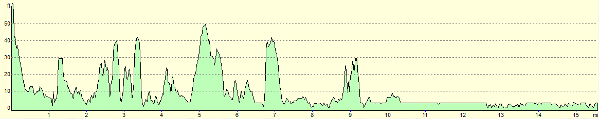
| Distance | 15.6 miles |
| Description | This was a very pleasant stroll around the River Exe, mostly following paths with very little road walking. The going was level with very little ascent or descent, especially on the western side of the estuary. |
| Pack | Today I carried my 30-litre Karrimor rucksack, filled with water, my waterproofs, a book and other odds and ends. |
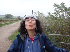
| Condition | I feel absolutely fine after this stroll; sadly Sencan's feet suffered a great deal during the day. |
| Weather | Today's weather was far from perfect. It started of grey, with clouds that threatened rain at any time. The wind was chilly when we were exposed to it, but it was surprisingly warm for the time of year. Later on it started to drizzle lightly, but the breeze blew it into our faces and forced us to put our coats on. |
| OS map | Landranger number 192 (Exeter & Sidmouth, Exmouth & Teignmouth) |
 |
 |
|
Map of the walk
Maps courtesy of Google Maps. Route for indicative purposes only, and may have been plotted after the walk. Please let me have comments on what you think of this new format. For a detailed table of timings for this walk, please see the table file.
 |
 |
|
Notes
Sencan and I wanted to do another walk after yesterday's rather pleasant walk along the South West Coat Path to Exmouth, and the only problem was which stretch to do. Technically the trail does not go around the Exe estuary, and instead uses the ferry to cross the river to reach Starcross on the western bank. However Sencan was keen to walk around the estuary as I did on my coastal walk. We therefore ate a hearty meal, got our kit together and set off from the hotel down the hill into Exmouth.
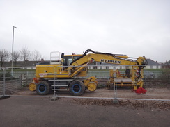
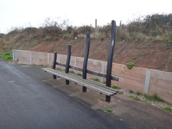
Exmouth's bus and rail stations are frankly a dump; concrete monstrosities that are an ill-fitting welcome for what is actually a rather pleasant seaside resort. We did not pause in the town and instead headed out along a road between the estuary and the railway on the right. A number of bright-yellow road-rail machines were lined up alongside the tracks; these had obviously been doing some work somewhere on the branch line. I was particularly pleased to see a couple of dozers with laser-controlled levelling blades, a pleasure I am sure Sencan did not share.
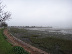
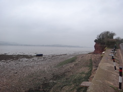
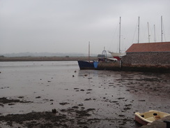
Sadly the tide was out, meaning that the views were over mudflats rather than glittering estuarine waters. However there would be little glittering today as the clouds had well and truly gathered. As light rain was forecast for later we had both set off with our coats on, although Sencan was soon to remove hers.
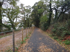
When I did this walk in 2003 I followed footpaths alongside the railway line to Lympstone, and then roads past the Commando barracks to reach the river bridge at Countess Wear. However a new cycle path had been constructed since then as part of a trail around the estuary. Initially we followed a path that was jammed between the estuary and the railway line, but this soon ended and we were forced to cross the railway and join the cycle path. This was far wider and better than I expected, and several stretches were wide enough to drive a vehicle down. It seemed fairly well used despite the poor weather with many people cycling or walking past.
At first there were stretches of footpath on the other side of the railway line, but the cycle path seemed to be a much easier route. Eventually it ended at a road which dived under the railway line and climbed to enter the village of Lympstone. We diverted off the trail to find some toilets in a car park - the men's conveniences were in a frankly disgusting state, although the women's were apparently much better. Sexism at work, or are women just cleaner? ?
On my trip in 2002 I had been forced to follow the road north from Lympstone, but a good cycle path now headed north alongside the railway line. Some stretches of the path were raised on a wide, heavily-engineered boardwalk above what I assumed was a stream below. It was all rather well - and possibly expensively - engineered, as if vehicles were allowed to use it for access. A high fence to the right protected Hutwell Court from view but this was soon replaced by forbidding fences that guarded the Commando training facility at Lympstone. There were three fences of varying ages, the older one basic and the newer ones much more formidable and topped with razor wire.
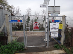
The station at Lympstone Commando is only open to people who have business at the base, which felt odd as the cycle path now passes between the railway line and the base, meaning that the soldiers and staff have to cross a public path to reach the base. I know a couple of people who have the aim of travelling to (and disembarking from) every train station in the UK, and I wonder how they dealt with private stations such as this. Further on we could see parts of an assault course that looked both exciting and frightening, with some obstacles seeming rather daunting. I prefer my exercise slightly less energetic.
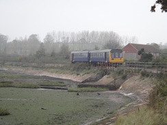
A short distance further on we reached Exton station, and the cycle path diverted away from the railway line to follow roads through the small village. The roads led back to the railway line, from where another stretch of cycle path soon was joined. The railway line had arc lights lying on the ground beside it - obviously a sign of the work being done on the line by the machines I had seen at Exmouth. The railway bridge over the River Clyst was festooned in blue netting, another sign of the work. Sadly we did not get a good view of the bridge as the cycle path diverted inland, passing a boatyard on the left that contained fibreglass moulds for large hulls.
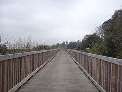
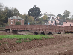
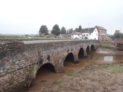
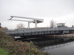
The cycle path ended at a road which we had to follow into Topsham. Sencan decided to take another layer off and I started humming the tune to 'the stipper' as she waved a fleece around her head. His was possibly not the best thing to do beside a busy road. The road crosses the Clyst on an attractive bridge of many low stone arches, but a new cycle bridge alongside it was a safer route even if it is still rather new and had yet to weather in appropriately; with time it will become a good addition to the landscape.
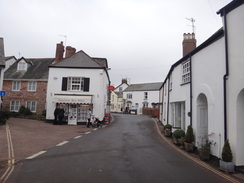
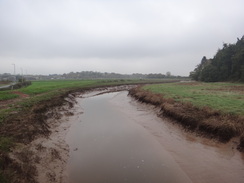
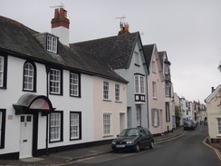
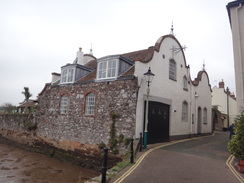
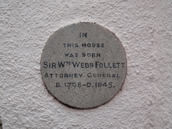
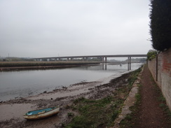
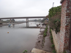
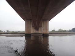
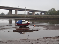
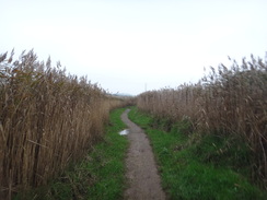
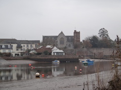
A looping road took the path over the railway line and down into Topsham, which is a rather stunning village with lots of old houses and low doorways. We strode on through the centre of the village and passed the landing for another ferry service across the river; sadly this had finished running for the year and so we were left to plod on. On the northern outskirts of the village we decided to leave the cycle path and instead take a tidal path alongside the estuary. Initially this was easy going but it became harder as the thunderous noise of the M5 started to intrude. Lines of damp driftwood and flotsam showed that the trail often floods at high tide, but fortunately the tide was currently well out. After passing under the ugly bridge that carries the M5 overhead we crossed a rather boggy area before reaching an area of reeds, where the going became drier and easier.
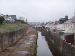
Soon a road was reached in Countess Wear, and this took us on to reach the A379 road. Soon we crossed the bridge over the River Exe; in 1944 this was used to practice the assault on the Pegasus Bridge in Caen, the first bridge to be captured by the Allies on D-Day. A smaller bridge led over the Exeter Canal, where we then left the road to follow a good surfaced path beside the canal. A rather noxious smell flowed over from the sewage works on the other side of the river, and no sooner was the stench left behind than it was replaced with the roar of traffic on the M5 bridge.
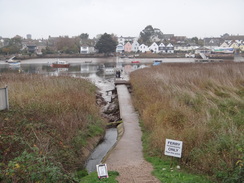
Sencan was starting to struggle a little, the hard tarmac surface playing havoc with her feet. She has often suffered with problems with her feet on walks, something that several pairs of new boots have not helped. Sadly these problems generally start a long distance into a walk, which means that the boots feel fine on shorter test walks. We stopped off beside the ferry landing of the Topsham ferry so she could take her boots off and apply some tape to her toes; whilst she did this I went for a stroll to see a couple and three dogs clambering into a rubber dinghy on the slipway. This seemed a rather large load for a small boat, but they soon drifted away down river.
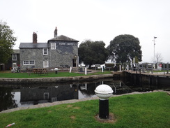
We stopped once more at the Turf Hotel, which is situated at the sea lock of the Exeter Canal. It is virtually in the middle of nowhere and I was more than a little surprised to see that it was open. We went in and found to our joy that they were still serving food - we ordered some toasted sandwiches that turned out to be delicious and by far the tastiest food that we have had on this trip. Even better, it was remarkably cheap.
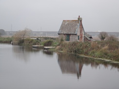
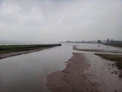
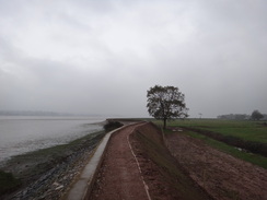
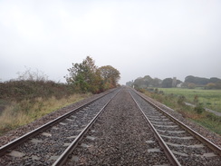
It started raining as we left the hotel and headed south along the sea wall. The rain seemed to be coming straight into our faces, and although it was not too heavy it was enough to make me glad that I had my coat on. Cloud and mist obscured the views over the estuary meaning that what should have been a wonderful waterside stroll was rather grey and ugly. After crossing the railway line the path reached a minor road near Powderham church - at least it should have been minor, but a large coach was having some difficulty negotiating the sharp bend beside the church. The stately home of Powderham Castle could be seen at one point, although this was little more than a small speck on the hillside.
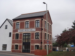
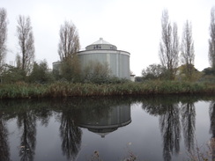
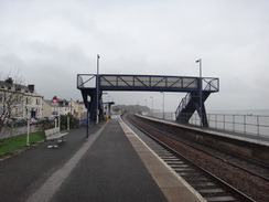
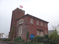
Sencan was suffering once more as we headed south, and we gave up all hope of progressing to Dawlish and instead chose to concentrate on reaching the station at Starcross. We reached the platform just as a train's doors were closing and it accelerated away as we approached - another thirty seconds and we would have caught it. Instead we wiped the rain off some seats in the shelter and sat down to wait an hour for the next train. I got bored after a while and went to explore the area and take some photos of the old pumping station, a symbol of Brunel's ill-fated scheme to create an atmospheric railway. The ferry across the estuary to Exmouth would have been an ideal way of getting back to our hotel, but it had stopped running at the end of the previous month.
To make matters worse for Sencan I invented a little ditty as we were waiting for the train: "Hobble, hobble, boils and trouble: bunions burn and blisters bubble". Needless to say she did not really appreciate it...
It had not been a particularly memorable day's walk; the weather had slightly spoilt the views and the problem with Sencan's feet slowed us down. Despite this I had enjoyed the day, but I'm not sure that the same can be said for my companion...
 |
 |
|
Directions
This walk starts off at the Fernside Hotel in Exmouth, which is situated on the junction of Dagmar Road and Rolle Road at SY004805. The first paragraph of these notes describes the route to Exmouth station, which might be a better starting place for some people. Start following the B3178 road northwestwards downhill towards the centre of the town; pass some bus stops and follow the road as it curves to the right to end at a roundabout. Turn left down Imperial Road and make sure you are on the right-hand side of the road, where a path leads to an underpass under the A376 road. Once under the road turn right and climb some steps to reach road level. Head straight on, crossing an entrance road to the bus station on the left to reach Exmouth railway station. Go between the railway and bus stations to reach the station car park at SX999811.
Turn left and head through the car park towards the riverfront. When this ends at a T-junction with The Royal Avenue turn right to follow the road northwards alongside the river's foreshore. Pass a car park on the right, and when this ends go through a clapper gate and continue along a path with the river to the left. The path splits at SX999818; here turn right along a path that heads uphill past some scrubland on the right. It then descends to reach a junction; turn right to reach a clapper gate that leads onto the railway line. Carefully cross the railway line and go through another clapper gate on the other side. Once across the line turn left along a surfaced path that soon reaches Carter Avenue at SY000819.
Turn left and follow Carter Avenue as it immediately curves to the right to cross a large storm drain. Immediately after crossing the drain, the road curves to the left to parallel first the drain and later the railway line on the left. When the public road ends continue on along a driveway that has frequent passing places. As the driveway curves to the right turn left to join a cycle path. The path eventually crosses a bridge over a stream, with a railway bridge off to the left; after a mile it ends at Sowden Lane to the south of Lympstone at SX991836.
Turn left to join the road and follow it as it immediately passes under a railway bridge. On the other side it turns to the right and winds around for a third of a mile before passing the Swan Inn to reach Lympstone railway station. Just before the bridge that carries the railway line over the road, turn left up the station approach. Pass the station car park and take a ramp off to the left that carries the cycle path up to the top of an overbridge. Once at the top, turn right to cross the bridge and then turn left to head down a slope with the railway line to the left. At the bottom go through some gates and pass under a footbridge.
The path continues on, squeezing between the railway line to the left and the Commando base to the right. About 1.3 miles after Lympstone station the path curves to the right and crosses a bridge over a ditch to reach a road near Exton station at SX981863. Turn right to follow the road uphill, passing the Puffing Billy pub on the left. Shortly afterwards the road curves to the right; as it does so turn left to head north along Exton Lane. After a quarter of a mile the road curves to the right; as it does so continue straight on along another road called Green Lane. Follow this as it heads downhill past houses for a sixth of a mile, and then turn left along a surfaced track that leads back towards the railway line. After a short distance turn right down another cycle path.
The cycle path curves to the left and soon the right to resume paralleling the railway line on the left. After 0.4 miles the path reaches the southern edge of the River Clyst, with a large railway bridge ahead. Here the cycle path curves to the right with the river to the left. This then turns to the right and reaches two gates. Head straight on past the entrance to a boat yard and a house on the left before turning left. The cycle path passes between two cottages and at a gateway; here turn right down a narrow surfaced path. Follow a wall and then a fence on the left to reach a road at SX976882.
Turn left along the road; there is a pavement on the left. It immediately curves to the right and shortly afterwards the left to approach Clyst Bridge over the river. Just before the road bride is reached turn left to cross the river on a wooden pedestrian bridge; the path rejoins the road on the other side of the river and climbs uphill, passing the Bridge Inn on the right. As the road curves to the right turn left down Elm Grove Road. This crosses the railway line on a bridge; after it does so turn right down Monmouth Street. When this ends at a T-junction, turn left along another road for a short distance to reach another T-junction at SX966877.
Here turn right and follow the Strand through Topsham. It passes a car park and an attractive quay on the left. Soon afterwards it curves to the right to pass the Lighter Inn on the right; as it does so turn left down Fore Street and then left down Ferry Road. Continue along this road as it parallels the foreshore and passes the Topsham ferry landing on the left. Buildings soon replace the foreshore on the left, and these are in turn replaced by a playing field. When the road curves to the right at the end of the playing field continue straight on along a path with grass off to the left. Note that the next stretch of path is tidal; if you are concerned about the state of the tide then it would be best to follow the road and cycle path to Lower Wear.
Initially the path passes some grass on the left as it heads towards the M5 bridge ahead. The grass soon ends and the path squeezes between a wall to the right and the foreshore on the left. Some steps lead down to a lower stretch of narrow path before more steps take it up once more. Cross a slipway and drop down to a muddier stretch of path that heads under the M5 bridge. On the other side continue on along the obvious path with the river to the left. The path crosses a concrete bridge over a stream and heads on with reeds on either side, passing under some high-tension power lines on the way.
The path curves to the right and then the left to head up a slope. It passes playing fields on the right; go through a gate to join a surfaced road that heads steeply down for a short distance to end at a T-junction with another road at SX946894. Turn left along this road and follow it as it immediately curves to the right to head northwestwards for a sixth of a mile until it ends at another junction. Here turn left to continue straight on for another couple of hundred yards until the A379 road is reached at SX943896. Turn left to follow the main road downhill; it crosses a bridge over the river and then another over the Exeter Canal.
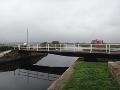
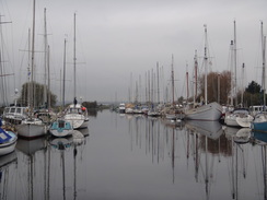
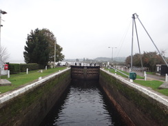
On the other side of the canal, turn left to follow a surfaced track southeastwards with the canal on the left. It curves around a little, and after a mile passes under the M5 bridge. Carry on with the canal on the left for another 0.7 miles until a swing bridge over the canal is reached at SX962879. The ferry landing for the Topsham Ferry lies on the other side of he bridge, and this is an alternative route across the river. Do not cross the bridge unless you need the ferry and instead head on south with the canal on the left for 1.2 miles until Turf Lock and the adjacent hotel are reached at SX963860.
Keep the lock to the left and continue on; go through a clapper gate and cross some sluices before turning left through a gate to head on along the seawall. Go through a couple of pedestrian gates; 1.1 miles after Turf Lock the path turns to the right to approach a railway line. Go through a gate on the left and head on to the railway line. Carefully cross it and go through a clapper gate on the other side to reach a track. Turn left along this track for 250 yards until it ends at a T-junction with a bend in a road opposite Powderham Church at SX973844.
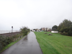
Continue straight on south along the road, keeping the railway line to the left. After 1.3 miles the road ends at a T-junction with the A379. Just before the junction is reached, turn left to join a surfaced cycle path that soon rejoins the railway line on the left. The cycle path curves to the right to parallel the railway line. When the path ends join the road and pass the Atmospheric Railway pub on the right. Starcross railway station is soon reached on the left at SX976819, where this walk ends.
 |
 |
|
Distances
| From | To | Distance (m) | Ascent (ft) | Descent (ft) |
|---|---|---|---|---|
| Exmouth | Exton | 4.8 | 302 | 358 |
| Exton | Lower Wear | 4.6 | 240 | 246 |
| Lower Wear | Starcross station | 6.2 | 69 | 66 |
This makes a total distance of 15.6 miles, with 611 feet of ascent and 670 feet of descent.
For more information on profiles, ascents and descents, see this page
Accommodation
We spent the night at the Fernside Hotel in Exmouth, which is situated on a hill about hald a mile southeast of the town from the railway station, although quite near to the southern coast in the town. It was a pleasant place to spend the night and, although not central, was convenient for the town.
Transport
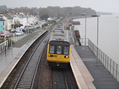
Trains run roughly every hour between Starcross and Exmouth, calling at Exeter on the way. See the National Rail website for more information. During the summer months a ferry runs from a pier beside Starcross station across the Exe towards Exmouth; this should be a great deal quicker than the train.
 |
 |
|
 |
 |
|
 |
 |
|
 |
 |
|
 |
 |
|
 |
 |
|
 |
 |
|
 |
 |
|
 |
 |
|
 |
 |
|
 |
 |
|
 |
 |
|
 |
 |
|
 |
 |
|
 |
 |
|
 |
 |
|
 |
 |
|
Disclaimer
Please note that I take no responsibility for anything that may happen when following these directions. If you intend to follow this route, then please use the relevant maps and check the route out before you go out. As always when walking, use common sense and you should be fine.
If you find any information on any of these routes that is inaccurate, or you wish to add anything, then please email me.
All images on this site are © of the author. Any reproduction, retransmissions, or republication of all or part of any document found on this site is expressly prohibited, unless the author has explicitly granted its prior written consent to so reproduce, retransmit, or republish the material. All other rights reserved.
Although this site includes links providing convenient direct access to other Internet sites, I do not endorse, approve, certify or make warranties or representations as to the accuracy of the information on these sites.
And finally, enjoy your walking!
Nearby walks
| # | Title | Walk length (miles) |
|---|---|---|
| 321 | Sidmouth to Lympstone | 15.3 |
| 322 | Lympstone to Dawlish | 16.0 |
| 323 | Dawlish to Torquay | 16.0 |
|
|

|