Walk #907: West Highland Way: Inversnaid to Tyndrum
 |
 |
|
General Data
| Date Walked | 02/07/2011 |
| County | Strathclyde, Central Scotland |
| Start Location | Inversnaid |
| End Location | Tyndrum |
| Start time | 06.29 |
| End time | 16.52 |
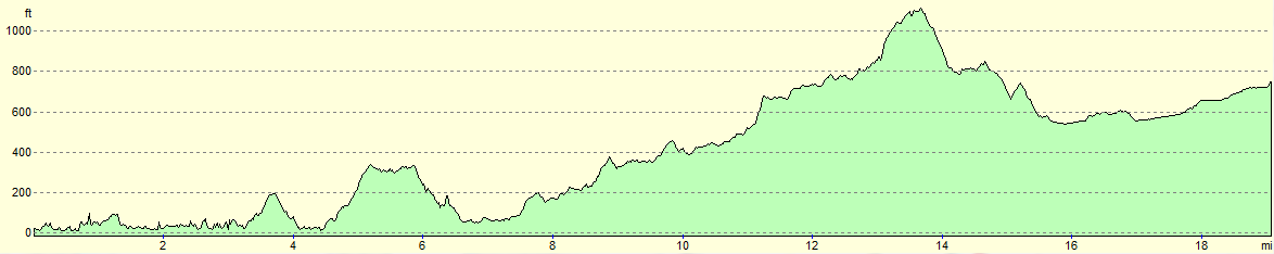
| Distance | 19.1 miles |
| Description | This was a pleasant - if strenuous - walk following the West Highland Way past the northern end of Loch Lomond and then up Glen Falloch. |
| Pack | Today I carried my Macpac Glissade rucksack containing my North Face Westwind tent, spare clothes, waterproofs, water, and enough food to last three days. In total it weighed about thirty-five pounds. |
| Condition | I feel fine after this walk, and have no problems to report. |
| Weather | Todat started off beuatifulyl sunny, but the clouds started to gather as the day went on. This was a relief as it meant that the day never got too hot. |
| OS map | Landranger number 56 (Loch Lomond & Inveraray) and Landranger number 50 (Glen Orchy & Loch Etive) |
 |
 |
|
Map of the walk
Maps courtesy of Google Maps. Route for indicative purposes only, and may have been plotted after the walk. Please let me have comments on what you think of this new format. For a detailed table of timings for this walk, please see the table file.
 |
 |
|
Notes
Snoring kept me awake for much of the night, along with a bellyache that forced me to run to the toilet twice; my thoughts immediately (and perhaps unfairly) went to the water I had got from the tap at the Rowardennan Hotel the previous day. I managed to get no sleep after four in the morning and lay in bed waiting for a decent time to get up. Eventually the clock approached six and I tried to make as little noise as possible as I gathered my stuff from the bunkroom and the drying room where I had left my tent to dry.
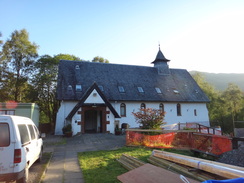
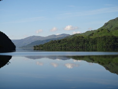
The lady got up at the same time as me and kindly offered to drive me down to the Inversnaid Hotel. This was exceptionally kind of her and I was soon deposited by Loch Lomond in glorious sunshine. It was an act of kindness that made up for the problems of yesterday.
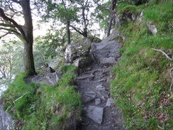
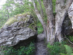
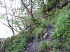
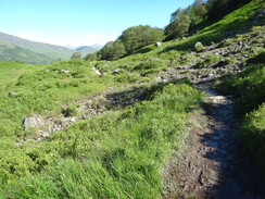
The next section proved to be the hardest of the entire West Highland Way - a path that constantly seemed to rise and fall with rocky, uneven ground underfoot. It made for hard going with a large pack, especially when I had to duck through a narrow gap between a boulder and a tree. Many of the boulders had obviously fallen from the cliffs above, forming a jumbled mess that the path had to negotiate. It was tiring and hot work despite the early hour.
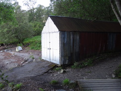
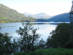
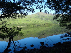
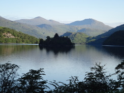
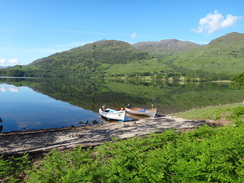
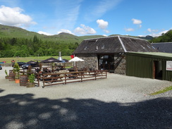
A sign pointed towards Rob Roys cave; I was tempted to go down and visit it, but the guidebook made it sound particularly uninteresting and so I strolled on. The going remained hard and I was soon sweating as my stomach gurgled ominously. Eventually the path reached the northern end of the loch, where I found Ardleish Bothy. This simple building would have been ideal to spend a night in, and the evocative smell of smoke hung in the air from an overnight fire. Another climb took me up past Cnap Mor before descending to reach the campsite at Inverarnan. This turned out to be far larger than I expected and a shop was open - never one to look a gift horse in the mouth I bought some chocolate, crisps and fruit and sat on a bench to eat them.
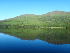
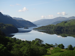
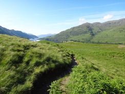
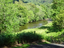
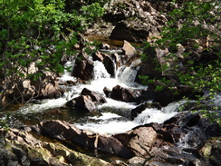
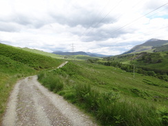
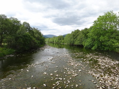
It all made for a lovely break and I was more than happy that the toughest part of the day was behind me. What followed was a pleasant stroll along the southern bank of the River Falloch, initially along a track but latterly a footpath that allowed me to make good time. It regularly rose and fell but none of the gradients were too punishing. Sadly noise from the main road on the other side of the river intruded all too often, as did the power lines that also used this corridor through the surrounding hills. There were a few tantalising glimpses of the Falls of Falloch below, but there was never really a good place to take pictures from this side of the river.
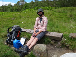
Soon I came across a bearded young man sitting on a rock whilst staring contemplatively at the surrounding hills, a large pack on the ground beside him. His name was James Urquhart and he had just started a gruelling five-month walk around all the Munros. I stood amazed as he told me about his plan, which is one of the greatest walks that can be done in Britain and something that I could not even contemplate doing. James is a journalist who is filming his round - his website is at munrofilm.com..
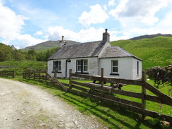
A short distance later the path passed a white cottage and crossed a bridge over the river. Shortly afterwards it used a sheep creep to get under a railway line; this literally was a creep as the roof was far too low for my pack and I had to half-crawl through. Fortunately the crossing of the main road proved easier and I was soon climbing up to join the old military road that runs along the northern side of the valley.
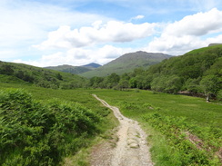
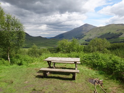
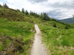
This made for wonderful walking, with grand views over the surrounding hills as it slowly rose towards an area of woodland. I stopped after going through the gate into the forest and met a couple of ladies who were just preparing to move off after a lunch break. Their spot seemed to be very habitable so I sat down as they moved off. Trees blocked most of the views but there were plenty of people passing, especially as the spot marked the junction with the path that led down into the village of Crianlarich.
Eventually I set off once more, reaching a high point as I met a couple of young women with large packs. They were Jade and Becky, who were doing a John OGroats to Lands End walk. We chatted for a few minutes and for the second time in an hour I was left slightly in awe of the trips that people were attempting.
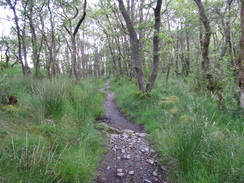
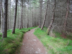
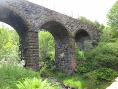
Unfortunately that proved to be both a literal and metaphorical high point, as the walk northwestwards through the woodland proved to be exceptionally boring. My mind was not in the stroll and my belly most certainly was not - at one stage I thought that I might have to find a quiet spot and christen my new plastic trowel. Fortunately by the time the path descended under a grand railway viaduct my guts had more or less settled.
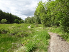
What followed was a pleasant stroll along tracks across the rivers floodplain; it passed the site of St Fillians church (the main signs of which are an old graveyard and some ramshackle ruins) before reaching a campsite at Auchtertyre. This seemed to be fairly busy and three women drinking wine outside a wooden cabin propositioned me as I passed. When I said that I was exceptionally sweaty they replied that was *exactly* how they liked their men...
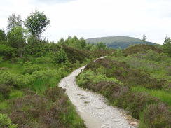
I stopped for a rest on a gabion by the bridge under the main road before continuing on towards Tyndrum. This proved to be one of the highlights of the day as the path passed over a little but perfect stretch of moorland above the banks of the Crom Allt. This ended abruptly at the site of an old lead mine where nothing grew, the pollutant minerals having leached into the ground. There was also a gold mine nearby that Scotgold are trying to reopen, showing how mineral-rich this remote area is.
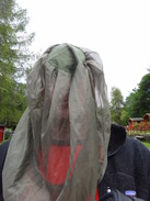
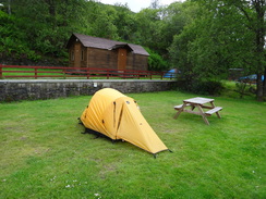
I crossed a bridge over the river to reach a campsite only to find that it was not the one I had booked into. This was a short distance further on, right below Tyndrum Lower railway station. The site was clean and well-kept, and I was soon pitching my tent on a flat area of grass. Sadly the midges also liked the site and I dove under the inner as soon as possible, leaving the flysheet to be put on later. After enjoying my traditional game of killing midges that had got inside the tent I stretched and relaxed.
Eventually I had to go out once more, and decked with overly-warm fleece and midge net I ventured out to put the flysheet on. The midges attacked me mercilessly, but my clothing kept the worst of them off me. Dinner was provided by Paddys Bar and I headed back to the tent feeling much better - even my stomach appeared to be behaving itself.
 |
 |
|
Directions
Pass in front of the Inversnaid Hotel and pass through the car park. Continue on northwards along a track paved with concrete blocks through trees along the shore, passing a toilet block on the right. The track soon becomes rougher as it reaches a boathouse. It runs along the side of the boathouse and then behind it; there is a good wild camping spot on the right of the path. Shortly after it curves to the left over a footbridge the path becomes rockier. It crosses another footbridge and continues on; the going soon becomes harder as it crosses a series of rockfalls. It soon reaches Rob Roys Cave, a nick in the rocks on the shore - it is hard to find, even with a sign on the ground beside the path.
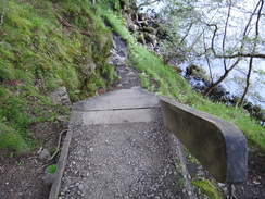
The path then becomes even rougher, climbing and falling as it continues north through the trees along the shoreline, including a set of 14 steep wooden steps that leads to a bridge over a chasm, with water pouring down the cliff. It is a wonderfully strenuous stroll, especially when it passes streams that thunder down the hillside, and the intermittent views over the loch to the left are superb. Navigation is easy; the path is well-walked and there are no branches leading off it.
At about NN333134 the path leaves the foreshore and follows a path that crosses a flat area of land. Cross a footbridge over a stream and turn right; the path follows the stream on the right before crossing it to reach a low stone wall on the right. It climbs up to pass inland of the little hillock of Creag a Mhadaidh before descending to reach the shoreline near Doune Bothy on the left at NN332144.
After this the path remains near the shoreline as it heads northwards for two-thirds of a mile towards Ardleish and the northern end of the loch; the going is easier than it was before but is still not easy. On the way it crosses a bridge and heads up some steps and across a stile through a stone wall before descending to another bridge over a stream to reach Ardleish. <> A path heads north from Ardleish, heading slightly inland as it climbs uphill and passing below the summit of the small Cnap Mor on the left. It crosses a couple of wooden causeys before passing the eastern shore of Dubh Lochan and then the ruined farm at Blairstainge as it slowly descends to meet the Ben Glas Burn at NN321185.
When the path approaches the southern bank of the burn, turn left and then right to cross a bridge over the burn to reach the Beinglass Farm campsite at NN321186; to reach Inverarnan turn left to cross a bridge over the River Falloch to reach the A82, then turn left to walk south along the main road to reach the small hamlet.
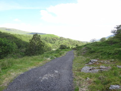
Do not enter Beinglass Farm, and instead follow the track that heads northwards behind the farm buildings. Follow this uphill to the north with the River Falloch a short distance away to the left; it slowly curves to take a more northeasterly course. After about a mile a crossroads with another track is reached at NN325200. Continue straight on along a rougher path that heads eastwards, still with the river on the left.
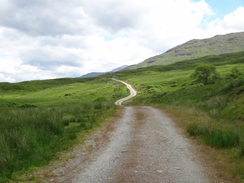
The good path continues to climb slowly eastwards along a spectacular stretch of path that crosses a series of bridges over small burns; several stiles and clapper gates are crossed as well. After 1.2 miles it passes the Falls of Falloch on the left and continues on along the southern bank of the river. Power lines come in from the left and are followed for a while. Half a mile after the Falls it crosses the Allt a Chuilinn on a footbridge (NN344213).
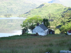
On the other side of the stream the path becomes a track that climbs uphill, passing under the power lines before descending to reach the remote whitewashed farmstead at Derrydaroch. Pass this and continue on for a short distance to reach a footbridge over the river at NN351218.
Cross this bridge and on the other side turn right along a narrow path that undulates northeastwards for three-quarters of a mile with the river on the right, slowly climbing along with the river. At NN359227 it passes through a low cattle creep under a railway bridge. On the other side go through a clapper gate and turn right along a path that slopes up to reach an old road. Turn right for 100 yards long the old road and cross a stile over a fence on the left to reach the southern side of the A82.
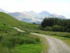
A little circular bridge heads under the A82, and on the other side climb up some steps. At the top cross a stile over a fence and immediately ford a little stream; the path slopes uphill, passing under the power lines to reach the Old Military Road at NN358229. Turn right and follow this good track northeastwards. Cross a stile near a metal gate to continue along the old road. After 1.8 miles it reaches a wooden clappergate in a deer fence; go through this to enter coniferous woodland at NN375250. To reach Crianlarich, turn right down an obvious path that leads to Crianlarich and the station.
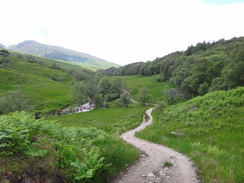
After crossing the stile into the woodland above Crianlarich, turn left to leave the track and continue along a path that twists and turns northwestwards as it climbs through the trees. It reaches a summit next to a picnic bench and continues to rise and fall. After a mile in the forest it crosses a large footbridge over the Herive Burn. On the other side it continues winding in a rough north-northwestwarly direction; it joins a track for a few hundred metres before leaving this once more and continuing through the trees. The route is easy to follow and obvious on the ground, although some of the descents are steep. It eventually turns to the right to descend with the Allt an t-Saoir on the left to reach the railway line at NN360275.
Descend some steps under a railway viaduct and then turn to the left to rejoin the Old Military Road. It immediately crosses the burn on a bridge and heads on north-northwestwards for a short distance before turning to the right to reach the A82. Carefully cross the road and continue on along an unsurfaced path on the other side; the path parallels the road on the left for a short distance, descending to cross a stile. On the other side follow the edge of a field to reach a wooden clapper gate; on the other side of this is Kirton Bridge over the River Fillan at NN358280.
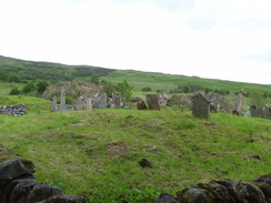
Go through a kissing-gate and turn right to cross the bridge. On the other side follow a surfaced track northeastwards towards Kirton Farm. Do not enter the farm, and instead turn left in front of it to take another path with the farms barns on the right. After a few yards a complex track junction is reached next to an old graveyard; go through a gate and immediately turn left. Follow the good track northwestwards through several gates as it heads across the edge of the floodplain. After 0.6 miles until the farm and campsite at Auchtertyre is reached.
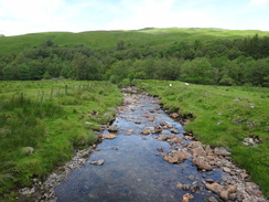
Follow the track through the middle of the farm and cross the Allt Auchtertyre on a bridge. On the other side of the bridge turn left to follow another good track southwestwards for a third of a mile. Just before the A82 is reached once more at NN349288, turn left to go through a metal gate and join a path that immediately sneaks under the bridge that carries the main road over the River Coonish.
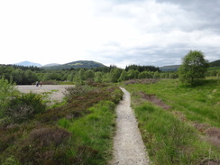
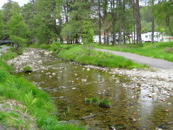
Continue on along a good gravel path with the river on the left. When it meets a track turn left to join this new track. It passes a lovely three-arch stone bridge on the left, at which the path curves to the right to reach the surfaced track that heads over the bridge. Cross the track and head on along a path on the other side, still with the river on the left. When the Crom Allt is met the path turns to the right to follow the stream northwards for a short distance until a track is reached. Turn left along this track to cross the stream to head westwards.
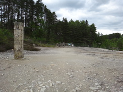
After about a fifth of a mile the track crosses a cattle grid; cross this and after about 200 yards turn right along a small footpath that winds northwards through trees. It roughly parallels the stream for a mile, crossing a gate through a deer fence that leads into an area devoid of any vegetation - the site of an old lead works. Go through another gate on the other side of the cleared area to join a track that runs along the southern bank of the Crom Allt. This track eventually curves to the right to reach a road; turn left to follow the road, passing the By The Way campsite on the left to reach the road near Tyndrum Lower railway station at NN327301.
 |
 |
|
Distances
| From | To | Distance (m) | Ascent (ft) | Descent (ft) |
|---|---|---|---|---|
| Inversnaid | Inverarnan | 6.9 | 1683 | 1647 |
| Inverarnan | Hillside above Crianlarich | 6.0 | 1348 | 584 |
| Hillside above Crianlarich | Tyndrum campsite | 6.2 | 928 | 1001 |
This makes a total distance of 19.1 miles, with 3959 feet of ascent and 3232 feet of descent.
For more information on profiles, ascents and descents, see this page
Accommodation
I spent the night at the Tyndrum By The Way campsite. They have a website at www.tyndrumbytheway.com. As well as a campsite, they also have a hostel and a B&B. The site is very well maintained and has a decent range of facilities - it is also fairly convenient for the village.
 |
 |
|
 |
 |
|
 |
 |
|
 |
 |
|
 |
 |
|
 |
 |
|
 |
 |
|
 |
 |
|
 |
 |
|
 |
 |
|
 |
 |
|
 |
 |
|
 |
 |
|
 |
 |
|
 |
 |
|
 |
 |
|
 |
 |
|
 |
 |
|
 |
 |
|
 |
 |
|
 |
Disclaimer
Please note that I take no responsibility for anything that may happen when following these directions. If you intend to follow this route, then please use the relevant maps and check the route out before you go out. As always when walking, use common sense and you should be fine.
If you find any information on any of these routes that is inaccurate, or you wish to add anything, then please email me.
All images on this site are © of the author. Any reproduction, retransmissions, or republication of all or part of any document found on this site is expressly prohibited, unless the author has explicitly granted its prior written consent to so reproduce, retransmit, or republish the material. All other rights reserved.
Although this site includes links providing convenient direct access to other Internet sites, I do not endorse, approve, certify or make warranties or representations as to the accuracy of the information on these sites.
And finally, enjoy your walking!
Nearby walks
| # | Title | Walk length (miles) |
|---|---|---|
| 150 | Gleann Meran to Bridge of Orchy Hotel | 11.1 |
| 462 | Rosneath to Ardgartan | 26.5 |
| 463 | Ardgartan to Carrick Castle | 17.4 |
|
|

|