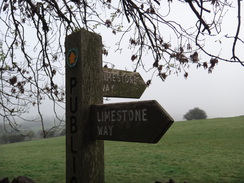
Walk #936: Limestone Way: Matlock to the Waterloo Hotel
 |
 |
|
General Data
| Date Walked | 02/11/2011 |
| County | Derbyshire |
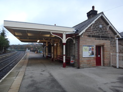
| Start Location | Matlock Station |
| End Location | Waterloo Hotel |
| Start time | 07.15 |
| End time | 15.27 |
| Distance | 18.7 miles |
| Description | This was a pleasant walk following the Limestone Way as it heads northwestwards through classic White Peak scenery. It is quite a strenuous walk with some fairly steep ascents and descents in places. The trail mostly follows paths, with some stretches along tracks and minor roads towards the end. |
| Pack | Today I carried my 30-litre Karrimor rucksack, filled with water, my waterproofs, a book and other odds and ends. |
| Condition | I feel fine after this walk and could have walked further if daylight and transport had allowed me. |
| Weather | Fog blocked the views early in the morning. This burnt off as the day progressed, leaving generally sunny skies with some cloud. It was welcomingly warm for the time of year. |
| OS map | Outdoor Leisure number 24 (The Peak District - White Peak Area) |
 |
 |
|
Map of the walk
Maps courtesy of Google Maps. Route for indicative purposes only, and may have been plotted after the walk. Please let me have comments on what you think of this new format. For a detailed table of timings for this walk, please see the table file.
 |
 |
|
Notes
I fancied an easier walk after yesterday's rather strenuous stroll over the southern Peak District, during which I had covered the first half of the Limestone Way. It did not take long to plan a route to the Waterloo Inn near Taddington on the A6, from where I could get a bus back to Matlock. I set off in the dark from my parents' house, although there were large gaps in the clouds overhead. However the clouds gathered as I crossed the Peak District, including large expanses of unwelcome fog and this remained as I parked at Matlock railway station.
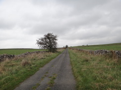
It cost me five pounds to park for the day, and soon I was struggling up the long hill that heads west-southwestwards out of the town. During my descent at dusk the previous day I had been greeted with grand views over the lit town; now it was mostly obscured by fog. I had expected the climb to be hard but it was not too bad and I did not need to stop as I passed Masson Lees Farm and got glimpses of the cliffs at High Tor. Despite this it was a relief when I reached the summit of the climb and stated a steep descent down into the pretty little village of Bonsall.
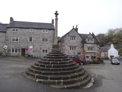
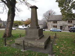
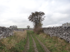
I did not have much food with me and so I stopped at a noticeboard near the beautiful cross; sadly no shop was shown on the map and the pub was well and truly closed at the early hour. A path climbed to Upper Town and here I left the route I had taken yesterday and instead took the Castleton branch of the trail. Initially this followed a road before heading across classic dry-stone walled fields. The trail met a lane which was little more than a boggy track and I followed this towards an opencast mine that was obviously being used for landfill. Sadly this was a mistake and I had taken the wrong path; rather than retrace my steps I followed a track to rejoin the proper route.
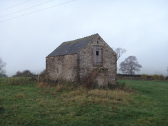
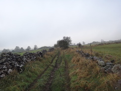
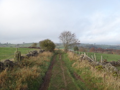
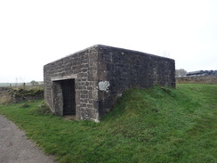
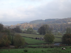
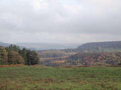
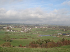
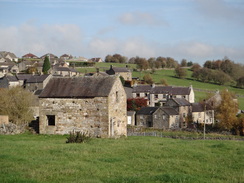
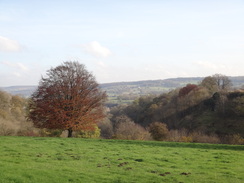
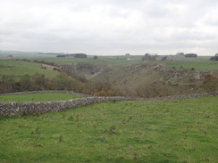
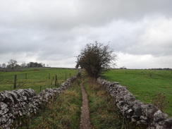
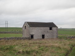
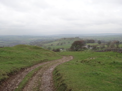
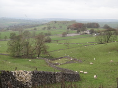
This took me northwestwards, crossing a road before curving to take a more westerly course below Luntor Rocks. I have done this walk several times before and it should have been beautiful; sadly the rather grey weather and wet ground underfoot meant that it was not a particularly rewarding stroll. I did get occasional glimpses back down towards the Derwent Valley and north towards Birchover, but even these were not as good as they should have been. The houses of Winster became visible below as a track took me west towards the B5056 road. This was reached opposite a rather strange-looking squat stone building whose frontage was guarded by an iron gate. This was a lead ore house, which was used to store the ore before it was taken for smelting in the village below.
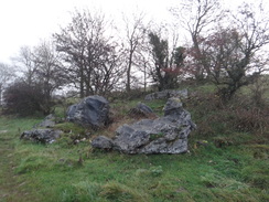
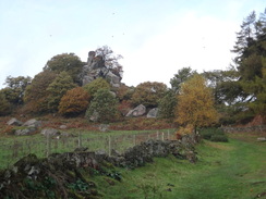
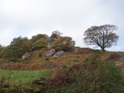
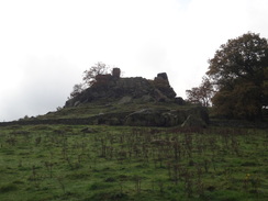
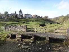
Another track took me northwestwards downhill to a road, after which another road took me further downhill. Just before the main road was rejoined a track headed uphill before a path led to one of the highlights of the day - Robin Hood's Stride. Legends abound about this rock formation, including one that Robin Hood strode across a wide gap between two stone pinnacles. Regardless of these legends it is a pleasant sight, and so is the small stone circle that was clearly visible nearby from the path.
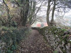
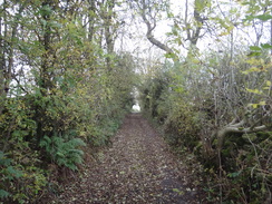
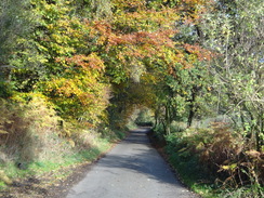
A short stretch of road was followed by a winding walk through a wonderful patch of woodland which was replete with all the colours of autumn, the leaves all vying with each other for the best display. It felt sad to leave this, especially when the next stretch of the trail was a rather boggy descent to reach the River Bradford in Youlgreave.
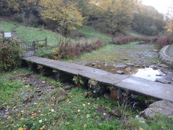
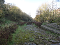
An unusual stone-plank bridge took me over the river, which was perfectly dry despite the recent wet weather. This, like several other Peak District rivers, disappears underground during dry weather. However the river looked exceptionally dry and the river bed was more like a path without a drop of moisture. A sign over a broad expanse of dry ground proclaimed a swimming area that a tadpole would have had difficulty swimming in! Initially the trail followed the northern bank of the river before reaching another stone-plank bridge that took it over to the southern. Slowly moisture started to be seen in the riverbed and soon ponds appeared where the river had been dammed. It felt strange to be alongside a river that was much wetter upstream than downstream.
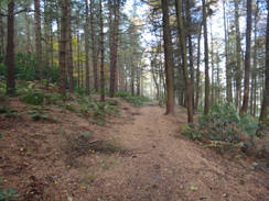
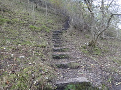
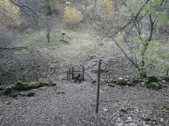
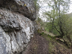
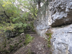
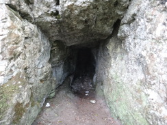
The river was soon left behind as the trail climbed up a steeply-wooded hillside to reach a road that gave some grand views to the right. More paths took me uphill past a car park before the trail settled on a relatively flat course across fields, skirting the farm at Calling Low before reaching the eastern edge of Cales Dale. This is one of the tributary dales of Lathkill Dale and like its larger neighbour is superb, with white craggy rocks. Years before I had had a bad descent down into the valley along a slippery path so I was overjoyed to find that it was now paved with slabs. These were slippery with a mulch of fallen leaves, but even this was better than the muddy path that had existed before. Once at the bottom of the dale a wonderful short stretch of path climbed under a large cliff and passed what looked suspiciously like a cave; it was actually an adit for a mine.
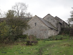
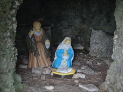
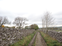
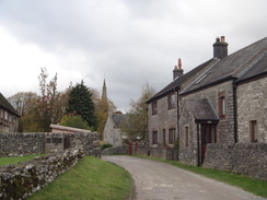
The trail passed the buildings of One Ash Grange Farm, where there was a shrine hidden inside a little cave, before continuing along pleasant paths towards Monyash. I was in need of a break by now so I went into the pub in the village and ordered a meal of scampi and chips; this came quickly despite the rather overworked barmaid (she was alone and the bar was filled with a group of chatty bikers). I hungrily scoffed down the meal before heading off along the trail once more. The village cross has small circular depressions in it; apparently this is where the local lead miners sharpened their chisels!
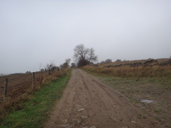
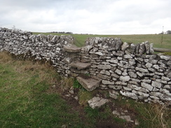
Monyash marks the spot where the nature of the trail changes. So far it had been dominated by narrow fields and stone walls; from here on tracks and roads would predominate. A road headed north before a track led on across classic Peak District terrain towards the farm at Knotlow; a man was restoring a drystone wall, the second person I had seen doing this in two days. A path and road then led on to the small village of Flagg, and a couple of miles of roads climbed steadily to the east of Chelmorton.
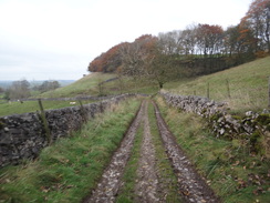
By now I was feeling very tired and it was a relief when I left the road and joined a track that would lead me down to the A6 and the end of the day's walk. Initially the track was badly churned up by vehicles, with several parallel lines of wheel ruts threatening to trip me up at any time. Fortunately the surface became firmer as the track wound downhill, and the Waterloo Hotel became visible below.
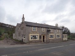
I reached the bus stop and phoned up Travelline to find the bus time back to Matlock. One was due in twenty minutes and so I sat down on a wall whilst I waited rather than go into the hospitable pub. It had been another enjoyable day' walk, although again the weather had slightly let it down.
 |
 |
|
Directions
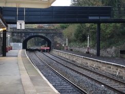
This walk starts off from Matlock station forecourt at SK296601. Leave the station, passing the black footbridge on the right to reach the bypass. Turn right to make your way beside the bypass until the bridge over the River Derwent is reached on the left. Do not cross the bridge and instead turn right to head uphill along Snitterton Road, passing an RBS branch on the right. The road curves slightly to the right; soon afterwards turn left along a narrow surfaced lane that continues uphill between two walls.
This path crosses the mouth of a railway tunnel below and emerges into a little farmyard; as the track curves to the left continue uphill along some steps to reach a stile that leads into a field. Continue uphill to the southwest towards some trees; ignore a path that leads off to the left and instead head on to reach a stile at the top of the field. Cross this stile and a surfaced track on the other side to enter a small patch of woodland. Head straight on through the trees to reach another stile that leads into a field.
Go through an open gateway and keep a hedge to the left; at the end of the field negotiate a stile and follow a hedge on the right. After a short distance go through a wooden gate and continue with a hedge on the left. Go through a hedge to reach another wooden gate and a stile, then continue with a hedge on the left. At the top of this field go through another stile and head on, still with a hedge on the left to reach a stile next to an open gateway on the left. Cross this and head across grass, aiming to meet a hedge on the right. When the hedge and fence on the right end go through a breach in a stone wall ahead and turn slightly to the left, aiming for a pedestrian gate through a wall.
Go through the gate and a stile and continue uphill with a field boundary to the right. At the top of the field cross a stile to join a track at SK287594, with Masson Lees Farm immediately to the left. Turn right along the track for about a yard away from the farm, then turn left past a field gate to enter a field and head diagonally towards the top right-hand corner. Cross a stile beside a field gate and continue with a hedge and then a fence to the right. At the top of this field cross a stile and a tumbledown wall, then turn right along a rough track.
After about five yards, turn left to pass a bench on the left to reach a clapper gate. Go through this and continue uphill across a field to reach a tumbledown stone wall at the top. Cross this and head on, following a stone wall on the right. Near the top of the field turn right through a gate in a wooden fence, then squeeze through a stile in a stone wall into a field. Turn left to reach another stile in a stone wall that leads to a track; cross a stile on the other side of the track to enter a field.
Head across this field, keeping five isolated trees to the right and a grass-covered water tank to the left. After passing the trees the path enters another field and joins a wall on the left. Aim for a barn on the right; shortly after passing the barn the path curves to the right to head towards a pedestrian gate in a hedge. Go through the gate and a stile, then turn left to follow a hedge on the left. This marks the top of the climb out of Matlock.
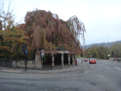
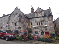
The path starts to descend down to a wooden gate. Immediately after this the path forks; take the right-hand branch which follows a stone wall to the left. Follow this downhill for a short distance and then turn left along another path that runs between stone walls. The walls end as the path curves to the right, continuing to fall. It twists and turns as it heads downhill; pass a triangular junction to join a concrete path between stone walls. Head steeply downhill; care needs to be taken in wet weather. This track emerges out onto a road opposite the market cross in the village of Bonsall at SK279582.
Pass the cross and then the Kings Head pub on the left; immediately after the pub the road curves to the left. As it does so turn right to continue straight on along a surfaced lane between houses. When this soon ends continue up stone steps to reach a path that heads uphill between stone walls. It goes through a stile to continue across grass to reach another stile. On the other side of the stile the path continues between walls to reach another stile. Cross this into another field to reach a stile.
Pass a couple of benches on the right and follow a hedge on the left to reach a stile through a wall. Follow a narrow path between walls to another stile; go through and cross about five yards of grass to reach the end of a surfaced road called Bell Lane in Upper Town. Follow this westwards between houses until it ends at a T-junction with another road. Turn left down this road for a few yards until another road junction is reached on the right at SK273583. This is the point at which the Limestone Way forks; the branch to Rocester continues downhill whilst the one to Castleton continues to the right.
Turn right and follow Moor Lane west-northwestwards. When a junction is reached with Able Lane on the right, turn right up Able Lane for a couple of yards and then left through a stile to enter a field. Turn half-right to head diagonally across this field. Go through a stile at the end of the field and continue diagonally across the next field to reach a gate. Go through this to enter a third field; head straight across this, aiming slightly to the right of a stone barn. At the end of the field go through a stile and turn left to cross a fallen wall and pass the end of the barn on the left.
At the other side of the field cross a stile and continue uphill with a wall on the left to reach another stile. Shortly afterwards the path forks; head straight on, crossing a little bank and aiming for a stile in the wall ahead. Go through this and head straight on across a narrow field to another stile. Head across a field, cresting a slight slope and descending gently downhill to reach a wooden gate and a gap in a wall. Cross this to join a track called Moorlands Lane at SK268590.
Turn left and follow Moorlands Lane southwestwards; after 250 yards turn right across a stile and follow a stone wall on the right. At the end of the field cross another stile and turn half-left to head diagonally across a narrow field. Cross a stile and continue diagonally to the top-left hand corner of a third field. Go through a gateway and turn right to follow a wall on the left for a few yards until it ends at a stile. Cross this and turn half left to join a wall on the left. Follow this northwestwards; as the wall curves to the left continue straight on, aiming for a stile in the corner of the field. Cross this into another field; head diagonally across this to a stile beside a field gate that leads to a track called Blakelow Lane at SK262592.
Turn right to head north along this track for a few yards, then turn left down another track. Almost immediately turn right through a clapper gate to enter a field. Head diagonally across this field, aiming for the far left-hand corner. Cross a tumbledown wall and turn half-left, aiming for a gap in the wall halfway down the wall ahead. Go through the gap and head towards a short area of bumpy ground. Cross this to reach another tumbledown wall that leads into a fourth field. On the other side cross a corner of the fourth field to reach a gap in another wall. Turn slightly to the right to head diagonally across this field, aiming for the far left-hand corner where a clapper gate leads out onto Bonsall Lane at SK258596.
Turn left to follow the lane westwards for about thirty yards, then turn right into a field through a clapper gate in a stone wall. Head diagonally across the field towards the far left-hand corner, passing under some power lines on the way. Pass through a clapper gate in the corner of the field and turn left to head straight across a second field, paralleling the road some way away to the left. Cross a track at the far end of the field to reach a gate into a third field. On the other side turn half-right to head northwestwards across the field. Cross a tumbledown wall and head on across another field towards a stile through a stone wall.
Negotiate the stile and turn half-right across the corner of a fifth field to reach another stile. On the other side head across a field; as the path meets a wall on the right go through a tumbledown wall ahead and follow the wall on the right. Go through two gaps in stone walls ahead as you cross two fields, still following the wall on the right. Halfway along the field turn right through a wooden clapper gate into another field and turn left to continue following the wall on the left. At the end of this field go through a clapper gate and head on across a muddy area, still with the wall on the left.
The path crosses hummocky ground below Luntor Rocks to the left; go through a stile and continue across a field. When a waymarker post is reached marking the junction of two paths, take the left-hand path that heads slightly uphill towards two stone gateposts at the top left-hand corner of the field. Pass between the gateposts and then turn right along a green lane. This soon reaches a field gate. Cross a stile beside the gate and continue westwards along the track. After half a mile it reaches the B5056 road at SK237600 to the southwest of the village of Winster, with the Miner's Standard pub off to the right.
Carefully cross the road and pass immediately to the left of the imposing lead ore house to reach a minor road. Turn left along this road for about a hundred yards until another road comes in from the left. At this point turn right along another track called Islington Lane. This descends and rises slightly; after 0.8 miles it ends at a T-junction with Chadwick Hill road at SK229610.
Cross the lane and head straight on along Dudwood Lane. This plunges downhill; when it curves sharply to the right after half a mile turn left through a pedestrian gate beside a cattle grid and head uphill along a track with a hedge to the left. The track goes through a gateway and curves to the right. At the start of the bend turn left along a grassy path, keeping a field boundary to the left. Follow the boundary uphill to reach a gate.
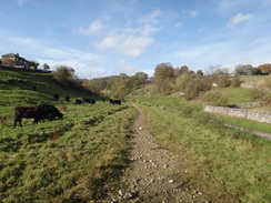
Go through the gate and follow a wall on the left uphill, passing Robin Hood's Stride on the left. Pass the rocks and continue on towards a field gate; do not go through the gate and instead turn left across a stile through a fence. Follow a wall on the right, with the Stride away to the left. Turn right through a stile beside a field gate and head down across a field, aiming for the far left-hand corner of the field. At the corner turn left through a gateway in the fence on the left and then after a few yards turn right through another gateway to enter a field. Turn half-left to head diagonally across this field; it reaches a stile beside a field gate. Cross this to reach a road at SK223626 opposite the driveway leading to Harthill Moor Farm.
Turn right and follow the road as it slowly falls northwards. Just before the road curves to the left after a fifth of a mile, turn left to enter some woodland. Follow the obvious path through the trees; this curves to the left before eventually exiting the wood through a clapper gate into a field. Head straight on across the field towards a field gate ahead. Go through a pedestrian gate beside the gate and turn right to head across another field, keeping away from the wall on the right. Pass under some power lines and continue over the crest of a hill. An obvious path curves to the left and starts to descend.
As it passes three old stones sticking out of the ground, turn right to head downhill, keeping a lake some distance away to the right. Cross a stile at the end of the field and continue descending, aiming for the tower of Youlgreave church ahead. The path descends stone steps to reach a stile; cross this and some more steps to reach a stream called Bleakley Dike, which can be crossed using stone slabs. The path curves slightly to the right on the other side, aiming for a telegraph pole on the brow of a small hill. Pass the pole and continue on toward the church tower. Go through a pedestrian gate beside a field gate and follow a stone wall on the right.
At the end of the field cross a stile beside a field gate to join a track. Follow this as it curves to the right and then the left to reach a stile beside a field gate. Negotiate the stile and head on across a field towards some houses, before which the path curves to the right to reach a stile. Cross this and turn slightly to the left to head diagonally across the corner of a field towards a pedestrian gate. Go through this to join a road on the outskirts of Youlgreave. Turn right down this road; there is a pavement on the left-hand side. As the road curves to the left turn left across a stile to follow a path with a low stone wall to the left. This leads to another stile, on the other side of which is a stone plank bridge across the River Bradford at SK213640.
Cross the plank bridge and immediately turn left through a pedestrian gate to join a stony track that follows the river on the left. Continue along the track for a quarter of a mile until it goes through a stile to reach the end of a track coming in from the right. Turn left down the track for a few yards to reach a second plank bridge over the river. Cross this and go through a pedestrian gate on the other side, then turn right to start following the river upsteam on the right. Initially it heads westwards before curving to the left; after 0.7 miles go through a pedestrian gate beside a field gate. Shortly after this a more substantial bridge over the river is reached at SK199636.
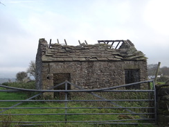
Turn right to cross the bridge and follow a zigzag path that heads up the hillside to the north of the river. It passes a ruined stone building on the right before settling on a west-northwesterly course uphill. It reaches a stile through a stone wall that leads onto a road at SK196637. Turn right and start following the road northeastwards; there is a pavement on the right-hand side of the road. After a quarter of a mile it curves sharply to the right; as it does so turn left through a stile that heads into a field. Aim half-right uphill. Cross a low stone wall and continue uphill to reach a stile through a stone wall that leads onto a road at SK198641.
Turn left along this road; it soon curves gently to the left. Turn right to a stile and gate that leads through a stone wall into a field. Turn half-left to angle to the upper left-hand corner of the field. Go through a gap in the wall and continue with a wall on the left. As the gradient slackens the path turns to the right. Go through a wooden pedestrian gate in the top corner of the field and follow a path with a wall to the right. This path widens out into a track as it passes a car park on the left and reaches a pedestrian gate beside a field gate. Go through this and continue on for a few yards until the track ends at a T-junction with Moor Lane at SK194644.
Turn left to follow Moor Lane westwards; it immediately passes the entrance to the car park on the left. After a couple of hundred yards this road ends at a T-junction with another road. Here cross the road ahead and go through a stile to enter a field. Turn half-left to head diagonally across the field to reach a stone stile. On the other side turn slightly to the right to cut across the corner of a field to reach another stile. Cross this and head northwestwards across a third field. Go through a clapper gate in a fence and continue straight on towards a band of trees called Low Moor Wood.
The path joins a wall on the right before reaching a pedestrian gate through the wall. Pass through this to enter the woodland. Follow the obvious path through the trees to reach a pedestrian gate beside a stone stile. Cross either of these to enter another field. Head diagonally across the field, aiming for the far right-hand corner of the field. Cross a rough track and then go through a clapper gate through a stone wall to enter another field. Head diagonally across this field, keeping the farm away to the left. Go through a clapper gate and follow a path through a small patch of woodland. Leave the trees through another gate and head on across a short field to another clapper gate with a barn on the left.
The path enters another patch of woodland and heads downhill to reach another clapper gate. Go through this and continue downhill, angling towards a wall on the right. Go through a clapper gate and head diagonally downhill across another field, aiming for a clapper gate beside a gateway ahead. On the other side continue on diagonally across the next field, still heading downhill. Another clappergate leads into a field, at the bottom of which another clapper gate leads onto the top of Cales Dale. Follow the obvious zigzag path down steps through the trees; care needs to be taken. This reaches a junction with a large path in the bottom of the dale at SK172652.
Cross a stile at the bottom of the dale and head on up the western side of the valley. Initially the path zigzags before curving to the left to pass a large rock face to the right. Follow the cliff and then turn right up some steps carved out of the rock to reach a pedestrian gate. On the other side continue on down a shallow valley with rocky outcrops on either side. The path joins a stone wall on the left and heads on towards One Ash Grange Farm. Head past a barn on the left and climb up some stone steps. Go through a pedestrian gate at the top and pass between two barns. The path joins a track; as this reaches another track in the farmyard, turn right along the new track. When the track forks once again take the right-hand branch and carry on along this.
follow the track as it curves to the right to reach a field gate. Go through this and turn left to follow a wall on the left. In the corner of the field cross a stile and turn right to follow a wall on the right. Go through a pedestrian gate in the wall ahead and follow a wall on the right. At the end of this field, go through a pedestrian gate and head on across the field. The path descends downhill into a dry valley called Fern Dale and then curves to the right, climbing slightly to reach a pedestrian gate at the top right-hand corner of the field. Turn left keeping a stone wall to the left. Follow the wall as it curves to the left, then go through a pedestrian gate to join a path that runs between stone walls. This curves around before reaching the end of a surfaced road to the south of Monyash at SK151662.
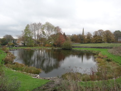
Head straight on along this road as it passes though the middle of the village. It curves to the right to pass a pond on the right to reach the B5055, with the village cross and pub on the right. Cross the main road and continue north along Chapel Street. It passes a car park on the left; just before some cottages are reached on the left, turn left down a track that runs between walls. Follow this track as it slowly climbs, twisting and turning as it does so. After nearly half a mile it reaches a complex junction of tracks at SK143673.
Continue on, passing a barn on the left and head on along another track between walls, heading towards Knotlow Farm on the right. The track ends at a stone wall; cross a stile over the wall to enter a field on the other side. Turn half-right to head diagonally across a field; it reaches a stile that leads into another field with the farm to the right. Follow a wall and then a hedge and fence on the right across another field to a pedestrian gate. On the other side follow a wall on the left as a track from the farm comes in from the right. Join the track and follow it northwestwards; go through a pedestrian gate beside a cattle grid and continue on until the track ends at a bend in a public road at SK136680.
Head straight on along this road; it soon curves to the right to head northeastwards into the tiny village of Flagg. At a road junction turn left to start following Main Road northwestwards uphill; this curves to the right when another road comes in from the left at Town Head. A mile after Flagg the road ends at a T-junction with another road at SK127695. Cross this road and continue on north uphill along Green Lane. When this ends at a T-junction with another road, turn right along this road. After 150 yards turn left down a rough track called Sough Lane. This soon curves to the right. Cross a stone stile beside a field gate and continue on along the track. Head through more field gates as the track starts to zigzag downhill. The gradient eventually levels out as the track passes the Wellington Hotel on the left before reaching the A6(T) at SK132714, where this walk ends.
 |
 |
|
Distances
| From | To | Distance (m) | Ascent (ft) | Descent (ft) |
|---|---|---|---|---|
| Matlock station | Upper Town | 2.5 | 965 | 407 |
| Upper Town | Youlgreave | 6.5 | 728 | 1142 |
| Youlgreave | Monyash | 5.5 | 1115 | 696 |
| Monyash | Waterloo Hotel | 4.2 | 587 | 266 |
This makes a total distance of 18.7 miles, with 3395 feet of ascent and 2511 feet of descent.
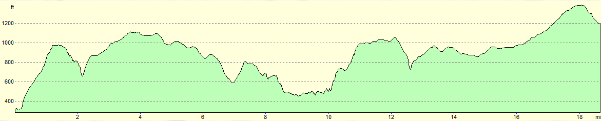
For more information on profiles, ascents and descents, see this page
Transport
It is possible to use public transport the entire way; as usual Travel line is a useful resource for working out public transport details. The best service is Trent Bus's Transpeak service, which runs roughly every hour between Buxton and Derby, calling at Matlock on the way. This calls at the Waterloo Inn, and also at the village of Taddington a mile to the east.
 |
 |
|
 |
 |
|
 |
 |
|
 |
 |
|
 |
 |
|
 |
 |
|
 |
 |
|
 |
 |
|
 |
 |
|
 |
 |
|
 |
 |
|
 |
 |
|
 |
 |
|
 |
 |
|
 |
 |
|
 |
 |
|
 |
 |
|
 |
 |
|
 |
 |
|
 |
 |
|
 |
 |
|
 |
 |
|
Disclaimer
Please note that I take no responsibility for anything that may happen when following these directions. If you intend to follow this route, then please use the relevant maps and check the route out before you go out. As always when walking, use common sense and you should be fine.
If you find any information on any of these routes that is inaccurate, or you wish to add anything, then please email me.
All images on this site are © of the author. Any reproduction, retransmissions, or republication of all or part of any document found on this site is expressly prohibited, unless the author has explicitly granted its prior written consent to so reproduce, retransmit, or republish the material. All other rights reserved.
Although this site includes links providing convenient direct access to other Internet sites, I do not endorse, approve, certify or make warranties or representations as to the accuracy of the information on these sites.
And finally, enjoy your walking!
Nearby walks
| # | Title | Walk length (miles) |
|---|---|---|
| 11 | Stanton Moor | 2.9 |
| 12 | Darley Dale, Stanton Moor and Rowsley | 8.7 |
| 14 | Friden, Long Dale and Gratton Dale | 7.8 |
|
|

|